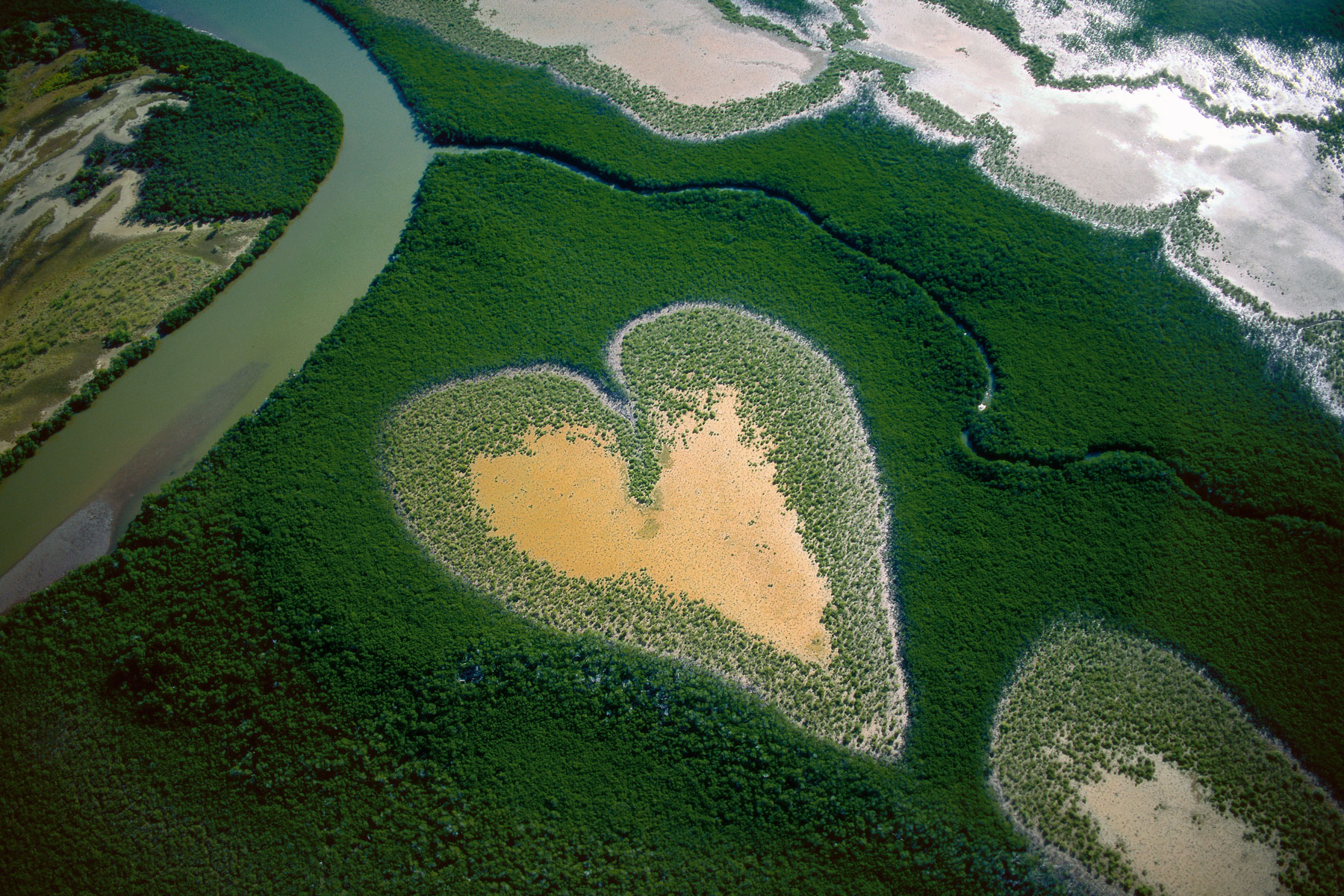
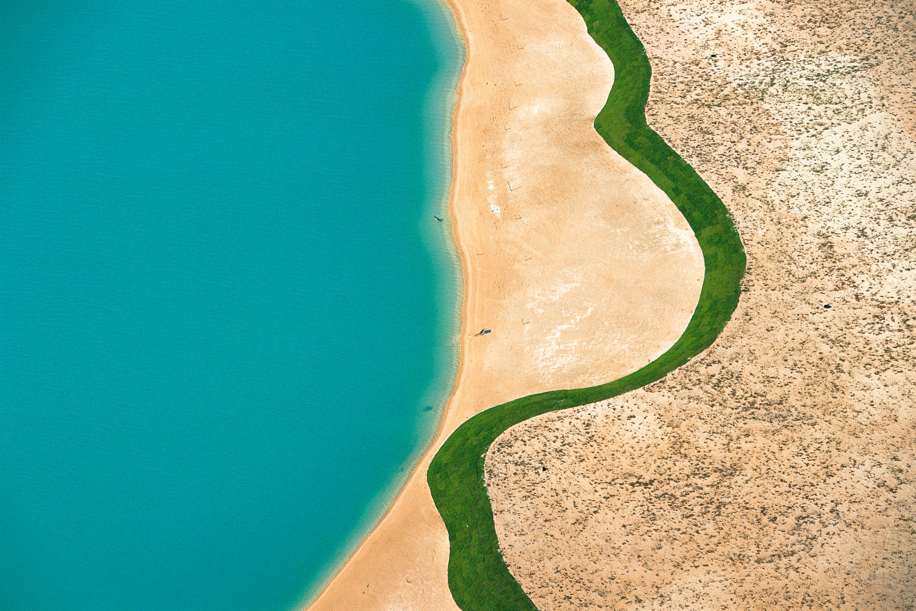
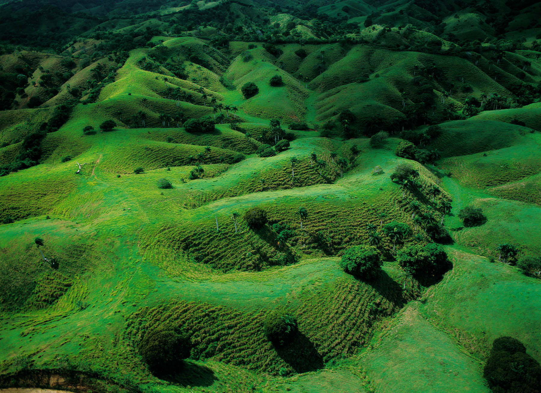
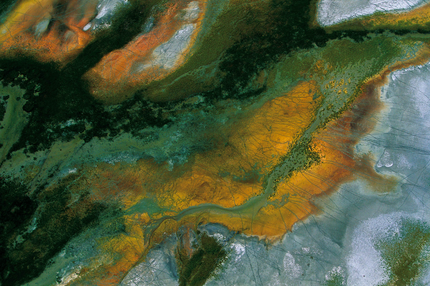
Heart in Voh, New Caledonia (French Overseas Territory) (20°56' S – 164°39' E).
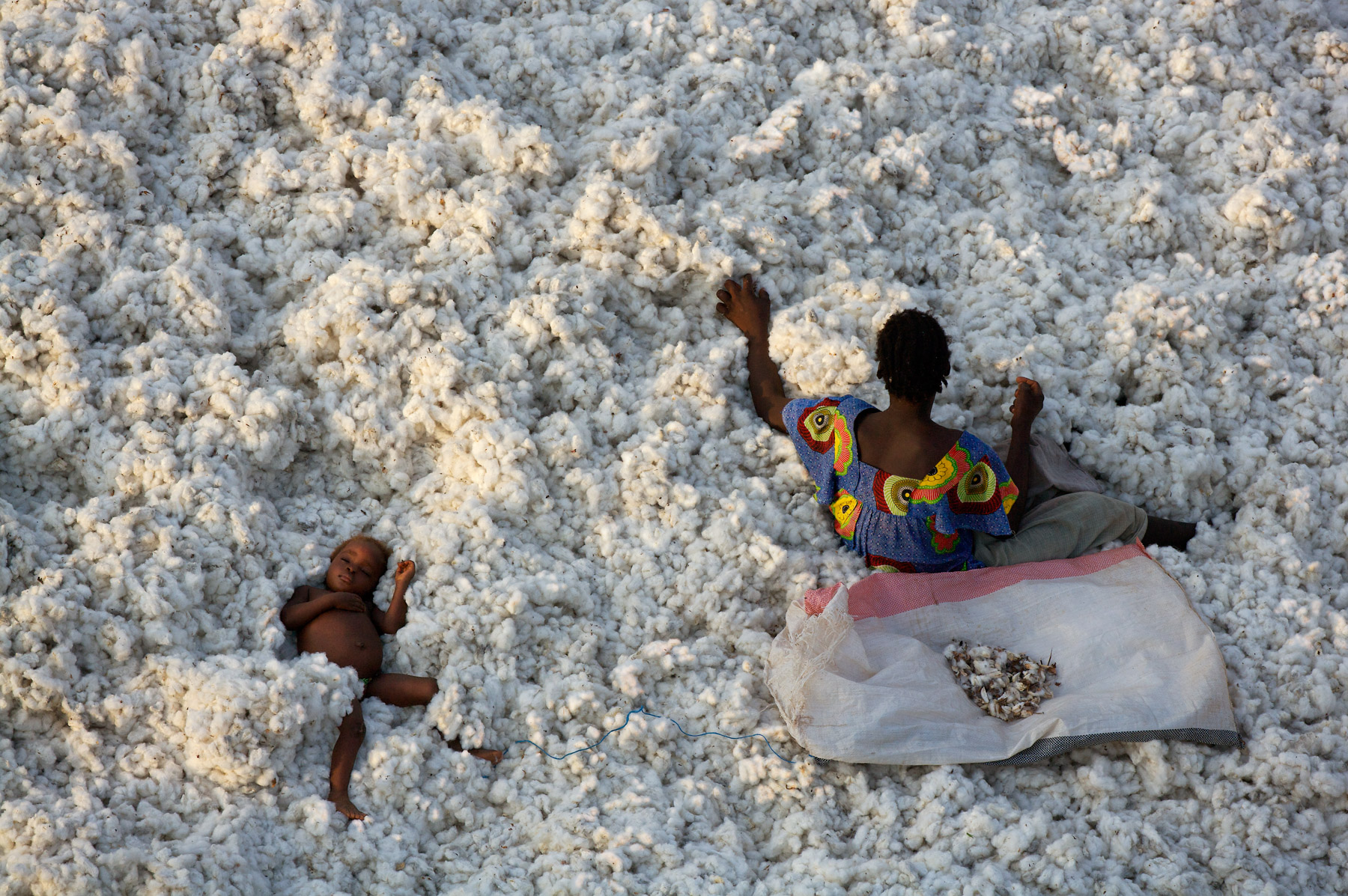
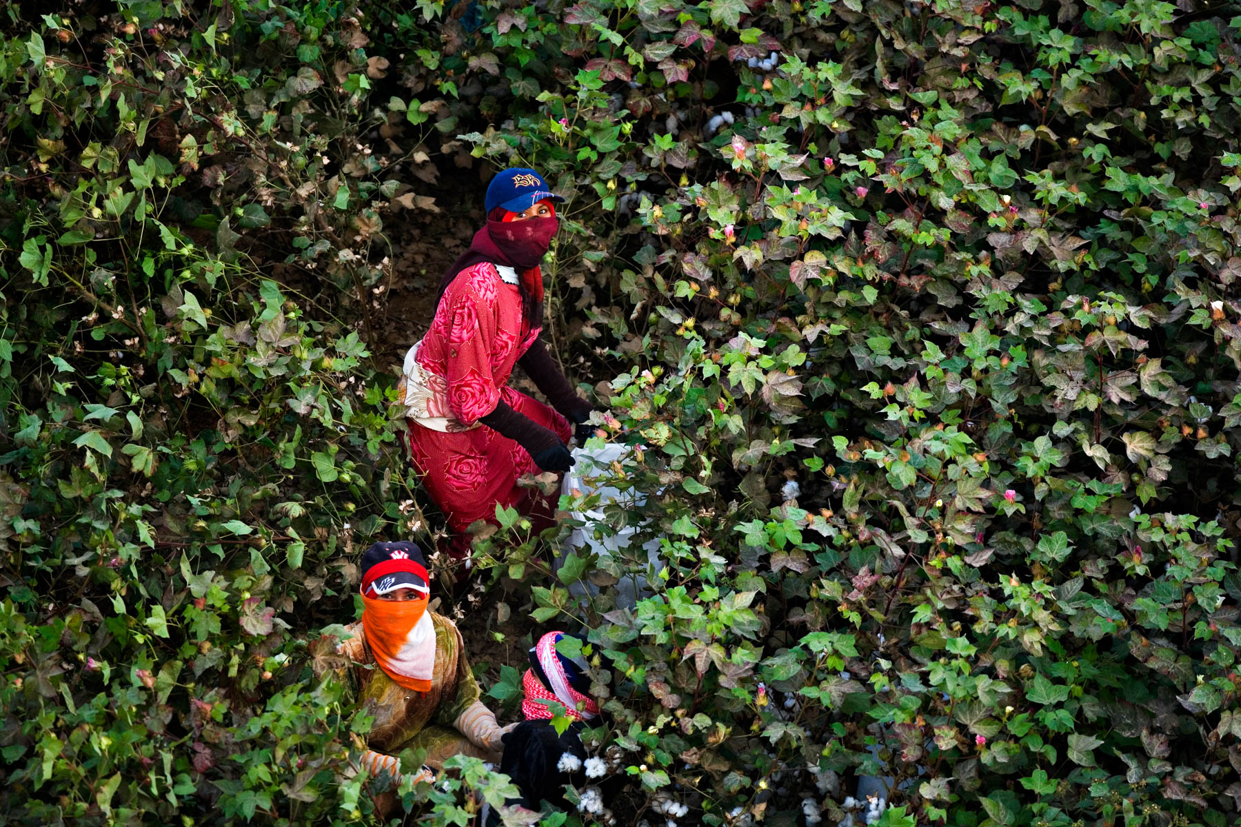
Cotton-picking near the town of Banfora, Burkina Faso (10°36'N - 4°47'W). Récolte du coton aux environs de Banfora, Burkina Faso (10°48’ N – 3°56’ O).
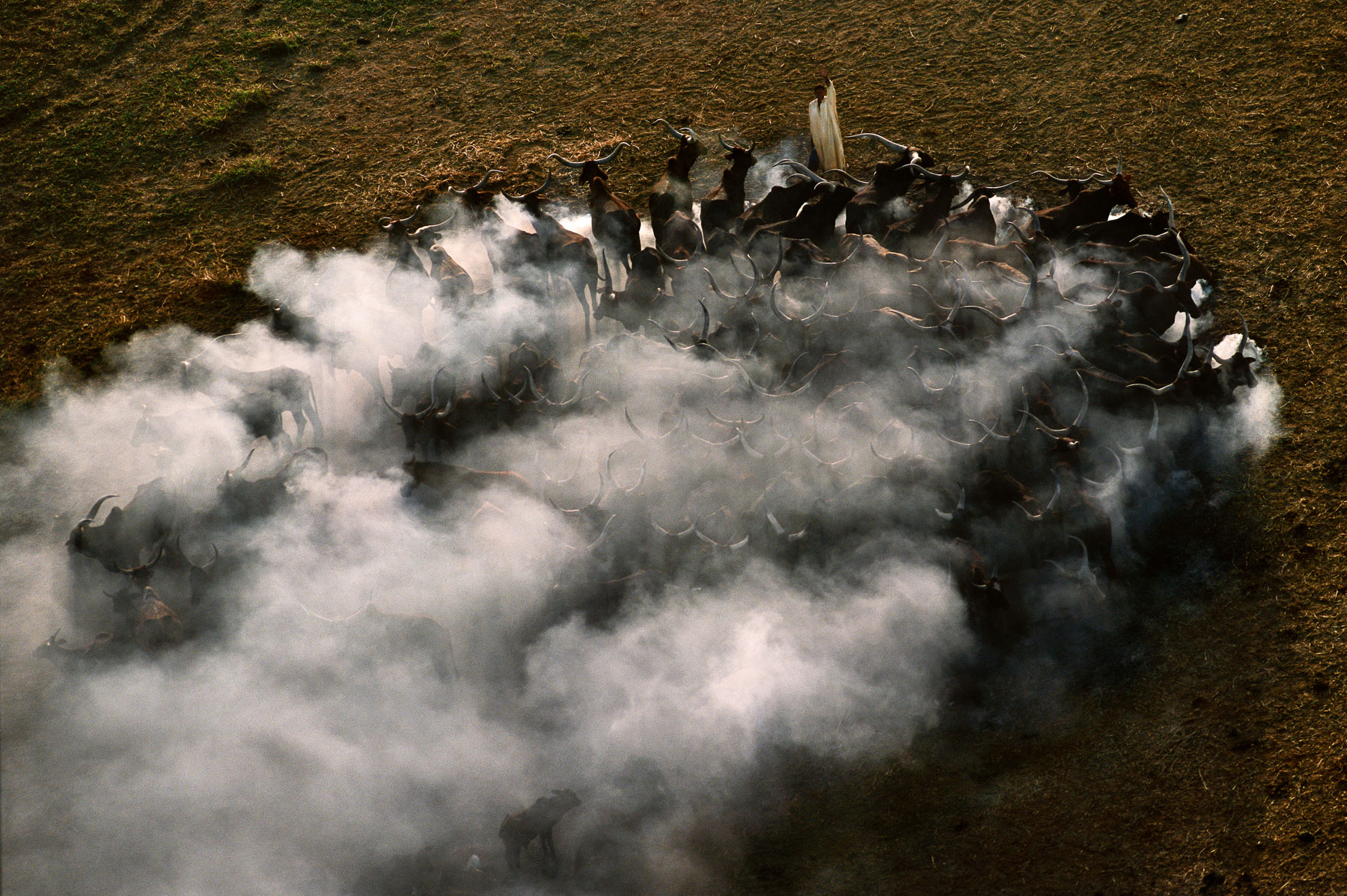
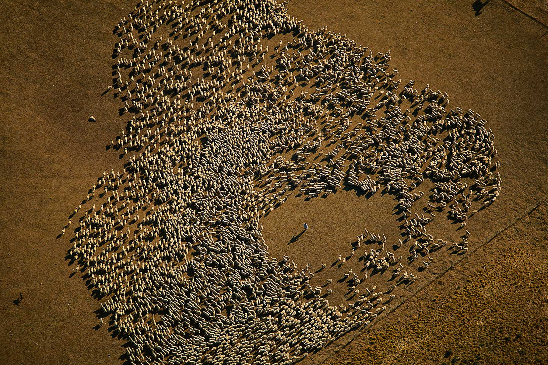
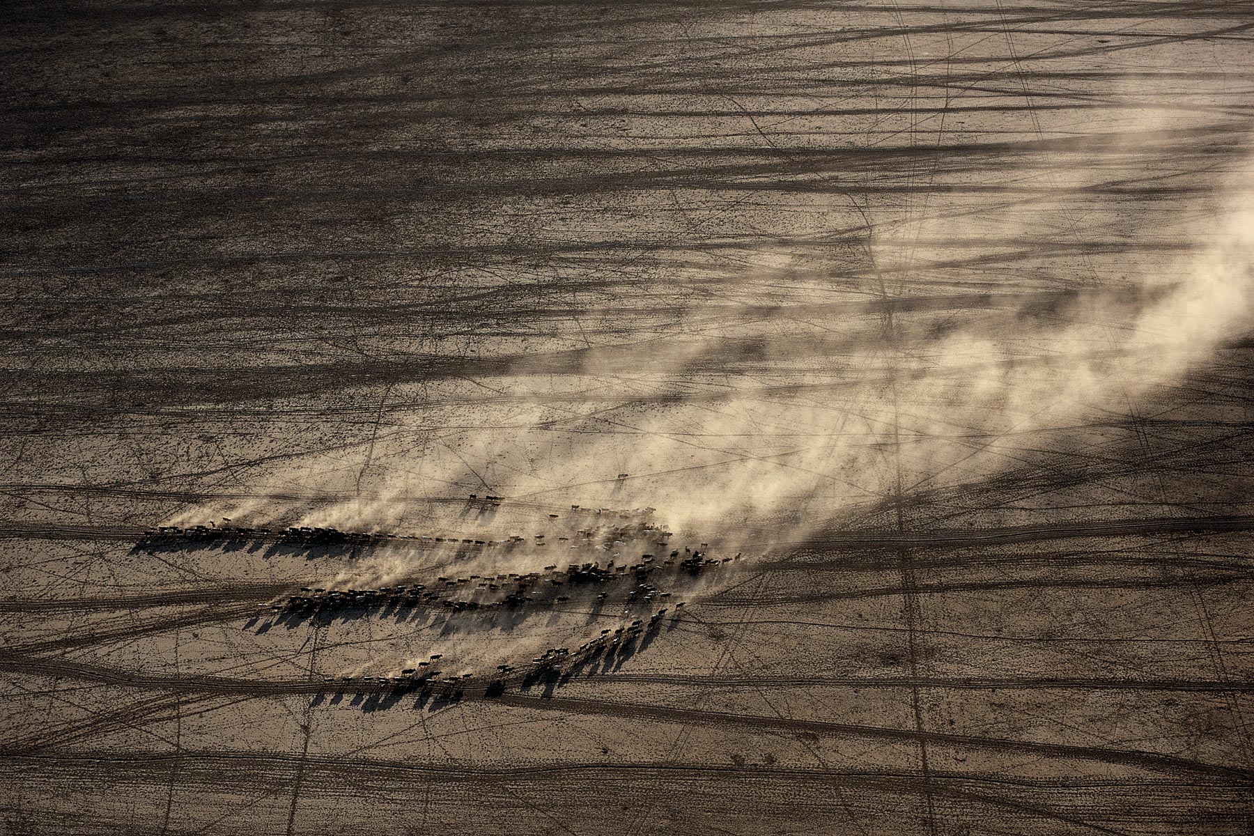
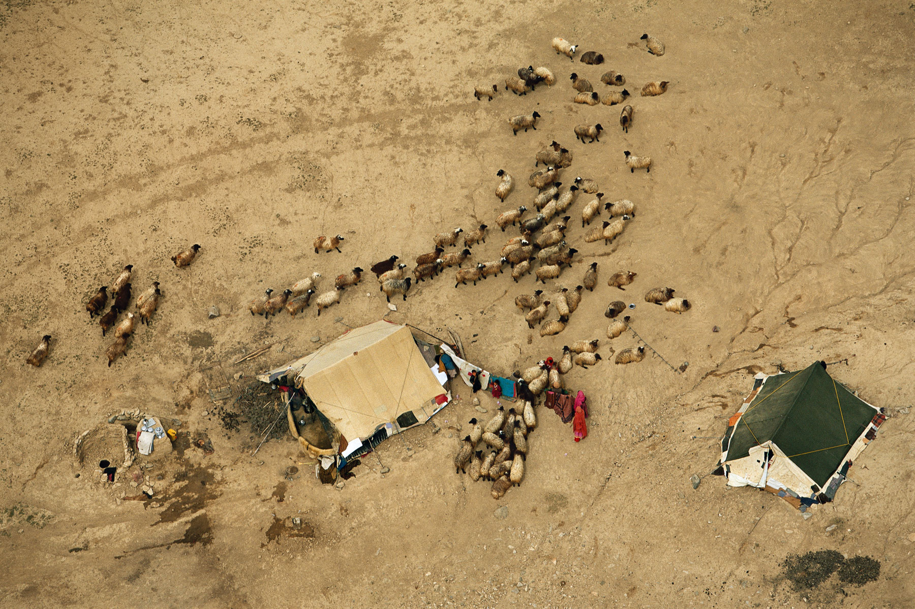
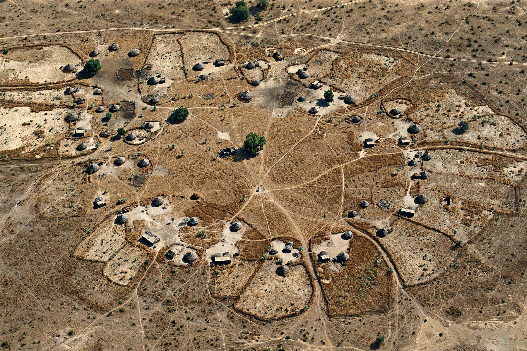
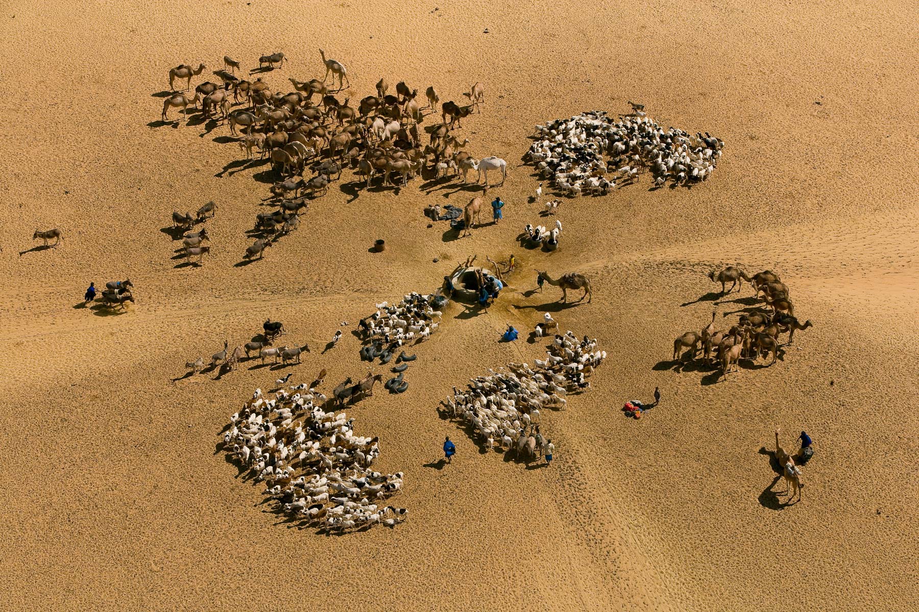
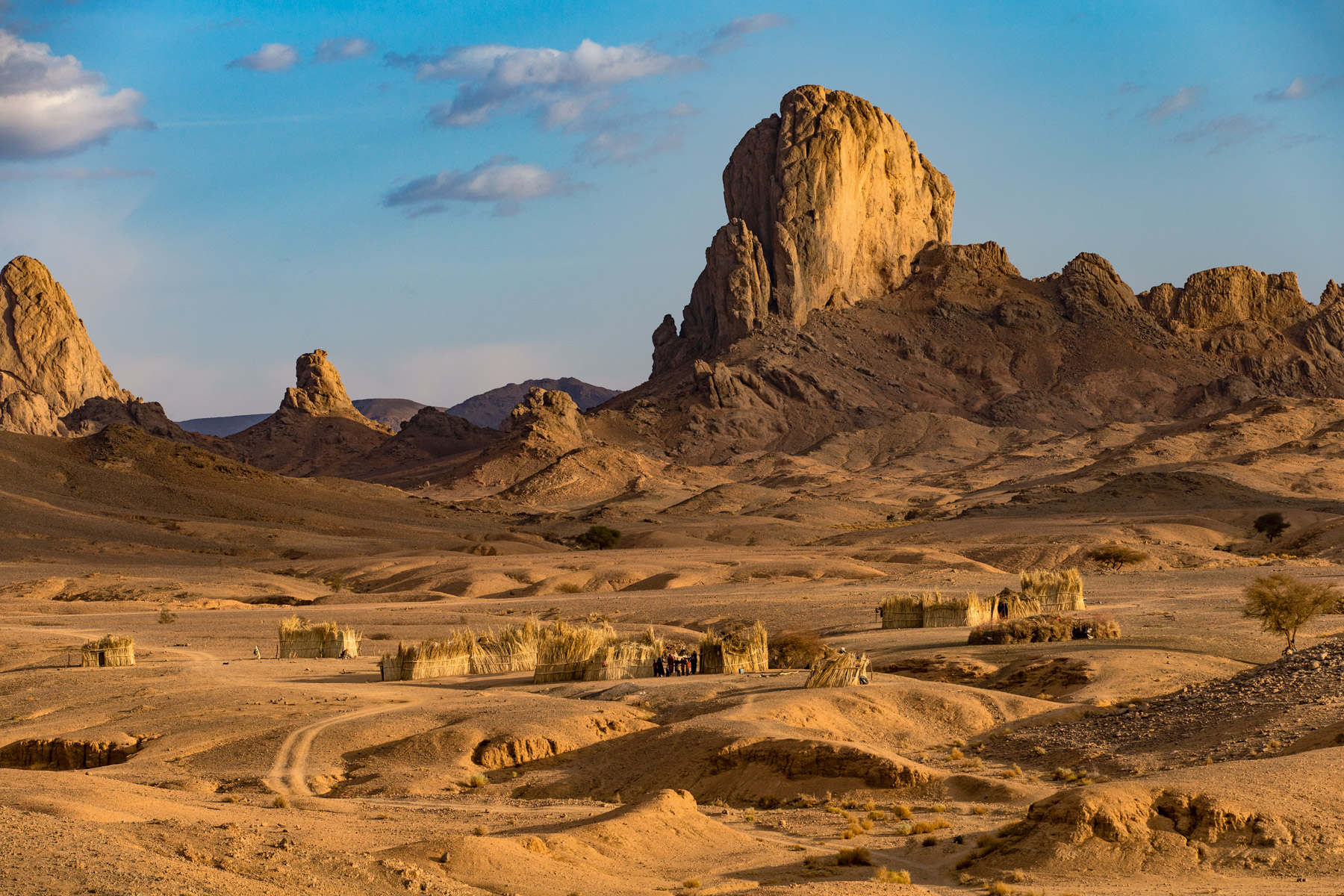
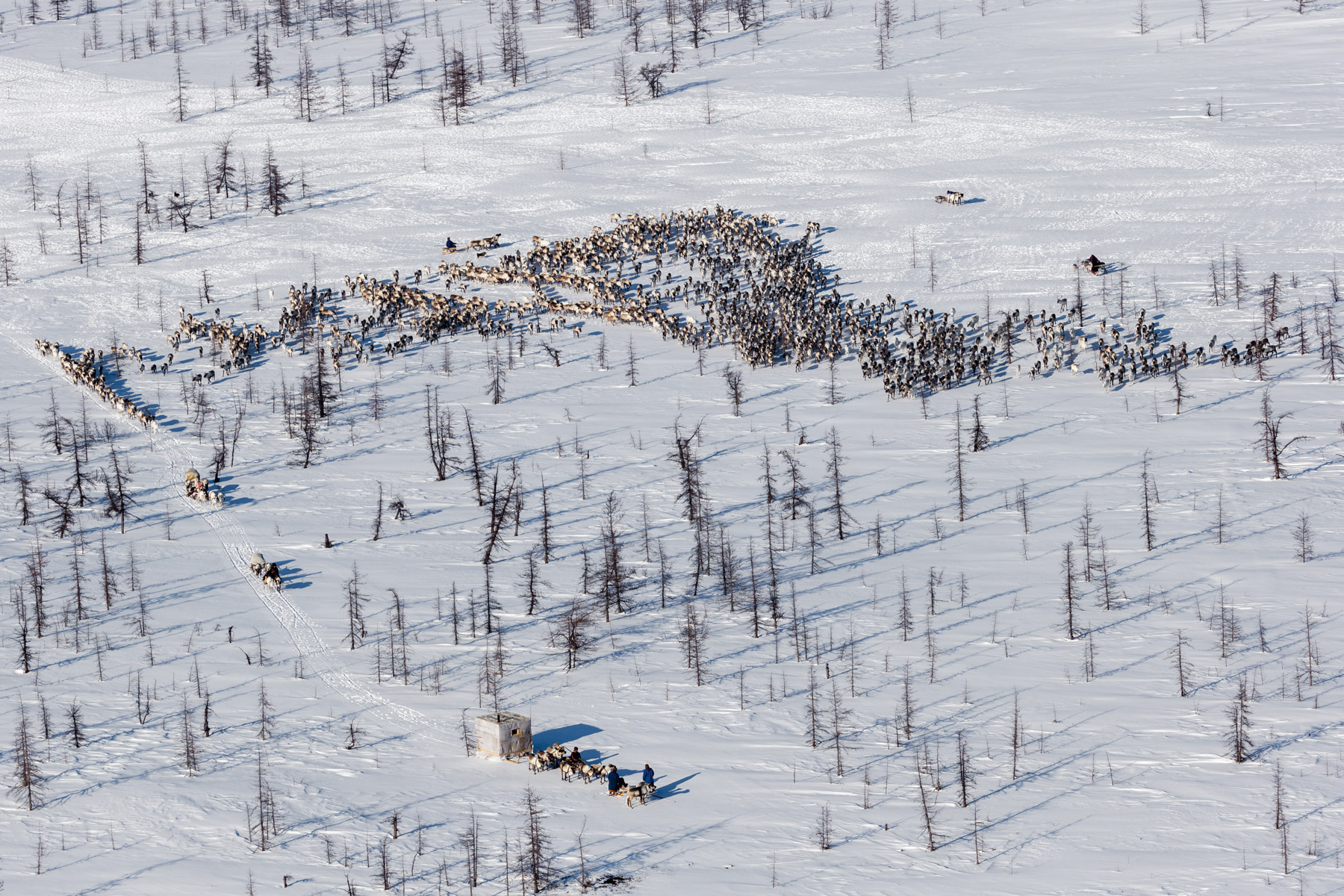
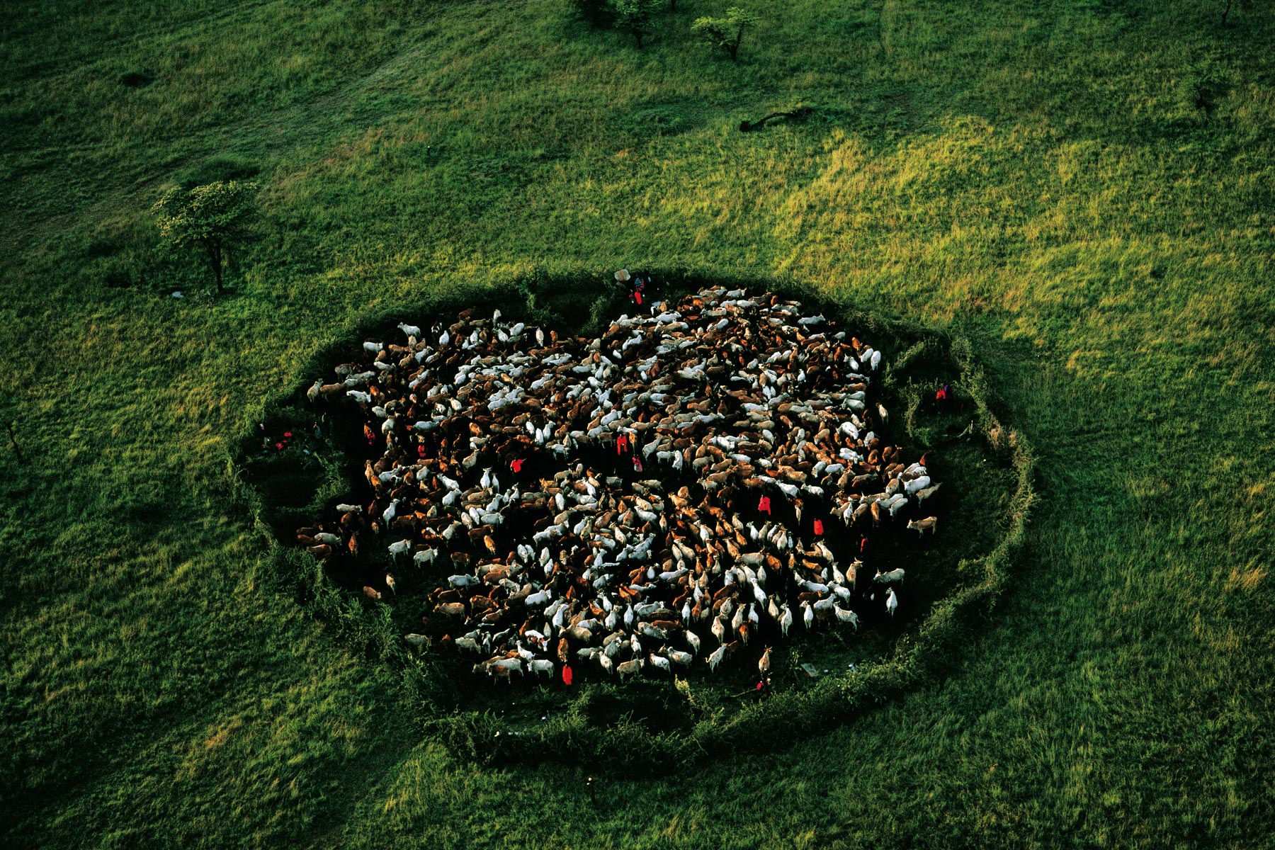
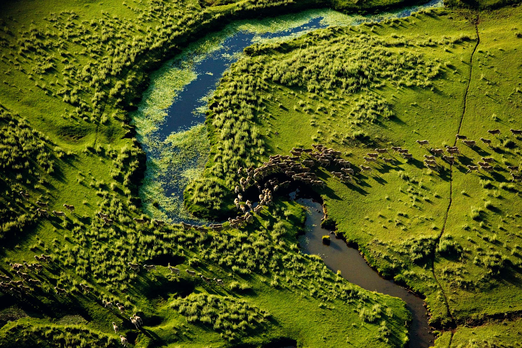
Nomad encampment and herd, Lake Chad region, Chad (13°15' N – 15°12' E).
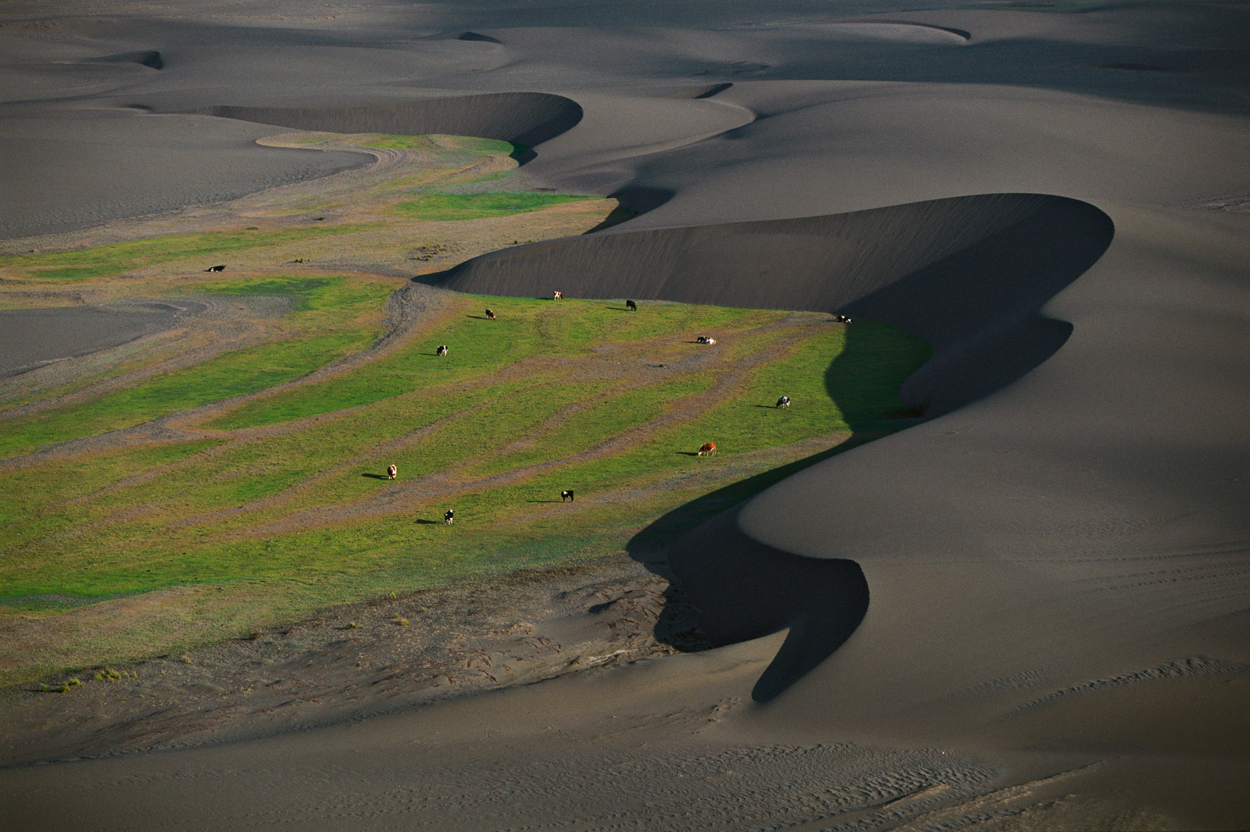
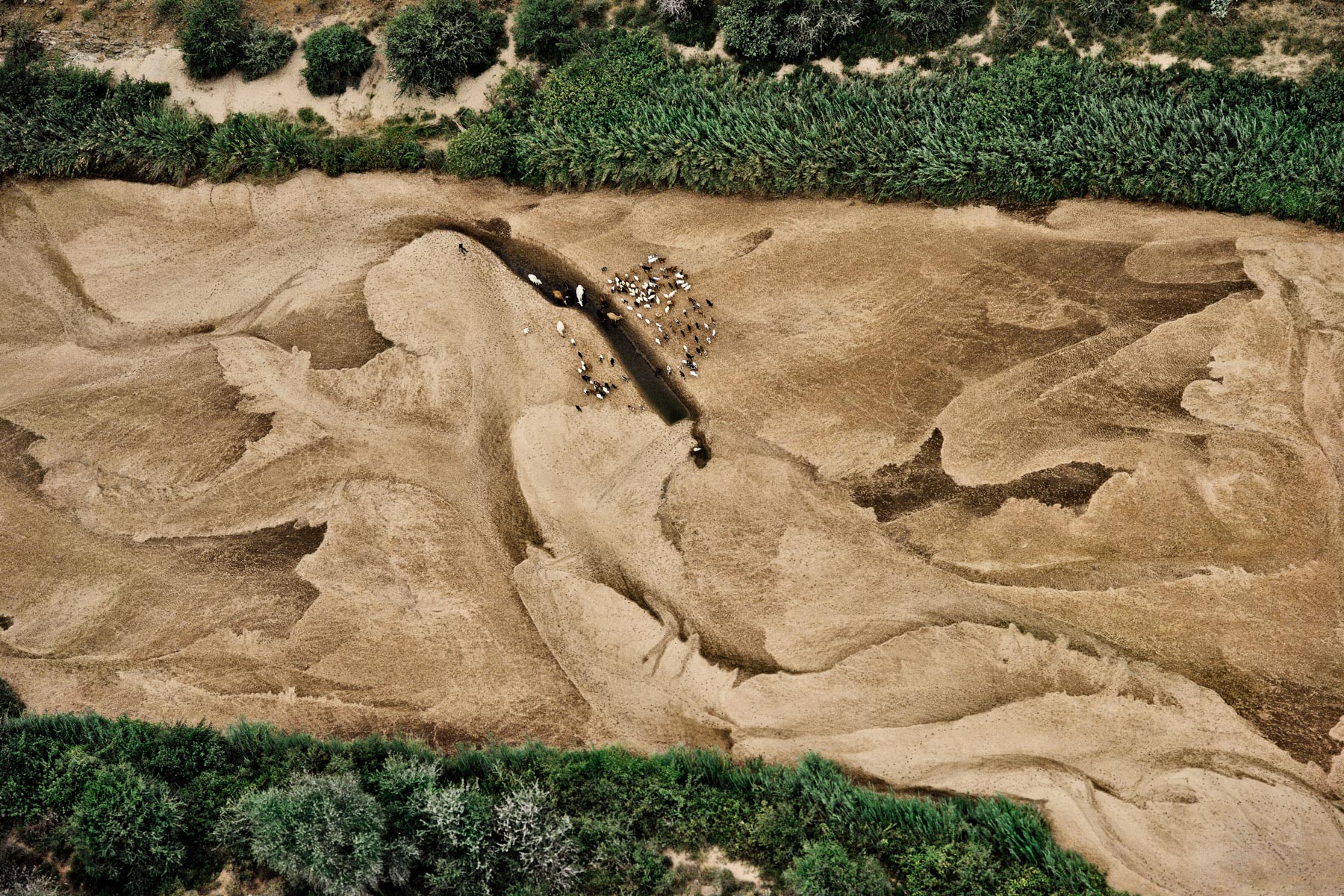
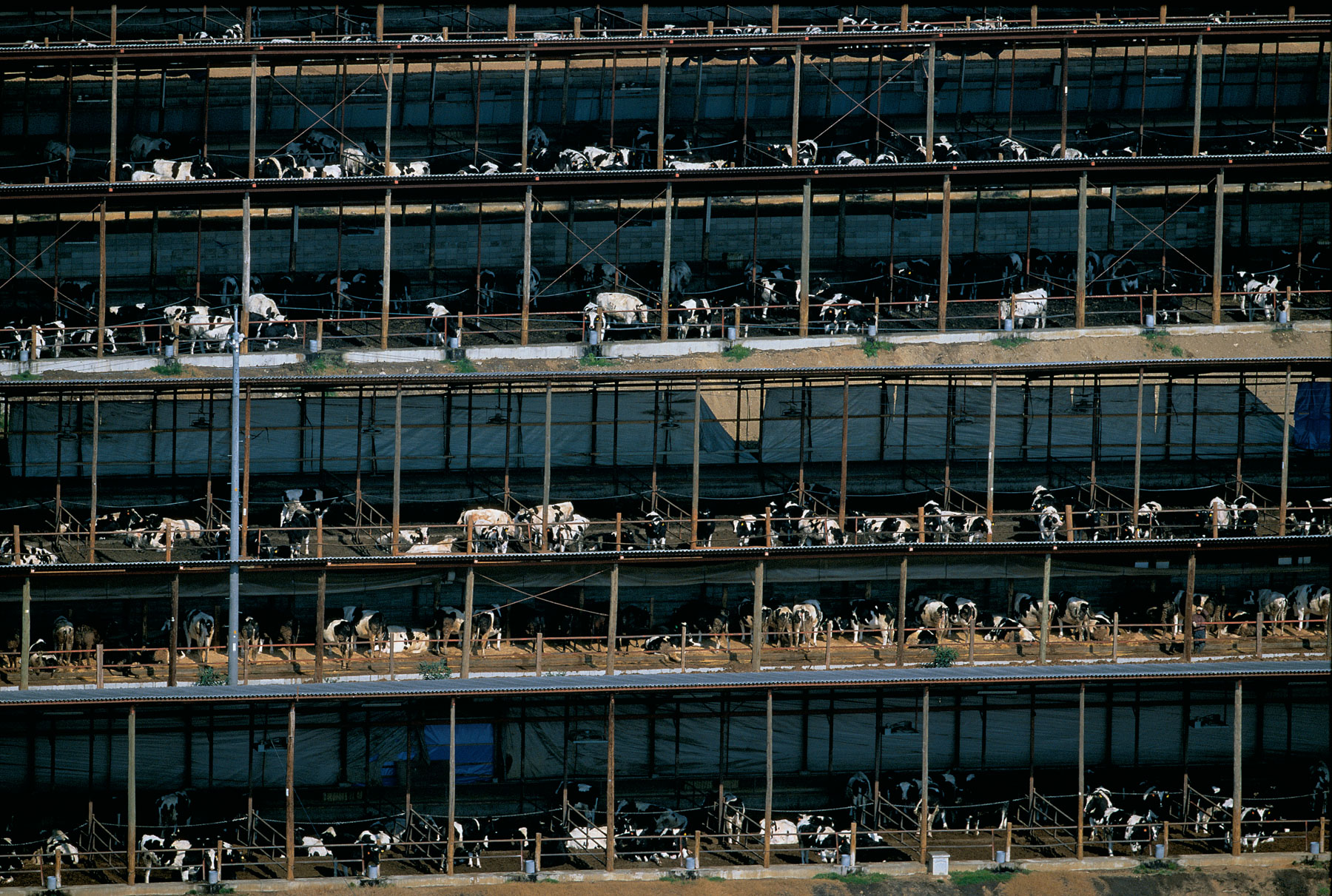
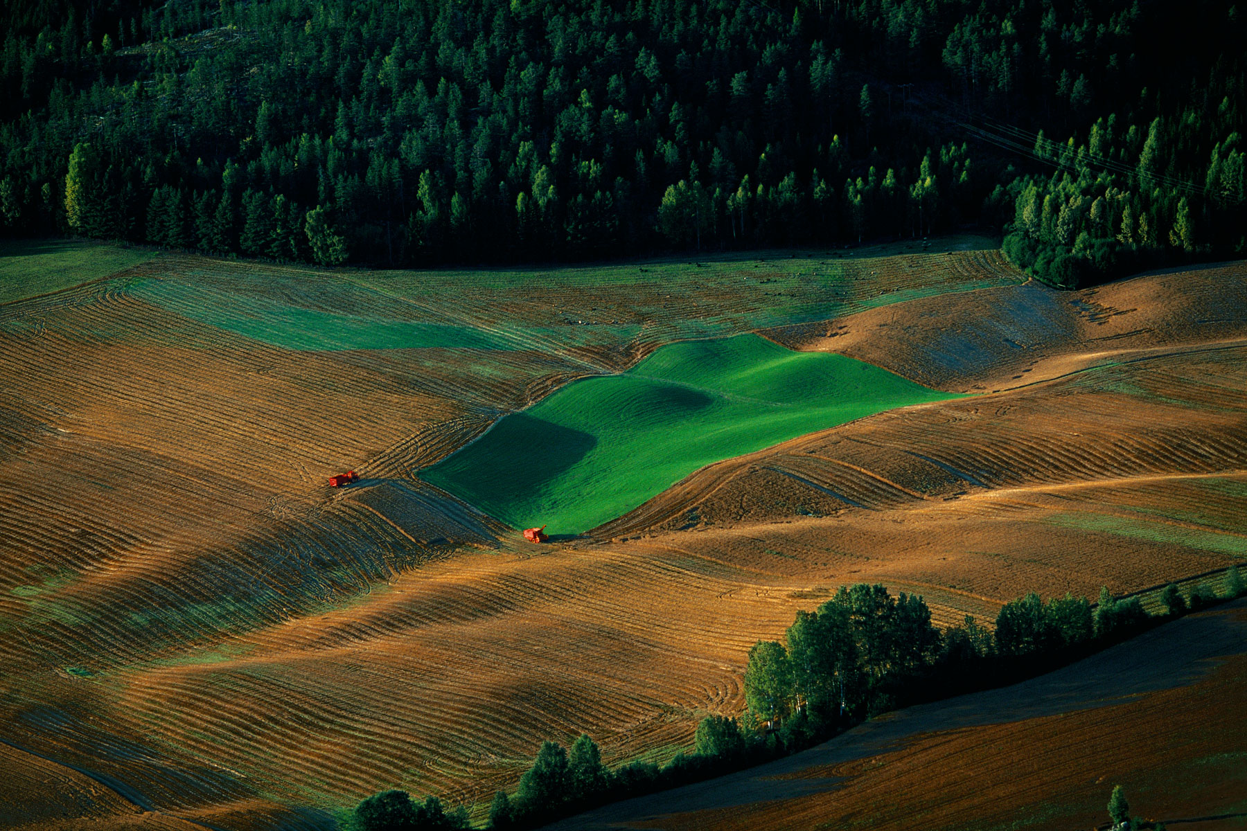
Dairy cows grazing between dunes, Maule province, Chile (35°47' S - 72°33' W).
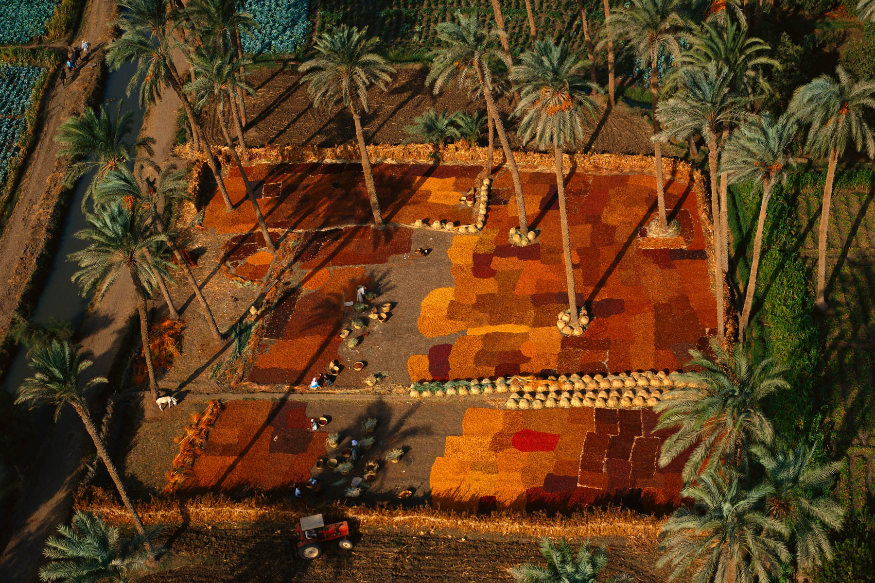
Drying dates, palm grove in the south of Cairo, Nile Valley, Egypt (29°43' N – 31°17' E).
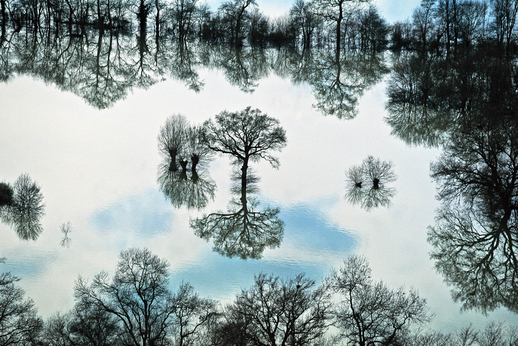
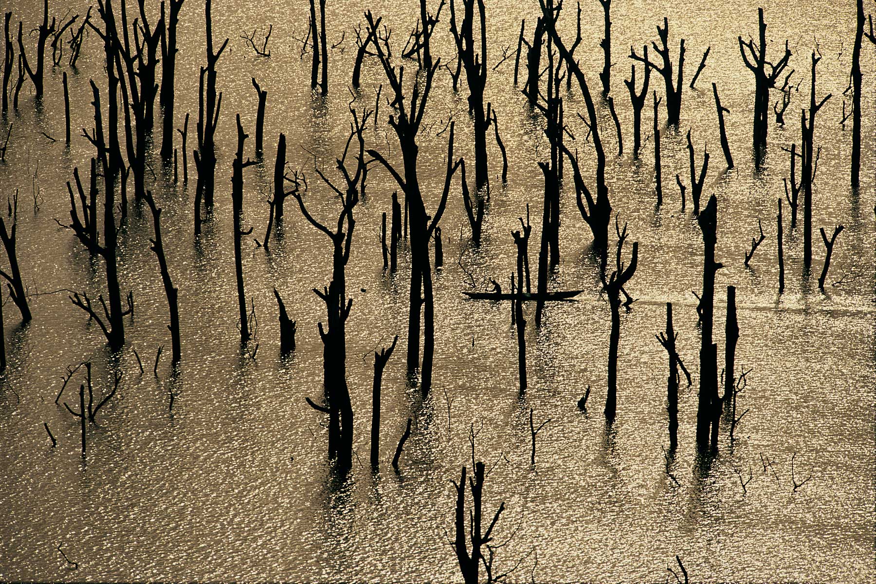
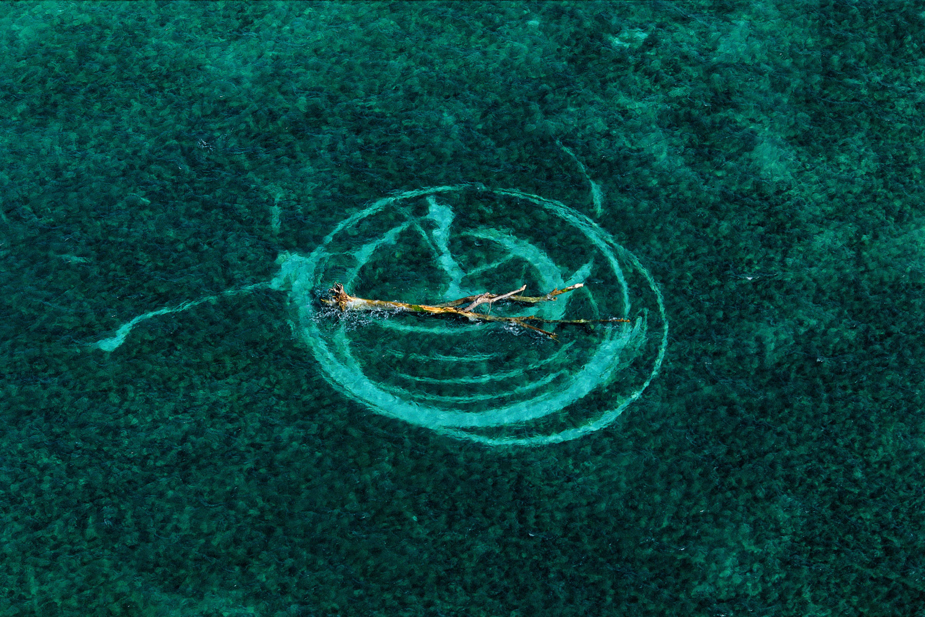
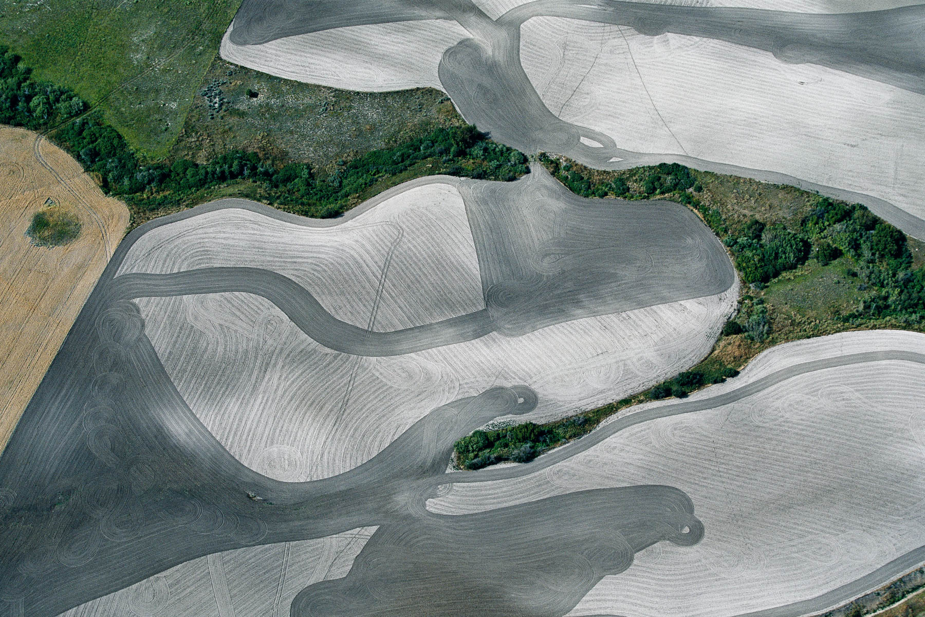
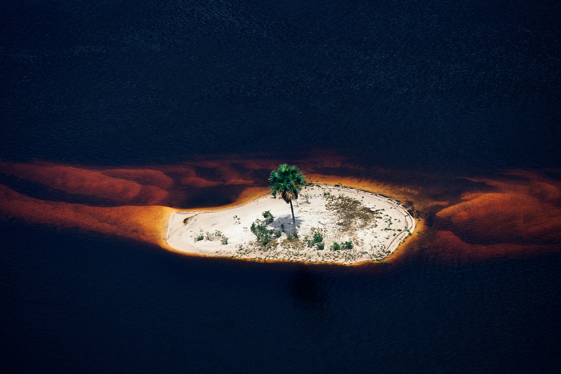
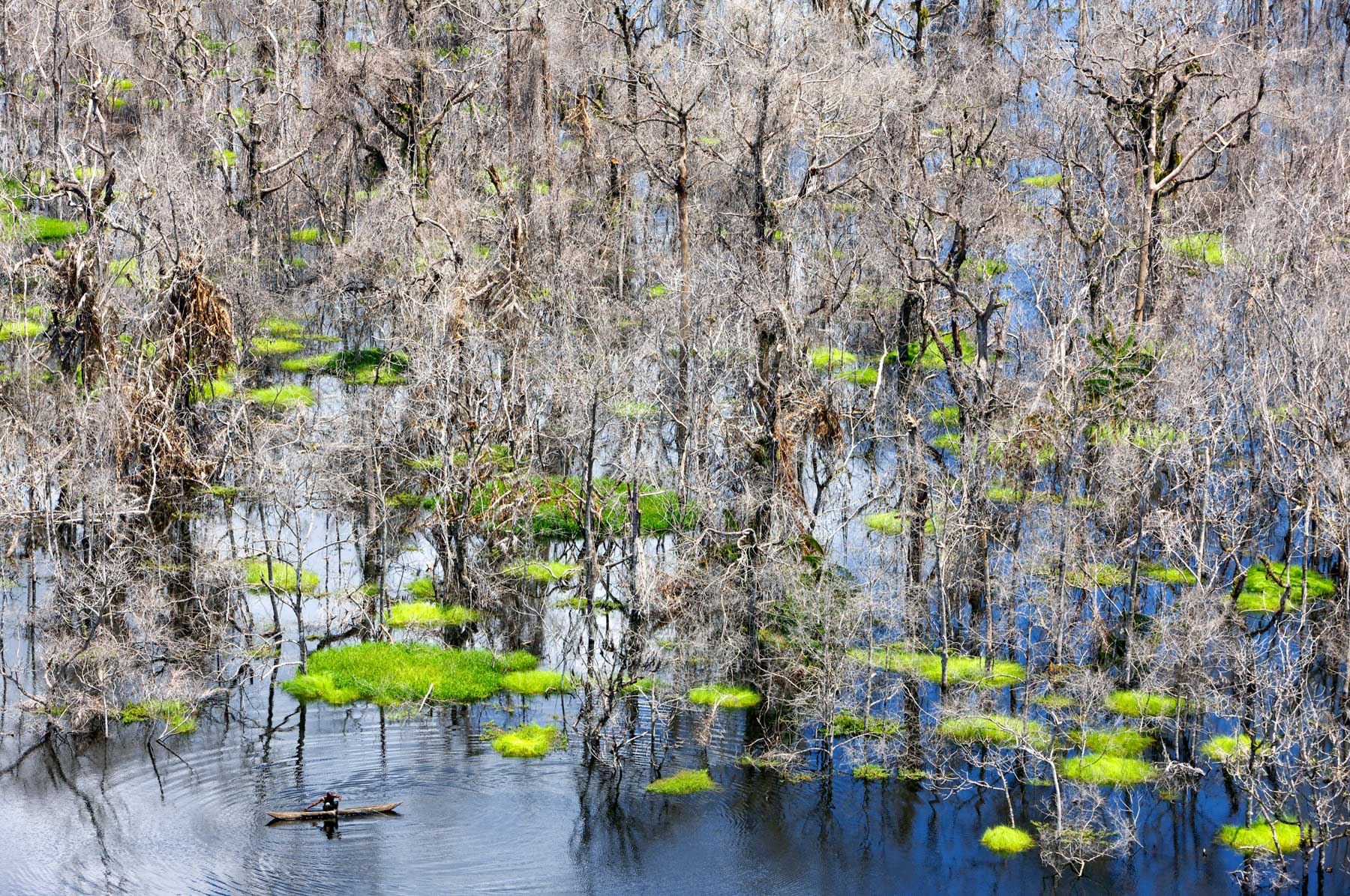
Trees in the middle of water near Taponas, Rhône, France (46°07' N – 04°45' W).
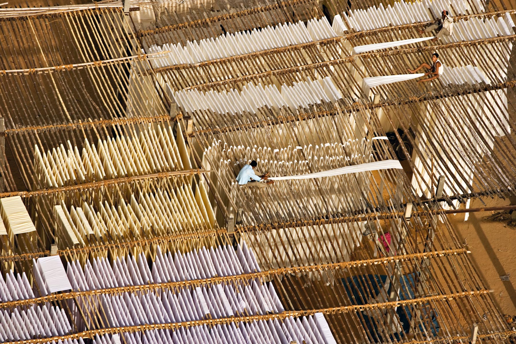
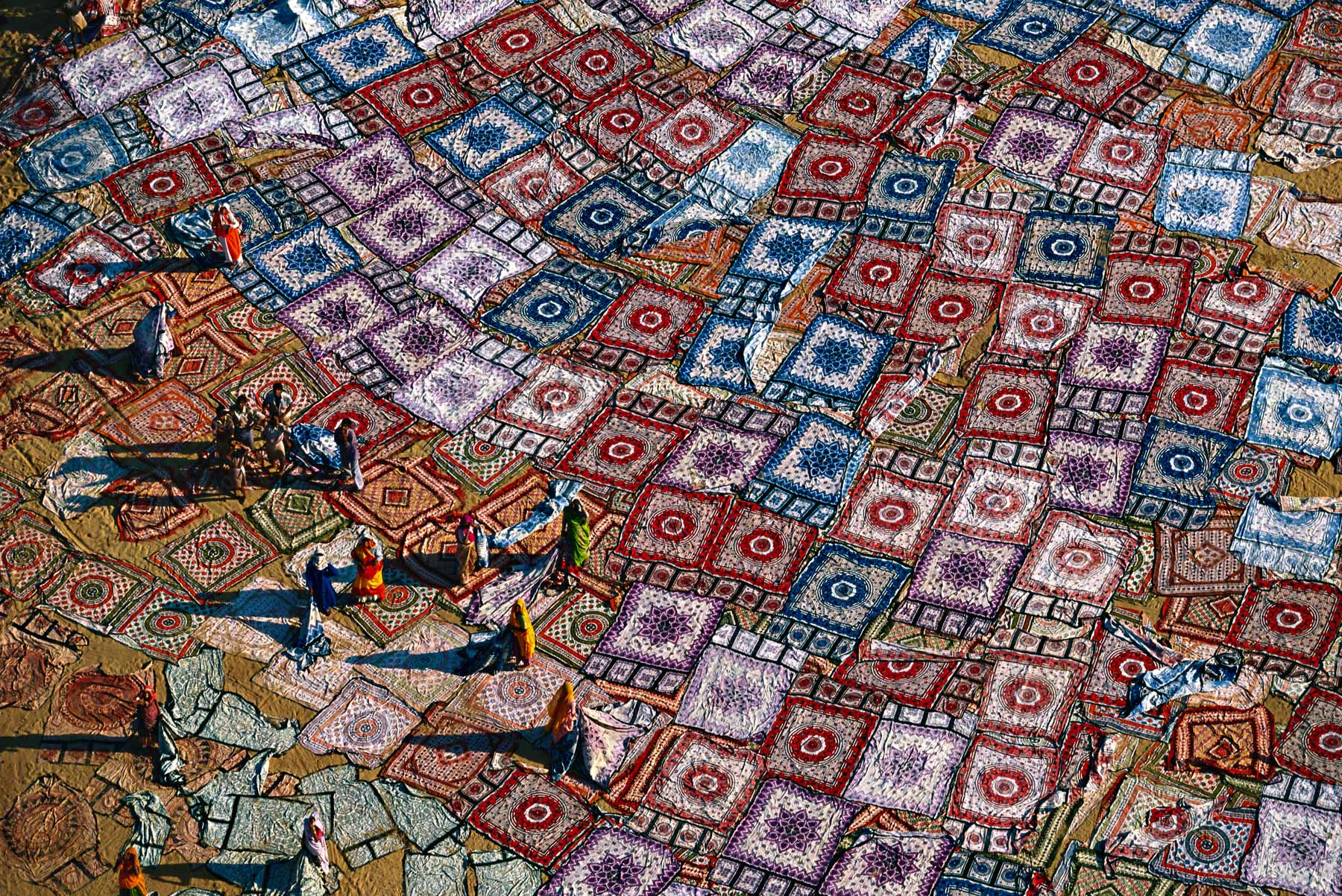
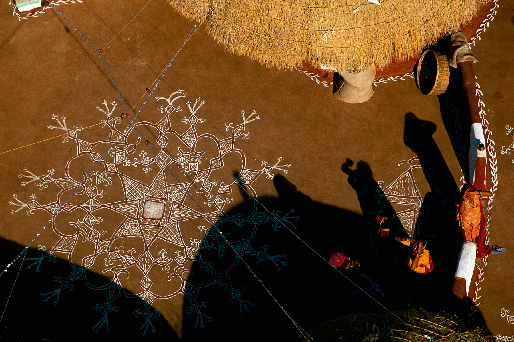
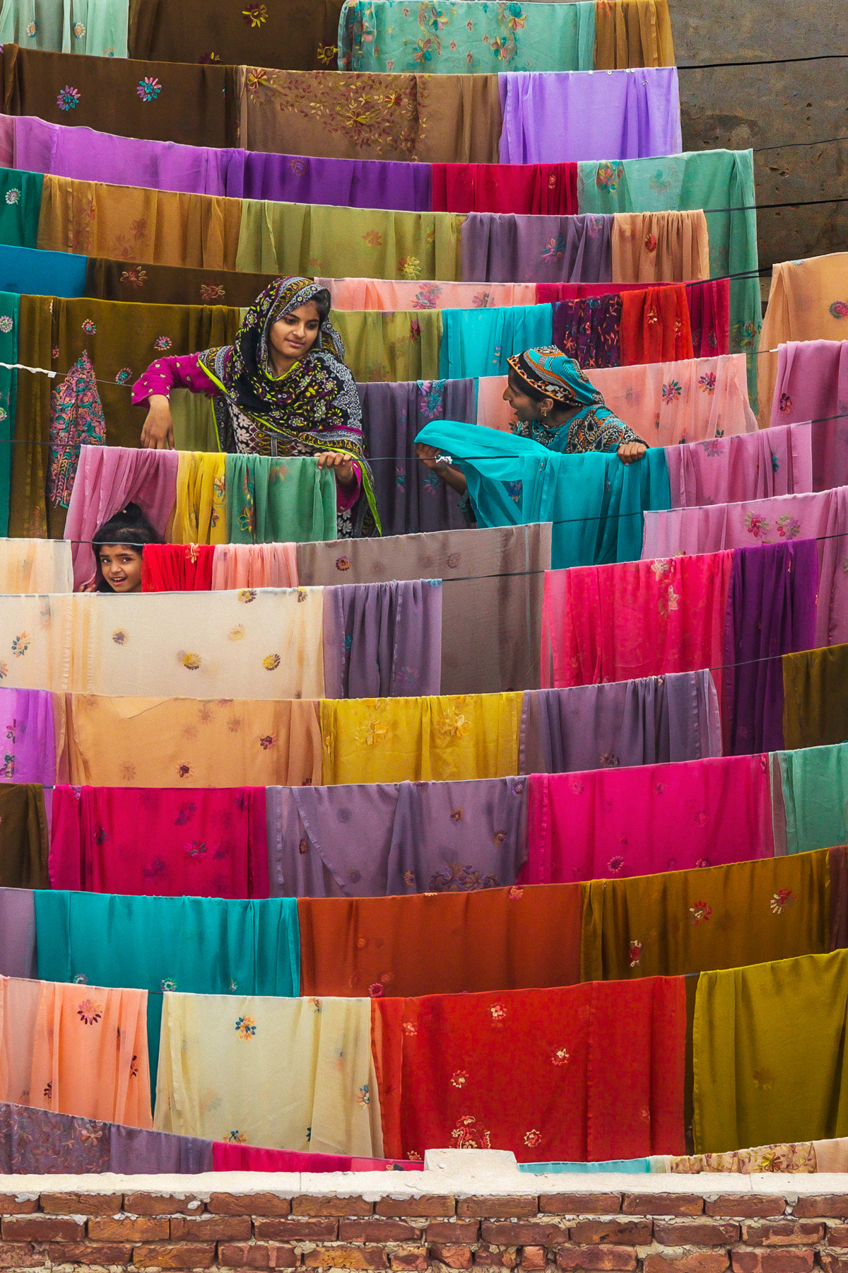
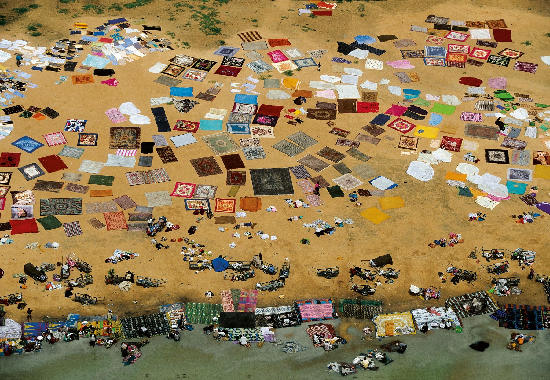
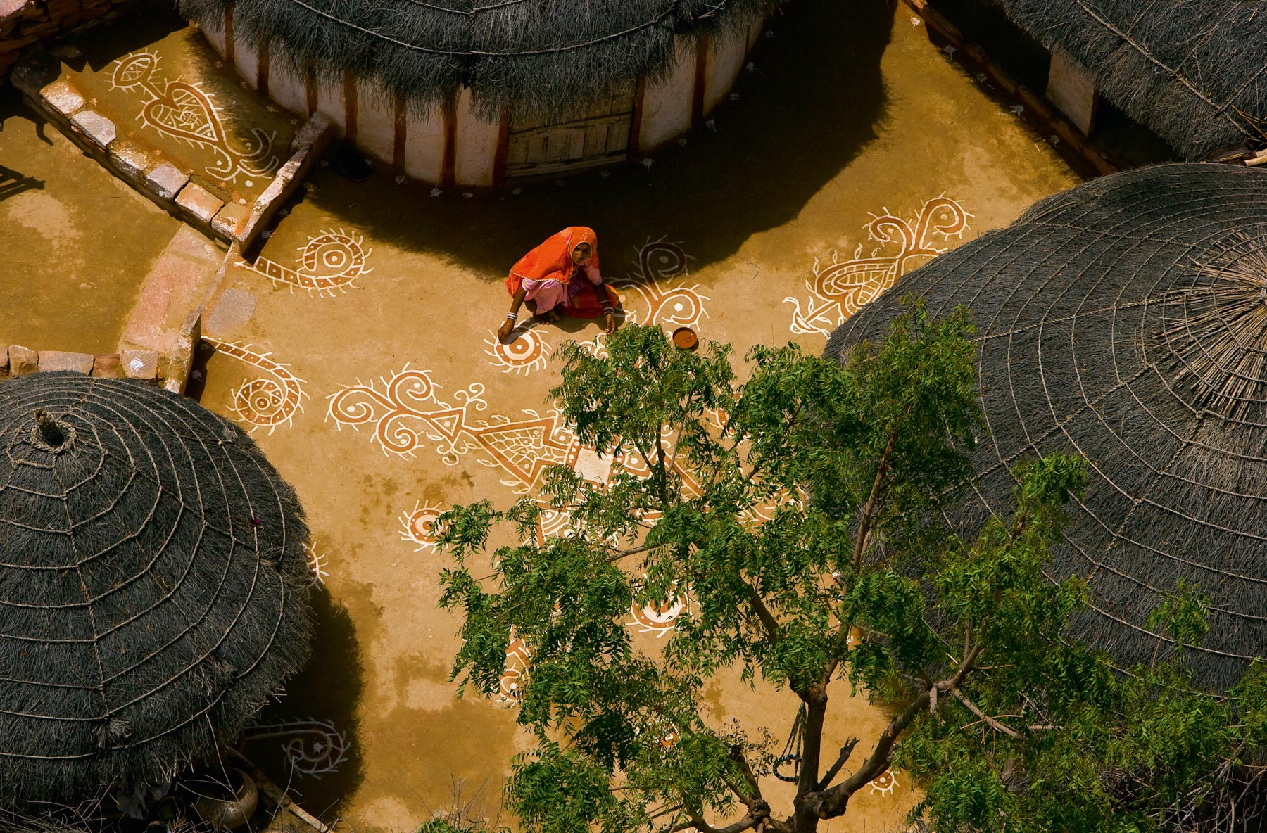
Cotton fabrics in Sanganer, Rajasthan, India (26°49' N – 75°47' E).
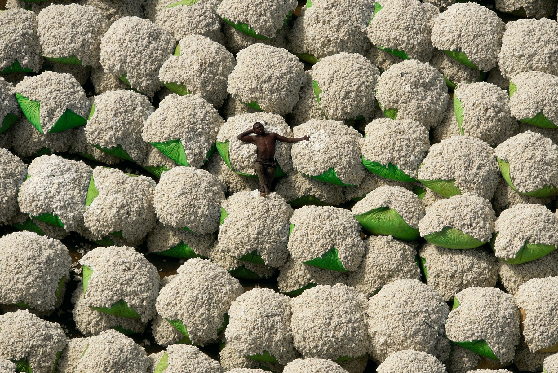
Cotton bales, Thonakaha, Korhogo region, Ivory Coast (9°28' N - 5°36' W).
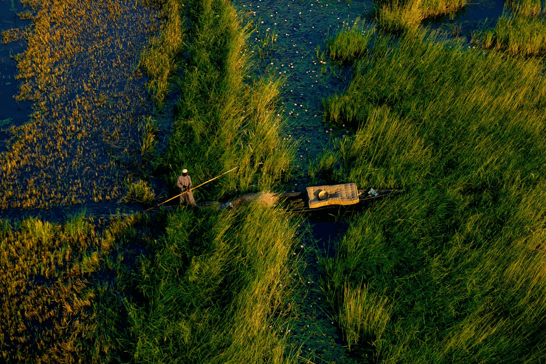
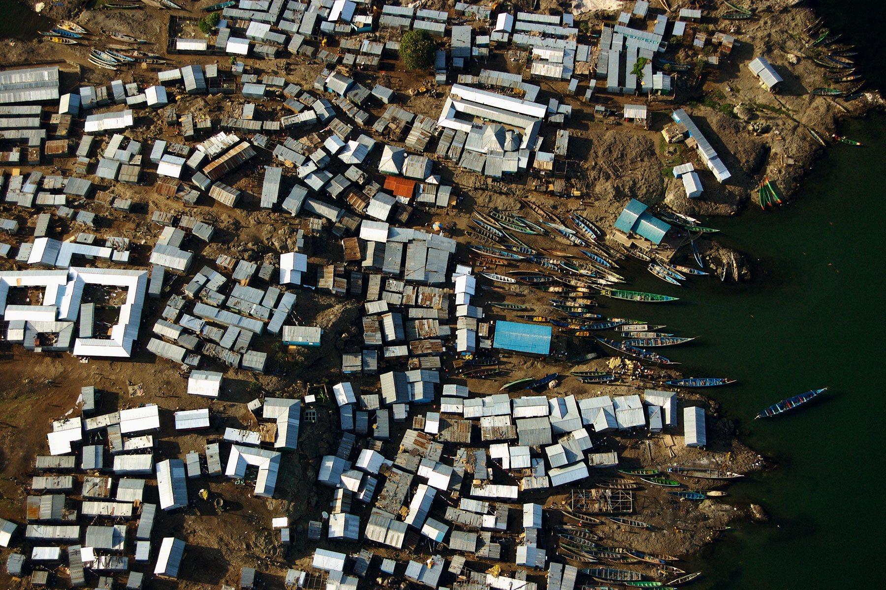
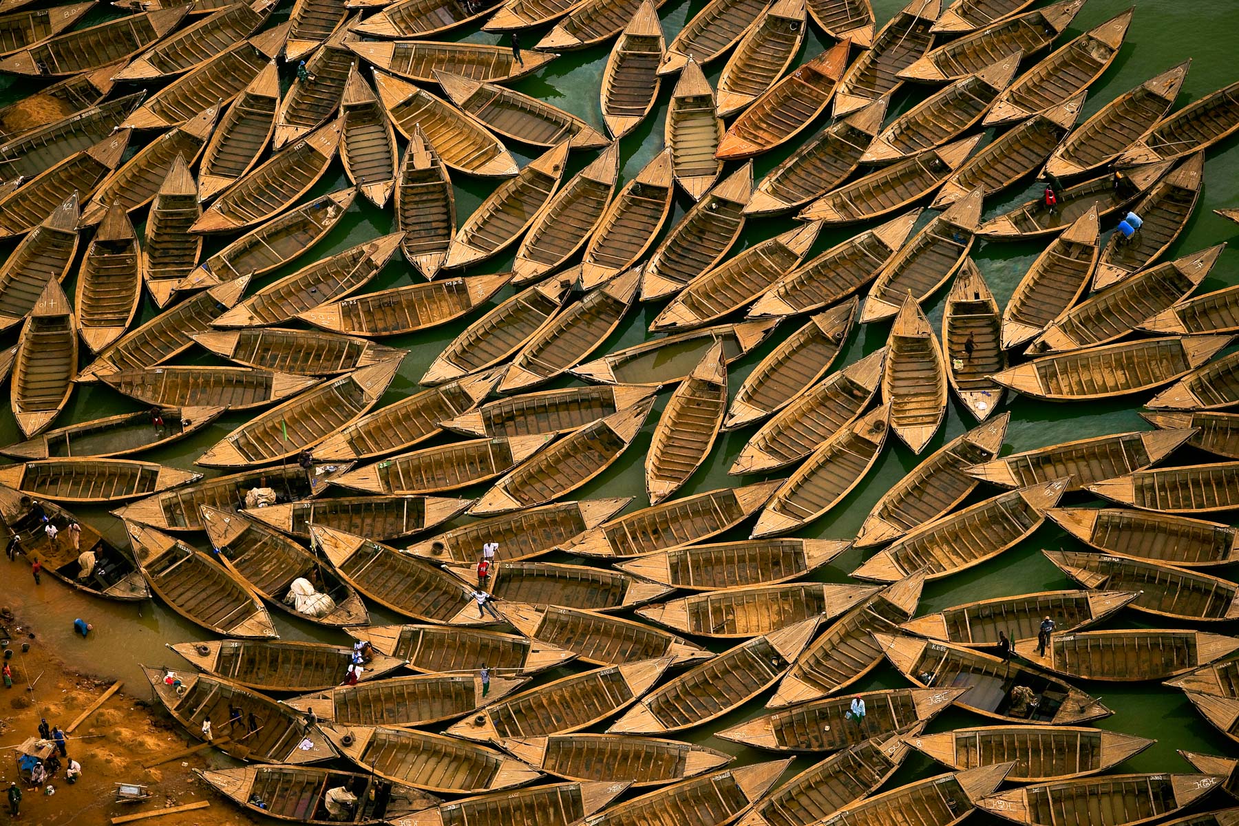
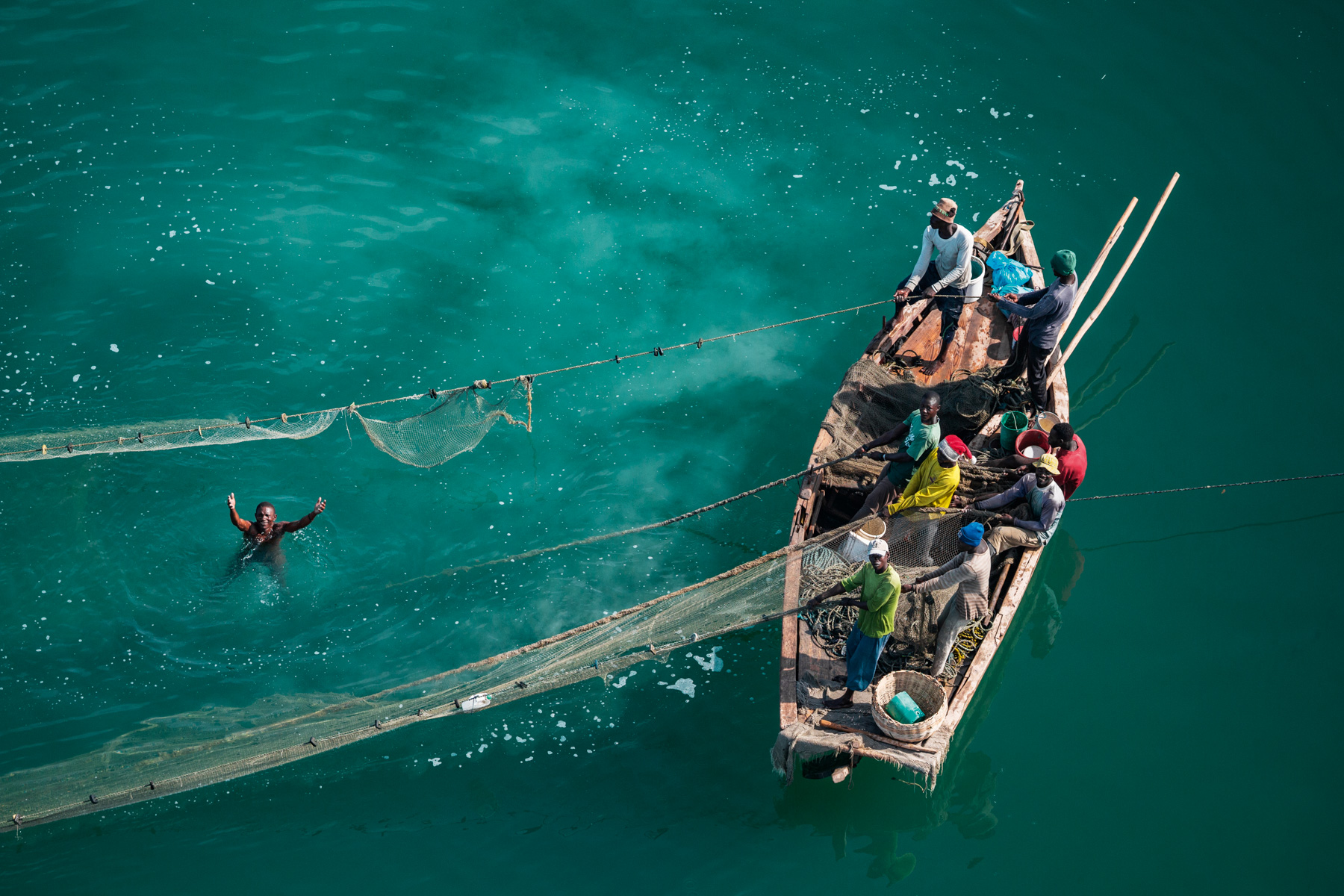
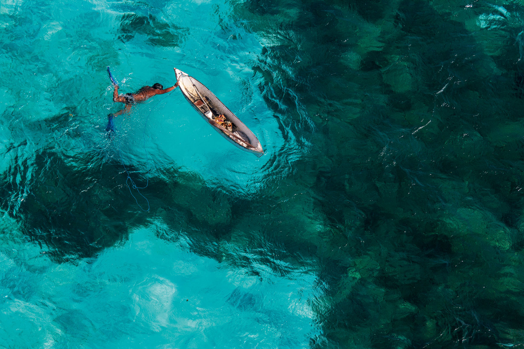
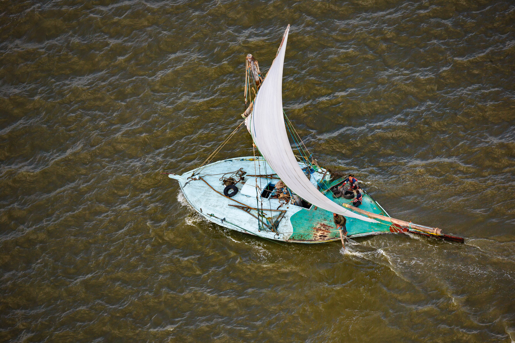
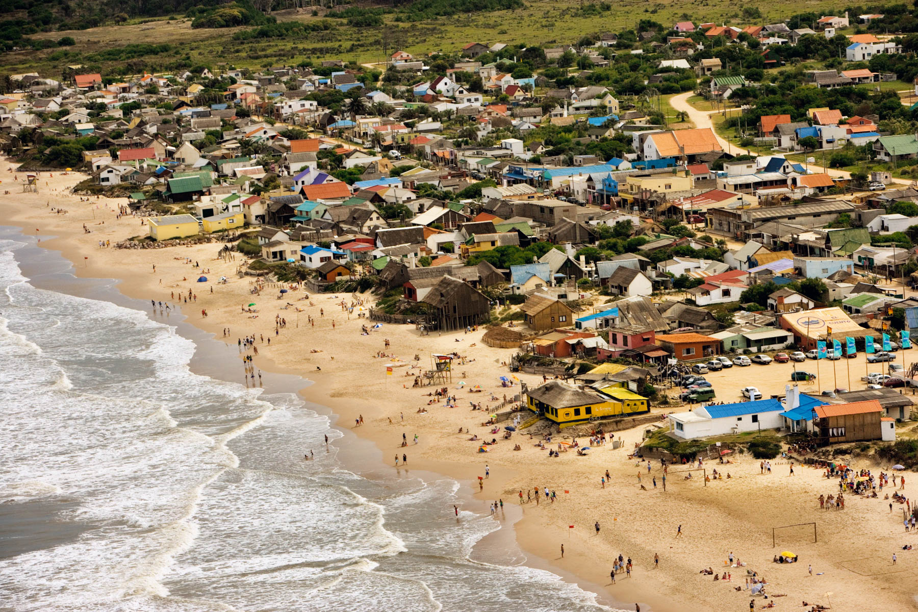
Fisherman on Lake Kossou near Bouaflé, Ivory Coast (7°07' N – 5°40' W).
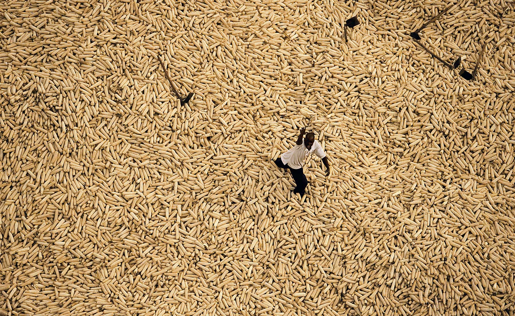
White corn storage on the edge of Maasai Mara National Reserve, Kenya (1°30' S – 35°10' E).
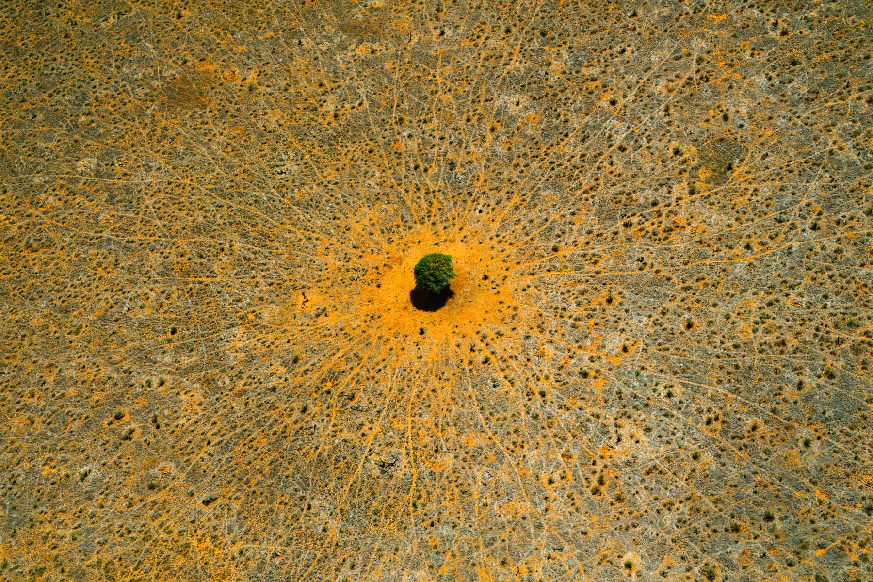
"The tree of life", Tsavo-East National Park, Kenya (3°36' S – 39°02' E).
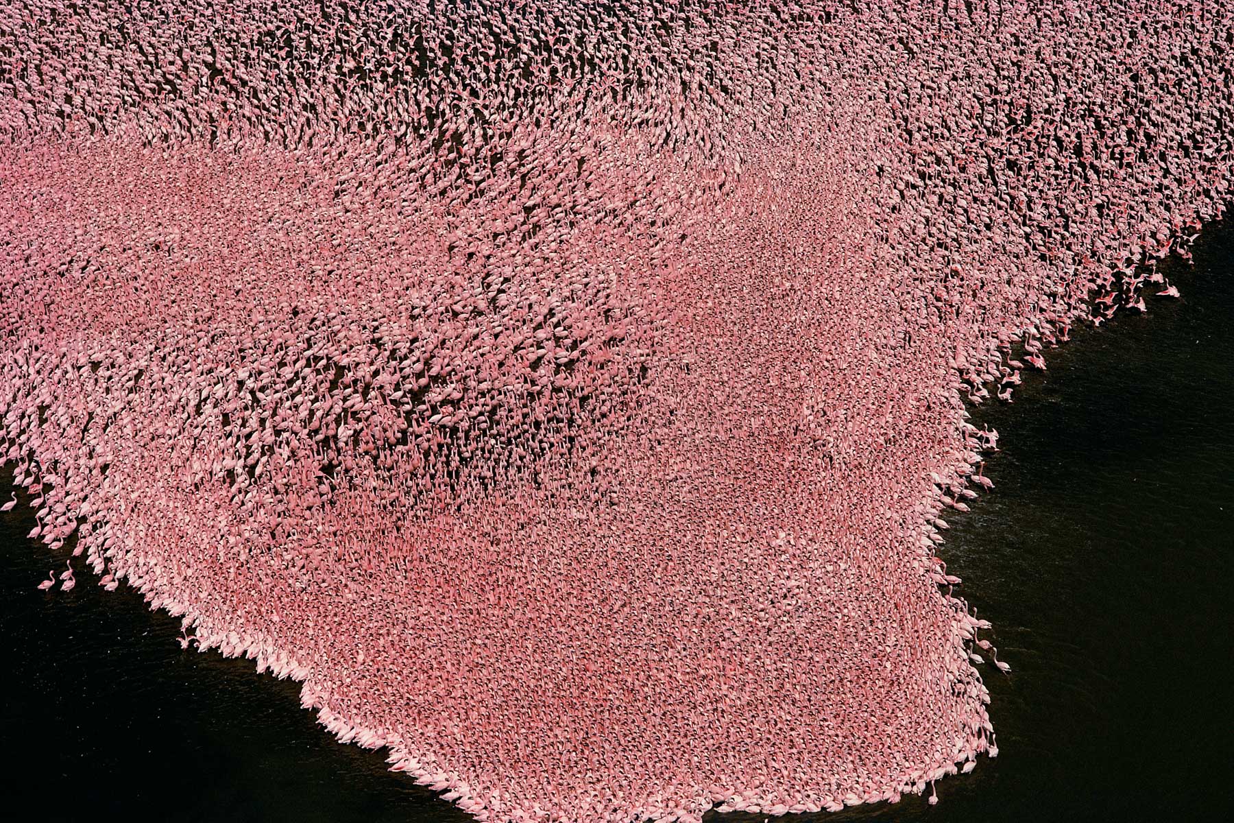
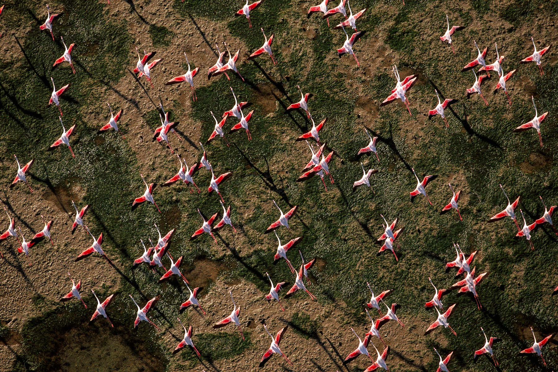
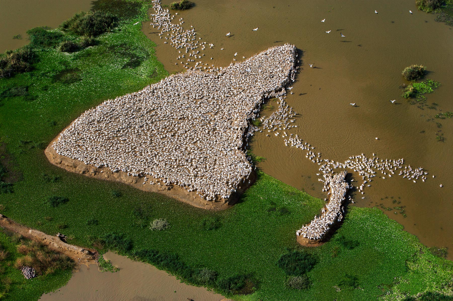
Flamingos on Lake Nakuru, Kenya (0°19' S – 36°06' E).
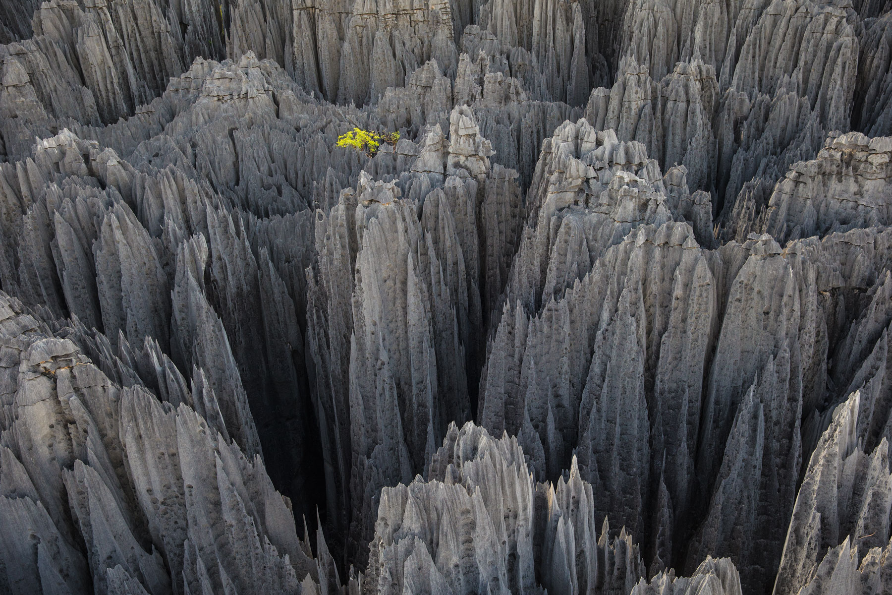
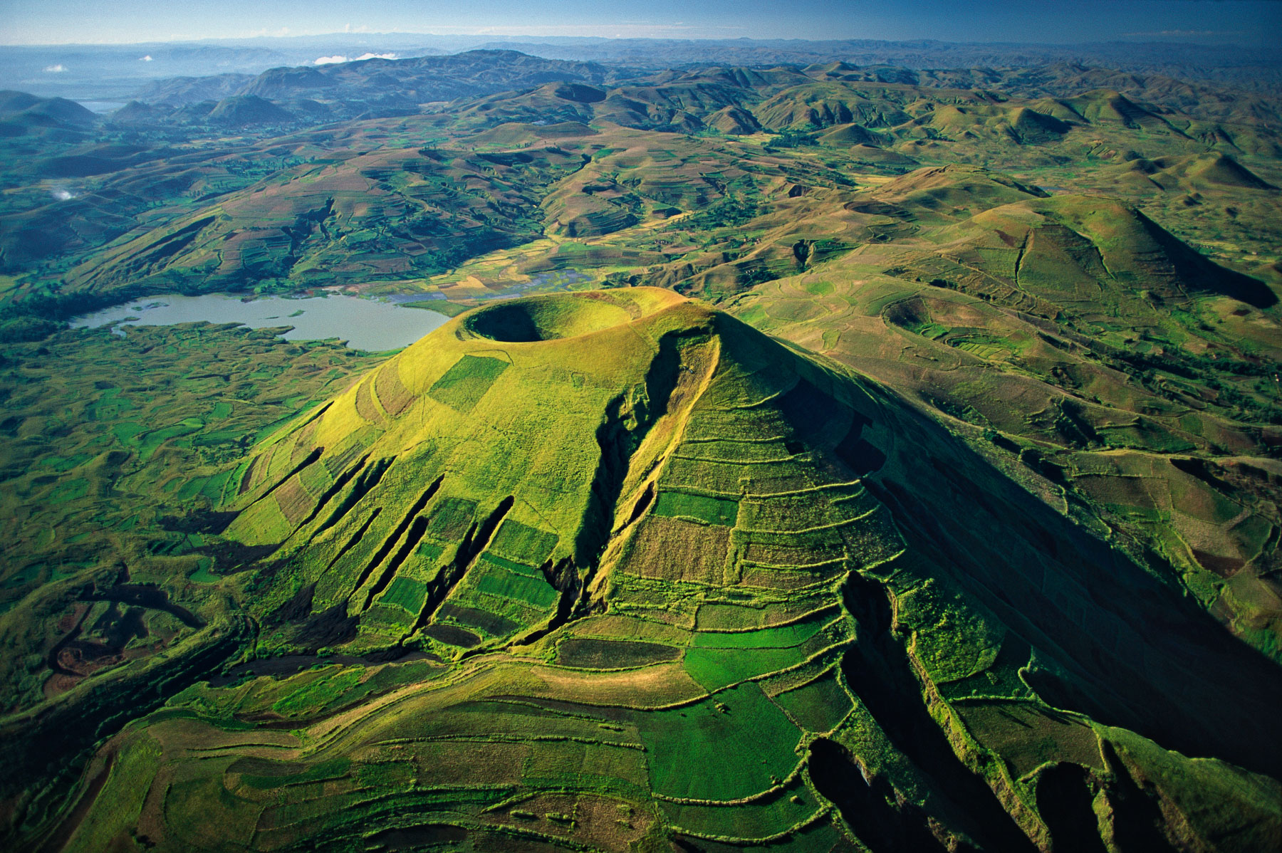
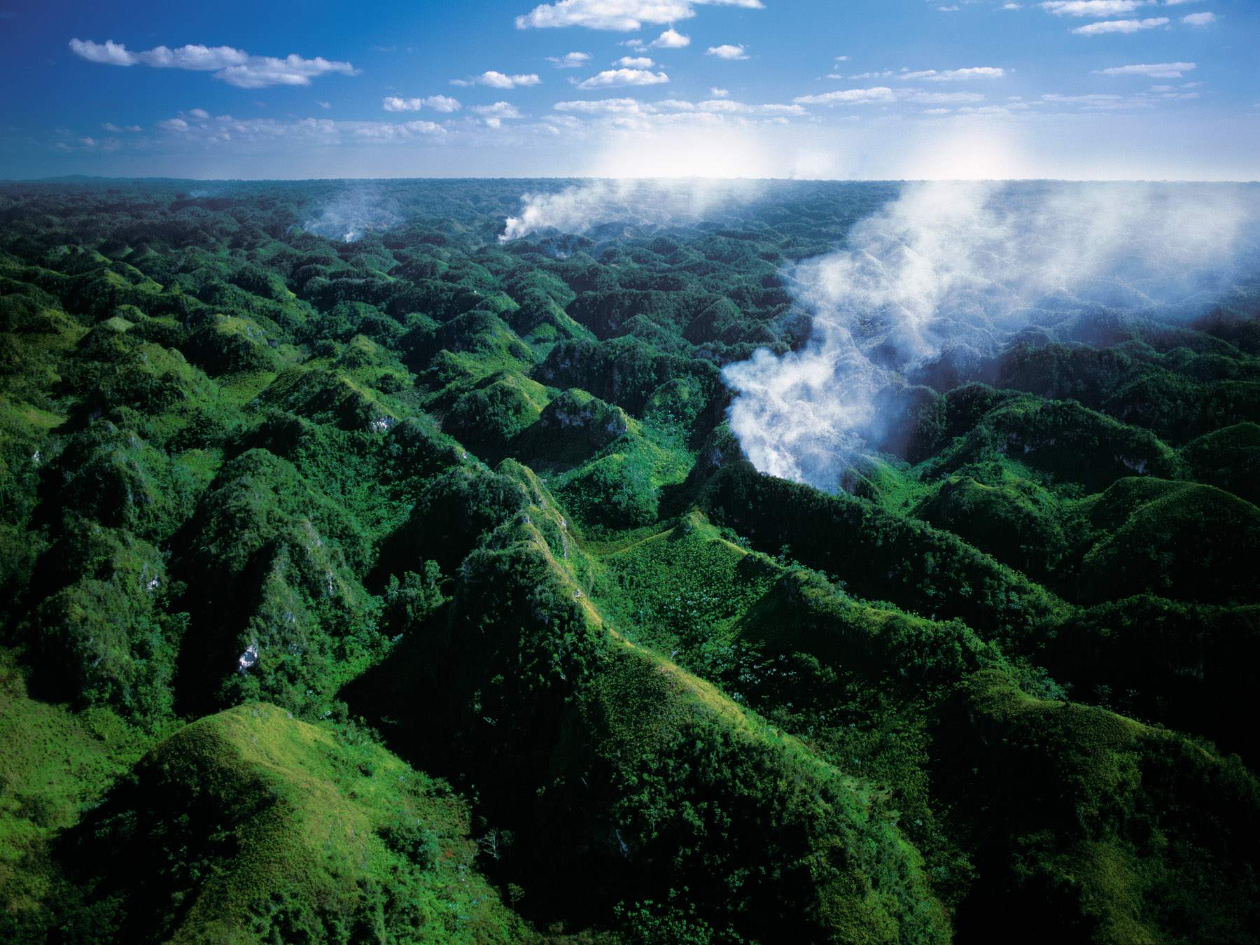
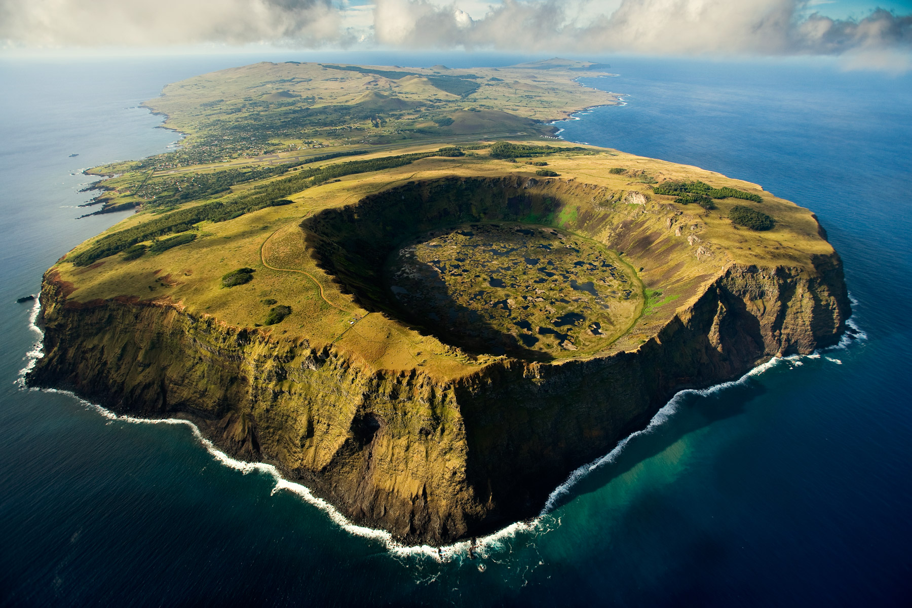
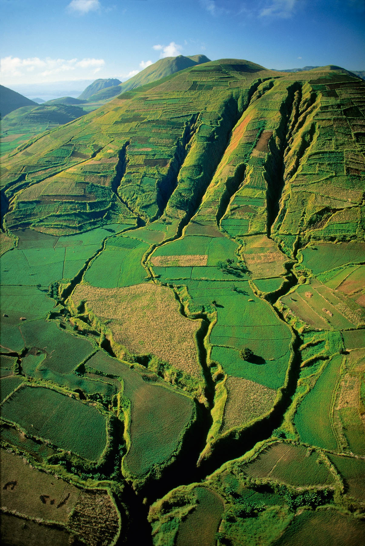
Tsingy de Bemaraha, région de Morondava, Madagascar (18°47’S – 45°03’E).
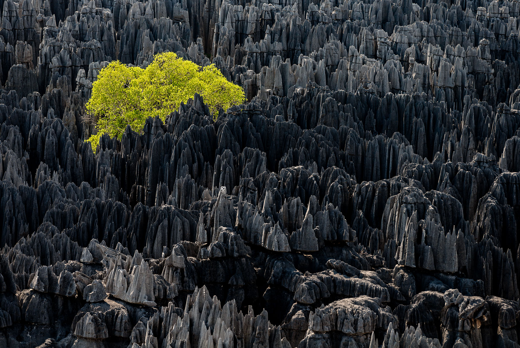
Tsingy of Bemaraha, Morondava region, Madagascar
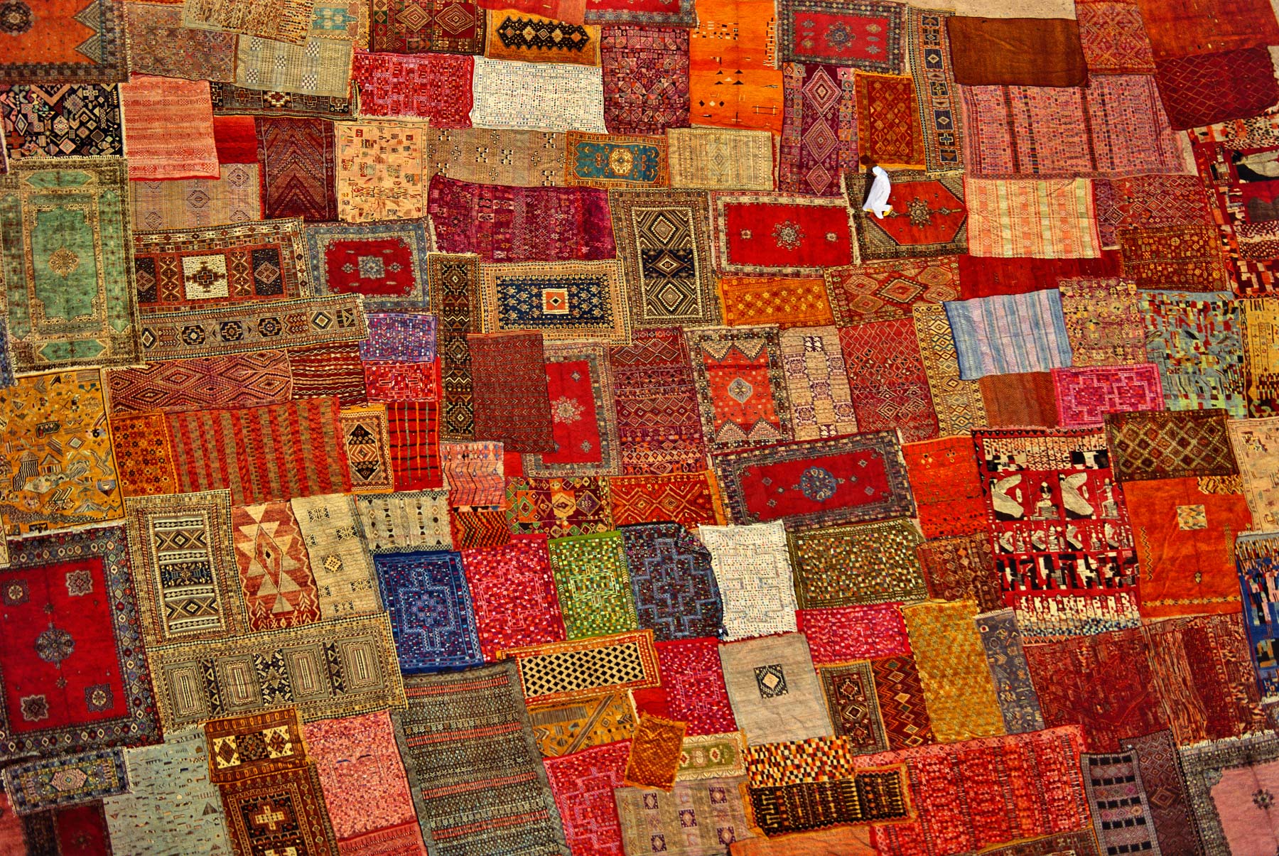
Marrakesh carpet, Morocco (31°37' N - 8°00' W).
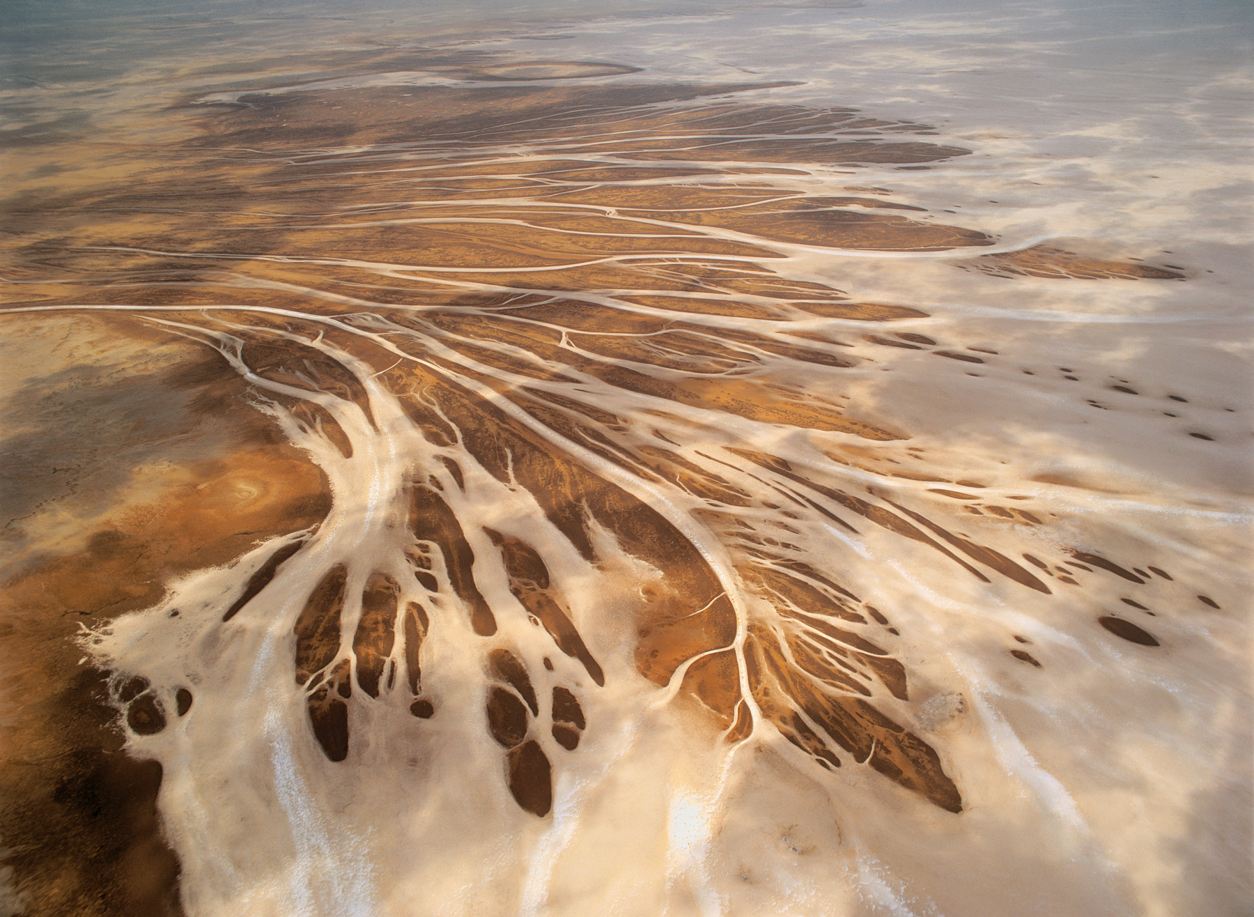
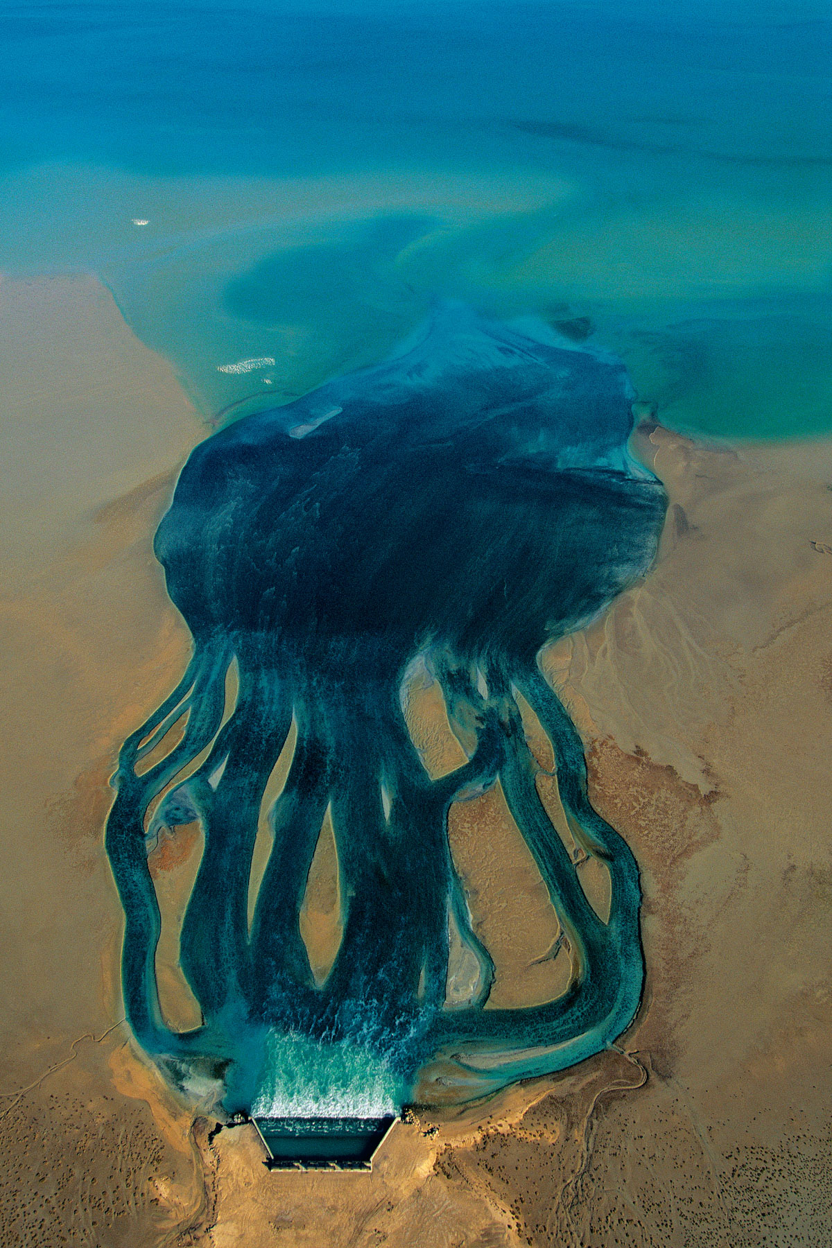
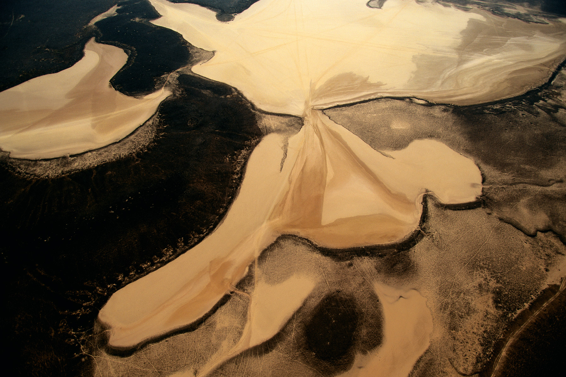
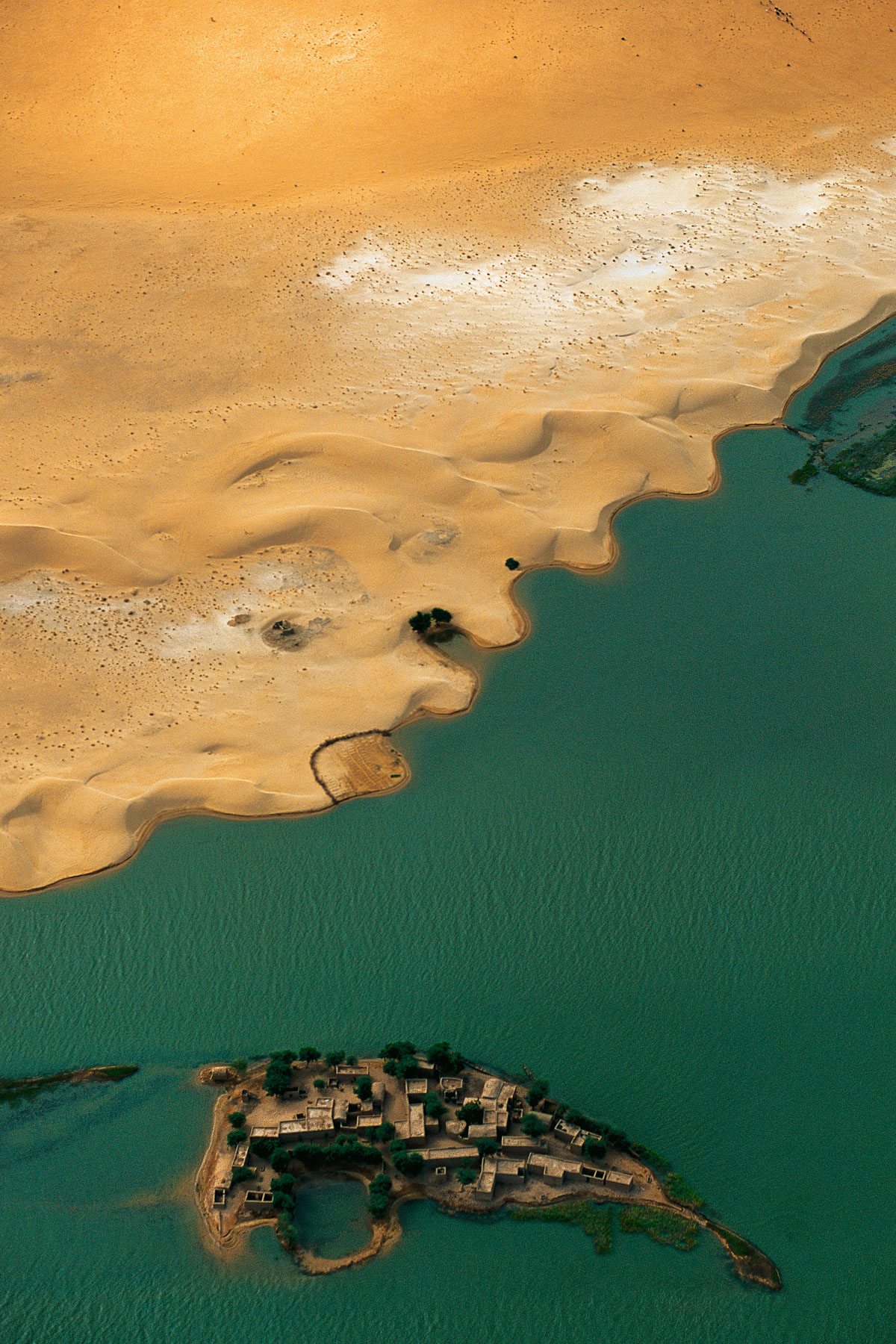
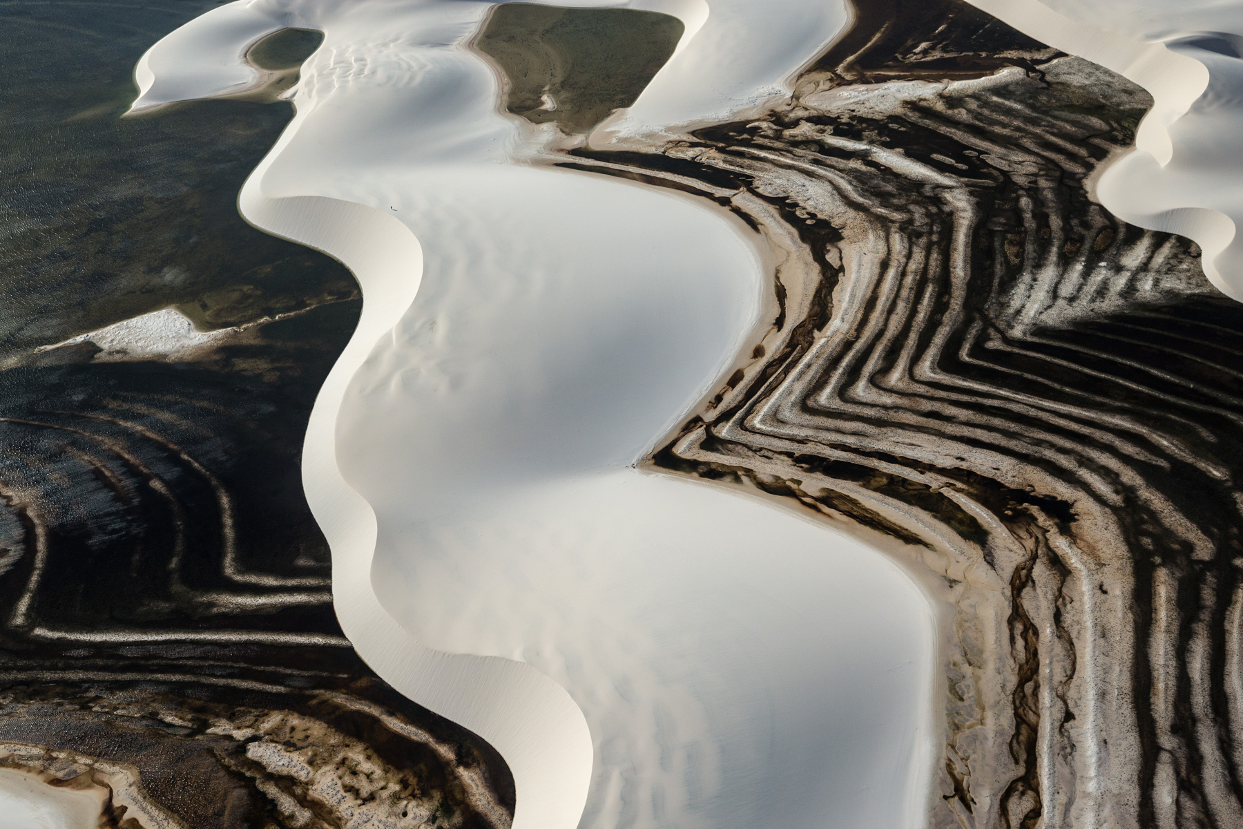
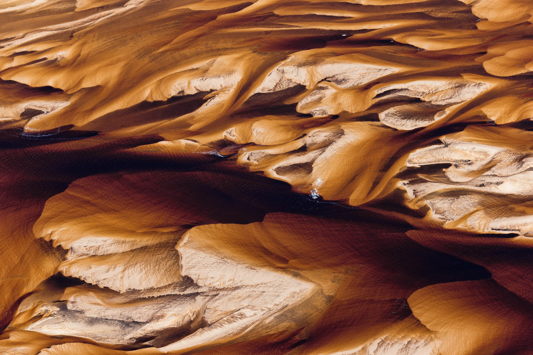
Sebkhet Aridal near Cape Bojador, Western Sahara, Morocco (26°09' N - 13°58' W).
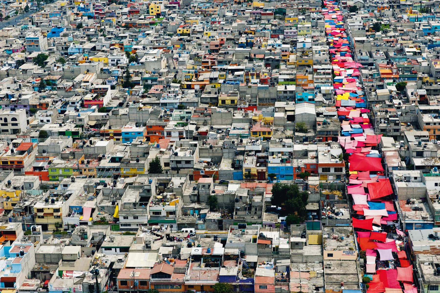
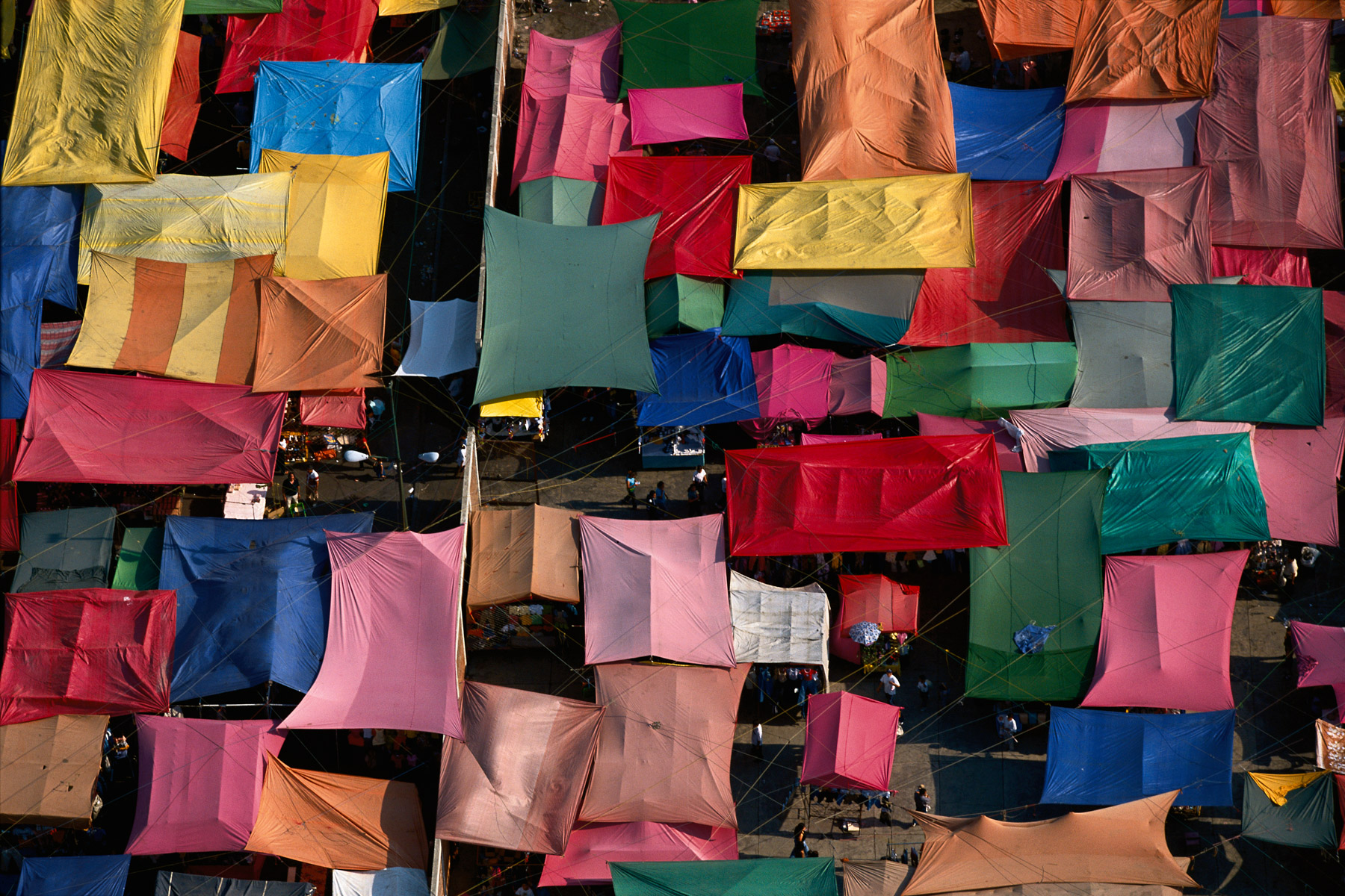
Marché en plein air à Nezahualcoyolt, état de Mexico, Mexique (19° 25’ N – 98° 59’ O).
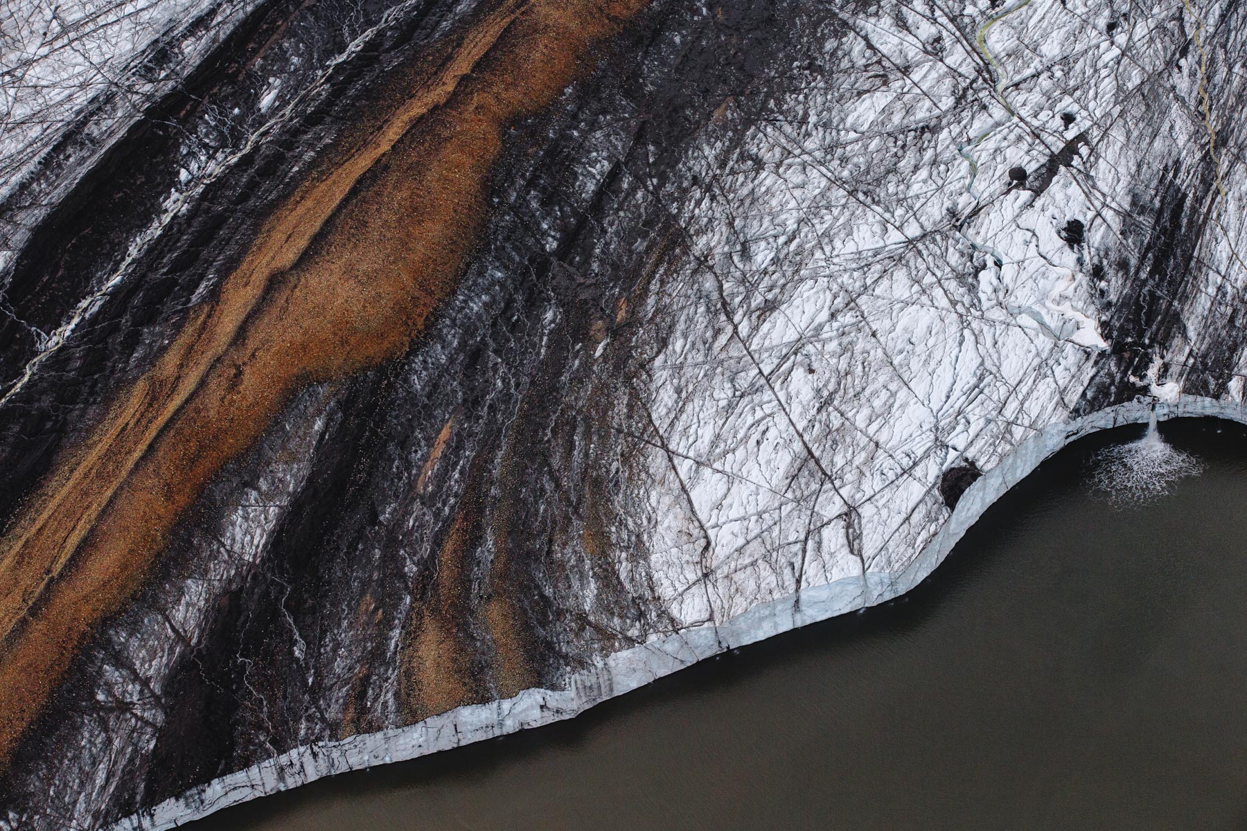
GLACIER STRONGBREEN, BAIE DE KVALVAGEN, SPITZBERG, SVALBARD, NORVÈGE (77° 34’ N – 17° 35’ E).
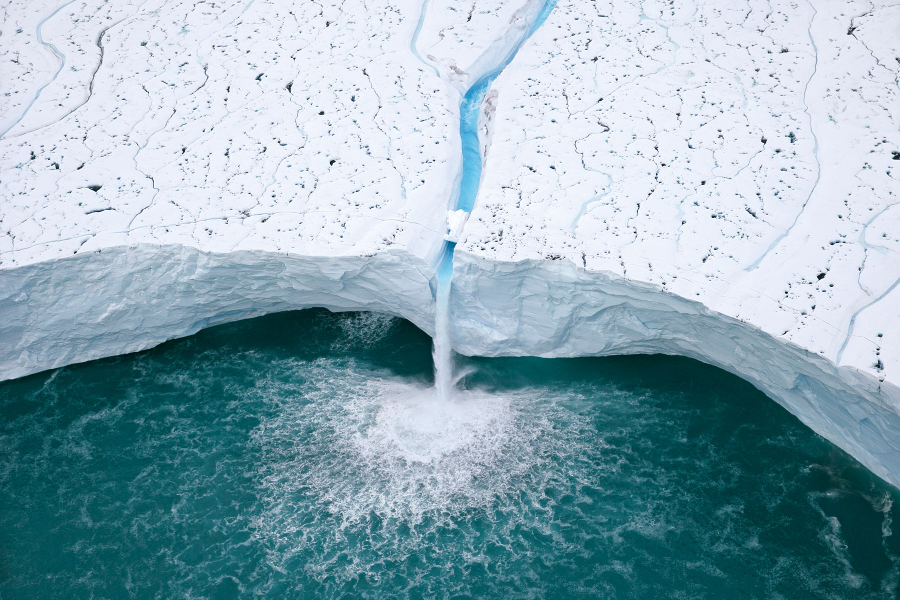
Cascade sur le glacier Brasvellbreen, sud de l'île de Nordaustlandet, archipel du Svalbard, Norvège ( 79°15'6.76"N - 22°57'43.68"E).
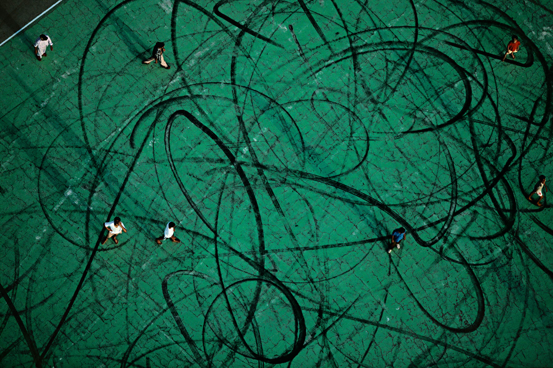
Tire marks on a playground near Doha, Qatar (25°17' N, 51°32' E).
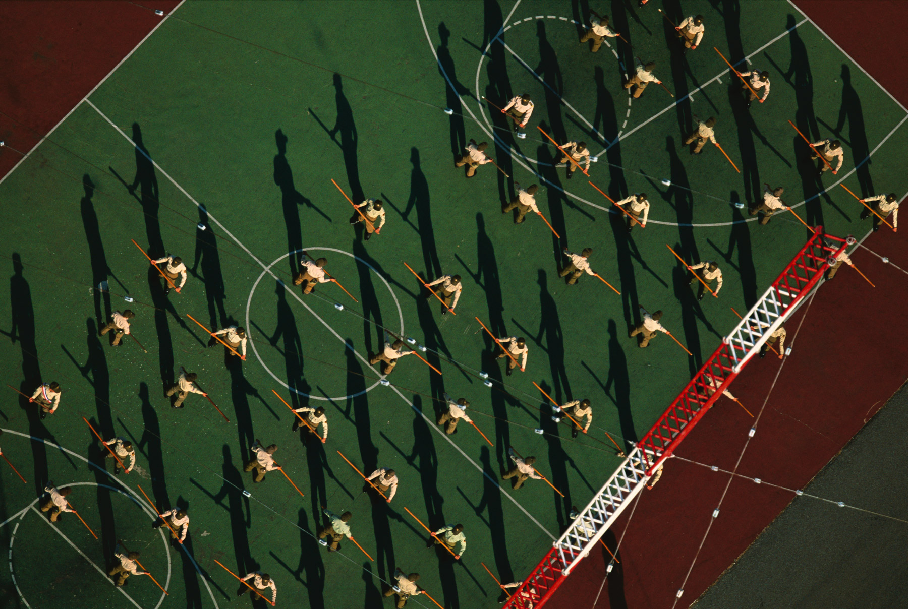
Military exercises at Makung on the island of Penghu, Taiwan (23°34' N, 119°34' E).
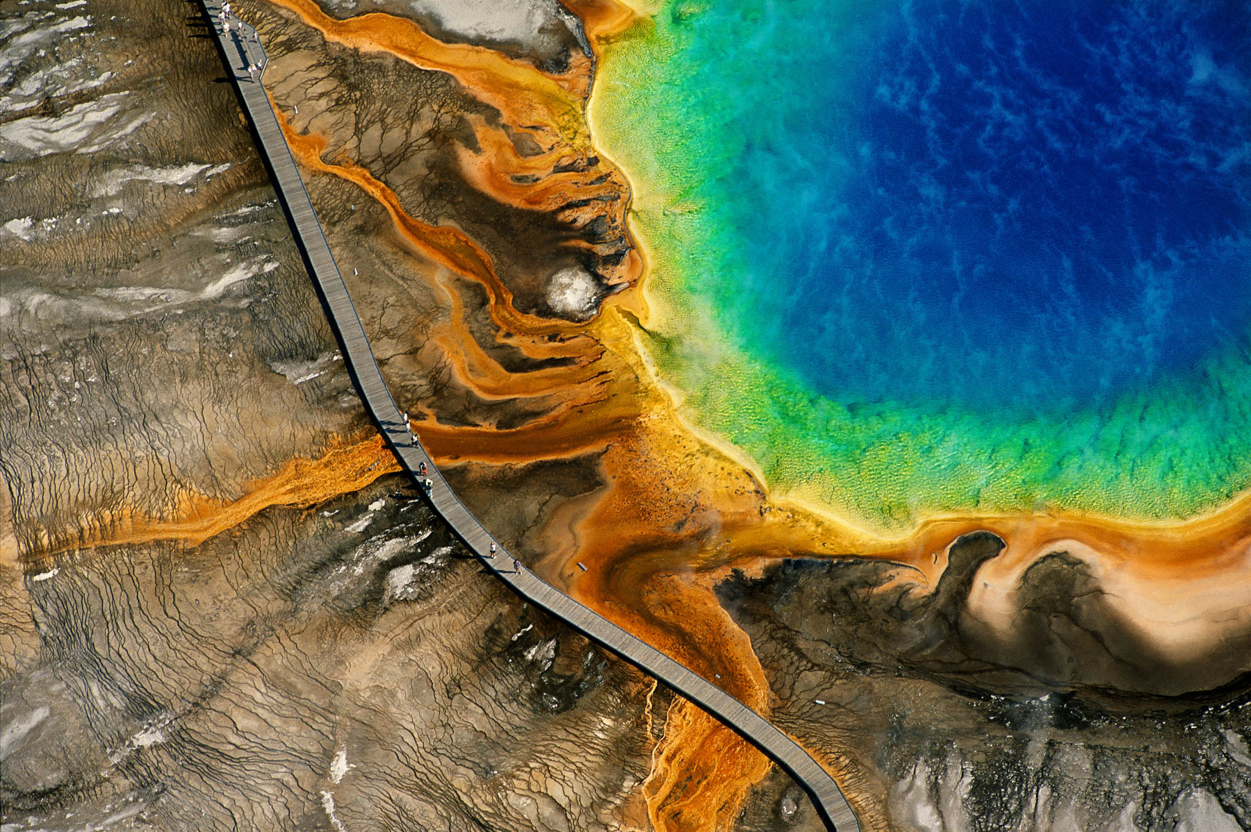
Grand Prismatic Spring, Yellowstone National Park, Wyoming, United States (44°31' N - 110°50' W)
Yankee Stadium, New York City, United States (40°49' N - 73°55' W). Le Yankee Stadium à New York, États-Unis (40°49’ N – 73°55’ O).
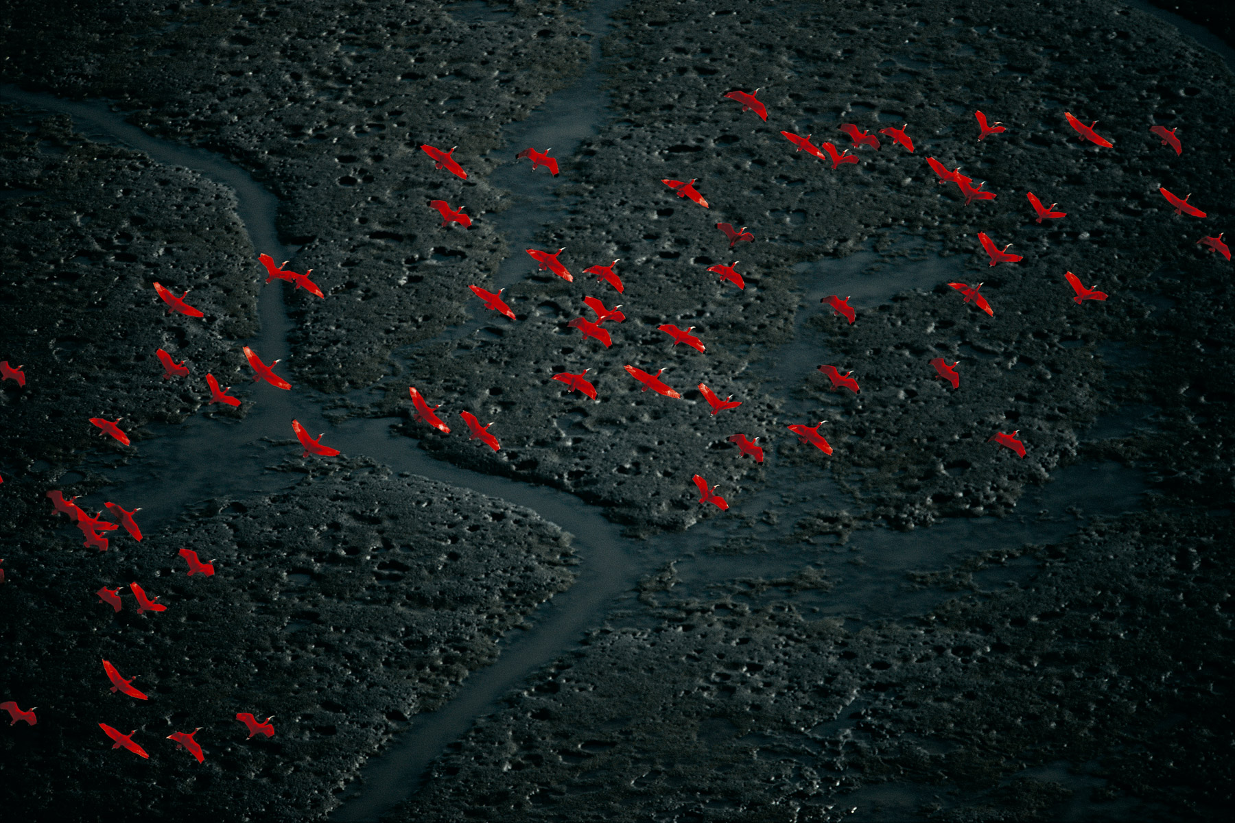
Scarlet Ibis in flight near Pedernales, Delta Amacuro, Venezuela (9°57' N, 62°21' W).
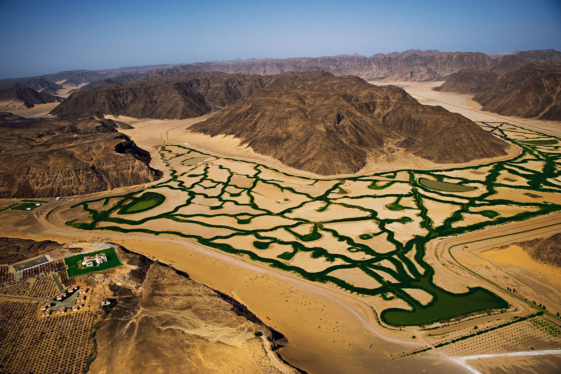
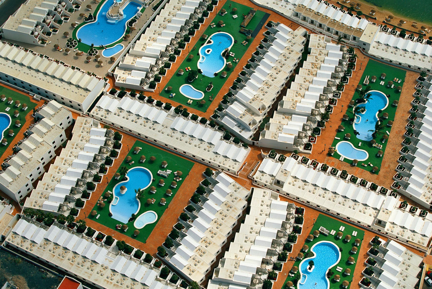
Building a golf course in Cap Cana, in the East of the Dominican Republic (18°27' N - 68°25' W).
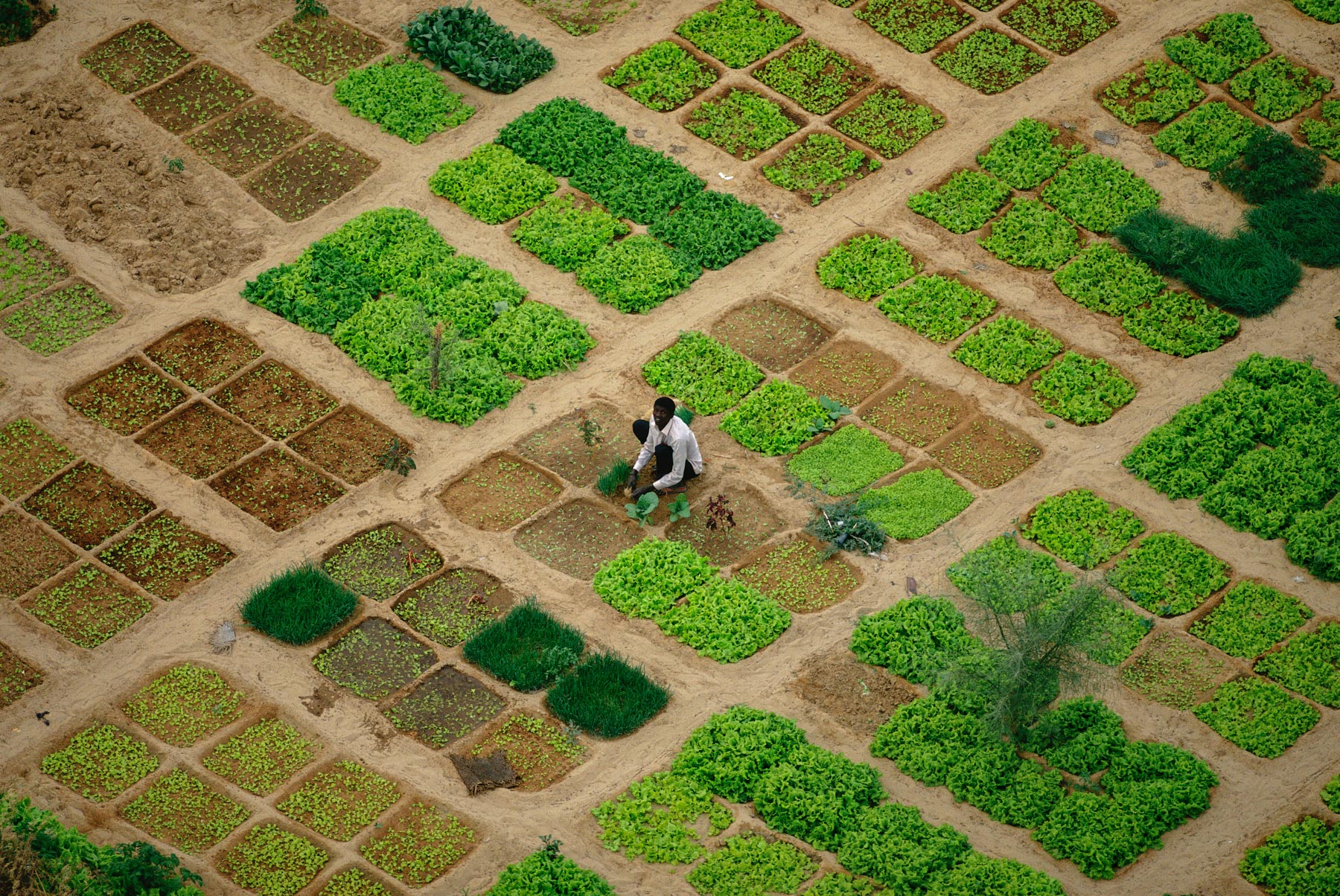
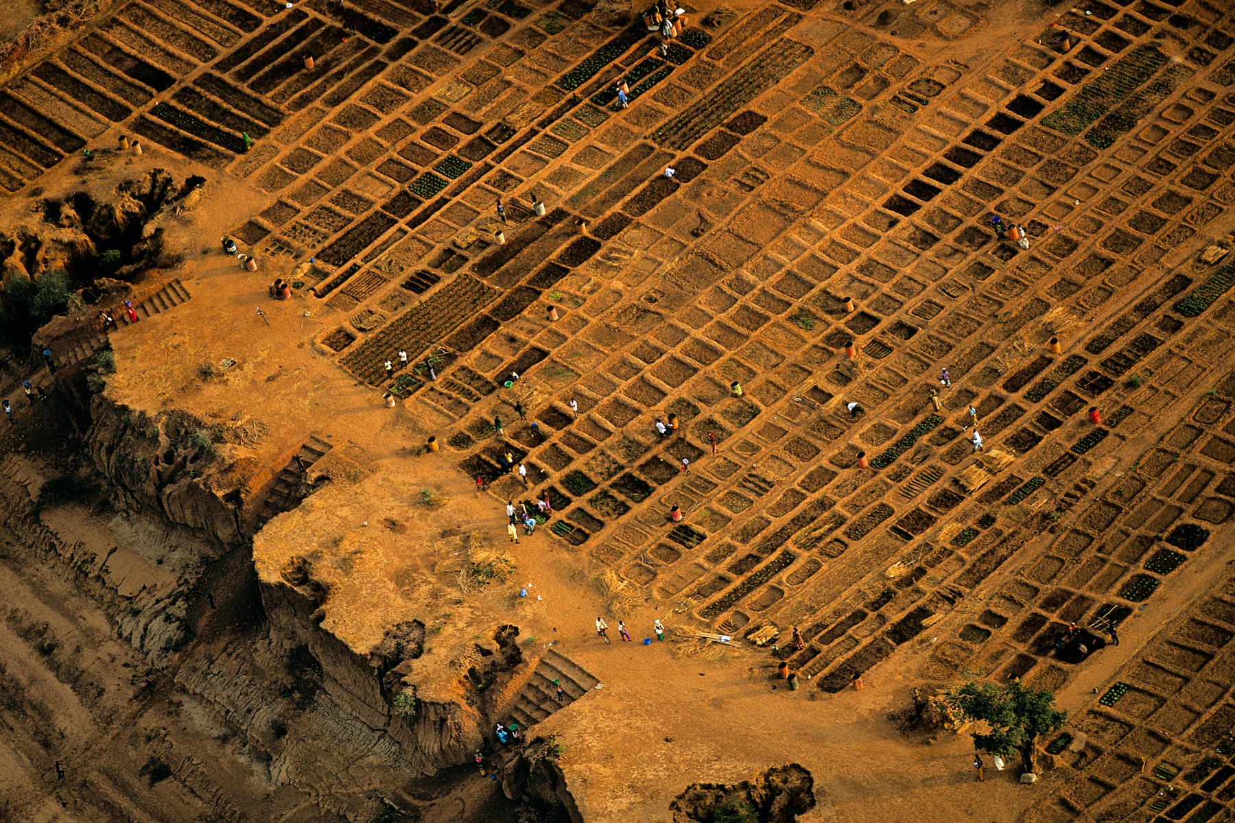
Market gardens near Timbuktu, Mali (16°48' N – 3°04' W).
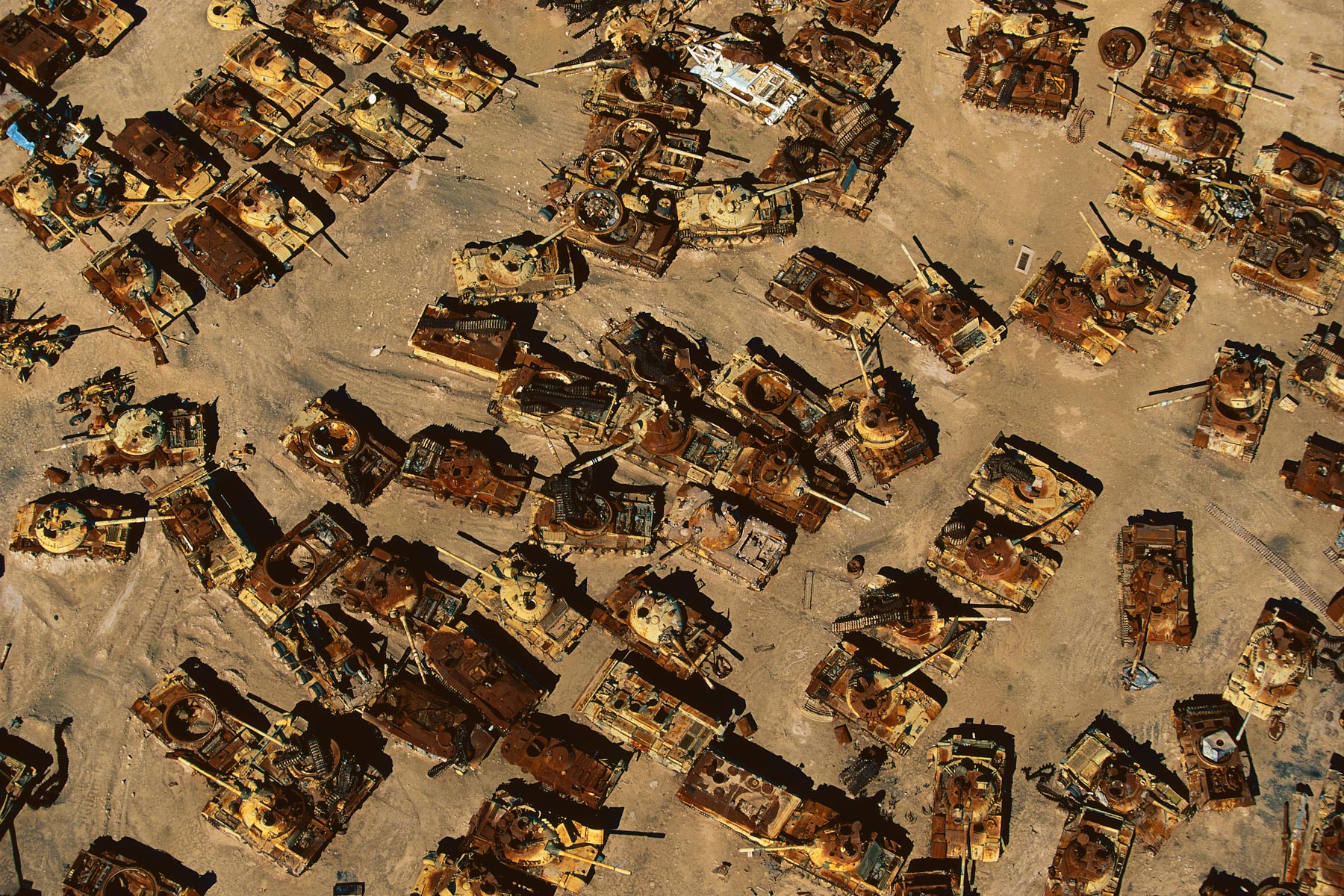
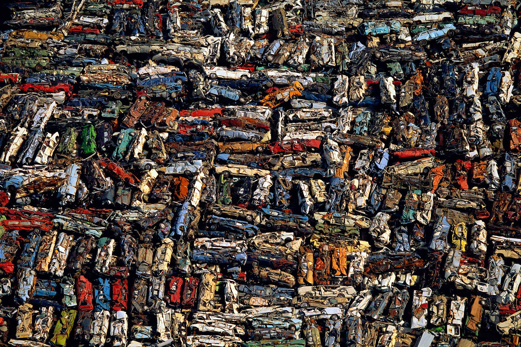
Iraqi tank junkyard in the desert near Al-Jahrah, Kuwait (29°26’ N – 47°24’ E).
Bank of a river in Etosha National Park, Namibia (18°43' S - 15°33' E).

Blue Lagoon, near Grindavik, Reykjanes Peninsula, Iceland (63°53' N – 22°27' W).
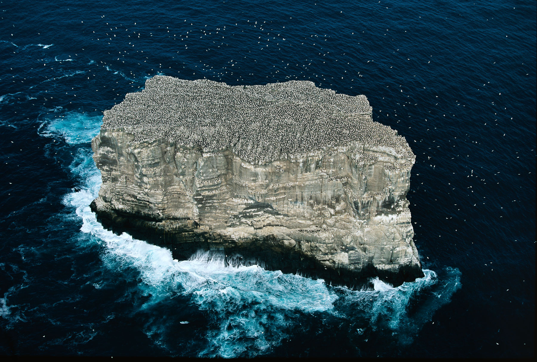
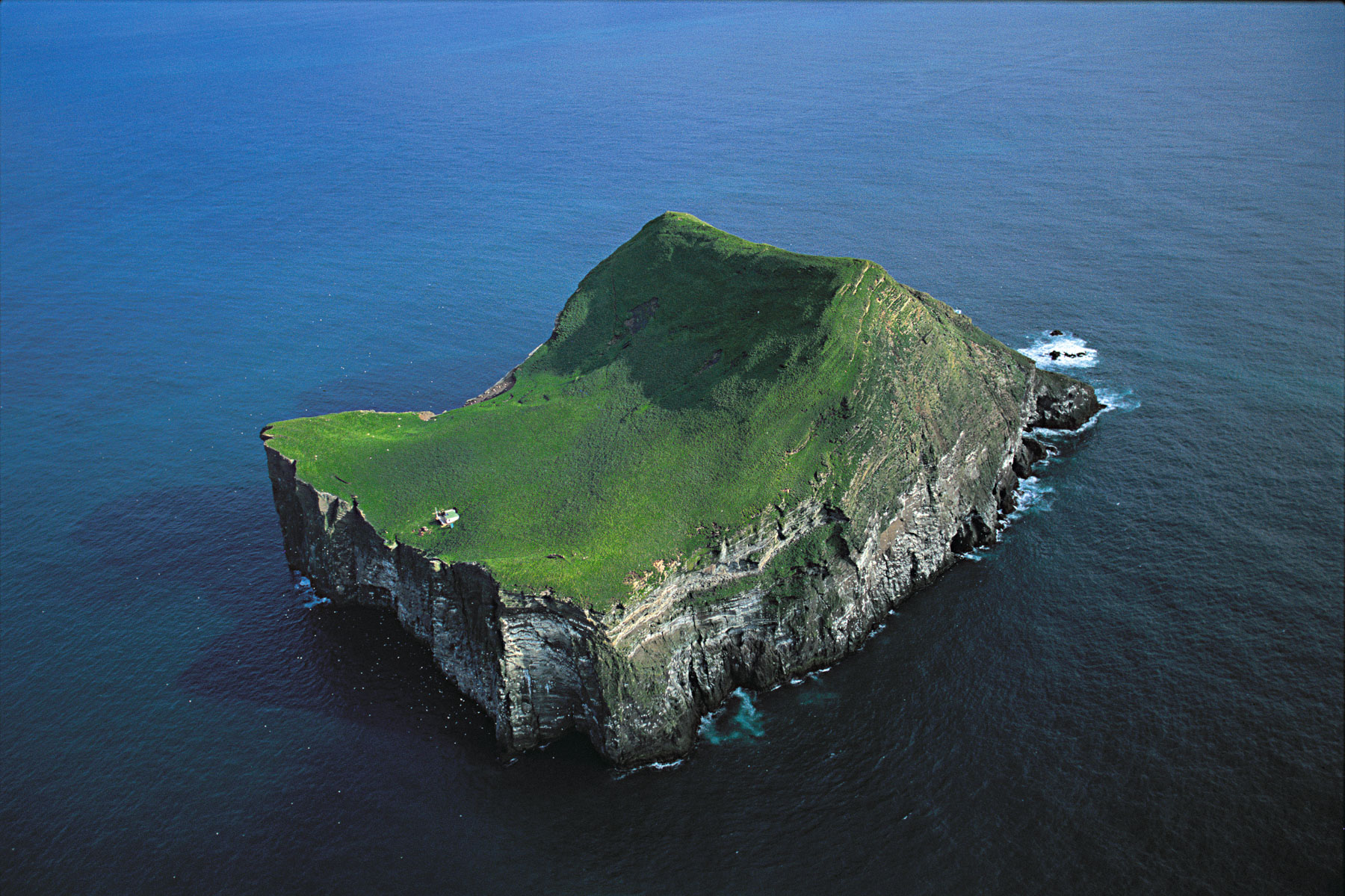
Gannet colony, Eldey island, Iceland (63°44' N - 22°57' W).
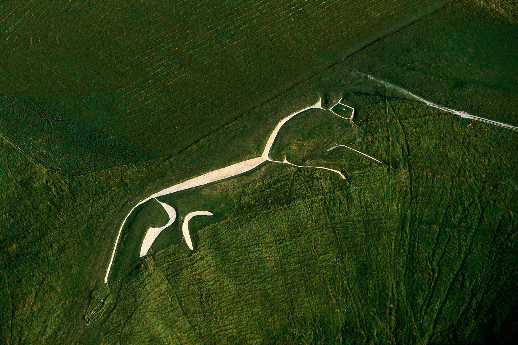
White horse of Uffington, Oxfordshire, England (51°35' N – 1°34' W).
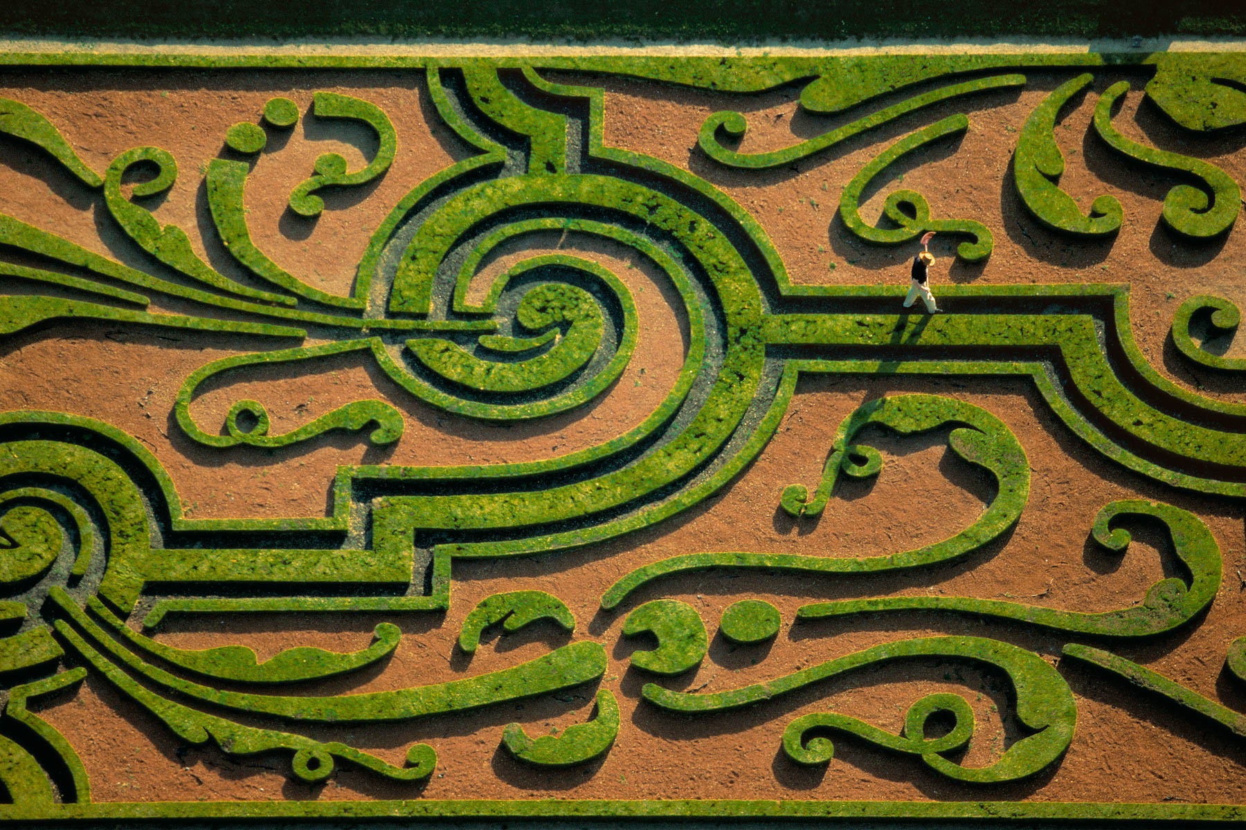
Gardens at the Château of Vaux-le-Vicomte, (© It has been restored by successivement by the architects Gabriel-Hippolyte Destailleur de 1875 à 1893 et Alfred Duchêne de 1911 à 1923), Seine et Marne, France (48°34' N – 2°43' E).
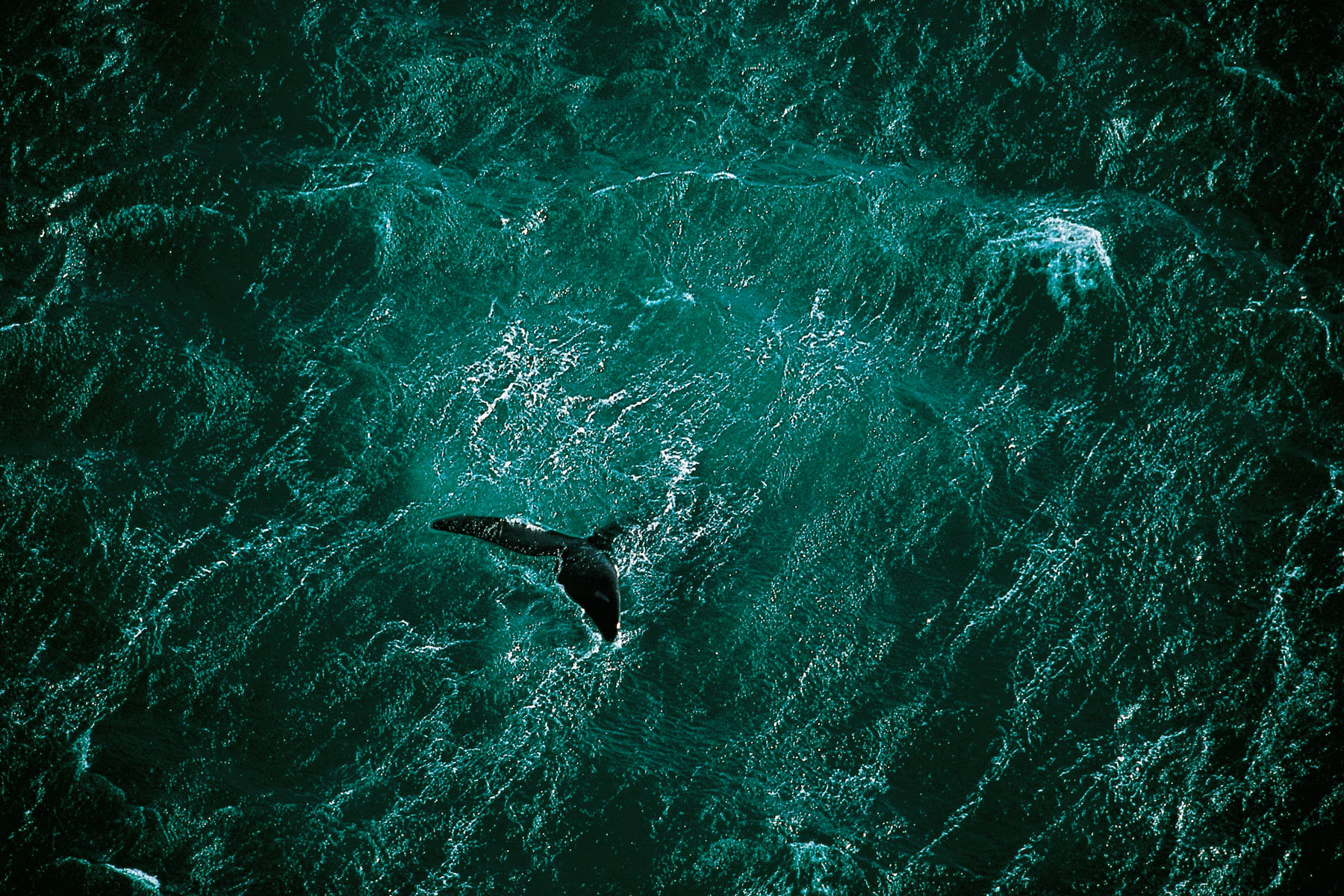
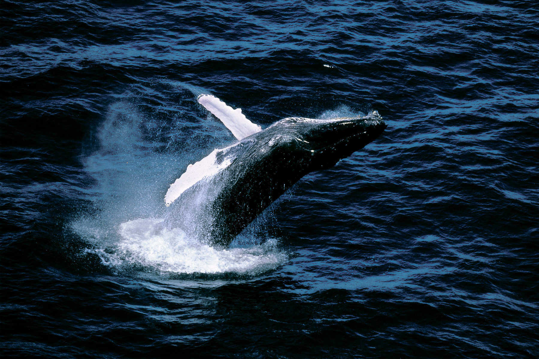
Whale off the coast of the Valdes Peninsula, Argentina (42°23' S – 64°29' W).
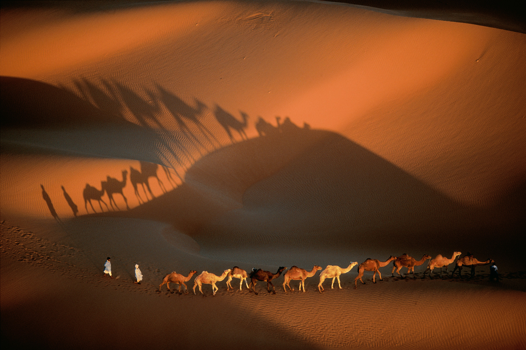
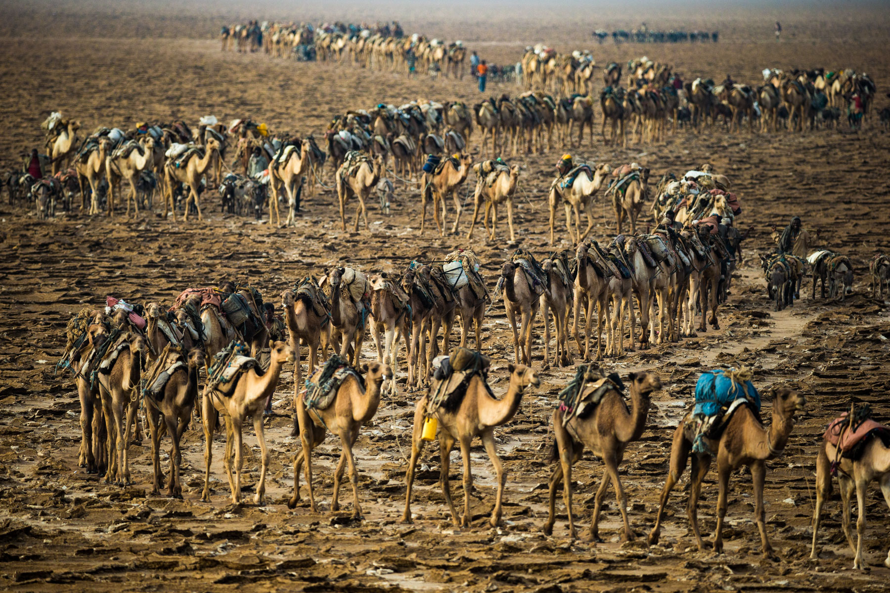
Dromedary Caravan near Nouakchott, Mauritania (18°09' N - 15°29' W).
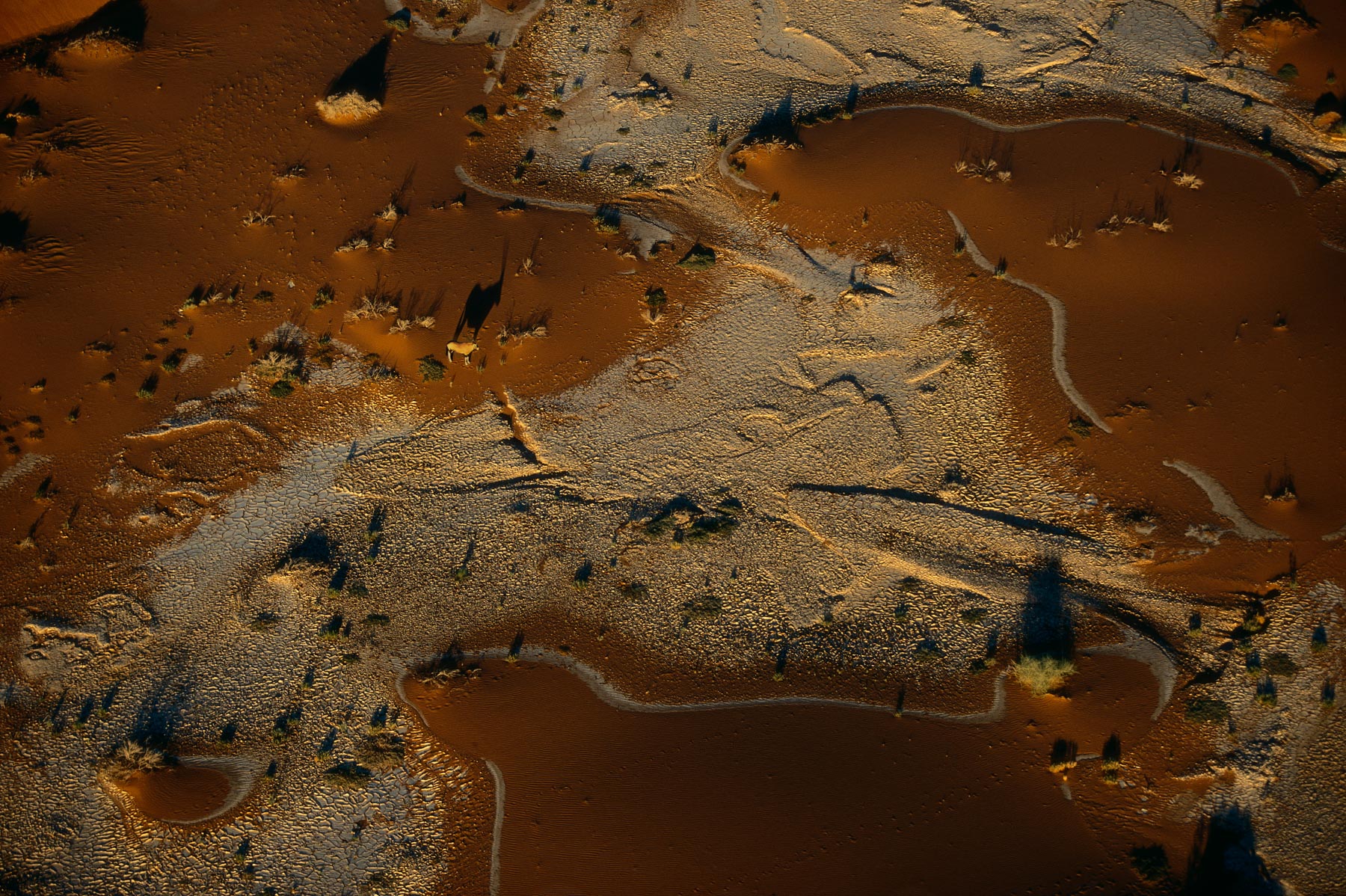
Oryx in the Namib desert, Swakopmund, Namibia (24°39’ S – 15°07’ E).
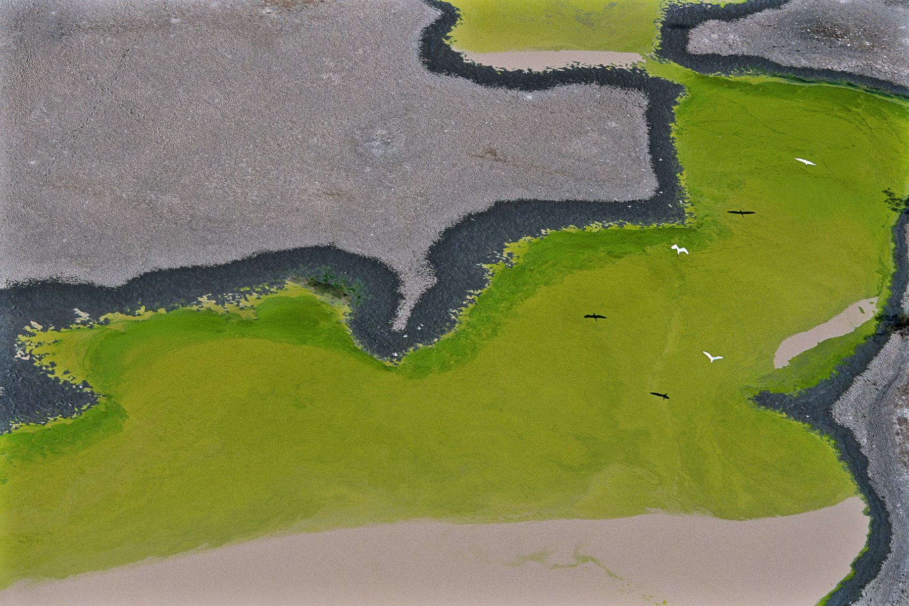
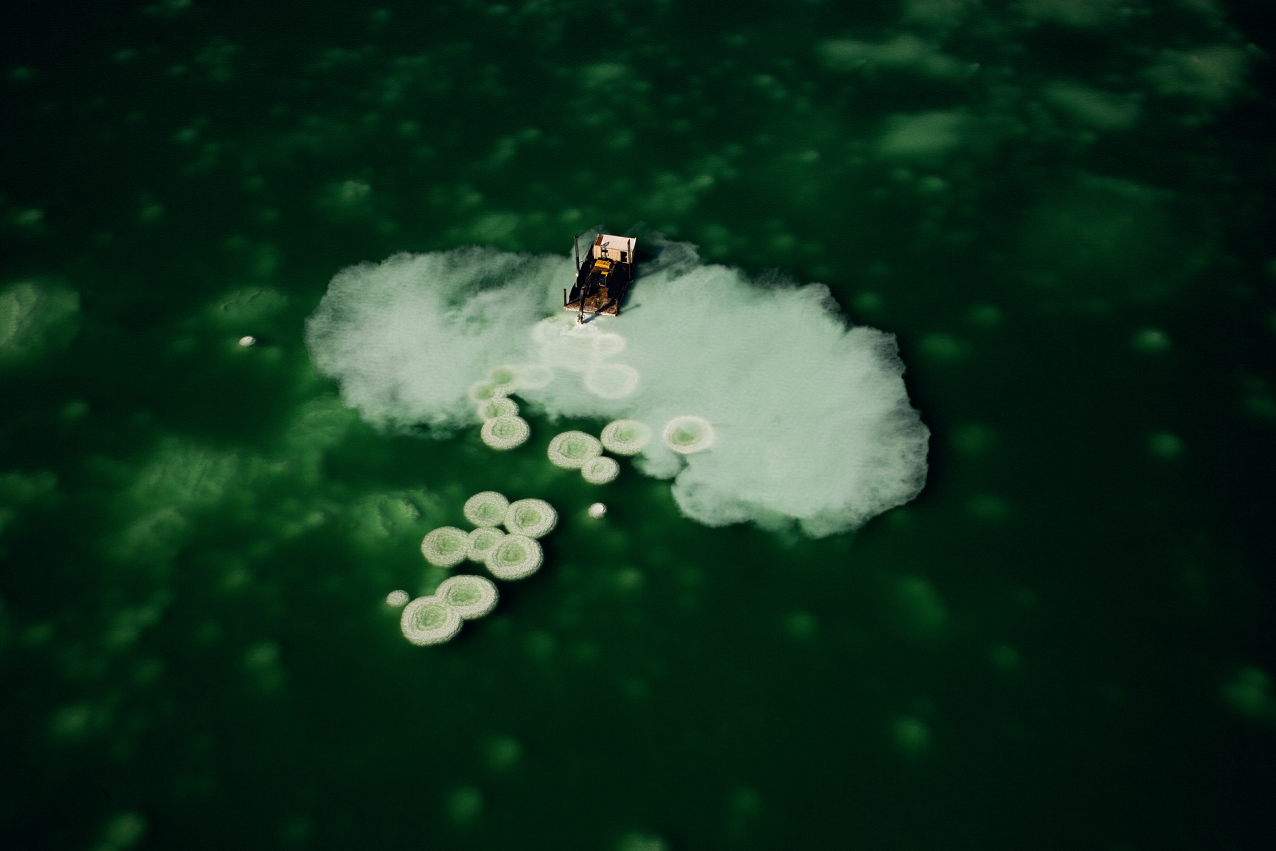
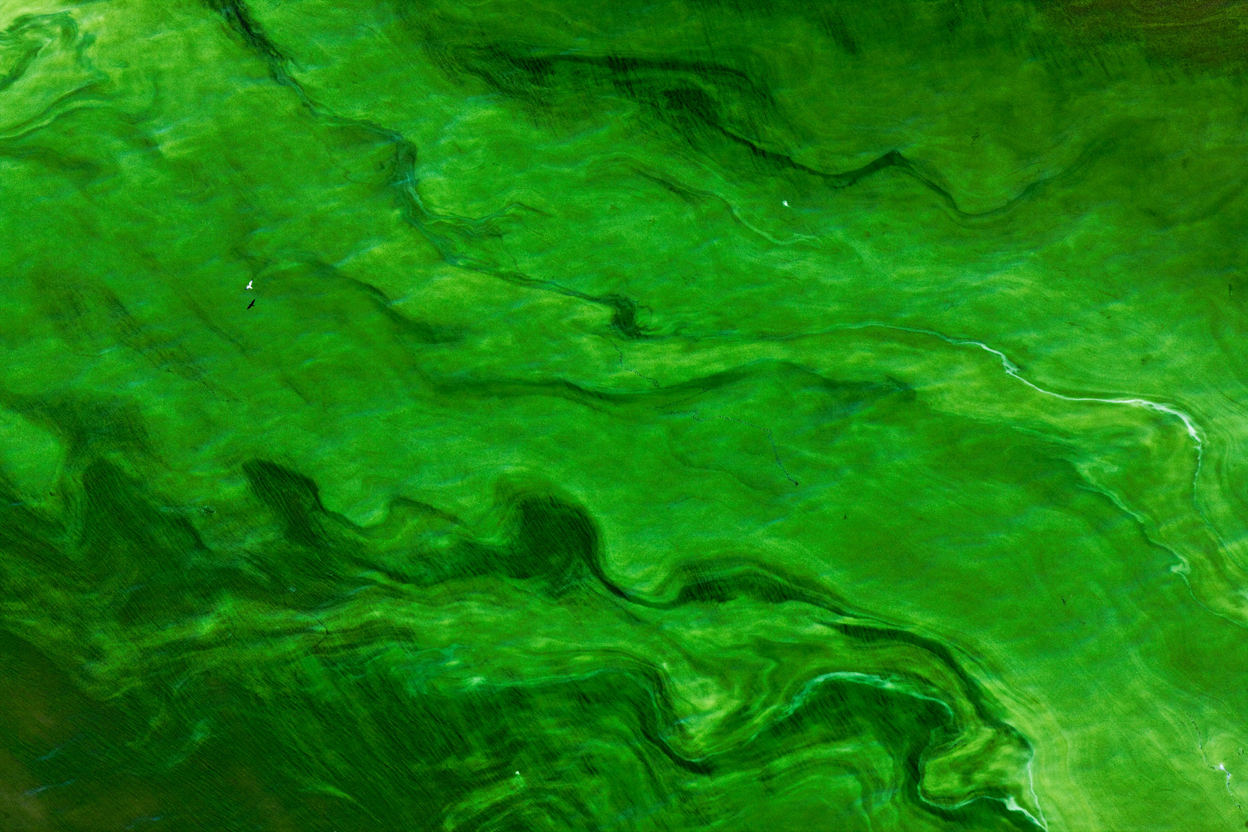
Algaculture in Bali, Indonesia (8°42' S – 115°27' E).
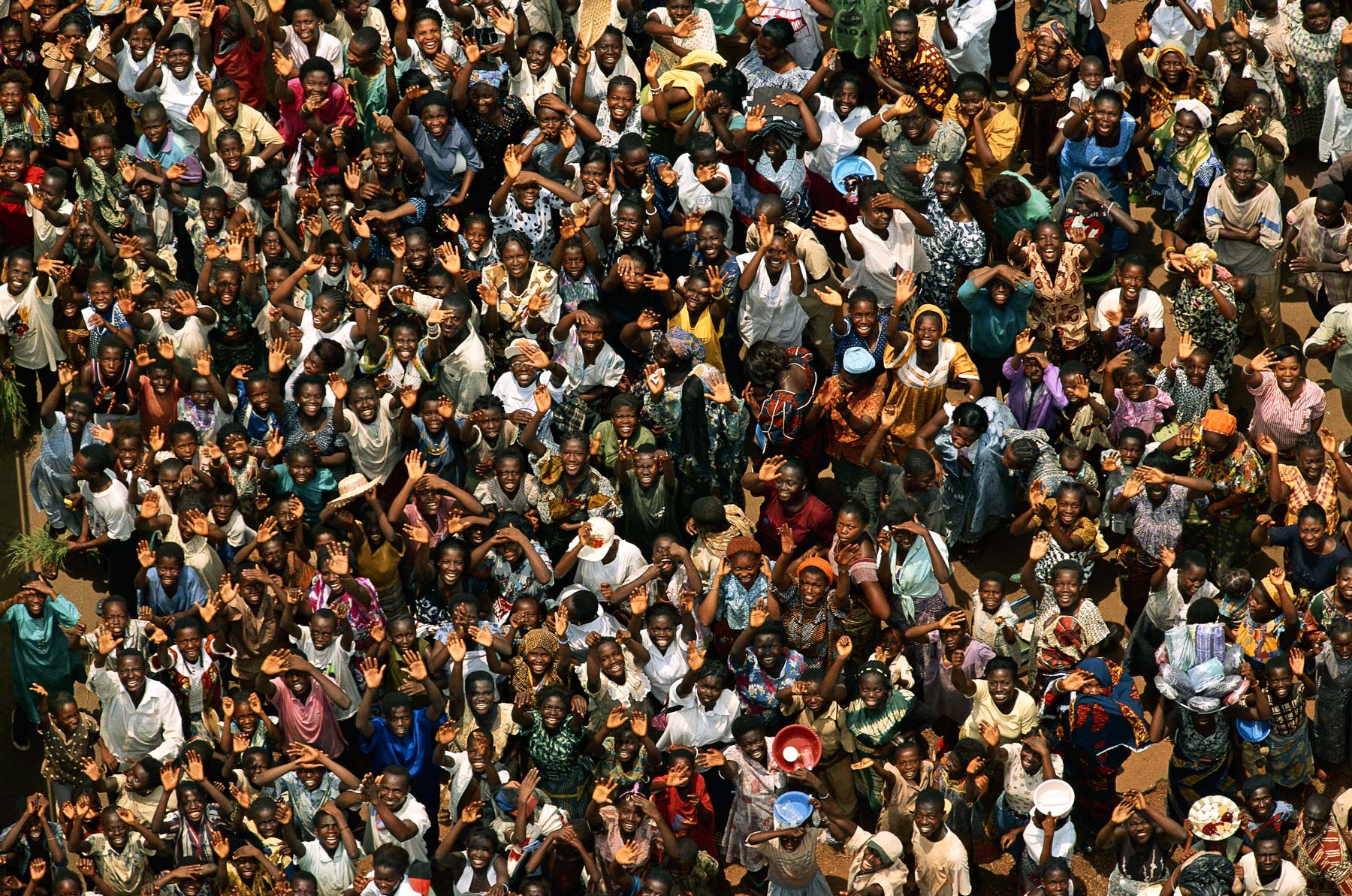
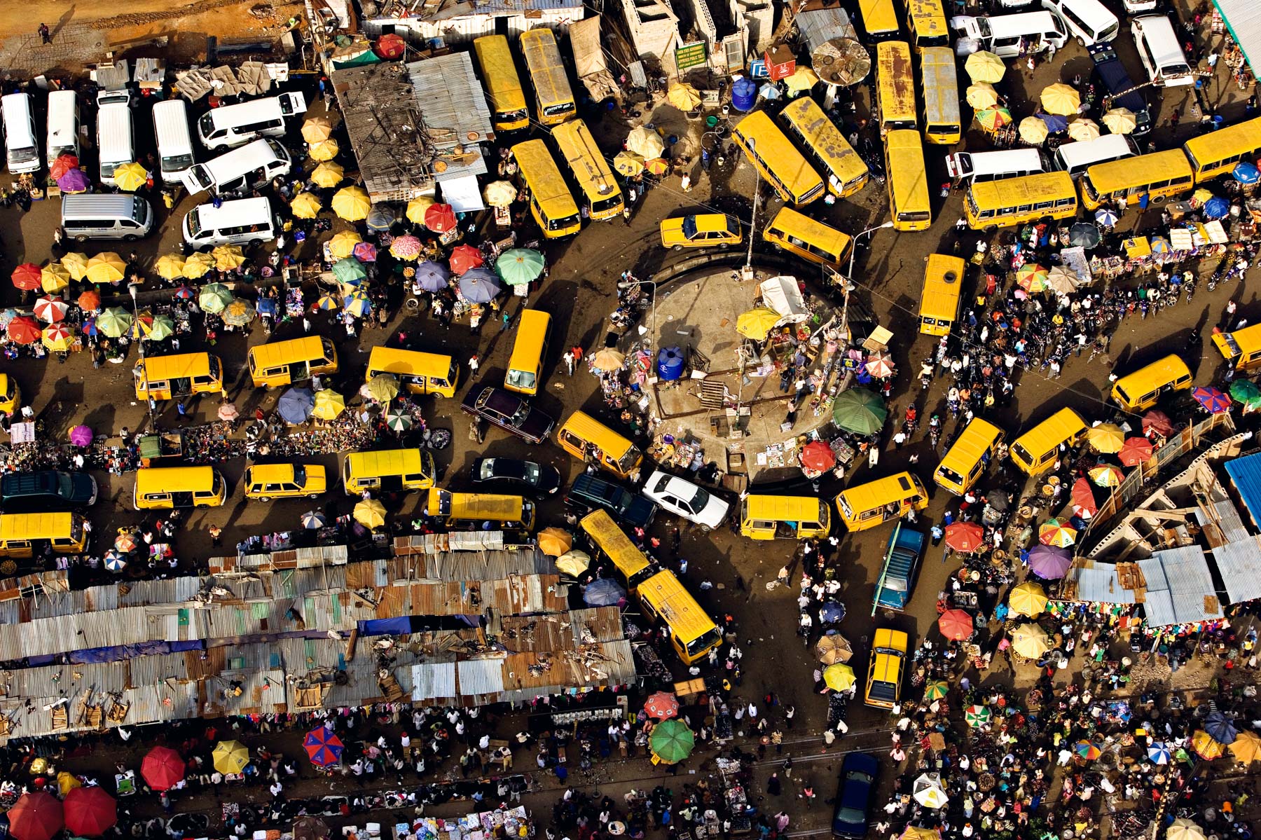
Crowd in Abengourou, Ivory Coast (6°44' N – 3°29' W).
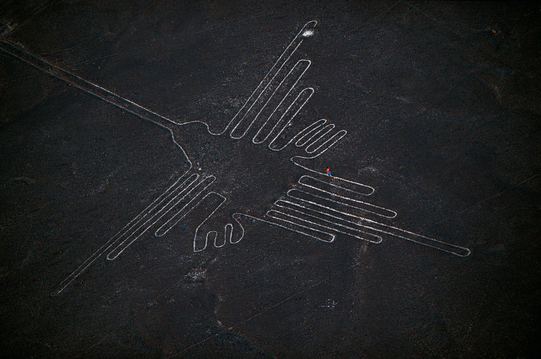
Drawing of a hummingbird in Nazca, Peru (14°41' S - 75°08' W).
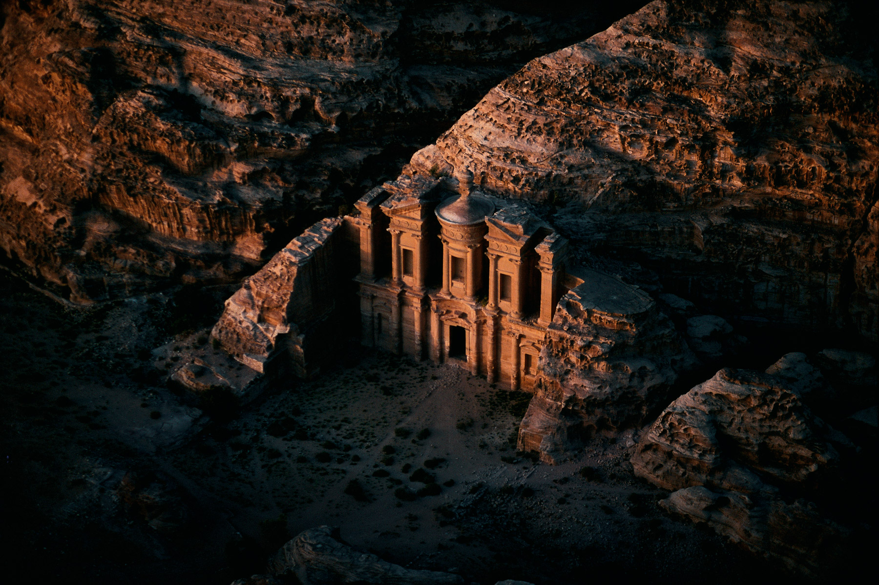
Al-Deir temple, Petra, Ma'An region, Jordan (30°20' N – 35°26' E).
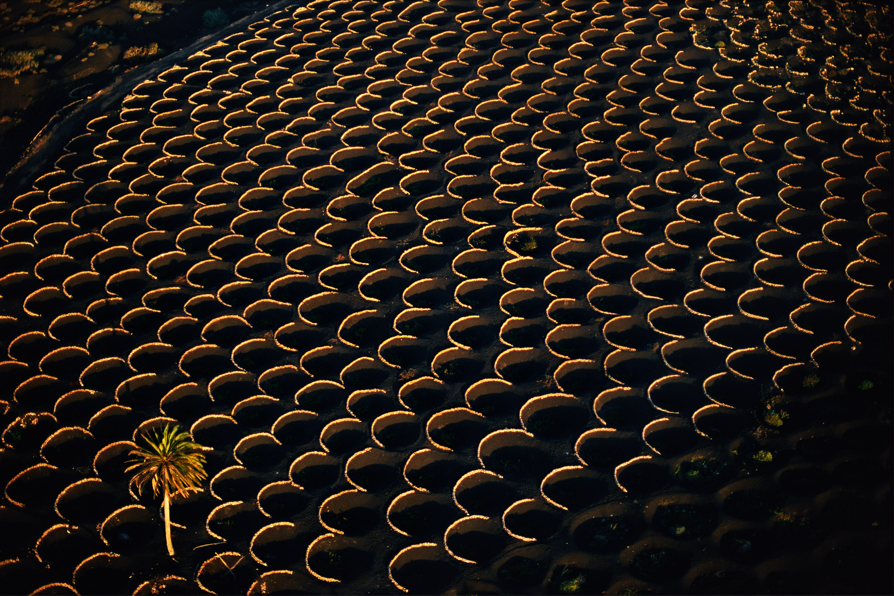
Vineyards, La Geria region, Lanzarote, Canary Islands, Spain (28°58' N – 13°43' W).
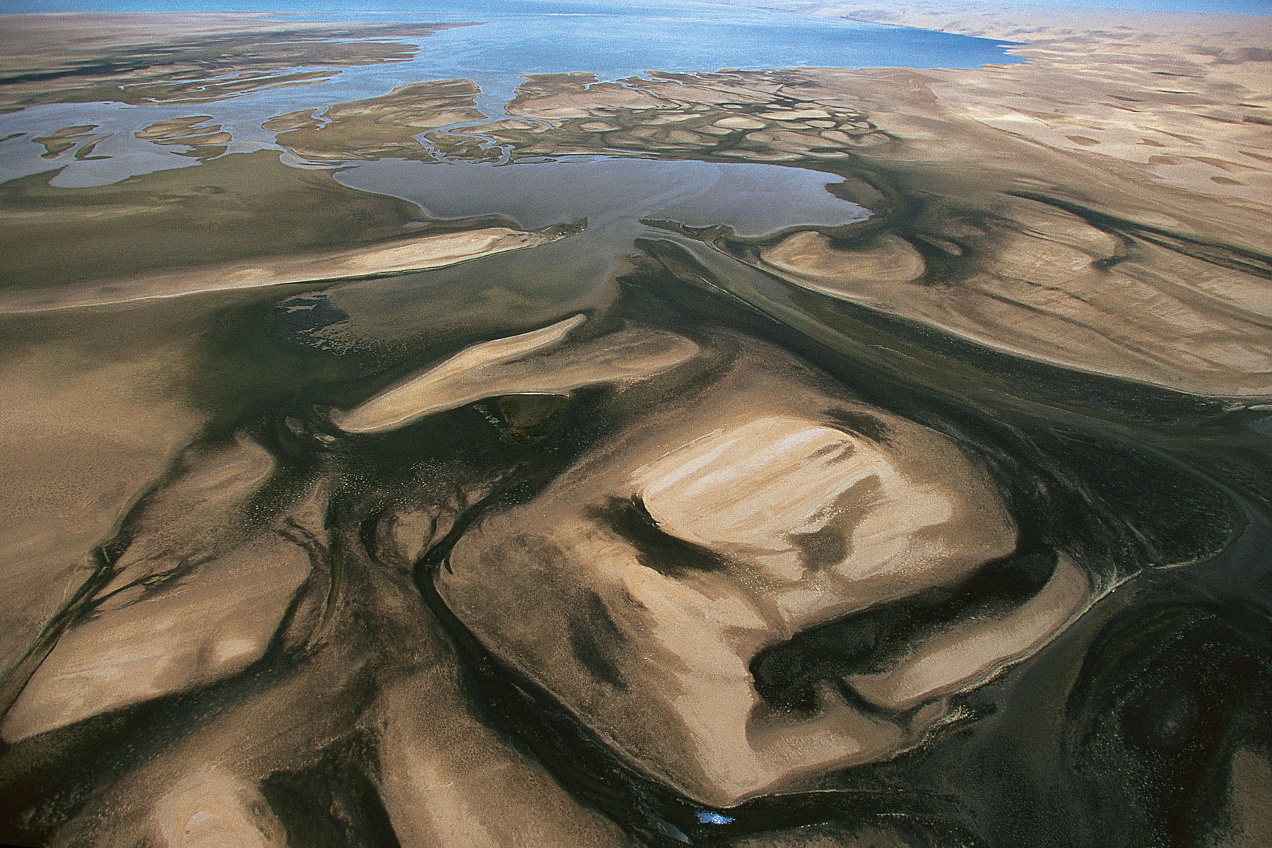
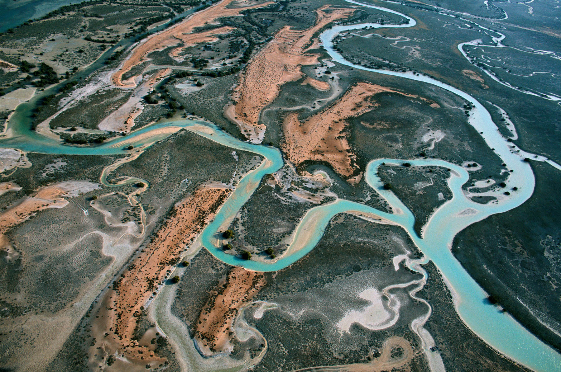
Sand bank of the río Caroni, Bolívar state, Venezuela (6°00’ N – 62°51’ W).
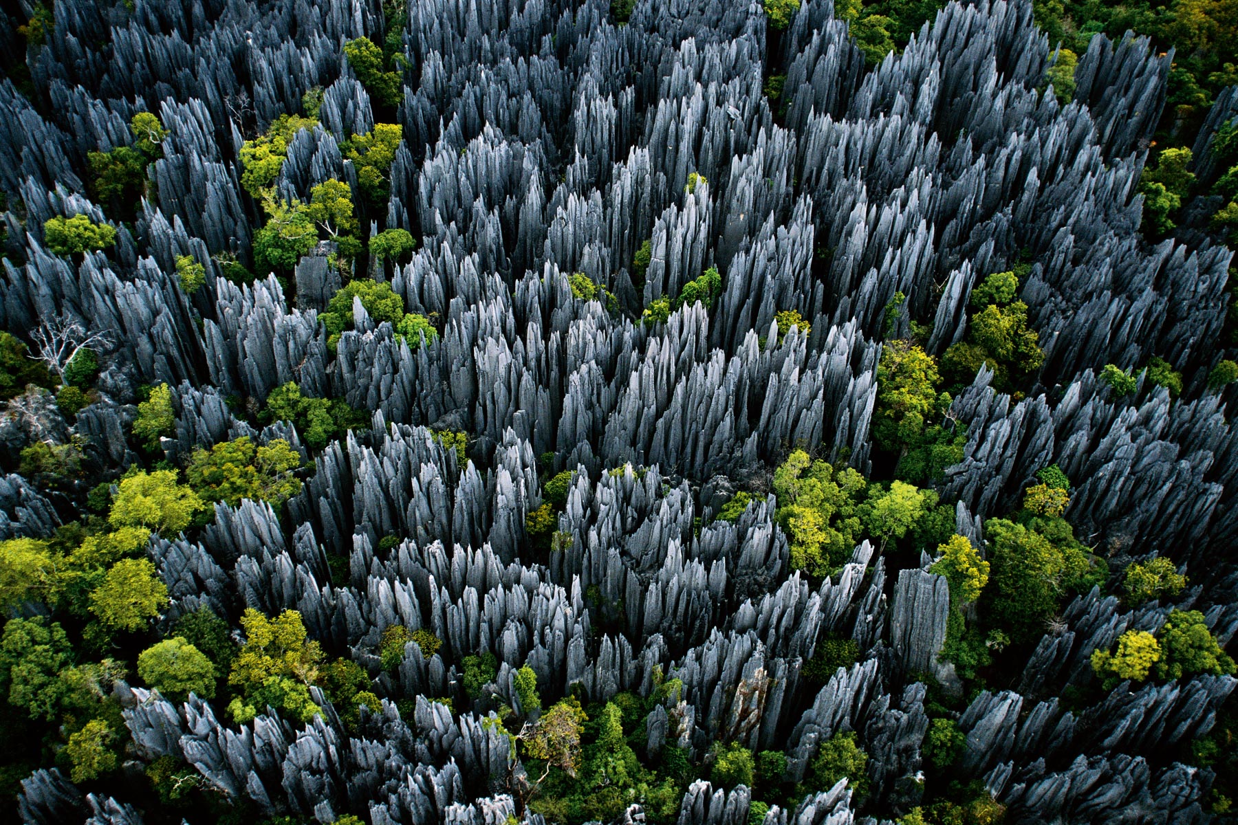
Tsingy of Bemaraha, Morondava region, Madagascar (19°02' S - 44°47' E).
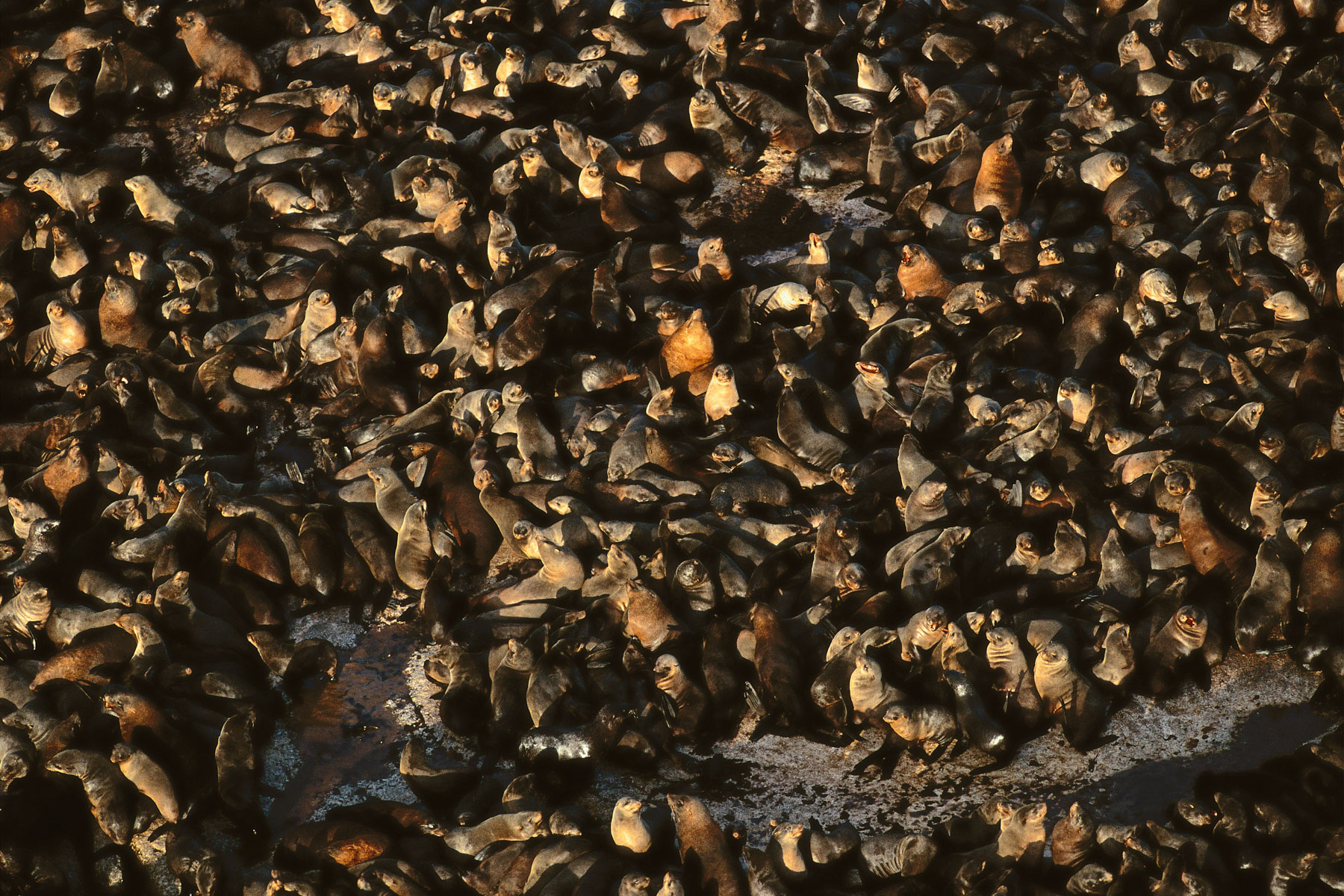
Seals on a rock near Duiker Island, Cape Province, Republic of South Africa (34°03’ S – 18°19’ E).
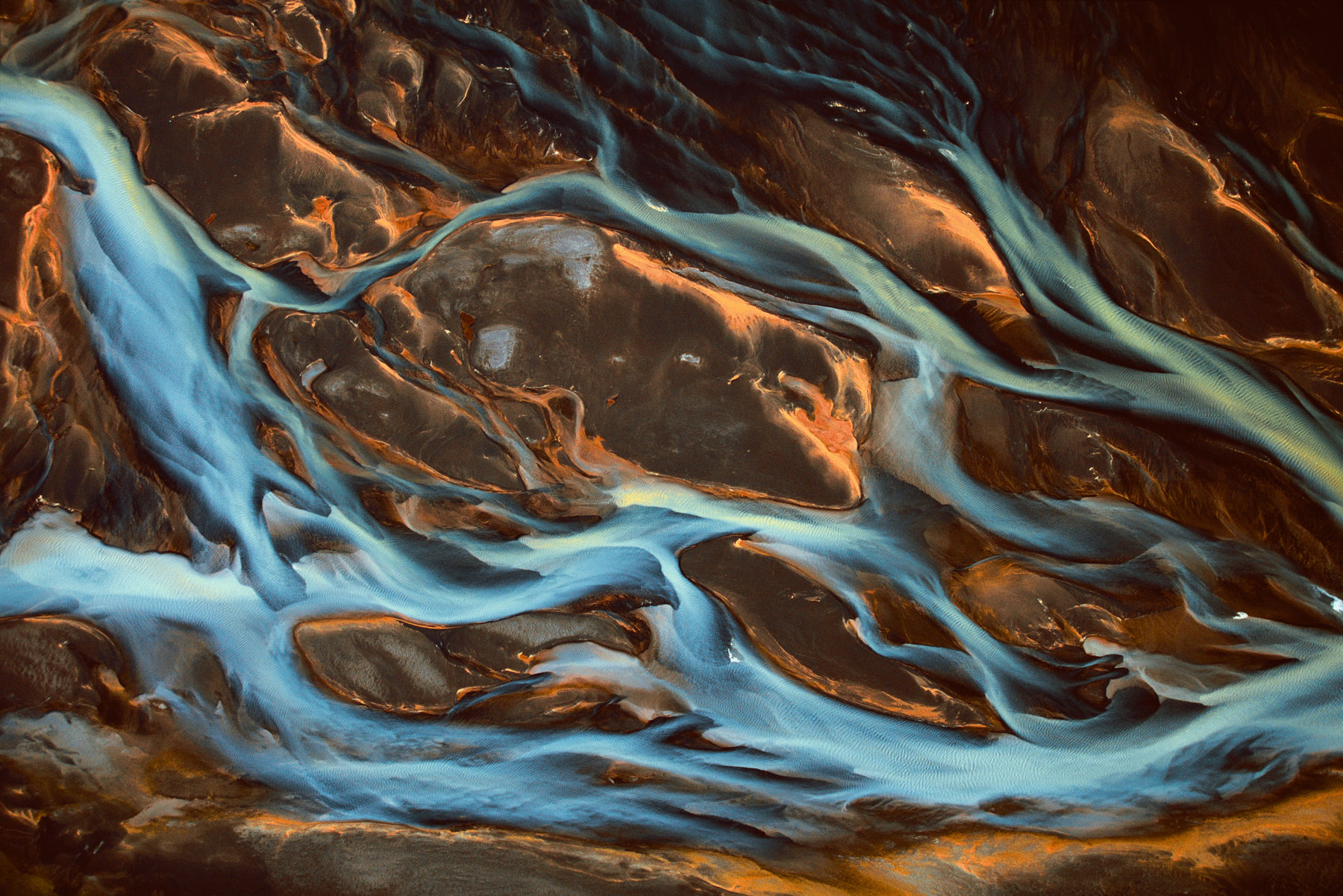
Pjorsa River detail, Iceland (63°57' N – 20°33' W).
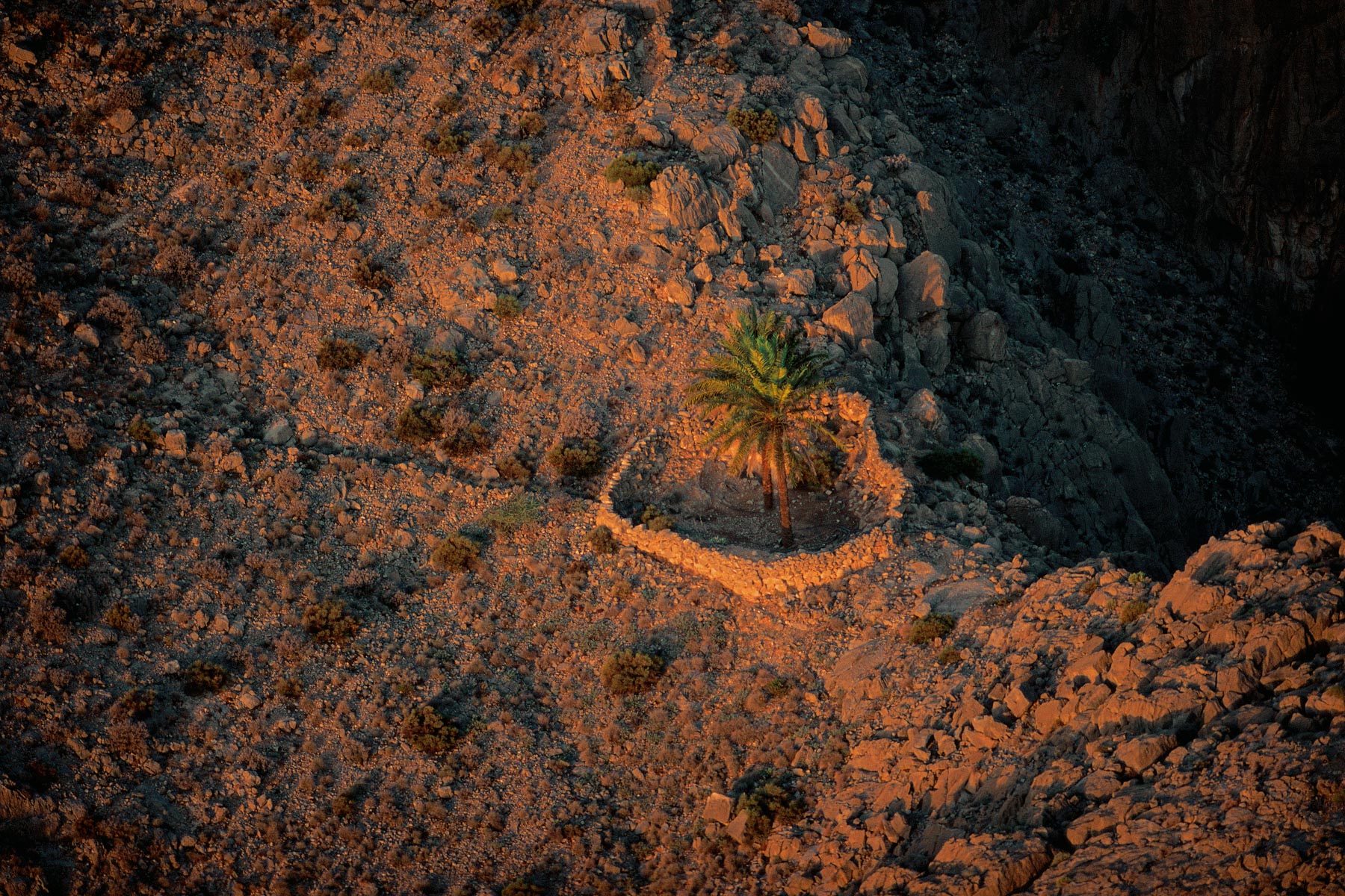
Palm trees in the mountains of the musandam peninsula, Oman (26°06' N – 56°16' E).
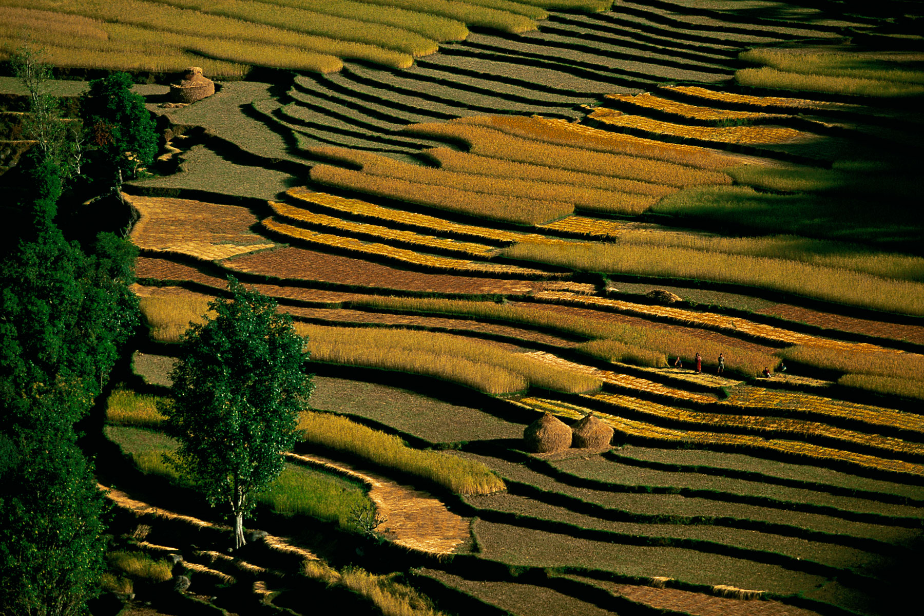
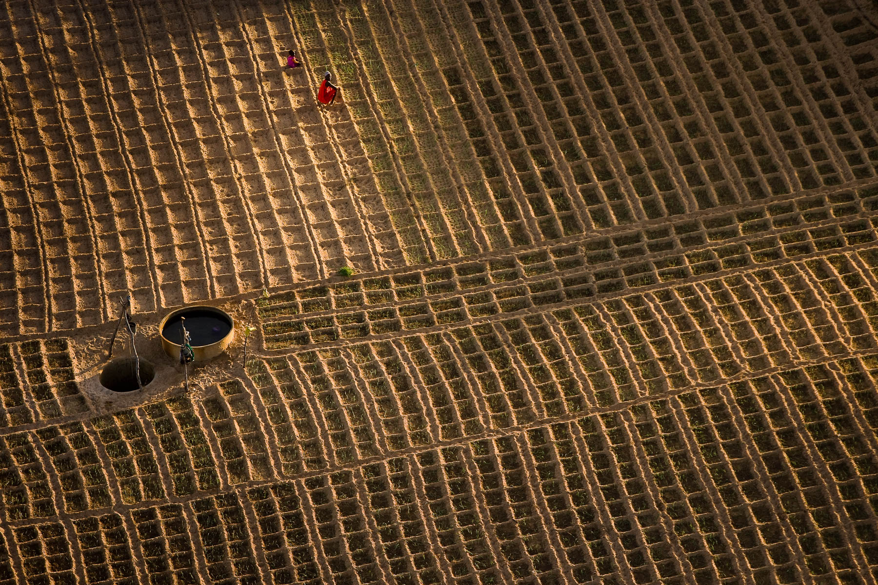
Field cultivation, north of Jodhpur, Rajasthan, India (26°22' N – 73°02' E). g
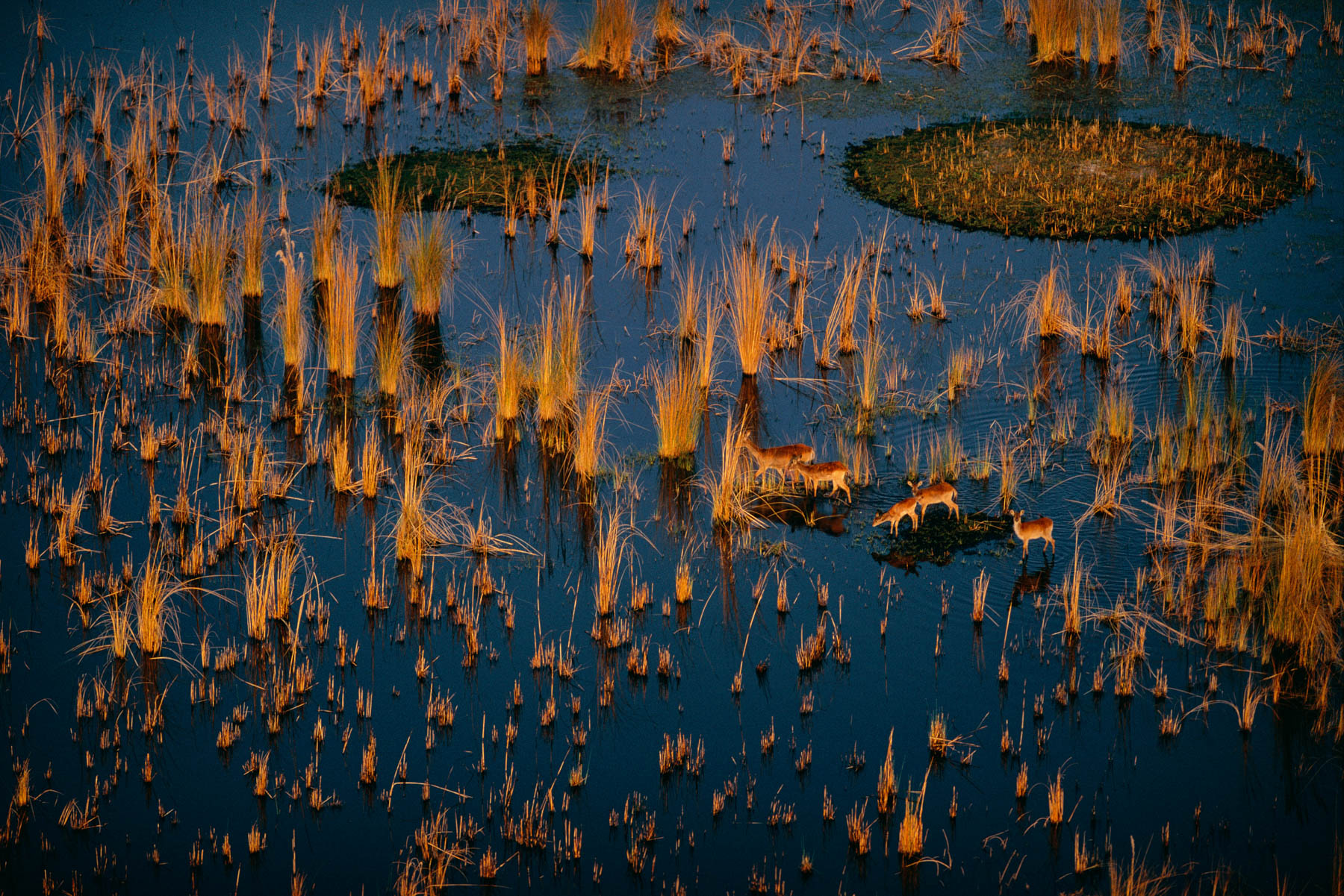
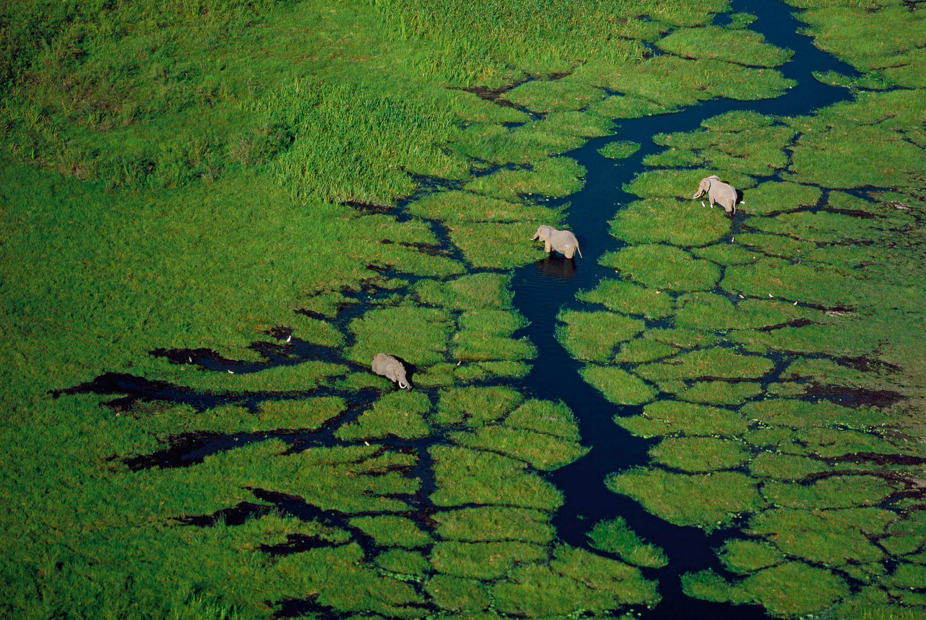
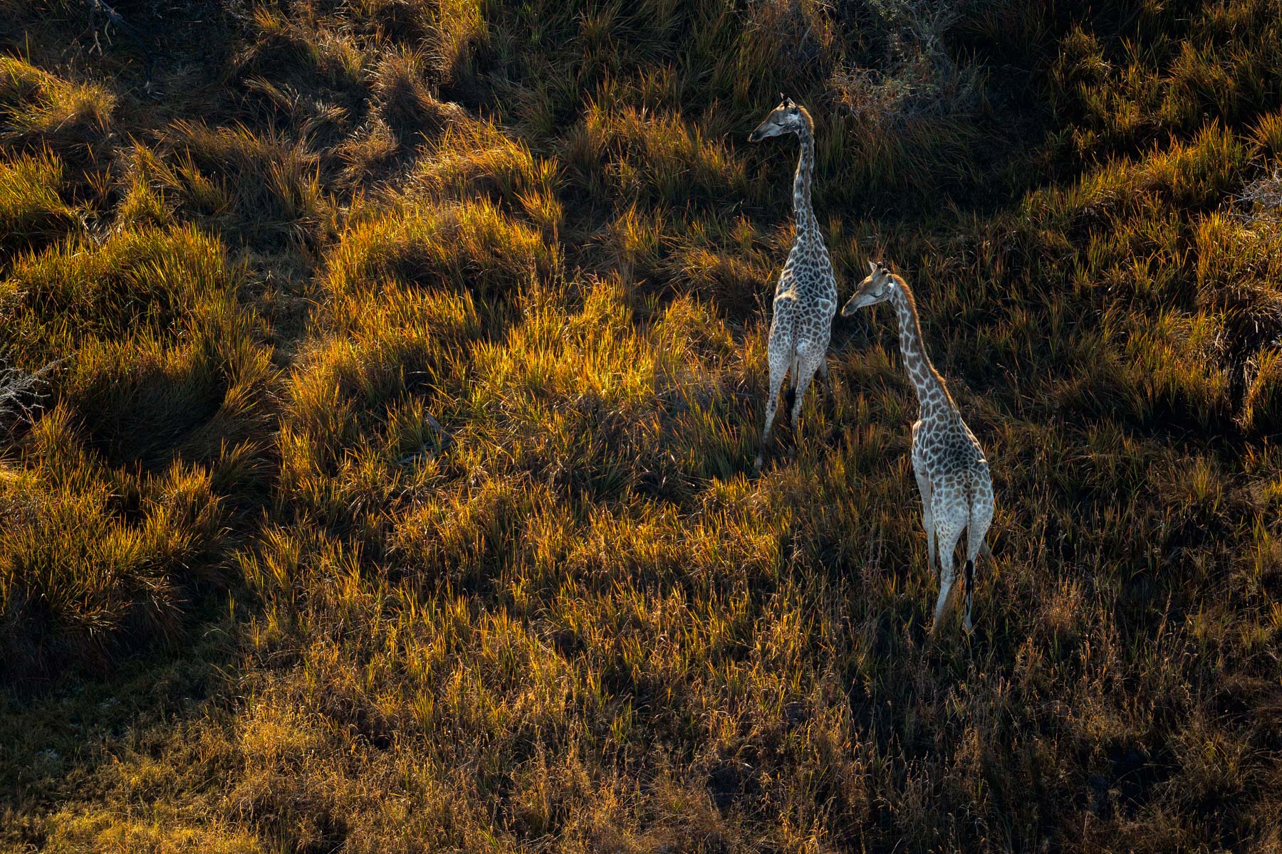
Lechwe in the Okavango Delta, Botswana (18°45' S – 22°45' E).
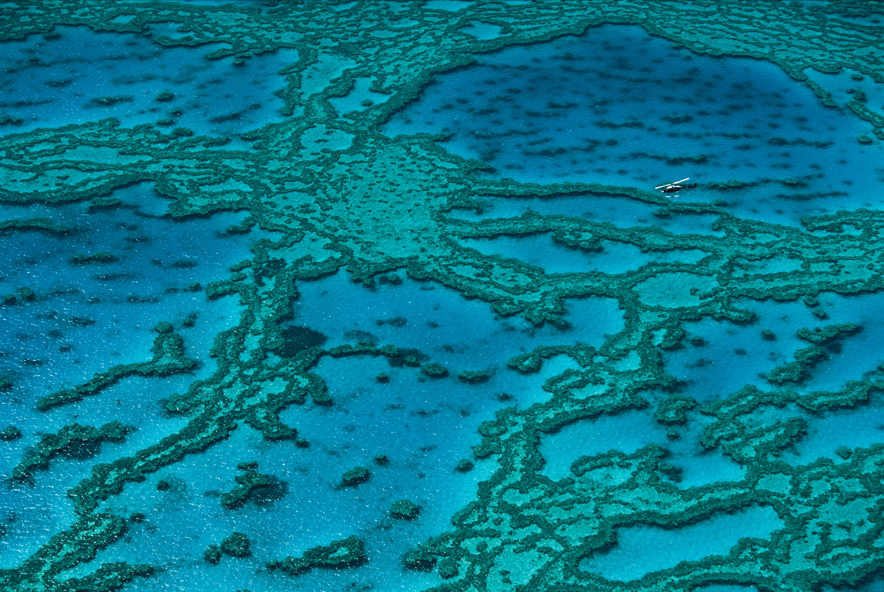
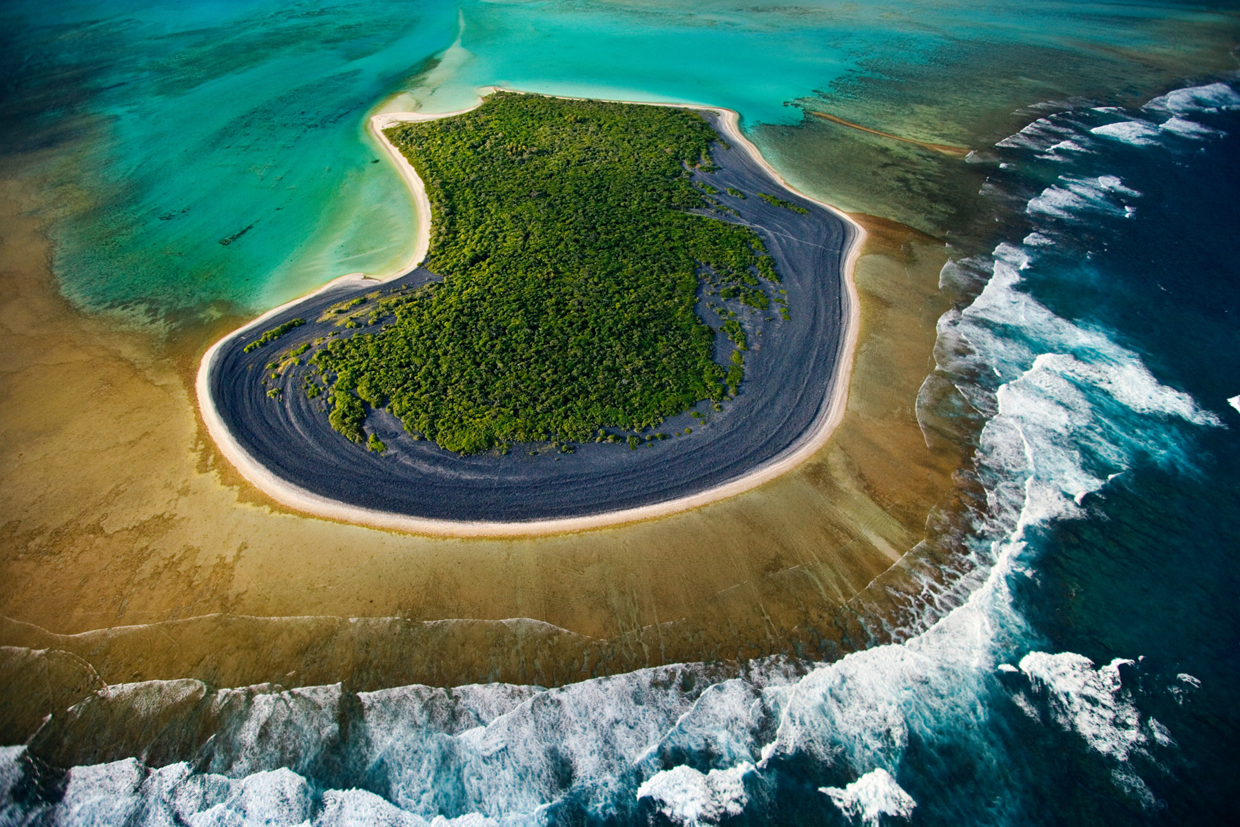
Barrier reef, Queensland, Australia (17°01' S - 146°10' E).
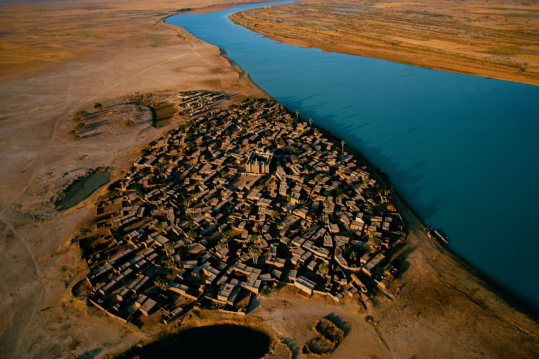
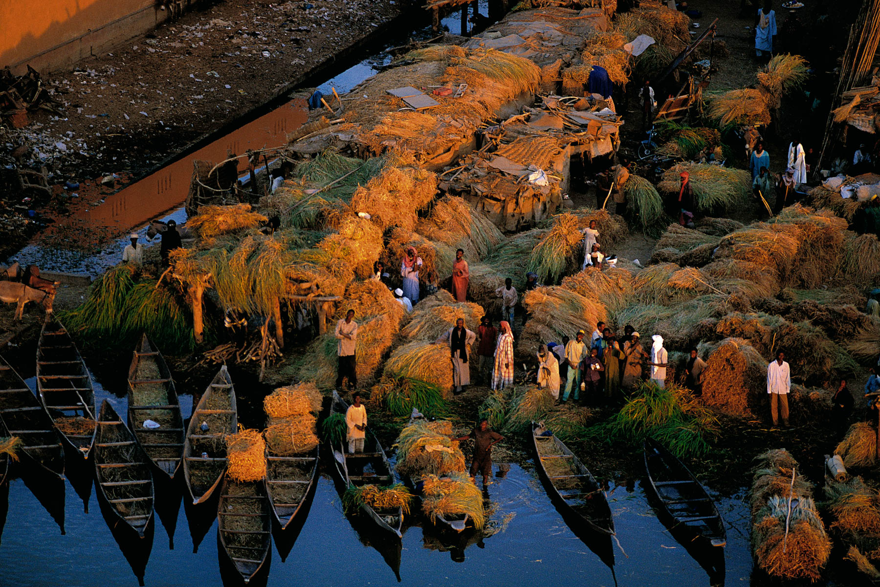
Village on the banks of the Niger River, region of Mopti, Mali (14°27' N – 4°16' W).
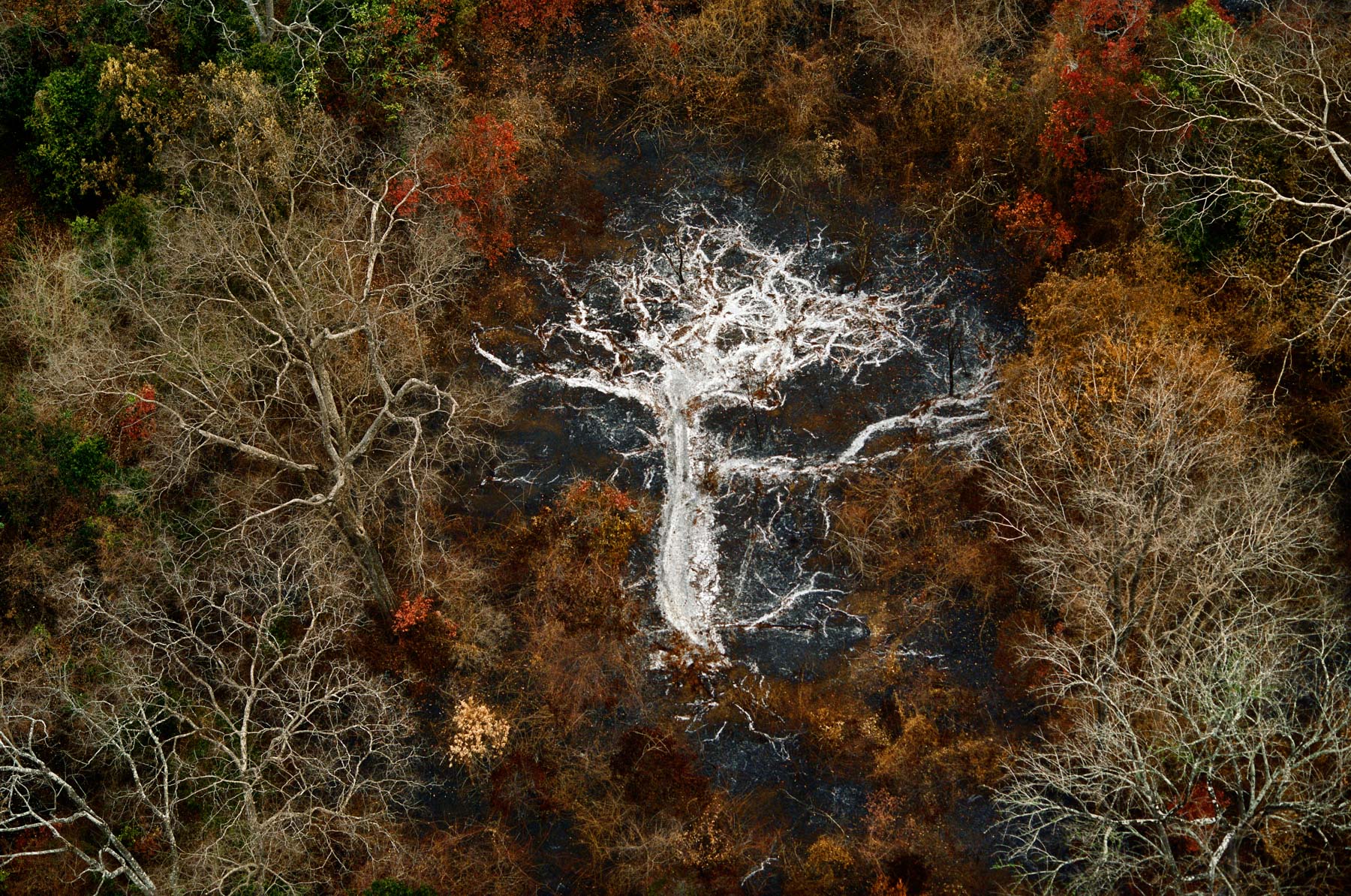
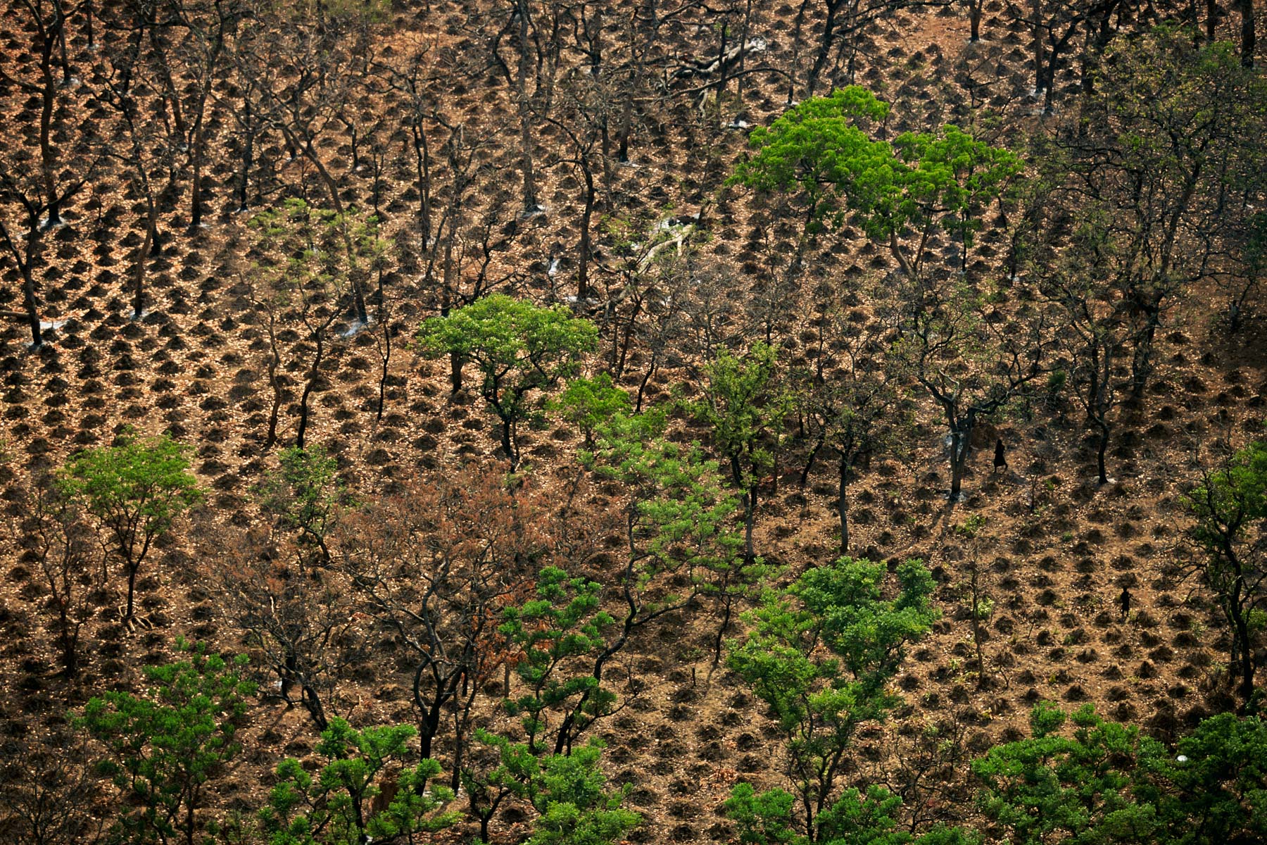
Ashes of a tree near the Gorohoui Kongoli Mountains, Savannah region, Ivory Coast
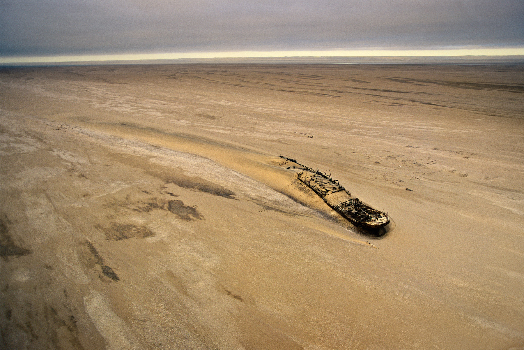
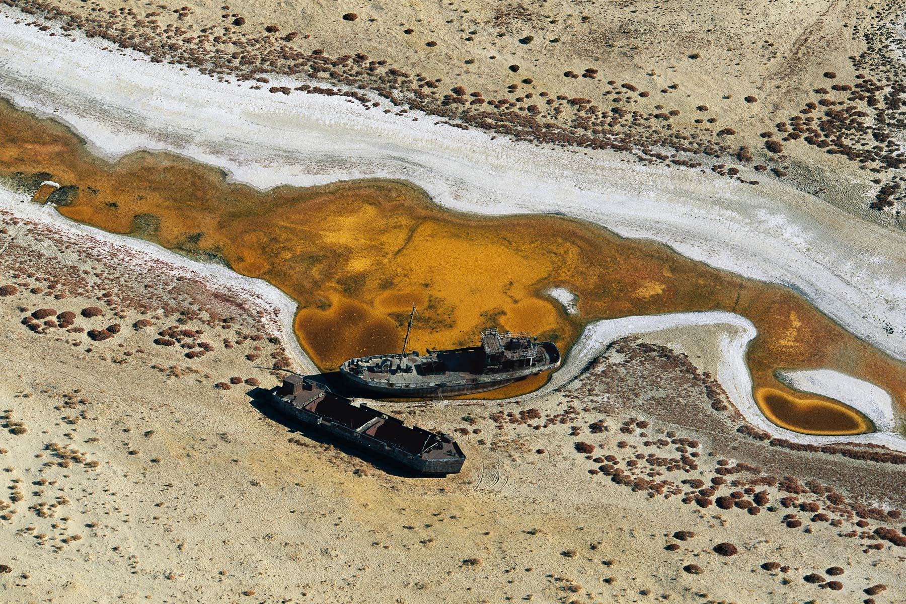
Eduard Bohlen boat run aground on the beach, Namibia (23°59' S – 14°27' E).
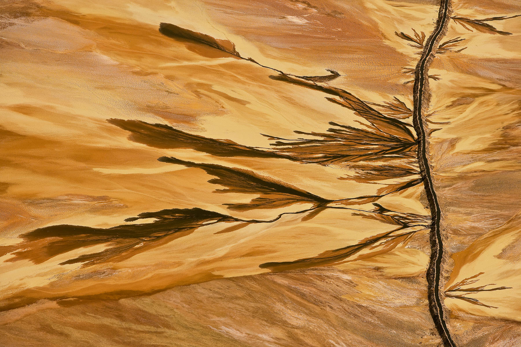
Crystalline formation on lake Magadi, Kenya (1°52’ S – 36°17’ E).

Subaquatic vegetation in the Loire river near Digoin, Saône-et-Loire, France (46°27’ N – 3°59’ E).
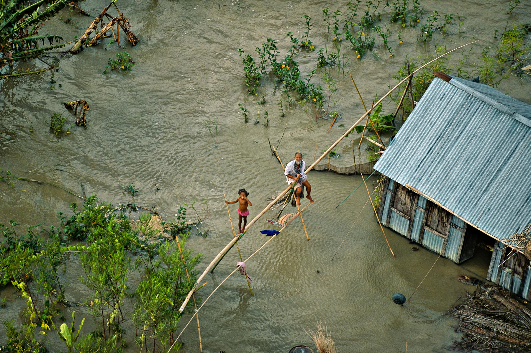
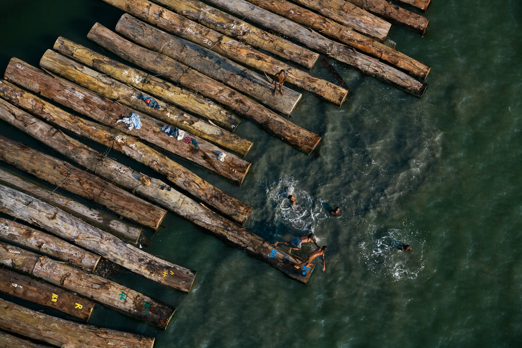
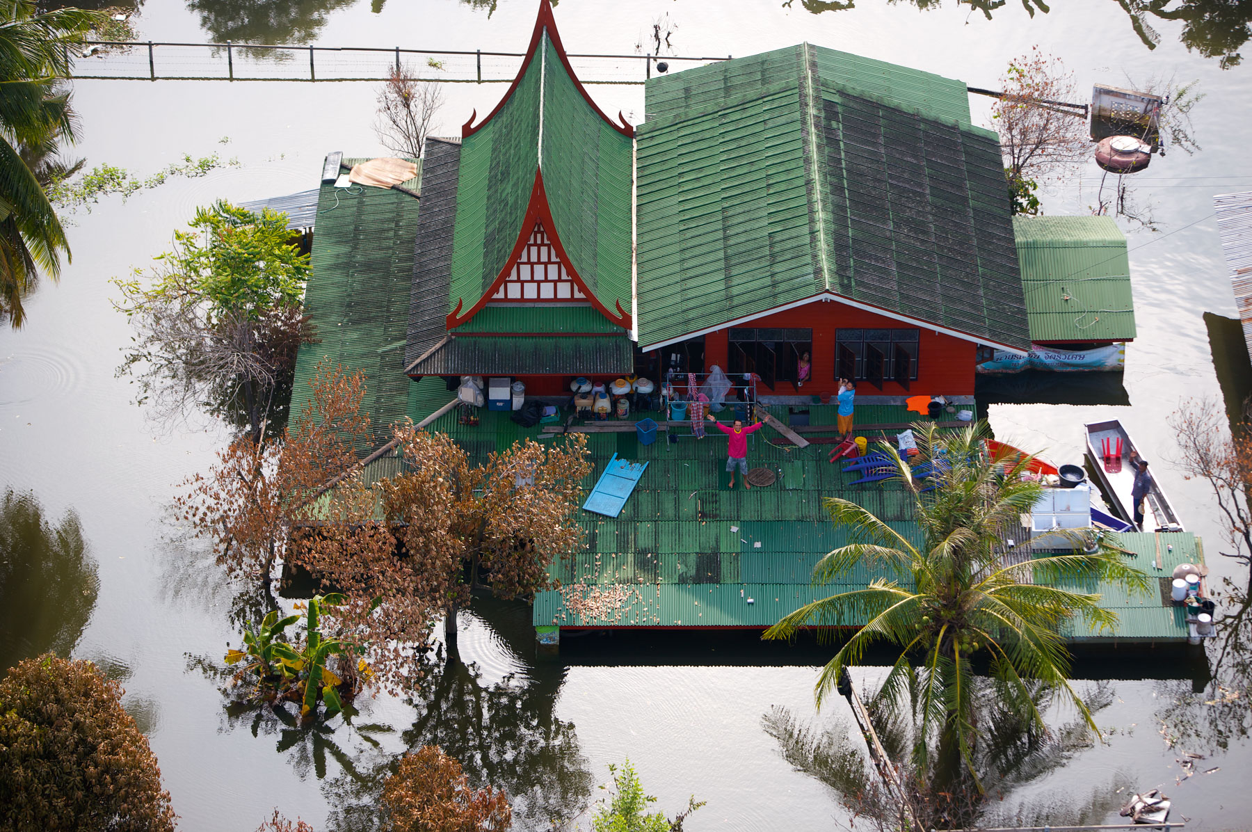
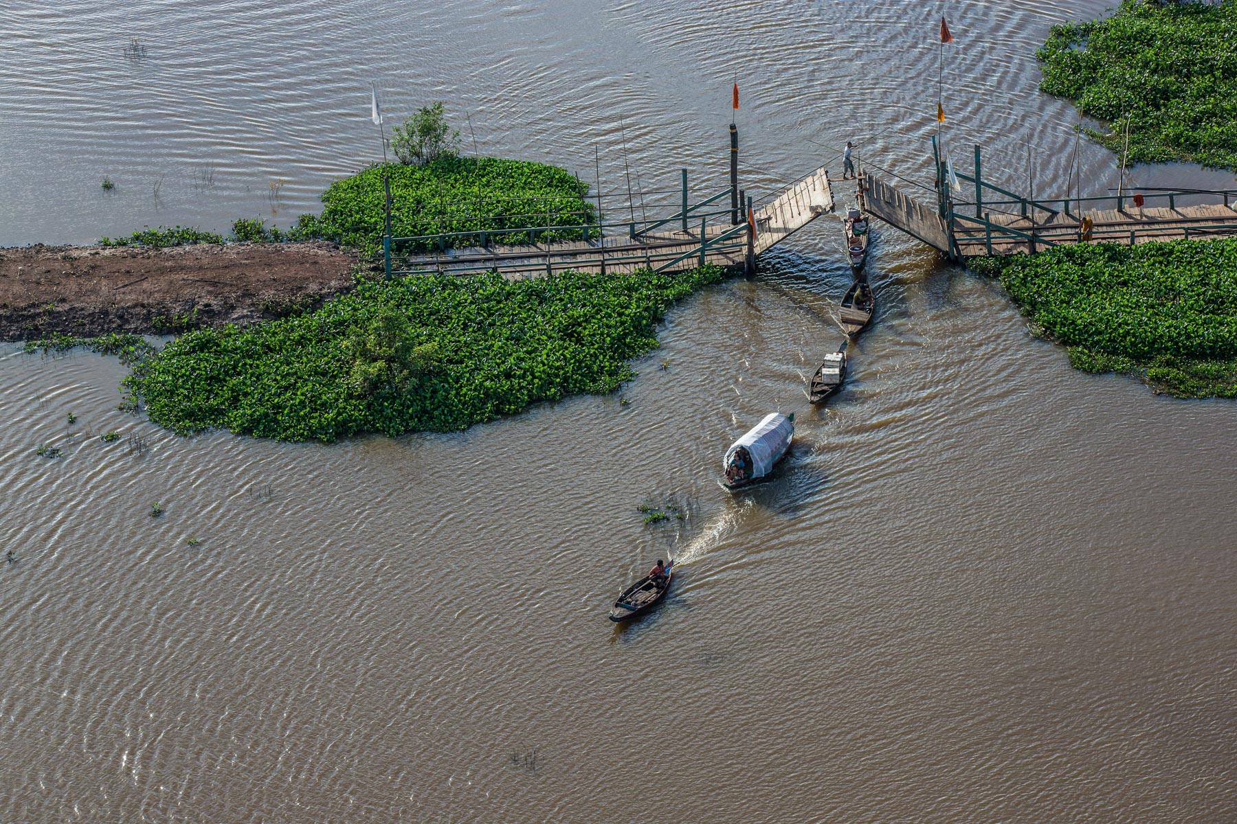
Flooded house south of Dhaka, Bangladesh (23°21’ N – 90°31’ E).

Boats blocked by Common Water Hyacinths on the Nile, Egypt (29°43' N – 31°15' E).
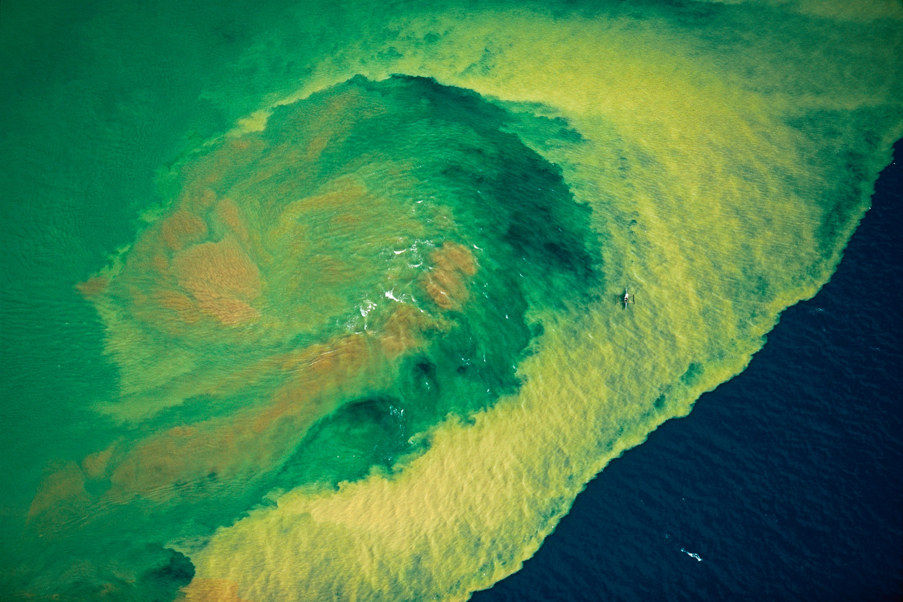
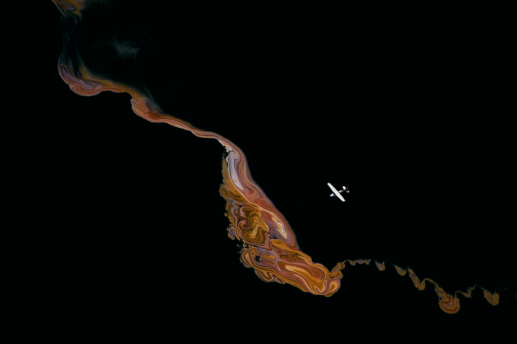
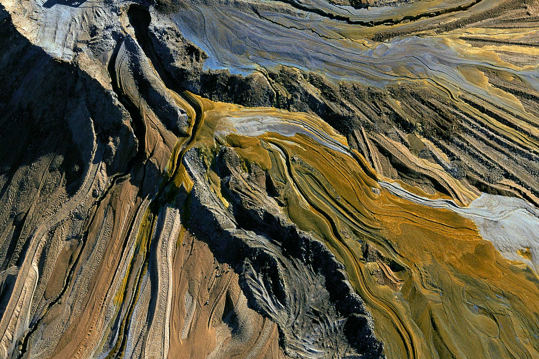
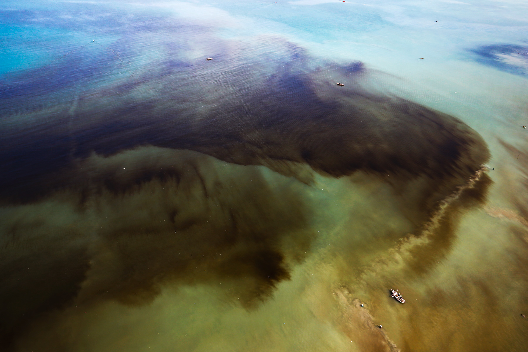
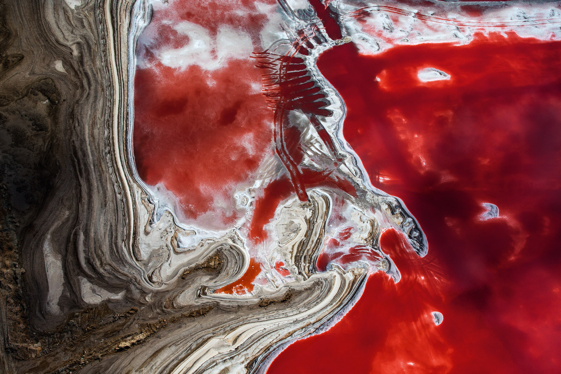
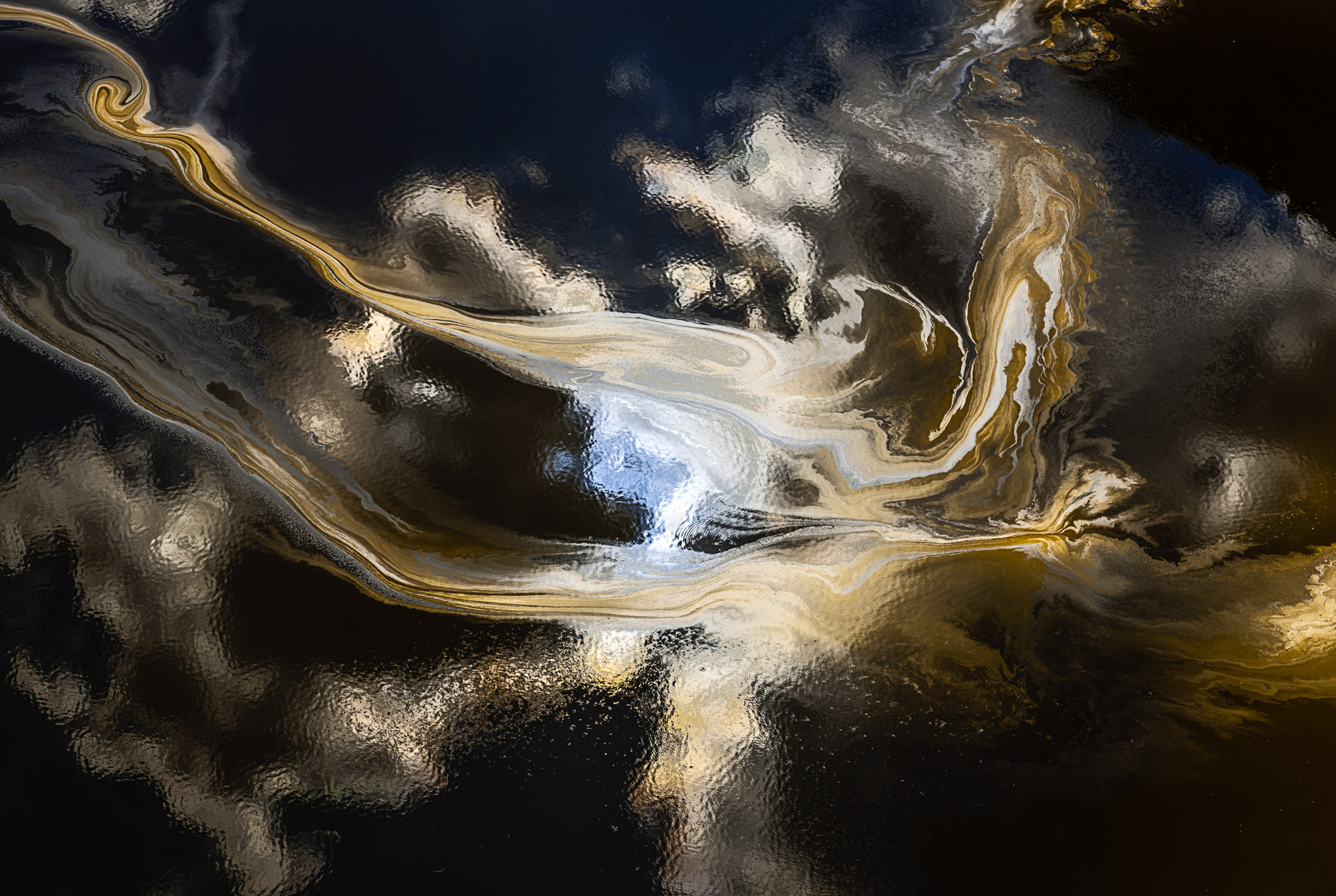
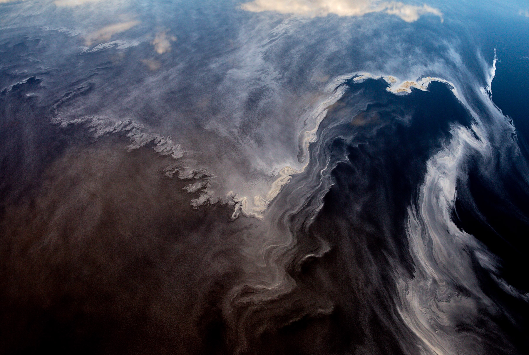
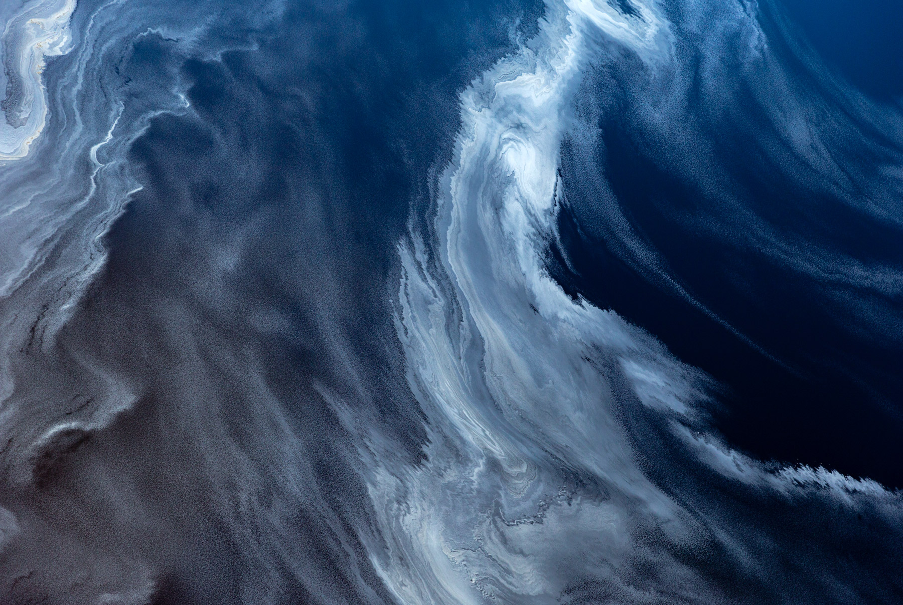
Discharge from the gold mine, off the coast of Mindanao, Philippines (6°52' N – 126°03' E).
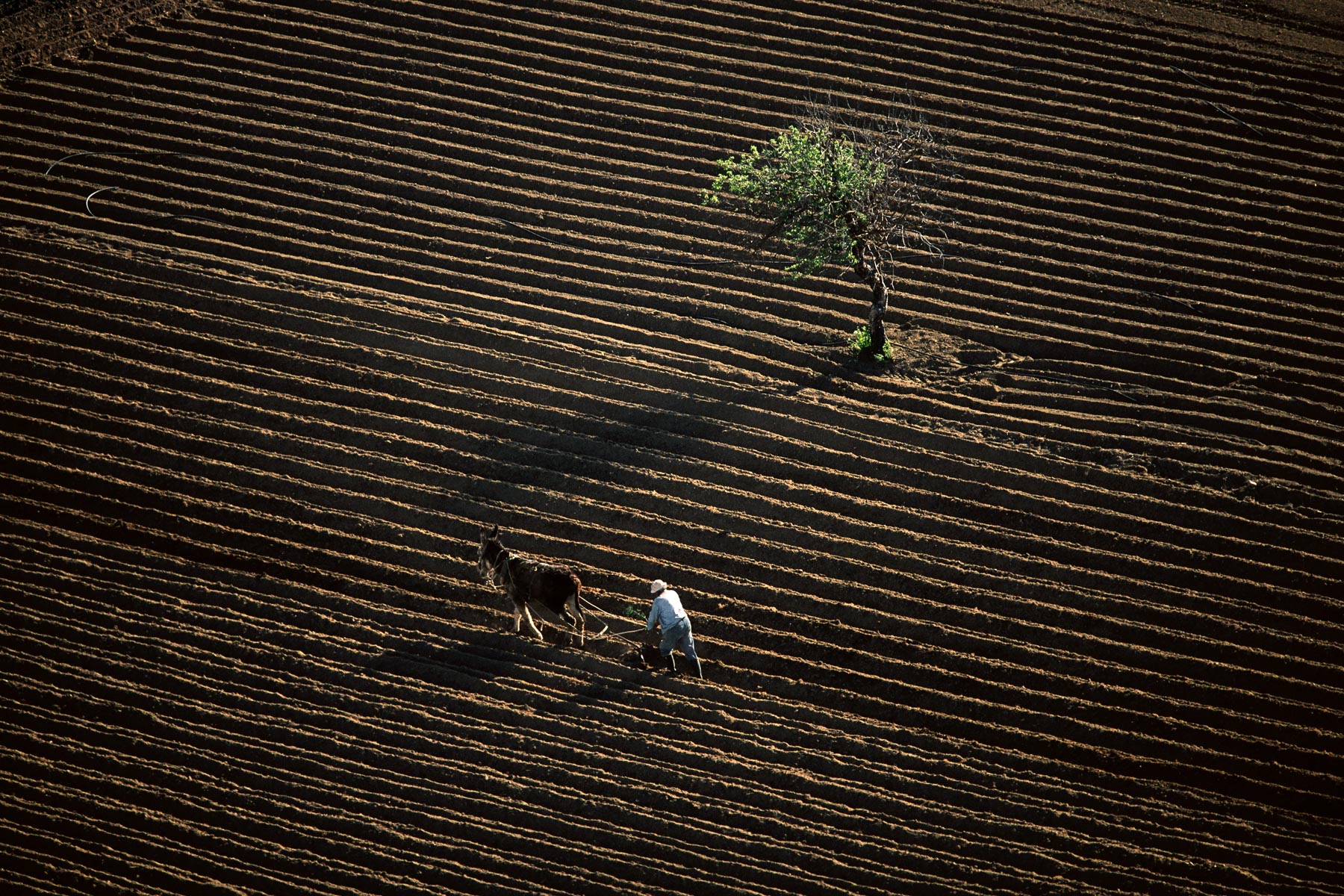
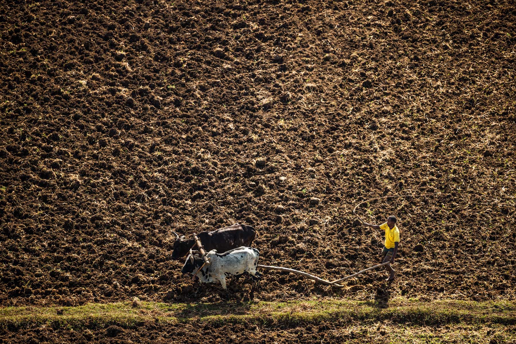
Farmer ploughing his field, Lassithi region, Crete, Greece (35°09' N - 25°35' E).
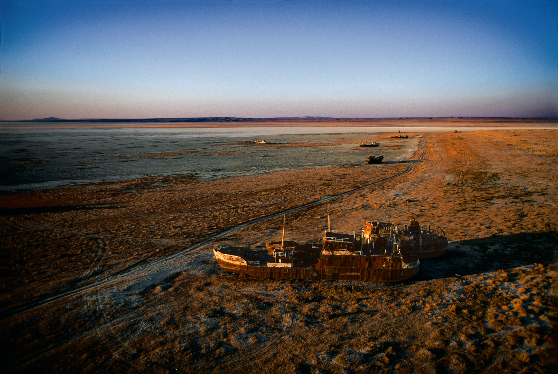
Stranded boat, Aral Sea, Aralsk region, Kazakhstan (46°39' N – 61°11' E).
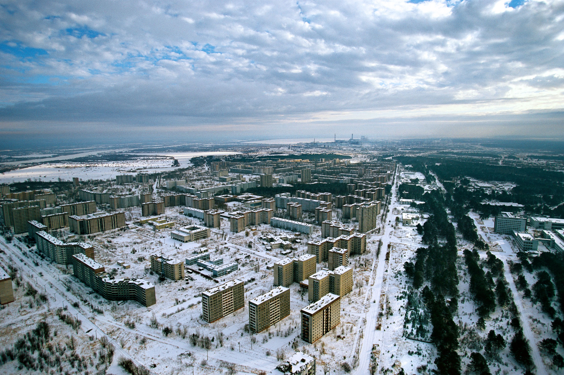
Pripiat, an abandoned town near the Chernobyl nuclear power station, Ukraine (51°24' N – 30°02' E).
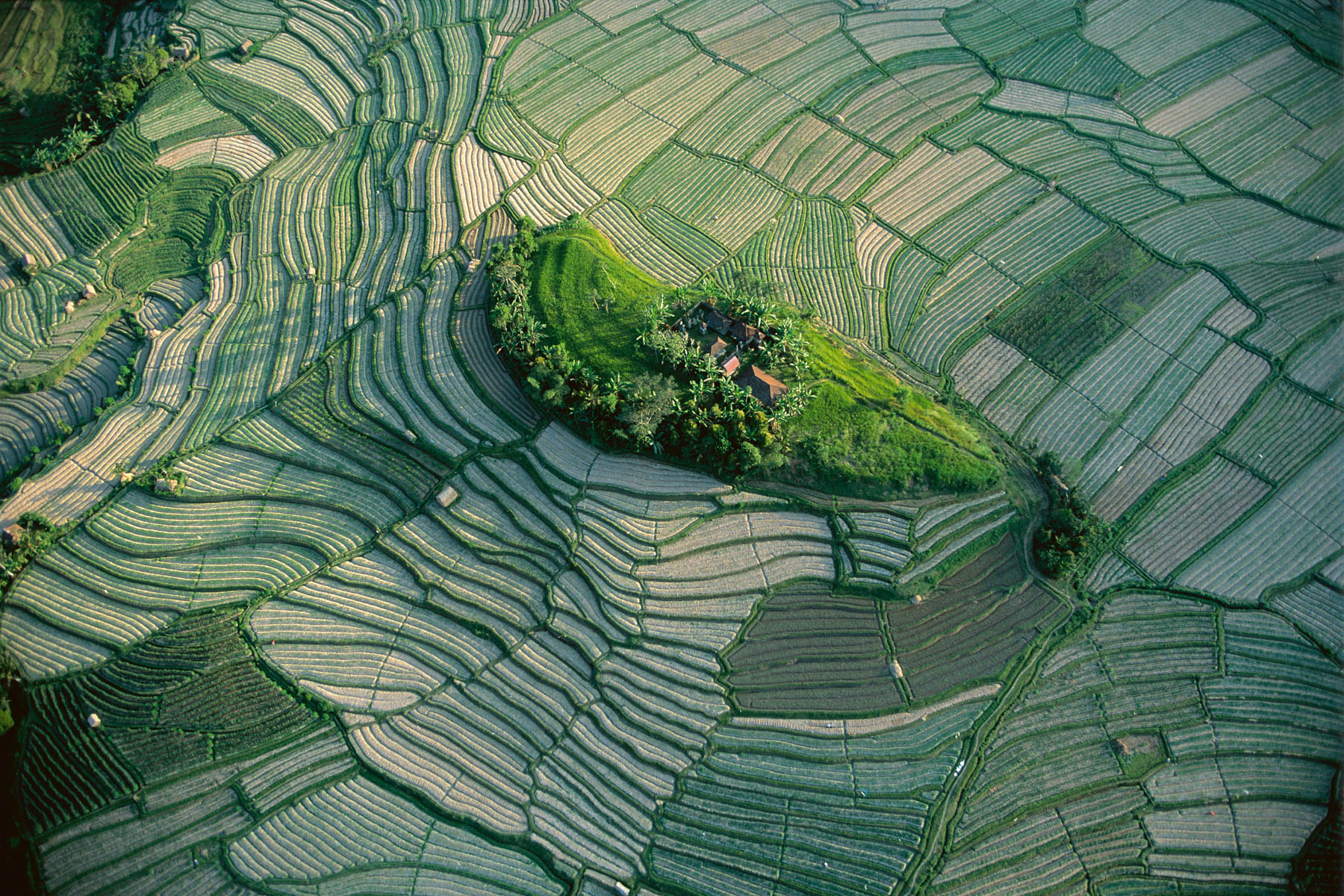
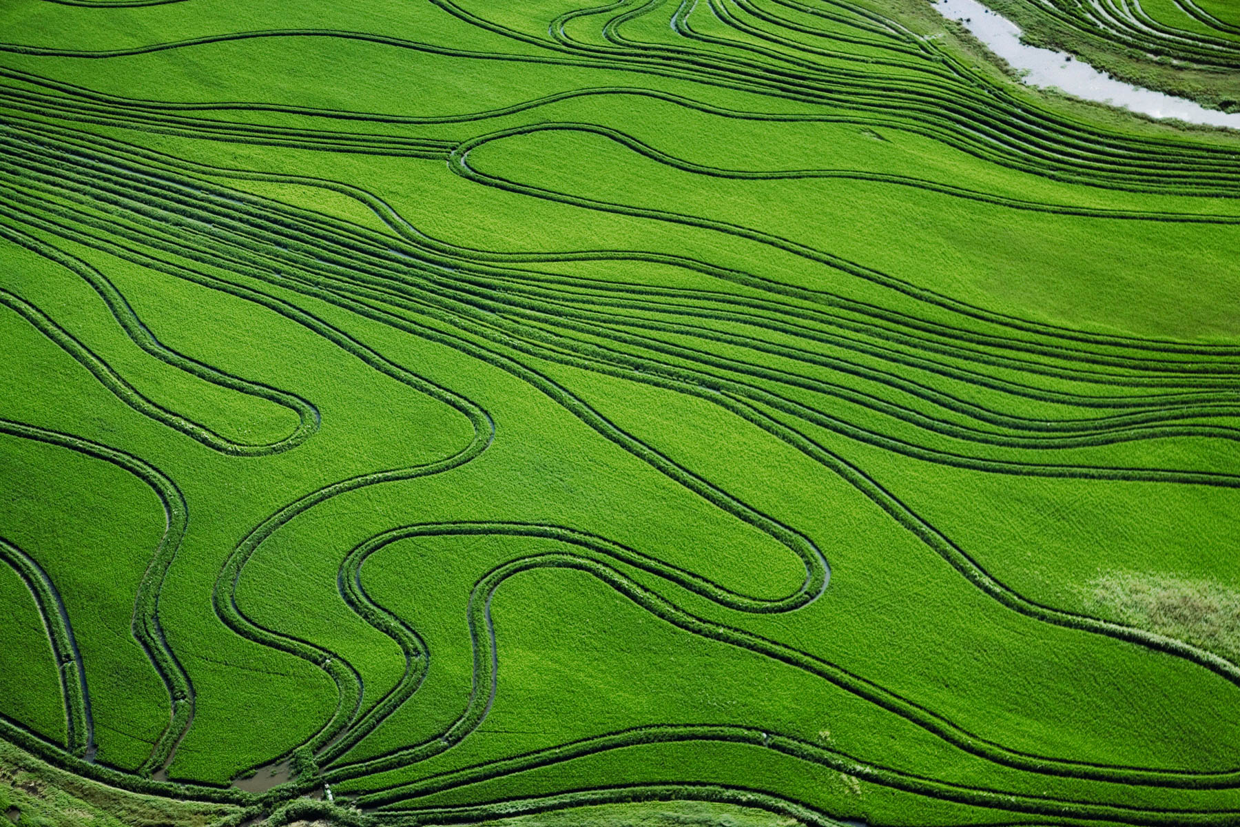
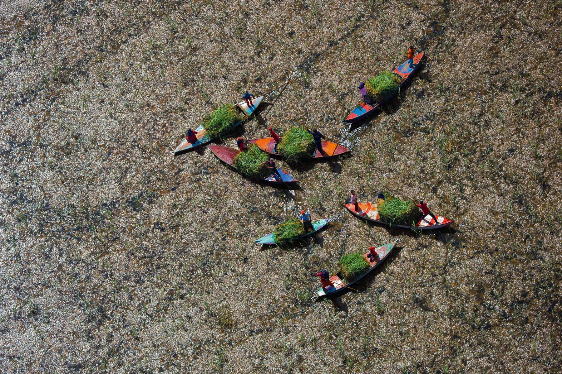
Islet in the terraced rice fields of Bali, Indonesia (8°22' S – 115°08' E).
Cows in a swampy river, region of Rabat, Morocco (33°57' N – 6°48' W).
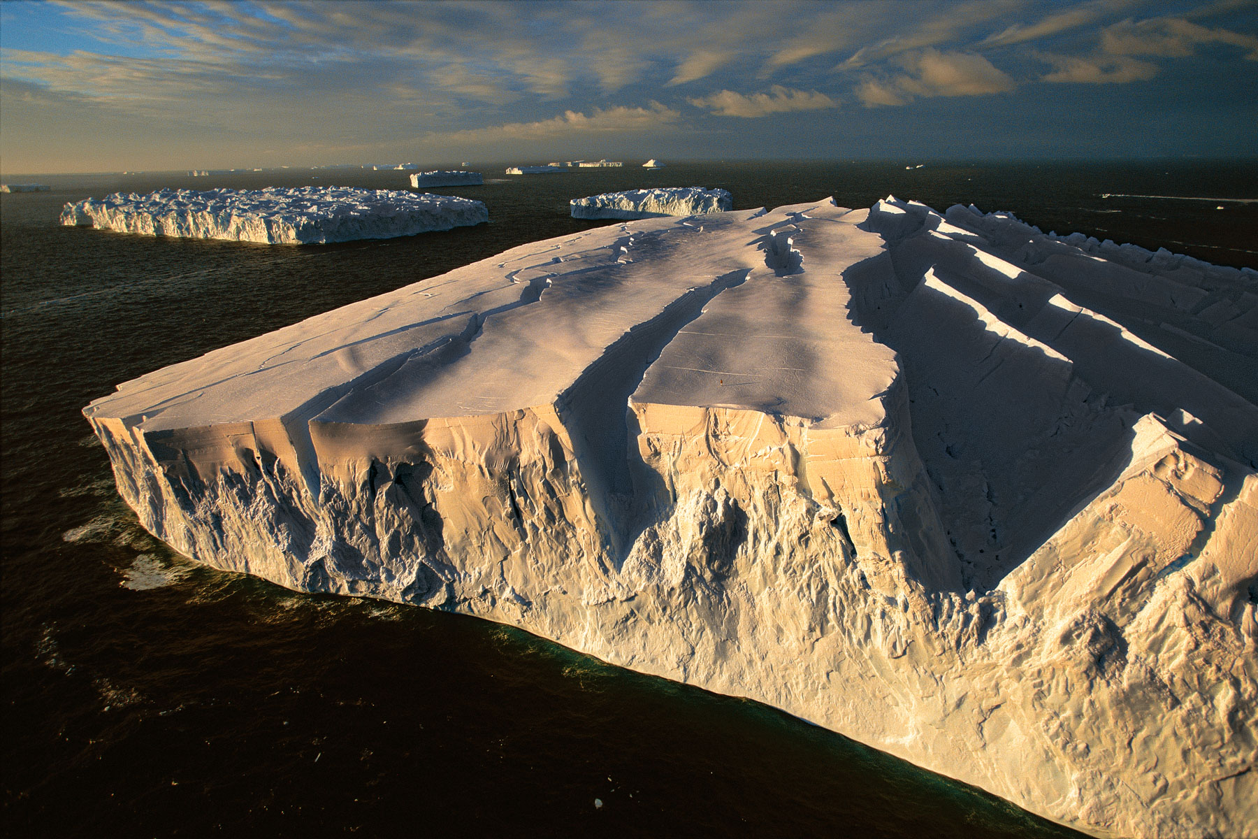
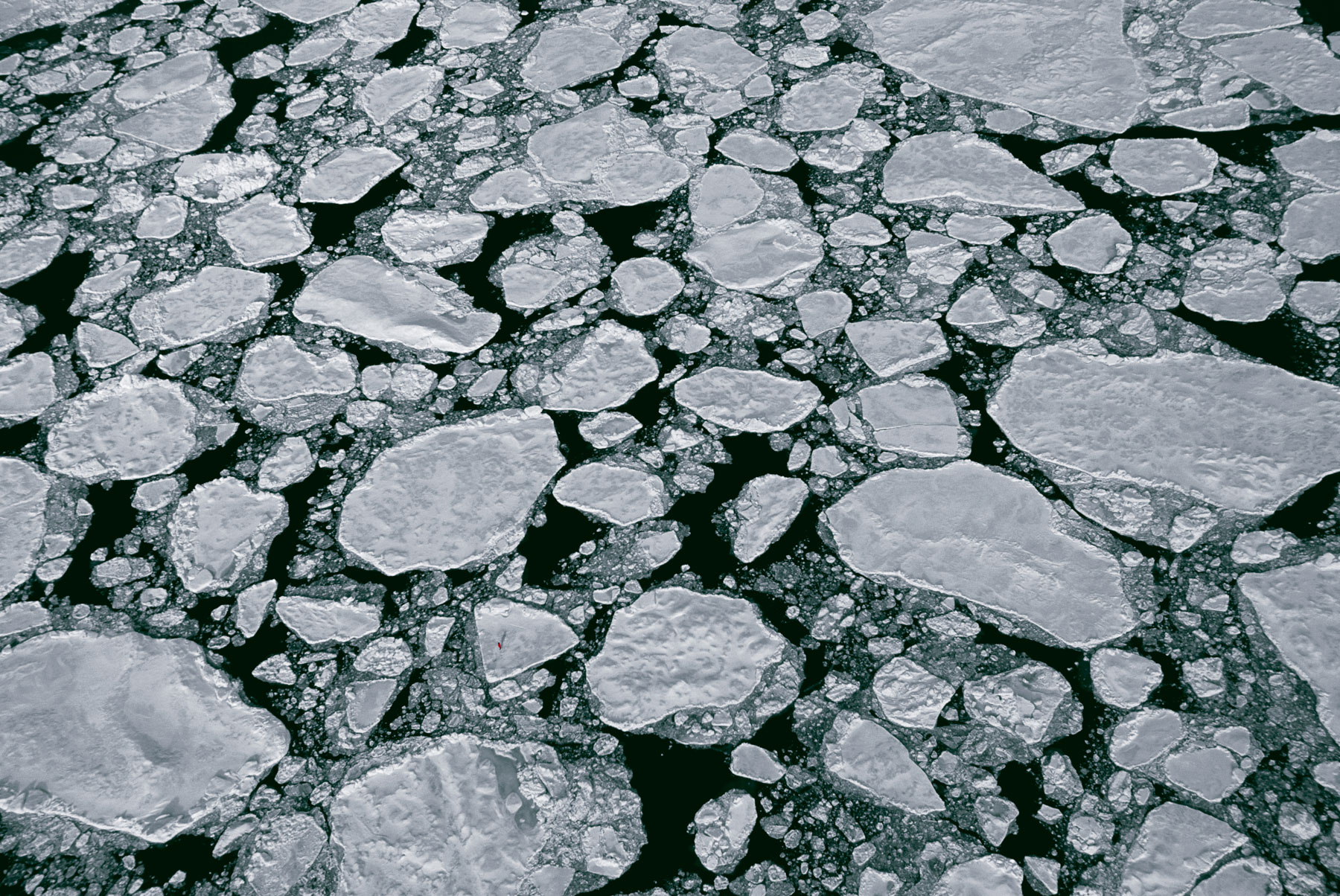
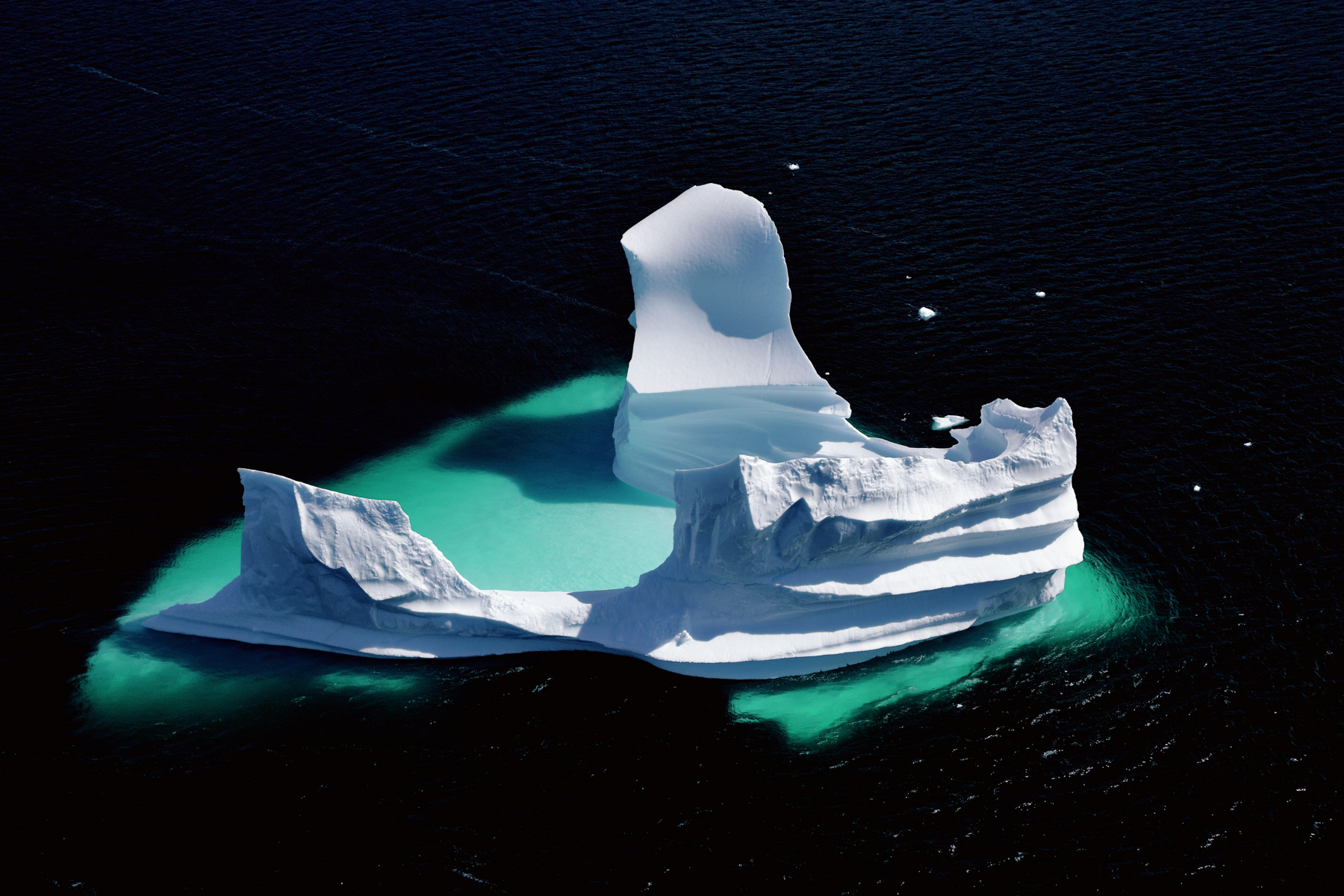
Icebergs off the coast of Adélie Land, Antarctica (South pole) (67°00' S – 139°00' E).
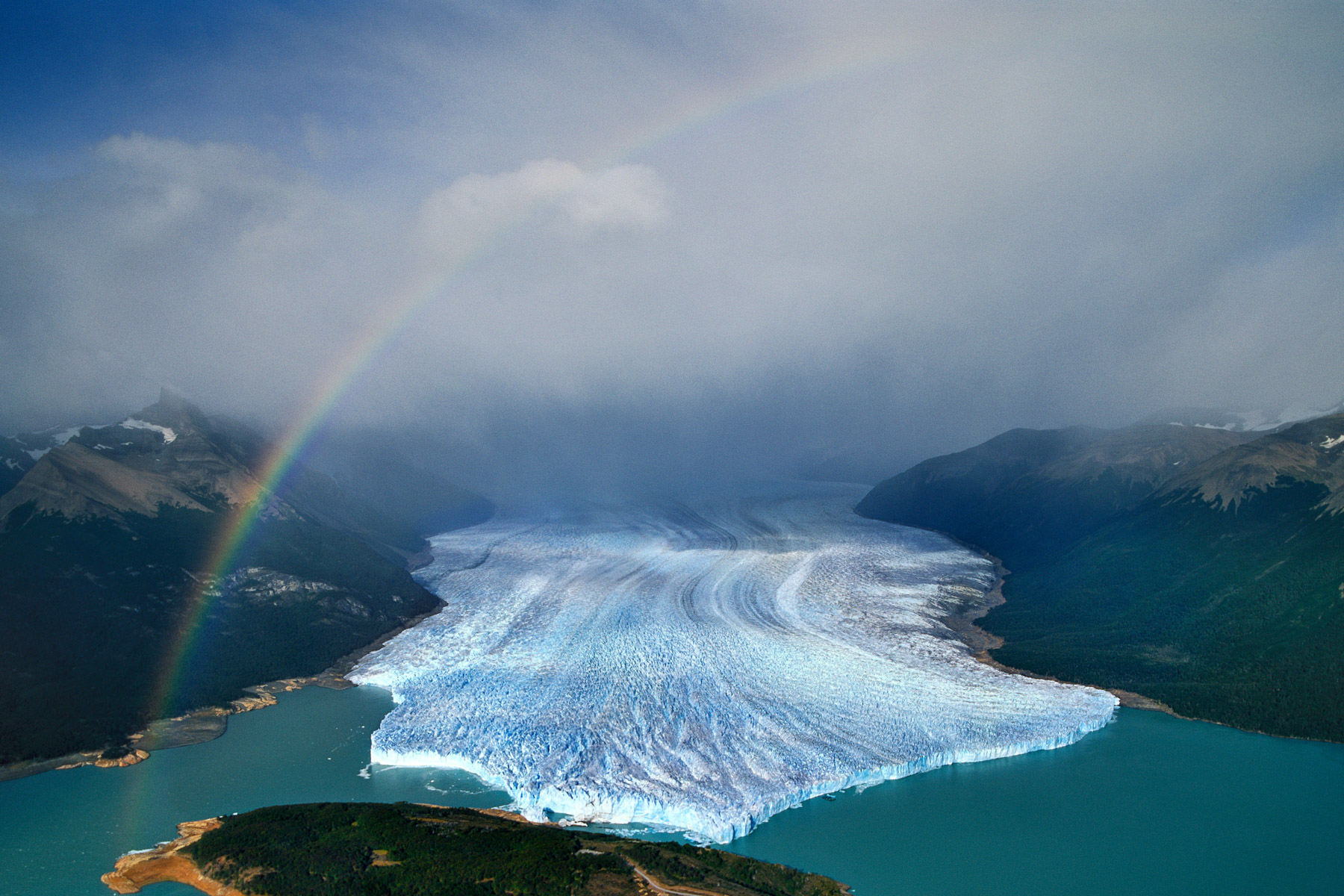
Perito Moreno glacier, Santa Cruz Province, Argentina (50°31' S – 73°06' W).
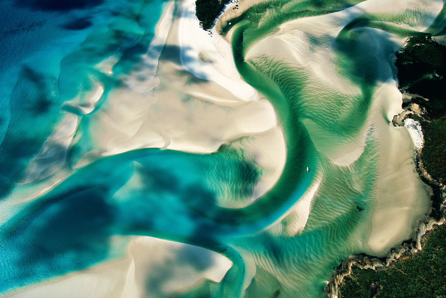
Sandbanks on the coast of Whitsunday Island, Queensland, Australia (20°15' S – 149°01' E).
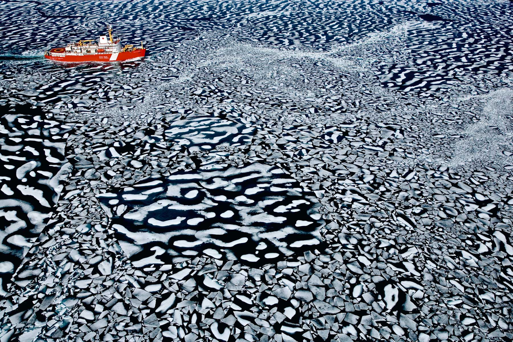
Landscape of ice, Nunavut Territory, Canada (75°57' N - 92°28' W).

Uranium mines in Kakadu National Park, Northern Territory, Australia (12°41' S – 132°54' E).
Cotton fabric drying in the sun in Jaipur, Rajasthan, India (N 26°45' E 75°49').
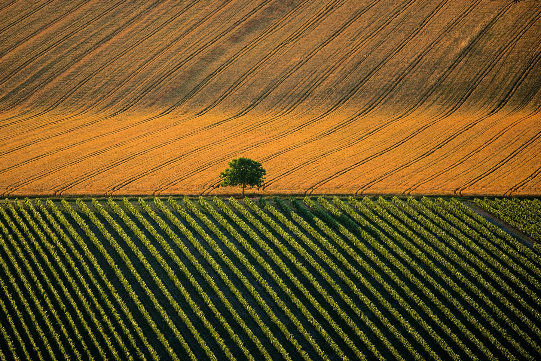
Agricultural landscape near Cognac, Charente, France (45°42' N - 0°17' W).
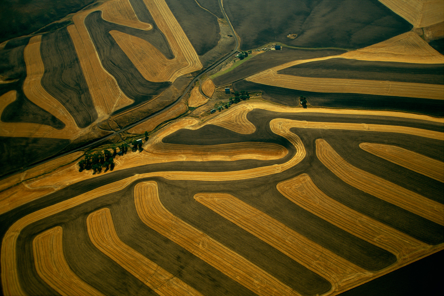
Farming near Pullman, Washington, United States (46°42' N – 117°12' W).
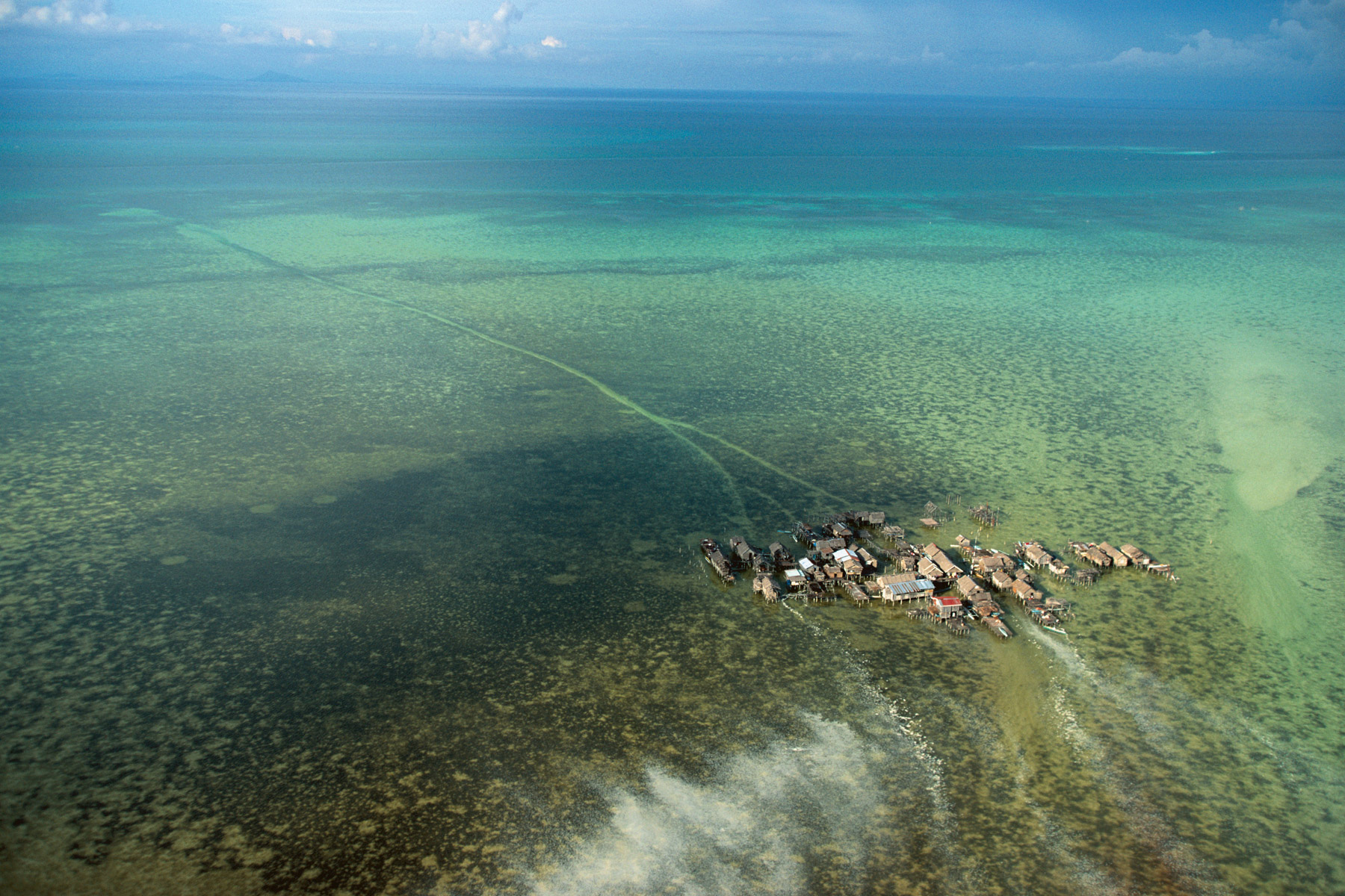
Village on stilts in Tongkil, Samales Islands, Philippines (6°04' N – 121°47' E).

Bora Bora, french Polynesia, France(16°30' S –151°44' W).
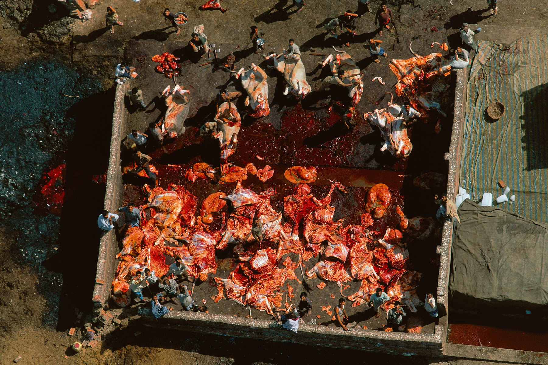
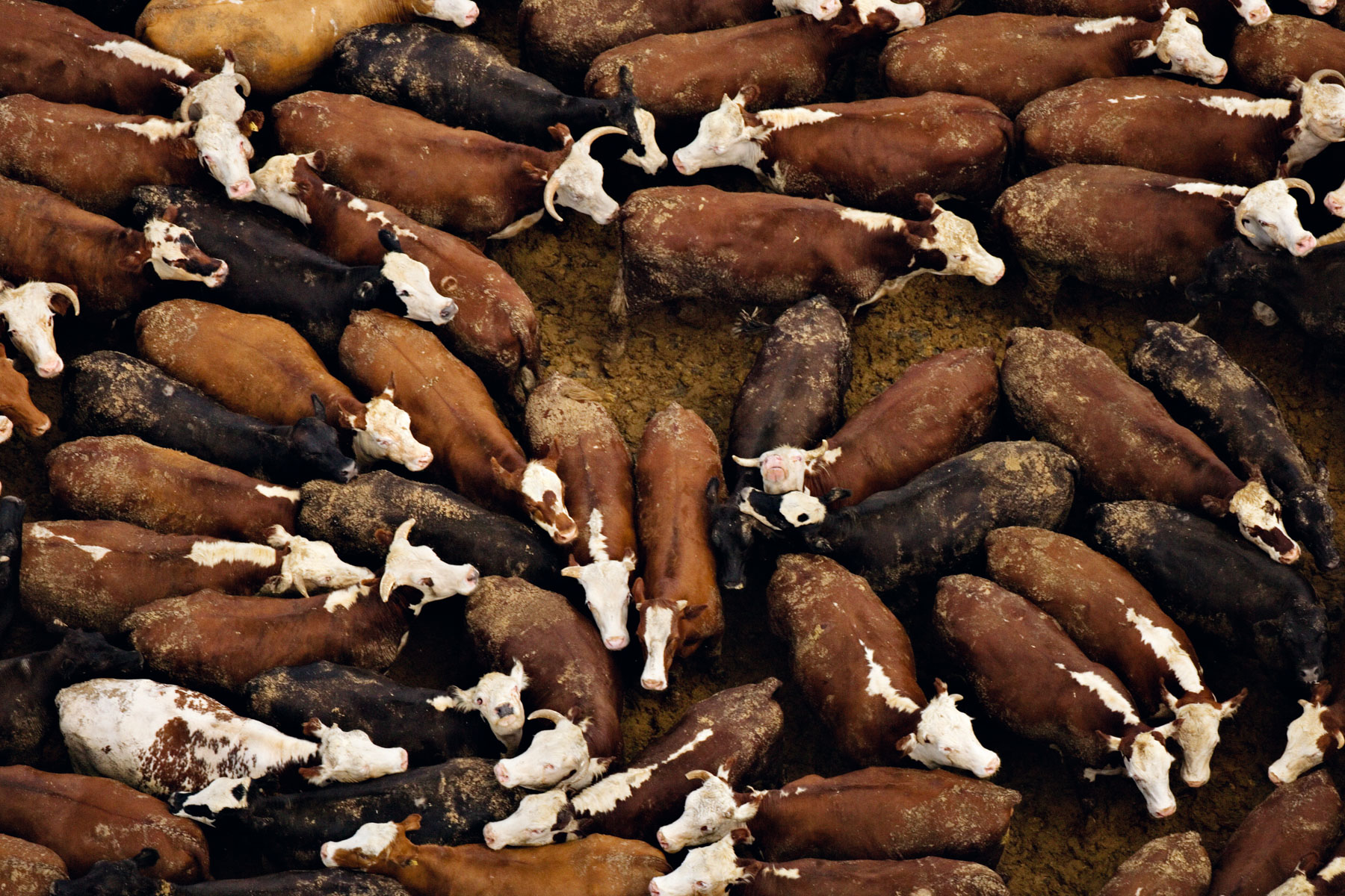
Slaughterhouse near Agra, Uttar Pradesh, India (27°10' N - 78°00' E).
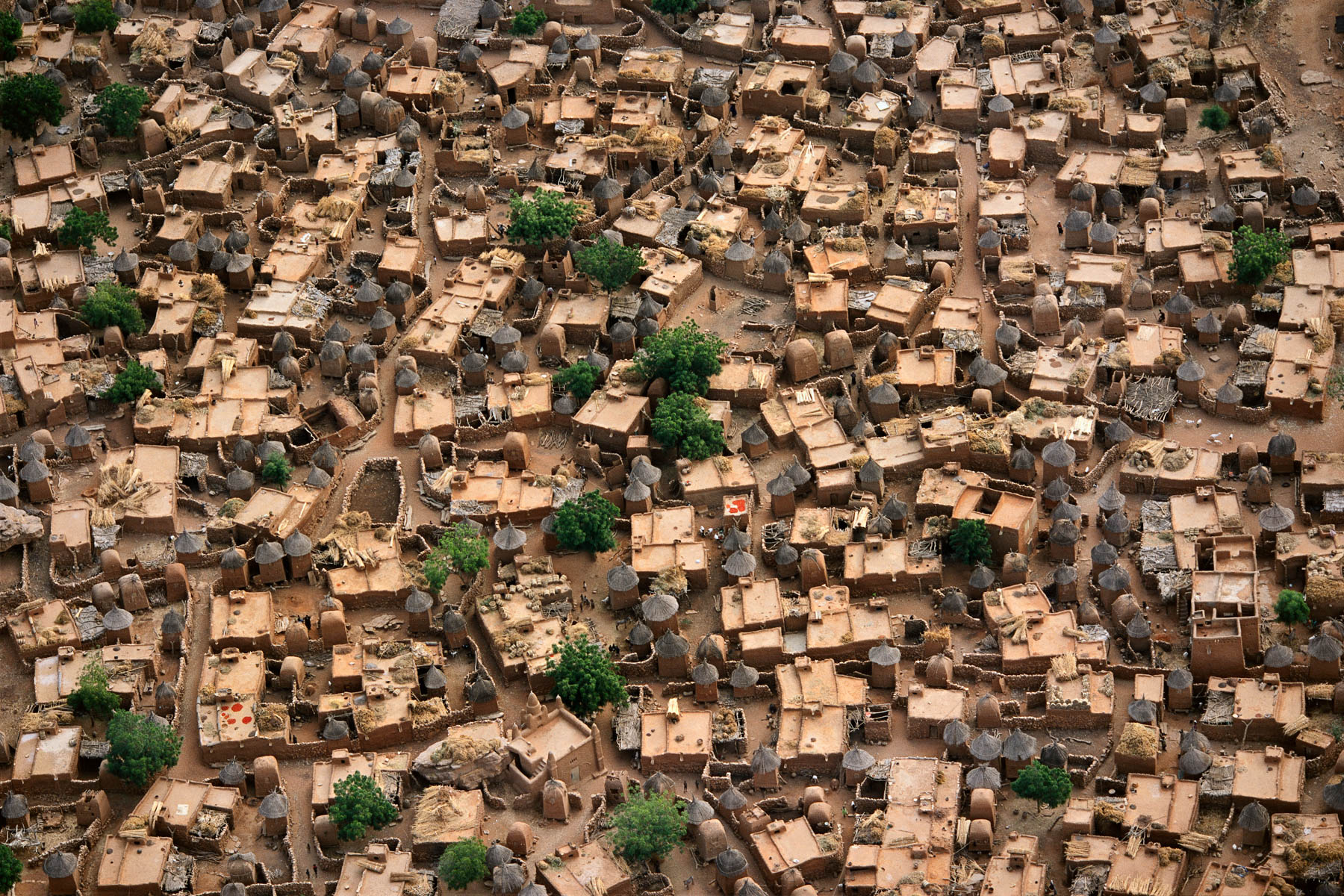
Dogon village near Bandiagara, Mali (14°23' N – 3°39' W).
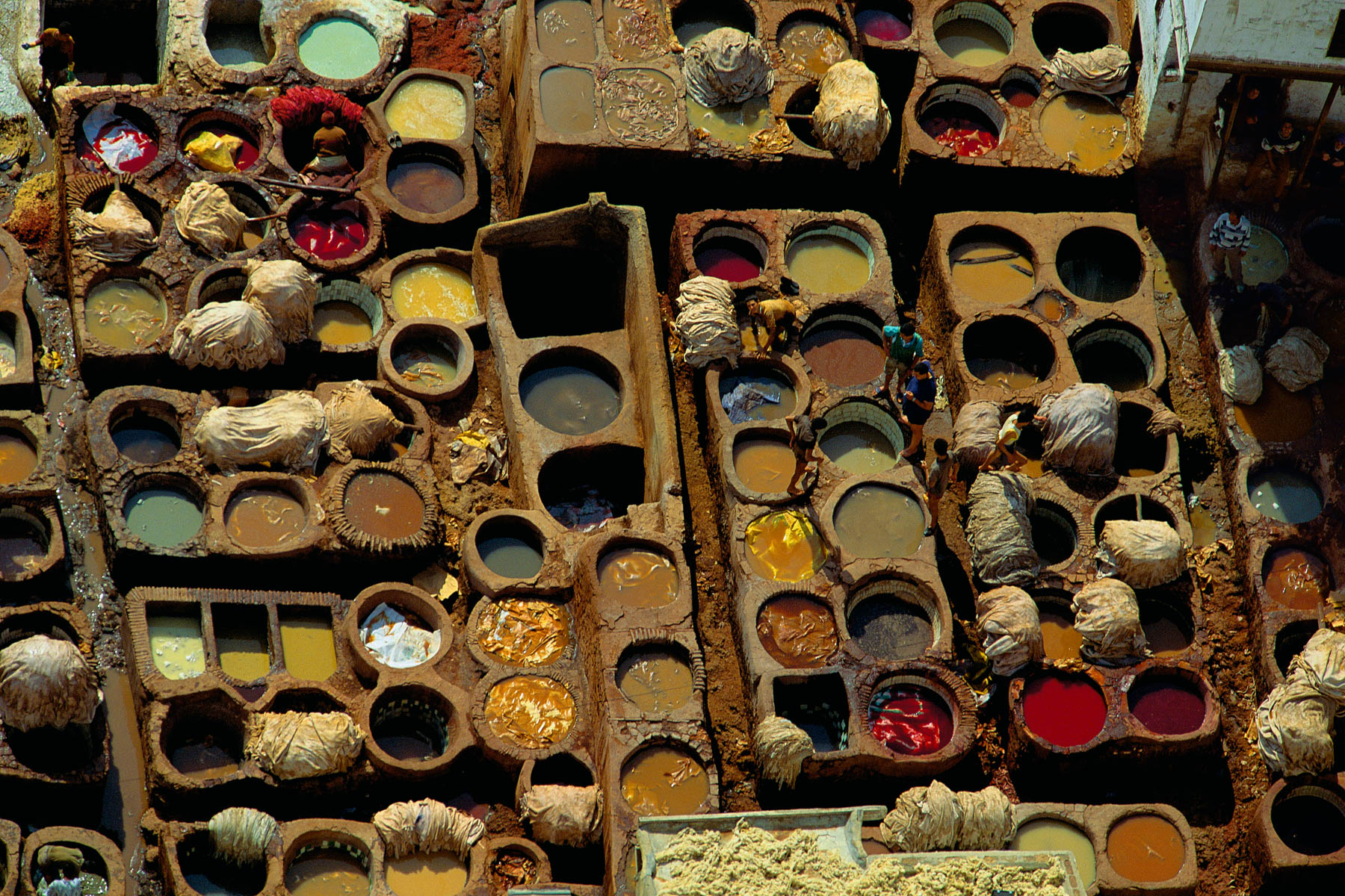
Dyer's vats and workshops in Fez, Morocco (34°04' N - 4°58' W).
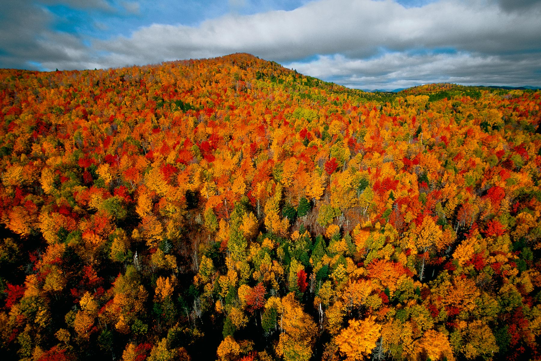
Autumn forest in the region of Charlevoix, Quebec, Canada (47°40' N - 71°02' W).
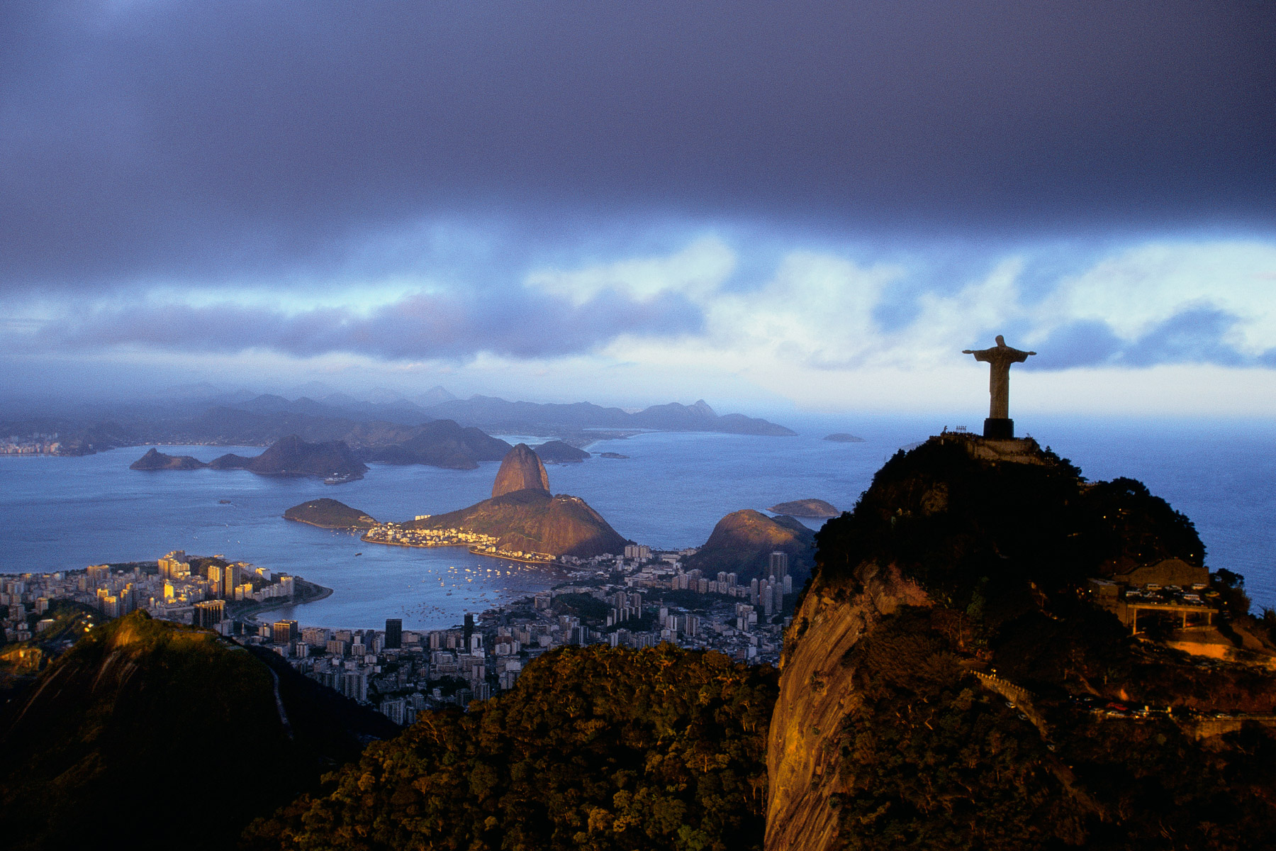
The Corcovado overlooking the city of Rio de Janero, Brazil (22°57’ S – 43°13’ W).
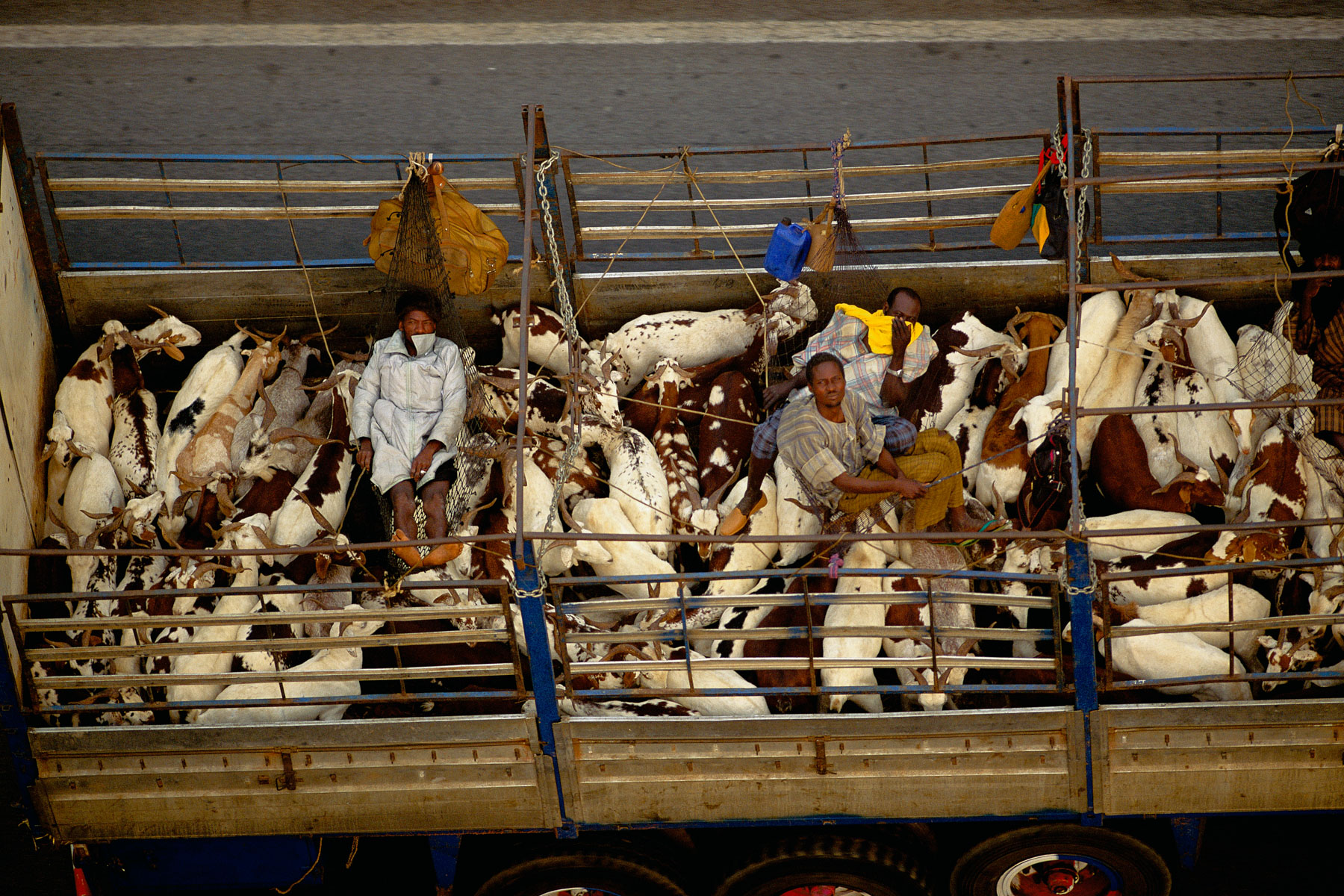
Transport of Goats Near Toumodi, Yamoussoukro, Ivory Coast (6°35’ N – 5°01’ W).
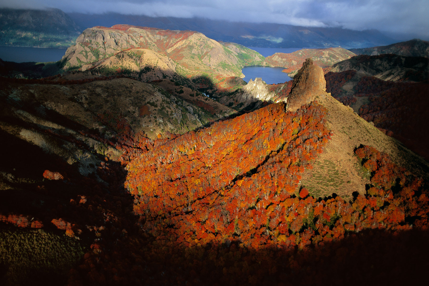
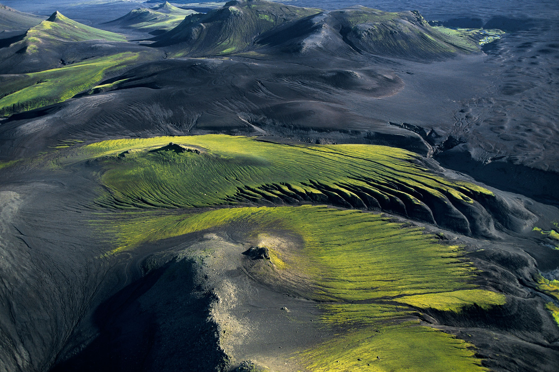
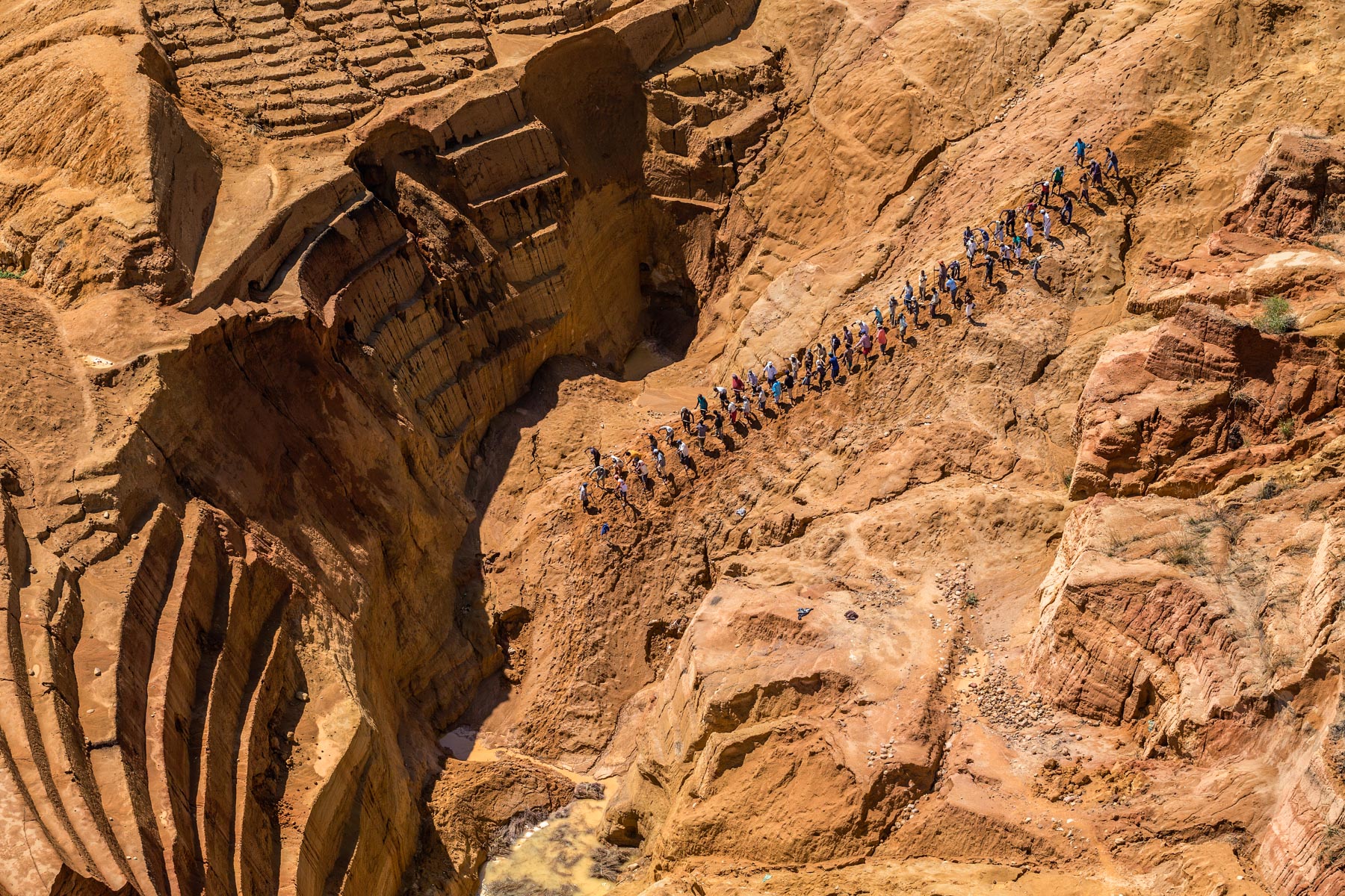
Erosion on the side of a volcano near Ankisabe, Tananarive region, Madagascar (19°04' S - 46°39' E).
Work in the fields between Chiang Mai and Chiang Rai, Thailand (19°36' N – 99°41' E).
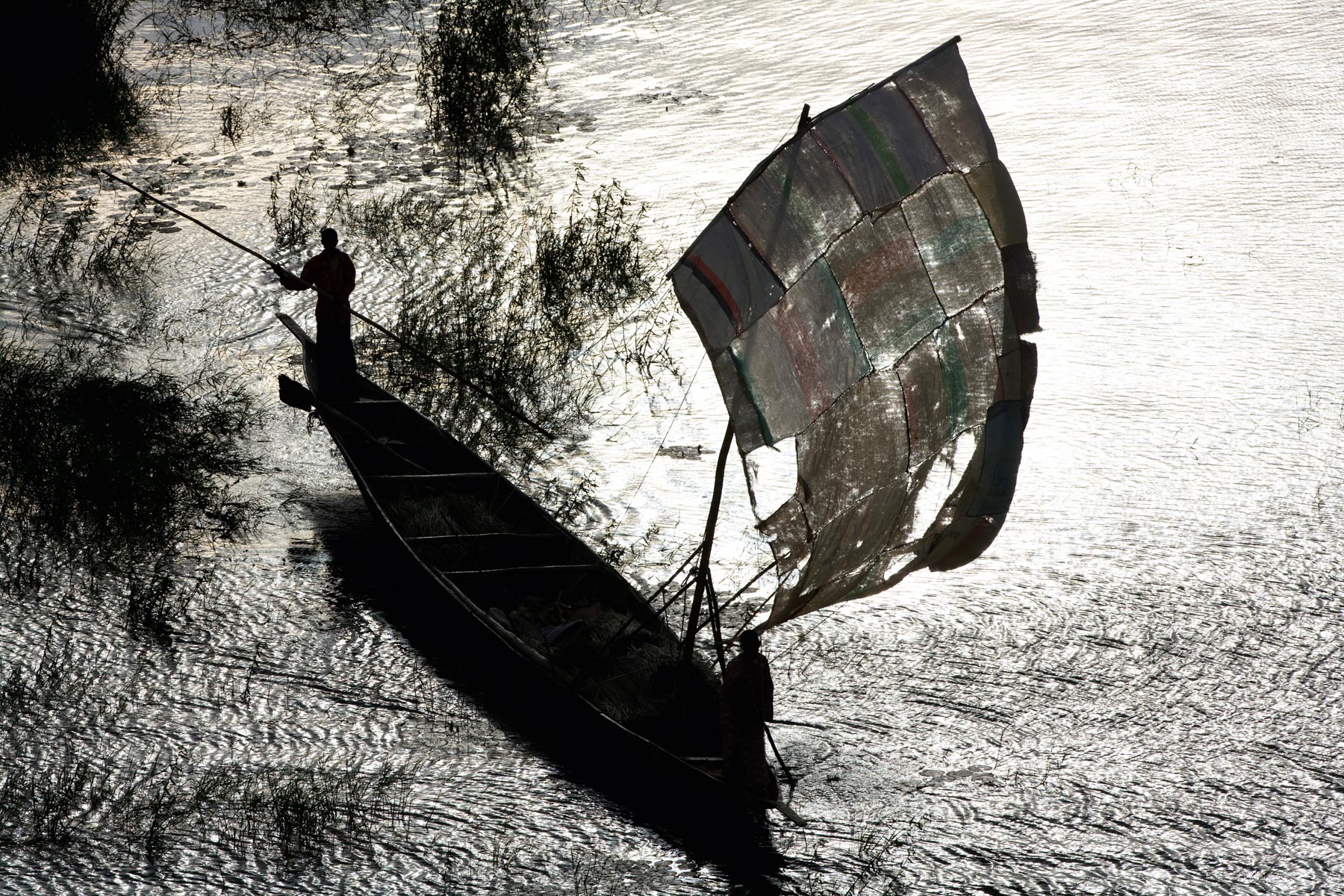
Pirogue on the Niger river in the Gao region, Mali (16°12’ N – 0°01’ W). The Niger
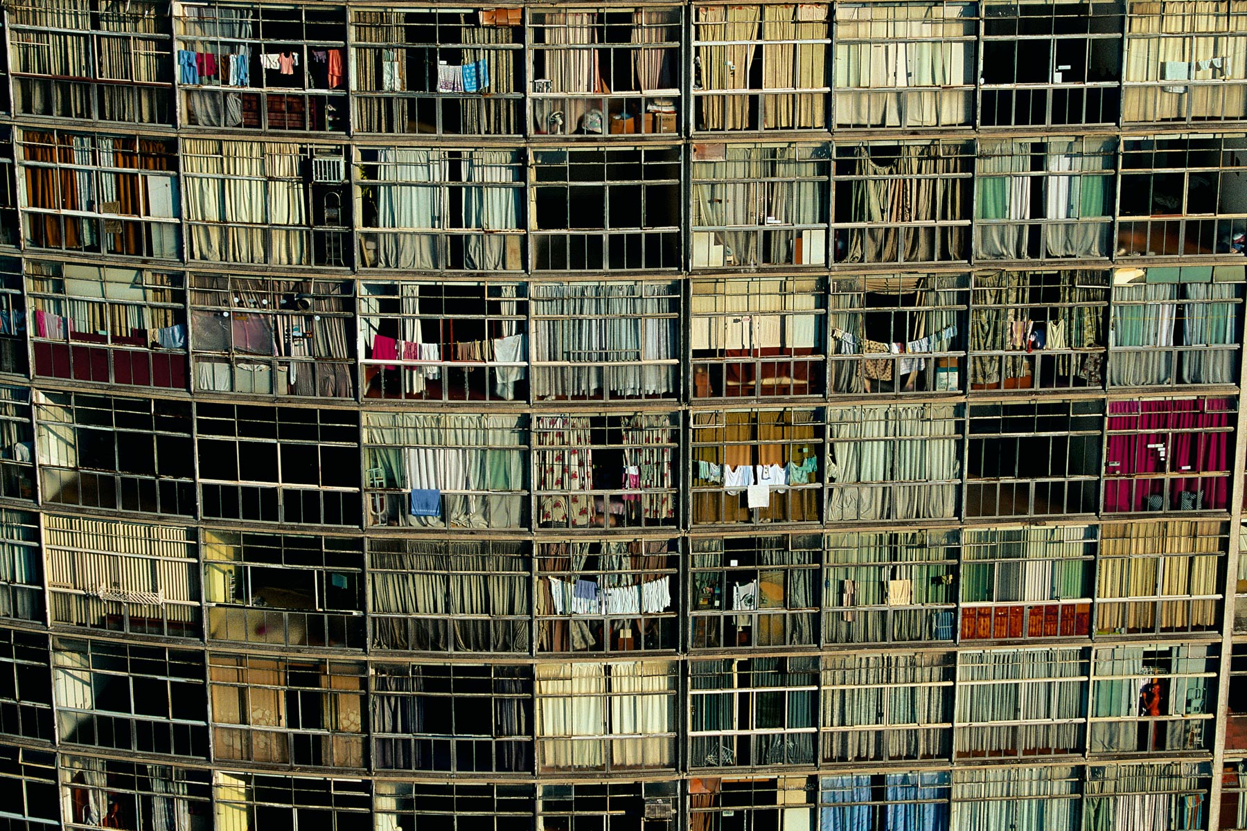
Detail of a building. Edificio Copan (1957) © Architecte Oscar Niemeyer, in São Paulo, Brazil (23°32' S – 46°37' W).
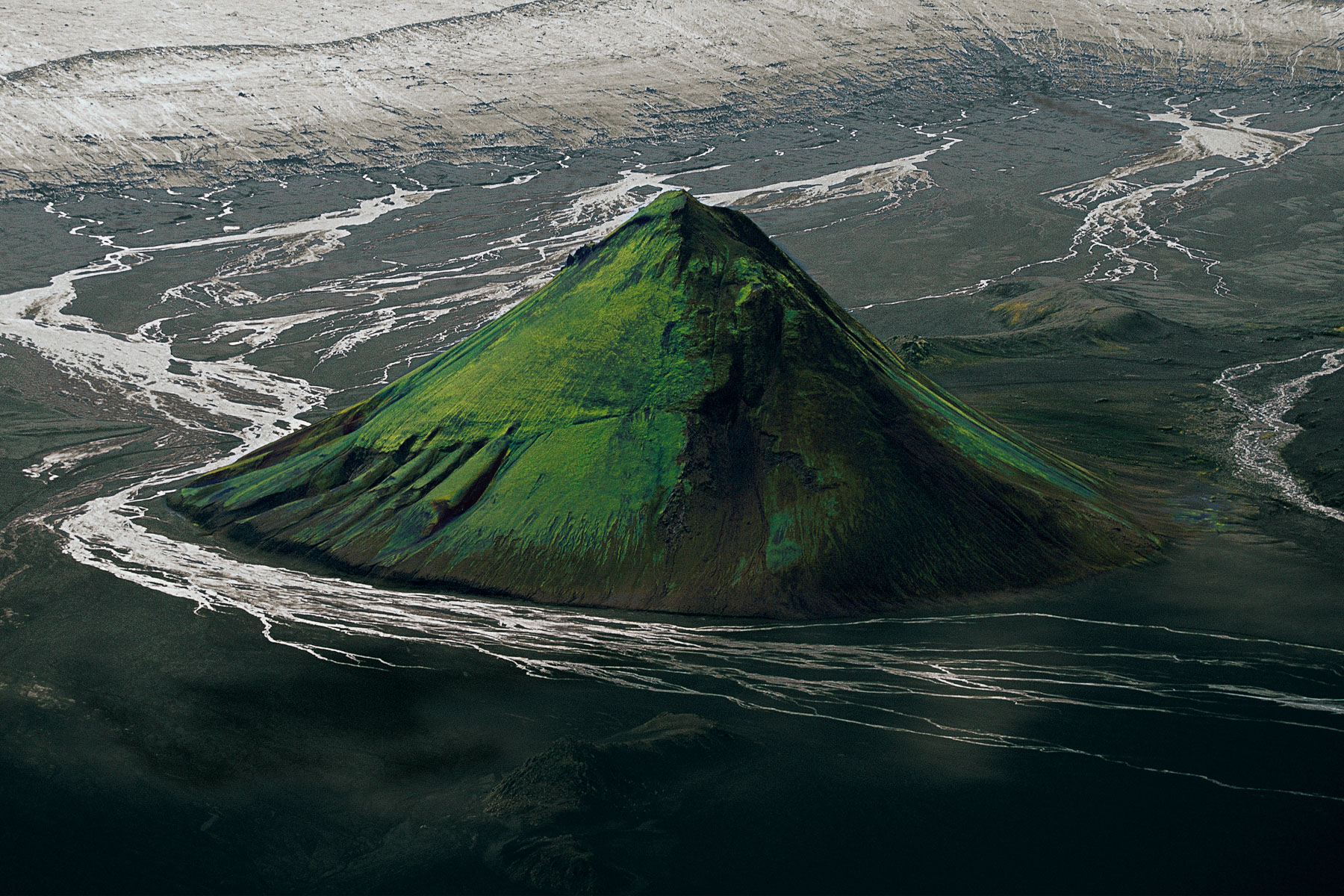
The Maelifell volcano on the edge of the Myrdalsjökull glacier, Iceland (63°51' N - 19°13' W).
Lakagigar volcano Chain, Iceland (64°07' N - 18°14' W).
Village near Panducan island, Philippines (6°18’ N – 120°35’ E)
Fields near Quito, Sierra region, Ecuador (0°17' N – 78°41' W).
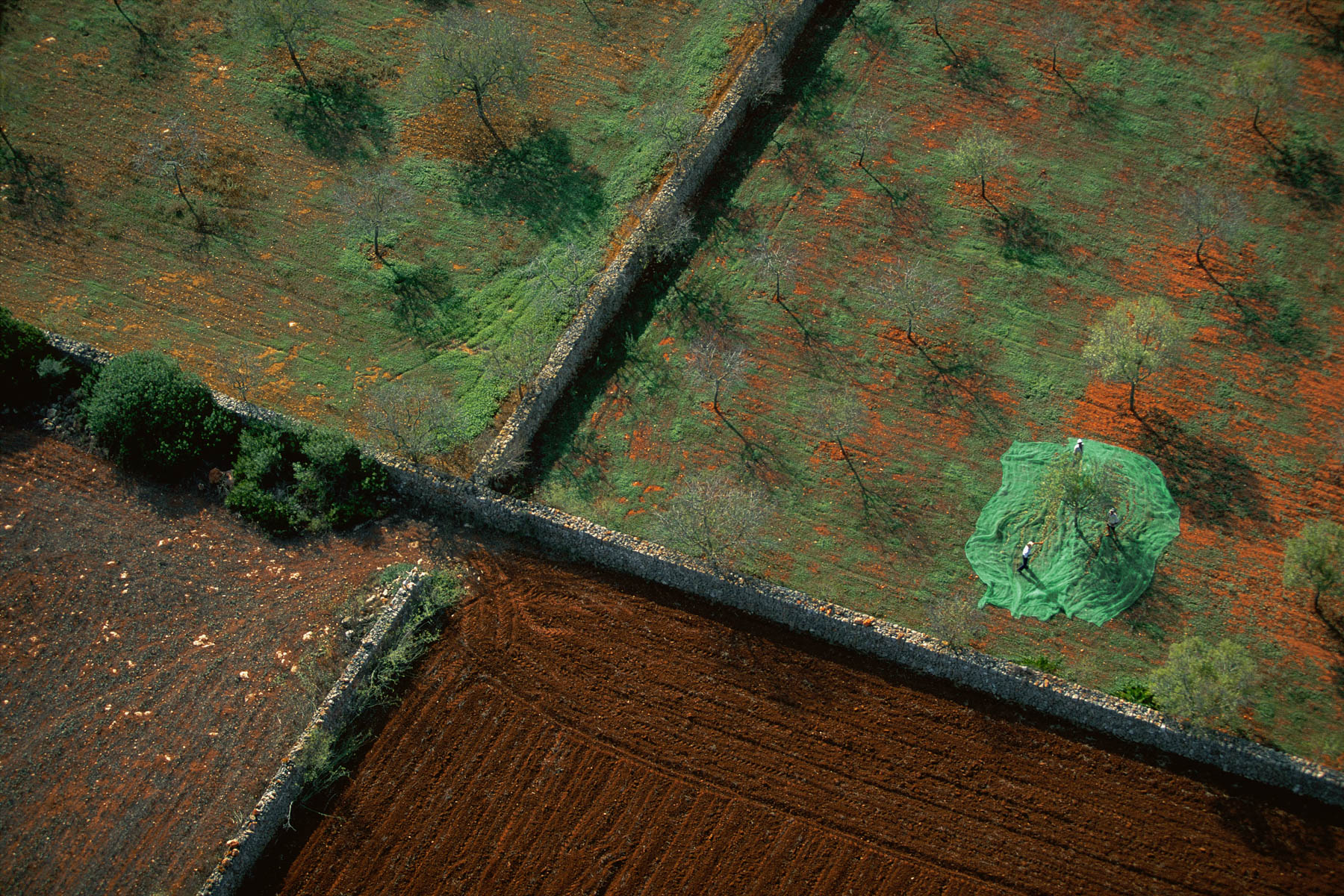
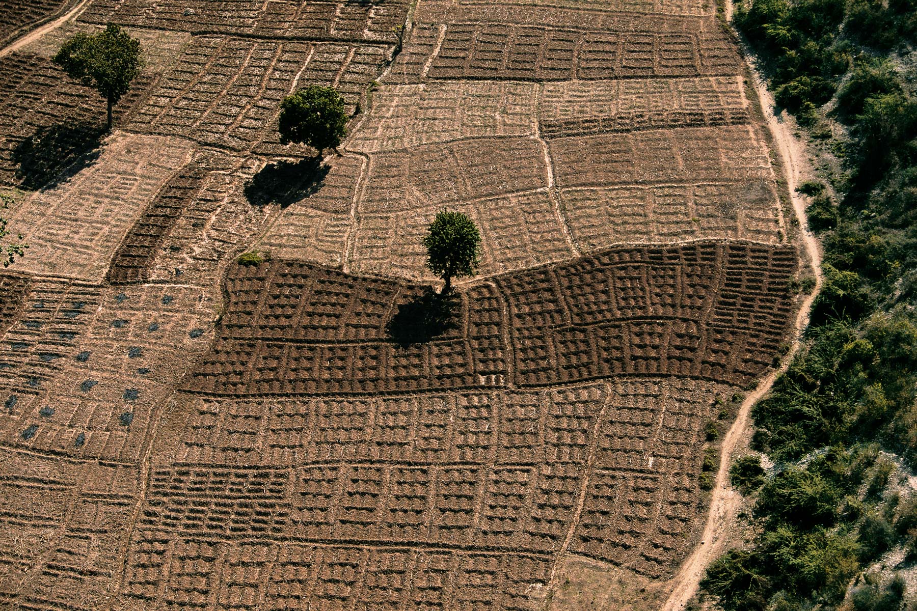
Harvesting almonds, Majorca, The Balearic Islands, Spain (39°36' N - 3°02' E).
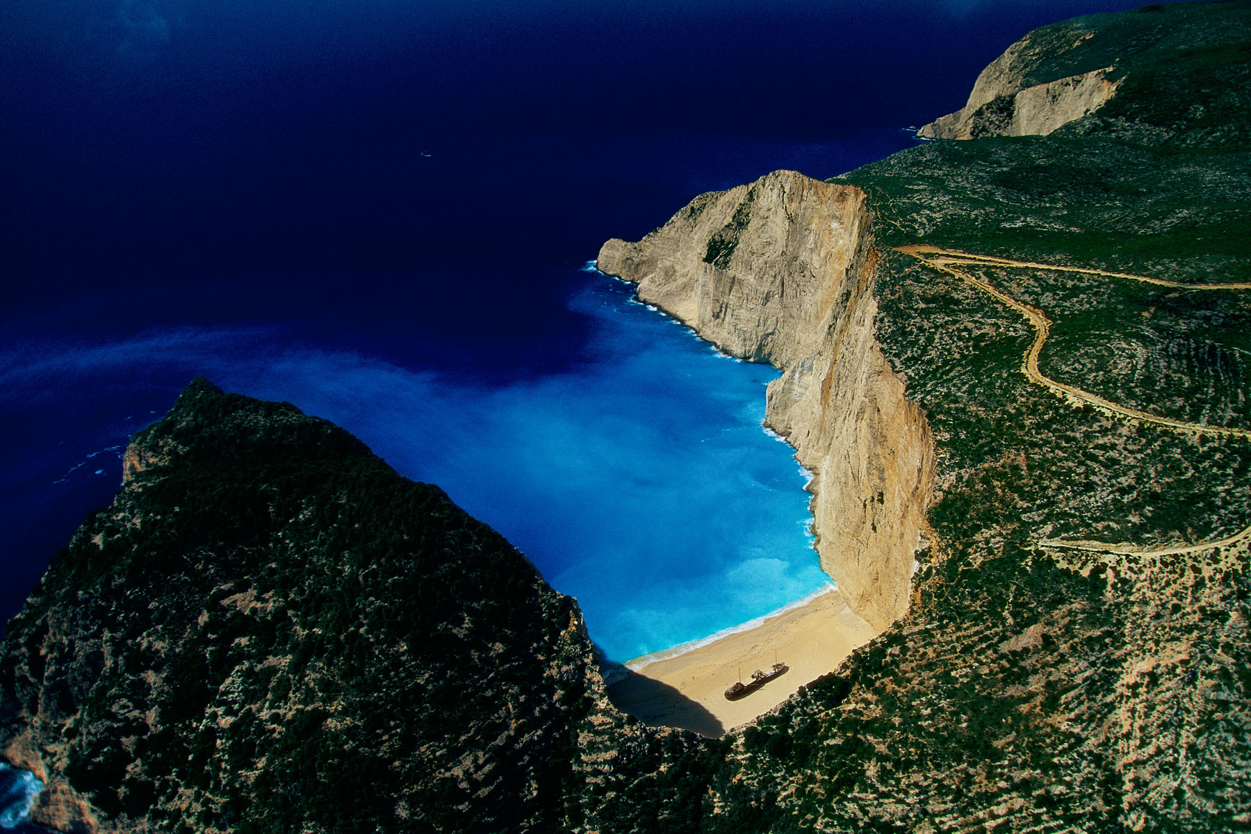
Boat beached to the north of Zakynthos Island (Zante), Ionian Islands, Greece (37°52' N – 20°37' E).
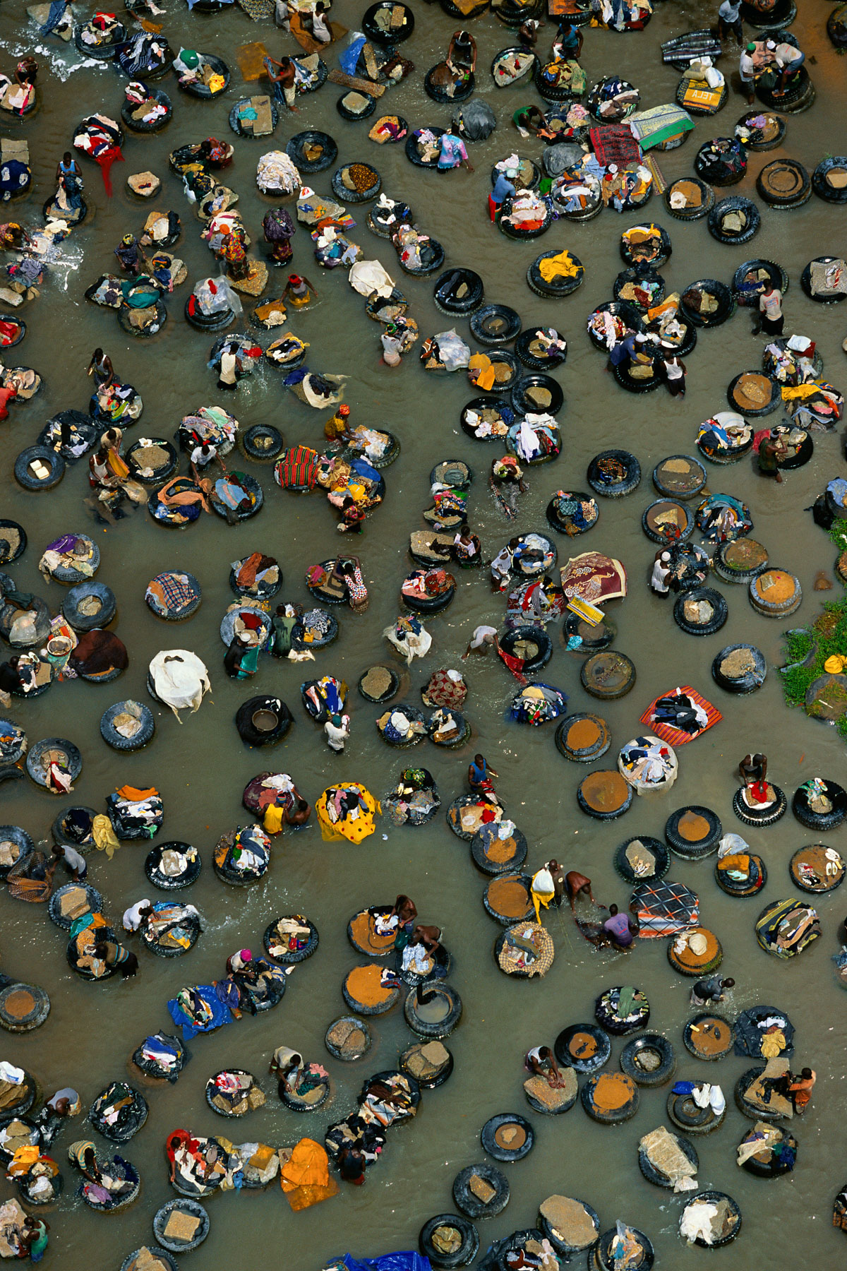
Washing laundry in a creek in the Adjamé neighborhood in Abidjan, Ivory Coast (5°19' N – 4°02' W).
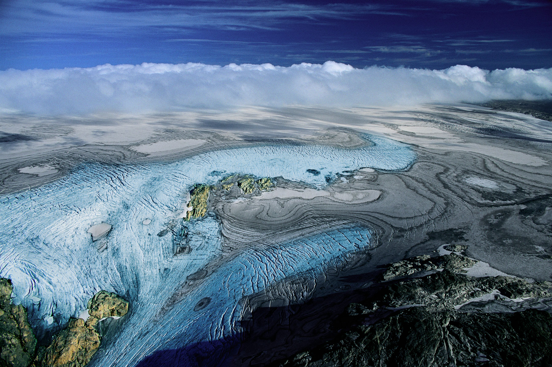
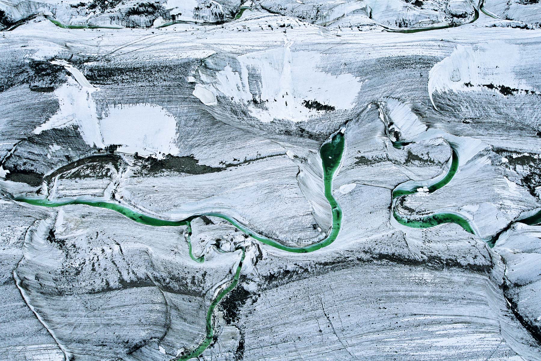
Folgefonna glacier on the high plateaus of SØrfjorden, Norway (60°03' N - 6°20' E).
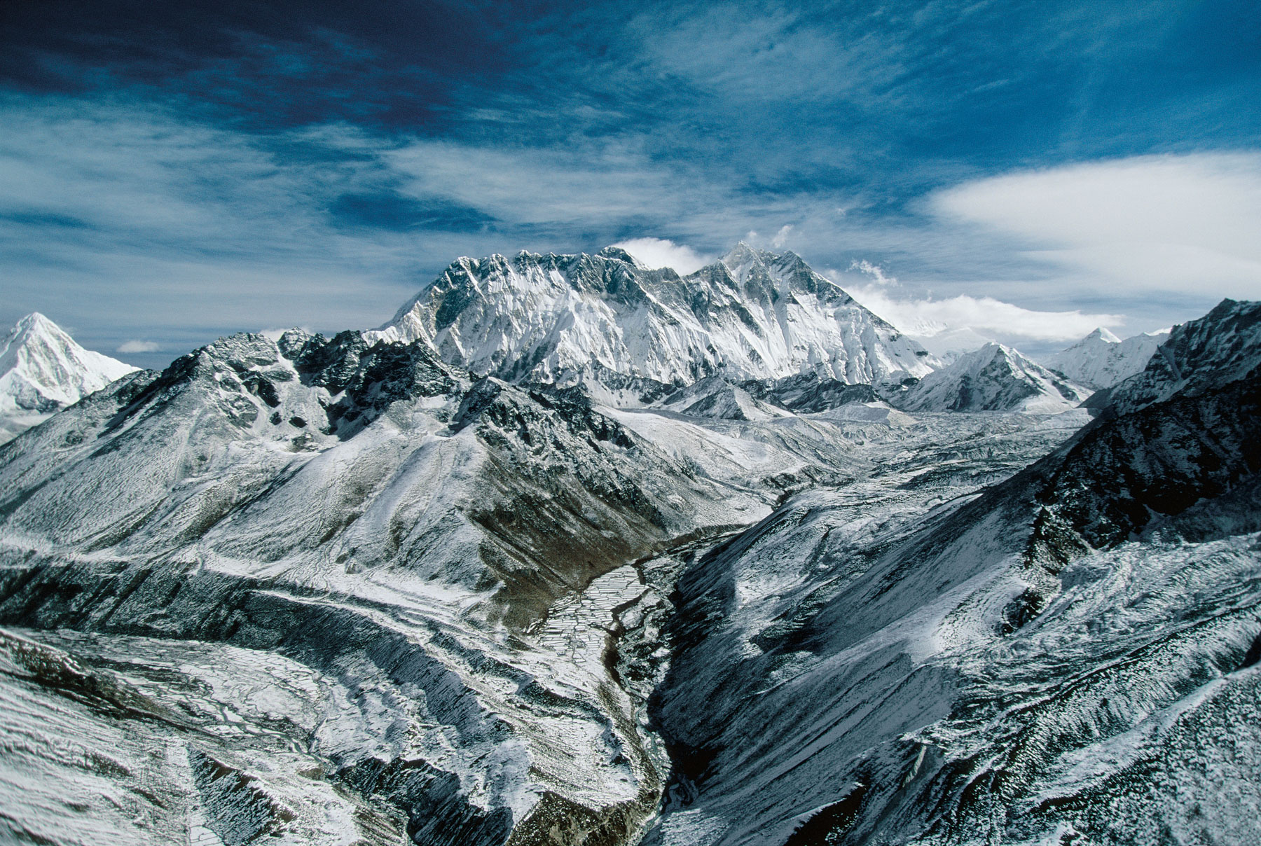
Mount Everest, Himalayas, Nepal (27°59' N – 86°56' E).
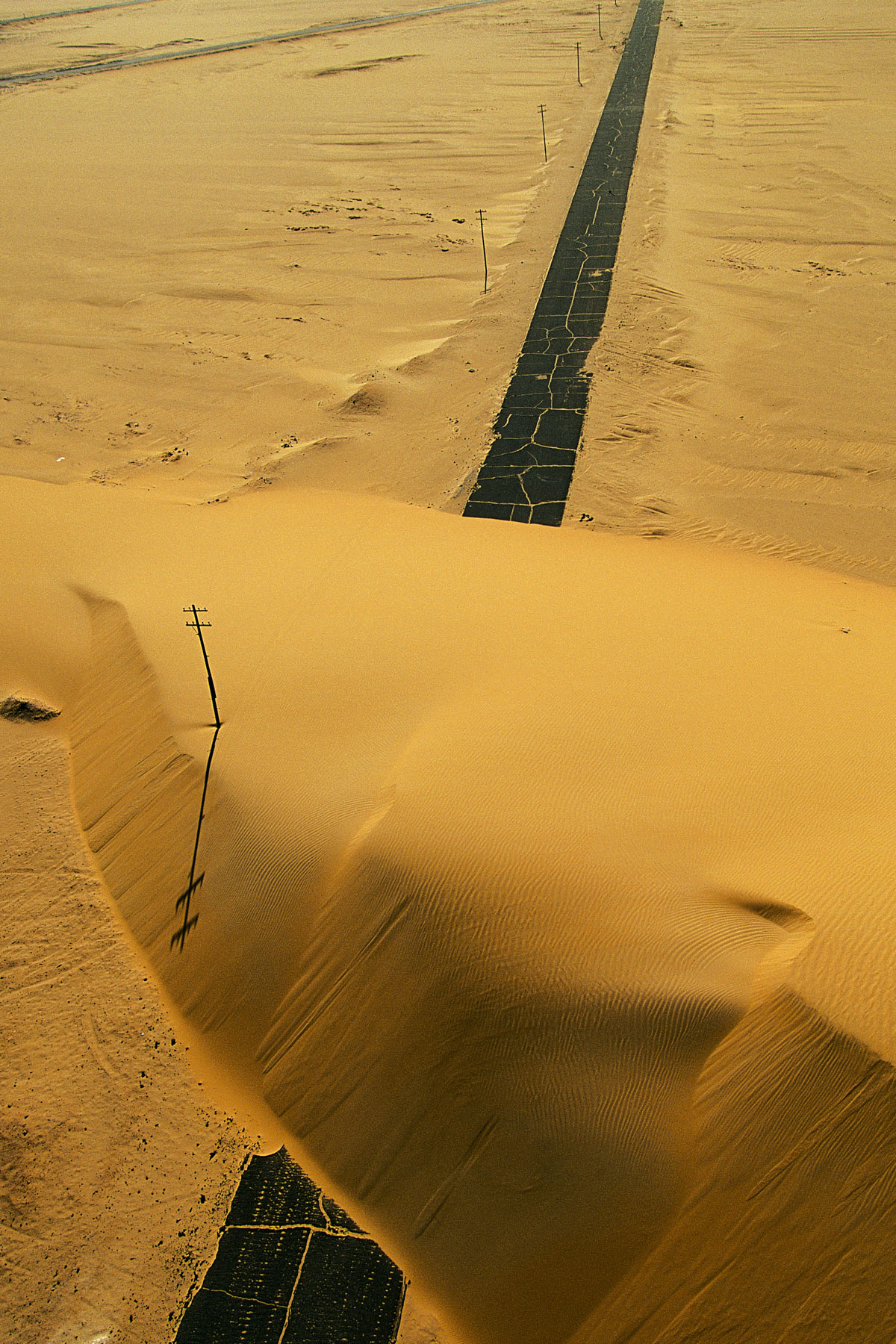
Road interrupted by a sand dune, Nile Valley, Egypt (25°22' N, 30°23' E).
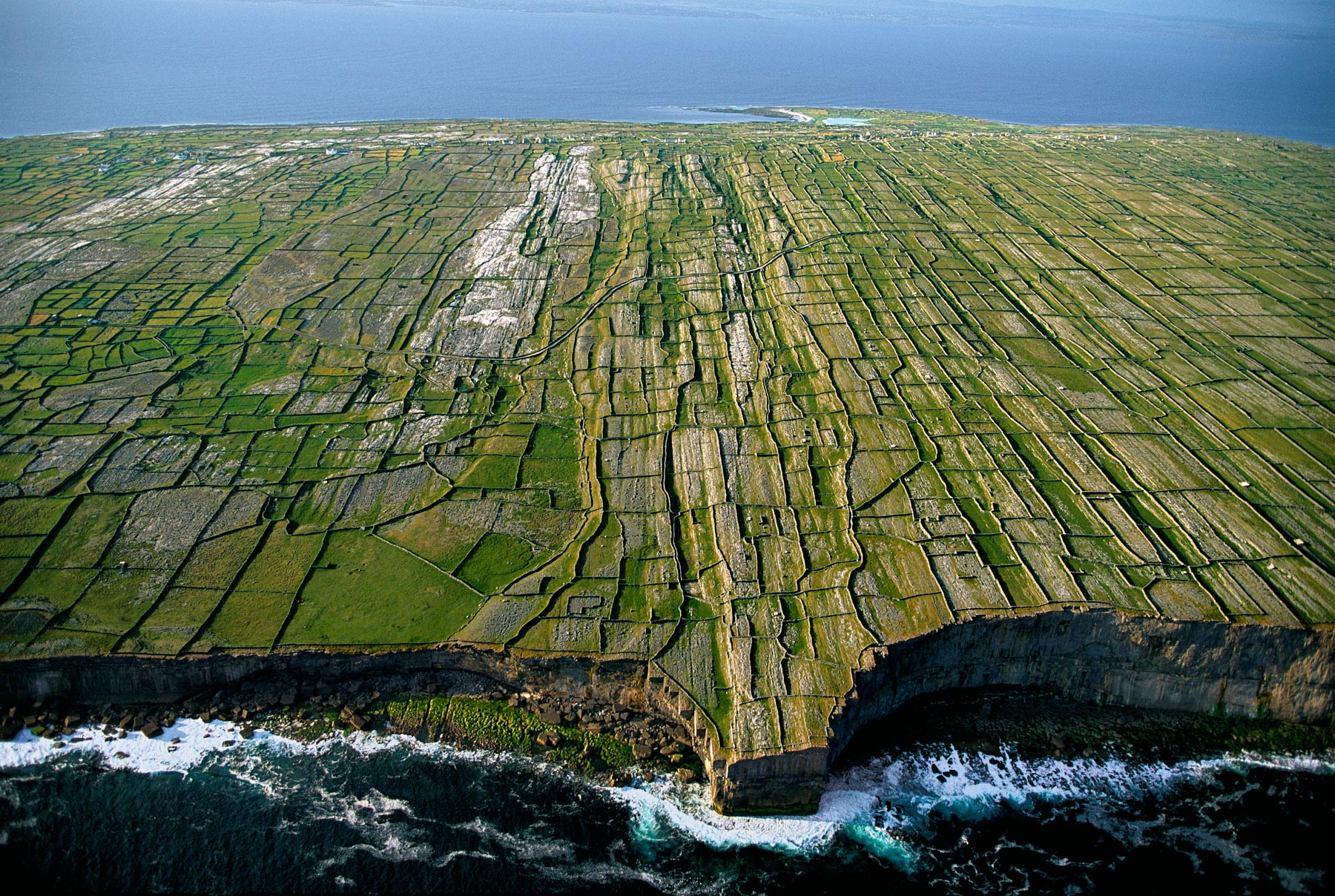
Inishmore cliffs, Aran Islands, County Galway, Ireland (53°07' N - 9°45' W).
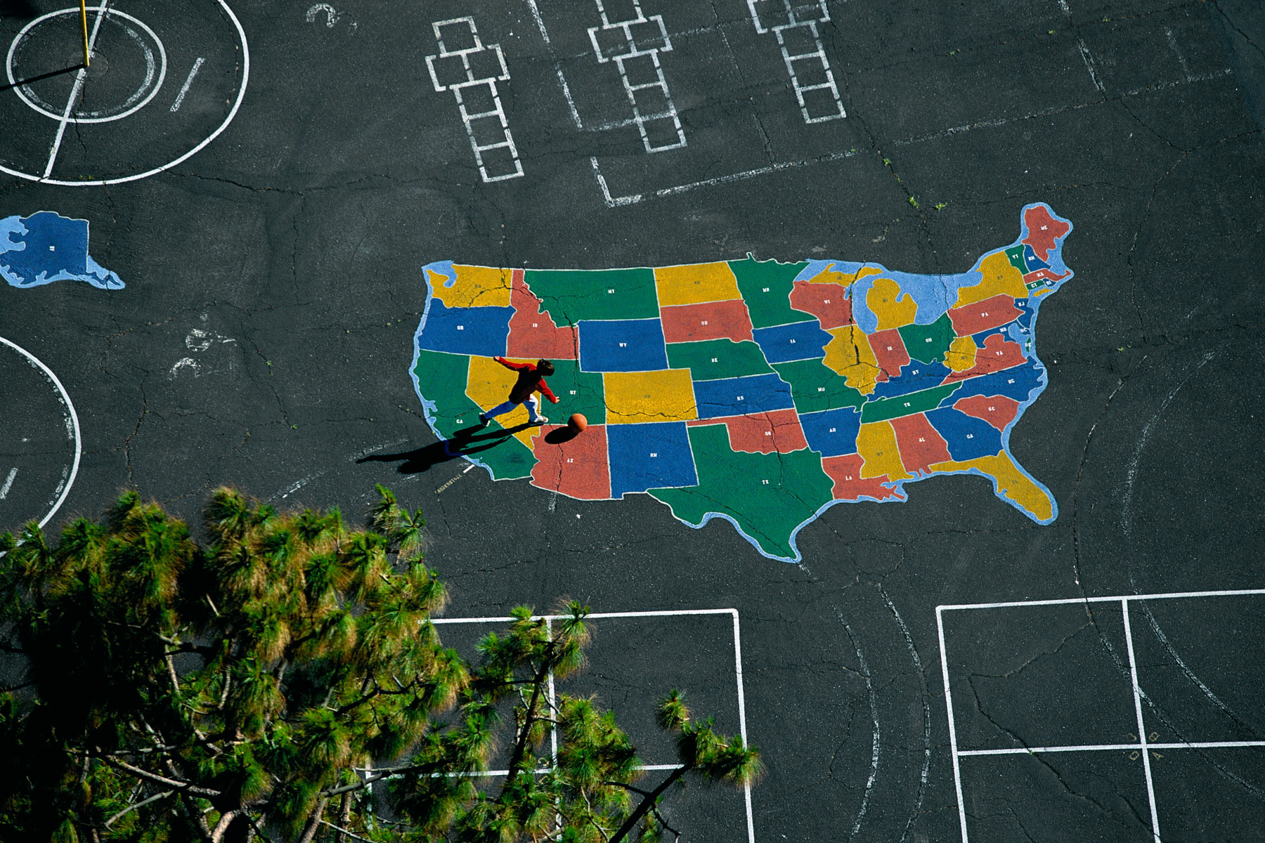
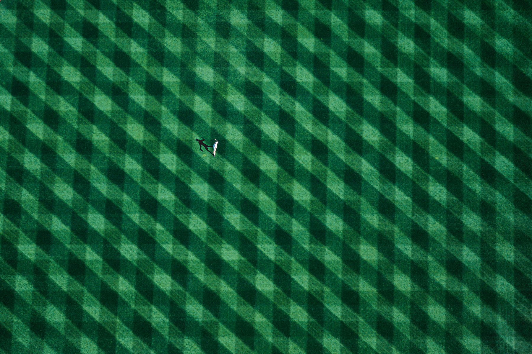
Young Basketball player at Torrance Cornerstone Elementary School, Los Angeles, California, United States (33°49' N – 118°20' W).
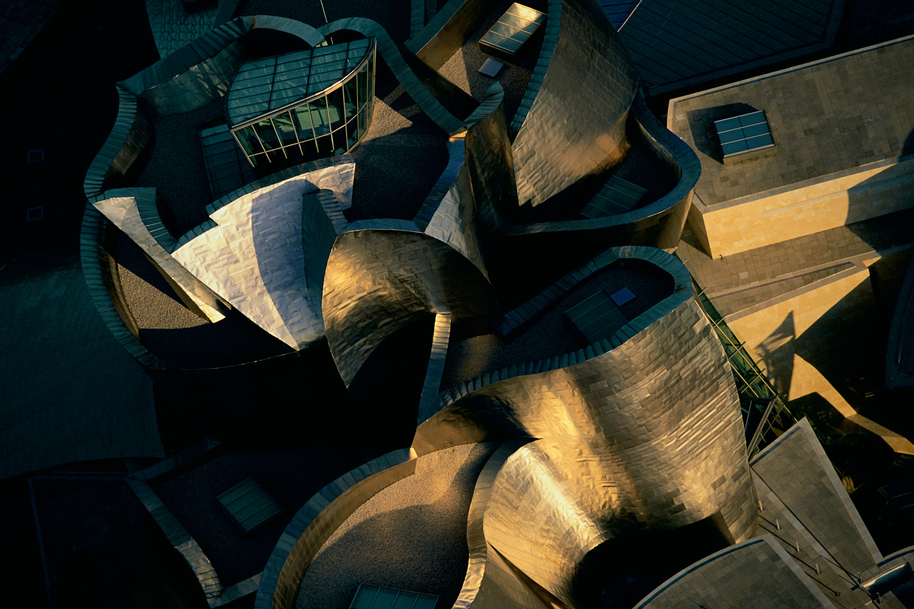
The Guggenheim Museum Bilbao, Basque Country, Spain (43°16' N – 2°56' W).
Tea cultivation in Corrientes province, Argentina (27°50' S - 56°01' W).
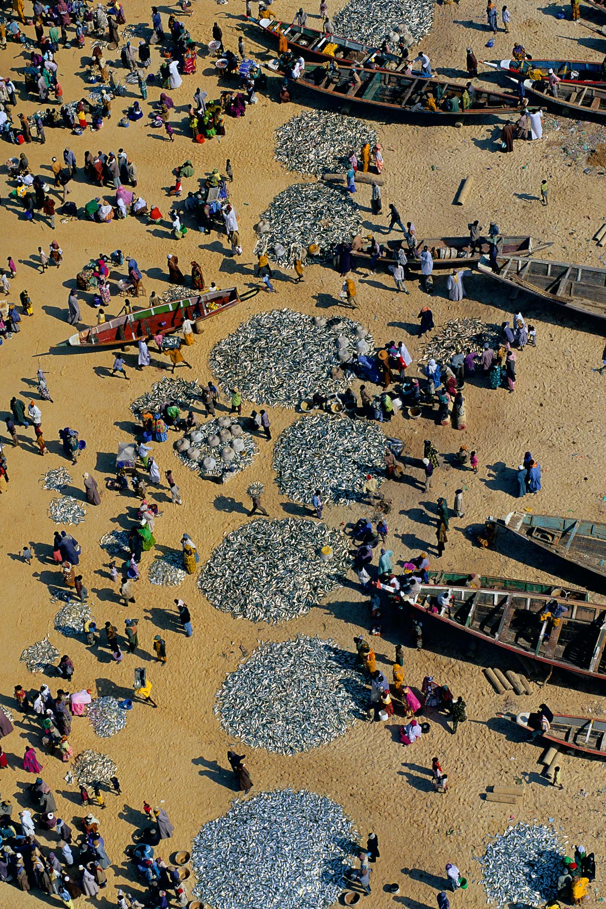
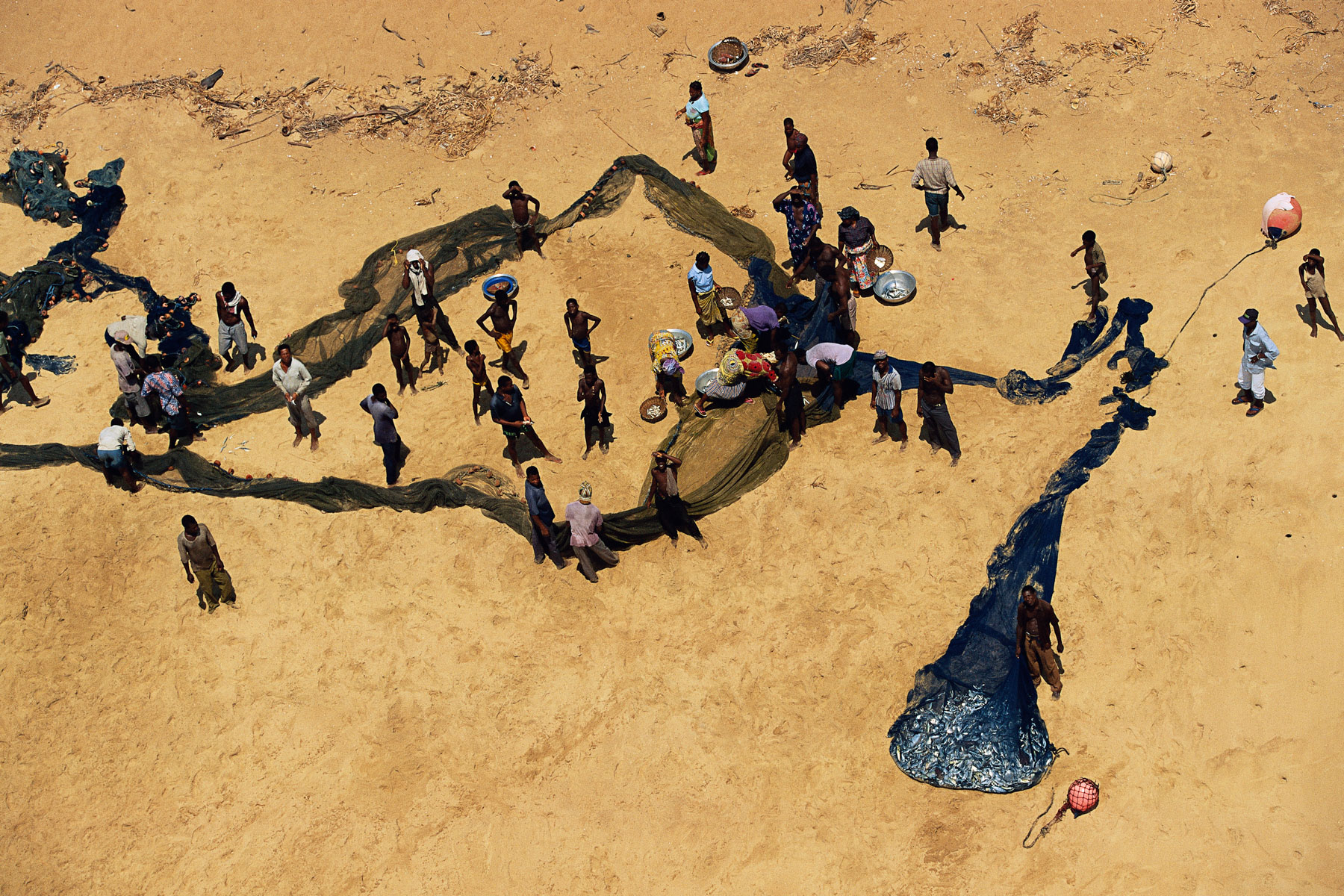
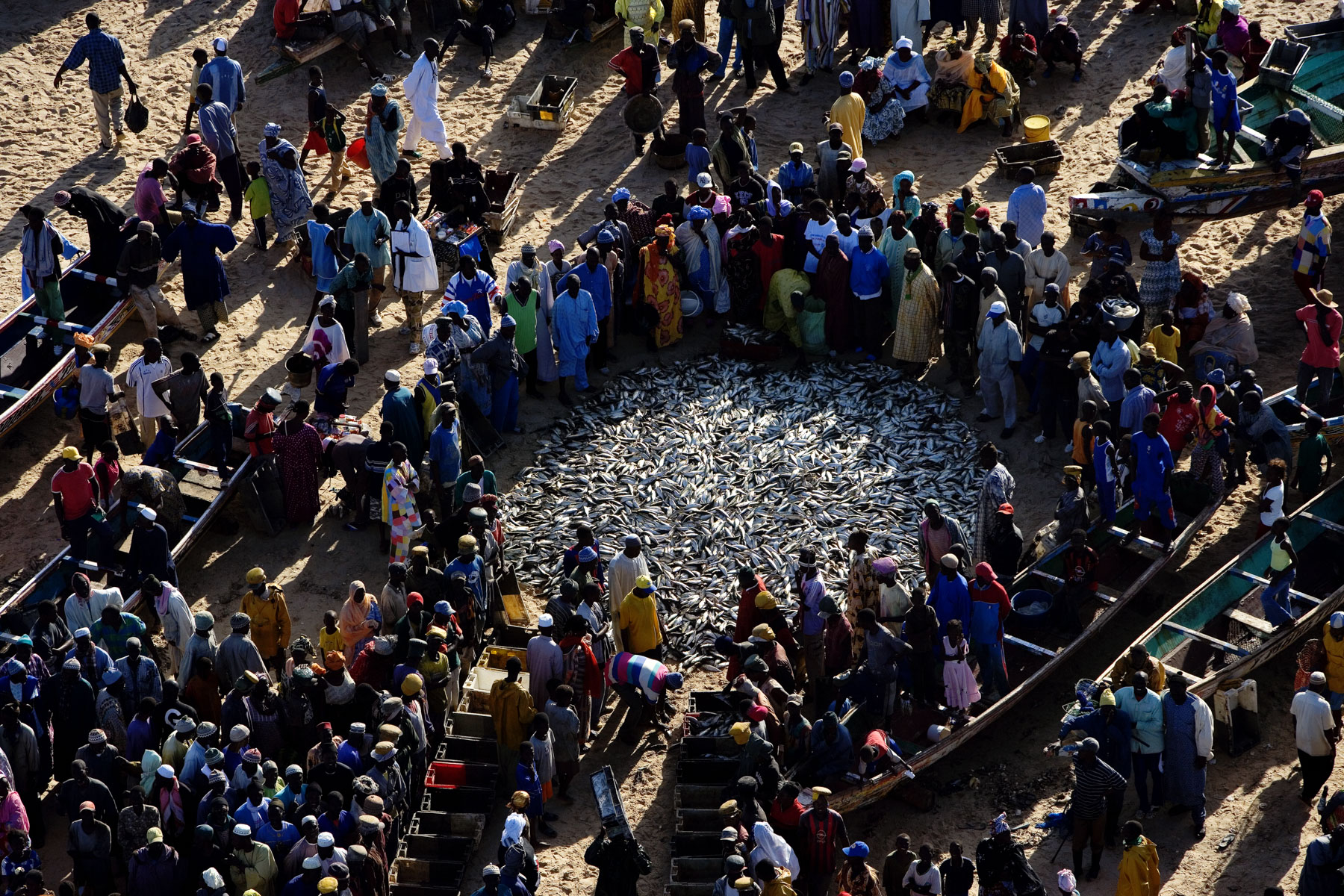
Back from fishing near Dakar, Senegal (14°55' N - 17°07' W).
Leona River, Santa Cruz province, Argentina (50°08' S – 71°59' W).
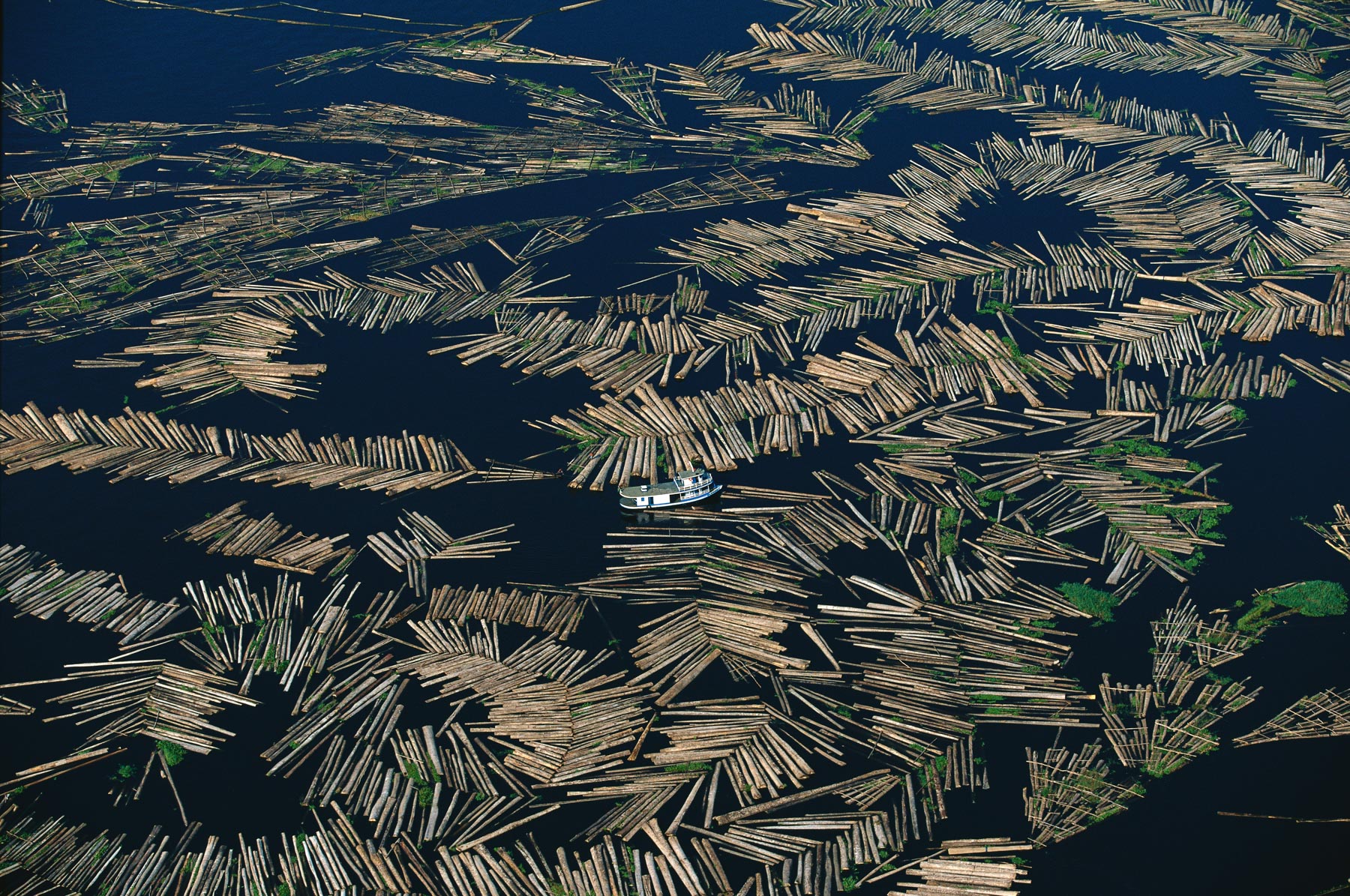
Forestry site on the Amazon near Manaus, Amazonas, Brazil (3°03' S - 60°06' W).
Beech trees in the Villa Traful mountains, Neuquén province, Argentina (40°38' S - 71°19' W).
Farm landscape, northwest of Guatemala City, Guatemala (15°04' N – 91°12' W).
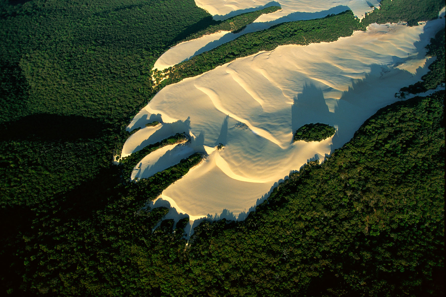
Sand dune in the heart of vegetation on Fraser Island, Queensland, Australia (25°17' S – 153°12' E).
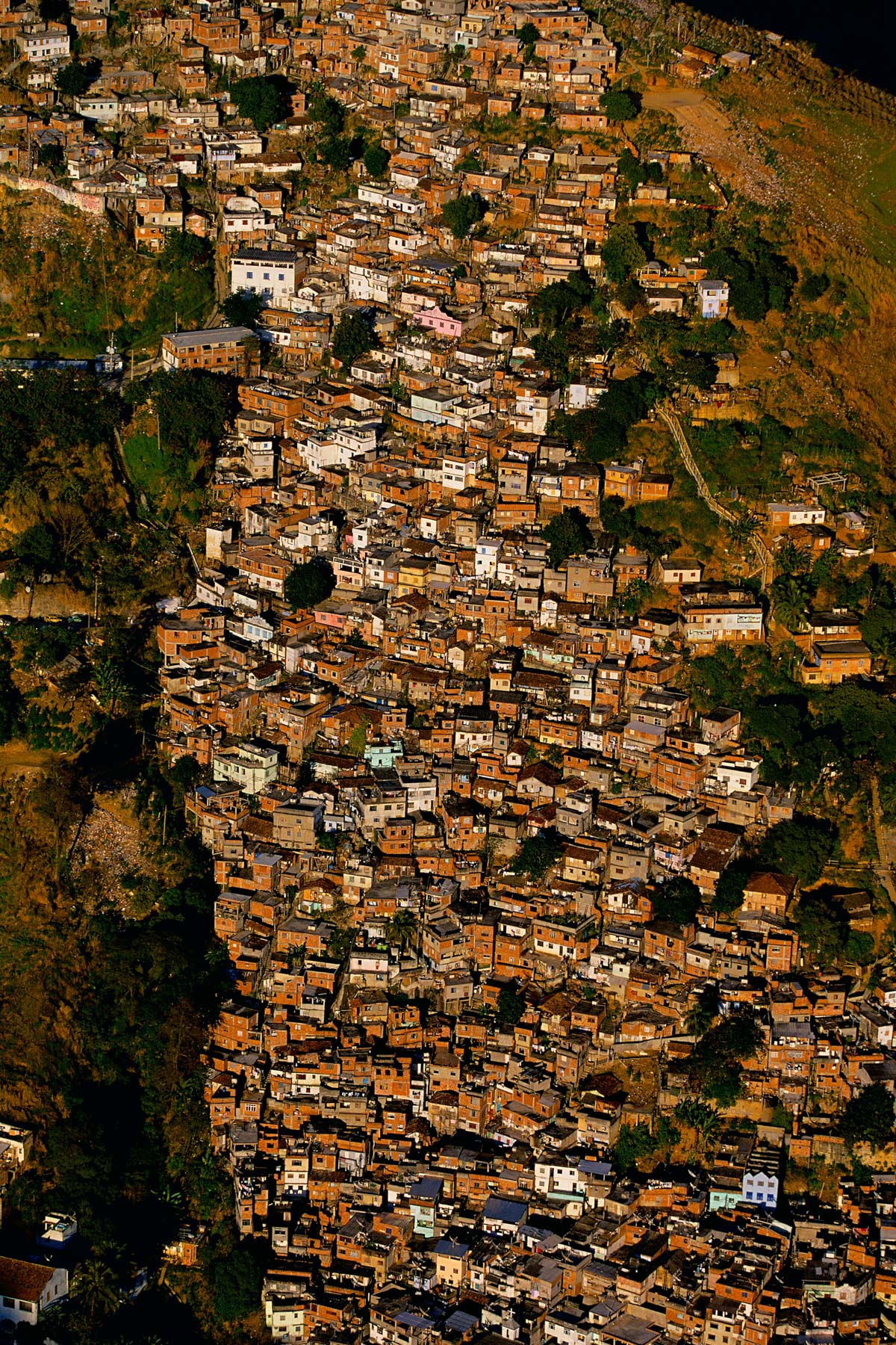
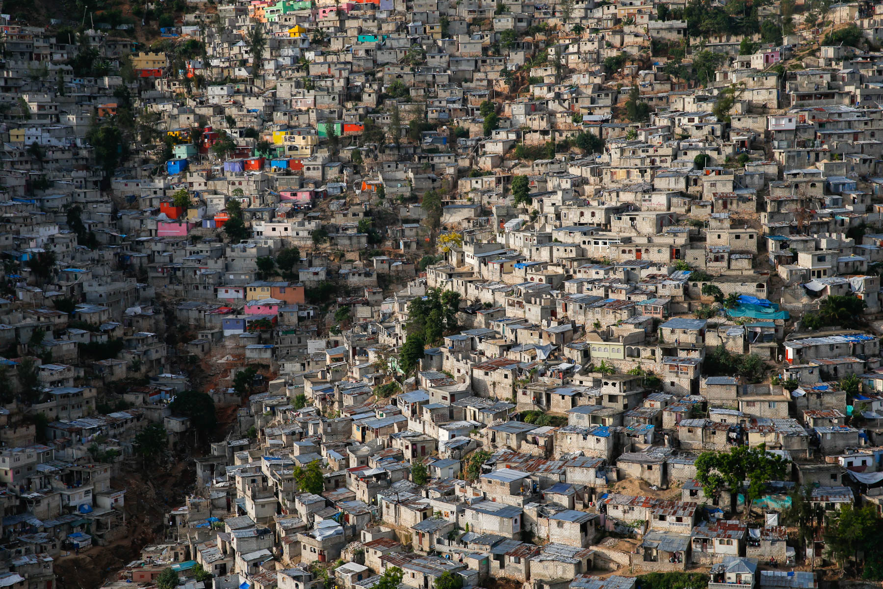
Favelas in Rio de Janeiro, Brazil (22°55' S – 43°15' W).
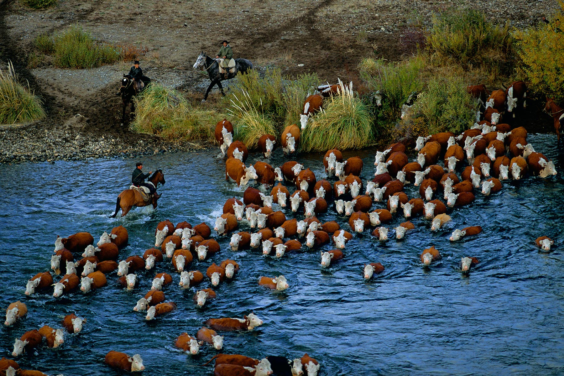
Fording the Chimehuin River, Neuquén province, Argentina (40°03' S - 71°04' W).
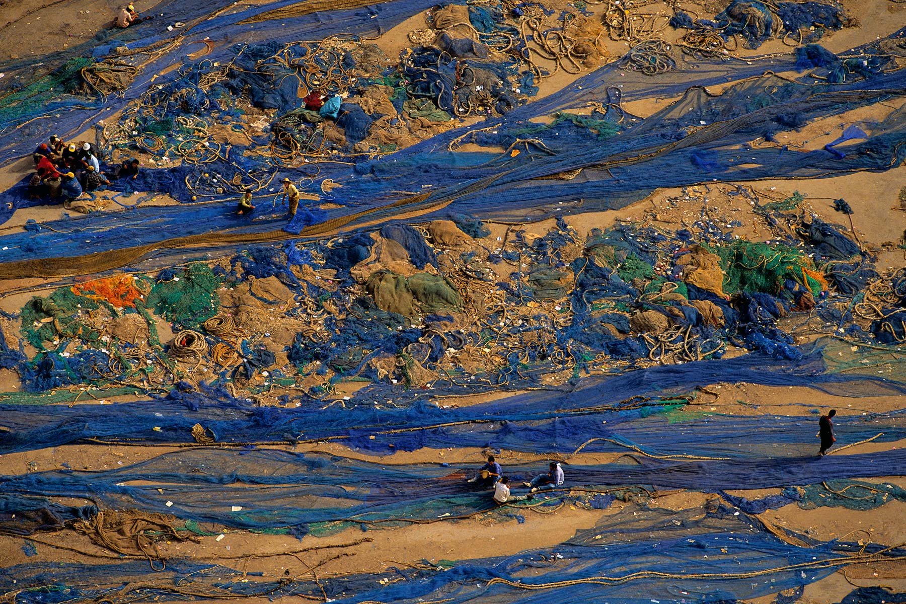
Fishing nets in the port of Agadir, Morocco (30°26' N - 9°35' W).
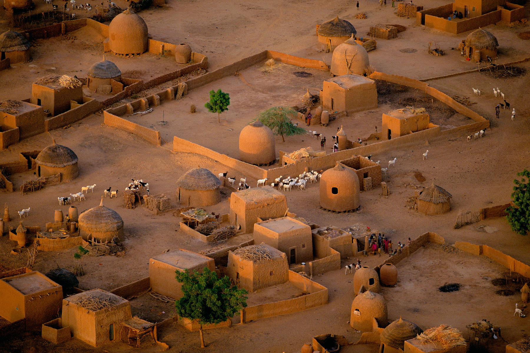
Portial view of a village near Tahoua, Niger (14°50' N – 5°16' E).
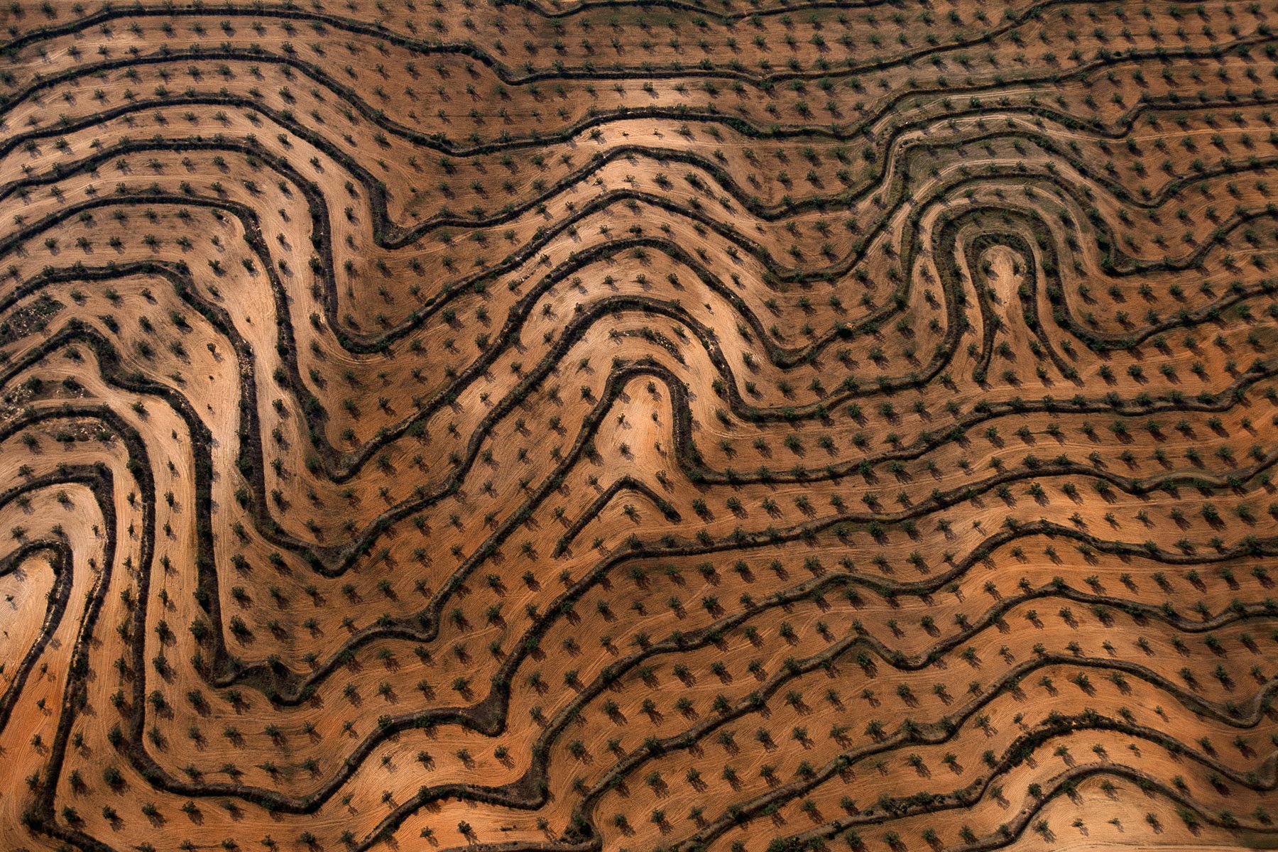
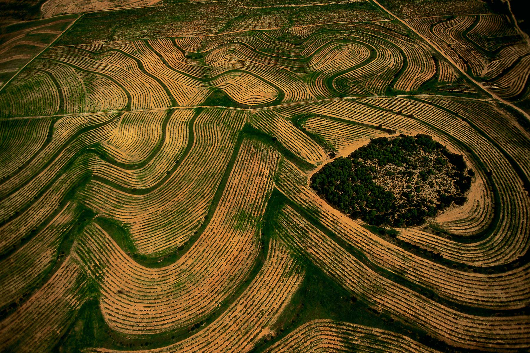
Newly planted olive groves, Zaghouan, Tunisia (36°24' N – 10°23' E).
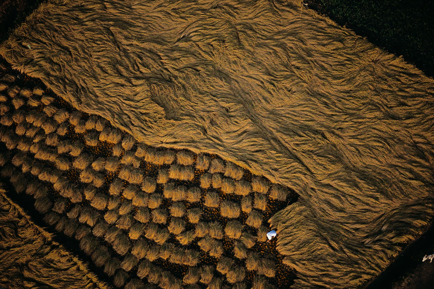
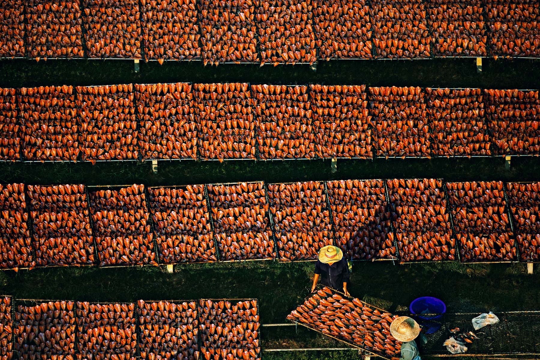
Yams drying in northern Tagadi, Bondoukou region, Ivory Coast (8°43' N - 2°39' W).
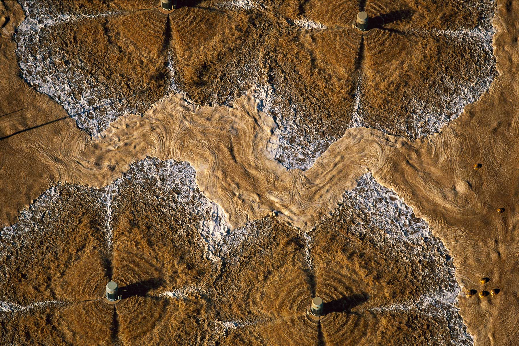
Waste from a seawater desalination plant in Al-Doha, Jahra Region, Kuwait (29°21' N – 47°49' E).
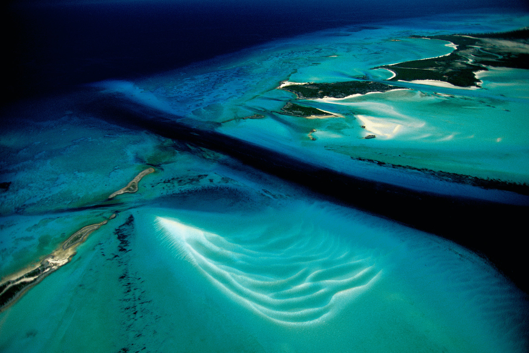
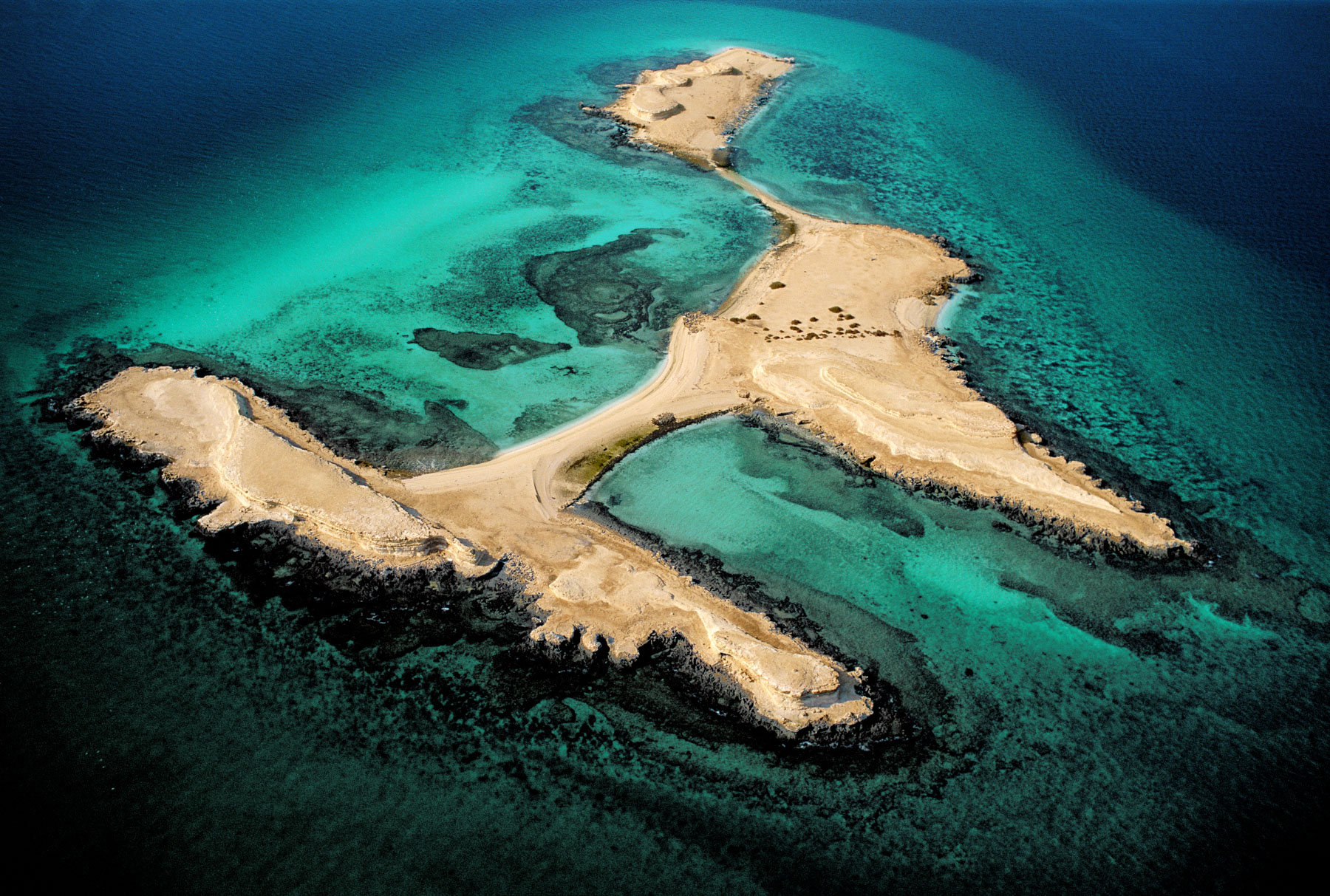
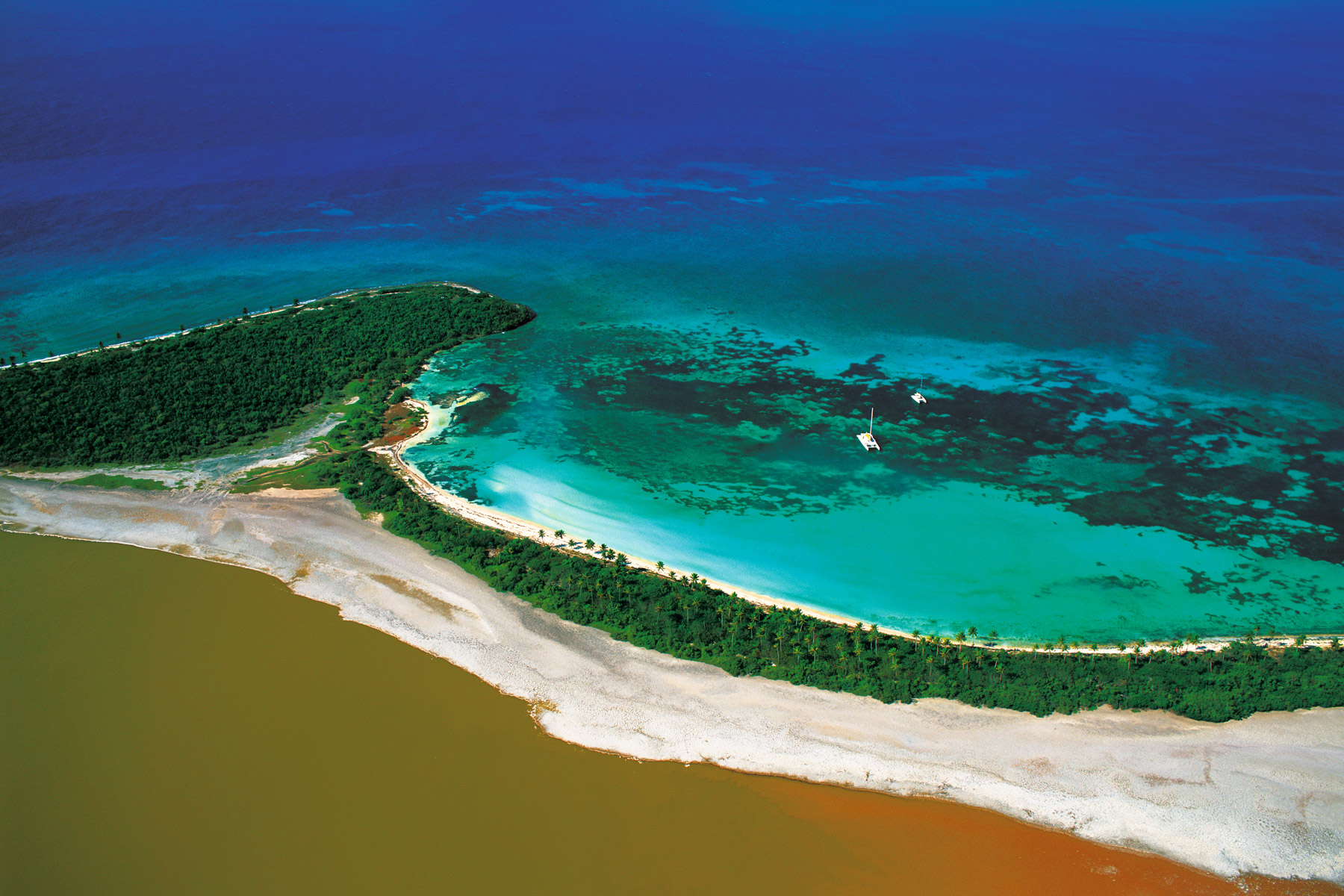
Islets and seabed, Exuma Cays, Bahamas (24°34' N – 76°48' W).
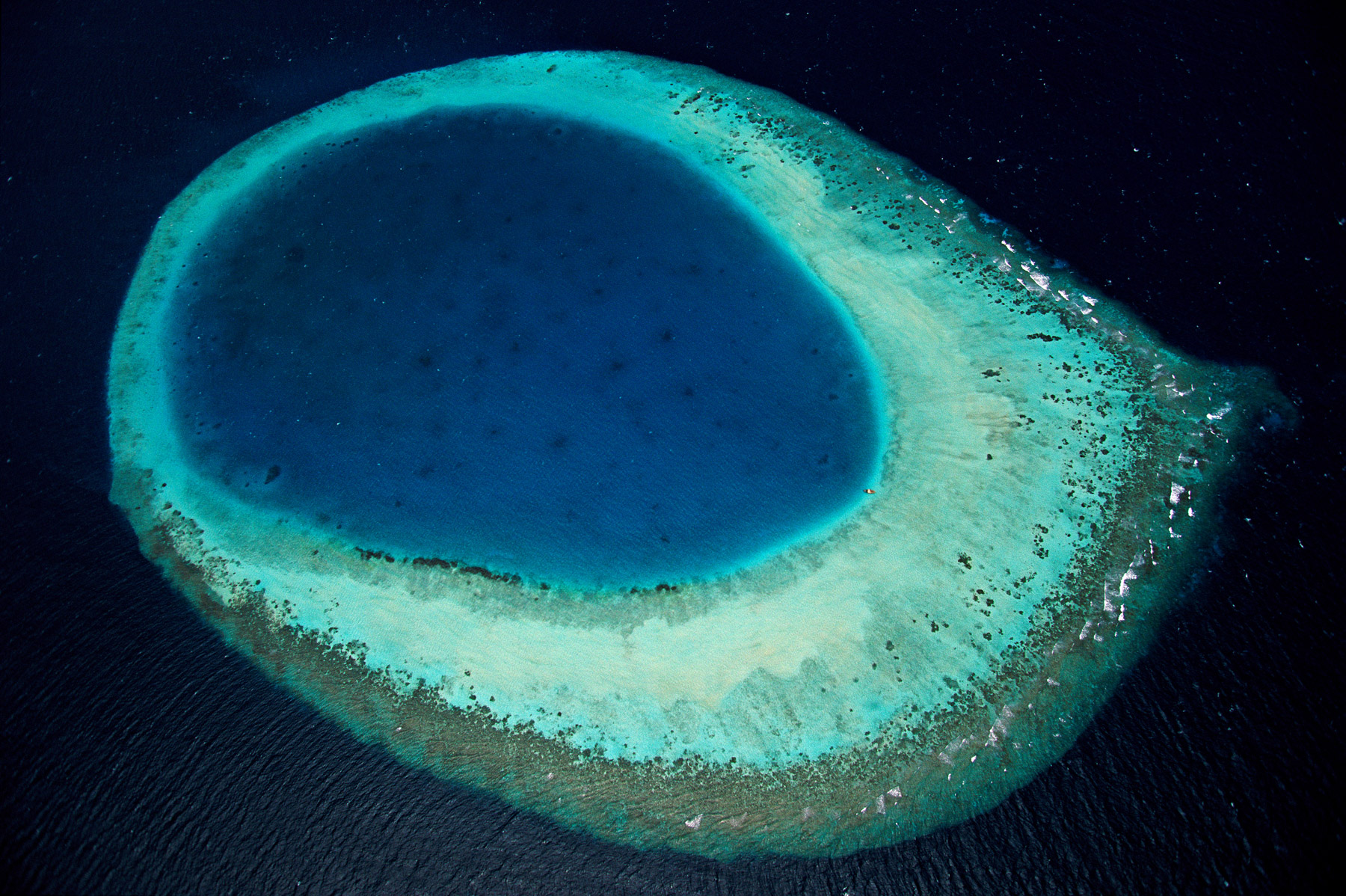
The Eye of the Maldive Islands, North Malé Atoll, Maldive Islands (4°14 ' N – 73°26 ' E). L’Œil des Maldives, atoll de Male Nord, Maldives (4°13’ N – 73°25’ E).
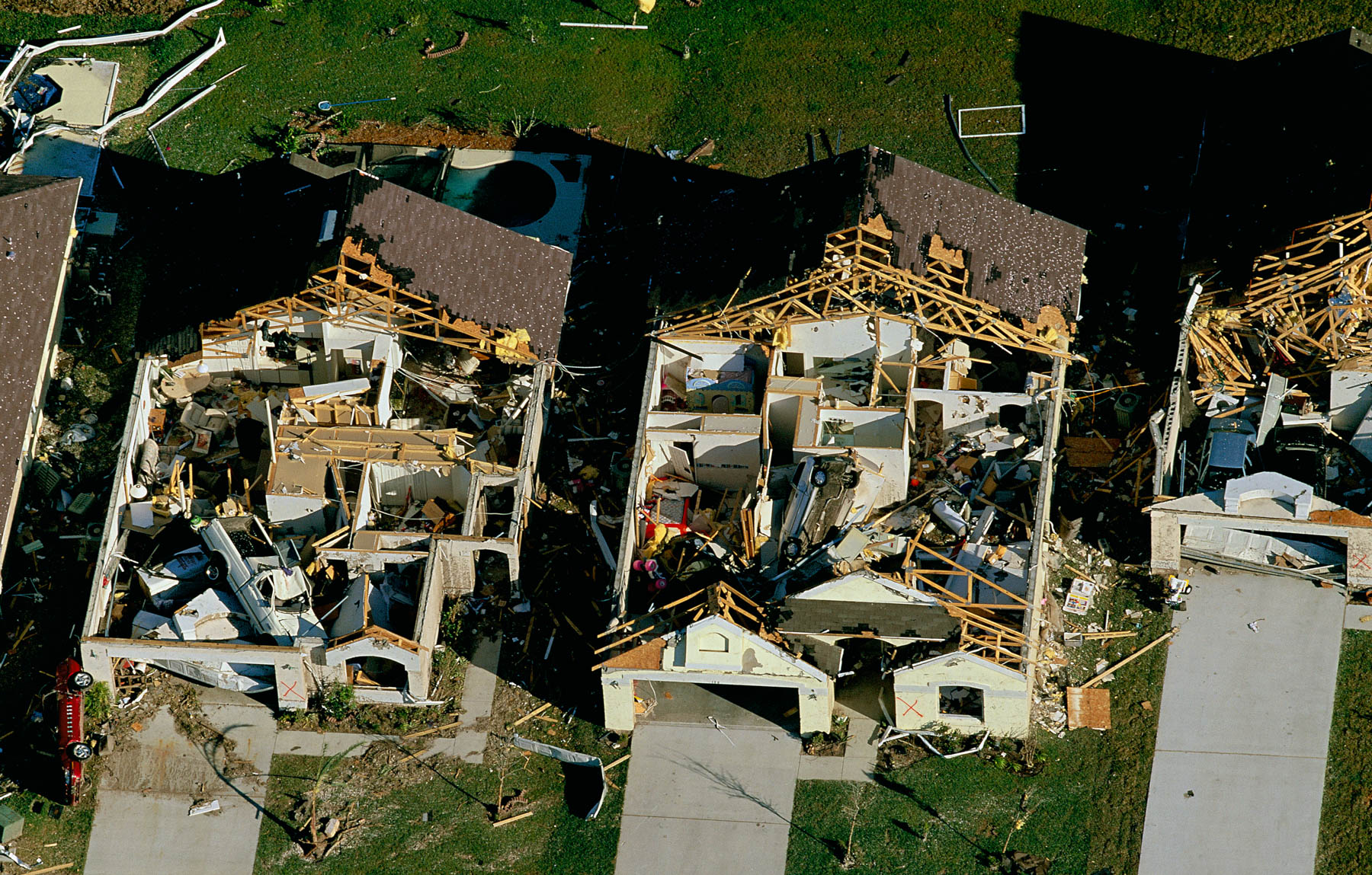
TORNADO DAMAGE IN OSCEOLA COUNTY, Florida, United States (28°16' N, 81°25' W)
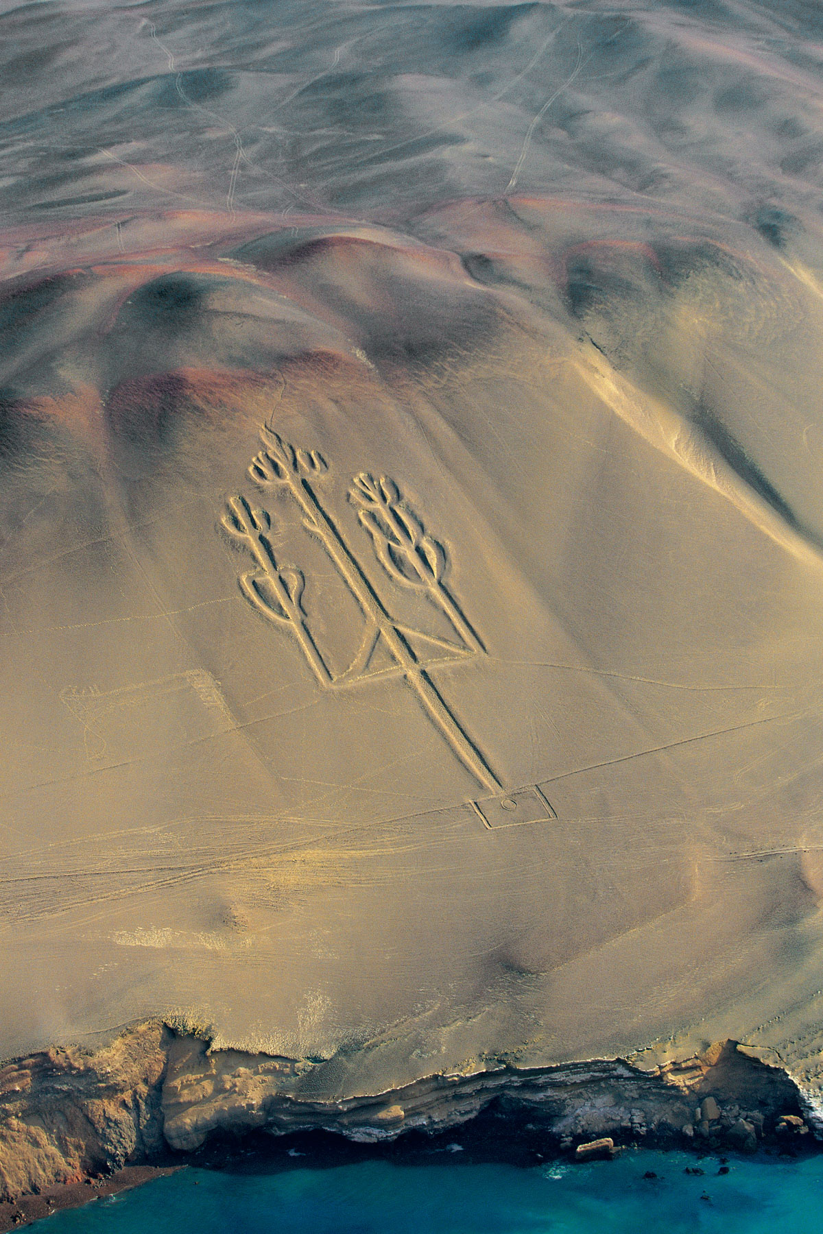
Candelabra of Paracas peninsula, Perú (13°47' S – 76°18' W).
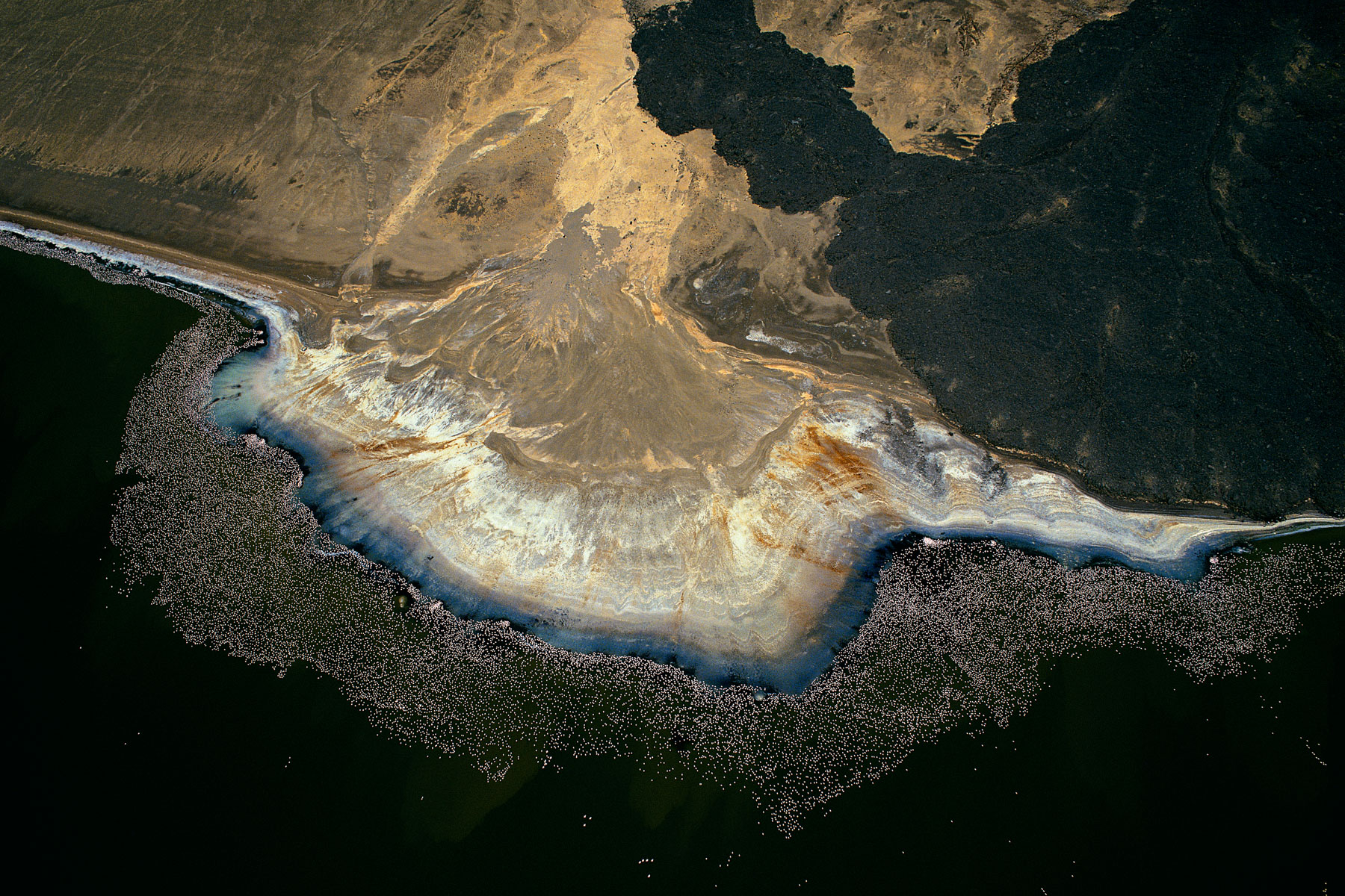
Greater flamingos on the edge of lake Logipi, Suguta Valley, Kenya (2°15’ N – 36°33’ E).
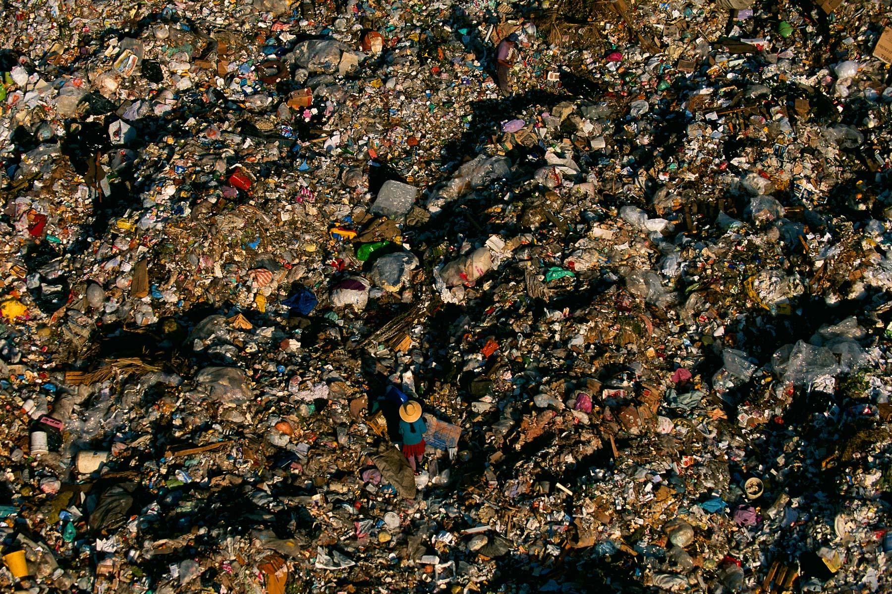
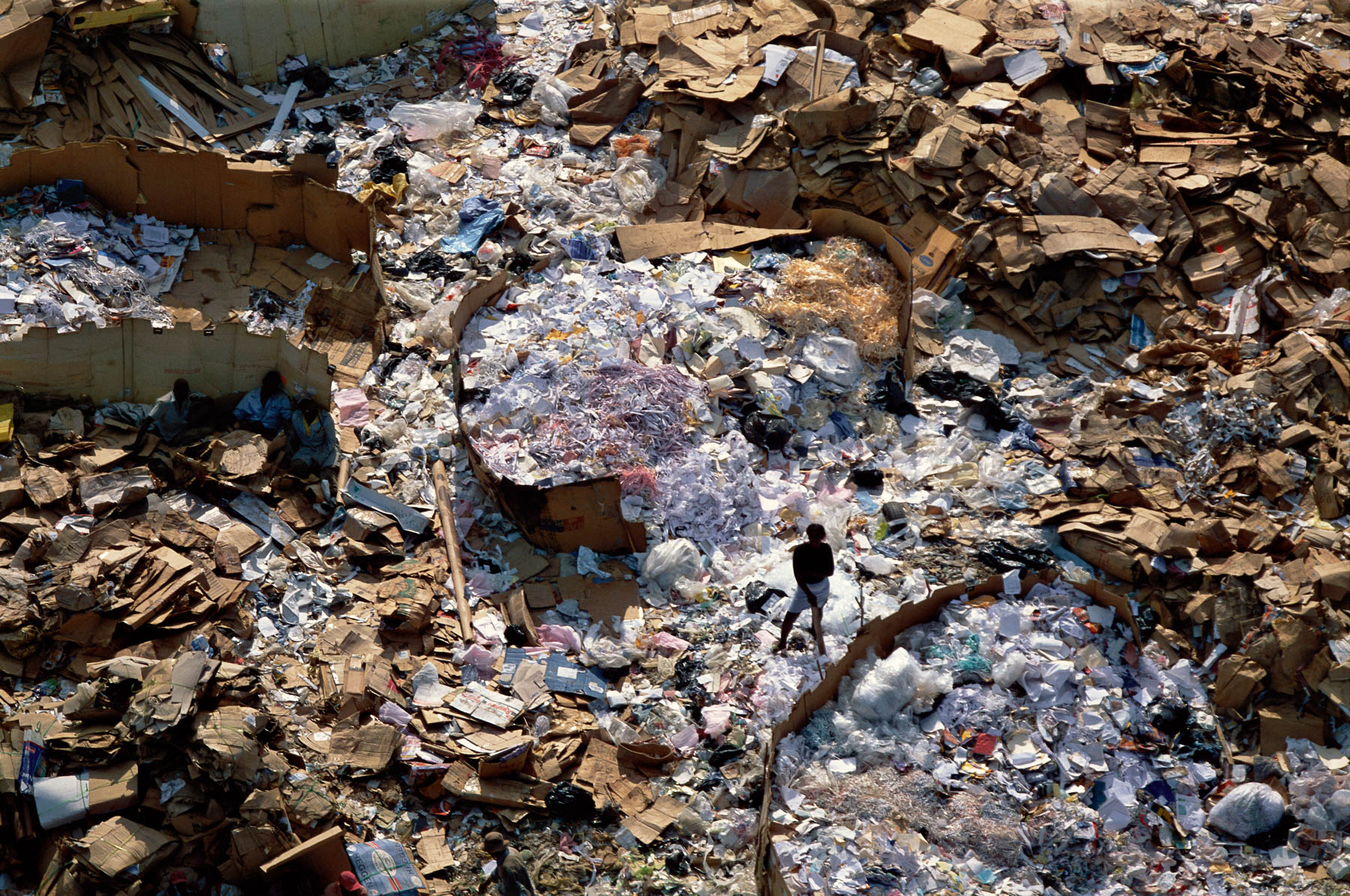
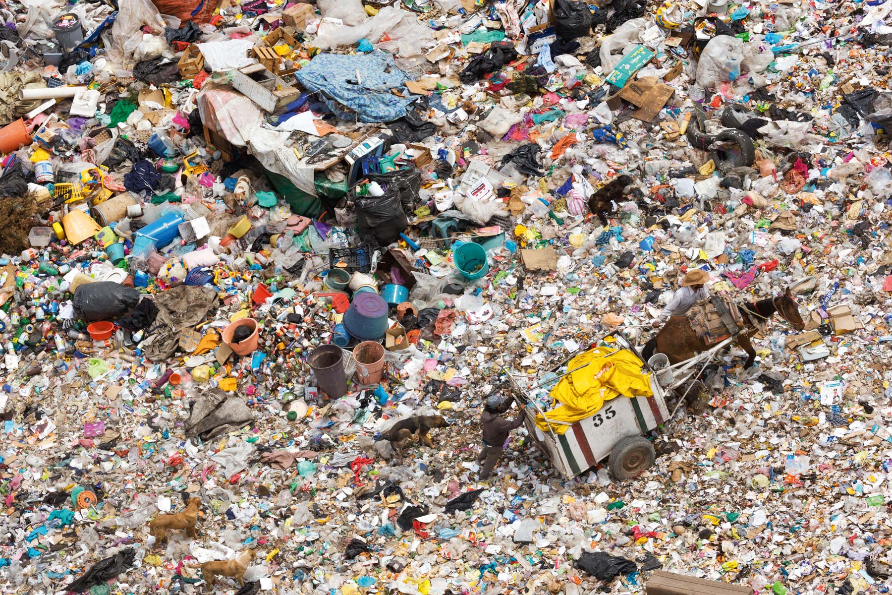
Refuse dump in Mexico City, Mexico (19°25’ N – 99°01’ W).
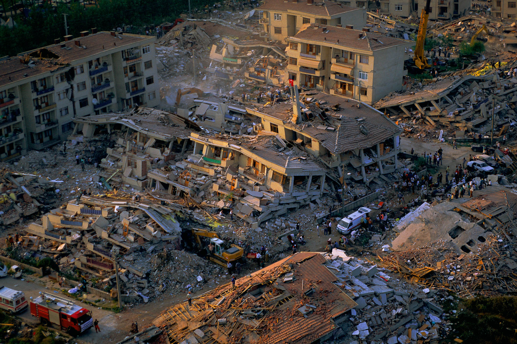
Earthquake at Gölcük, on the coast of the sea of Marmara, Turkey (40°43’ N – 29°48’ E).
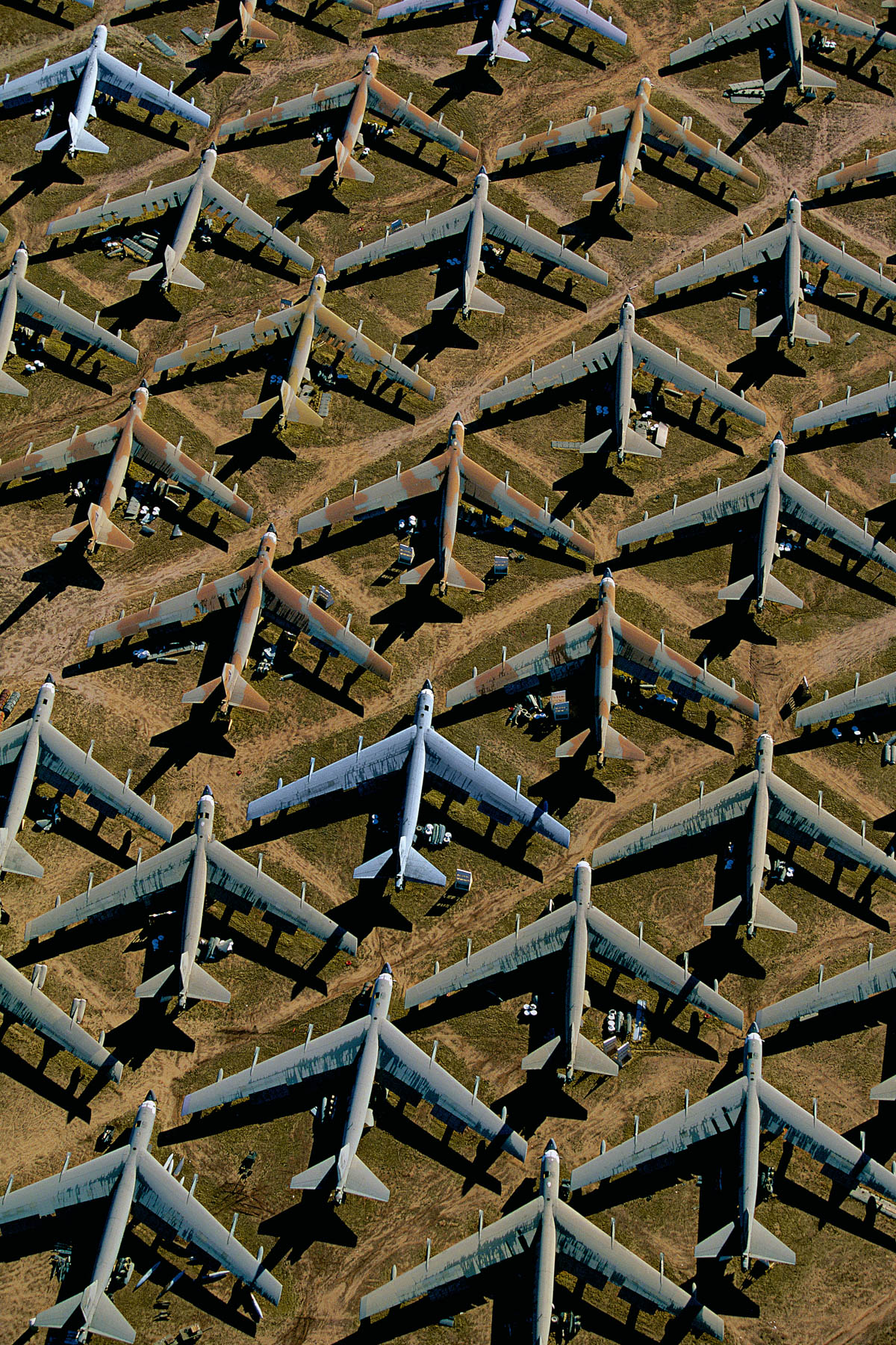
B-52s at Davis-Monthan Air Force Base near Tucson, Arizona, United States (32°10' N – 110°52' W).

River on the Auyán Tepui, gran sabana region, Venezuela
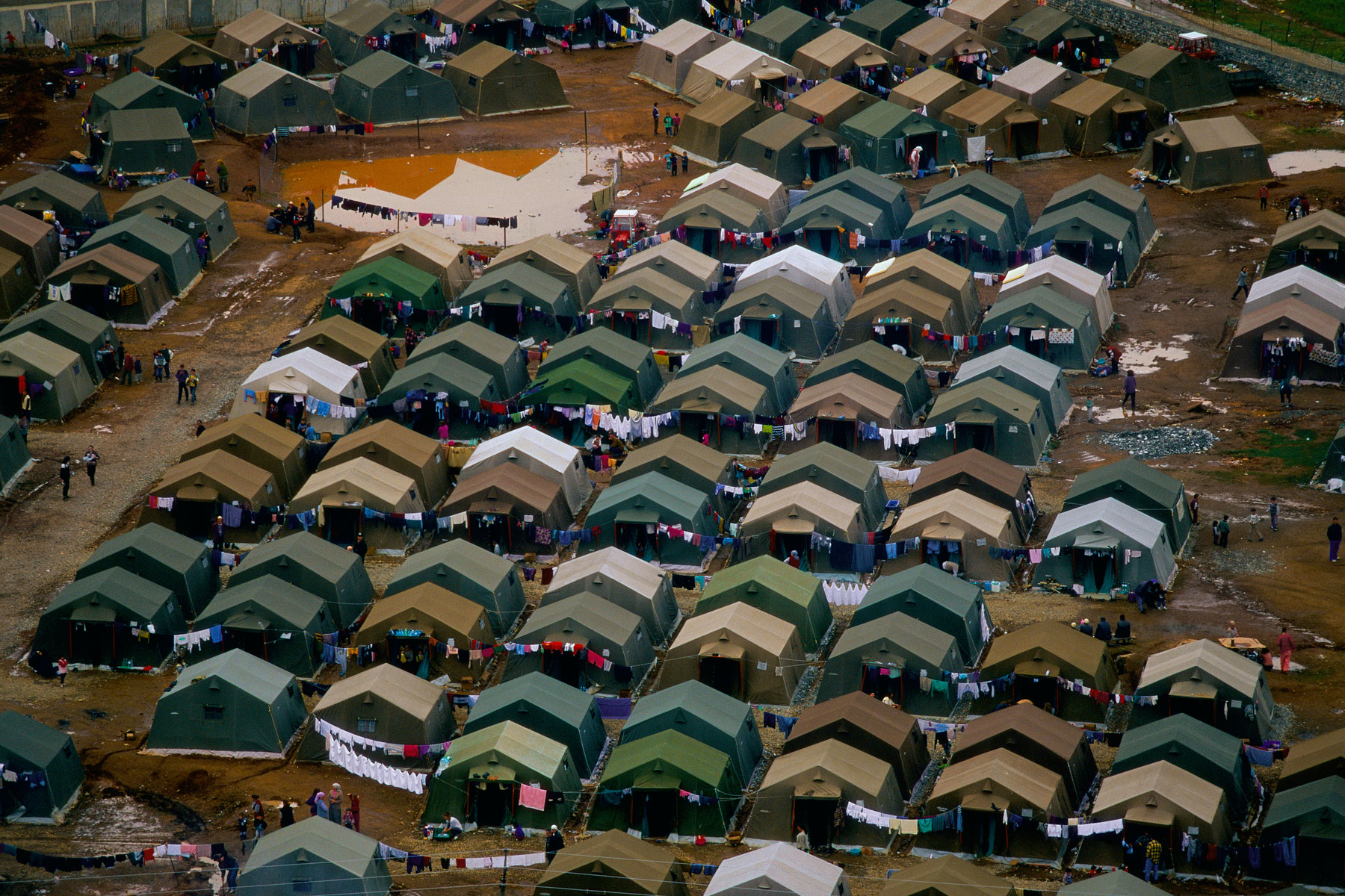
Refugee Camp northwest of Kukës, near Tirana, Albania (42°08'N, 20°22'E).
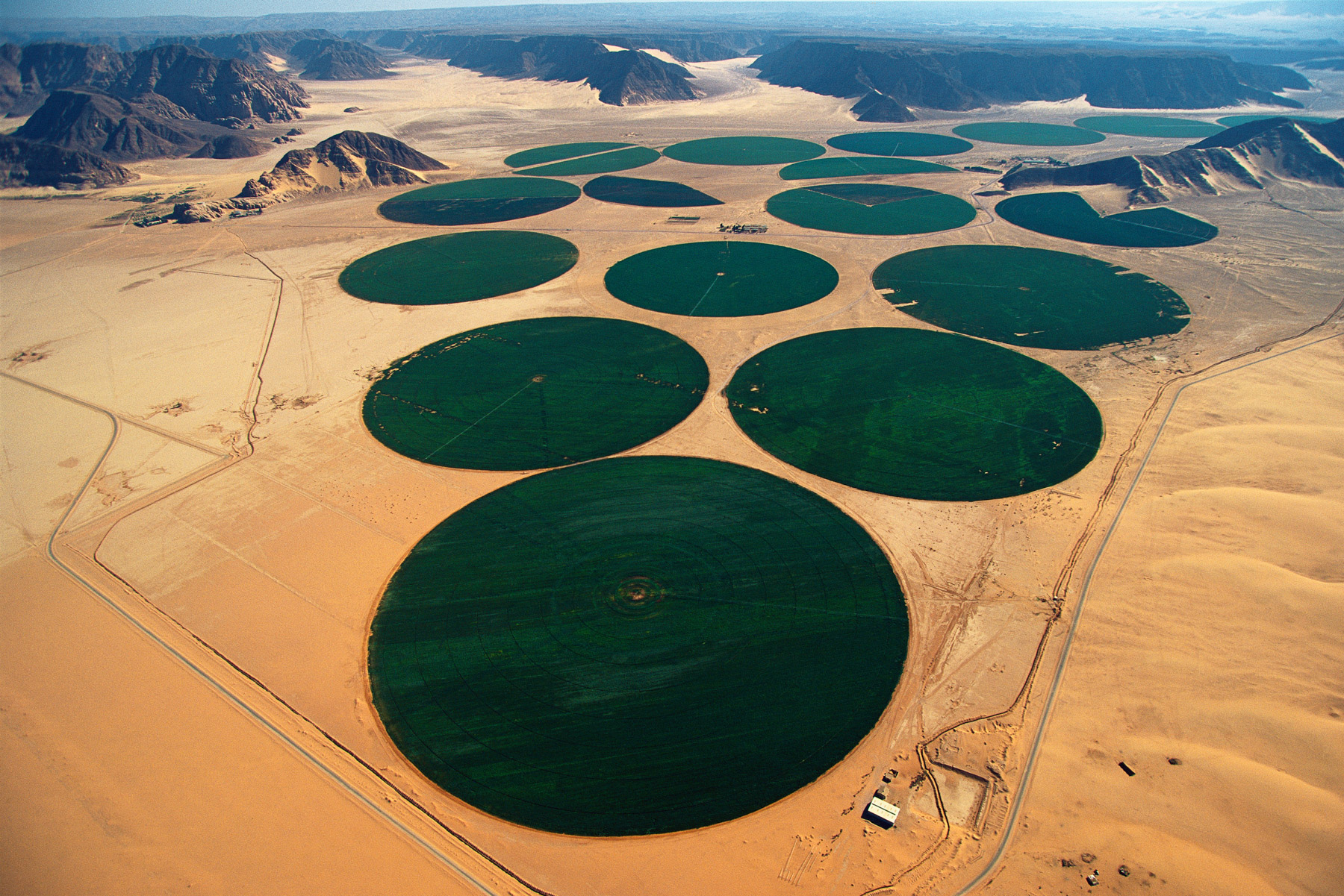
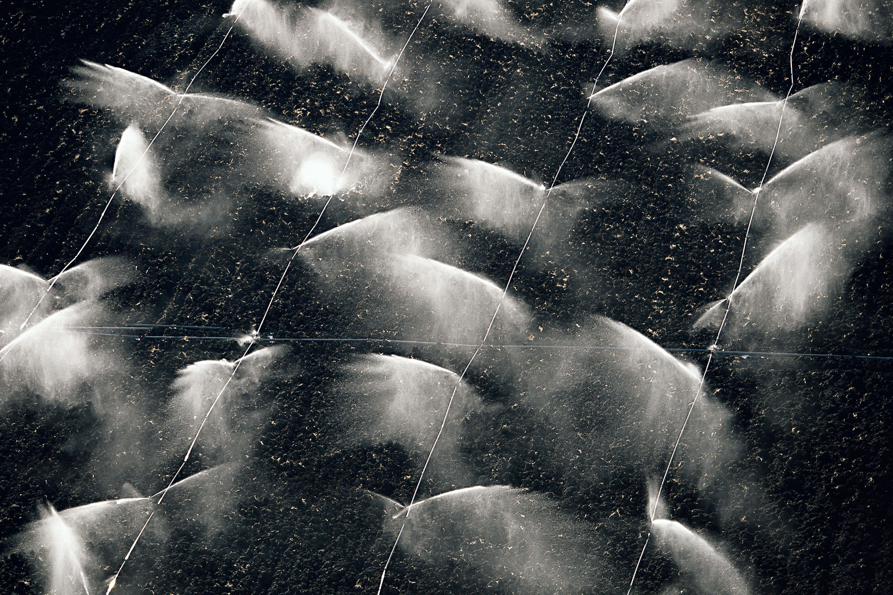
Carousel irrigation, Wadi Rum, Ma'an, Jordan (29°36' N – 35°34' E).
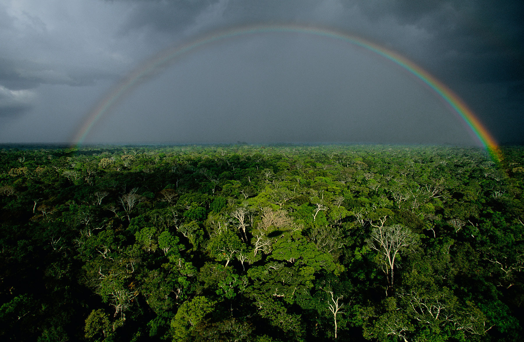
Storm over the Amazonian rainforest near Téfé, Amazonas State, Brazil (3°32' S – 64°53' W).
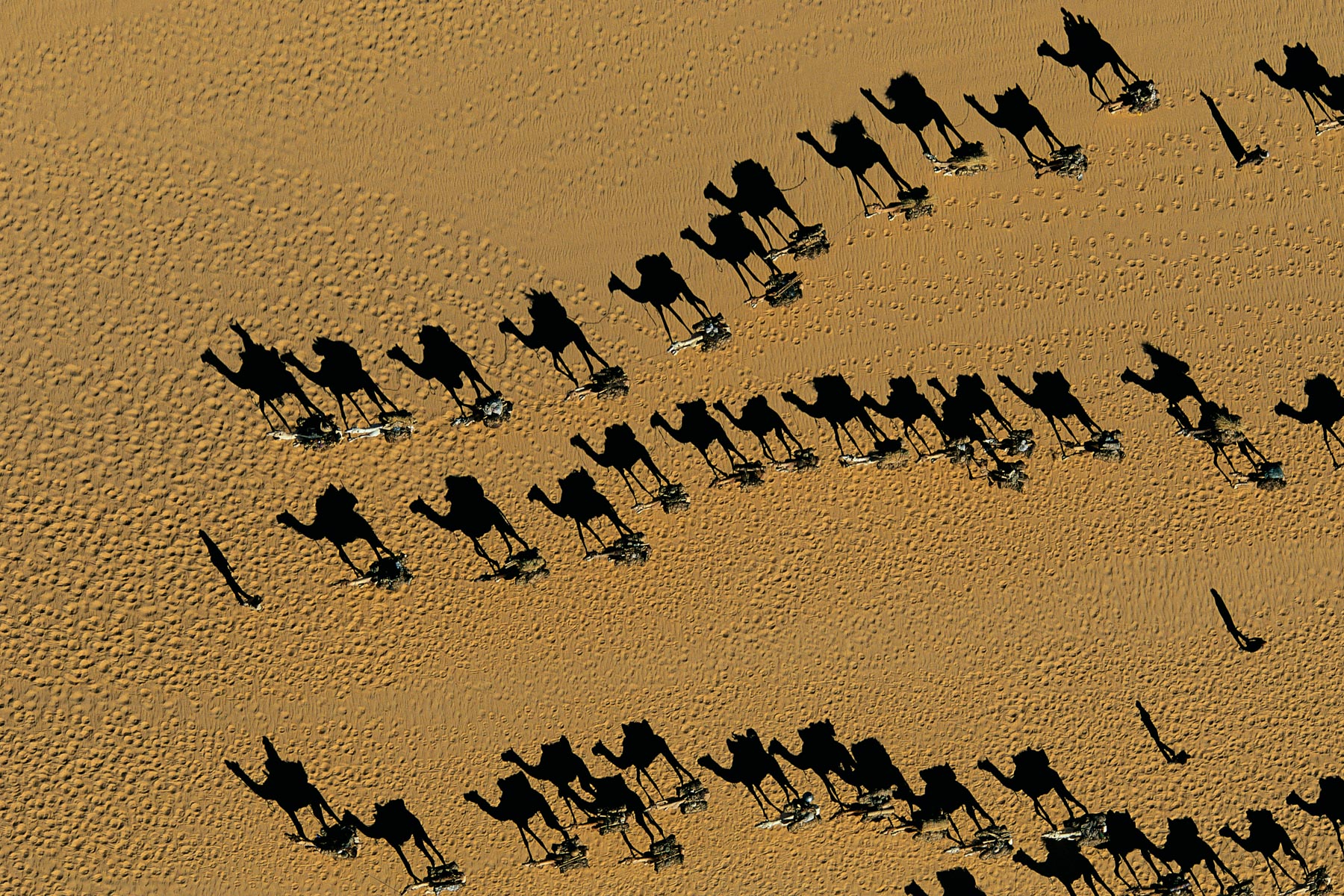
Dromedary caravans near Fachi, Ténéré Desert, Niger (18°14' N – 11°40' E).
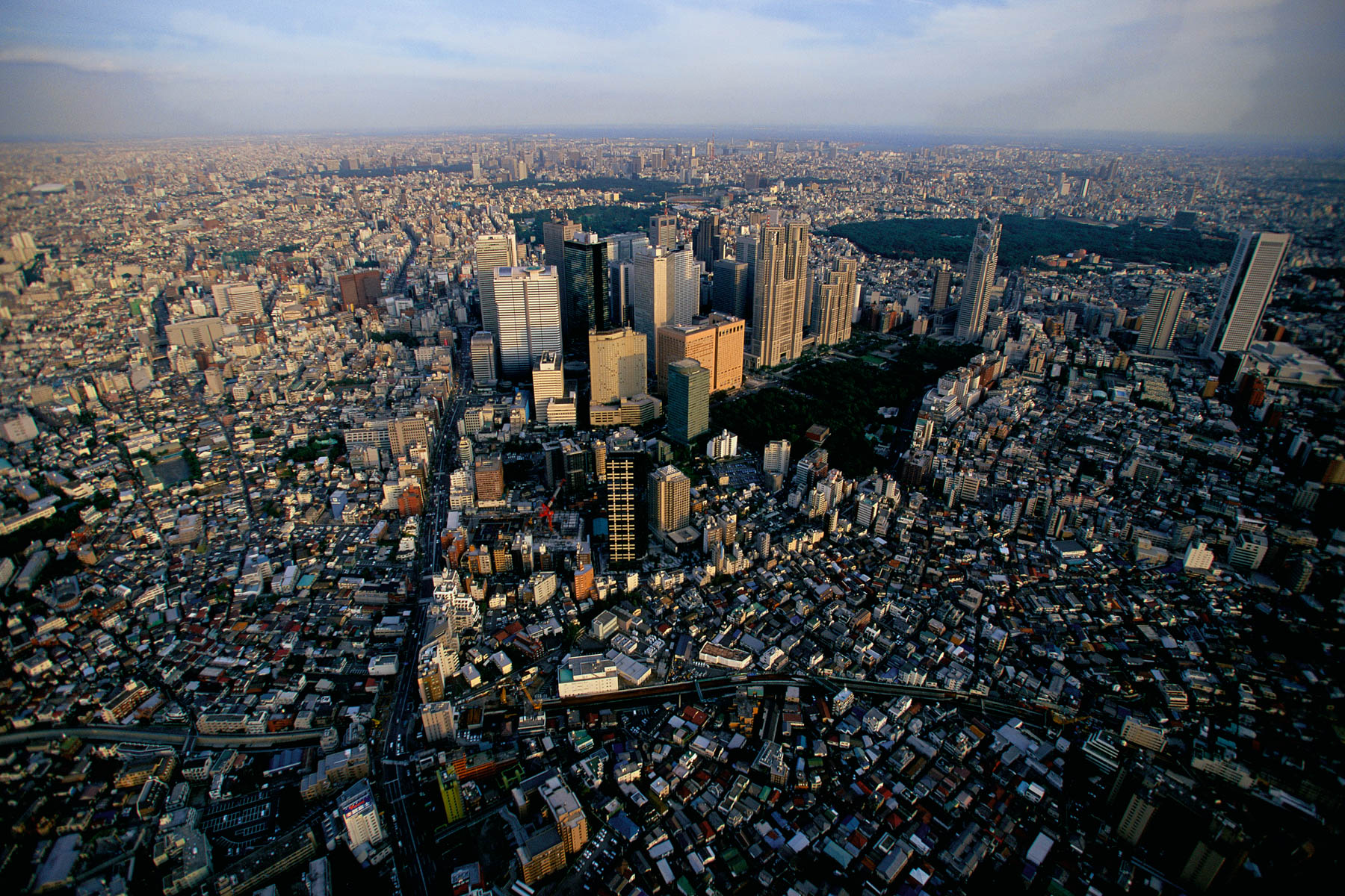
Shinjuku district of Tokyo, Japan (35°41' N – 139°42' E).
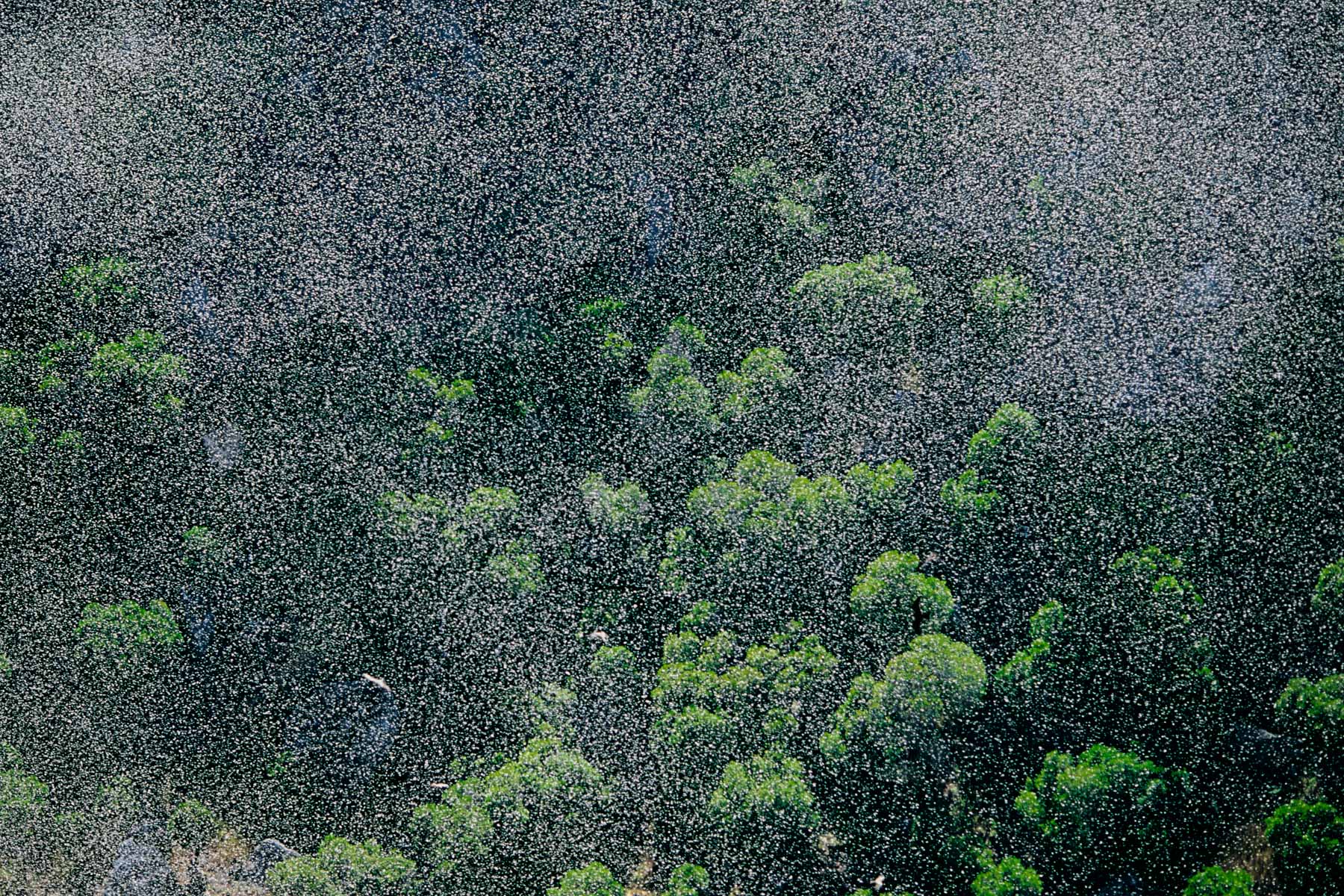
Locust swarm outside Ranohira, near Fianarantsoa, Madagascar (22º27' S - 45º21' E).
Hydraulic drilling station in a village near Doropo, Bouna district, Ivory Coast (9°47' N - 3°19' W).
Confluence of the río Uruguay and a tributary, Misiones province, Argentina (27°09’ S – 53°56’ W).
Gosses Bluff Meteoric crater, Northern Territory, Australia (23°50' S - 132°18' E).
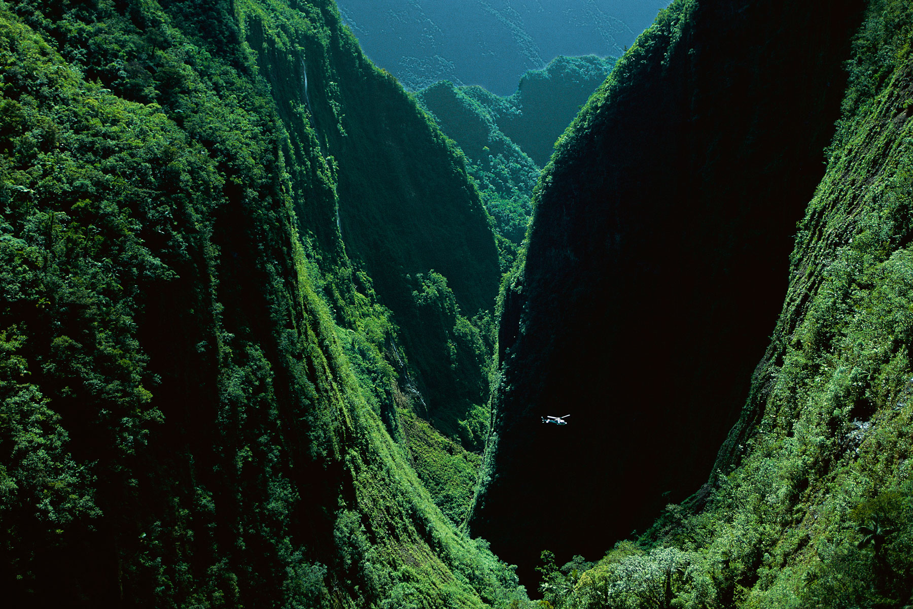
The gorges of the Bras de Caverne, Island of Réunion (French overseas territory) (21°01' S – 55°33' E).
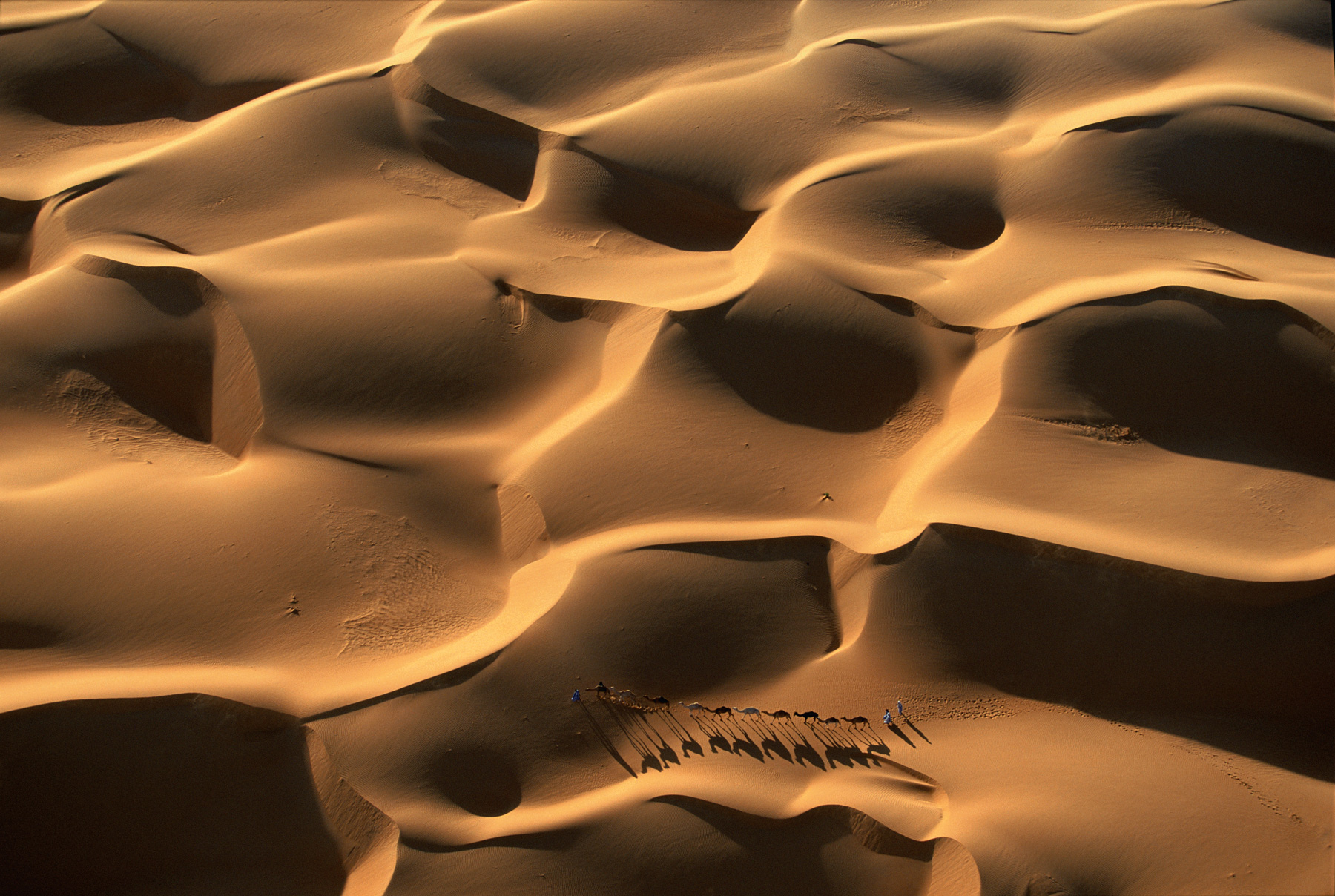
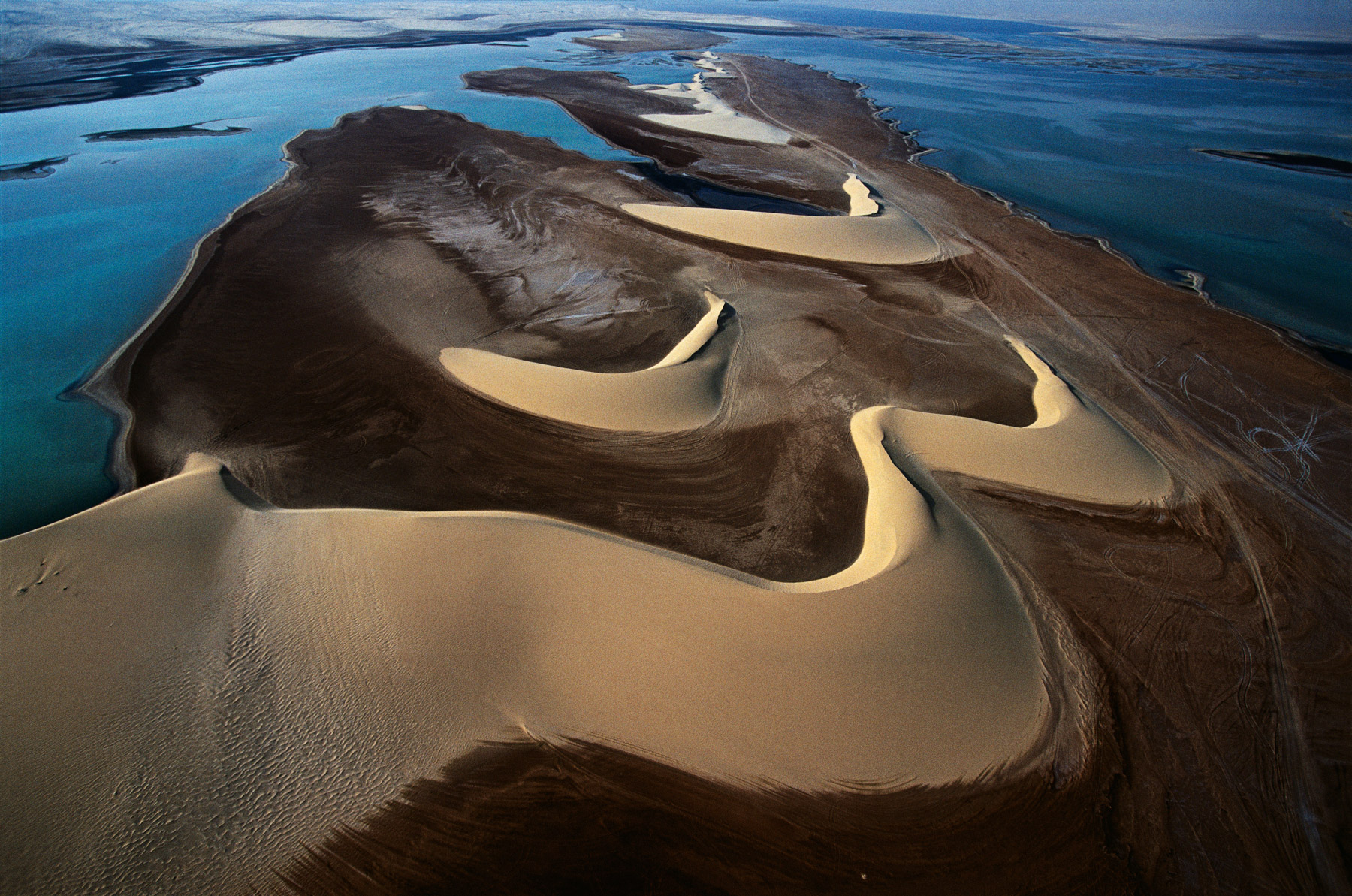
Dromedary caravan in the dunes, near Nouakchott, Mauritania (18°09’ N – 15°29’ W).
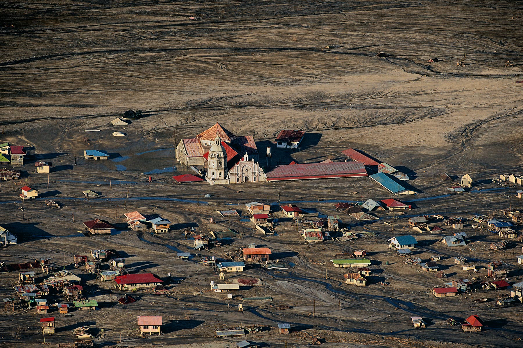
Village of Bacolor under a layer of mud, the island of Luzon, Philippines (14°59' N – 120°39' E).
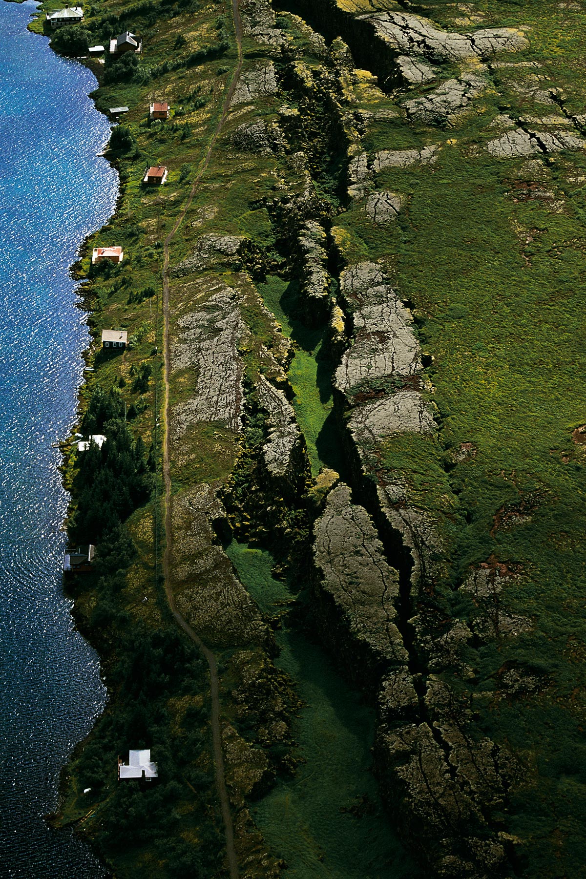
Pingvellir Fault east of Reykjavik, Iceland (64°18' N – 21°16' W).
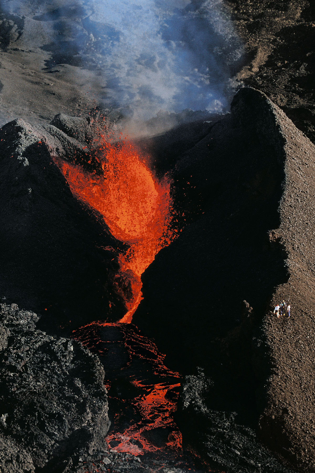
Eruptive cone of Piton de la Fournaise, Réunion island, France (21°14' S – 55°43' E).
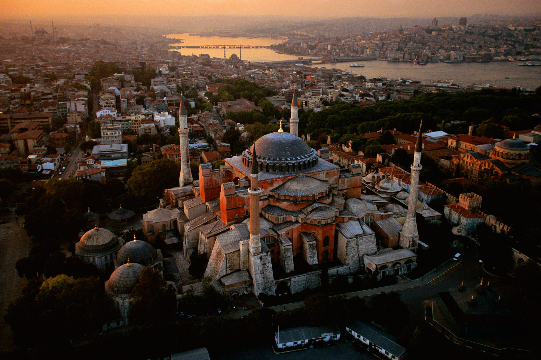
Hagia Sophia Istanbul, Turkey (41°00’ N – 28°59’ E).
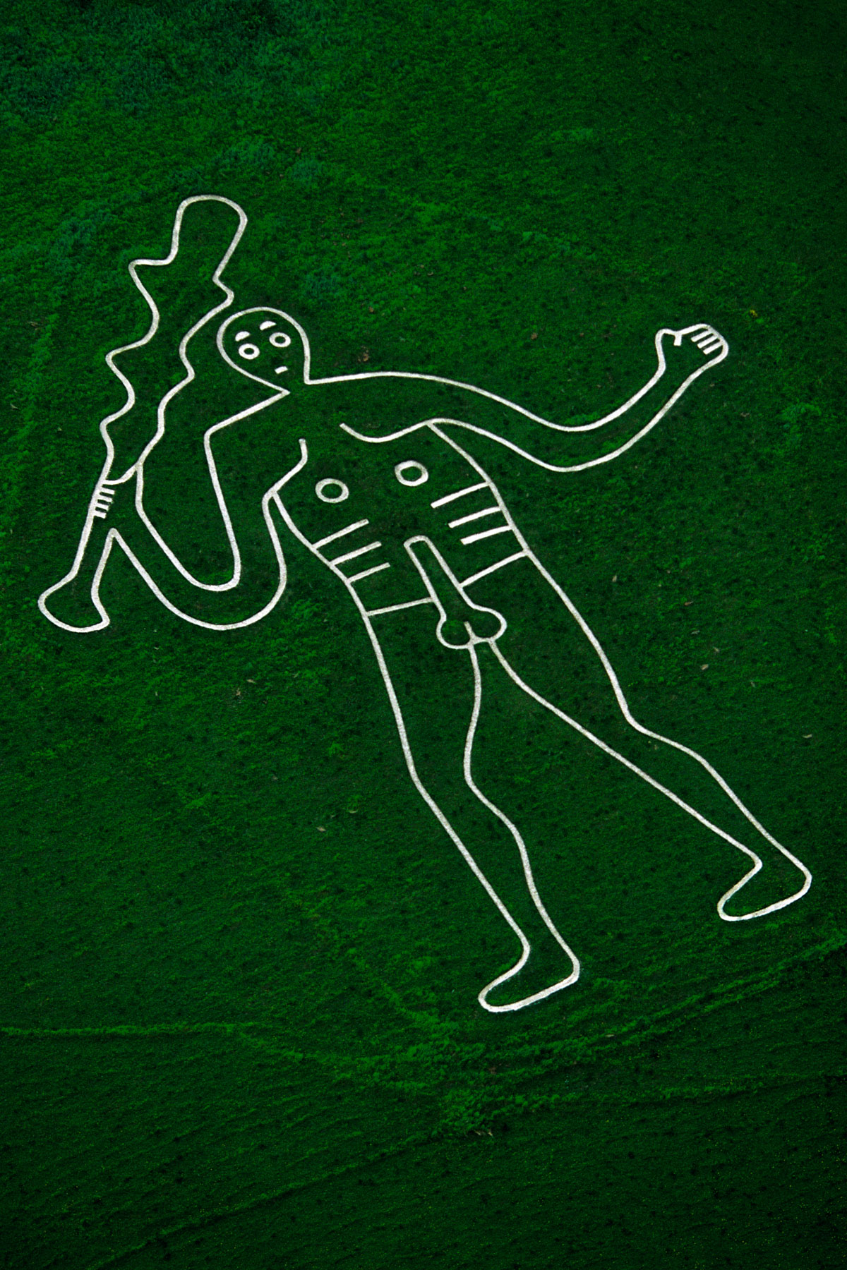
Giant of Cerne Abbas, Dorset, England (50°49’ N – 2°29’ W).
Landscape between Safawi and Qasr Burqu, near Al Mafraq, Jordan (32°32' N – 37°34' E).
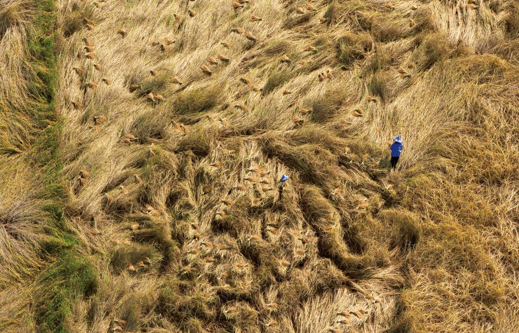
Toiling in the fields in the region of Phitsanulok, Thailand (19°32’ N – 99°43’ E).
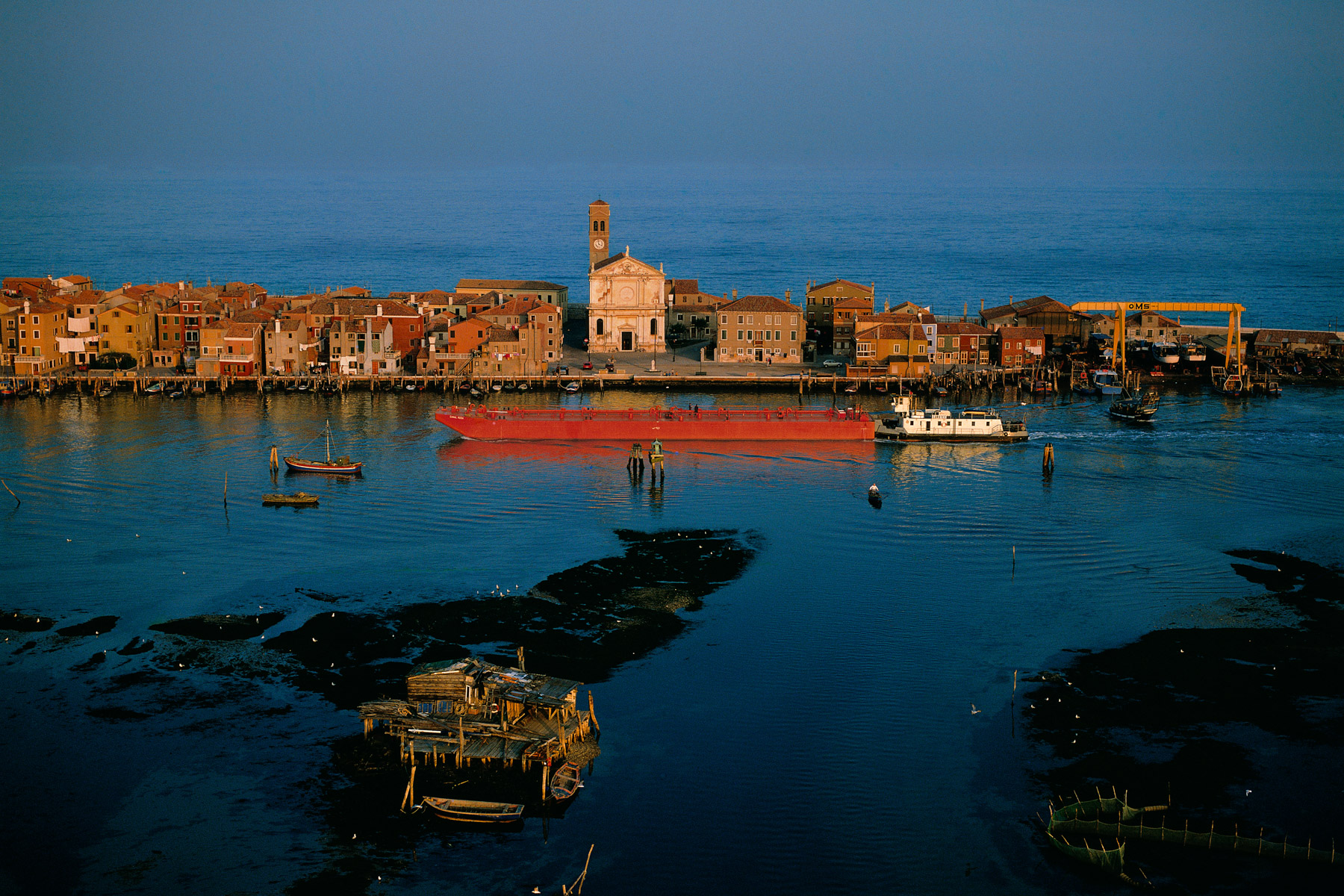
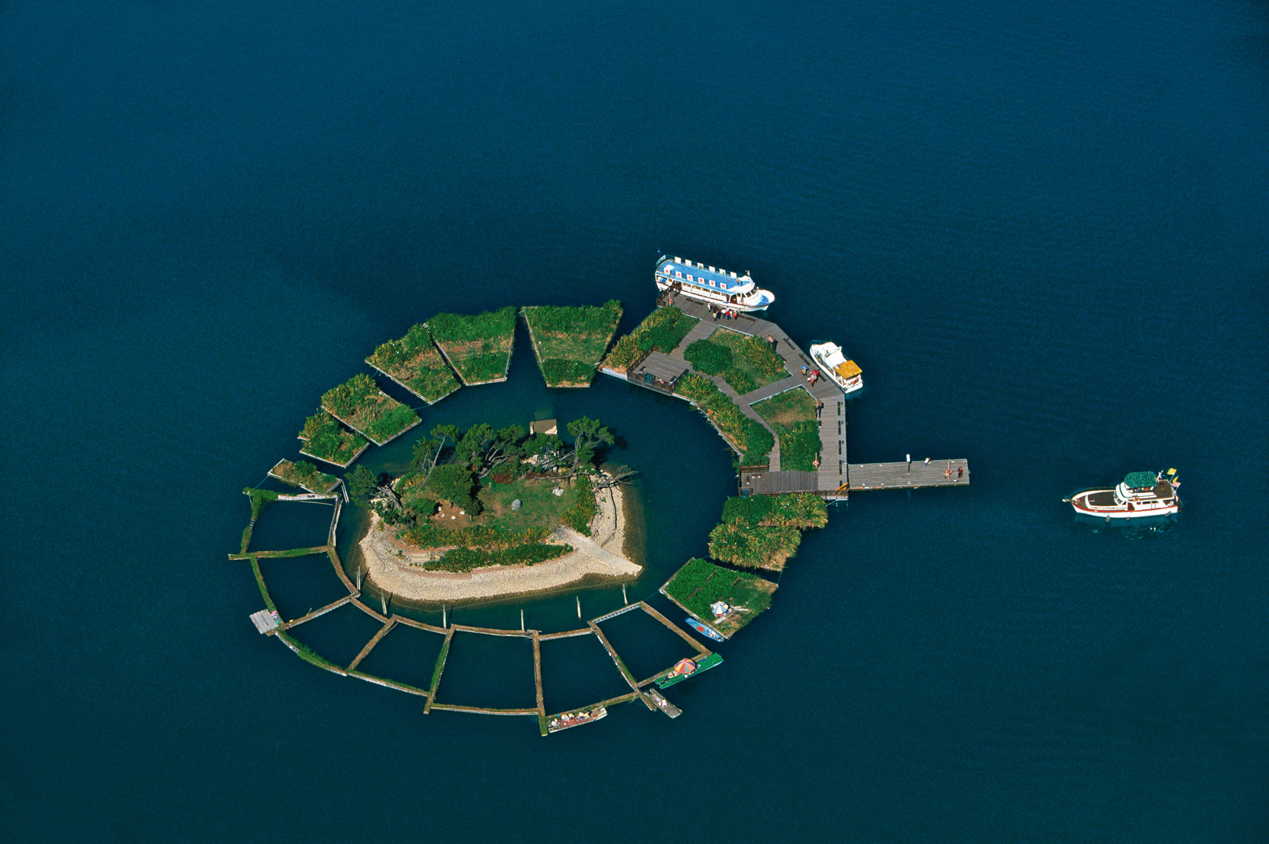
Fishermen’s village at Pellestrina, lagoon of Venice, Venetia, Italy (45°15' N – 12°18' E).

Market near the national reserve of Masai Mara, Kenya (1°14' S – 34°48' E).
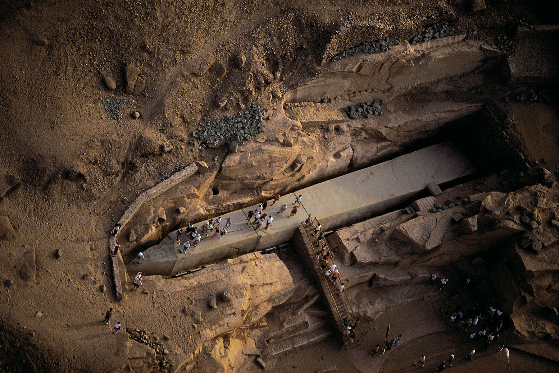
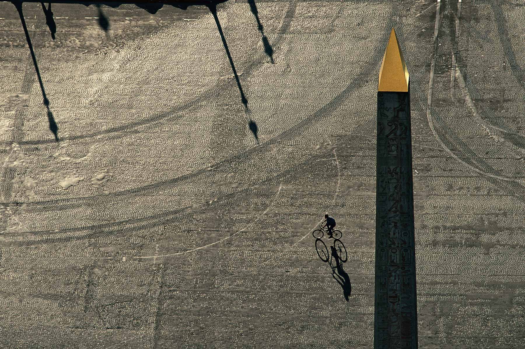
The Unfinished Obelisk, Aswan, Egypt (24º01' N - 32º58' E).
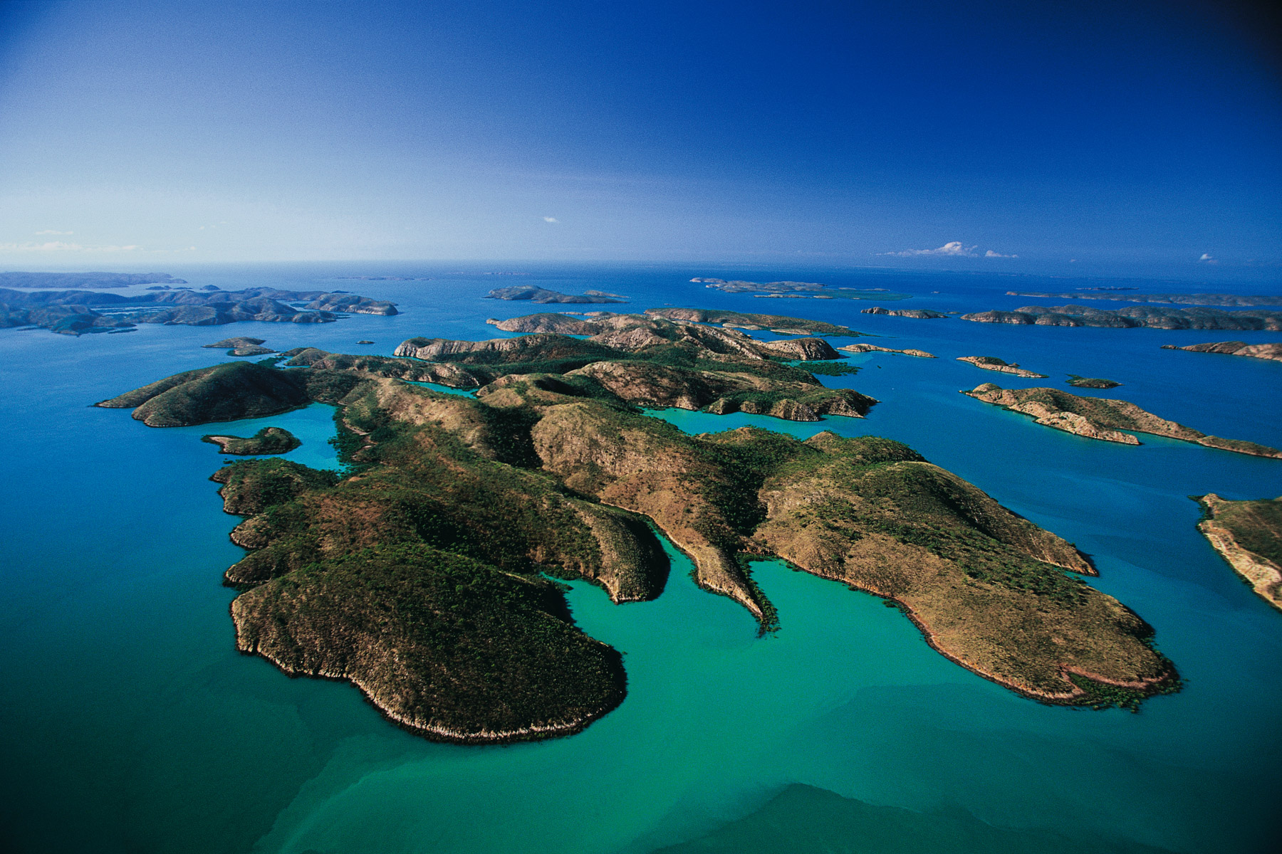
Buccaneer archipelago, West Kimberley, Australia (16°15' S – 123°49' E).
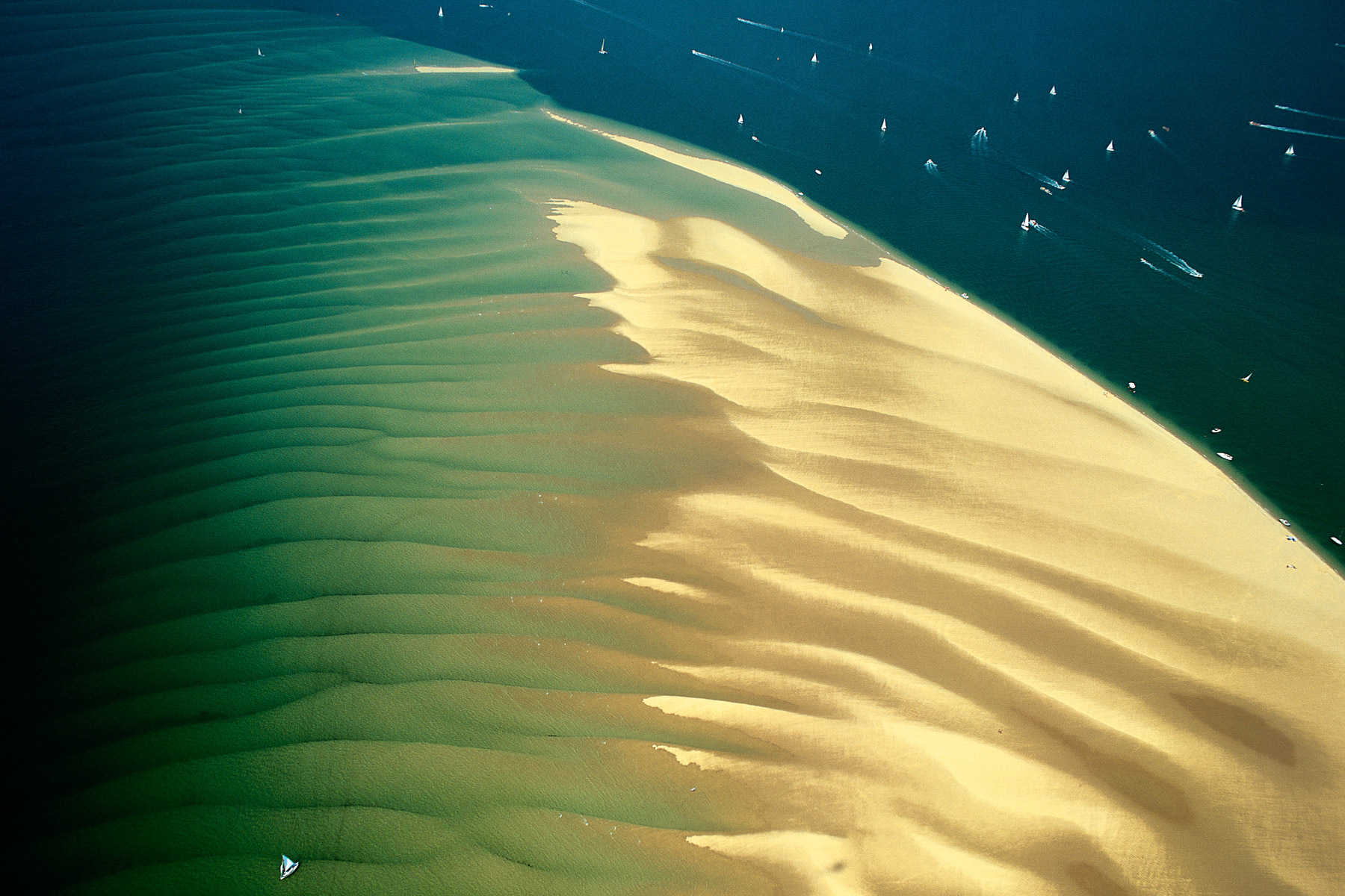
Banc d'Arguin natural reserve, Gironde, France (44°34' N - 1°15' W).
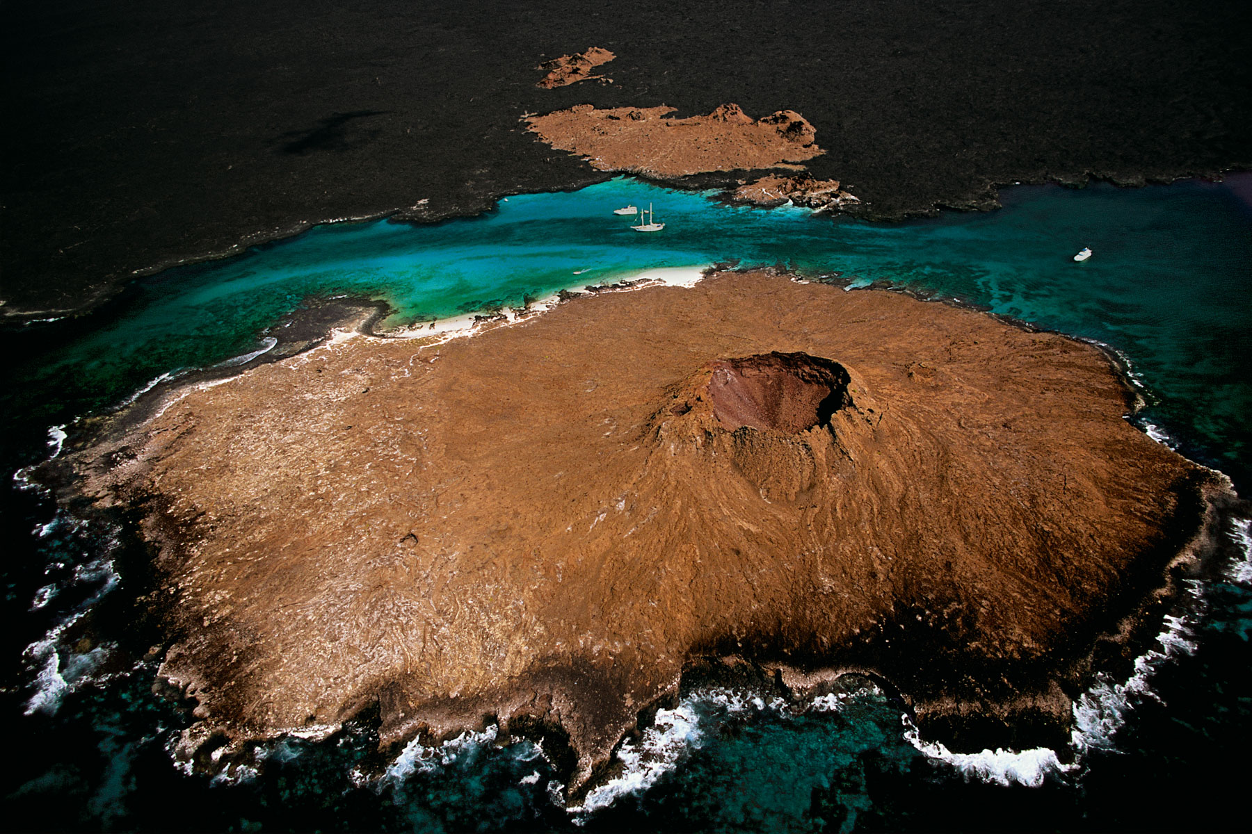
Volcano on the west coast of San Salvador Island, Chinese hat islands, Galápagos Archipelago, Ecuador (0°22' S – 90°35' W).
Planted fields on the banks of the Uruguay River, Misiones province, Argentina (27°24' S - 54°24' W).
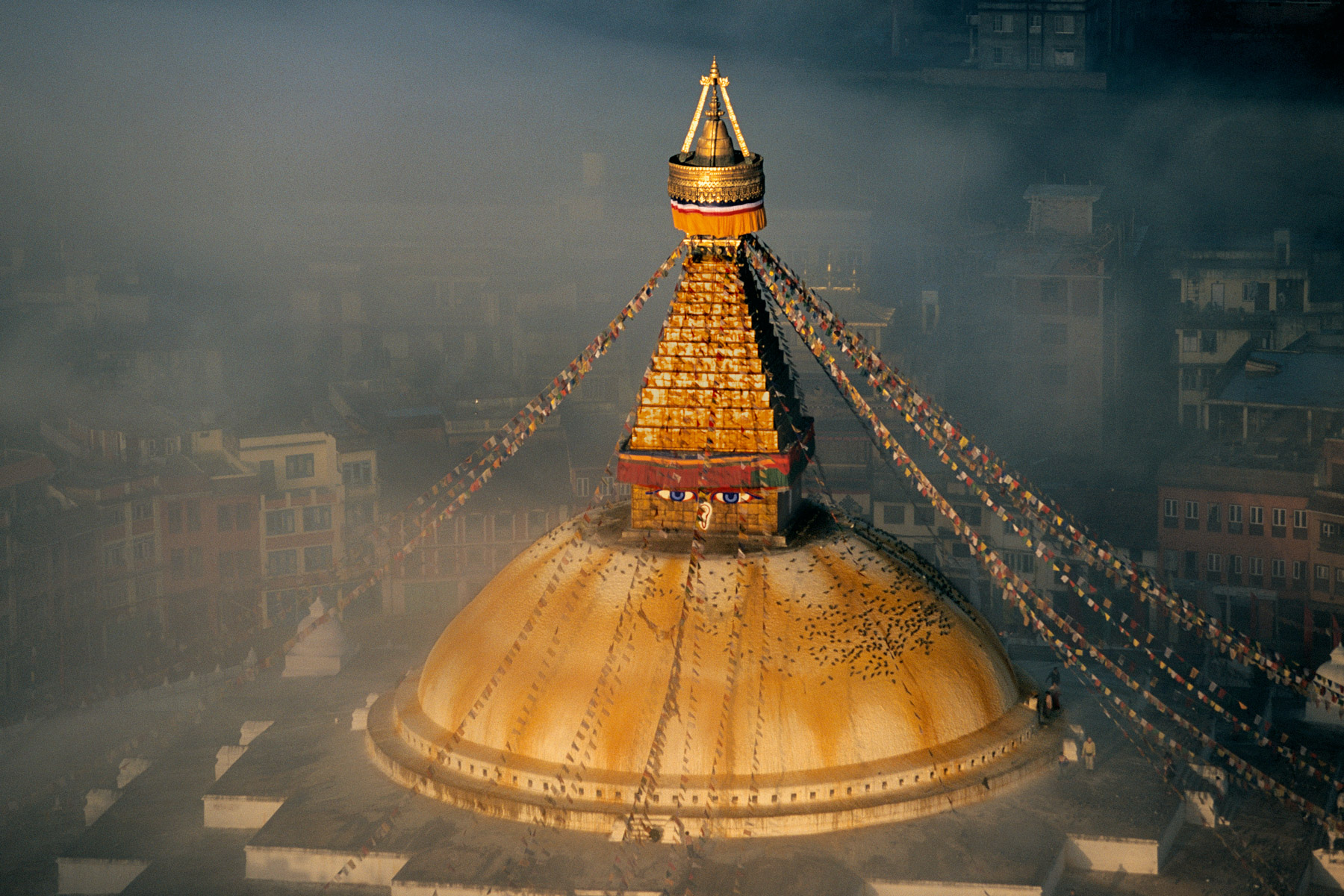
The stupa of Boudhanath, Buddhist Temple, Kathmandu, Nepal (27°43' N - 85°22' E).
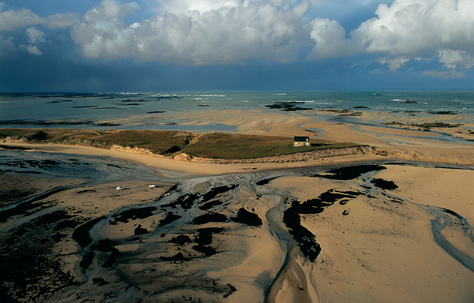
House in Keremma, on the Kernic cove at low tide, Finistère France (48°39' N – 4°14' W).
Market gardening on the Senegal River near Kayes, Mali (14°34' N – 11°46' W).
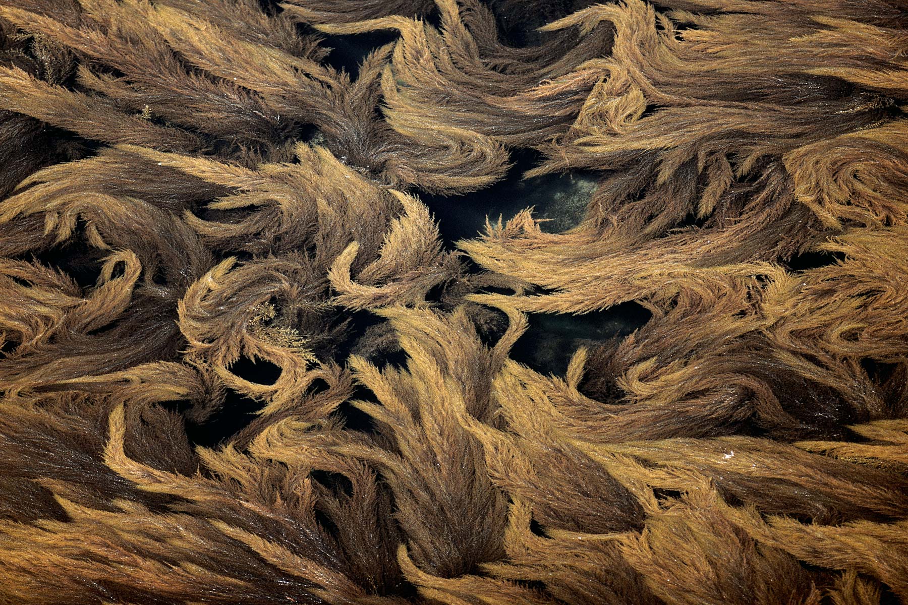
Algae in the gulf of Morbihan, France (47°55'N, 2°50'W).
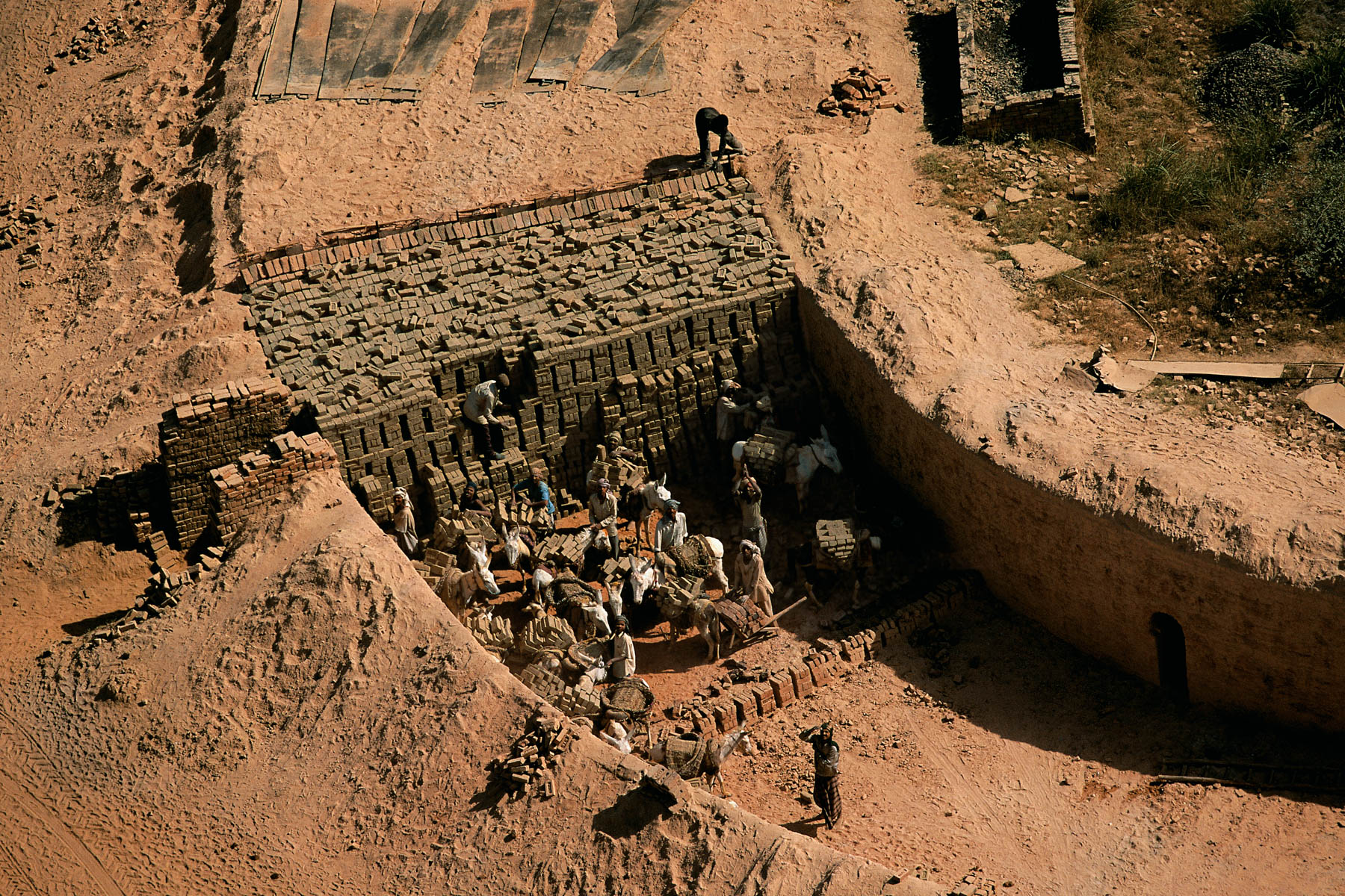
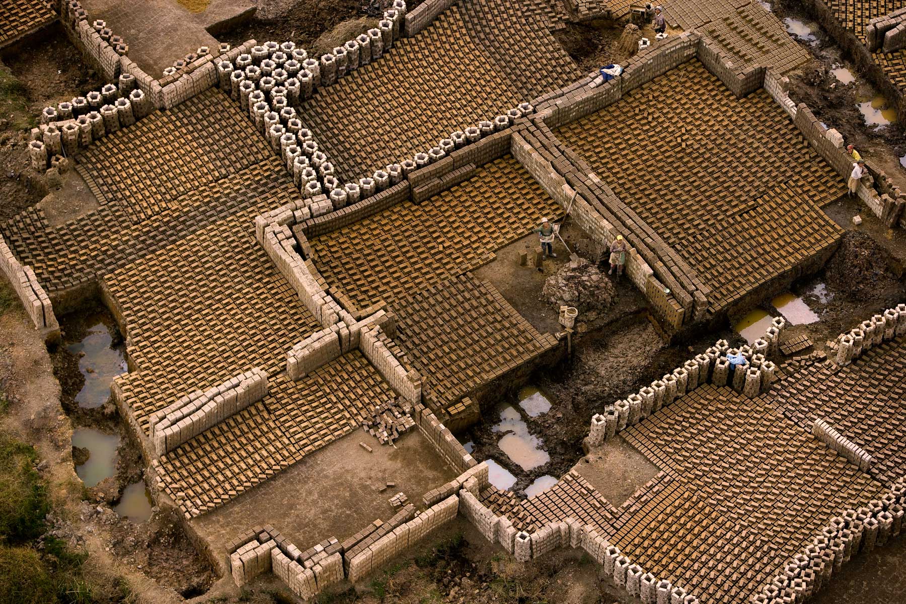
Brickyard east of Agra, Uttar Pradesh, India (27°04' N - 78°53' E).
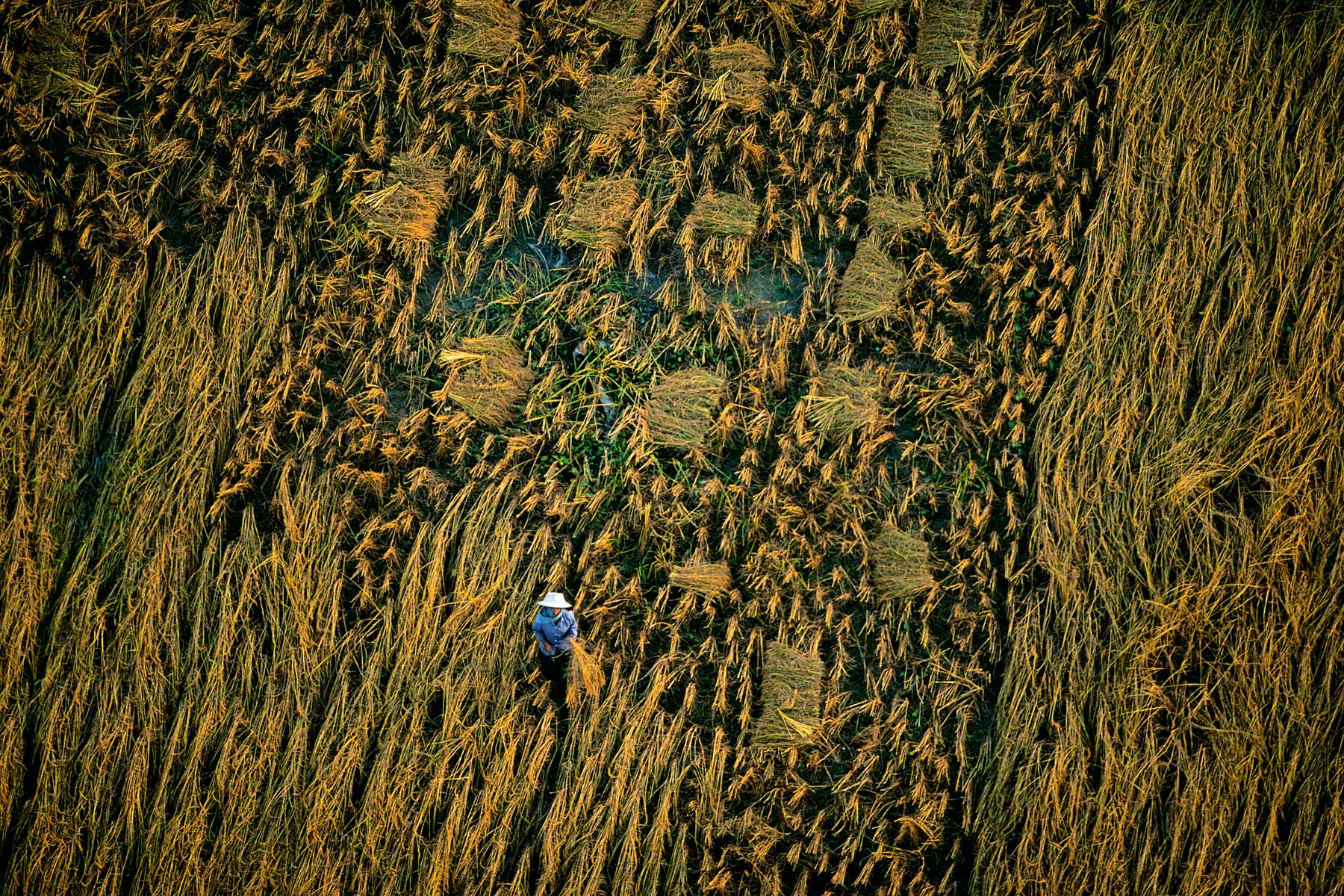
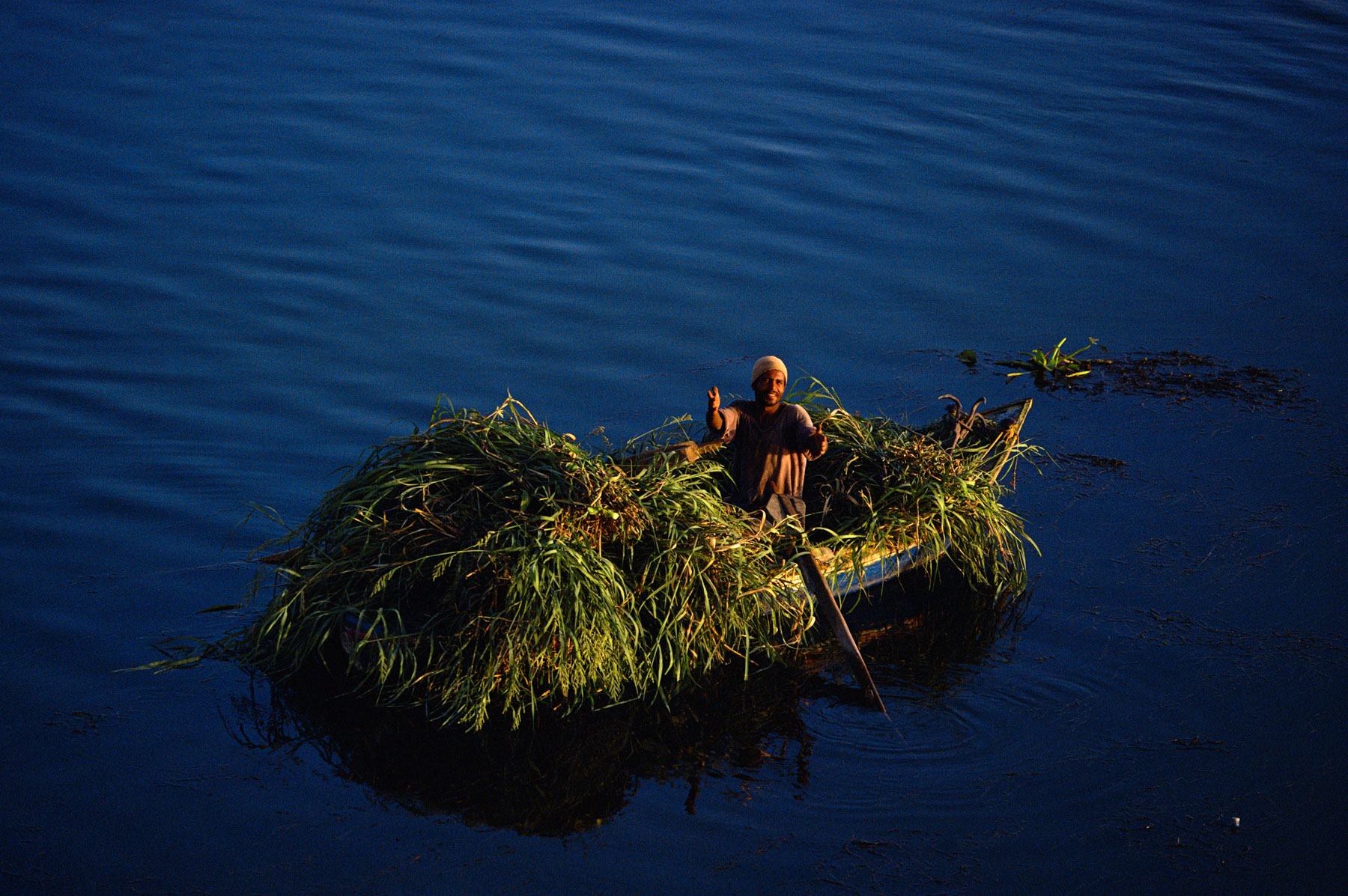
Rice being bundled into sheaves by a Fellah in the Nile valley, Egypt (30°49’ N – 30°28’ E).
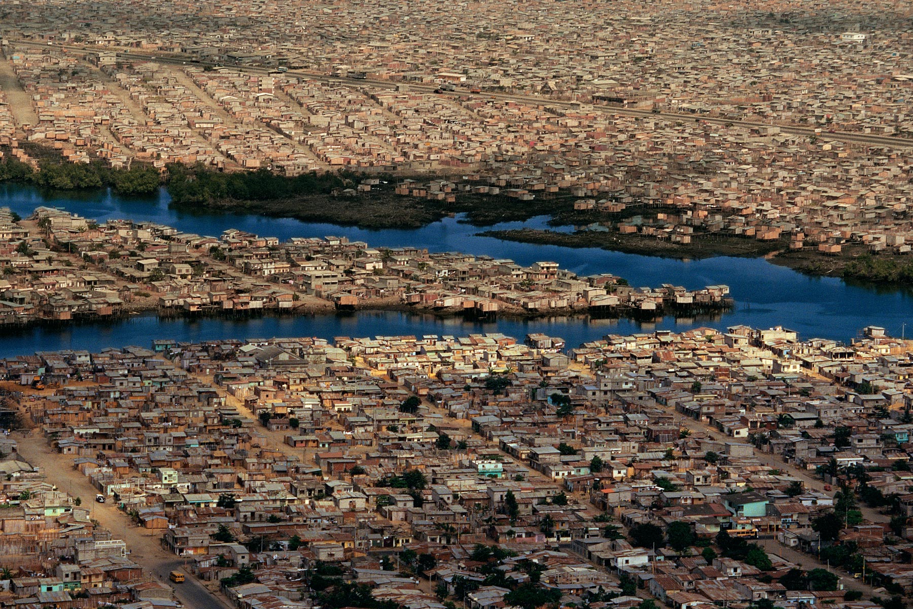
Shantytown of Guayaquil, Guayas, Ecuador (2°14' S – 79°56' W).
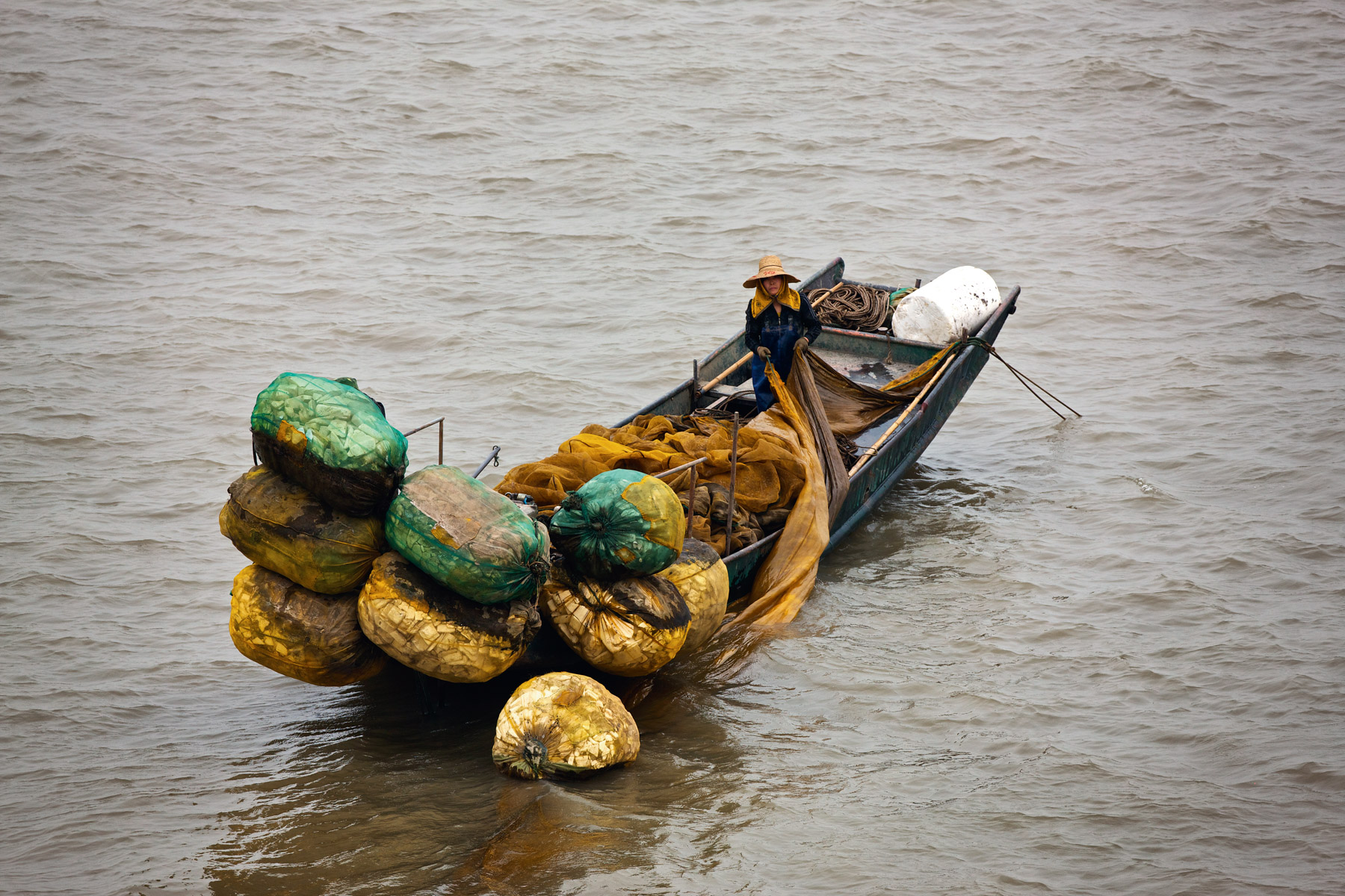
Gold mining near Davao, island of Mindanao, Philippines (7°04’ N – 125°36’ E).
Agricultural landscape between Al Massira Dam and Rabat, Morocco (32°33' N – 6°36' W).
Rawing in the yard of a village house, west of Jodhpur, Rajasthan, India (26°21' N, 72°45' E).
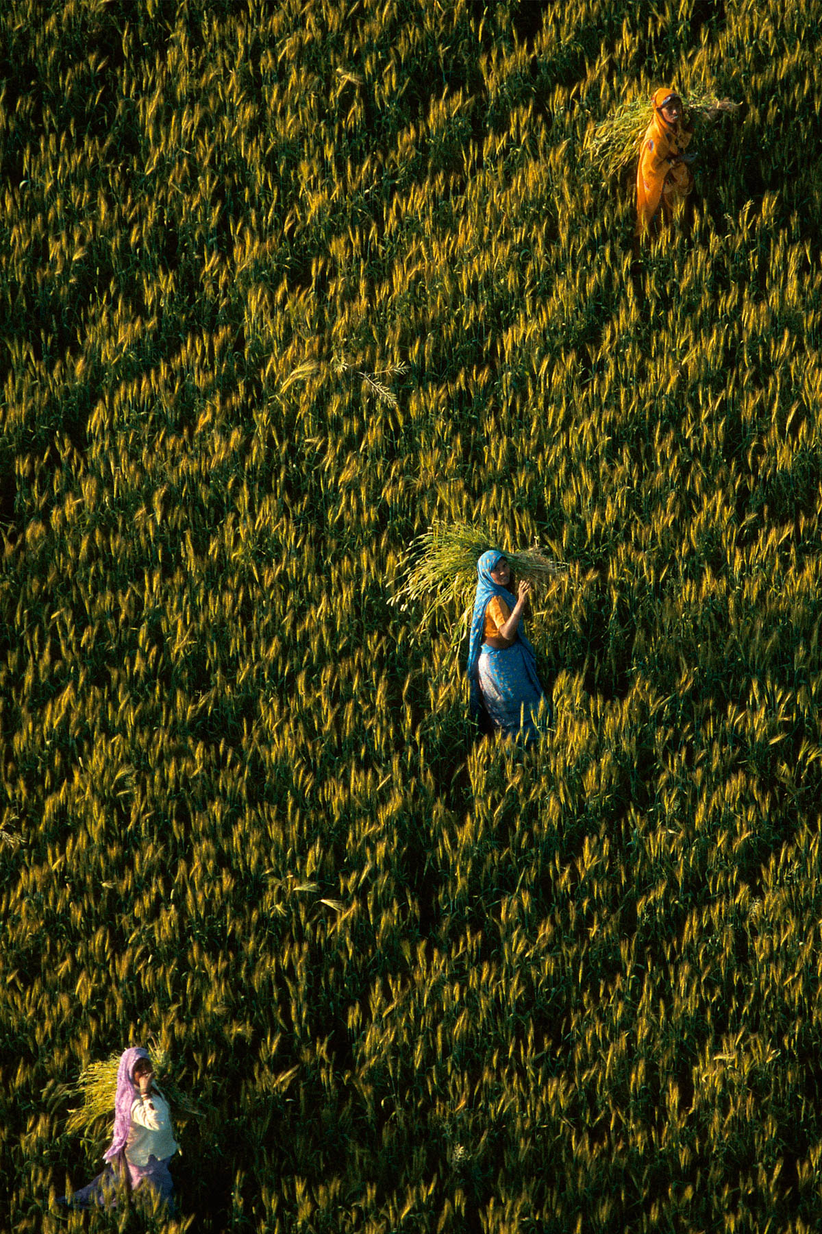
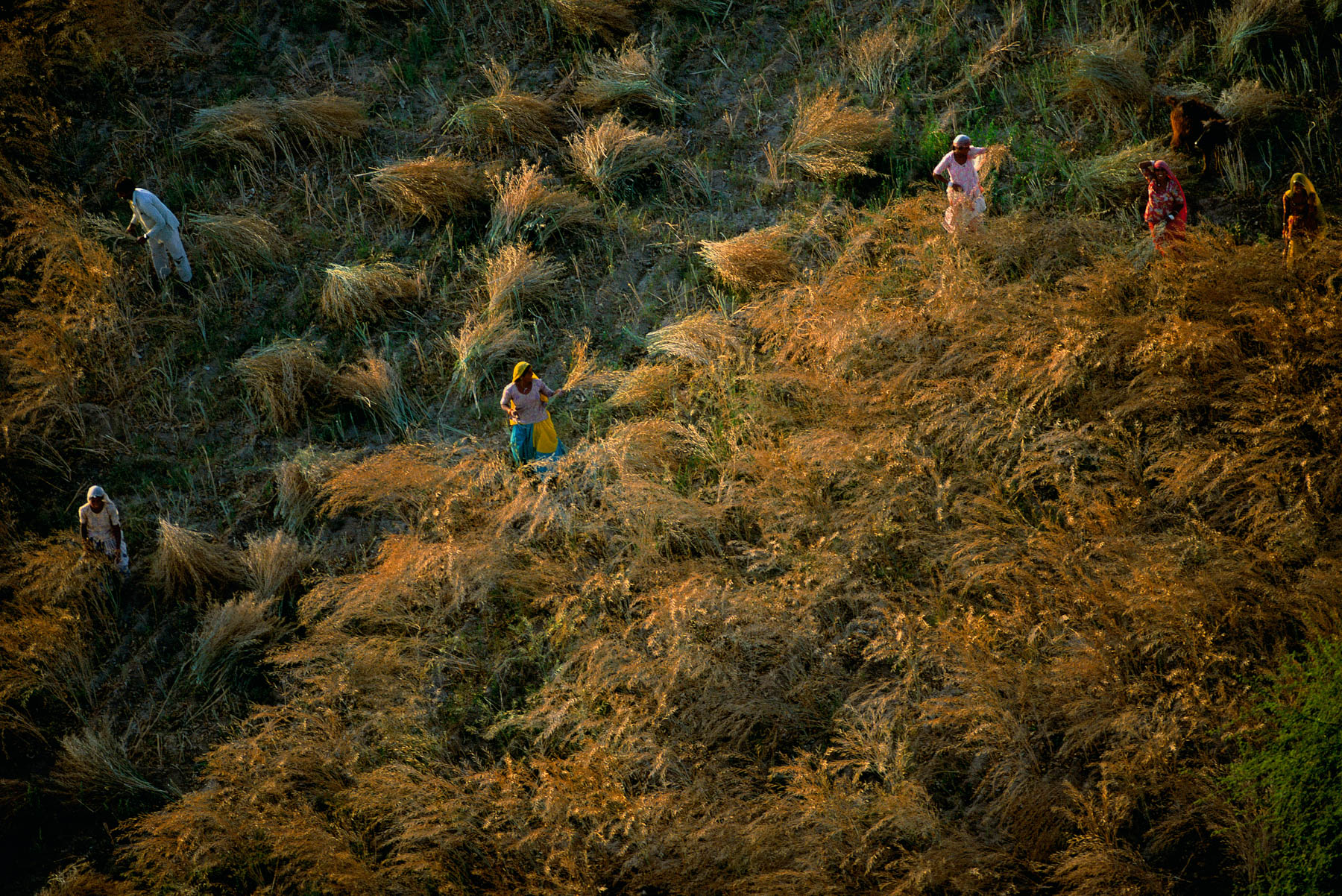
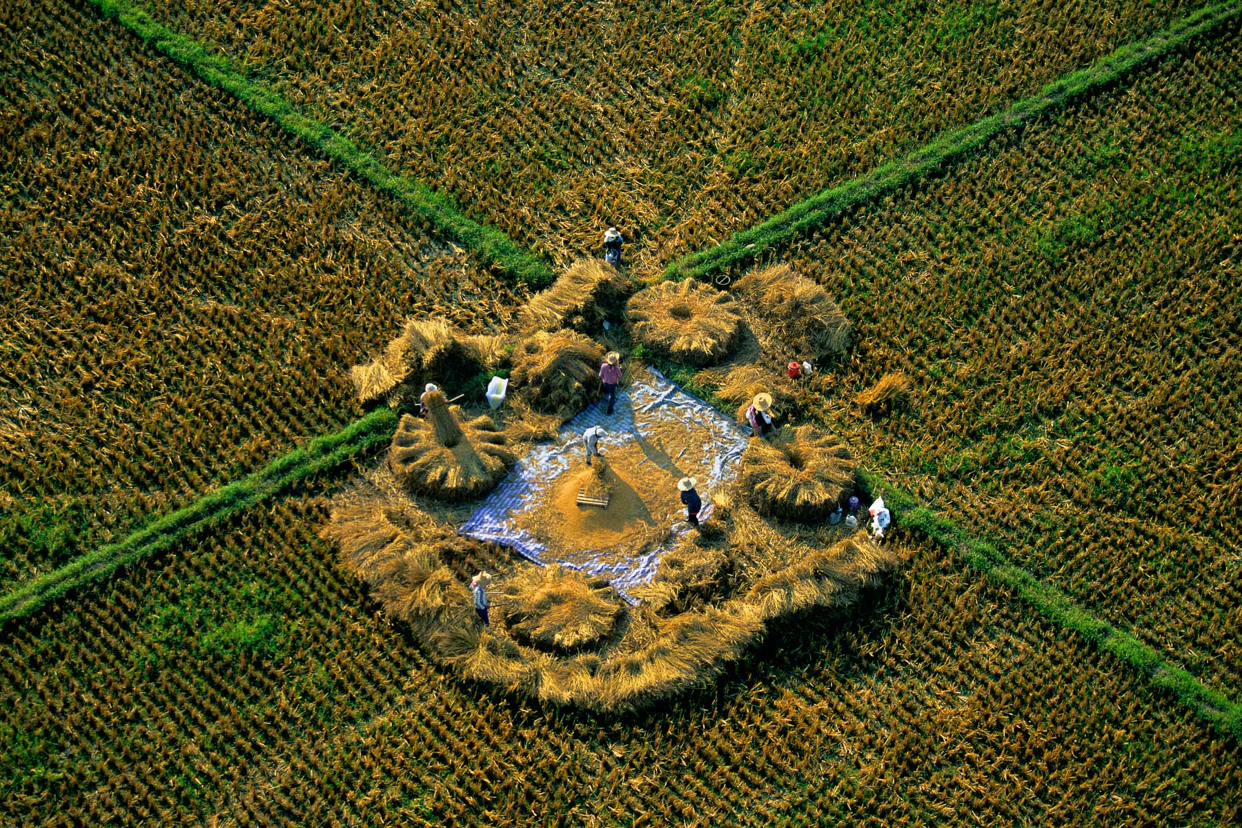
WHEAT HARVEST NEAR MATHURA, Uttar Pradesh, India (27°21' N, 77°51' E).
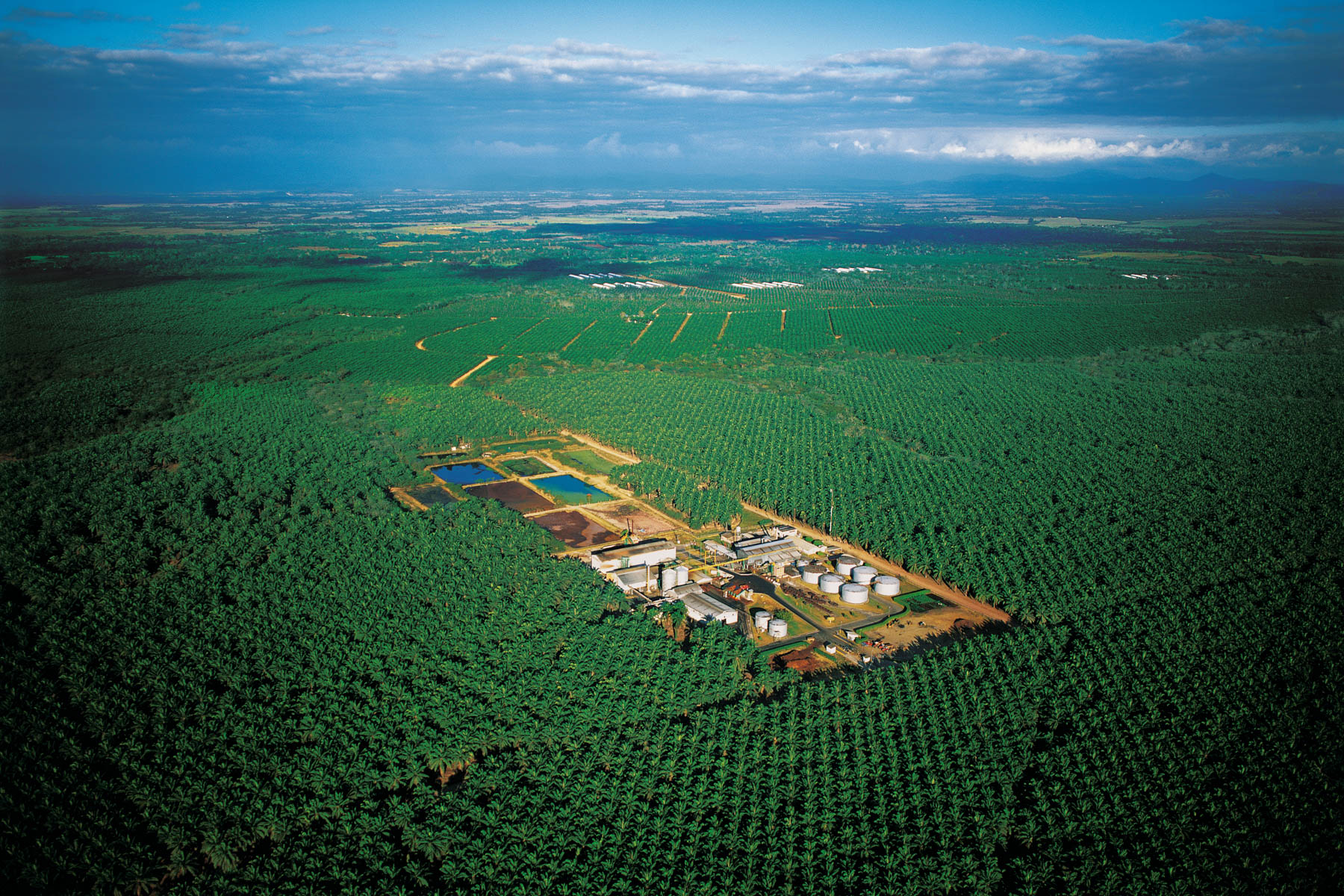
Palm tree plantation, near Kuala Lumpur, Malaysia (3°09' N – 101°48' E).
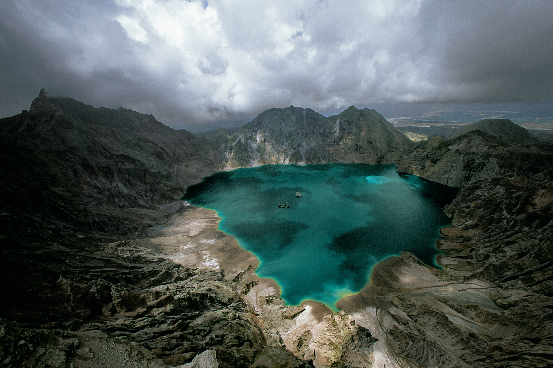
Mount Pinatubo, a volcano north of Manila, Luzon, Philippines (15°08' N – 120°21' E).

Tourist in a swimming pool in Pamukkale, Anatolia, Turkey (37°58' N – 29°19' E). The
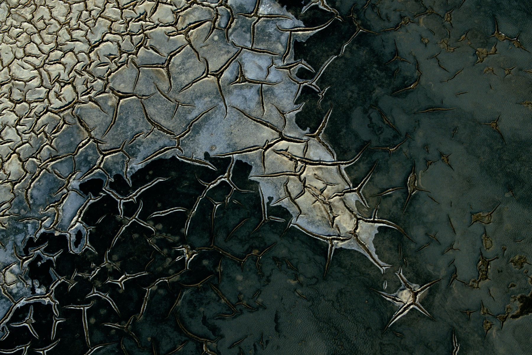
Dried cracked mud in Camargue, Bouches-du-Rhône, France (43°24’ N – 4°40’ W).
Dried up Athi River, Tsavo National park, Kenya (2°59' S - 38°31' E).
Lagoon of Venice, Veneto, Italy (45°17' N, 12°12' E).
Andes cordillera between Cuzco and Arequipa, Peru (15°14' S - 71°48' W).
Cattle-raising near Fukayama (east of Hiroshima), Honshu, Japan (34°31’ N, 133°20’ E).
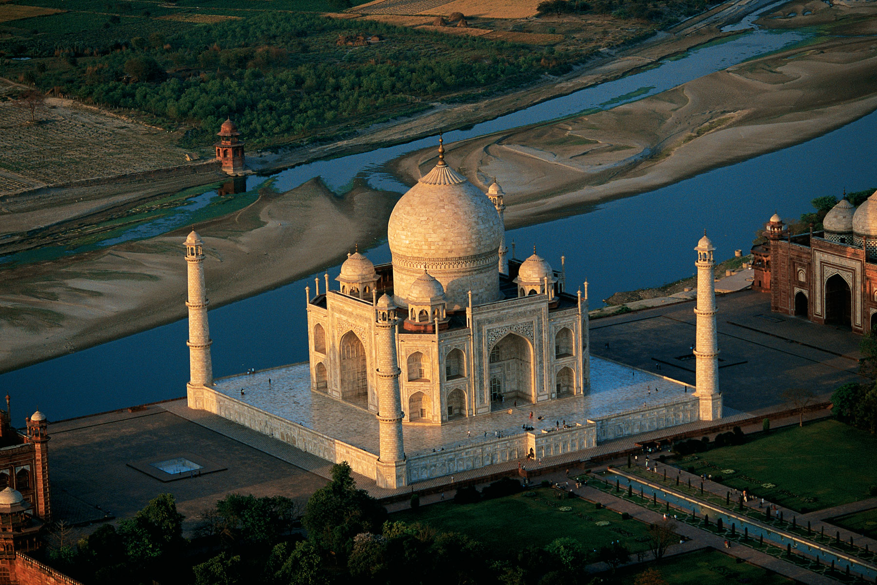
Taj Mahal, in Agra, Uttar Pradesh, India (27°10’N, 78°03’E).
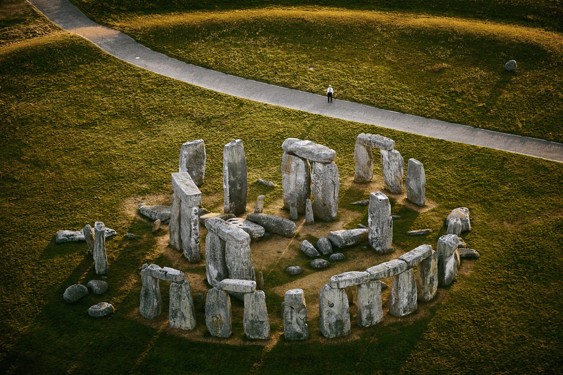
STONEHENGE, Wiltshire, England (51°11’N - 1°50’W).
Orchard among the wheat, Salonica region, Macedonia, Greece (40°26' N, 23°07' E).
Pirogues on the Niger river in the Gao region, Mali (16°16' N, 0°03' W).
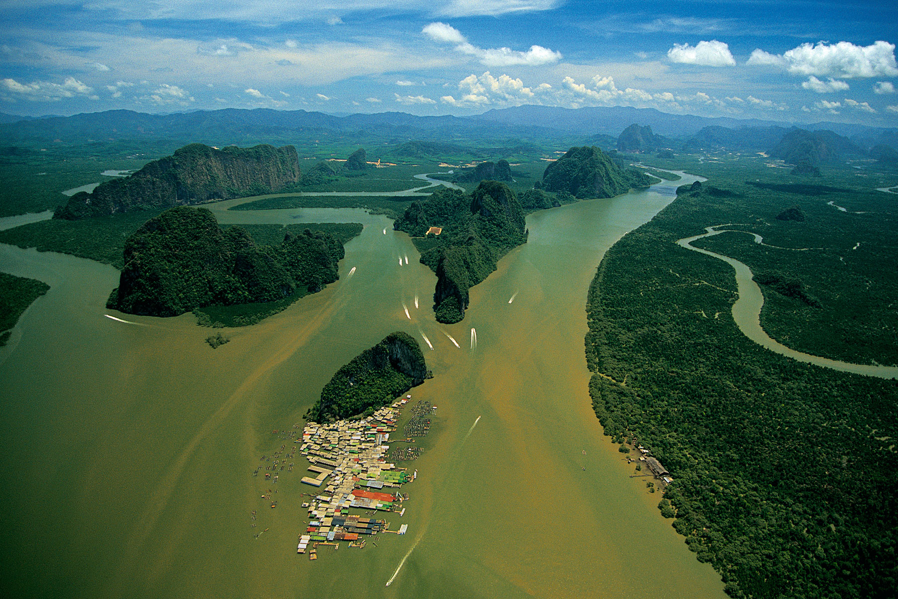
Village of Koh Panyi, Phang-nga Bay Thailand (8°20’ N – 98°30’E).
Mangrove swamps in the Everglades National Park, Florida, United States (25°17' N - 81°04' W).
Islet in the Sulu archipelago, Philippines (7°58' N - 118°40' E).
Rice fields in the south of Pokhara, the Pahar region, Nepal (27°49’N - 84°08’E).
DWELLINGS ON AN ISLET IN THE RIVER NIGER, BETWEEN BOUREM AND GAO, MALI (16°30’ N, 0°12' W).
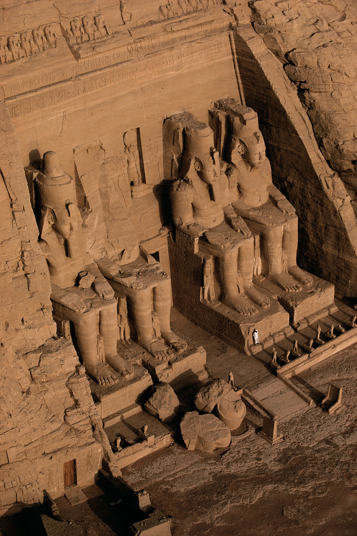
ABU SIMBEL, Nile Valley, Egypt (22°22'N, 31°38'E).
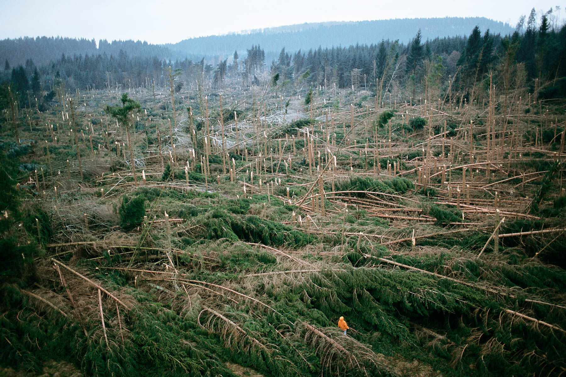
Trees brought down by the storm in the Vosges forest, France (48°39' N - 7°14' E).
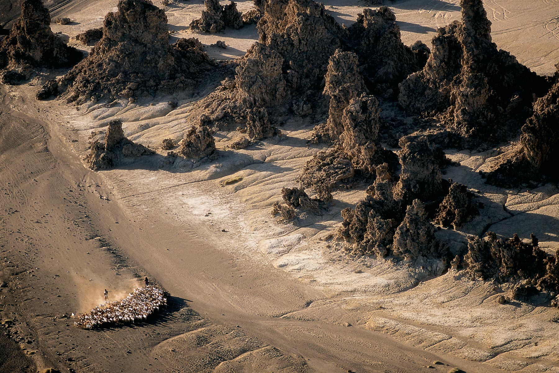
Herd of goats among the chimneys of Lake Abbé, Djibouti (11°06' N, 41°50' E).
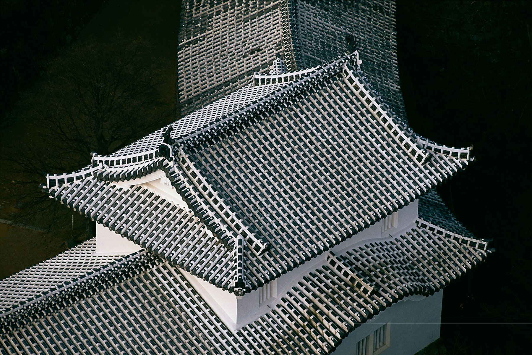
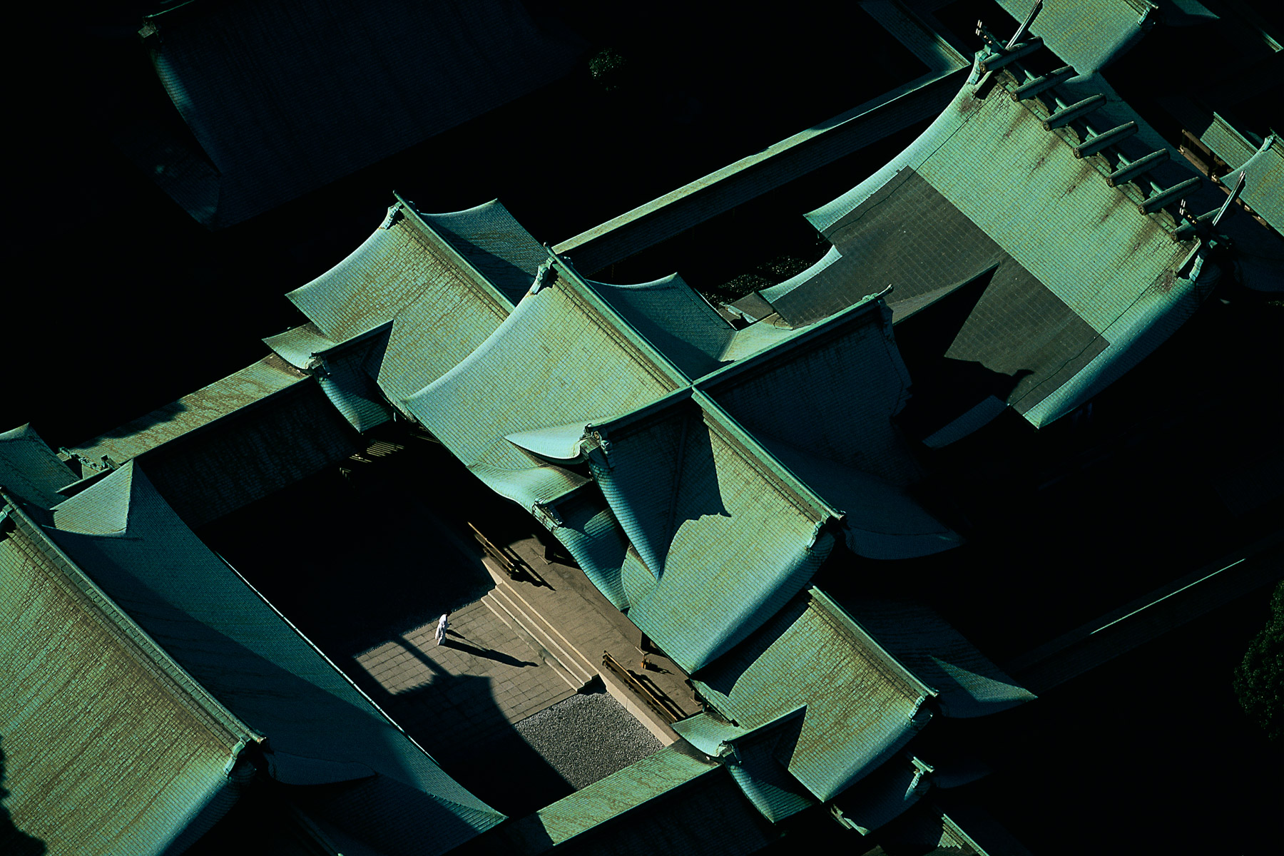
Detail of Himeji Castle, west of Osaka, Honshu, Japan (34°49' N, 134°42' E).
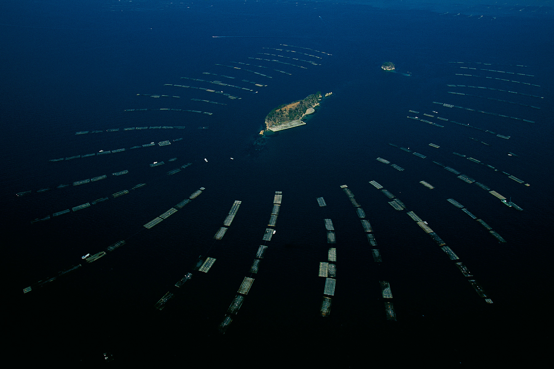
Fishermen’s island in Hiroshima Bay, Honshu, Japan (34°18’N, 132°24’E).
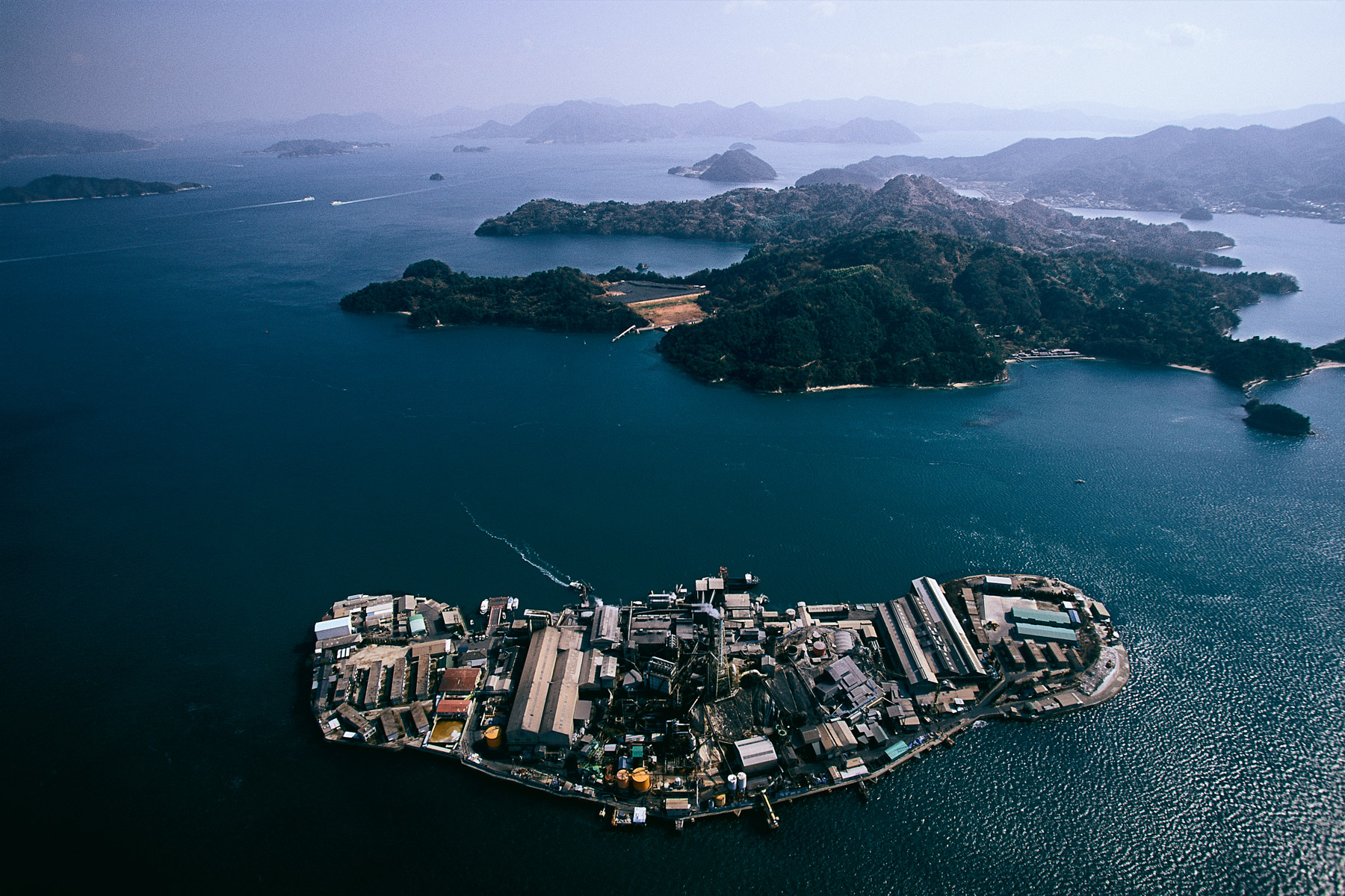
Factory on an island east of Hiroshima, Honshu, Japan (34°18’N, 132°54’E).
Meiji Jingu Shinto Shrine, Tokyo, Honshu, Japan (35°41’ N – 139°42’ E).
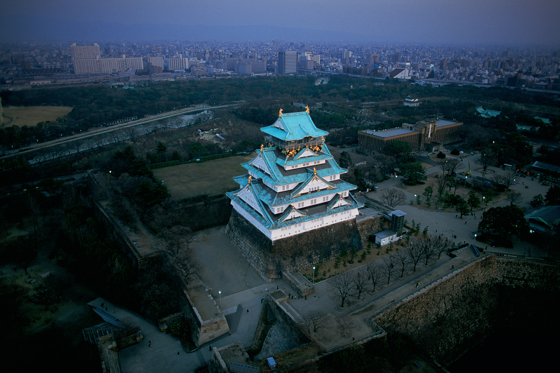
Osaka Palace, Honshu, Japan (34°41' N, 135°31' E). The south coast of the island of
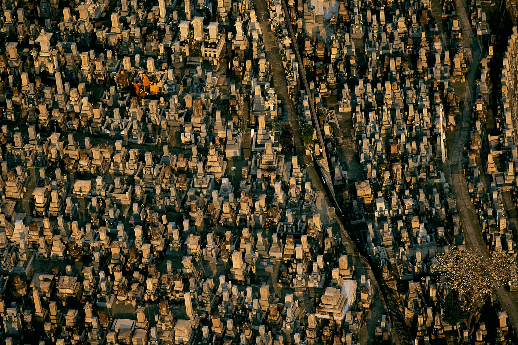
Cemetery in Kyoto, Honshu, Japan (34°59' N, 135°47' E).
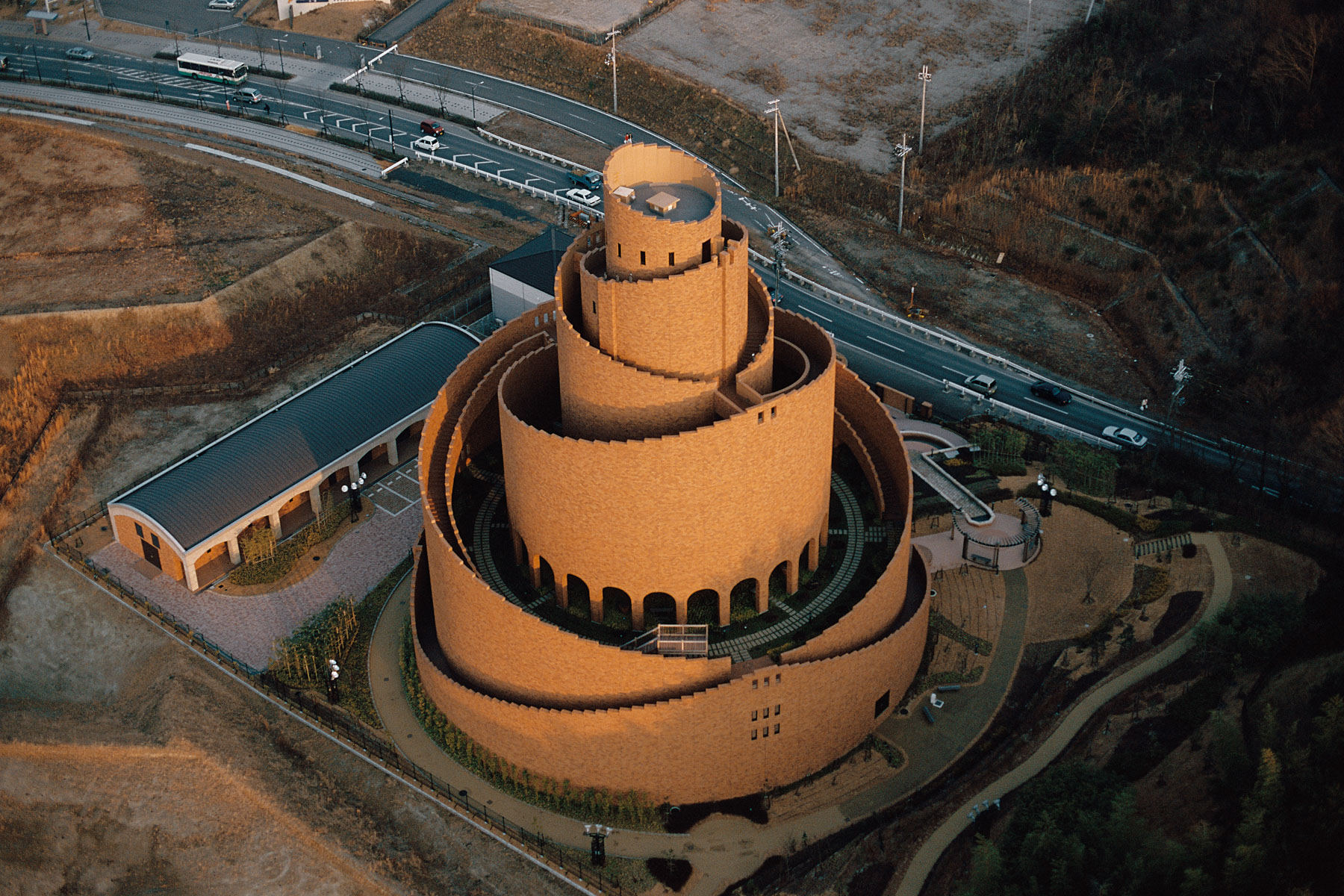
Kizuminami water tower, south of Kyoto, Honshu, Japan (34°41' N, 135°47' E).
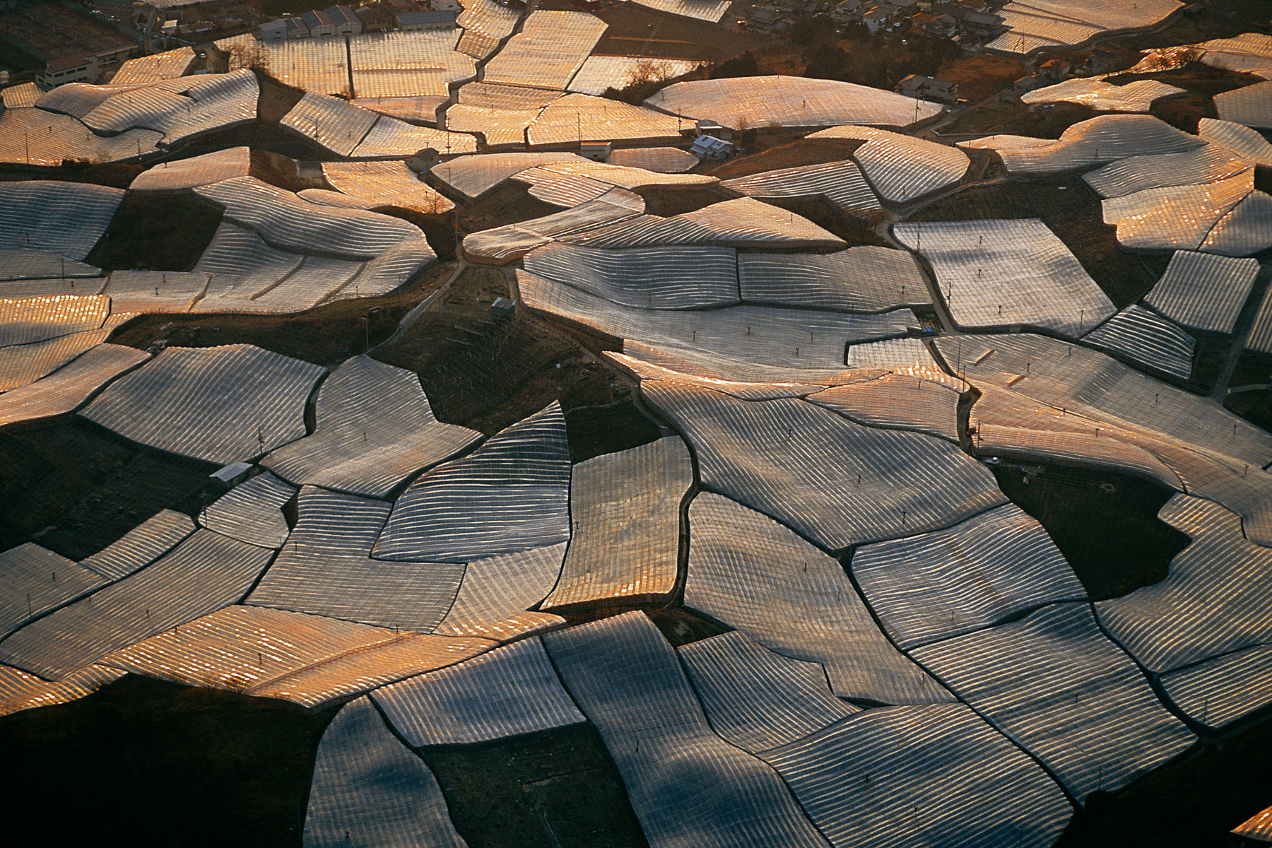
Greenhouses between Nara and Osaka, Honshu, Japan (34°37’N, 135°41’E).
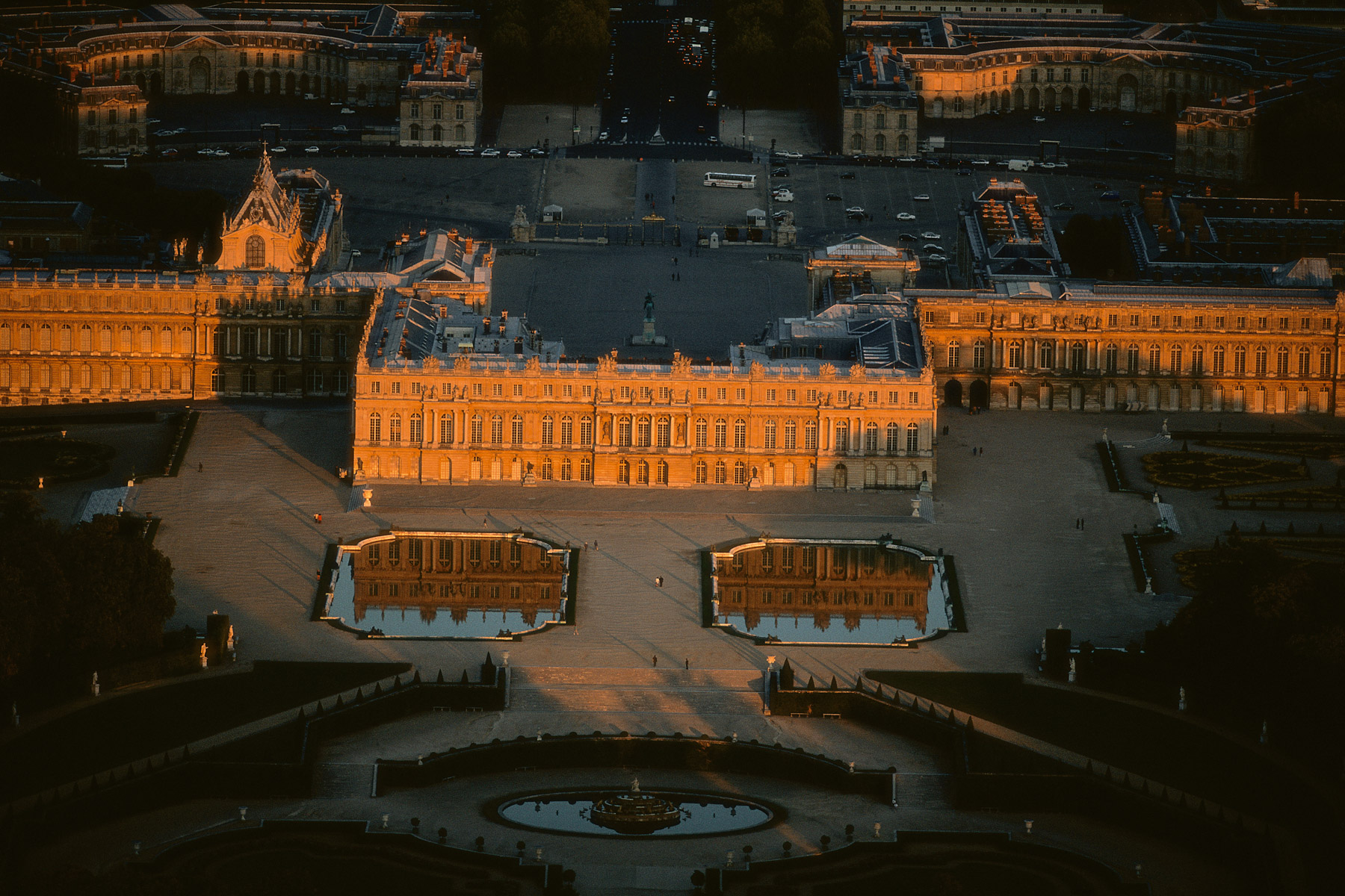
VERSAILLES CHÂTEAU AT SUNSET,Yvelines, France (48°48'N, 2°07'E).
Lagoon on the island of Djerba, Governorate of Médenine, Tunisia (33°42’N, 10°59’E).
Slash-and-burn farming near the artificial reservoir of Guri, Bolivar state, Venezuela (7°30' N - 62°50' W).

Coral reef near Nosy Sainte-Marie, region of Toamasina, Madagascar (16°50' S – 49°47' E).
Waste from the Arlit uranium mine, Aïr Mountains, Niger (19°00' N – 7°38' E).
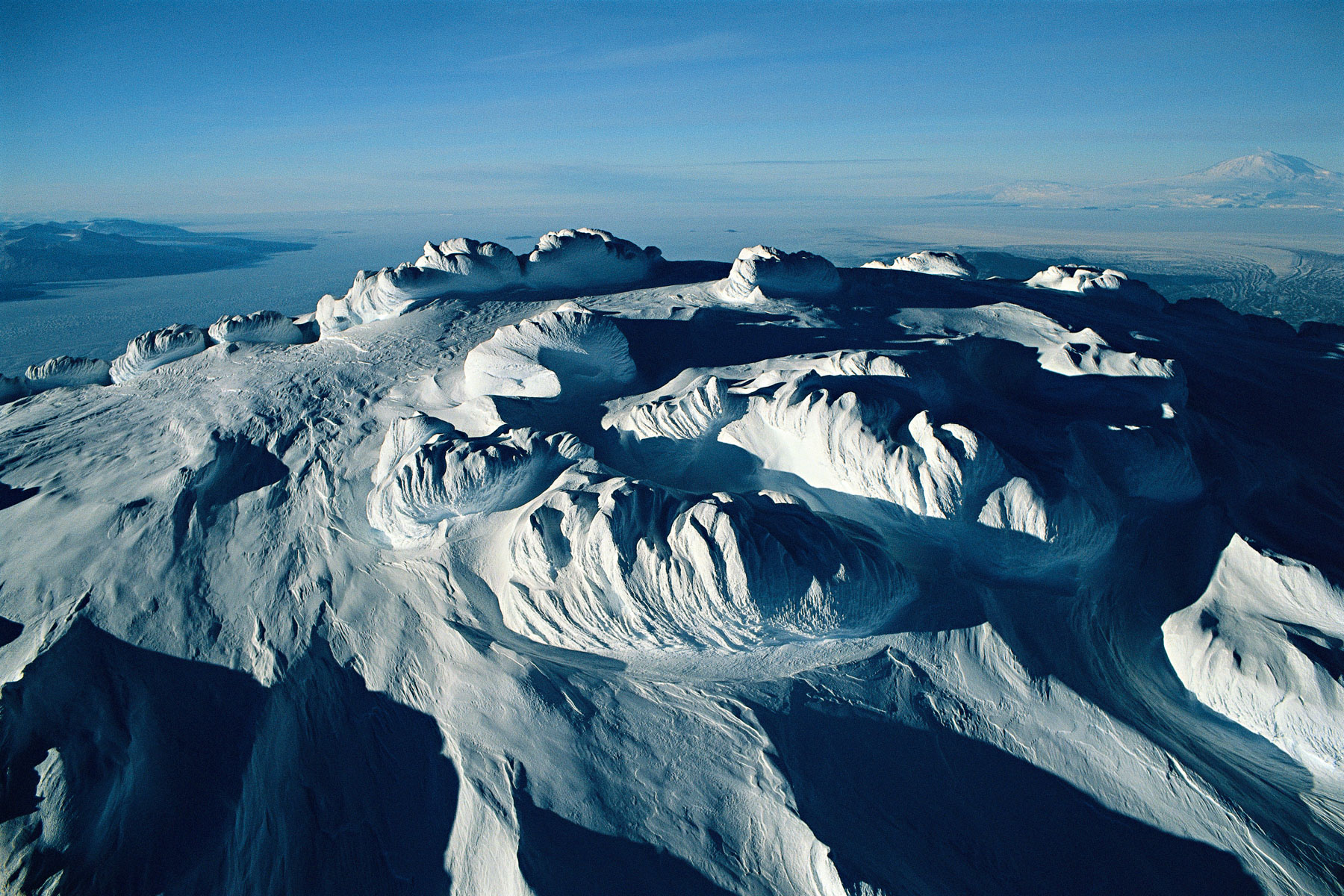
Snow-covered flanks of Kronotskaya volcano, Kamchatka, Russia (56°00' N – 160°00' E).
Pink flamingoes on the Banc d’Arguin, Near Nouâdhibou, Mauritania (20° 55’N, 17° 03’W).
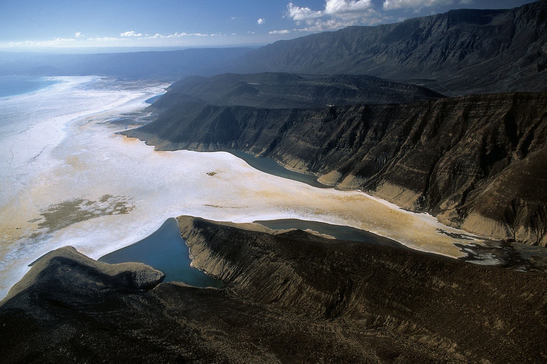
Lake Assal, Djibouti (11°42’N, 42°20’E).
Flock of sheep, Tierra del Fuego, Argentina (54°14’ S, 68°04’ W).
Sandwich Harbor, Swakopmund region, Namibia (23°22' S, 14°03' E).
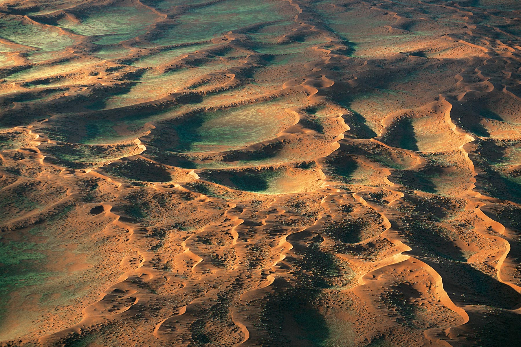
Beginning of the Namib desert, west of Gamsberg, region of Windhoek, Namibia (22°35' S, 17°02' E).
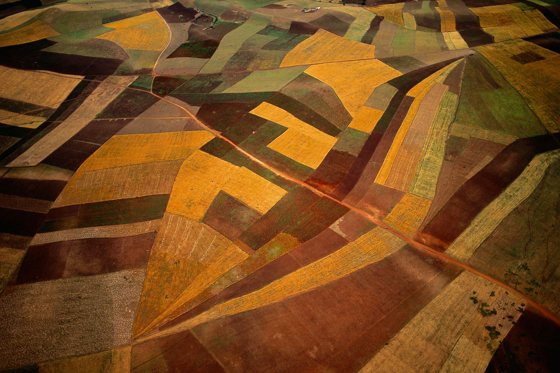
FIELDS NEAR THE TOWN OF HAMMAMET, NABEUL GOVERNORATE, TUNISIA (36°24' N, 10°37' E).
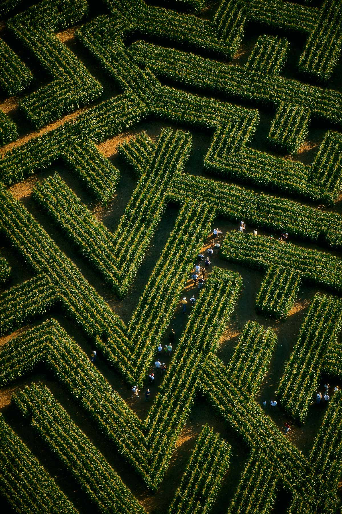
The largest plant maze in the world, at Reignac-sur-Indre, Indre-et-Loire Department, France (47°13'N, 0°54'E).
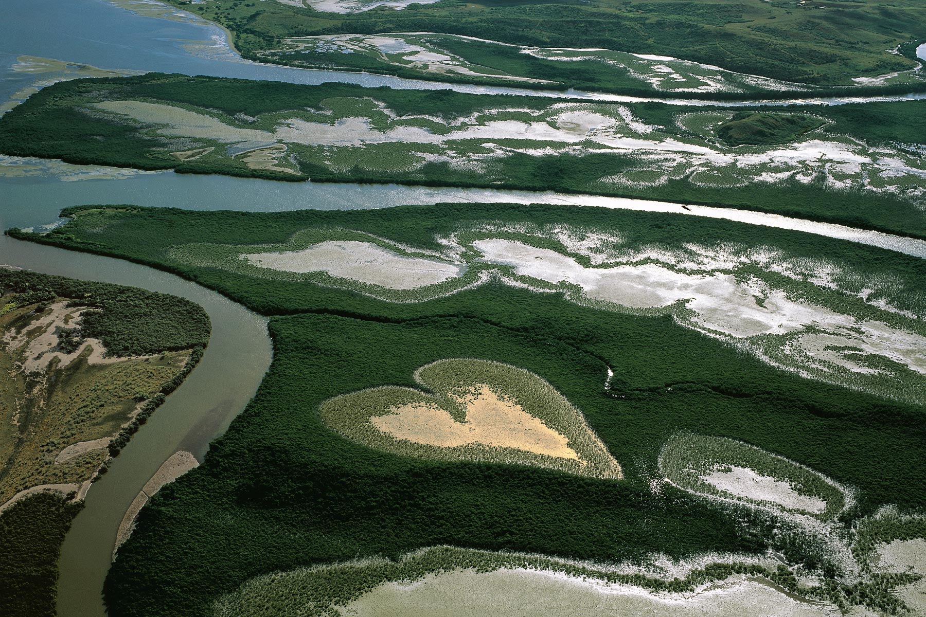
The Heart of Voh in 1990, New Caledonia, France (20°56' S – 164°39' E).
The dried-up Lake Amboseli, Masai cows, Masai Mara Reserve, Kenya (2°37'S - 37°08'E).
Suguta Valley, Turkana, South of Lake Logipi, Kenya (2°25’ N, 36°42’ E).
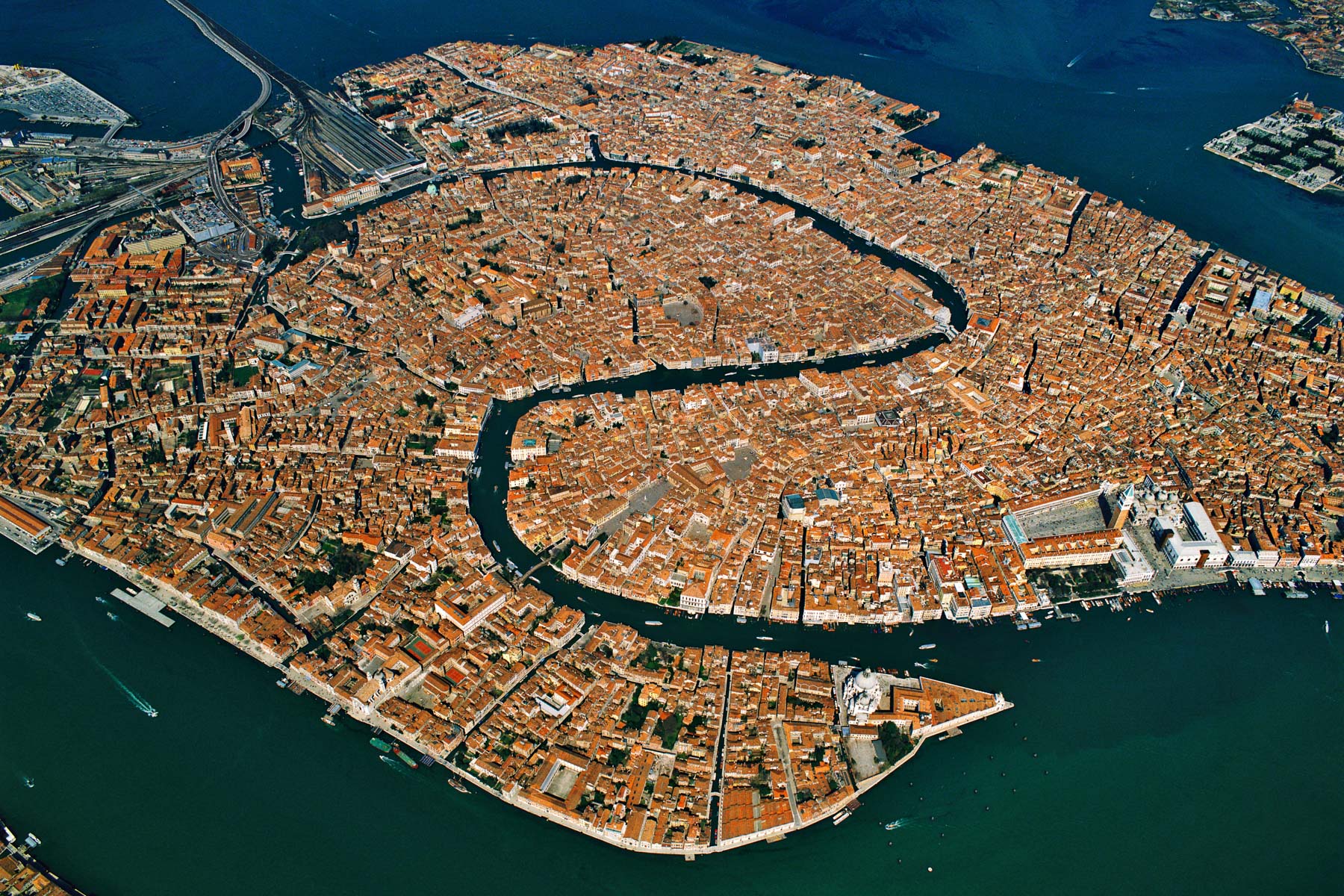
General view of Venice, Veneto, Italy (45°25' N – 12°21' E).
Modern graves in a cemetery at Asyut, Nile valley, Egypt (27°10' N - 31°10' E).
Village in the Rheris Valley, Er Rachidia region, High Atlas Mountains, Morocco (31°28'N, 4°13'W).
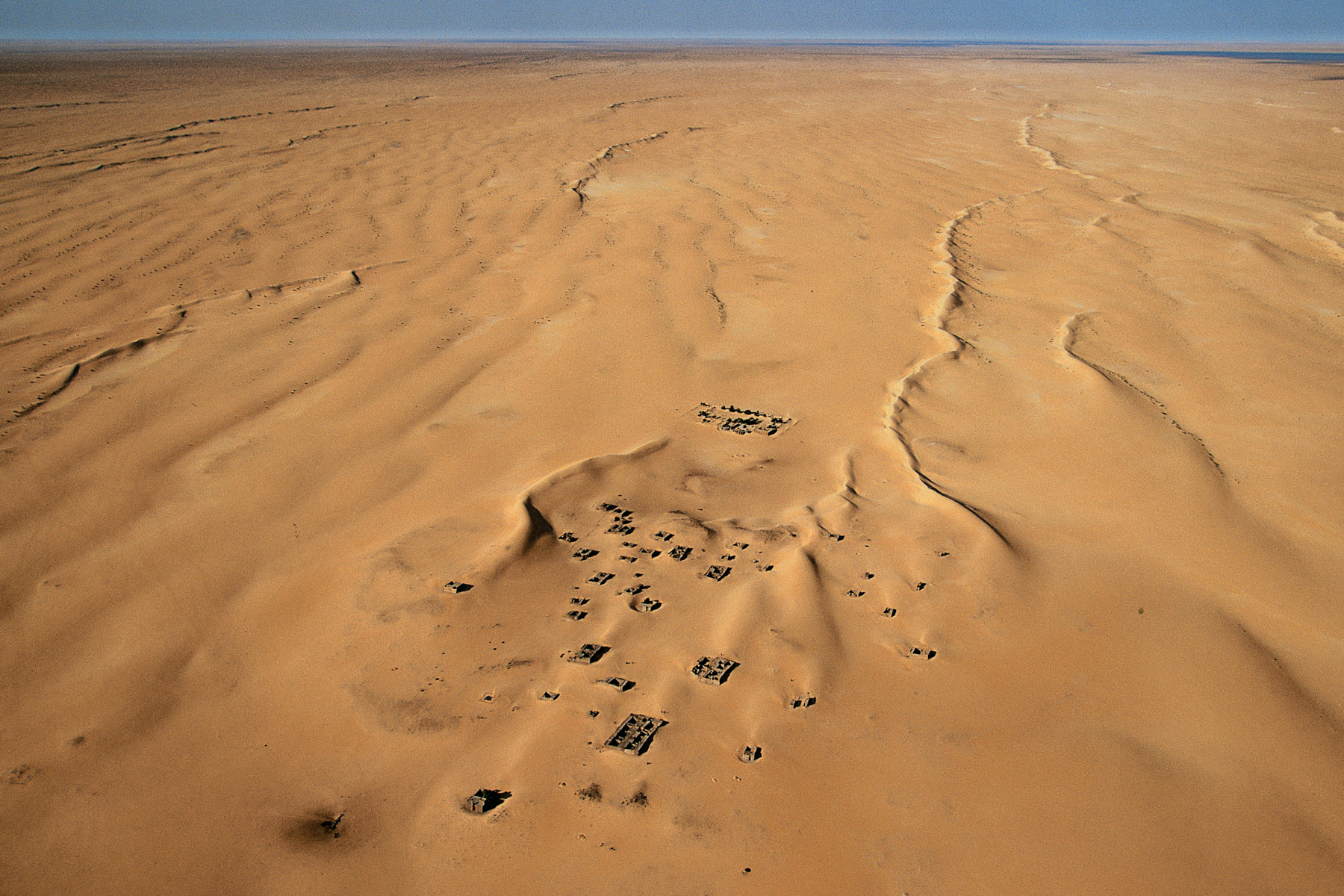
Village of Araouane, north of Timbuktu, Mali (18°54' N, 3°31' W).
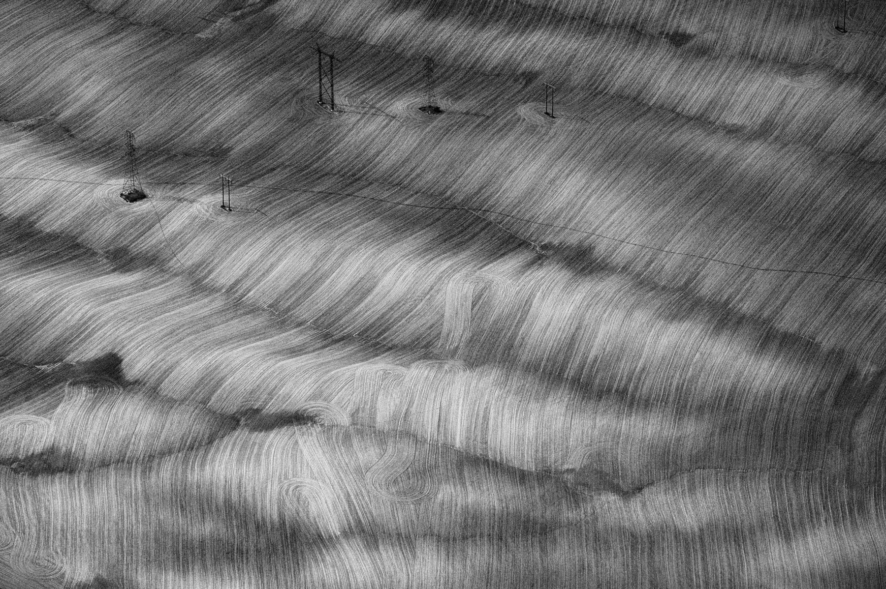
Power lines in the middle of a field near Idaho Falls, Idaho, United States (43°30' N – 112°06' W).
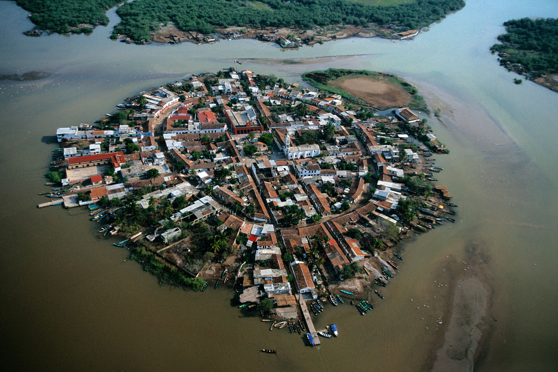
Mexcaltitán, Nayarit State, Mexico (21°54' N – 105°28' W).
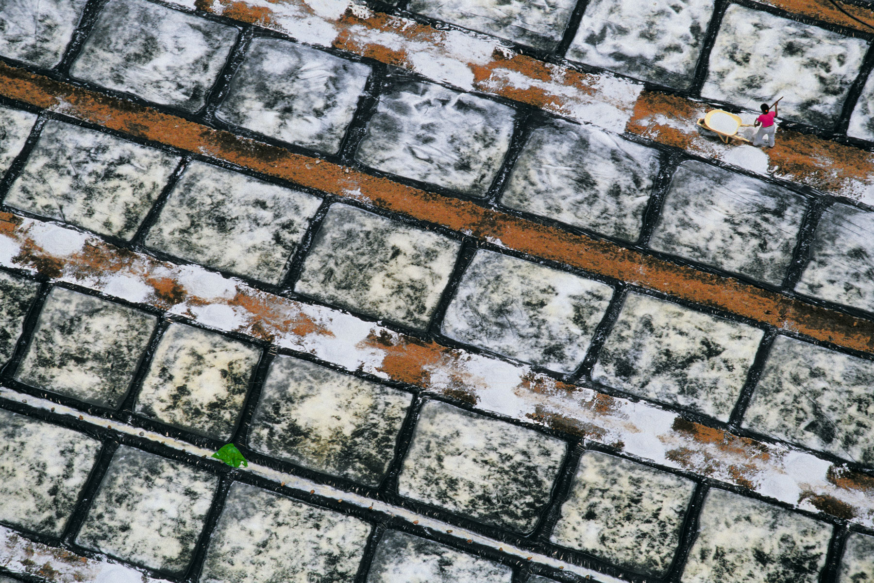
Salt drying on the coast of Quemaro, Jalisco, Mexico (19°58' N, 105°26' W).
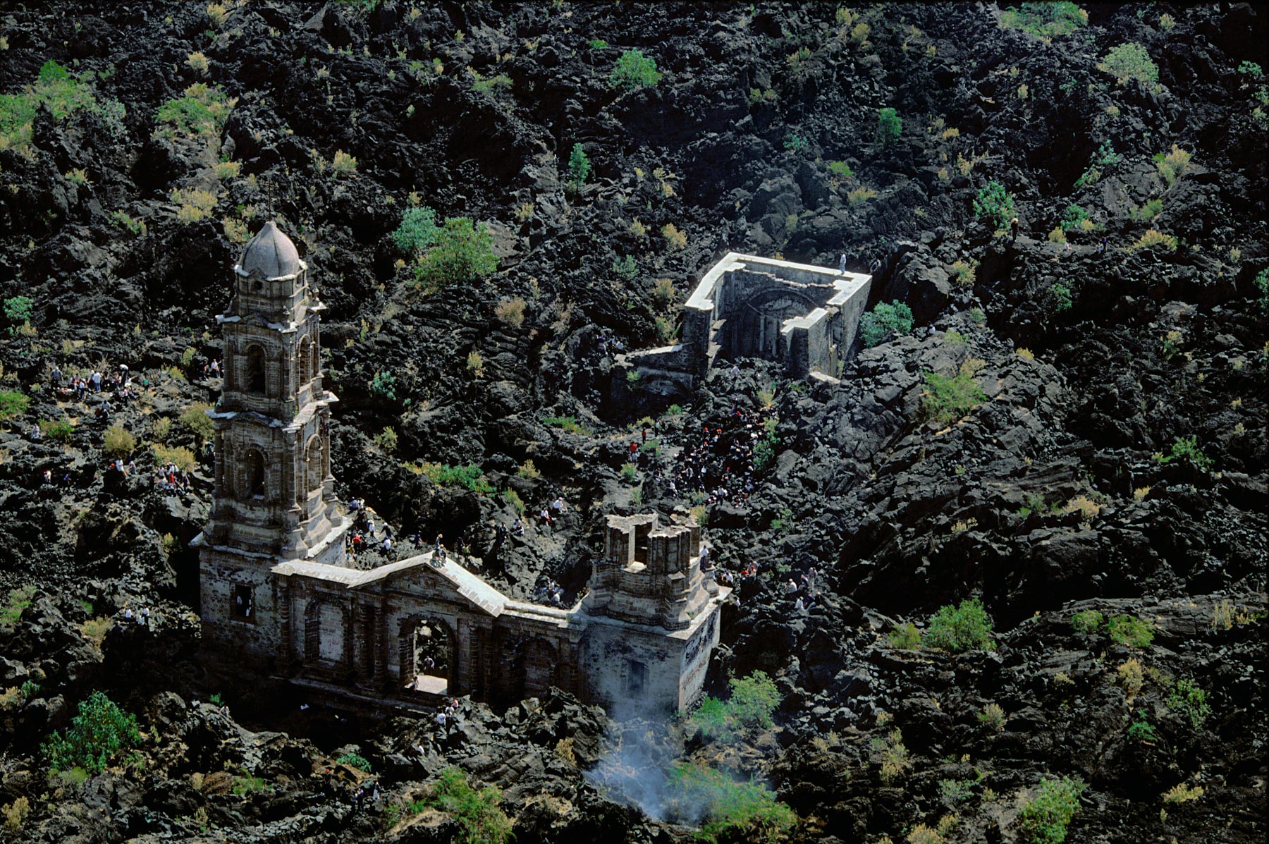
Church at the foot of the Paricutín volcano, San Juan Parangaricutiro, Michoacán, Mexico (19º32’ N – 102º14’ W).
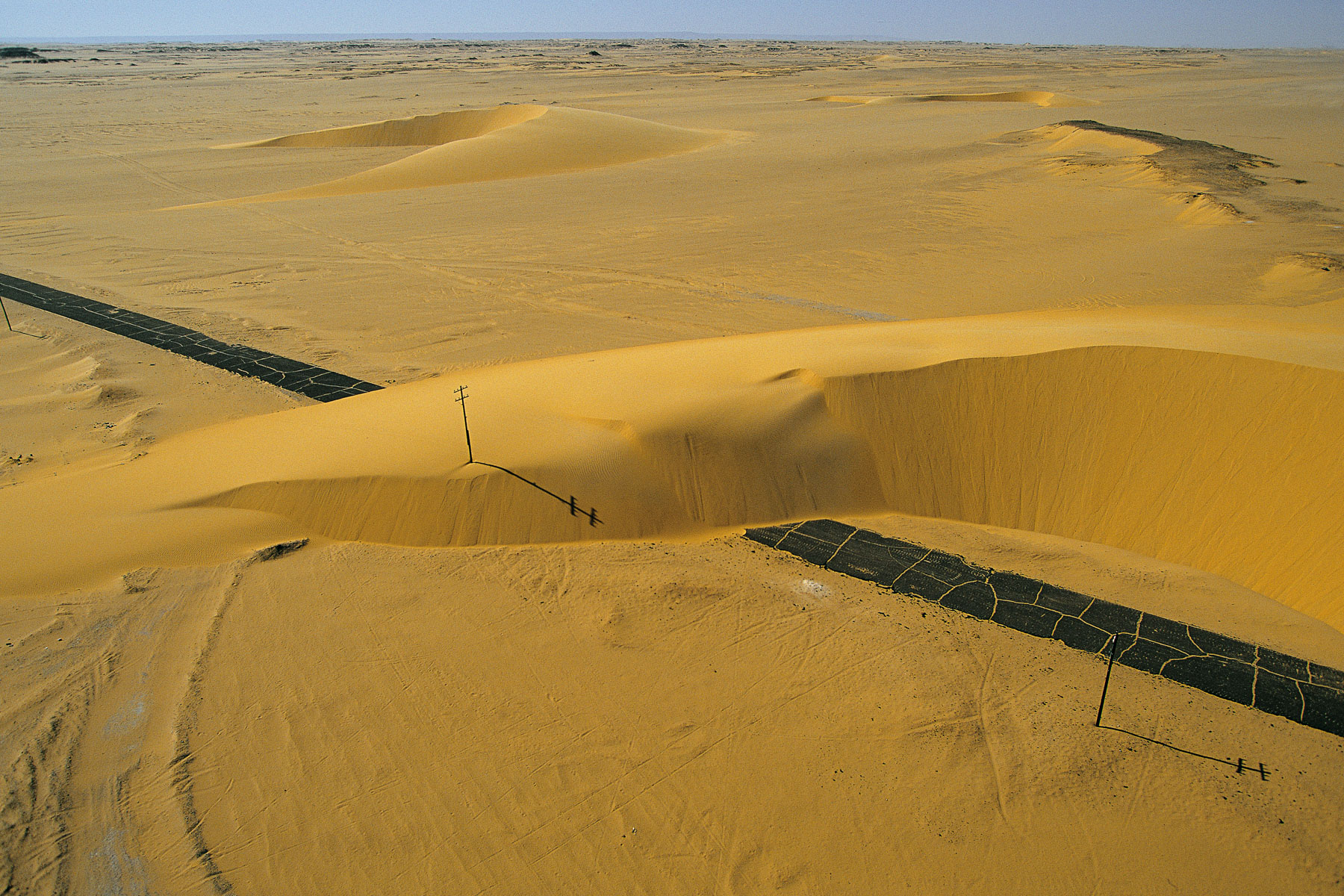
Road interrupted by a sand dune, Nile Valley, Egypt (25°22’ N, 30°23’ E).
HYDRAULIC DRILLING STATION IN A VILLAGE NEAR DOROPO, IVORY COAST (9°47' N, 3°19' W).
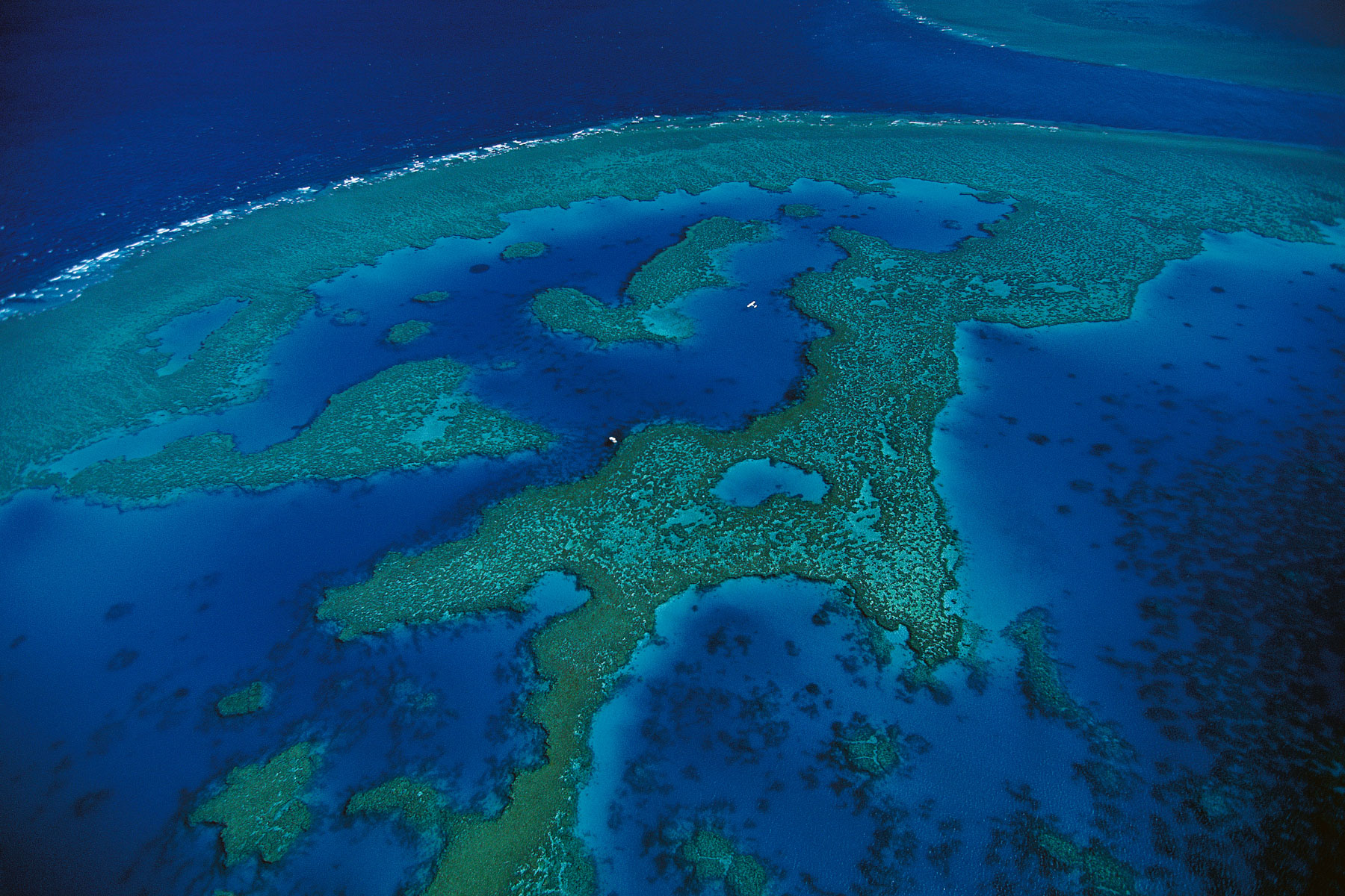
Barrier reef, Queensland, Australia (16°55' S - 146°03' E).
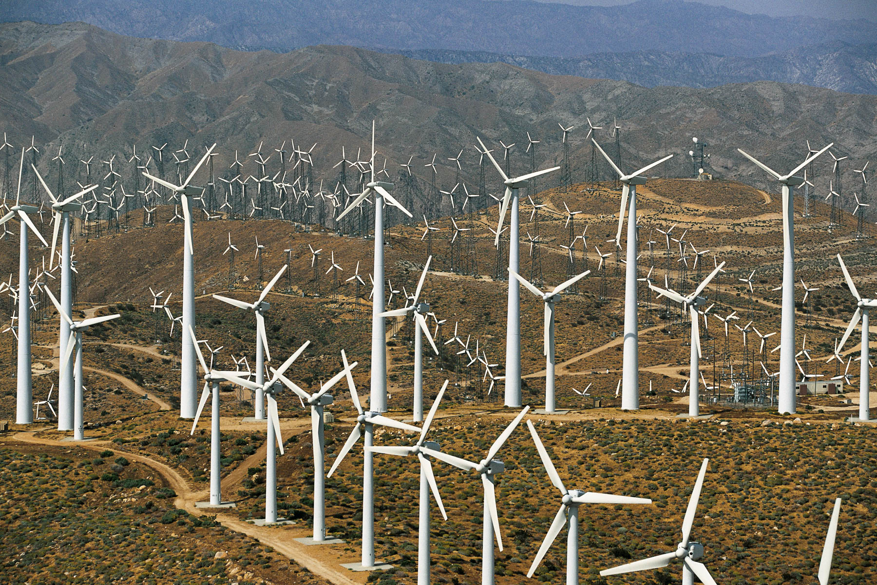
Wind turbines OF BANNING PASS, near Palm Springs, California, United States (33°55' N, 116°42' W).
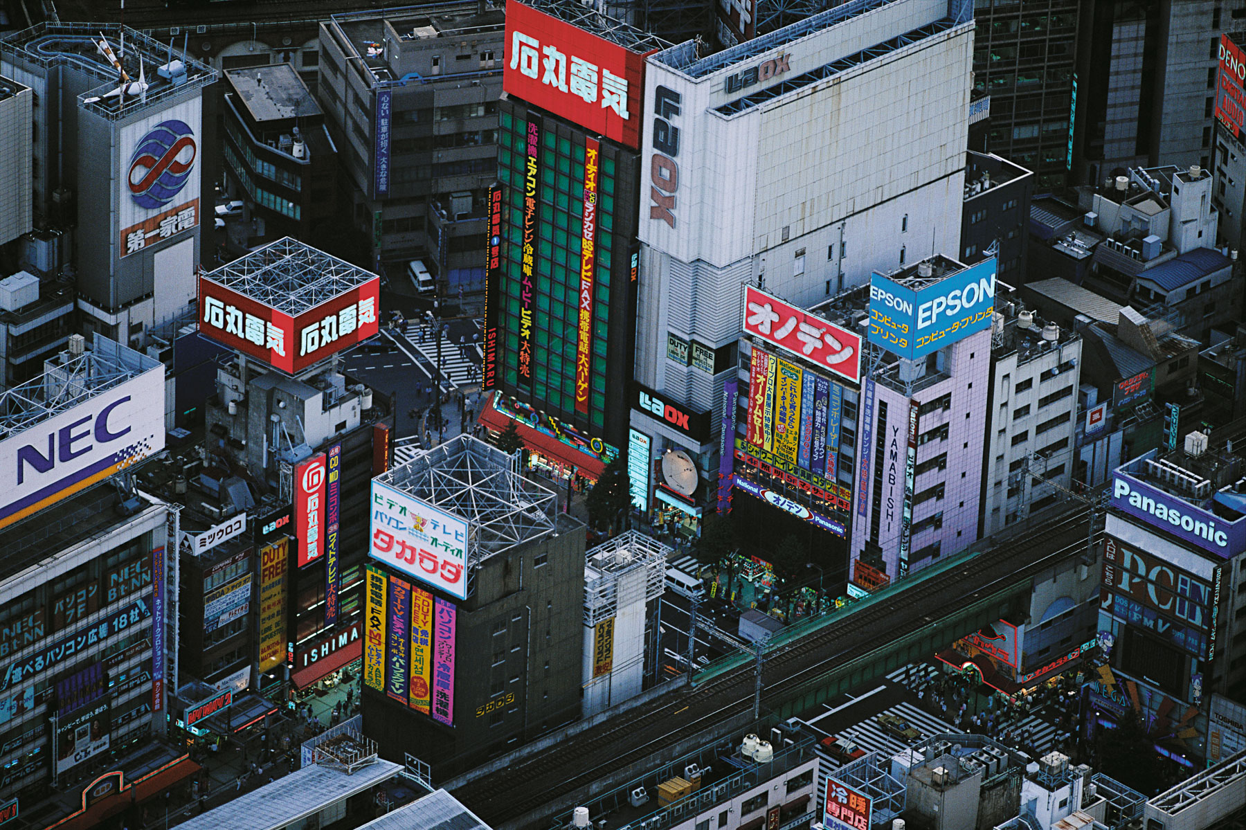
Quartier commerçant à Tokyo, Honshu, Japon (35°42' N - 139°46' E).
Islet near Heimaey, Vestmannaeyjar Archipelago, Iceland (63°26' N, 20°17' W).
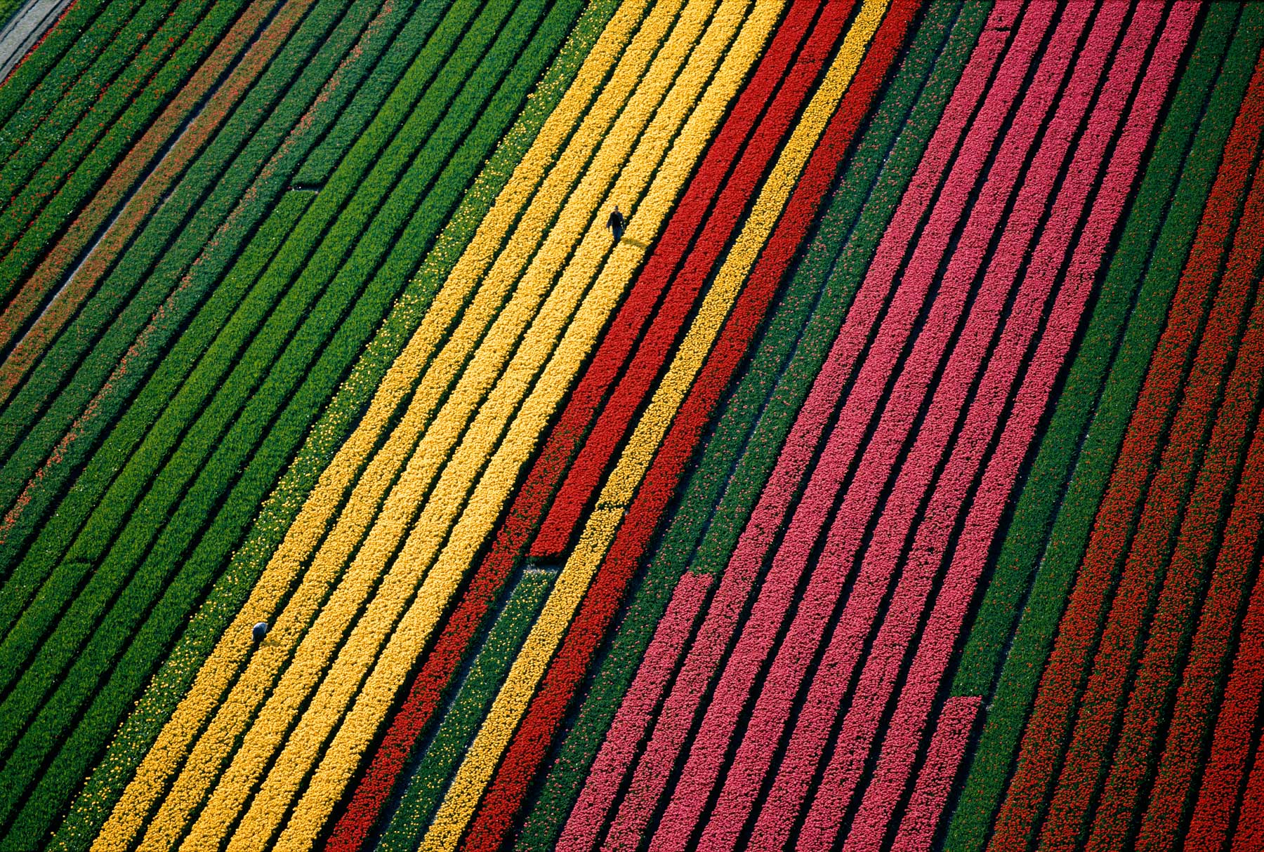
Fields of tulips near Lisse, near Amsterdam, Netherlands (52°05' N - 4°42' E).
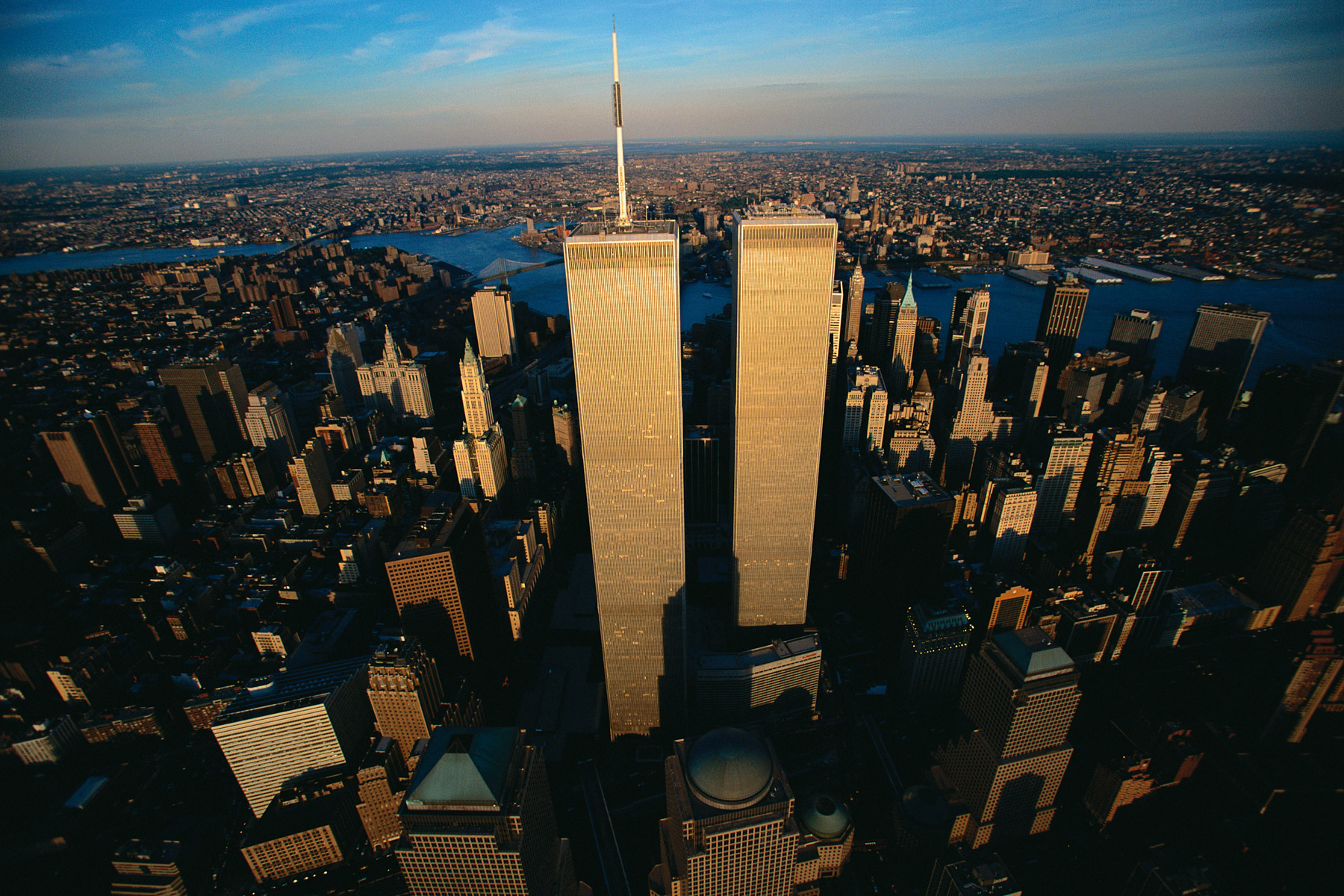
The World Trade Center, New York, United States (40° 42 N ,74° 00’W).

La "love parde" et la colonne de la Victoire - Parc de Tiergarten - Berlin - Allemagne
Market near the neighborhood of Xochimilco, Mexico City, Mexico (19°27' N – 99°16' W).

METEORA MONASTERY, Thessaly, Greece (39°46'N - 21°36'E).
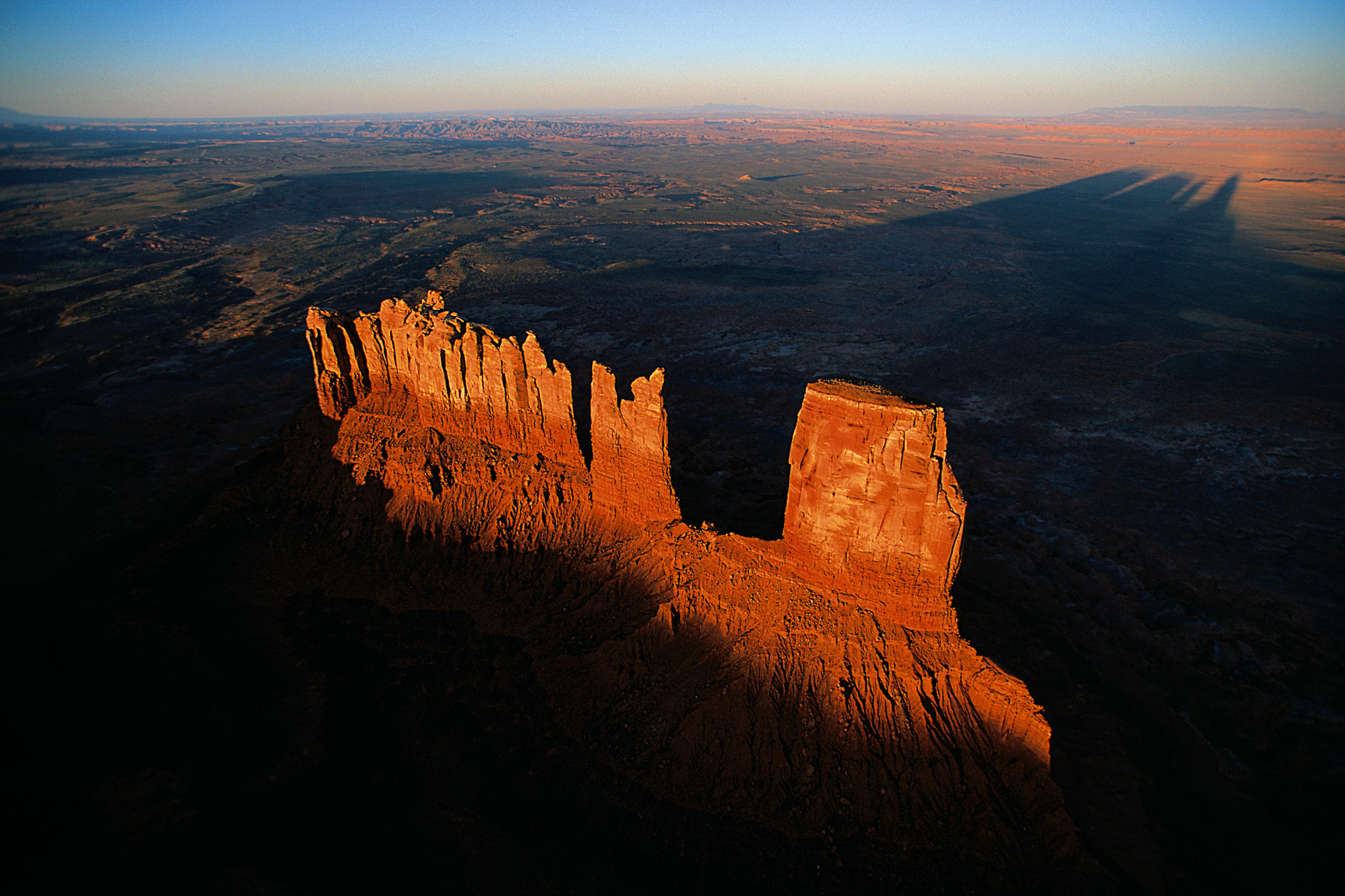
Monument Valley Park, West Mitten Butte, East Mitten Butte et Merrick Butte, United States (37°05’ N - 110°20’ W).
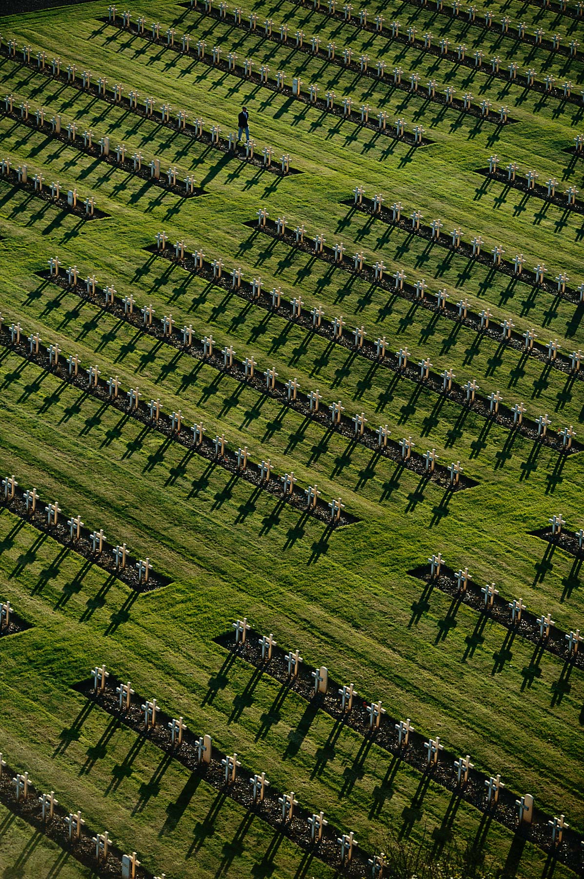
NATIONAL MILITARY CEMETERY OF NOTRE DAME DE LORETTE, NEAR ABLAIN-SAINT-NAZAIRE, PAS-DE-CALAIS, FRANCE (50°23' N, 2°42' E).
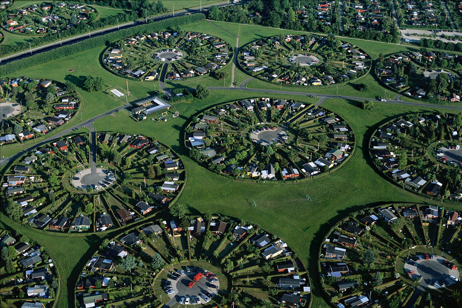
Housing plots at Brøndby, on the outskirts of Copenhagen, Seeland, Denmark (55°38' N, 12°24' E).
Agricultural landscape between Ankara and Hattusha, Anatolia, Turkey (40°00' N – 33°35' E).
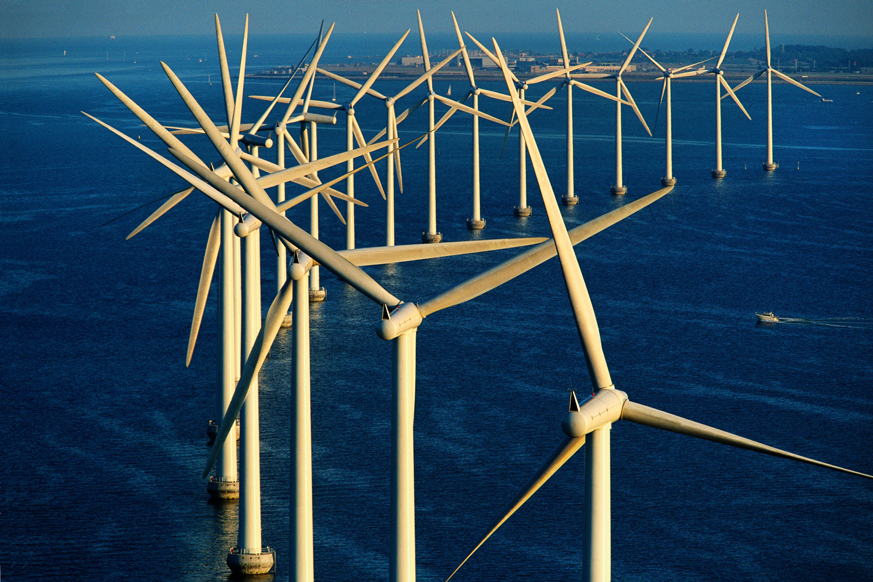
Middelgrunden offshore wind farm, off the coast of Copenhagen, Denmark (55°41' N - 12°40' E).
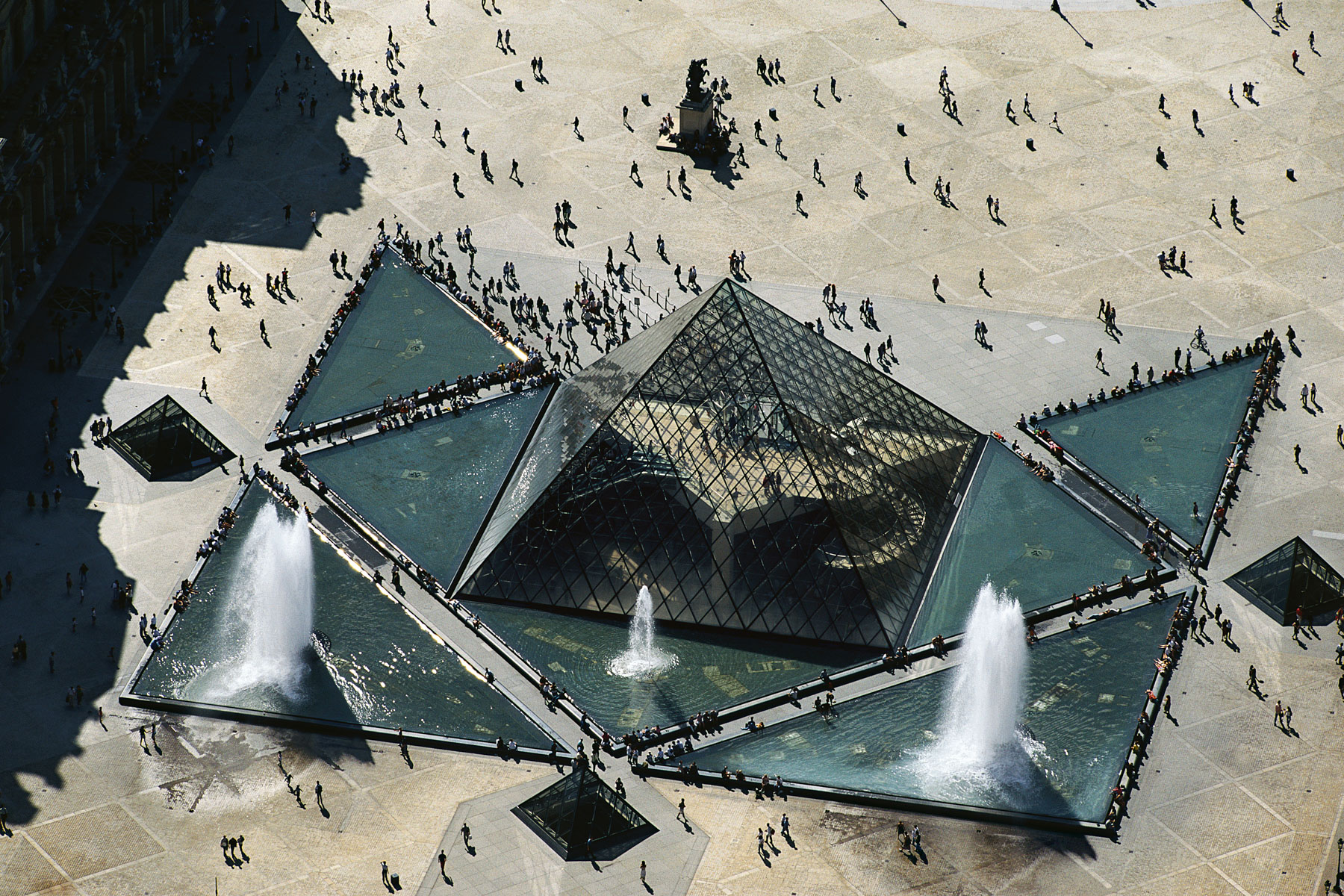
The Louvre Pyramid, Paris, France (48°52’ N - 2°20’E).
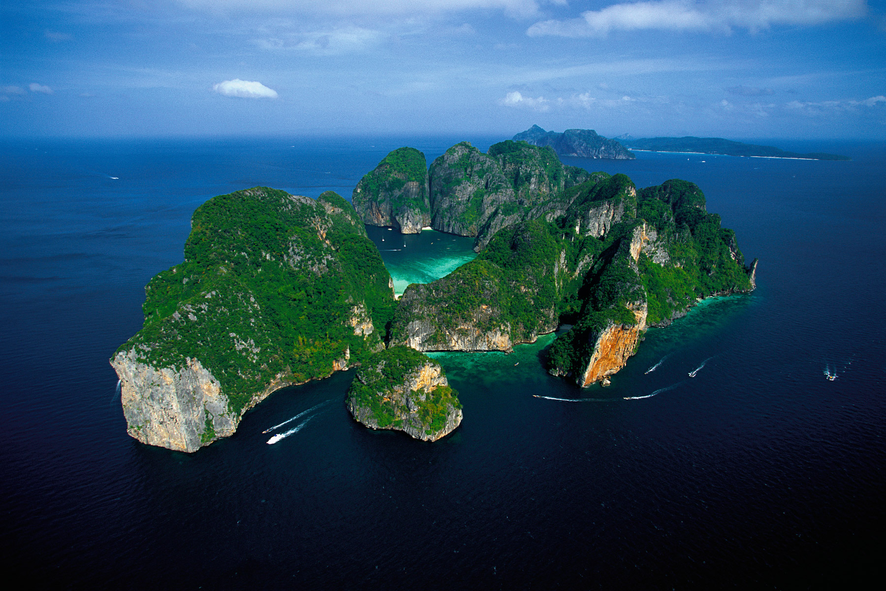
Phi Phi Le, near Phuket island, Thailand (7°42' N, 98°46' E).
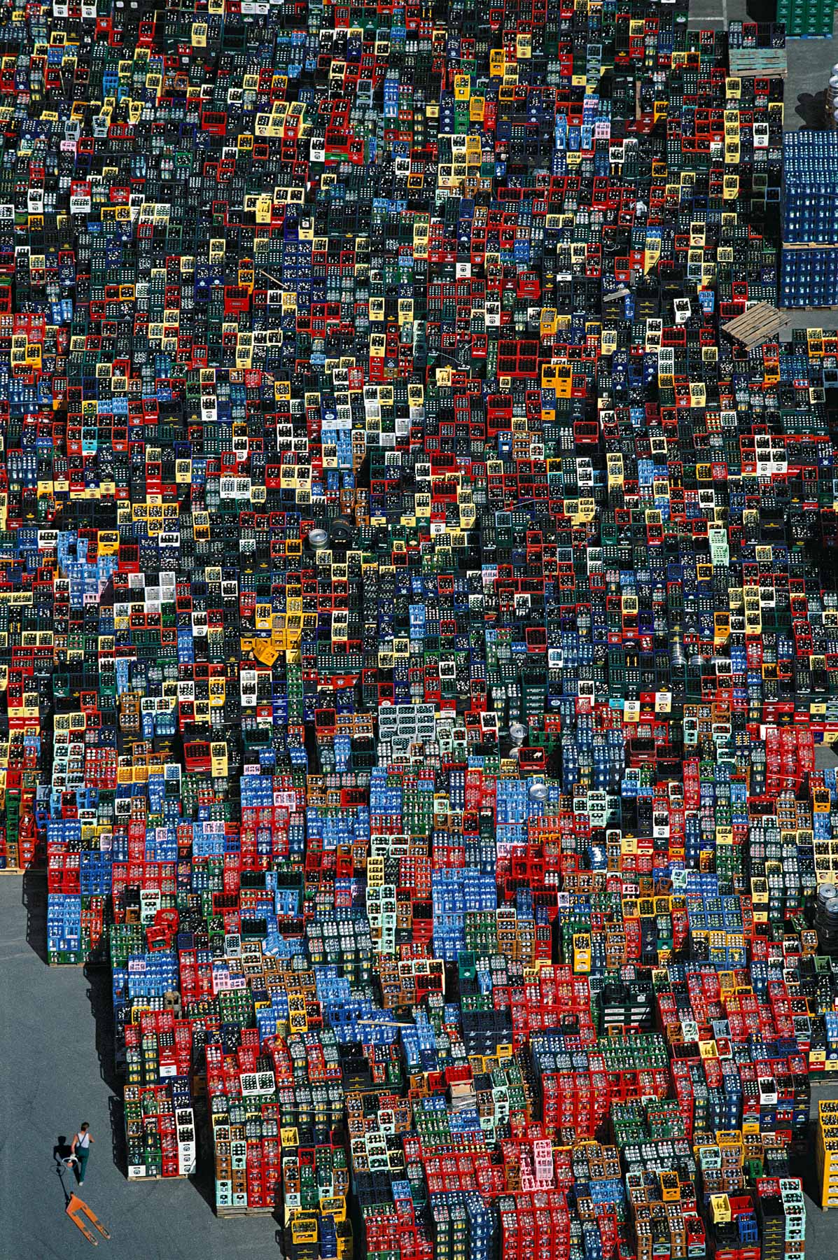
Bottle racks near Braunschweig, Germany (52°19' N – 10°31' E).
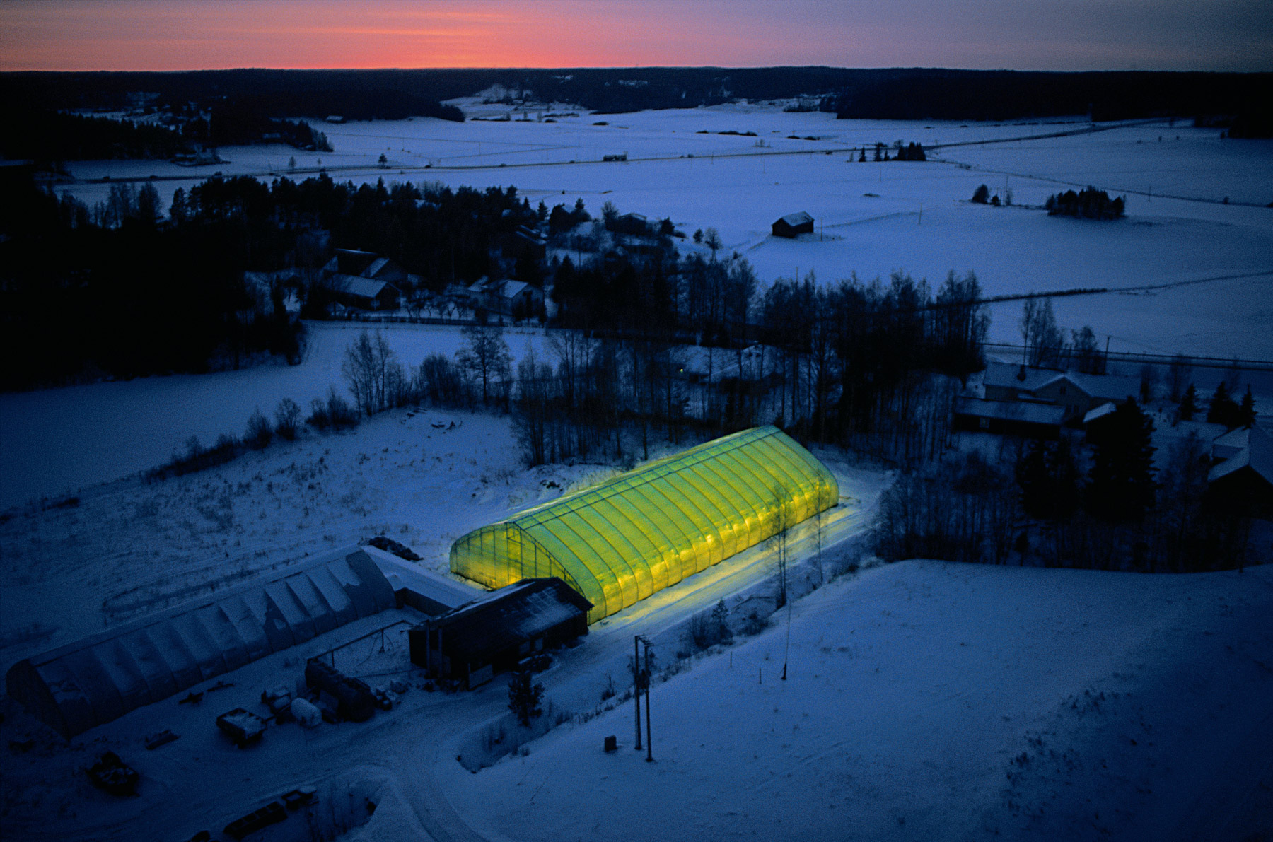
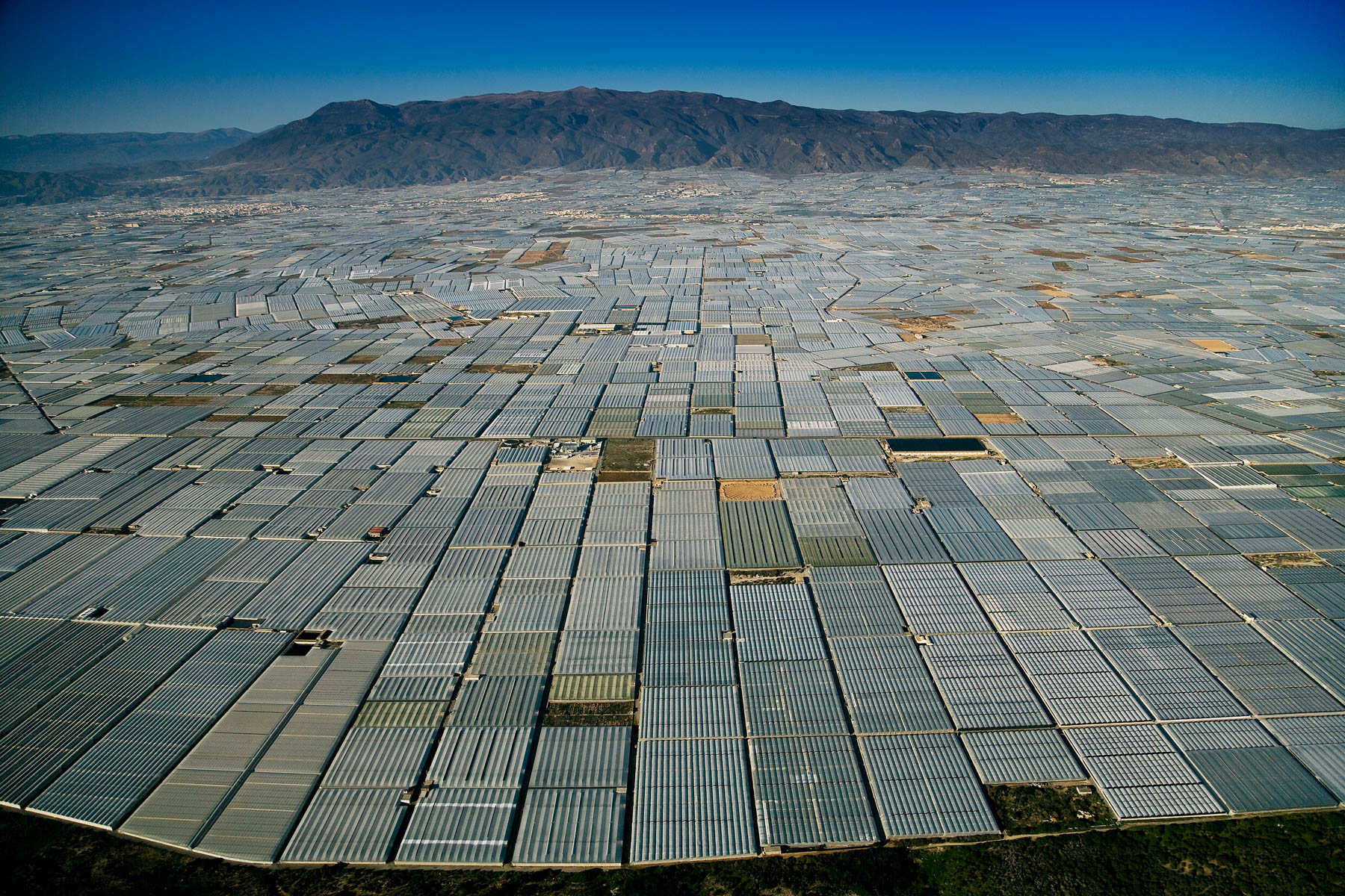
Floodlit greenhouse near Sauvo, Varsinais-Suomi region, Finland (60°18' N – 22°36' E).

Countryside outside of Siena, Tuscany, Italy (43°19' N – 11°19' E).
Agricultural landscape between Ankara and Hattusha, Anatolia, Turkey (40°00' N – 33°35' E).
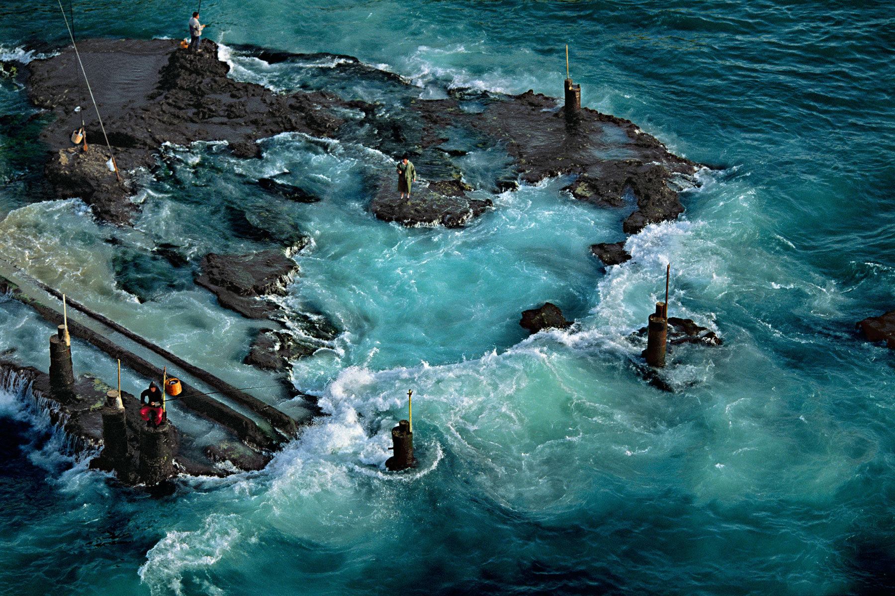
Fishermen on rocks, Ras Beirut, Beirut, Lebanon (33°53' N, 35°30' E).
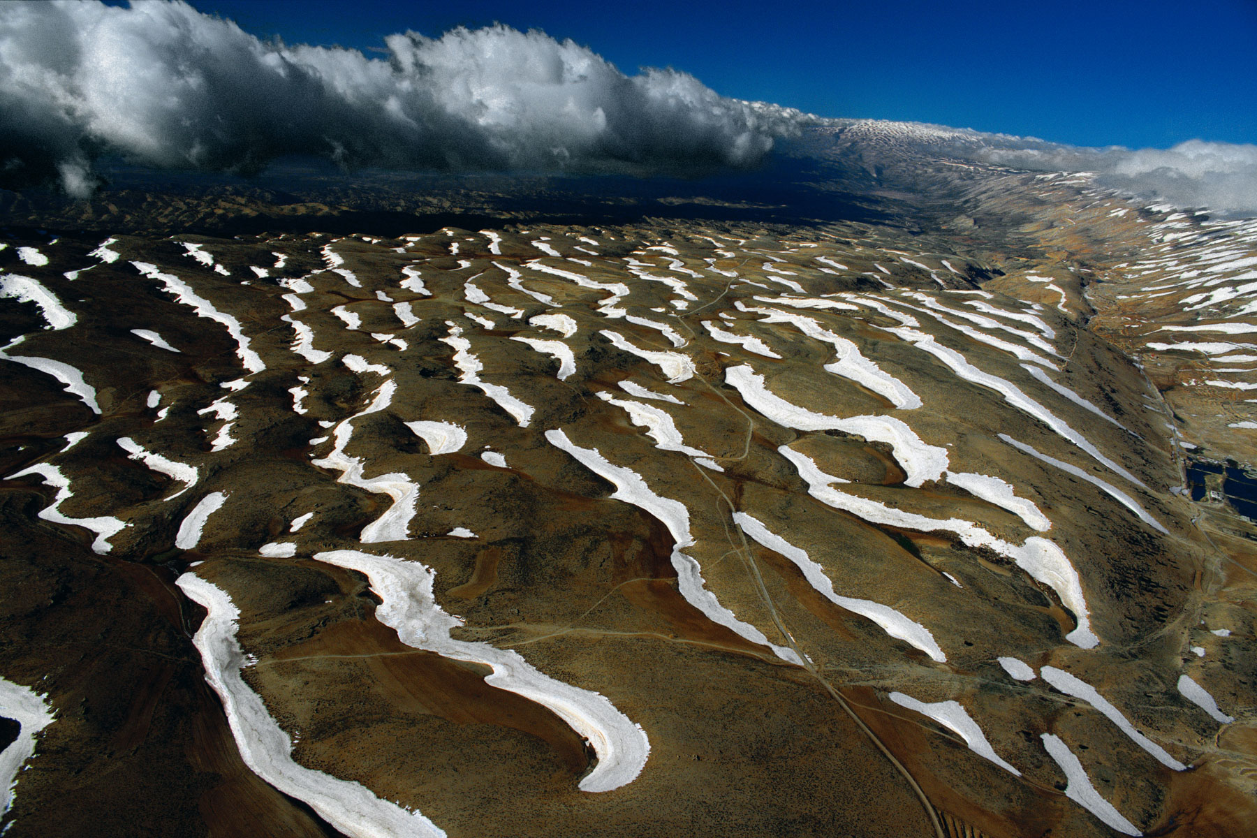
Snowdrifts on the Mount Lebanon range, Lebanon (34°09' N, 35°59' E).
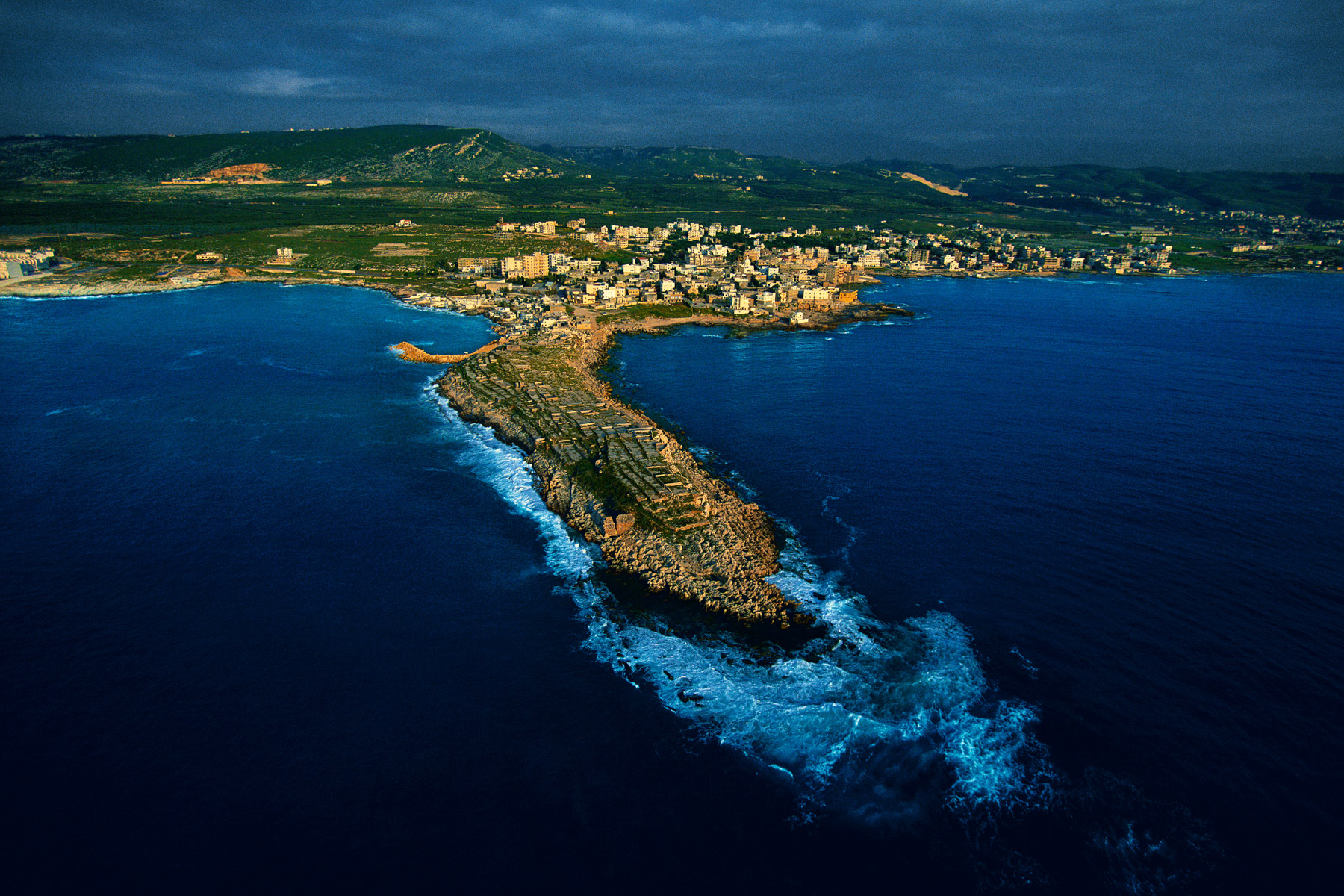
Citadel of Anfeh, El-Koura district, Lebanon (34°20' N, 35°41' E).
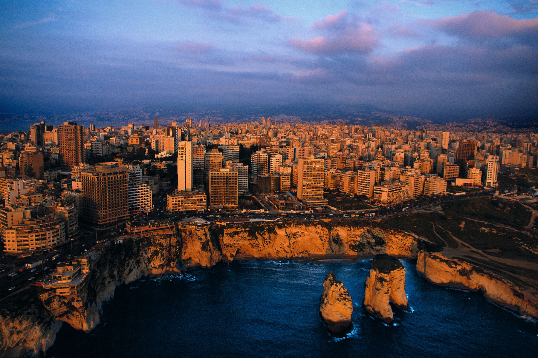
Vue de Beyrouth derrière la "Grotte aux Pigeons" (Raouché), Liban (33°53'N - 35°30'E).
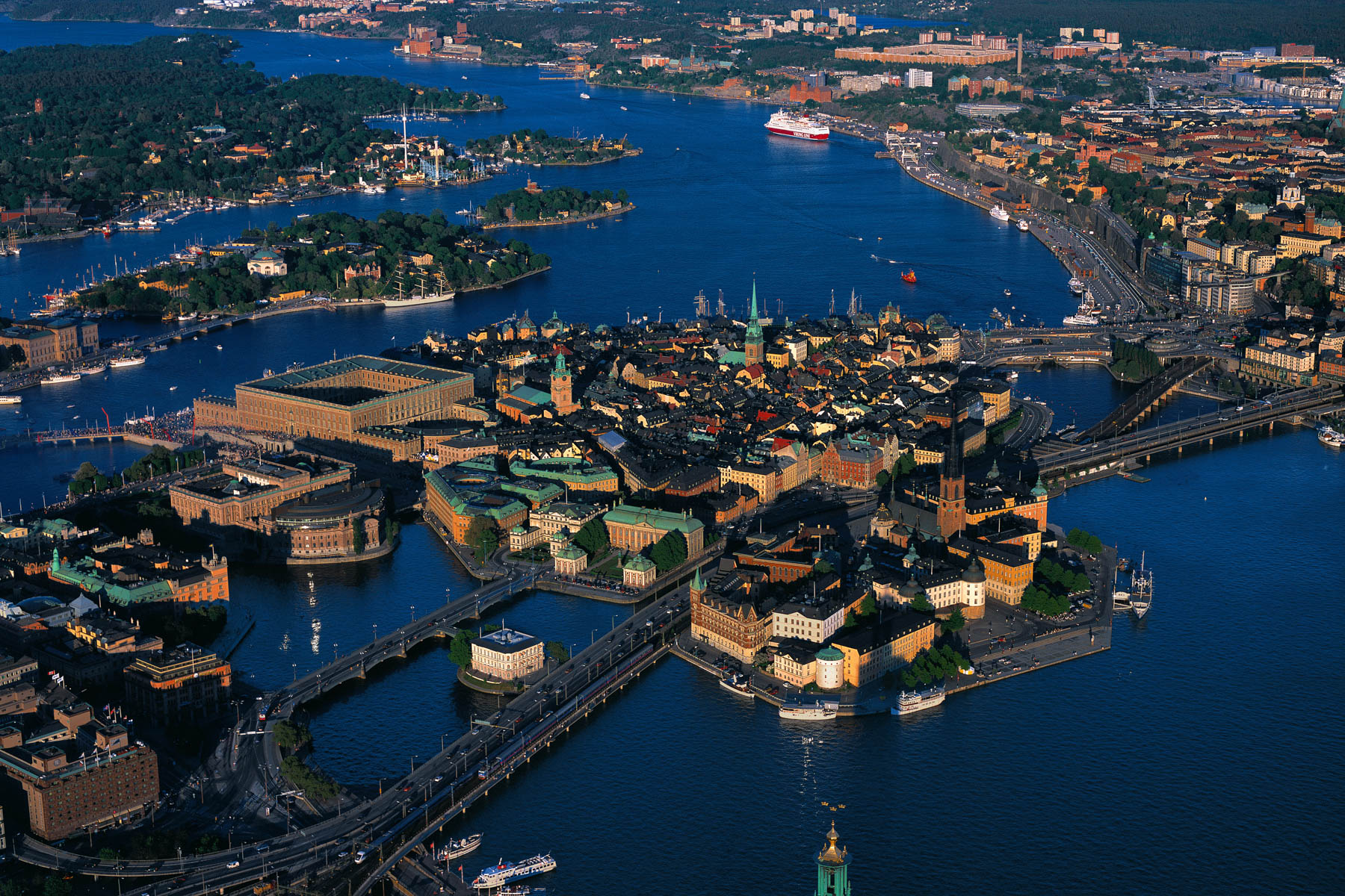
GAMLA STAN, STOCKHOLM, SWEDEN (59°20' N, 18°03' E).
Harvesting near Bøsnes, Tyrifjorden, Norway (60°04' N - 10°08' E)
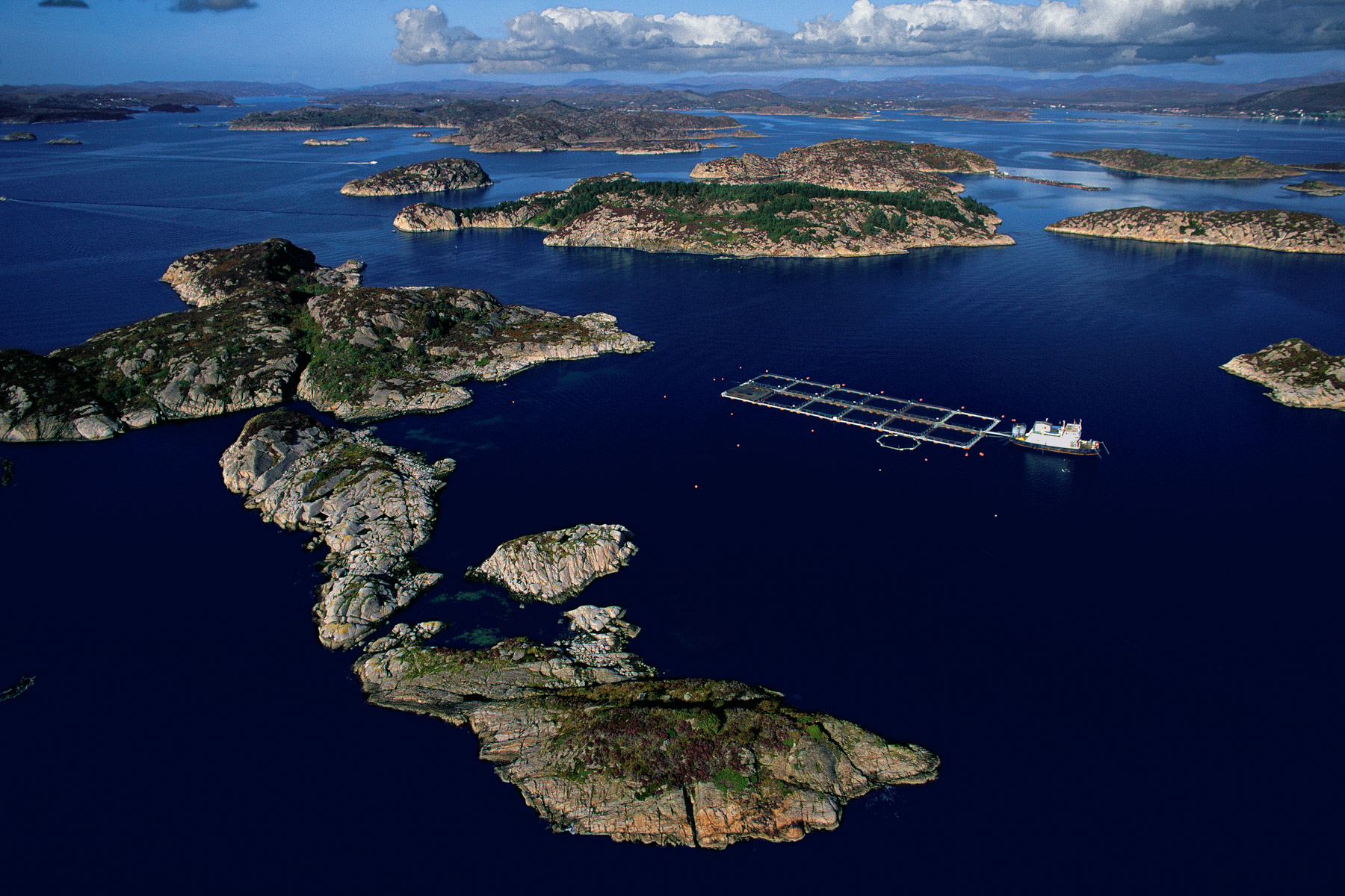
Fish farm, Boknafjorden, Norway (59°10' N, 5°35' E).
Catamaran in the Glénan archipelago, south coast of Finistère, France (47°43' N – 4°00' W)
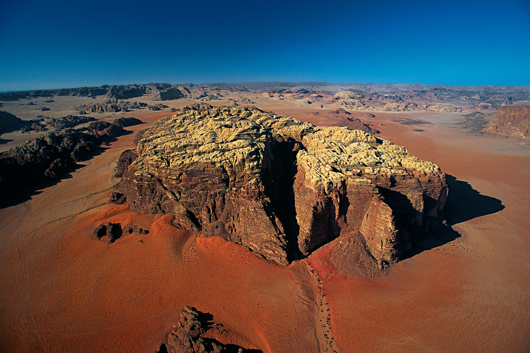
Mountainous landscape, Wadi Rum, Ma’an region, Jordan (29°31'N, 35°25'E).
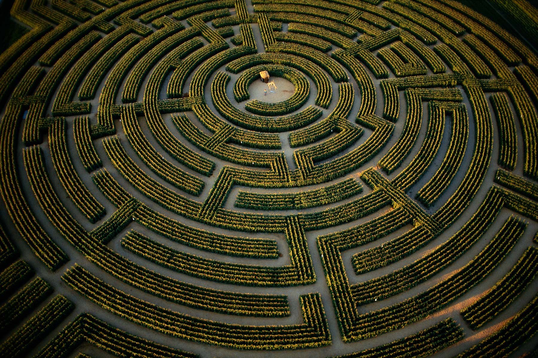
The largest plant maze in the world, at Reignac-sur-Indre, Indre-et-Loire Department, France (47°13'N - 0°54'E)
Boat on the Dead Sea near a potash plant, Al Karak region, Jordan (30°50' N, 35°30' E).
Wright Valley - suspended glaciers (Dry Valley) - Victoria Land - Antarctica (South Pole)
Glacier near Mount It-Tish, Ysys-Köl Region, Kyrgysztan (41°51' N – 78°23' E).
Birds flying over the lagoon near the mangroves of San Blas, Nayarit State, Mexico (21°60' N, 105°30' W).
Detail of the tarmac at the airfield in Gibraltar, Great Britain (36°09' N – 5°21' W).
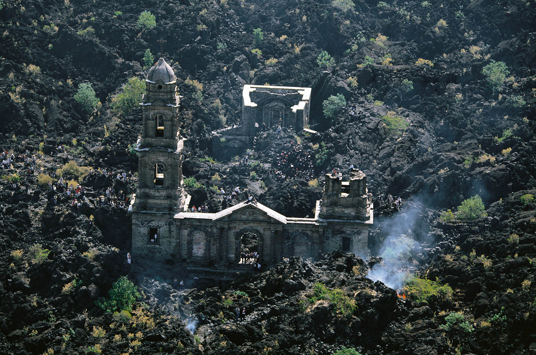
Church at the foot of the Paricutín volcano, San Juan Parangaricutiro, Michoacán, Mexico (19°32' N, 102°15' W).
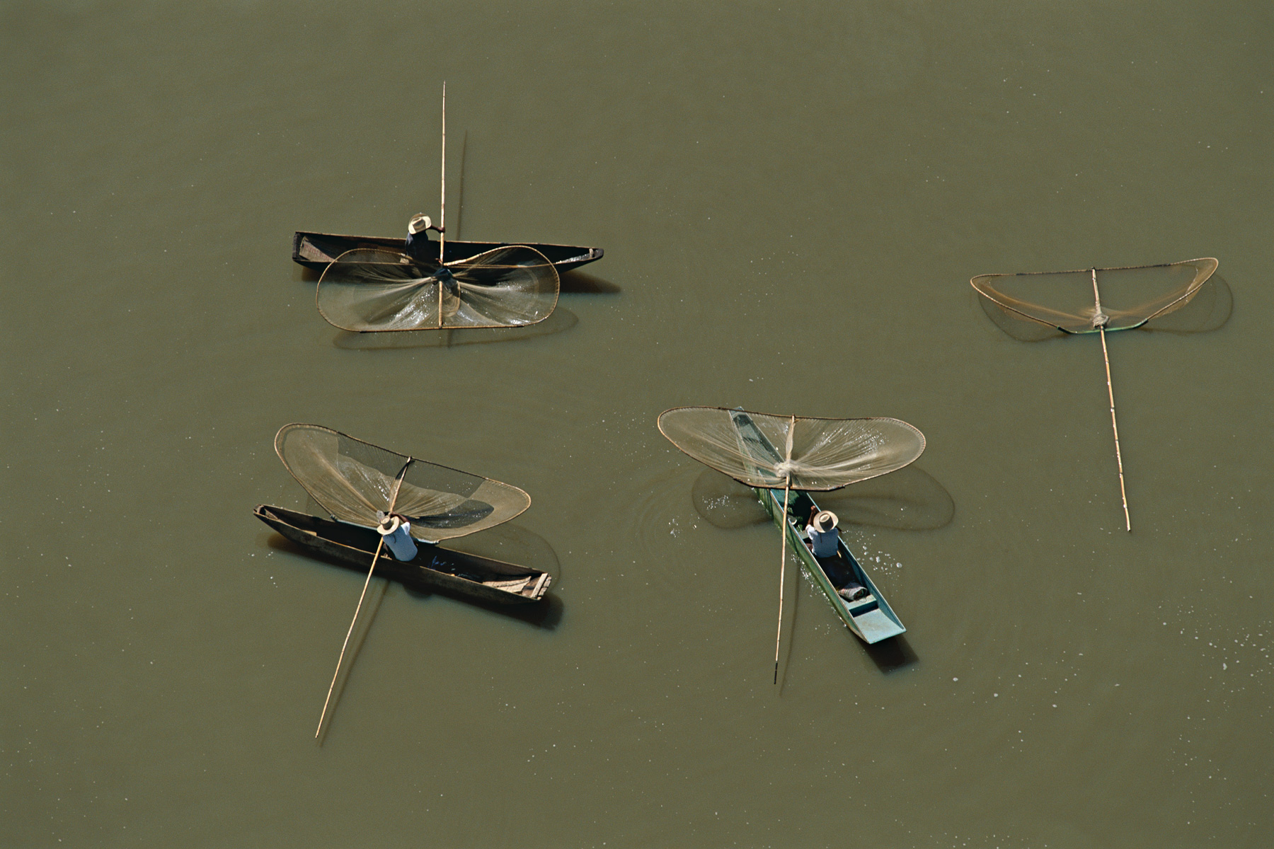
Fishermen in Lake Pátzcuaro, Michoacan state, Mexico (19°35' N, 101°35' W).
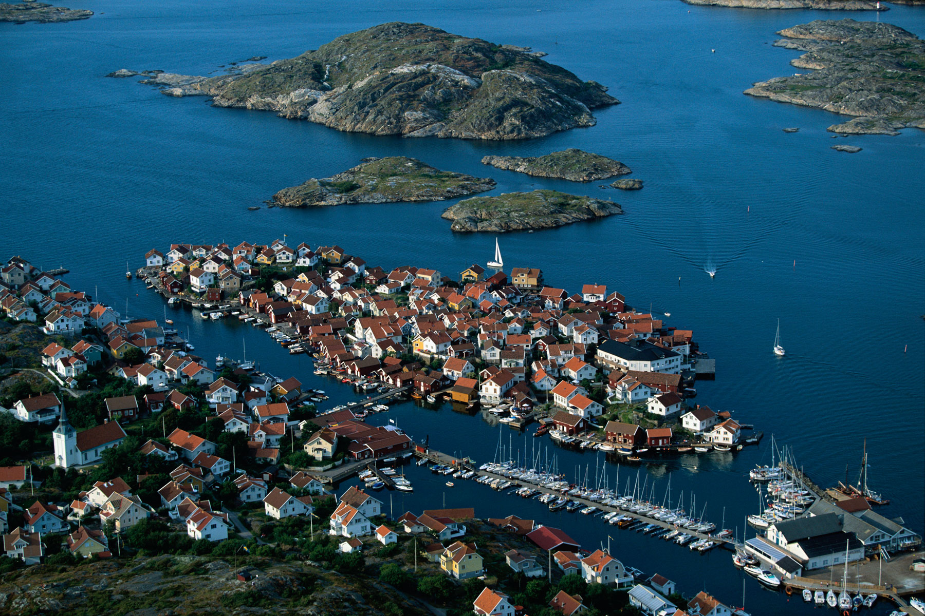
Gullholmen village, north of Göteborg, Sweden (58°10' N, 11°24' E).
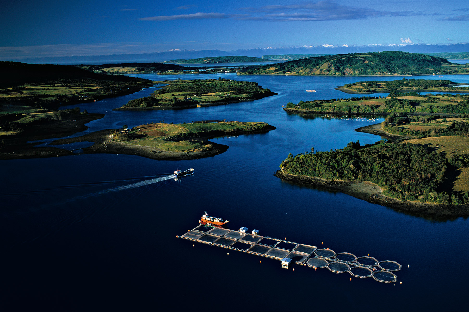
Salmon farm near Mechuque in the Chauques Islands, Chile (42°17' S – 73°34' W).
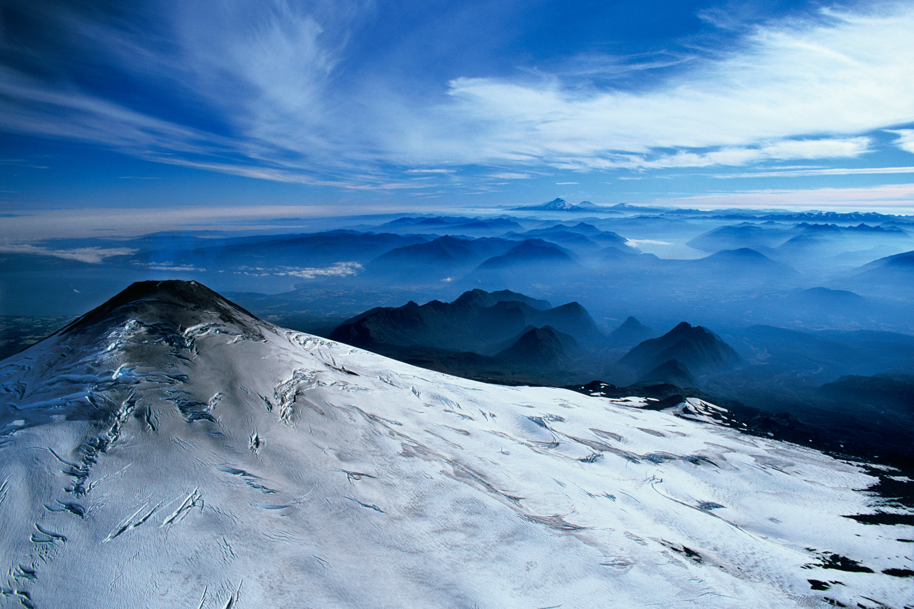
Snow-covered summit of Villarrica volcano, Chile (39°25' S - 71°57' W).
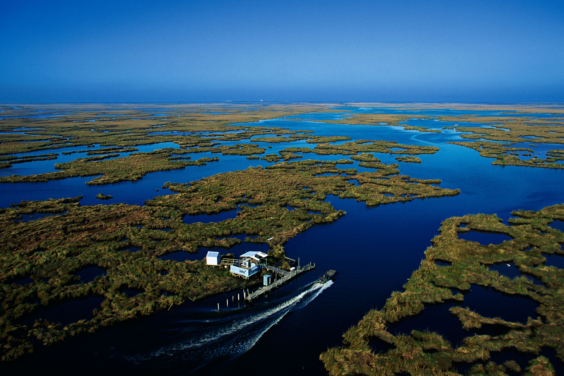
Mouth of the Mississippi river, Louisiana, United States (29°36' N, 89°49' W).
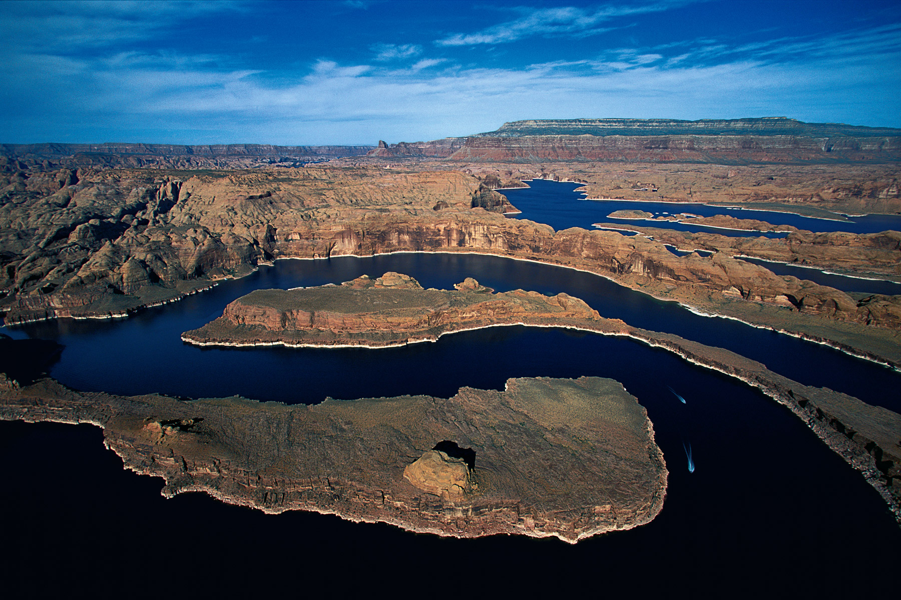
Lake Powell, Arm of the San Juan River, Utah, United States (37°25'N - 110°45'W).
Houses on stilts at Fisherman’s Point, Orinoco Delta, Venezuela (9°50'N, 61°30'W).
Aerator in a shrimp farm, Tungkang lagoon, Taiwan (22°26' N - 120°28' E).
Village viking, Danemark
Mangroves, northeast of the Qatar peninsula, Qatar (25°47’ N – 51°35’ E).
Dunes near the sea at Khor Al-Abaid, Qatar (24°38’ N - 51°21’ E).
Islet off Niqyan Al Baghia, Messaieed, Qatar (25°00’N - 52°00’E).

Laguna, Khor al-Adaid, Messaieed, Qatar (24°33' N - 51°19' E).
Dunes near the sea at Khor Al-Abaid, Qatar (24°30’ N - 51°30’ E).
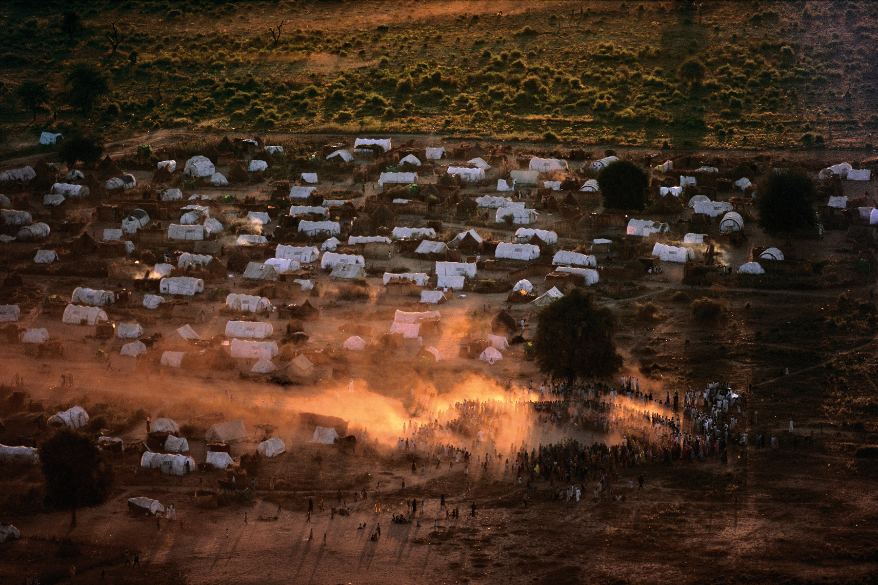
Goz Amer Sudanese refugee camps, near the Sudanese border, Chad (12°00' N - 21°23' E).
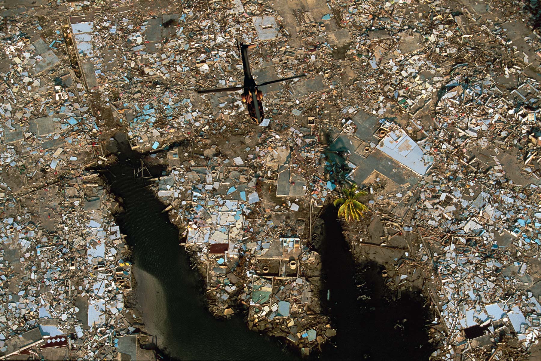
The ruins of Meulaboh after the tsunami, Sumatra Island, Indonesia (4°00’ N – 96°00’ E).
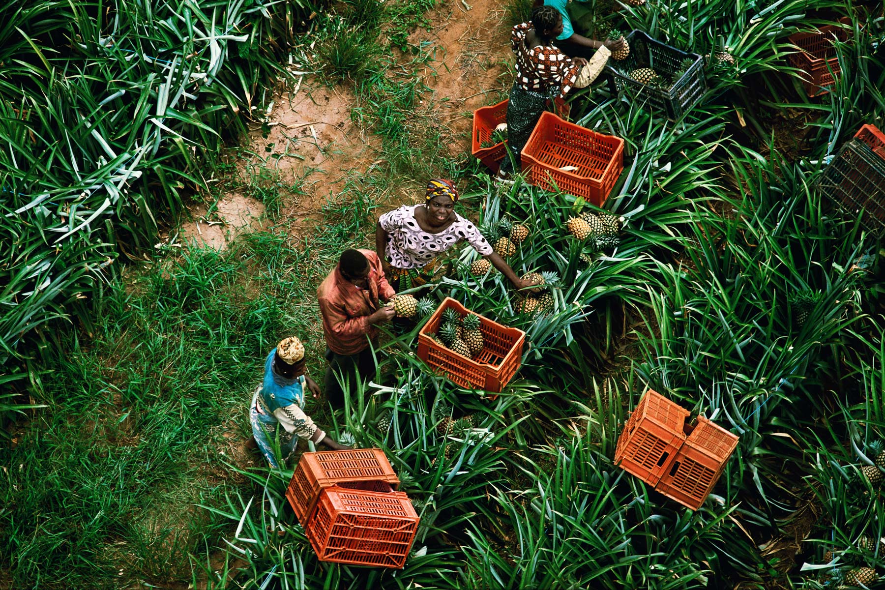
Pineapple harvesting, Abidjan, Ivory Coast (5°19' N - 4°02' W).
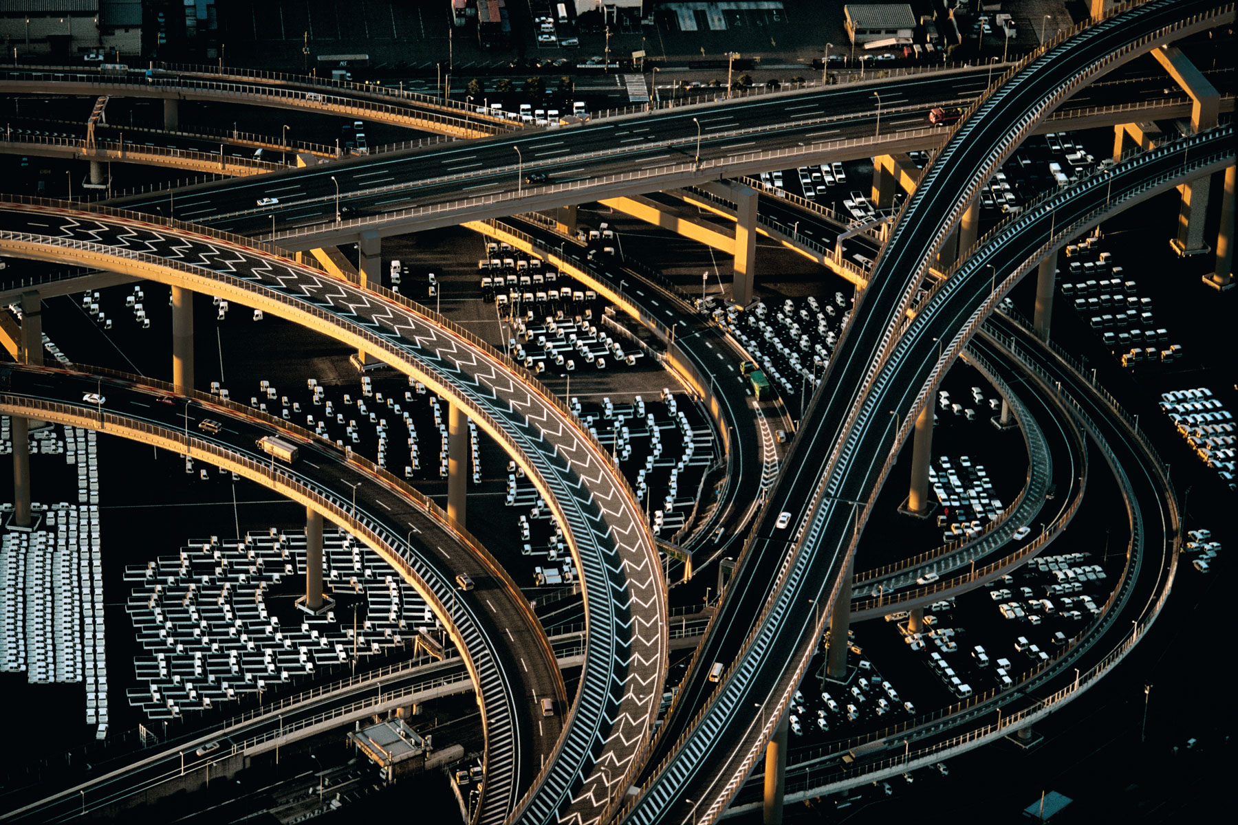
Motorway interchanges near the Yokohama port, Honshu, Japan (N 35°28' - E 139°41').
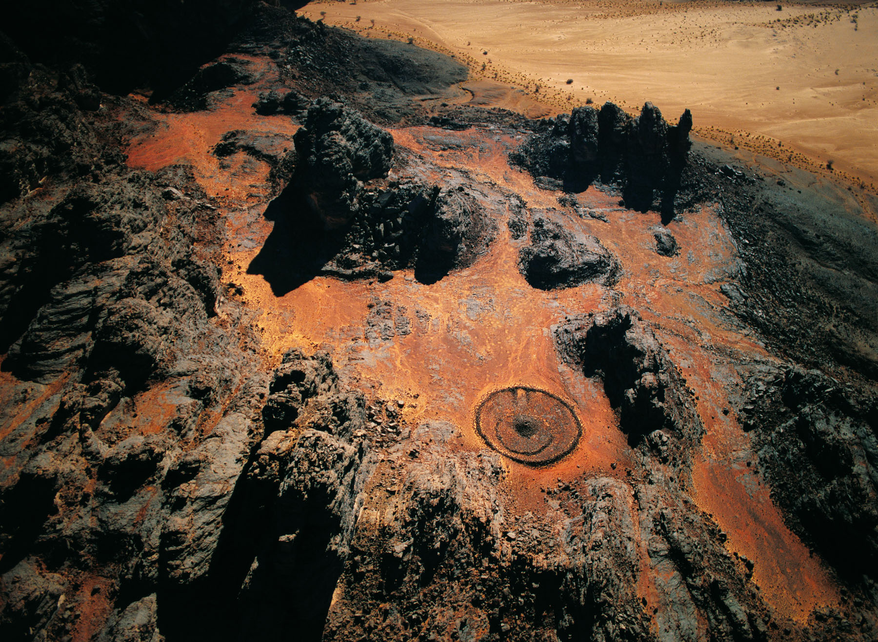
Neolithic burial enclosure, south of Djanet, Tassili n’Ajjer, Algeria (24°26' N – 9°34' E).
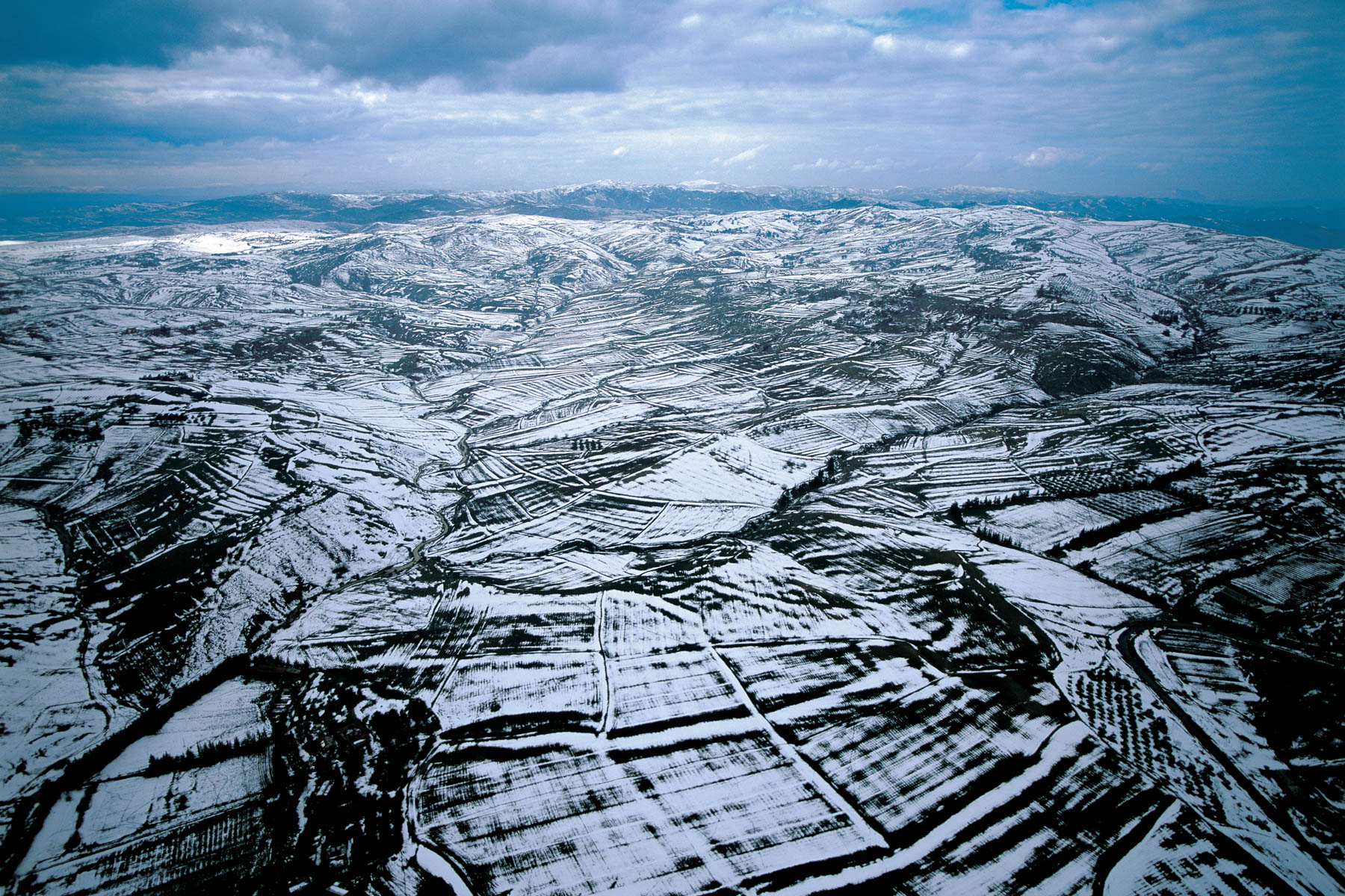
The Hodna Mountains under snow, near El Hammadia, Algeria (35°55' N – 4°47' E).
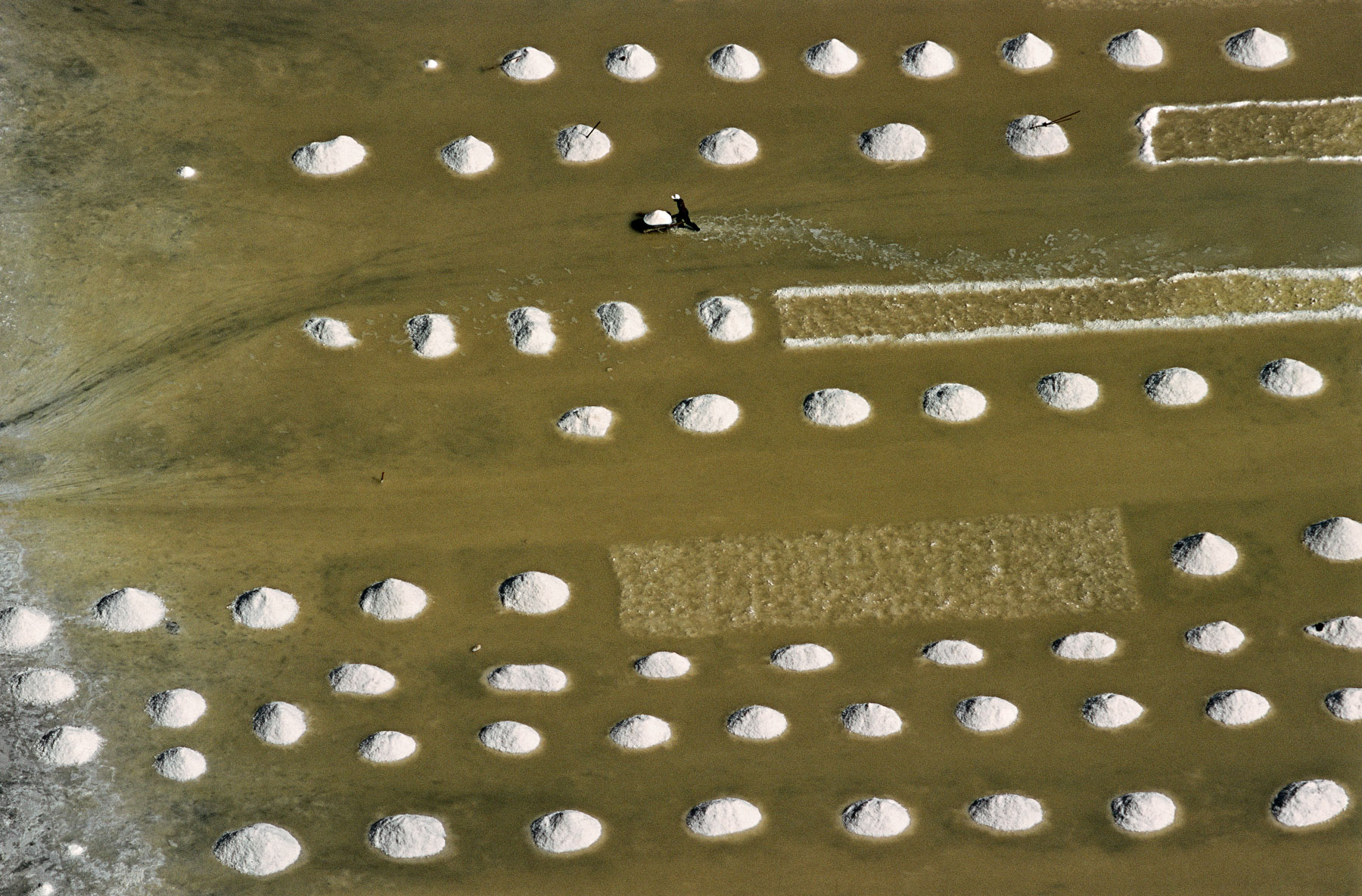
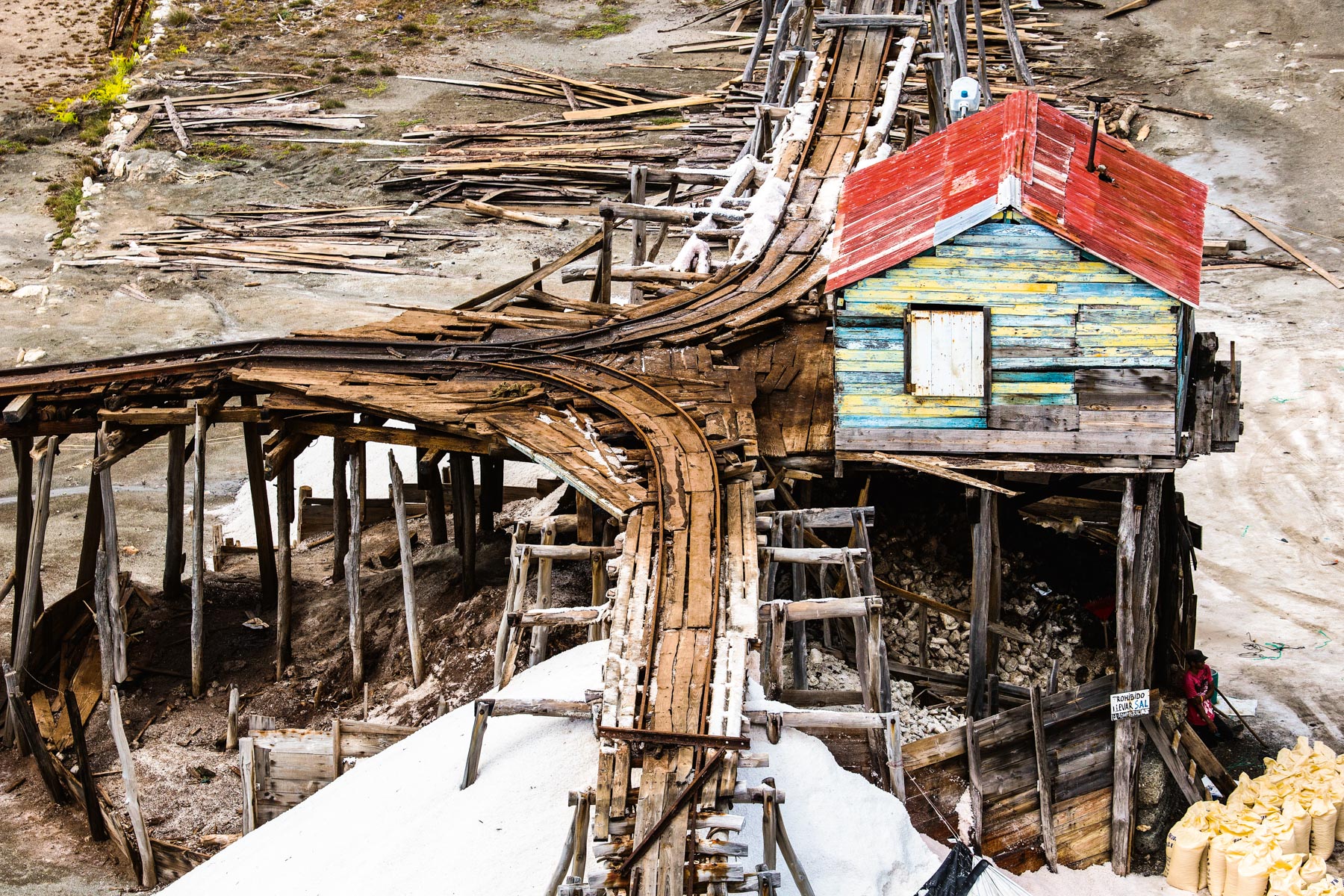
Drying sea salt in the Punta Vigia saltworks, Ocoa Bay, Dominican Republic (18°21' N - 70°44' W).
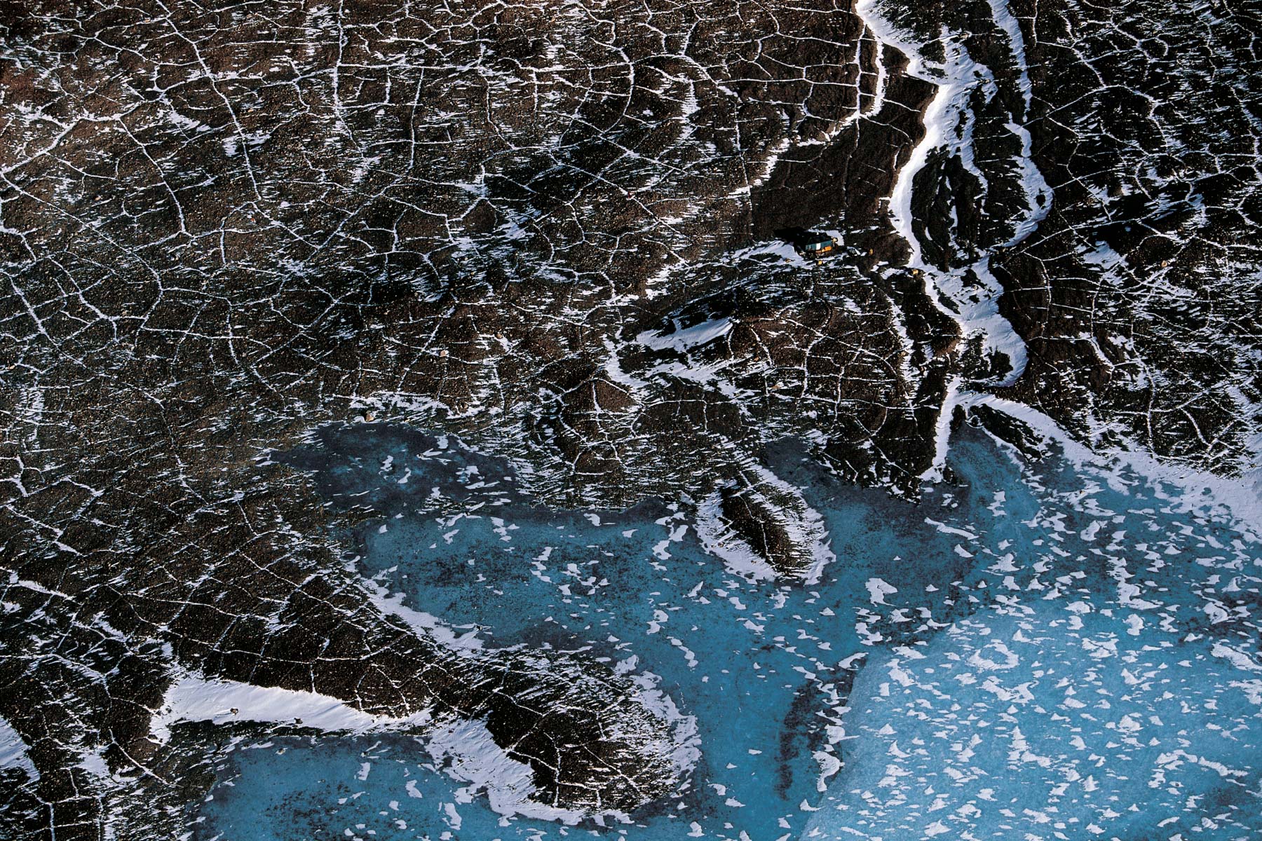
Polygonal patterns on the ground in the Beacon Valley, McMurdo Dry Valleys, Antarctica (77°50' S – 160°50' E).
Montagne entre Luperon et Puerto Plata, République Dominicaine (19°50’ N – 70°58’ O).
Tree trunk against a background of coral, Dominican Republic (18°20' N – 68°55' W).
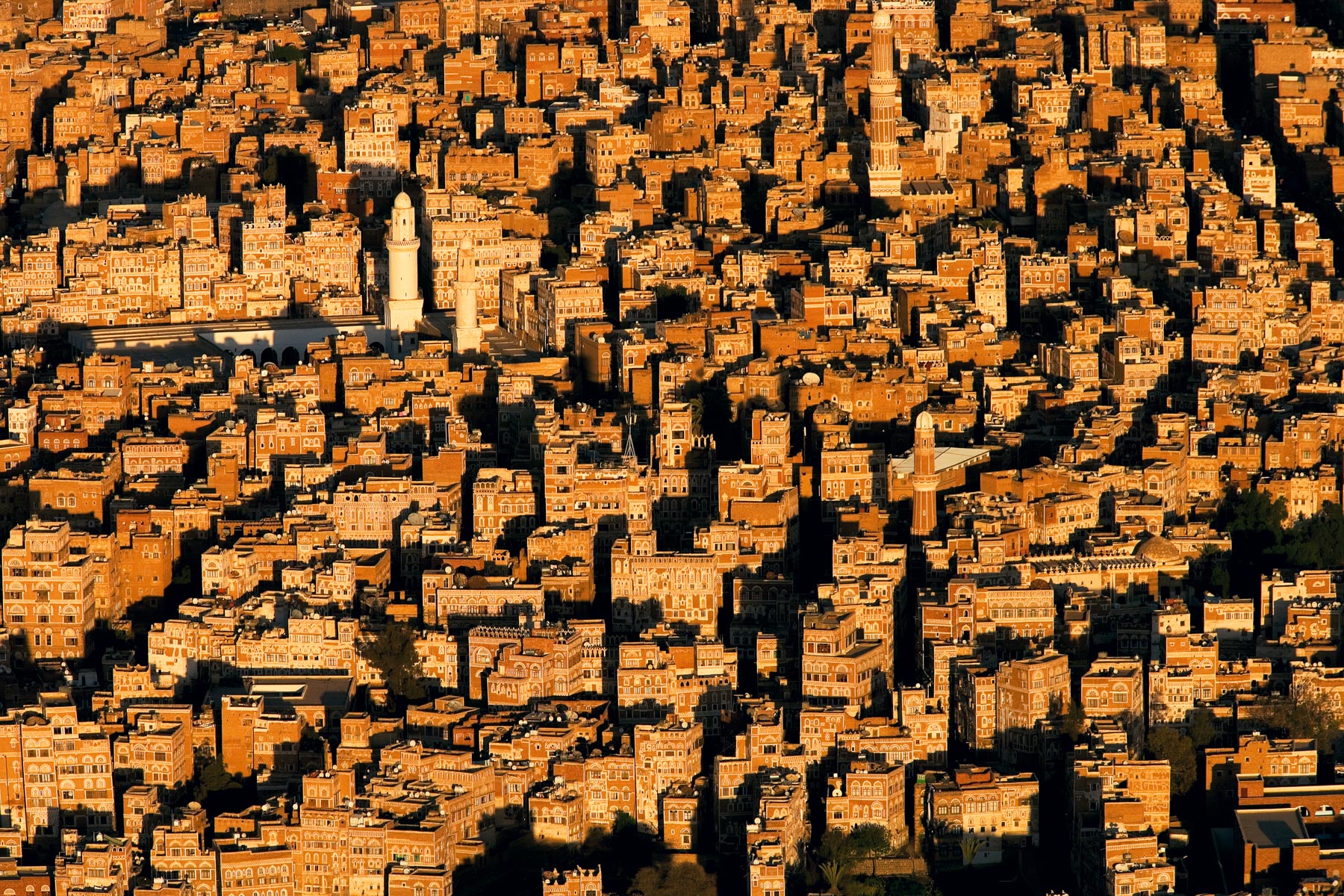
Sanaa's old town and the Al Khbir Mosque, Yemen (15°21' N - 44°13' E).
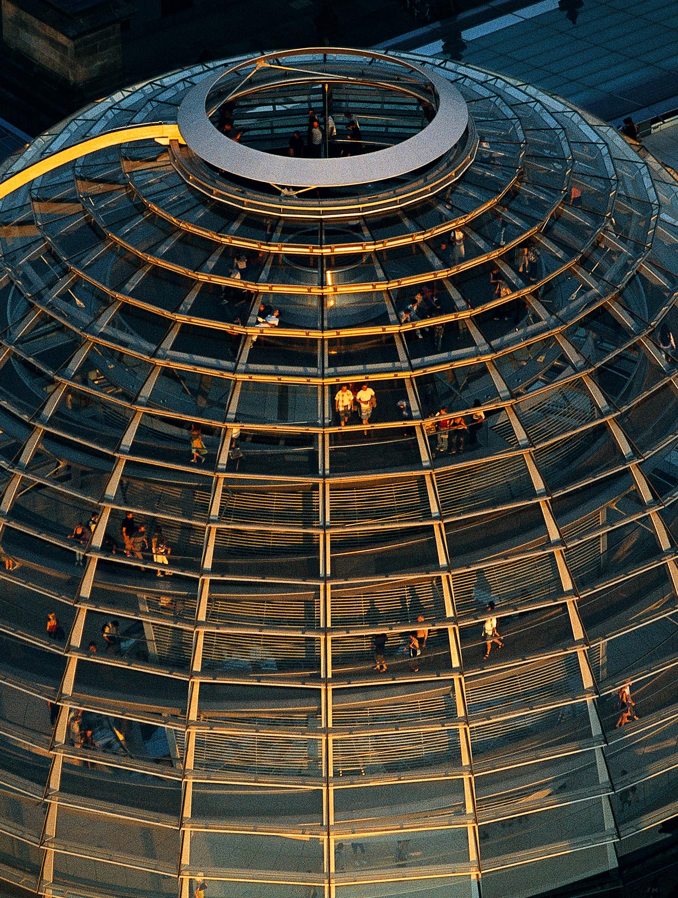
The Reichstag and its dome, Berlin, Germany (52°31' N, 13°25' E).
LAKE ENRIQUILLO, DOMINICAN REPUBLIC (18°30' N, 71°35' W).
Baleine dans la baie de Samana, République dominicaine (18°20’ N- 69°50’ O).
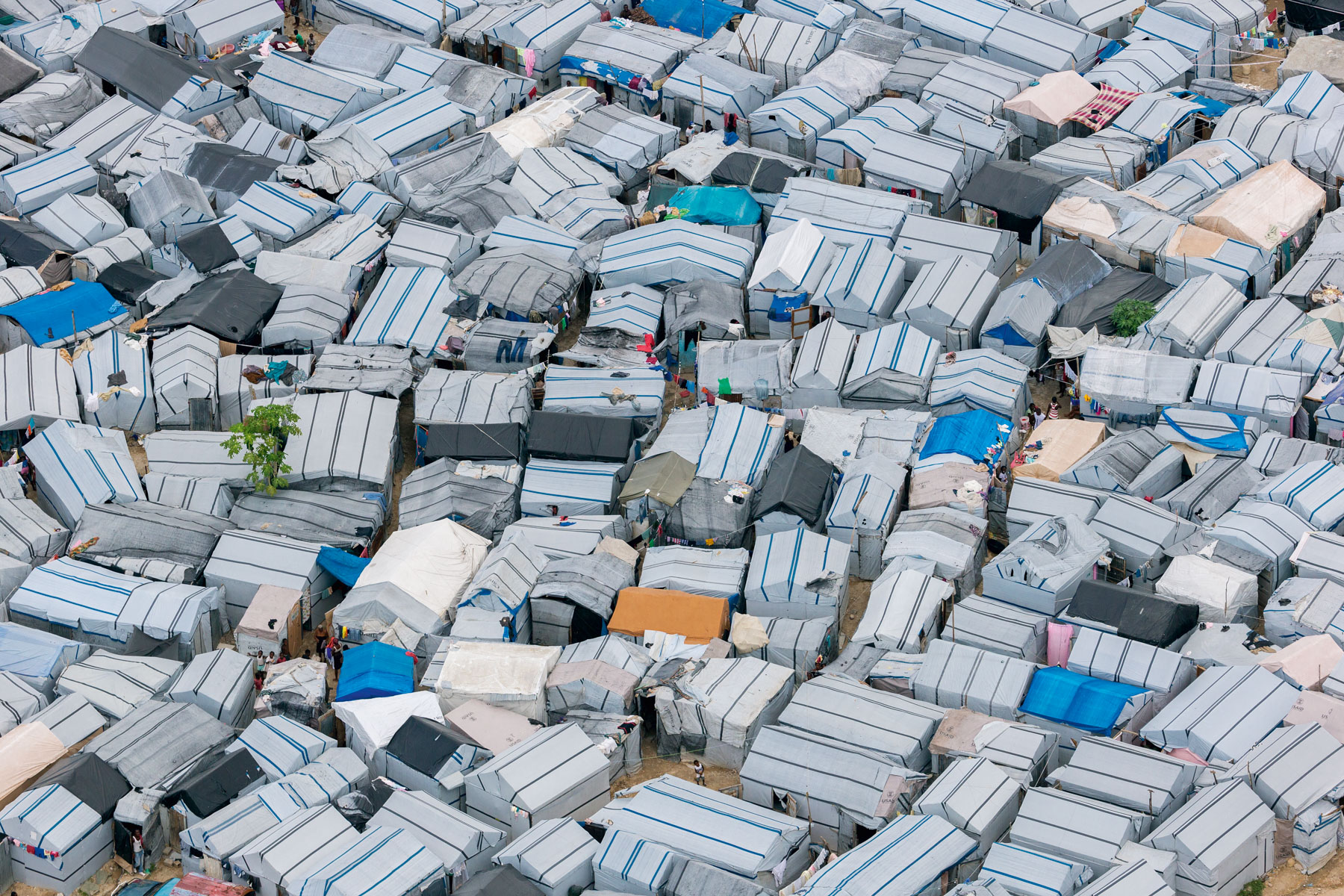
Field between Dominican Republic border and Port-au-Prince, Haiti (18°31’ N, 72°06’ W).
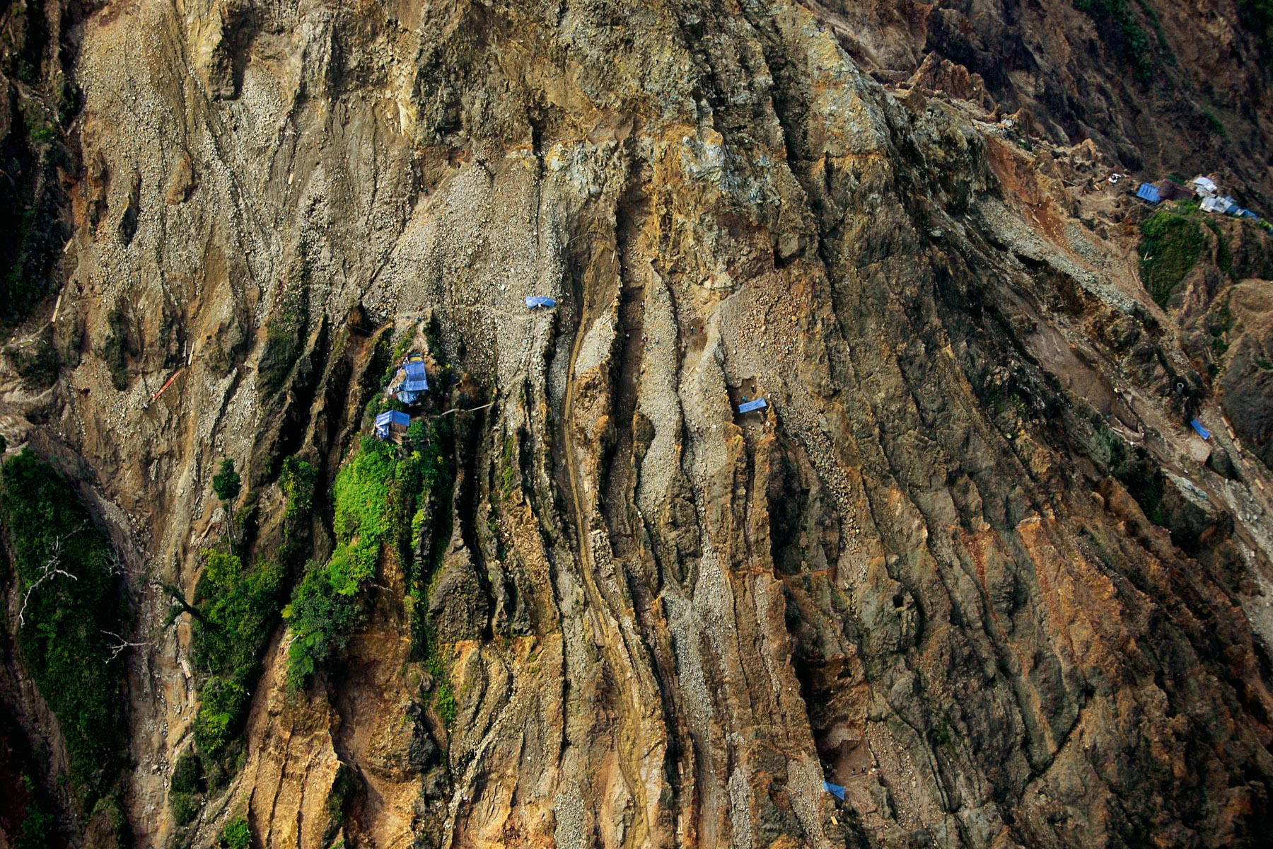
Stripped mountains north of the city of Comendador, on the border with the Dominican Republic, Haiti (18°57' N – 71°42' W).
Punta Laguna dans le Parc National del Este, Ile de la Saona, République dominicaine (18°08'N - 68°45'O).
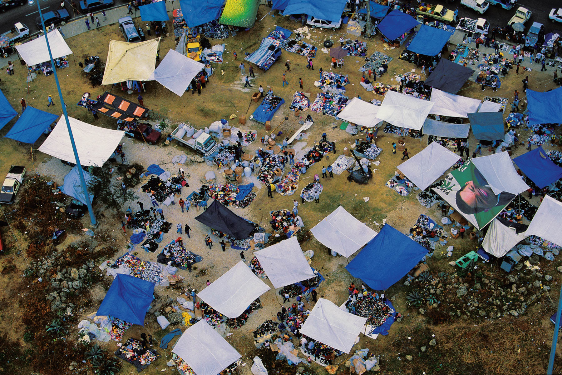
LAS PURGAS MARKET, SANTO DOMINGO, DOMINICAN REPUBLIC (18°28' N, 69°53' W).
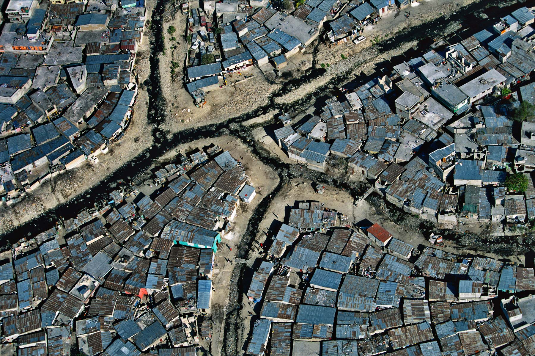
Shanty town Port-au-Prince, Haiti (18°32' N - 72°21' W).
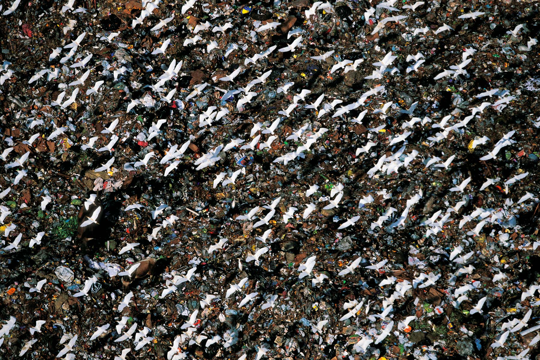
Open-air dump, Santo Domingo, Dominican Republic (18°28' N – 69°53' W).
Déforestation dans le parc national de Los Haitises, République dominicaine (19°04'N - 69°40'O).
Palmeraie et usine d’huile de palme, Monte Plata, République dominicaine (18°48' N – 69°47' O).
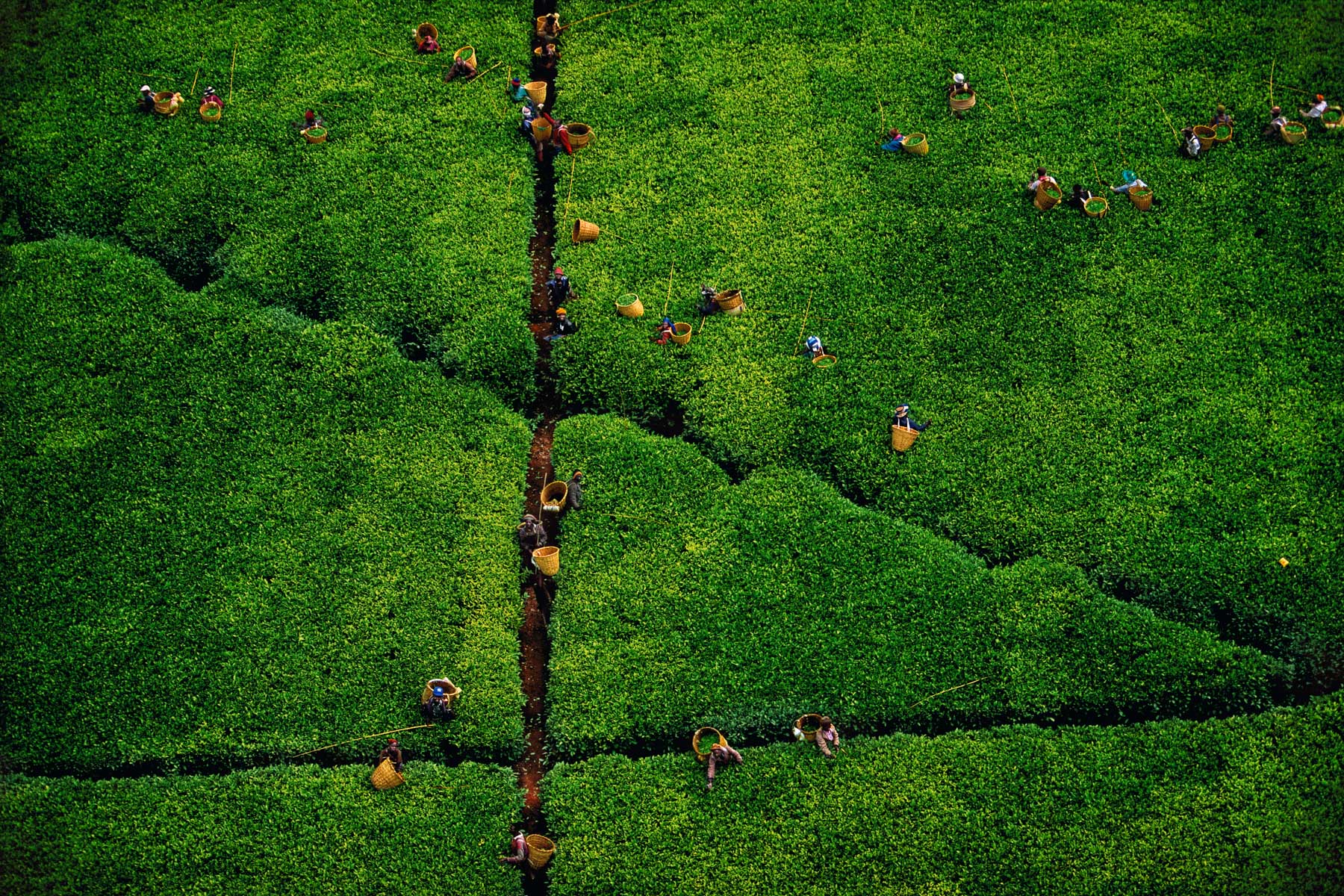
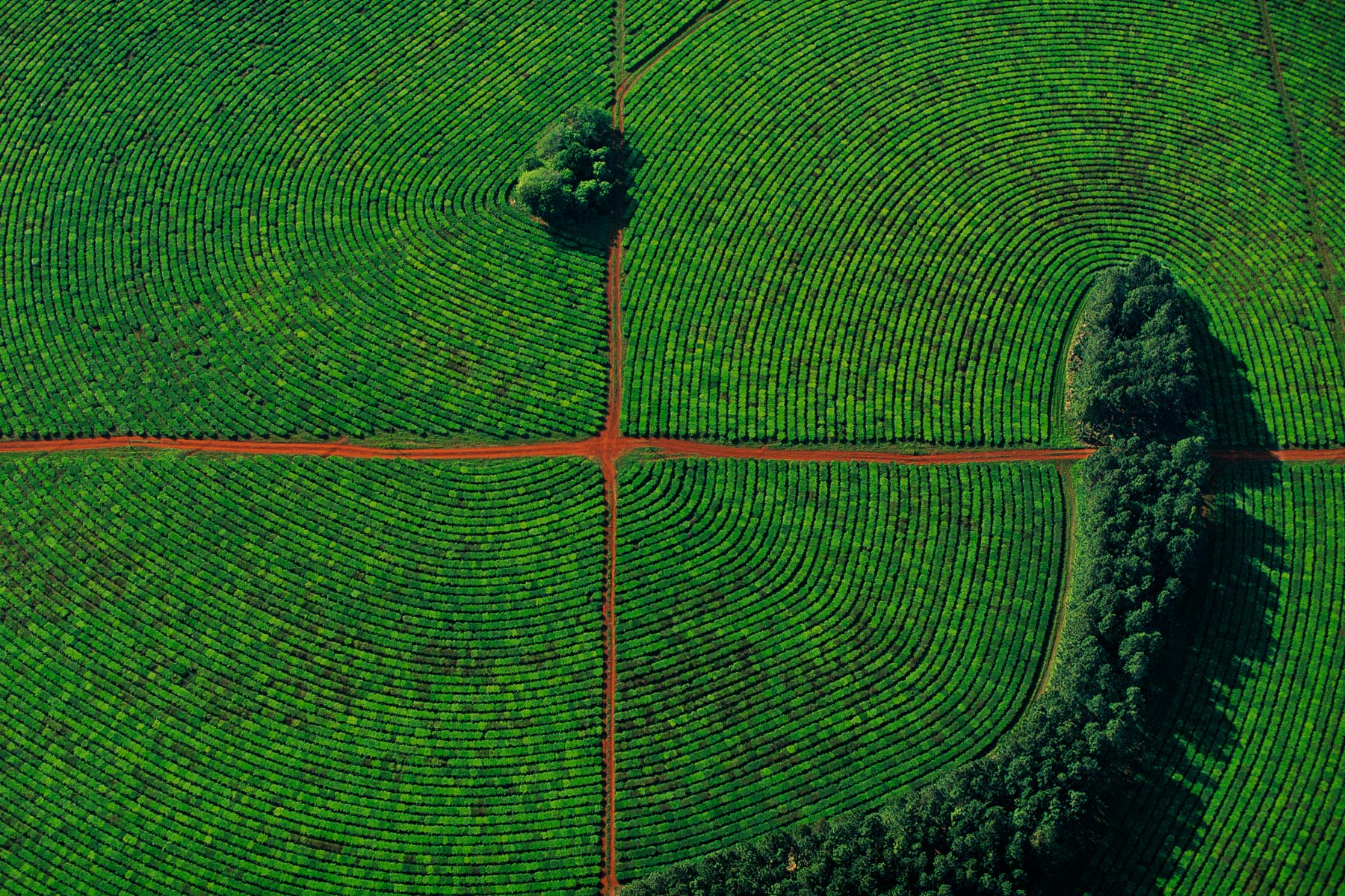
TEA PLANTING, KERICHO REGION, KENYA (0°22' S, 35°16' E).
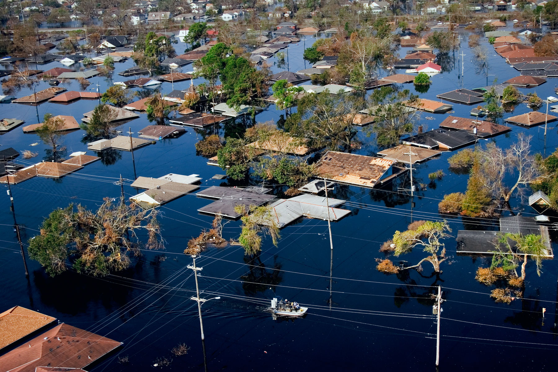
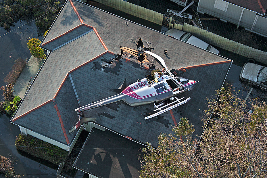
Northwest New Orleans near Pontchartrain Lake, after Hurricane Katrina, Louisiana, United States (30°00' N- 90°05' W).
Open-air dump, Santo Domingo, Dominican Republic (18°28' N – 69°53' W).
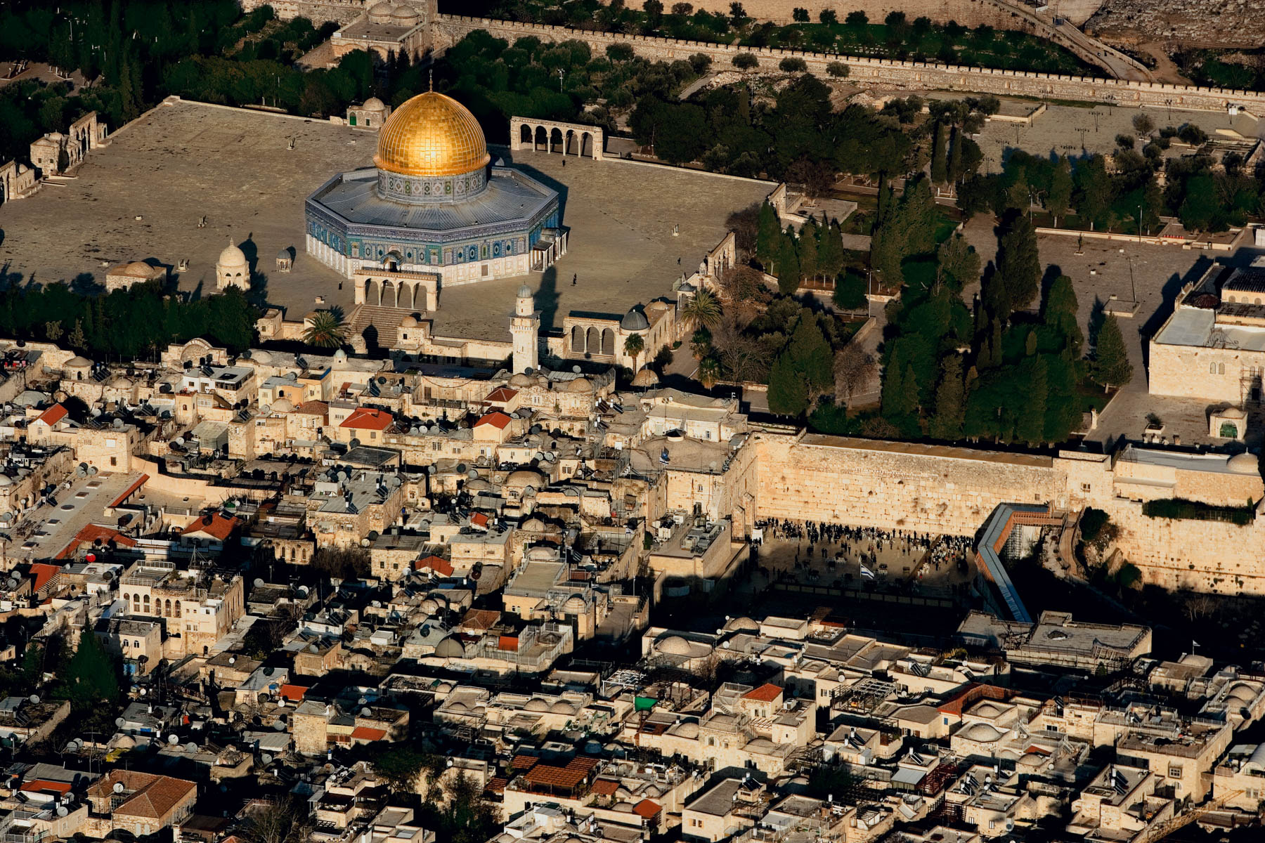
The Esplanade of the Mosques and the Wailing Wall, Jerusalem, Israel and The Palestinian Territories (31°47' N – 35°14' E).
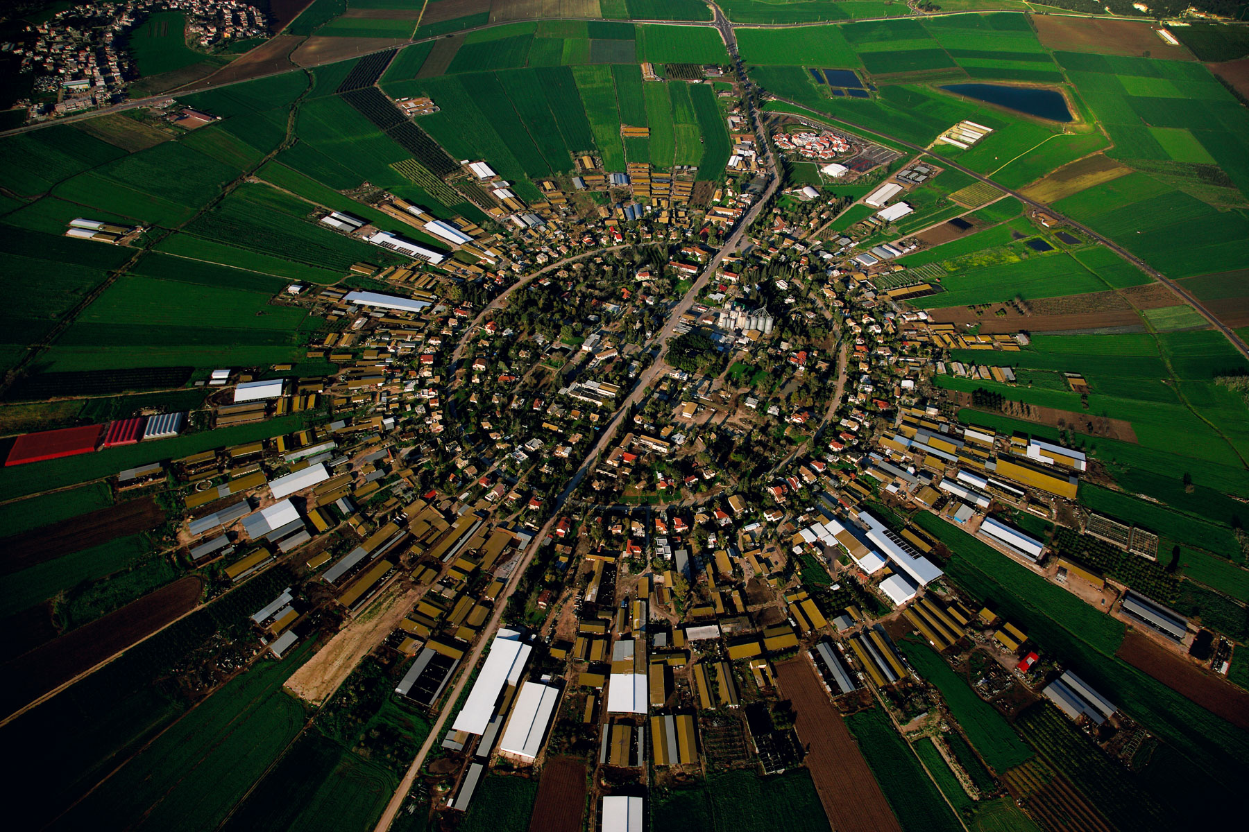
Moshav (co-operative village) farm at Nahalal, Jezrael plain, Israel (32°41' N, 35°13' E).
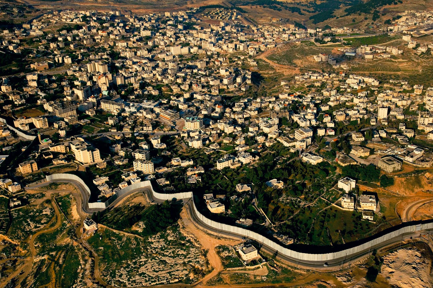
The Separation Wall built by Israel in the West Bank (31°50' N – 35°14' E).
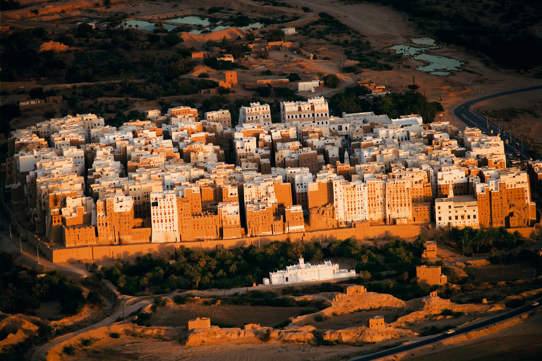
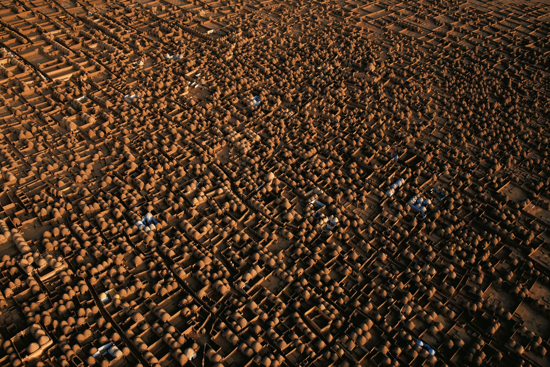
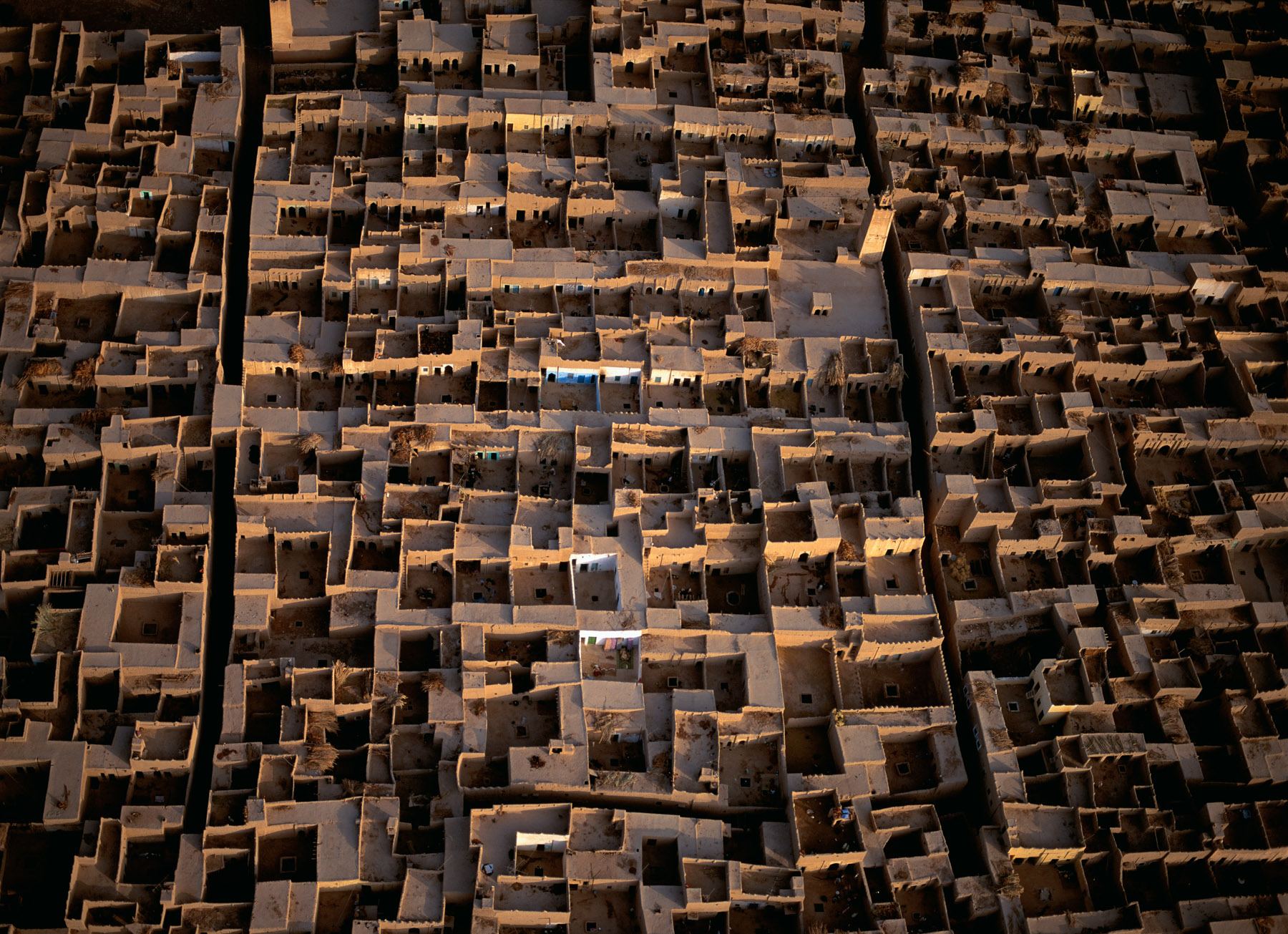
City of shibam, wadi Hadramaut, Yemen (15°55’ N - 48°38’ E).
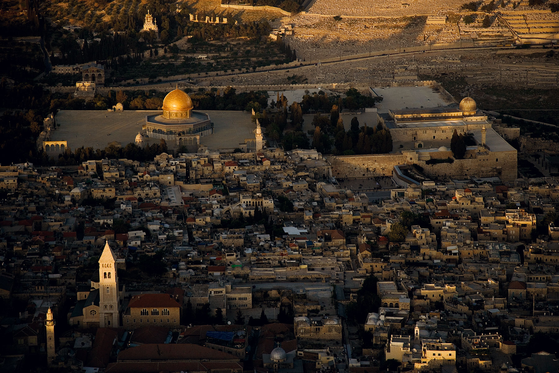
The Esplanade of the Mosques and the Wailing Wall, Jerusalem, Israel and Palestinian Territories (31°45' N – 35°15' E).
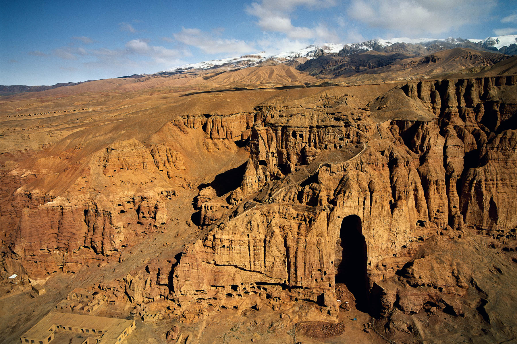
Buddhist sanctuary of Bamiyan, Afghanistan (34°50' N – 67°49' E).
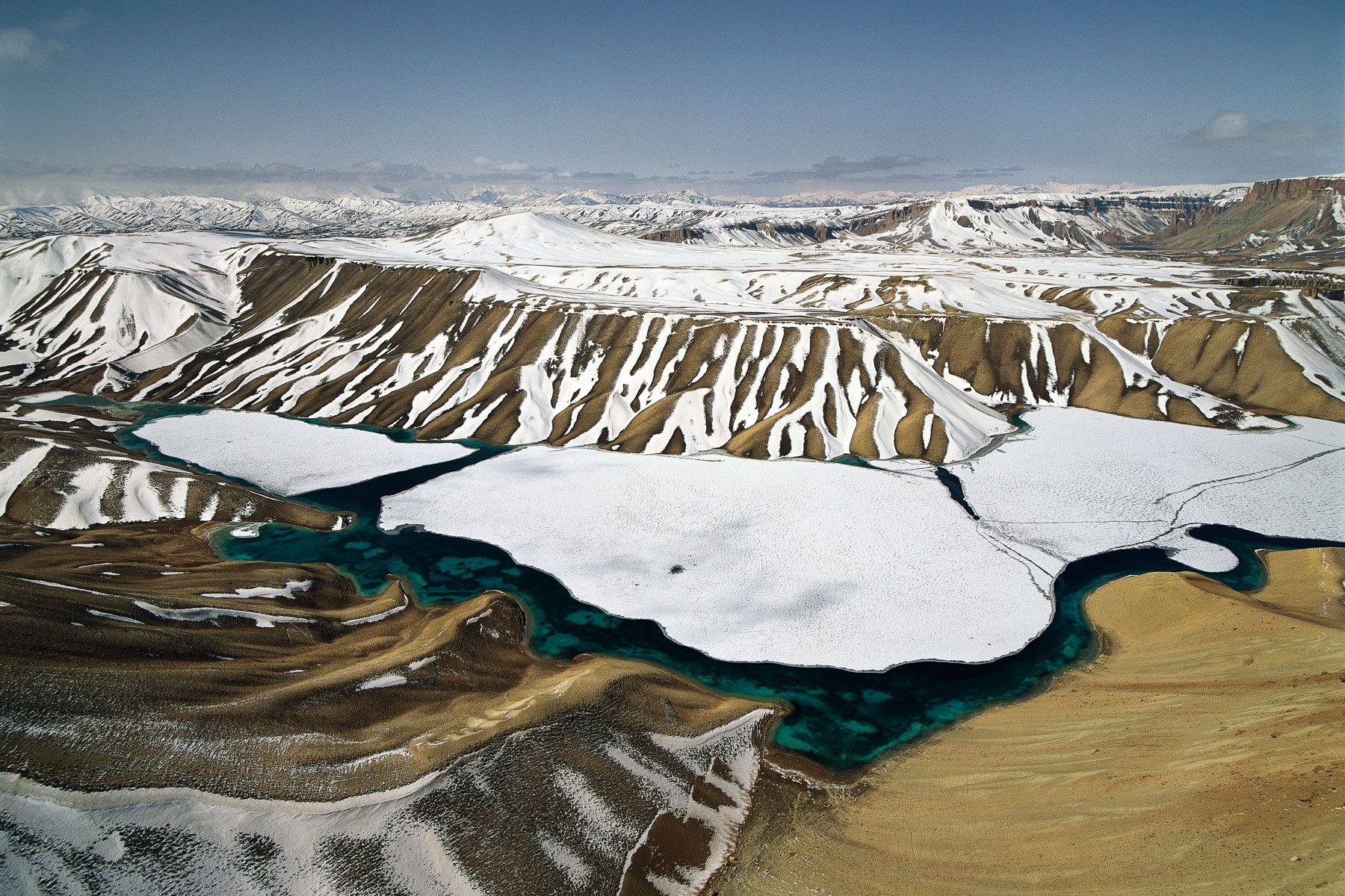
Band-e Amir snowy mountains, Bamiyan Province, Afghanistan (34°50' N - 67°15' E).
Kuchi nomads on the Ghazmi road, south of Kabul - Wardak Province - Afghanistan
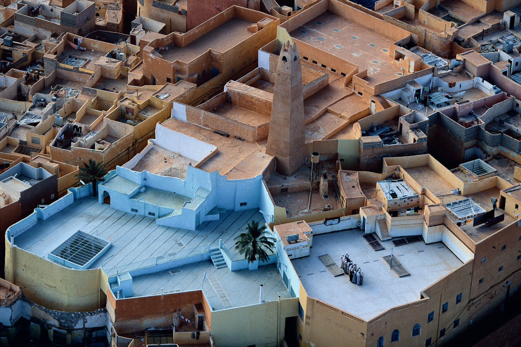
Beni Isguen, M’Zab Valley, Algeria (32°29' N – 3°40' E).
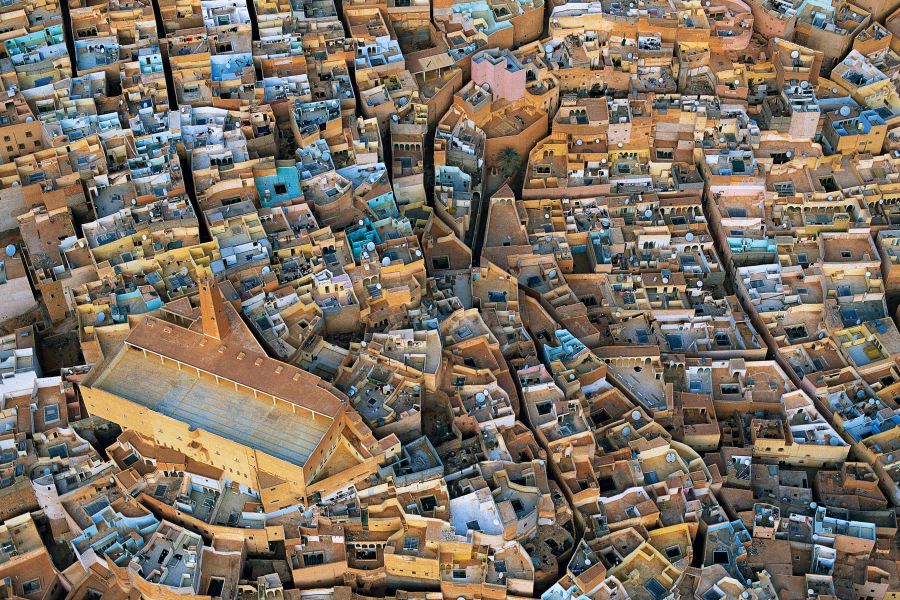
El Ateuf, M’Zab Valley, Algeria (32°27' N – 3°44' E).
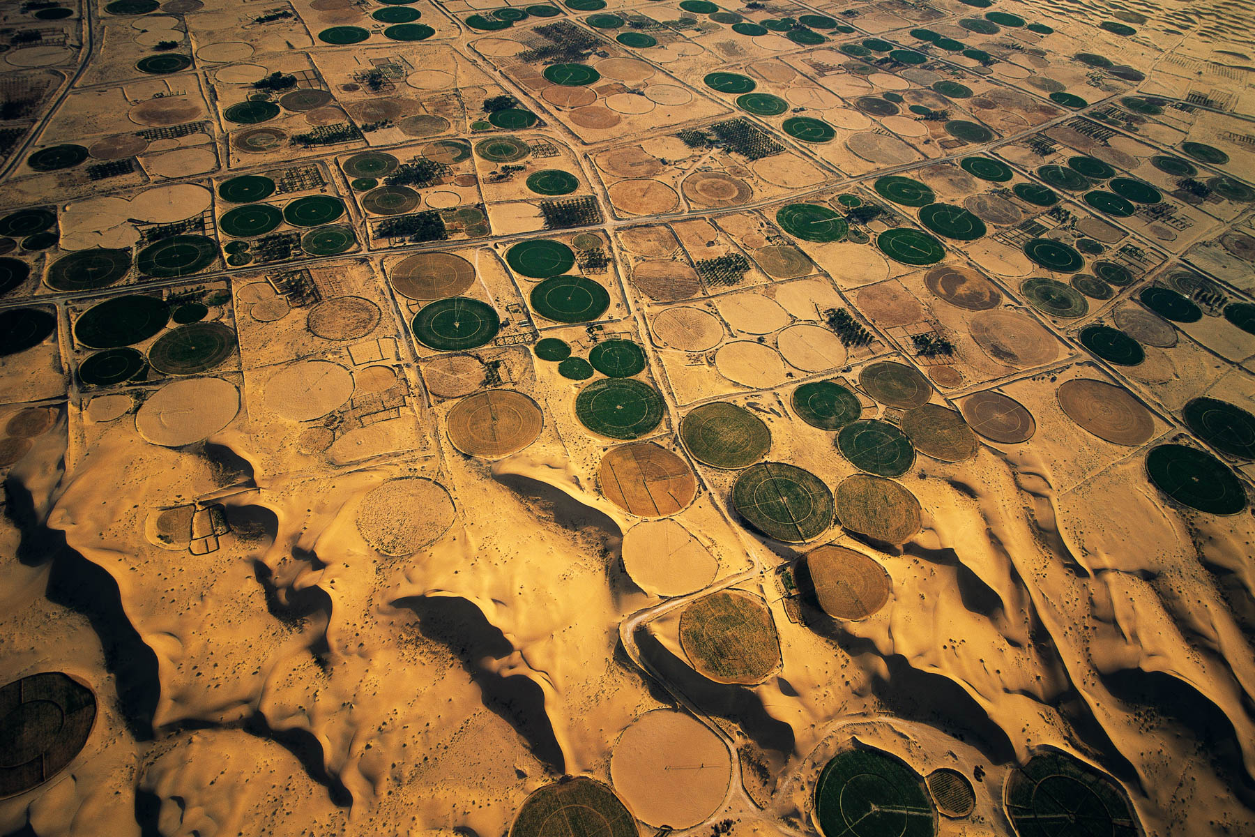
Irrigation near the El-Oued oasis, Algeria (33°22' N - 6°52' E).
Ice sculpted by the wind at the summit of Mount Discovery, Antarctica [South pole] (78°18' S - 164°02' E).
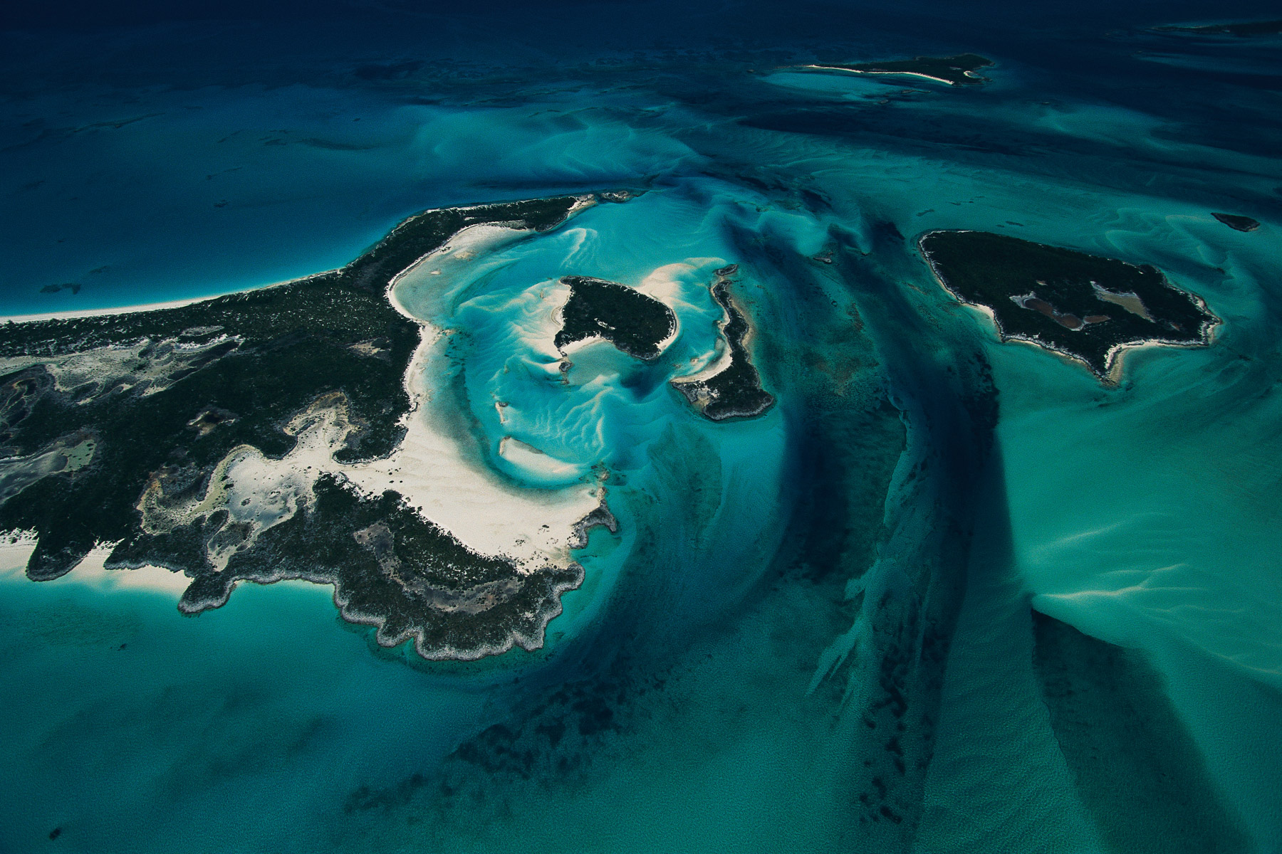
Islets and seabed, Exuma Cays, Bahamas (24°28' N – 76°46' W).
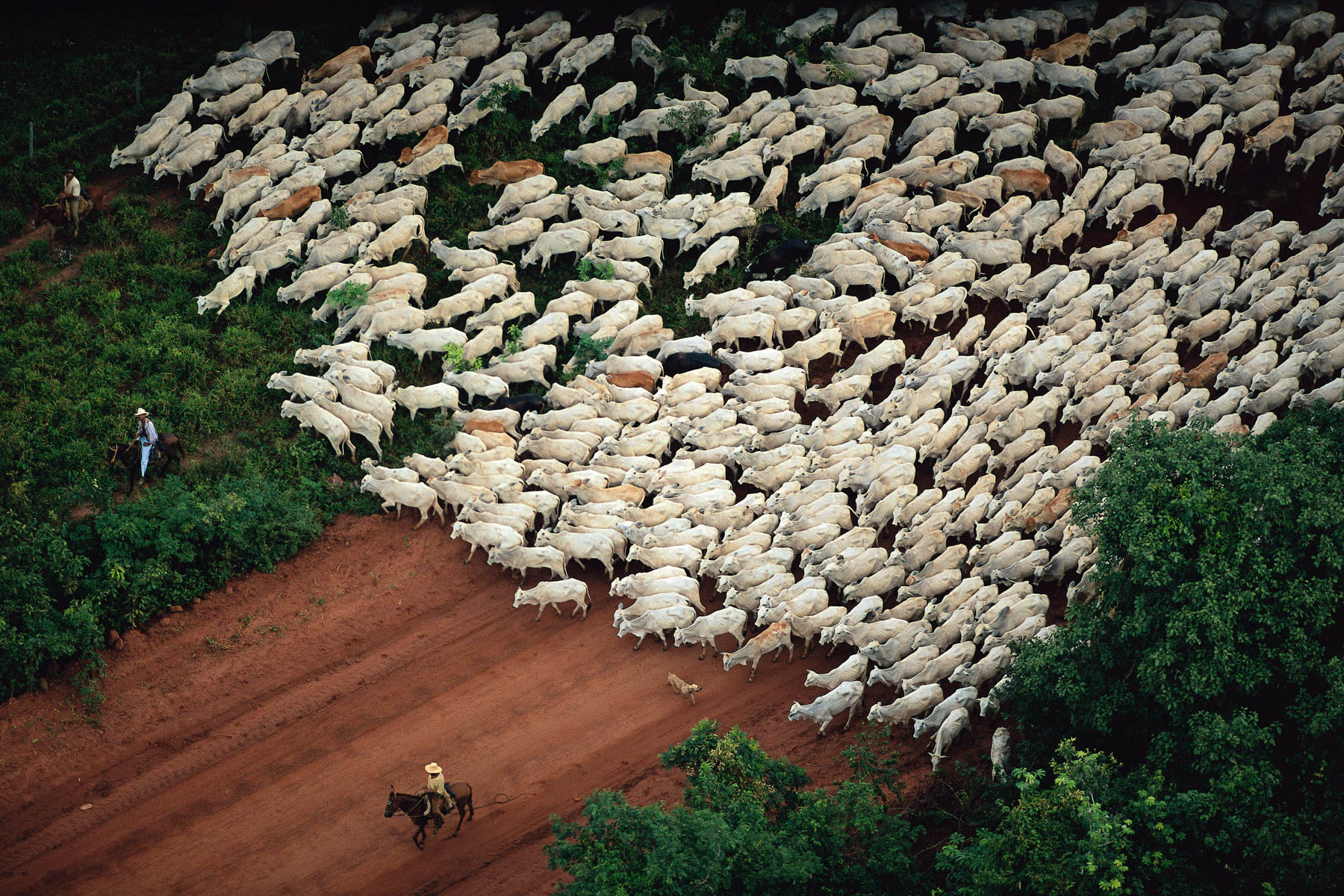
Herd of Zebu near Cáceres, Mato Grosso, Brazil (16°05' S, 57°40' W).
Cows grazing in the Pantanal, Brazil (17°36' S – 57°30' W).
Traditional fishing method between Abidjan and Grand-Bassam, Côte d’Ivoire (5°13' N – 3°53' W).
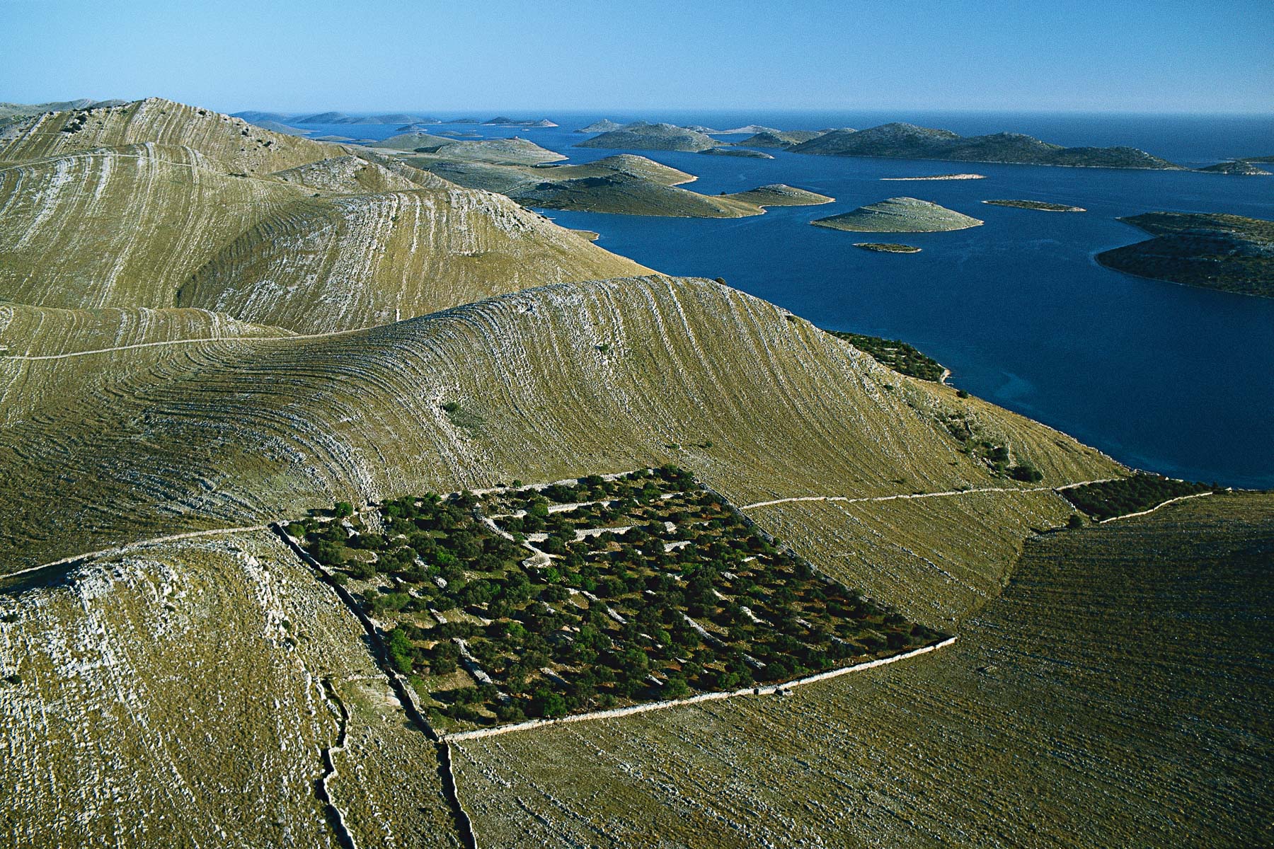
Island of kornat, Kornati national park, Dalmatia, Croatia (43°50' N, 15°16' E).
Mouth of the Kalou wadi in the Lake Assal, Republic of Djibouti (11°37' N - 42°23' E).
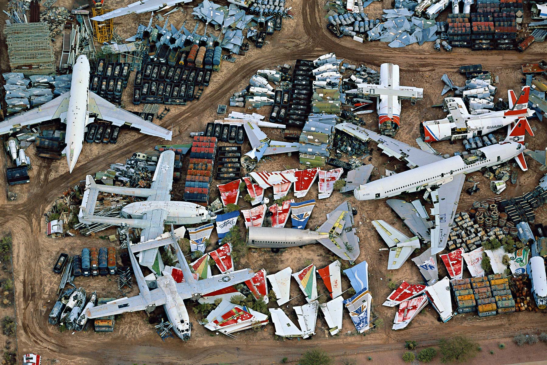
Aircraft Apron at Davis Monthan Airfield, Arizona, United States (32°09' N – 110°53' W).
Agricultural landscape around Idaho Falls, Idaho, United States (43°28' N, 112°01' W).
Ice in the Turku archipelago, Finland (60°15' N ,21°51' E).
Pink ebony on the Kaw mountain, French Guiana, France (4°30' N - 52°00' W). Ébène rose sur la montagne de Kaw, Guyane (4°30’ N – 52°00’ O).
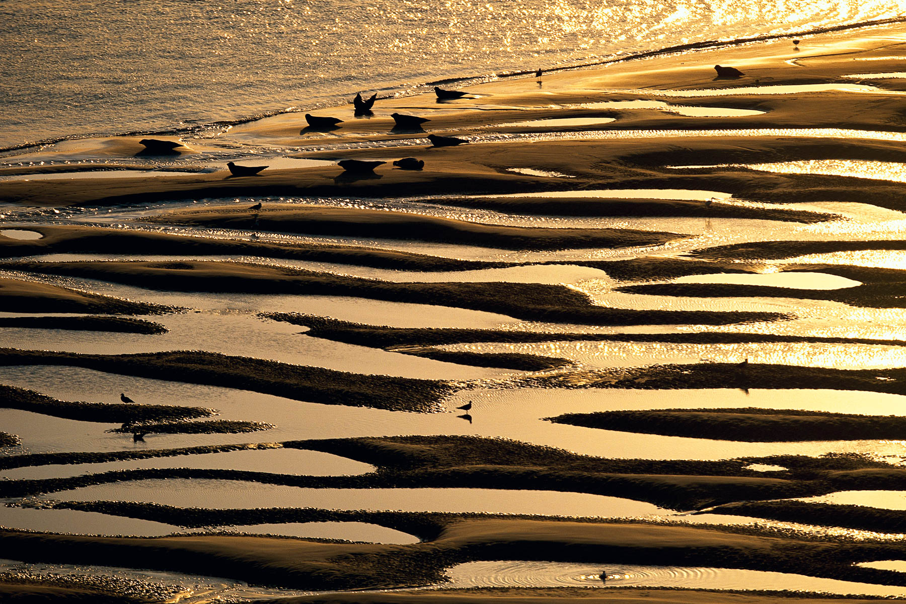
Common seals in the bay of the Somme, Hauts de France, France (50°13' N - 1°31' E).
Scrap yard, Saint-Brieuc, Côtes-d'Armor, France (48°31' N - 2°46' W).
Deoiling basin at a water purification centre, Marne, France (49°00’ N, 4°20’ E).
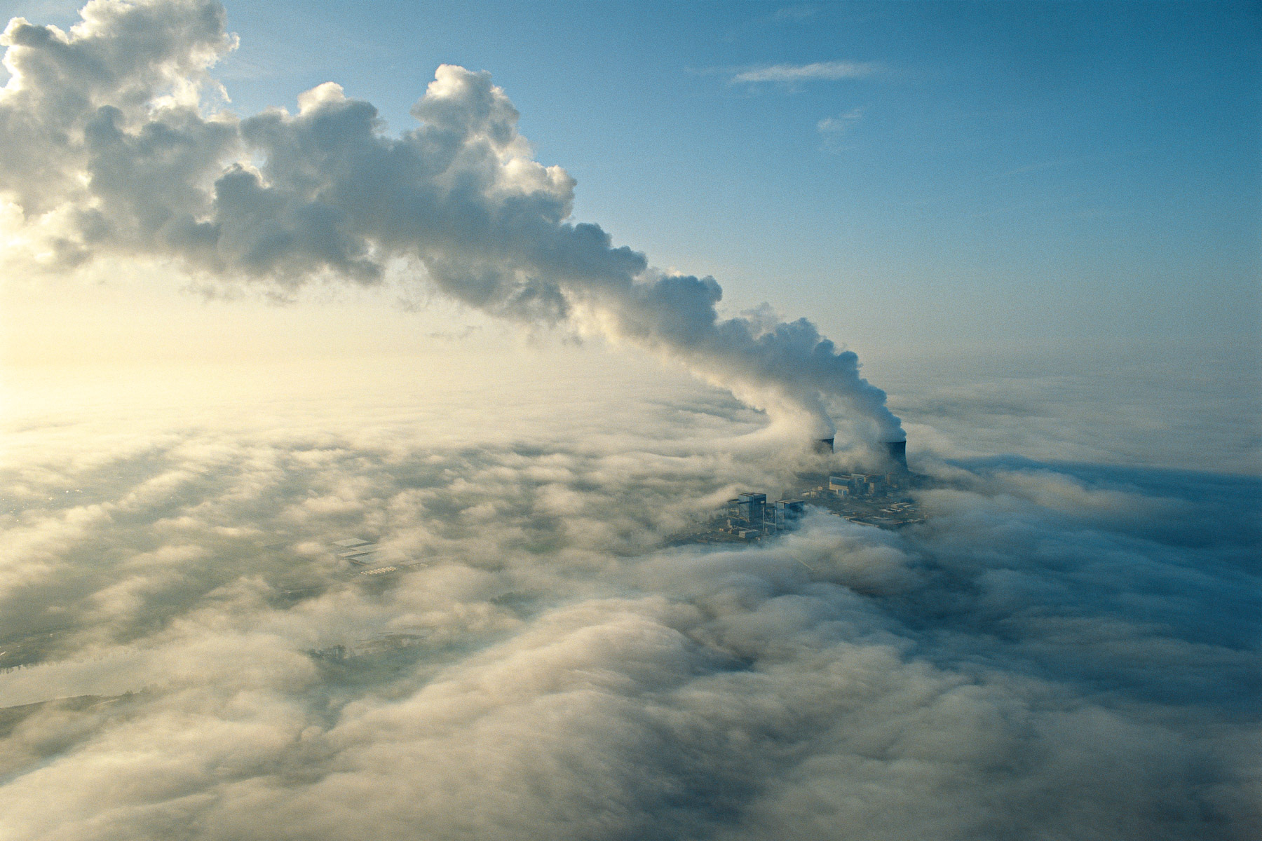
Saint-Laurent-Nouan electronuclear power station, Loir-et-Cher, France (47°42' N - 1°35' E). Centrale électronucléaire de Saint-Laurent-Nouan, Loir-et-Cher, France (47°42’N – 1°35’E).
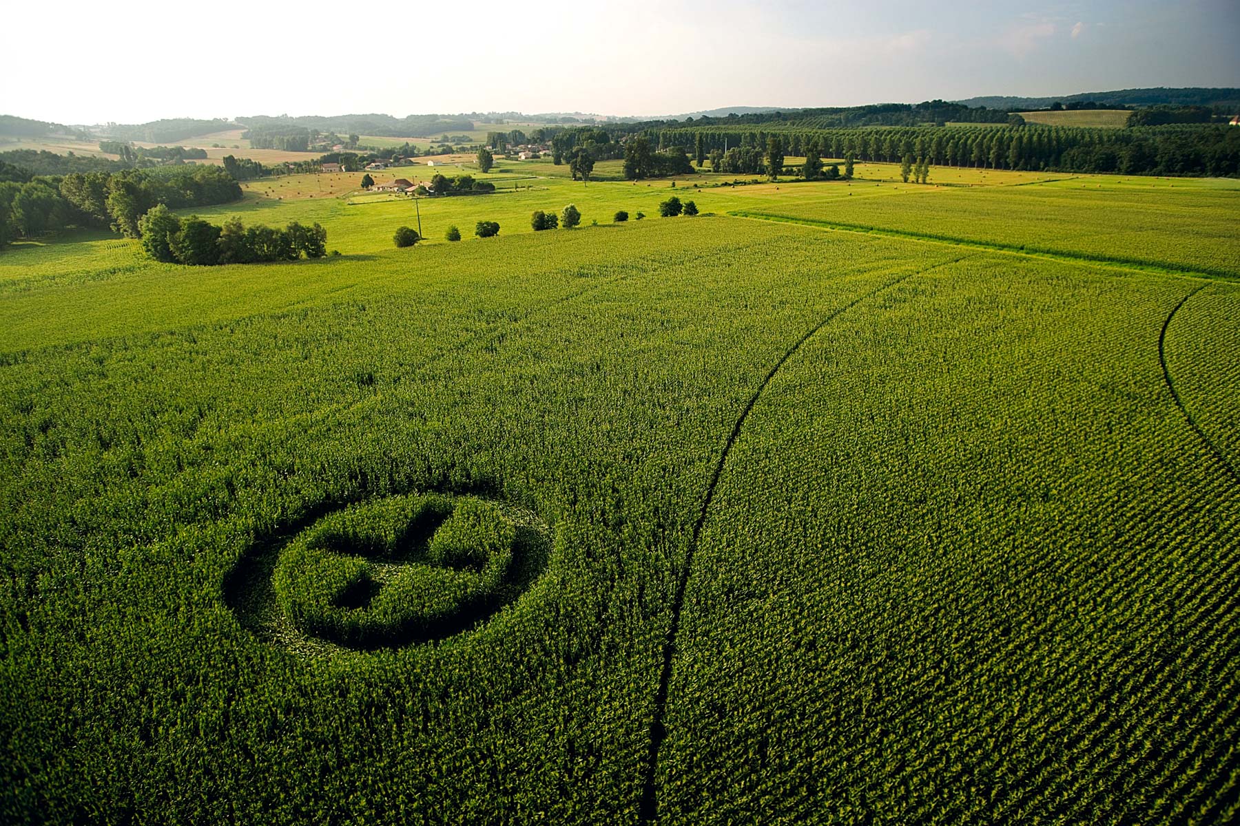
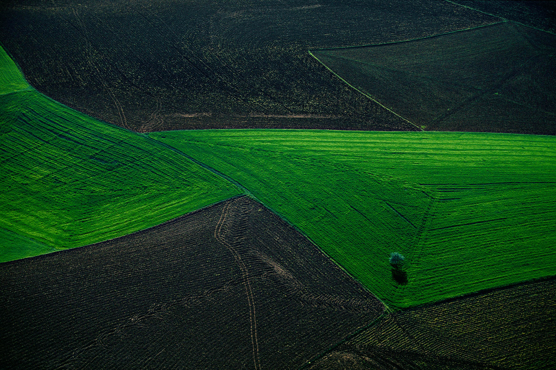
Marking in a field of GM maize in Grézet-Cavagnan, Lot et Garonne, France (44°23' N, 0°07' E).
Mountainous countryside near Maelifellssandur, Myrdalsjôkull Region, Iceland (63°51' N, 19°18' W).
Salt formations on the west coast of the Dead Sea, Israel (31°20' N, 35°25' E).
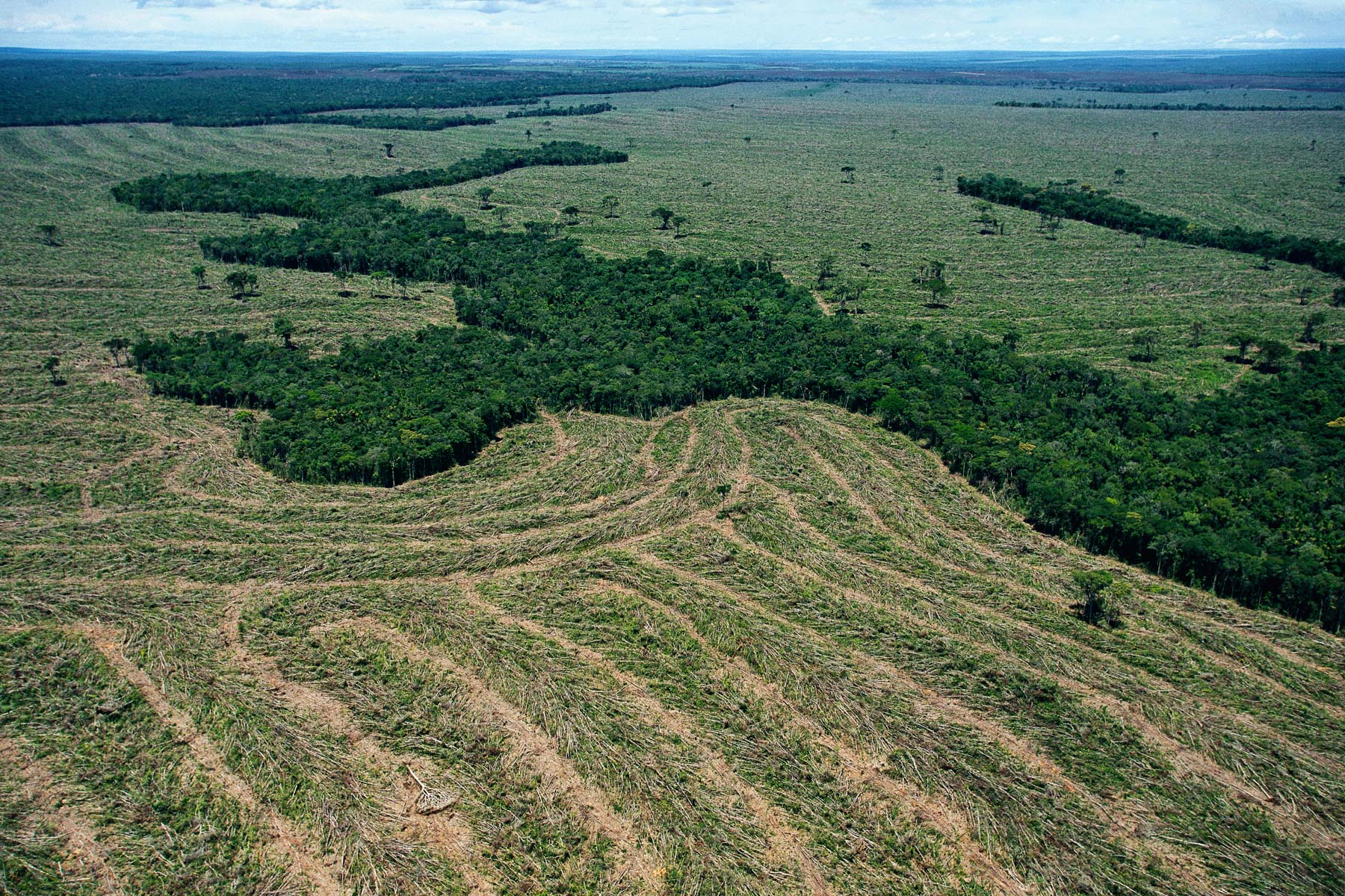
Deforestation in Amazonia, Mato Grosso, Brazil (9°26’ S, 54°43’ W).
Gardens created in the middle of the Wadi Rum desert, Jordan (29°33' N - 35°39' E).
Stranded boat, Aral Sea, Aralsk region, Kazakhstan (46°39' N – 61°11' E).
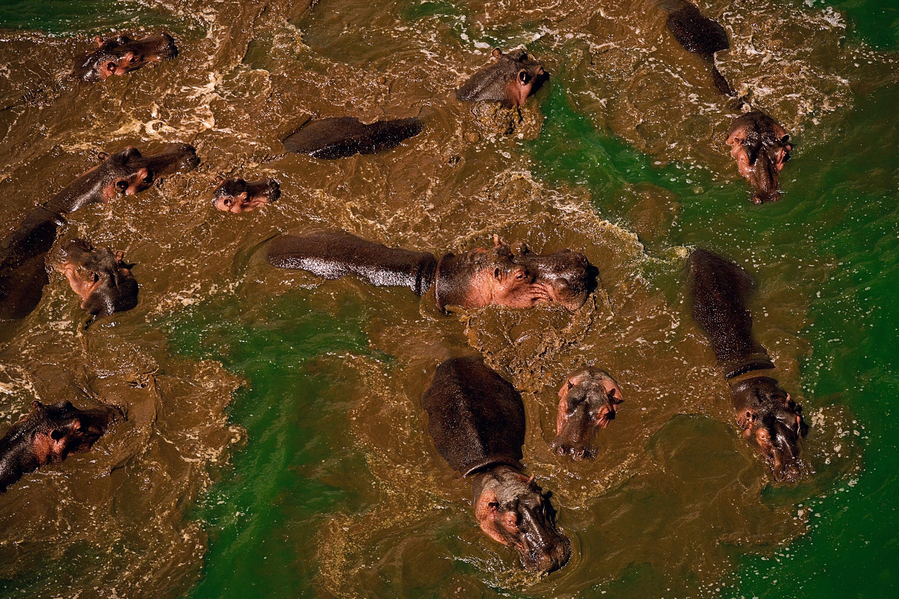
Hippopotami in Lake Naivasha, Kenya (1°00' N - 38°00' E).
Glacier tongue near the Khan Tengri peak, Sary-Jaz Mountains, Ysyk-Köl region, Kyrgyzstan (42°10' N - 80°00'E).
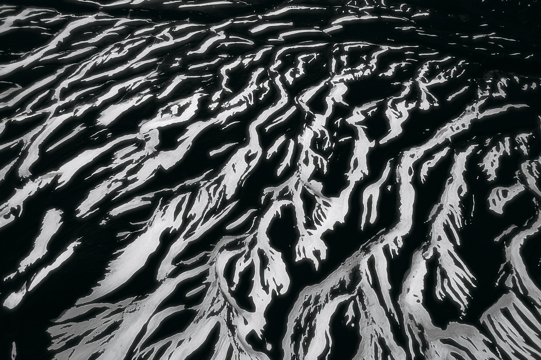
Erosion in the southwest of the Ysyk-Köl Lake near Kara-Koo, Kyrgyzstan (42°12' N - 76°37' E).
Water spraying in the Beqaa Valley, Lebanon (34°03' N, 36°08' E).
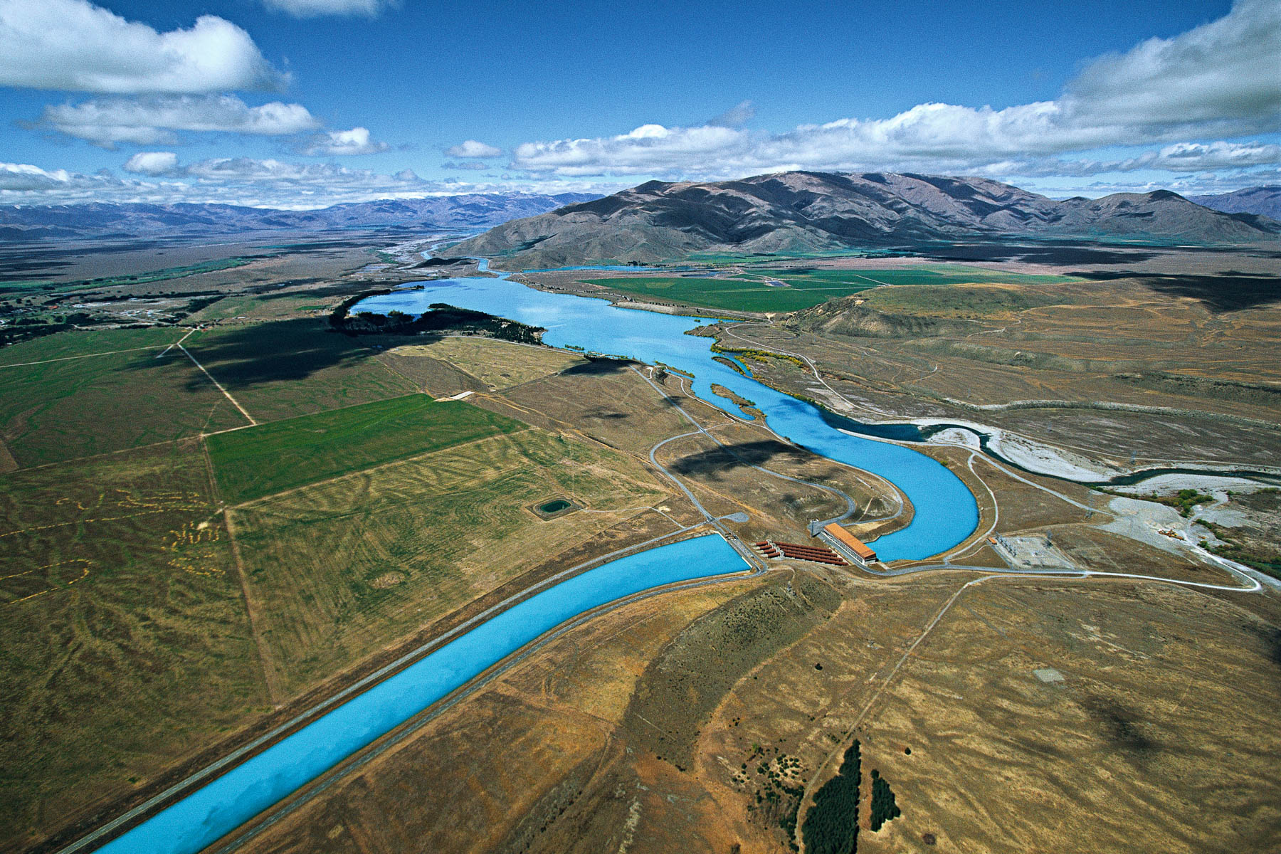
Ohau A hydroelectric power station, South Island, New Zealand (40°40' S – 175°15' E).
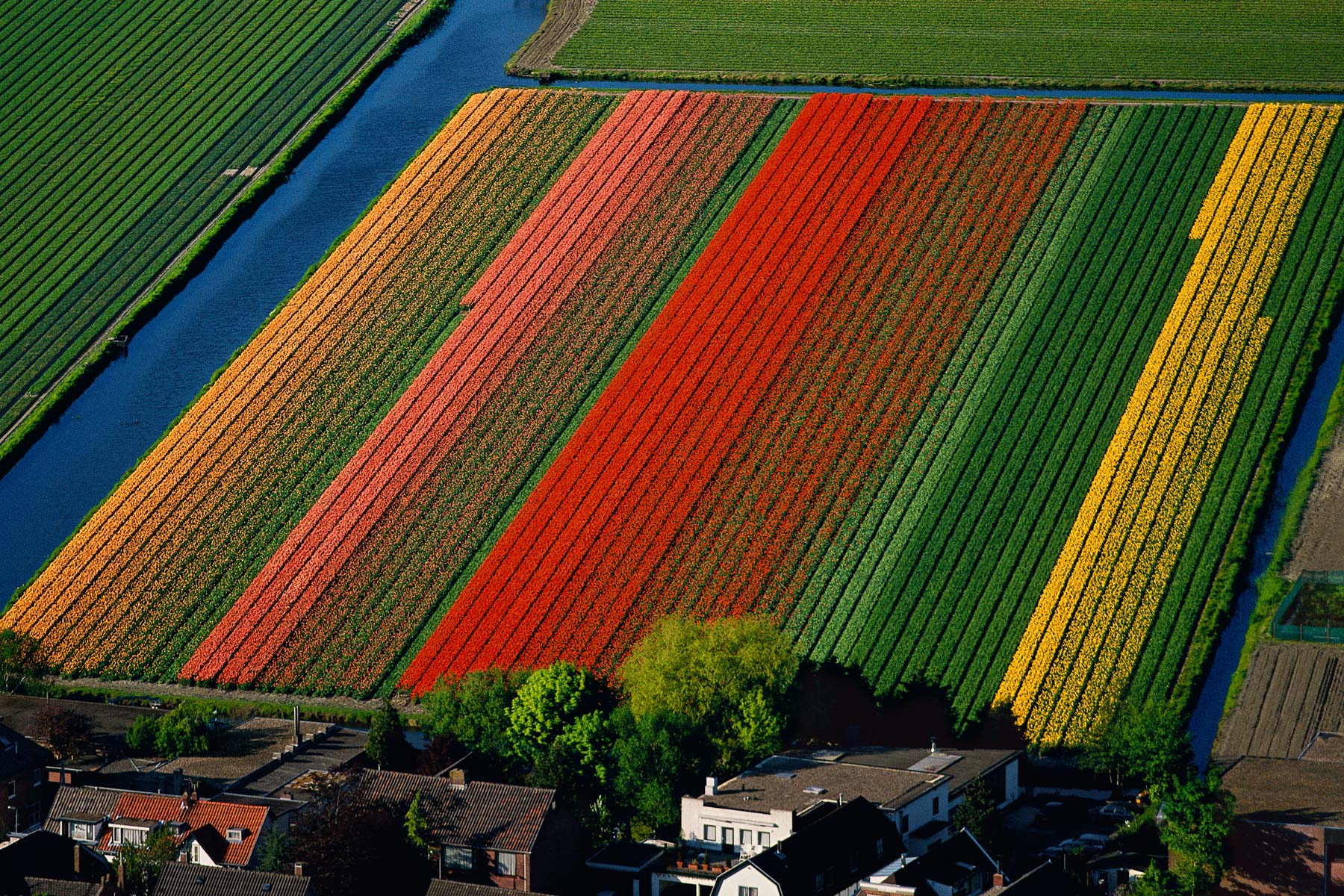
Tulip fields near Lisse, Amsterdam Region, Netherlands (52°15’ N, 4°37’ E).
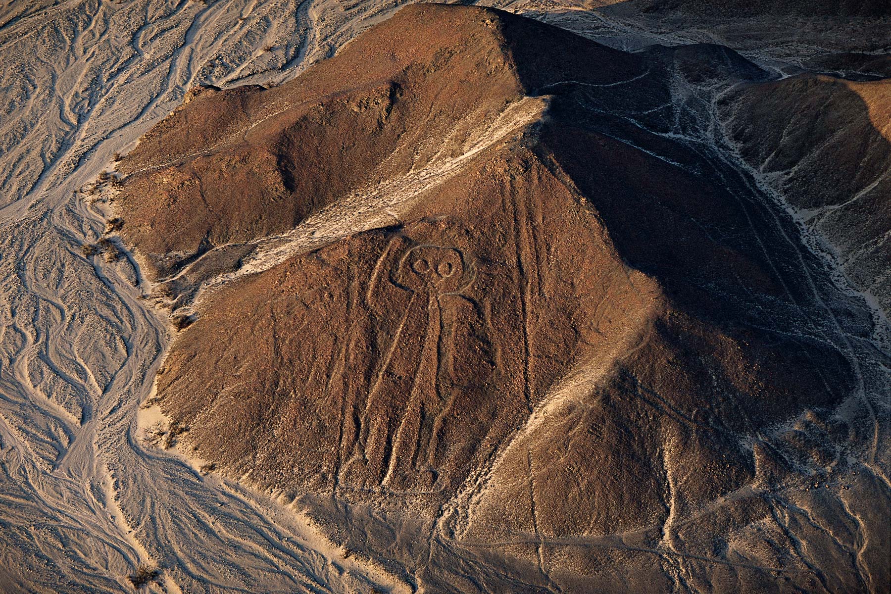
The Nazca astronaut, Ica, Peru (14°50' S - 74°60' W).
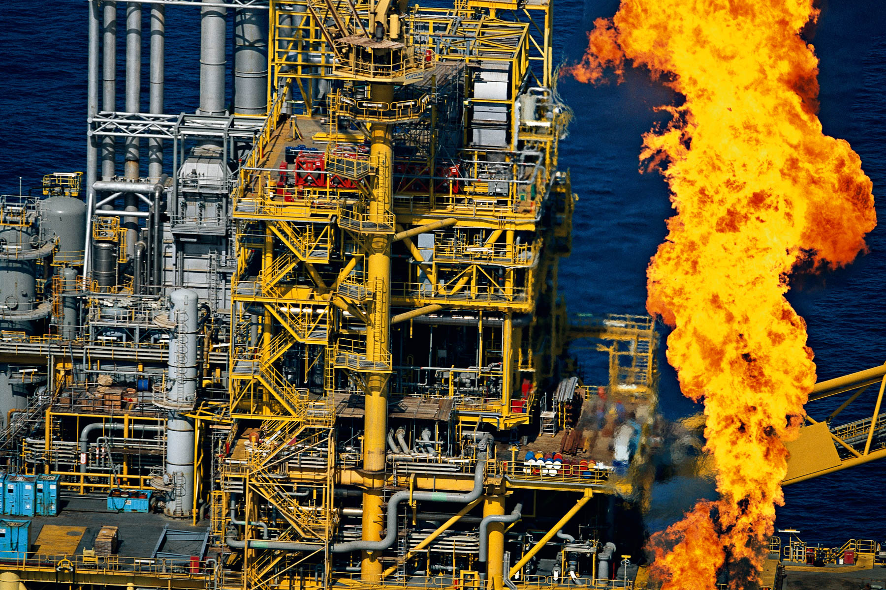
Al-Shaheen oil rig, Qatar (25°30' N - 51°30' E).
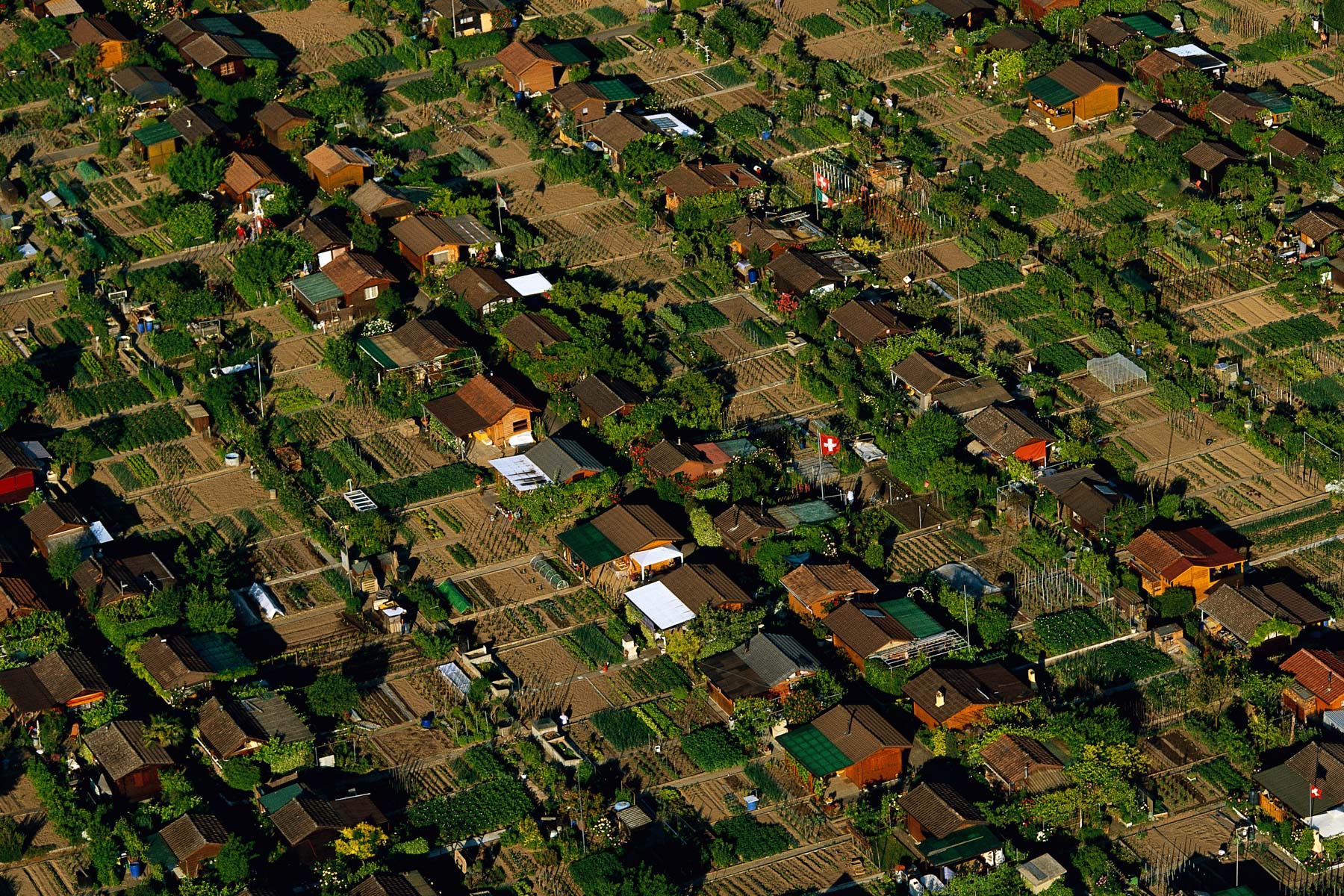
Allotments in the Avanchets estate, Geneva, Switzerland (46°12' N, 6°09' E).
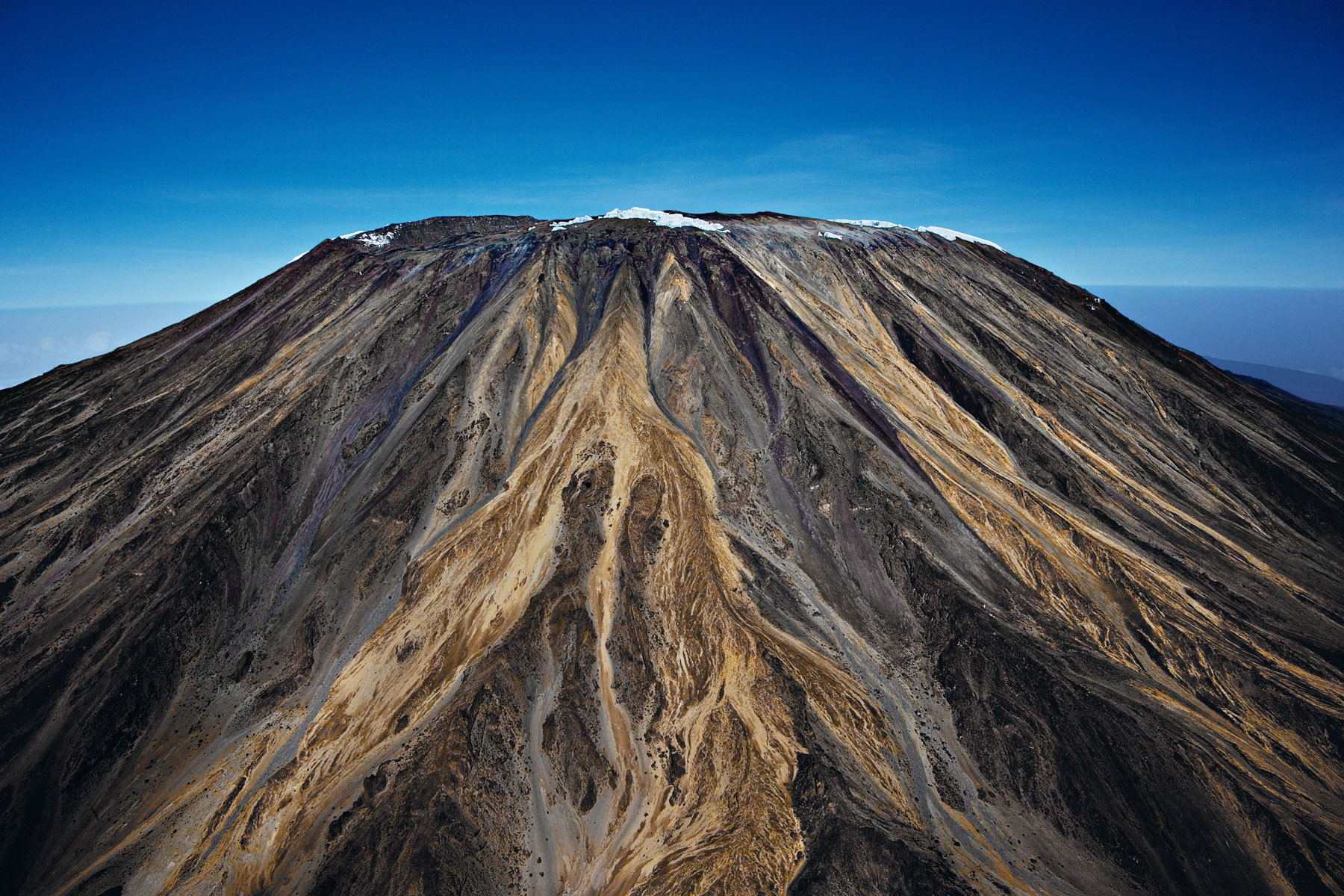
Kilimanjaro's disappearing snow, Tanzania (3°04' S - 37°22' E).
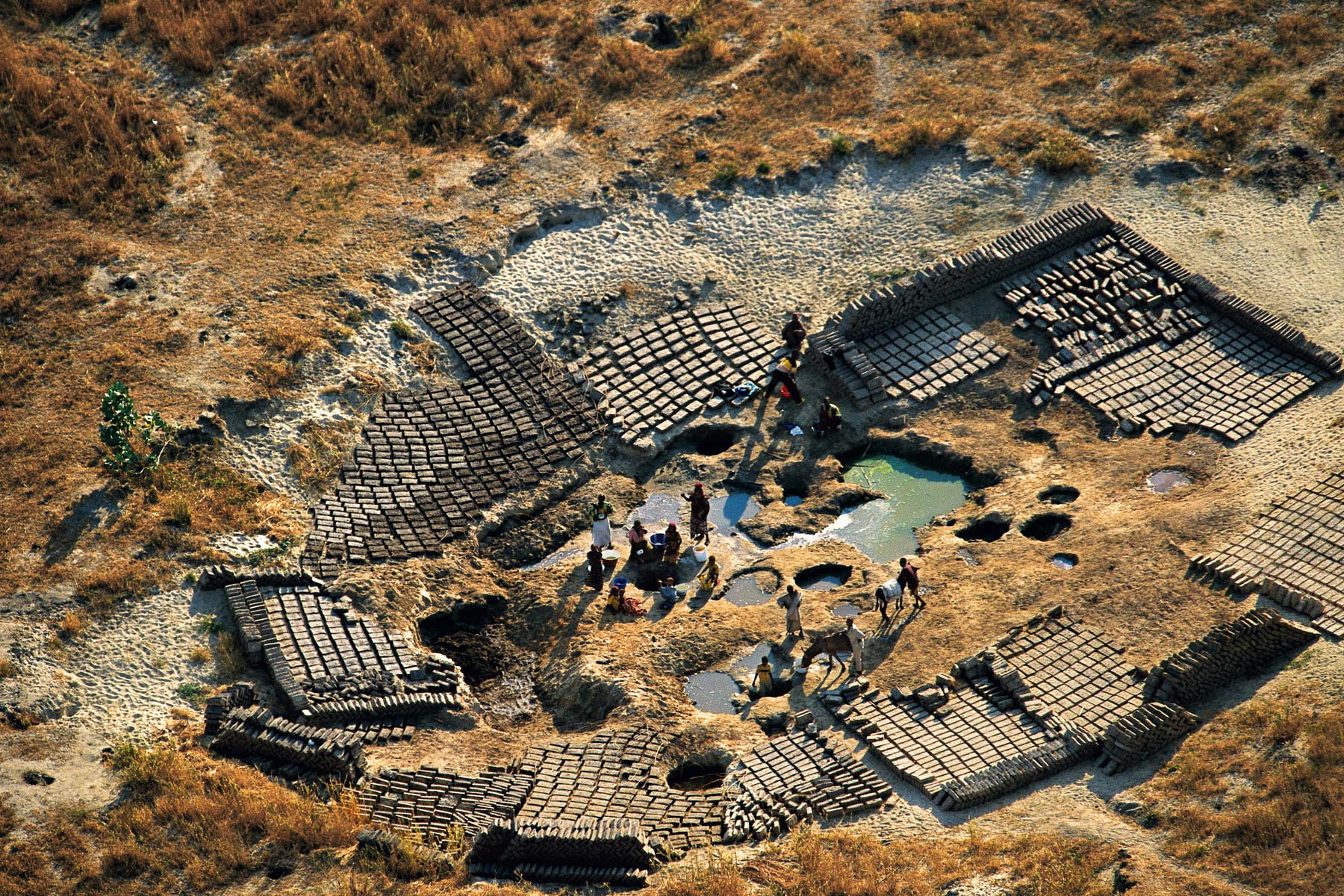
Brickworks near Karal, Chad (12°50' N, 14°45' E).
Village near Tom Maréfin, Chad (12°30' N – 14°55' E).
Caroni River in the Canaima National Park, Bolivar, Venezuela (6°00' N, 62°52' W).
Fishing village on a island of Lake Victoria, Kenya (0°27' S - 33°56' E).
Nuami Islet, Nokan Hui atoll at the south of the Isle of Pines, New Caledonia, France (22°45' S - 167°34' E).
Feed lot near the city of Young, Rio Negro Department, Eastern Republic of Uruguay (32°42’S, 57°38’W).
Rice field in the basin of the Rio San Salvador, Soriano Department, Eastern Republic of Uruguay (33°39’S, 57°59’W).
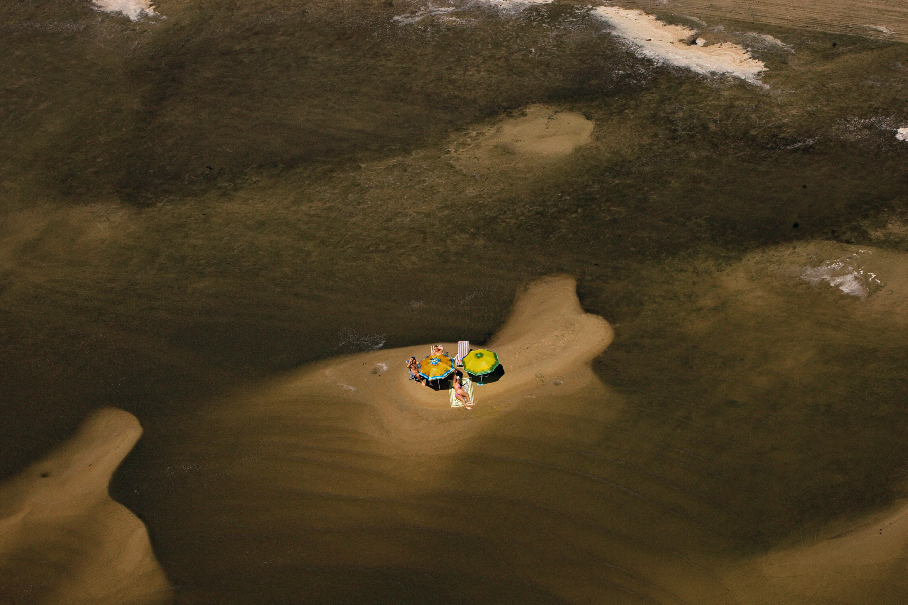
Swimmers on Laguna Merin near Punta Cachimbas, Rocha Department, Eastern Republic of Uruguay (32°45’S, 53°16’W).
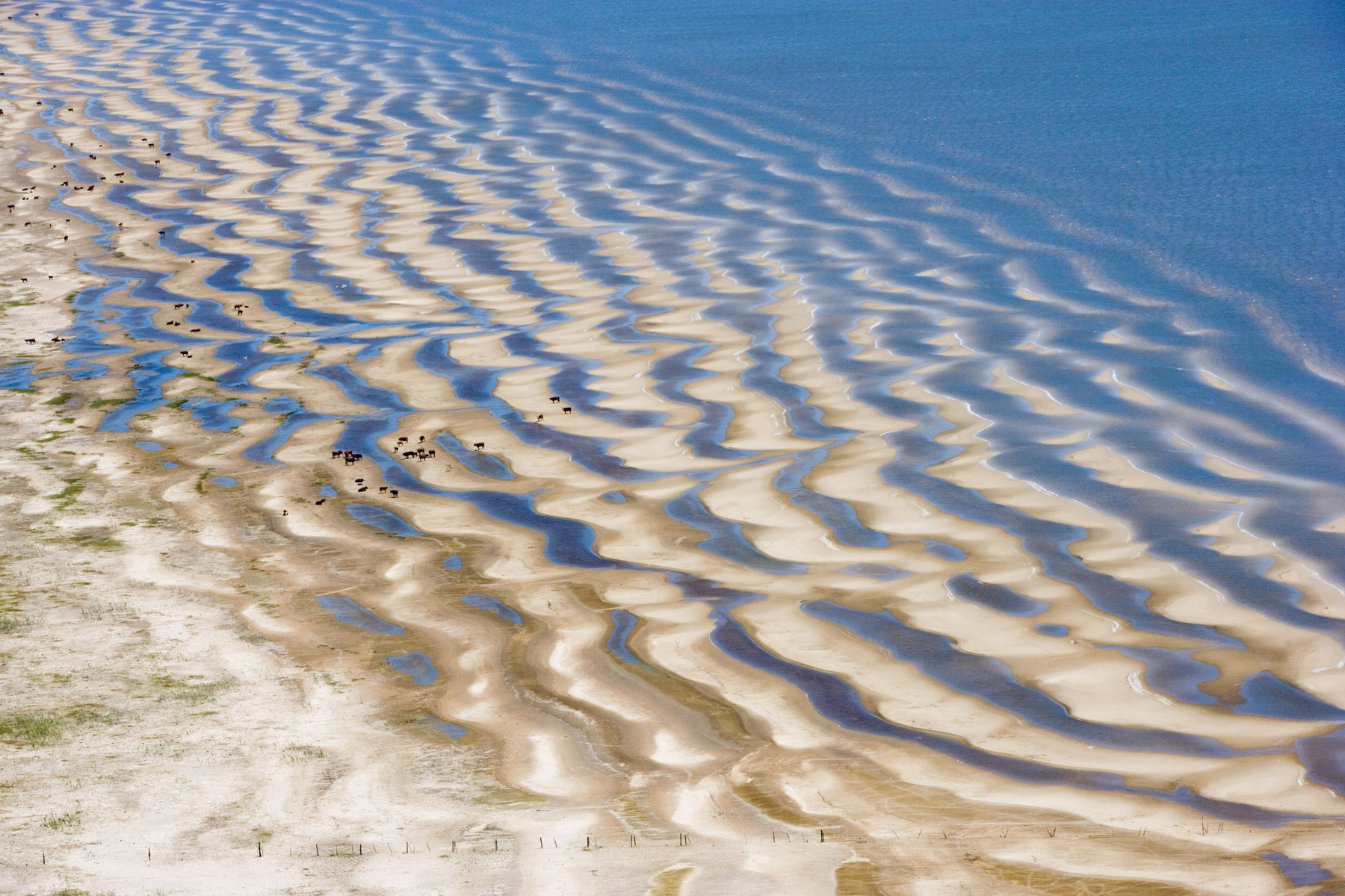
Herd of bovines, Laguna Merin near Punta Magro, Rocha department, The Oriental Republic of Uruguay (34°07' S -53°44' W).
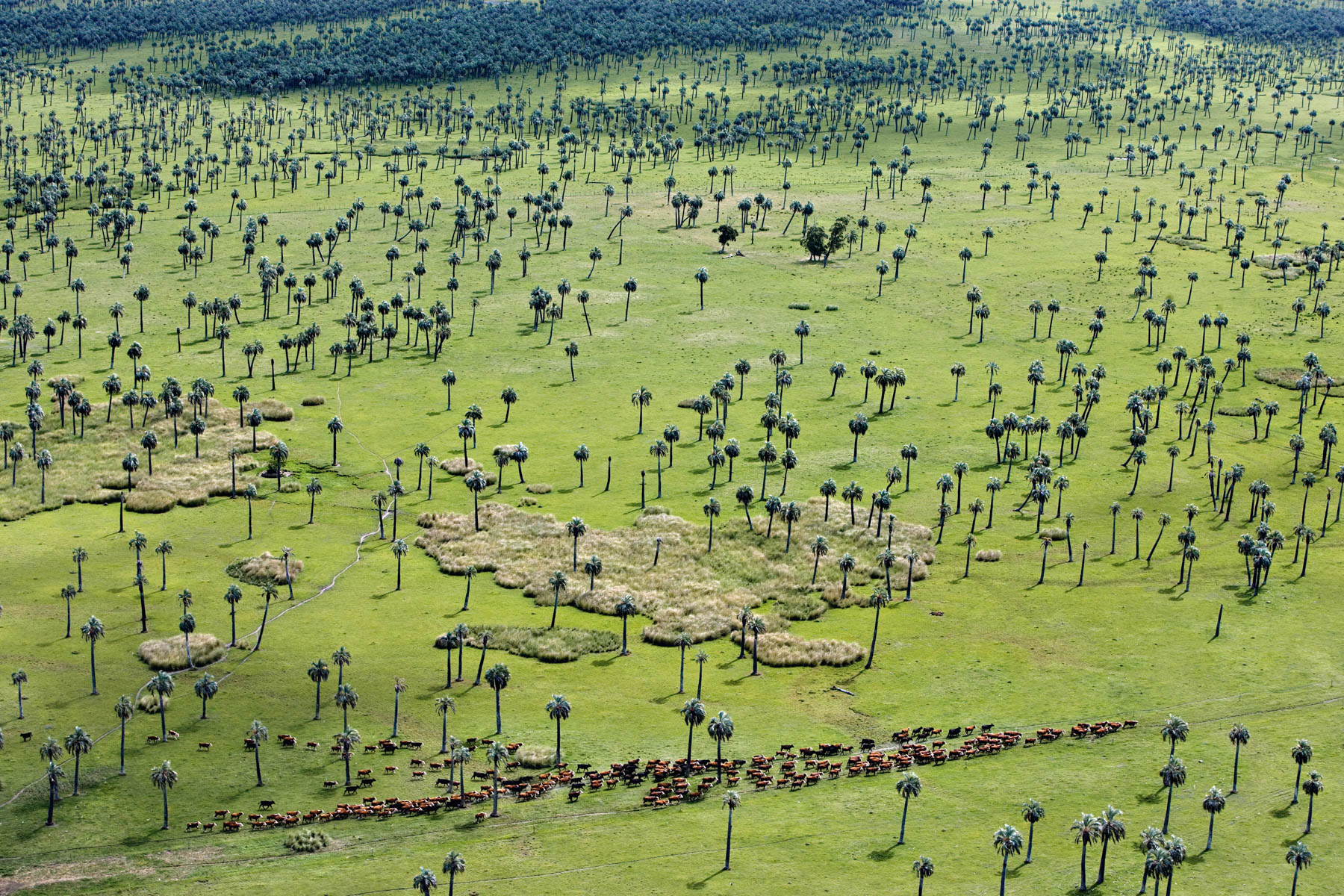
Palm grove and herd of cattle near Laguna Negra, province of Rocha, Eastern Republic of Uruguay (34°07' S - 53°44' W).
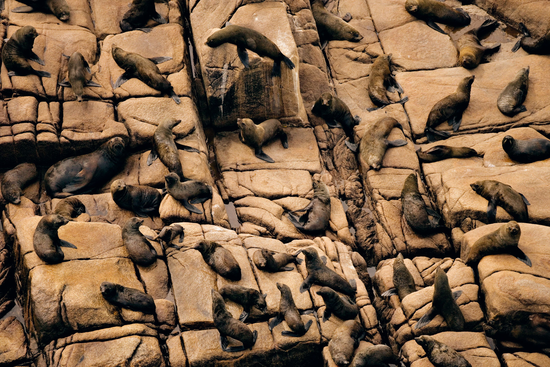
South American fur seals, Cabo Polonio in Rocha Department, Eastern Republic of Uruguay (34°24' S – 53°46' W).
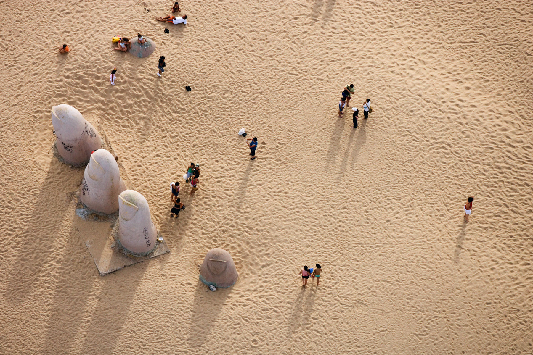
«The Mano»(© Mario Irrazábal/1982) on the beach of Brava to Punta del Este, Maldonado Department, Eastern Republic of Uruguay (34°57’S, 54°56’W).
Drying fish in the countryside in North Bangkok, Thailand (14°00' N - 100°36' E).
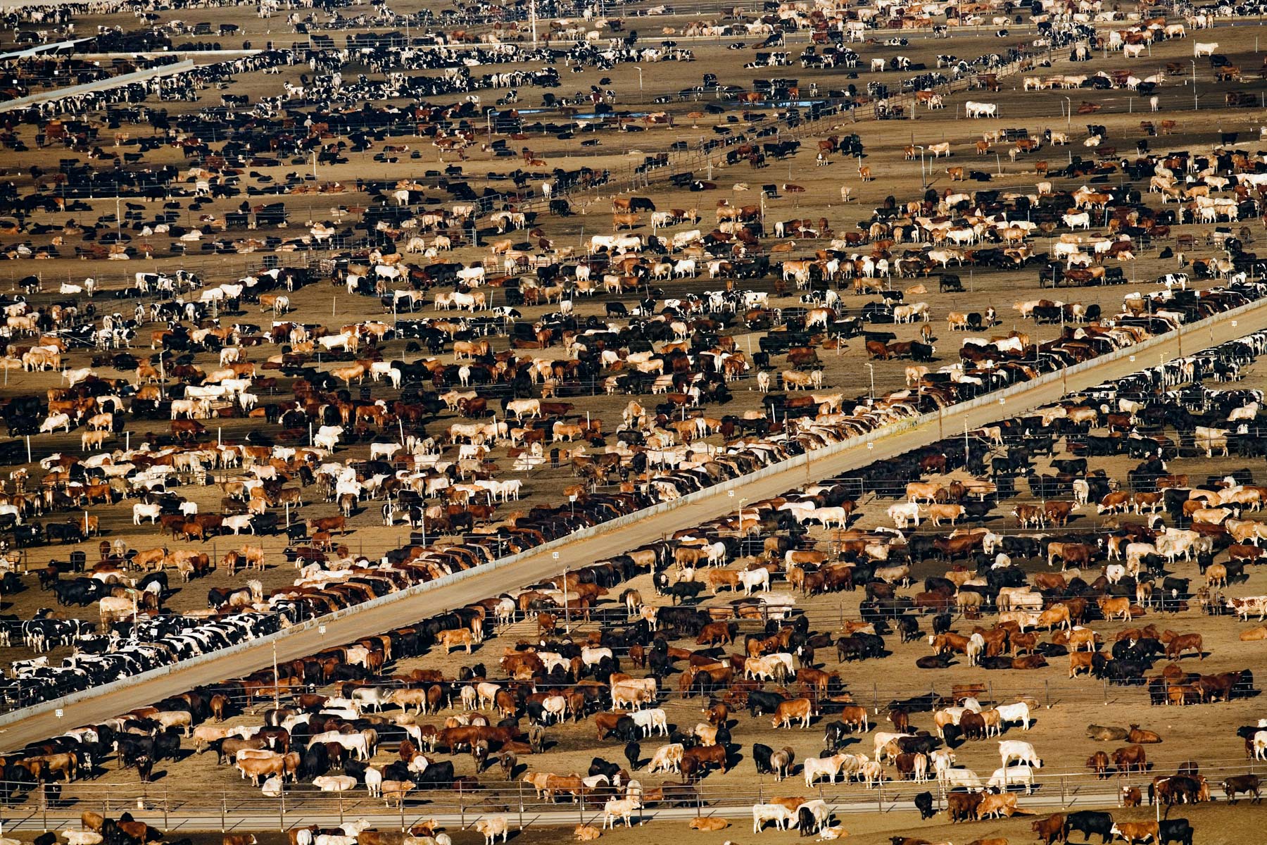
Feedlot near Bakersfield, California, United States (35°19' N - 120°16' W).
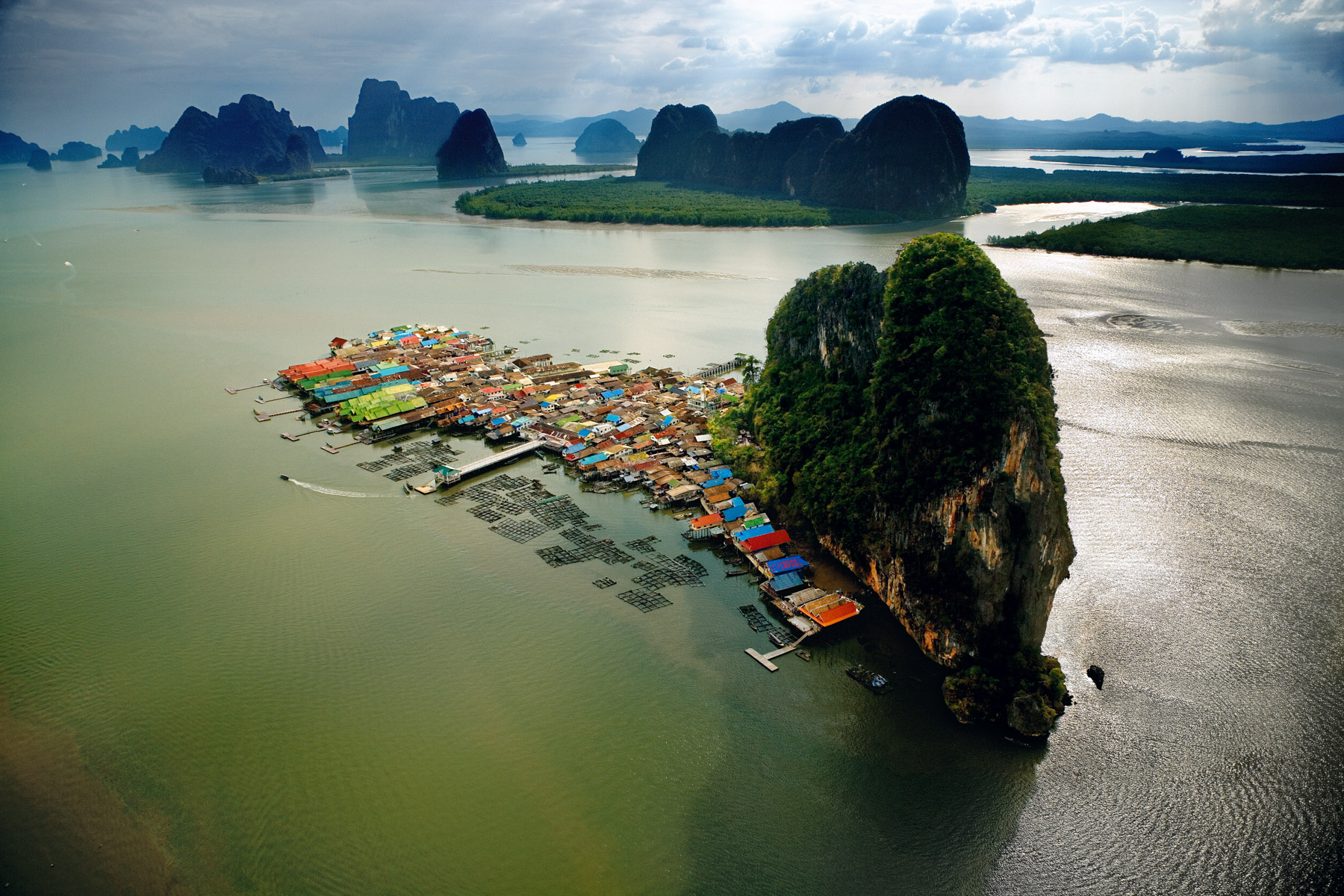
Village of Koh Panyi, Phang-nga Bay Thailand (8°20’ N – 98°30’E).
Working the fields in the north of Phuket Island, Thailand (8°14' N – 98°19' E).
Nets used for drying algae, Wando Archipelago, South Korea (34°19' N - 127°05' E).
Eroded iceberg Unartoq fjord, Greenland, Denmark (60°28' N - 45°19' W).
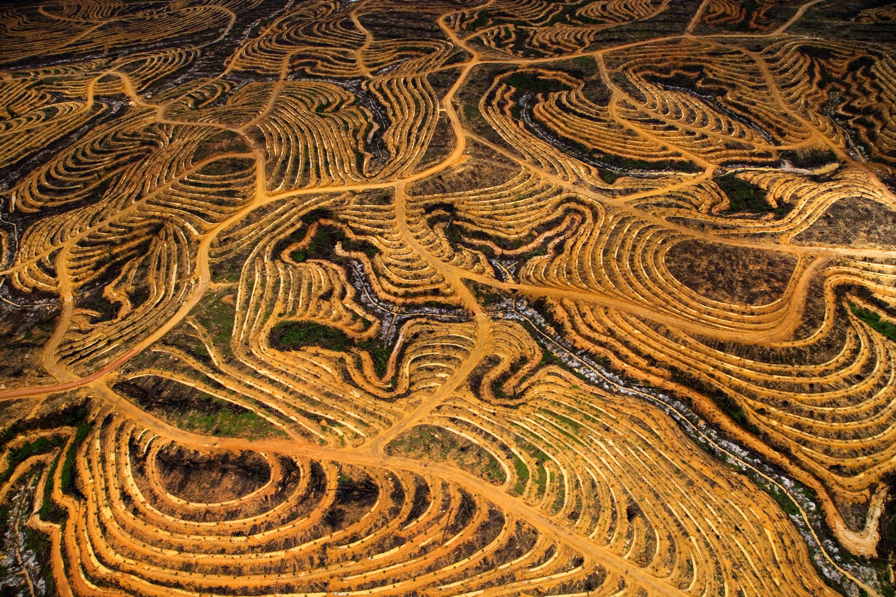
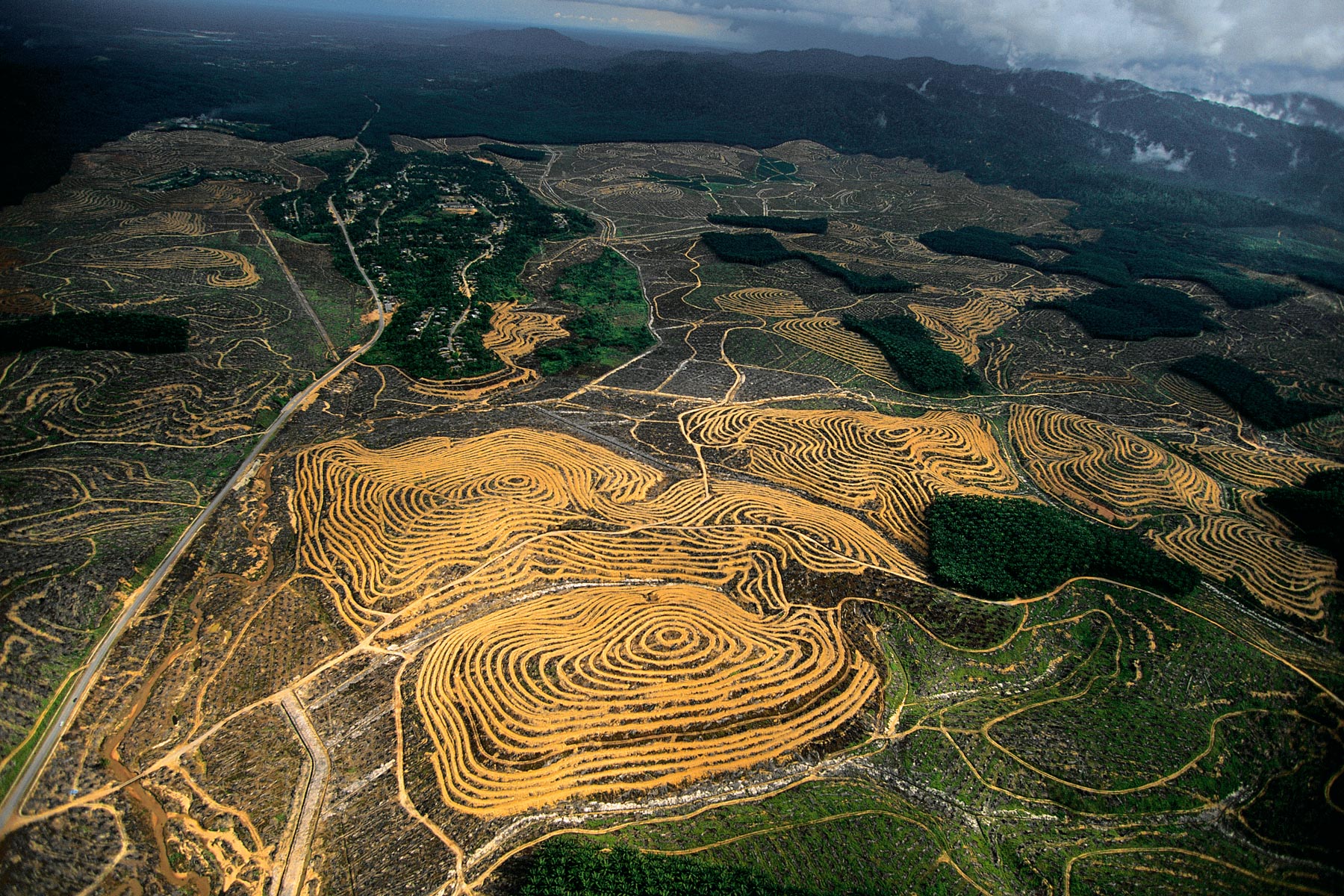
New oil palm plantations near Pundu, Borneo, Indonesia (1°59' S - 113°06' E).
Back from fishing in Kayar, Senegal (14°55' N - 17°07' W).
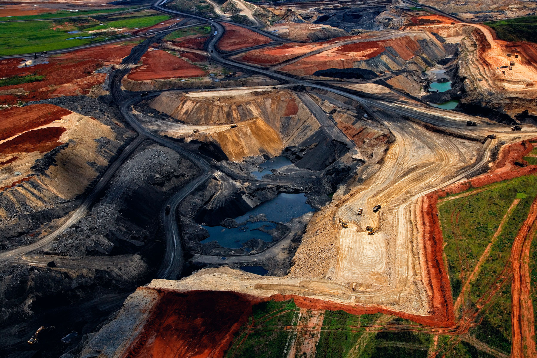
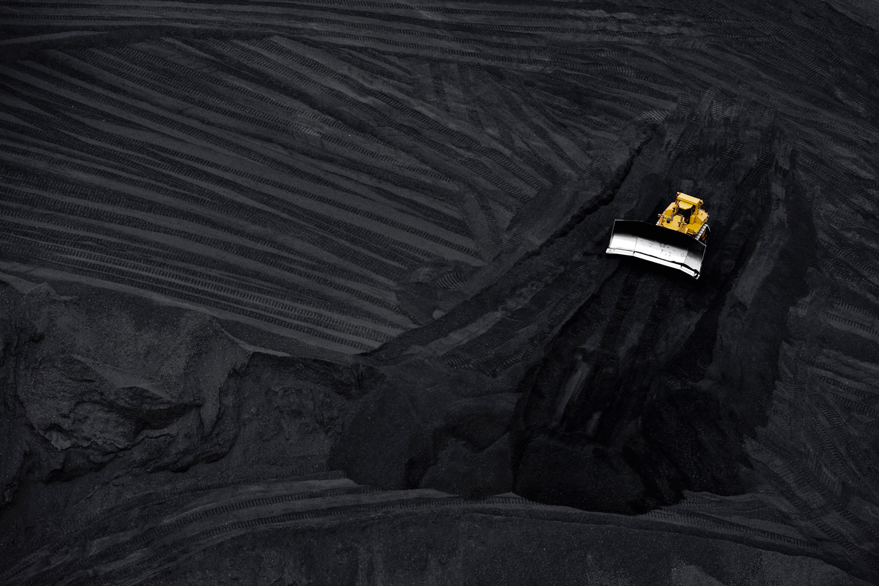
Delmas open-air coal mine, Republic of South Africa (S 26°10' E 28°44').
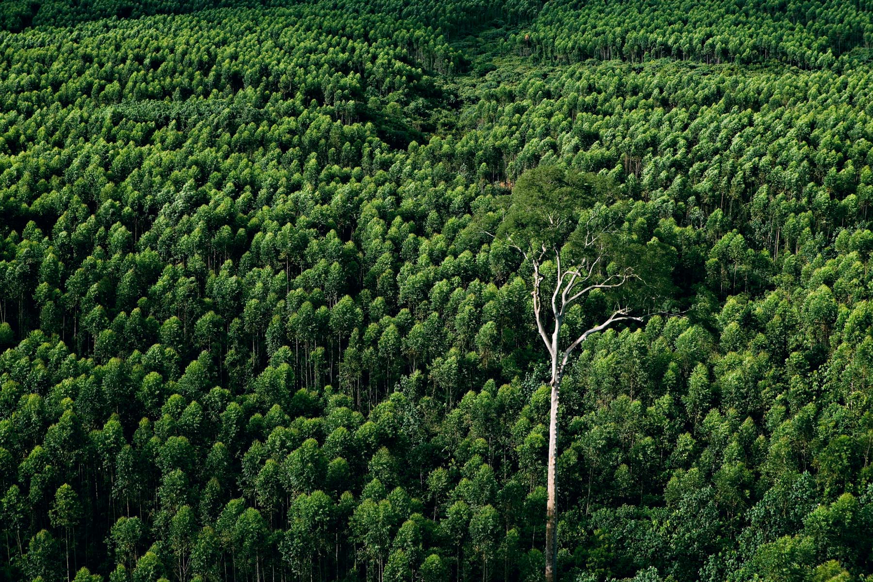
Isolated tree in a eucalyptus plantation, Indonesia (1°54' S - 112°29' E).
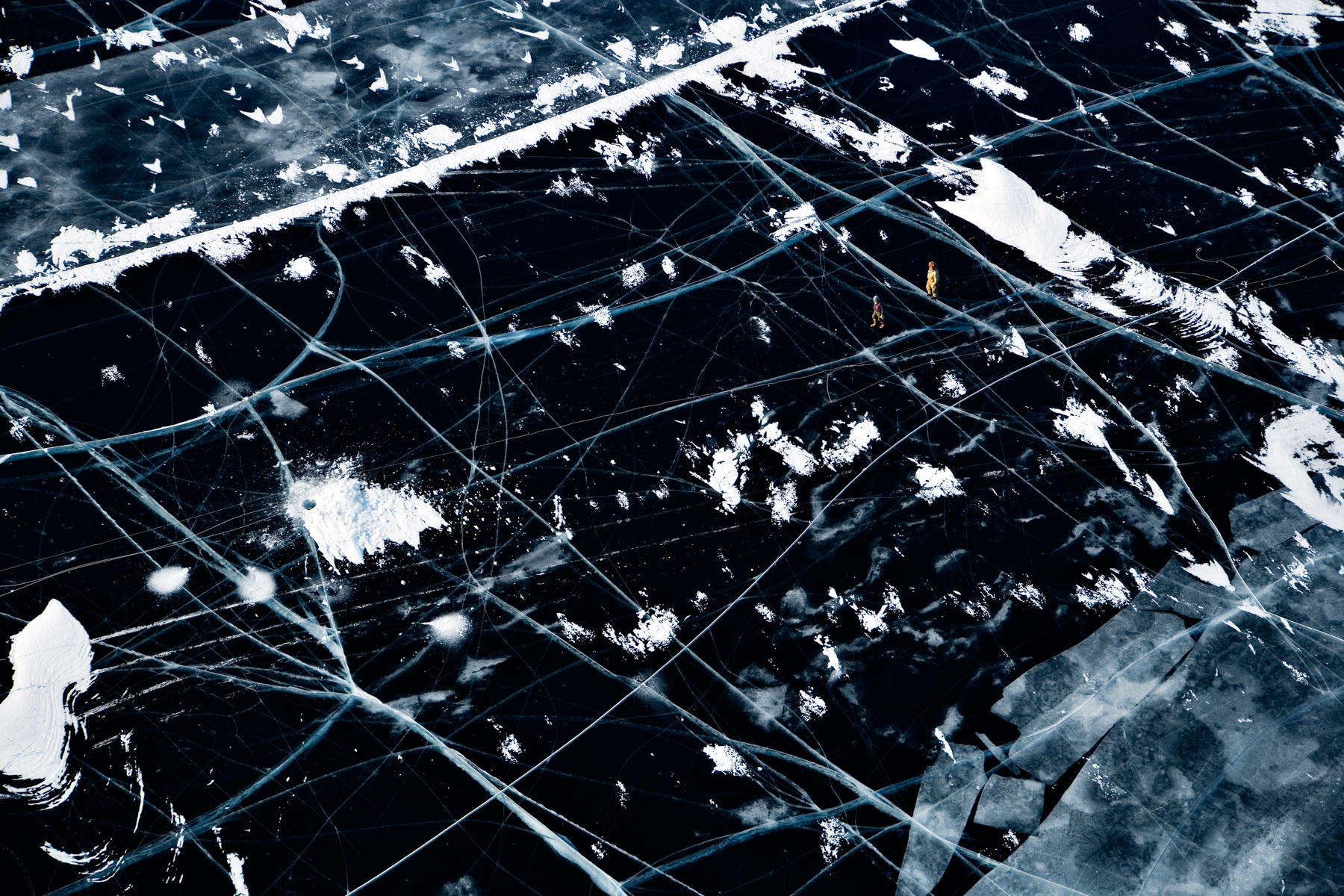
Fishermen on frozen Baïkal Lake, Siberia, Russia (53°46' N - 108°19' E).
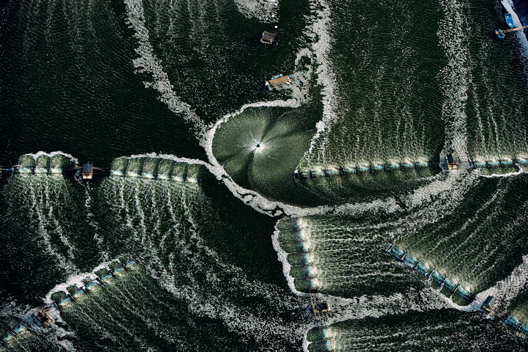
Shrimp farm, Phang Nga bay, Thailand (8°23' N - 98° 34' E).
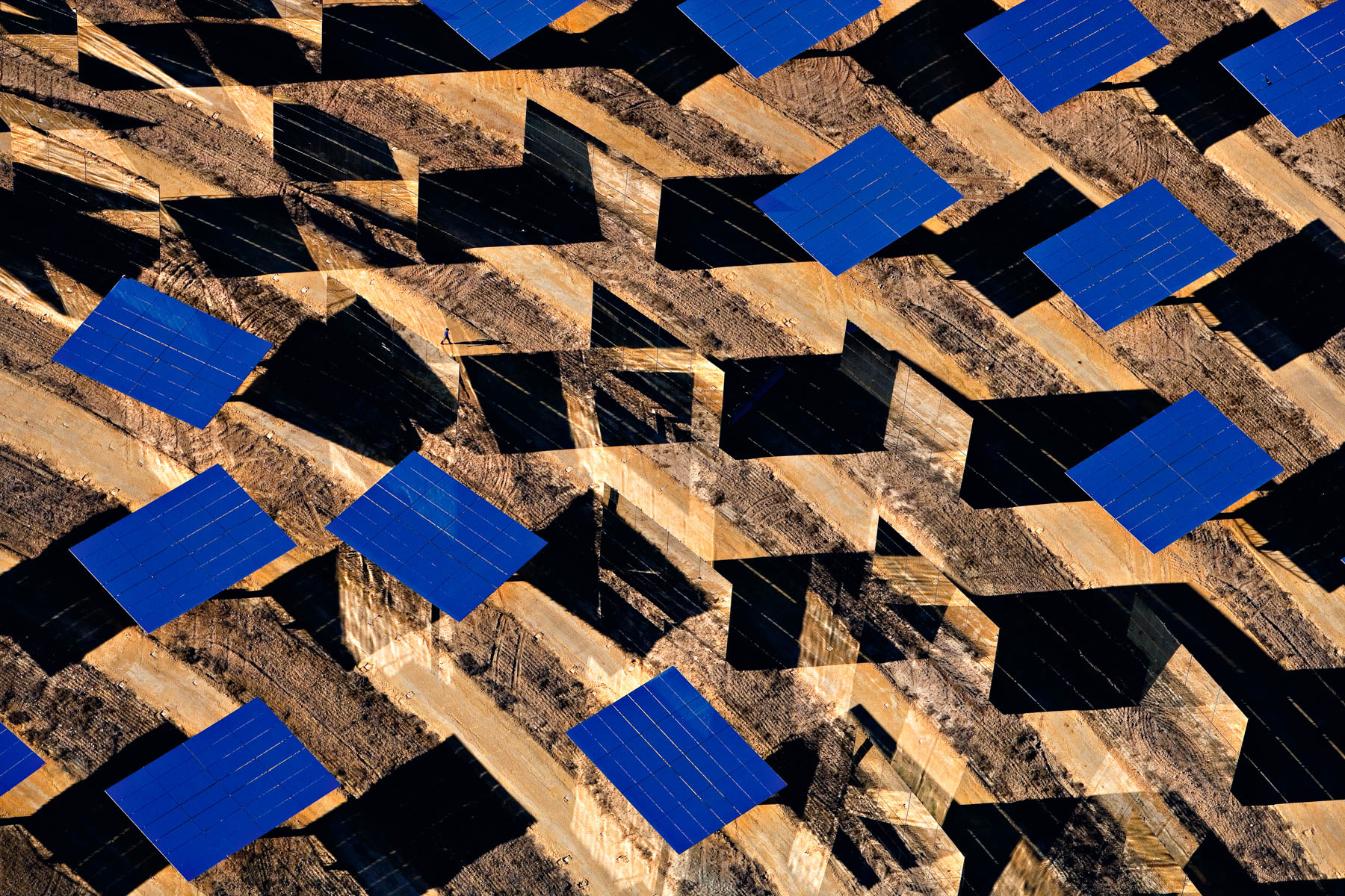
Solar thermal power plants in Sanlúcar la Mayor, near Sevilla, Andalusia, Spain (37°26’ N, 6°15’W).
Market near Surulere in Lagos, Nigeria (6°31' N – 3°22' E).
Waste from a marble exploitation near Kishangarh, Rajasthan, India (26°35' N - 74°51' E).
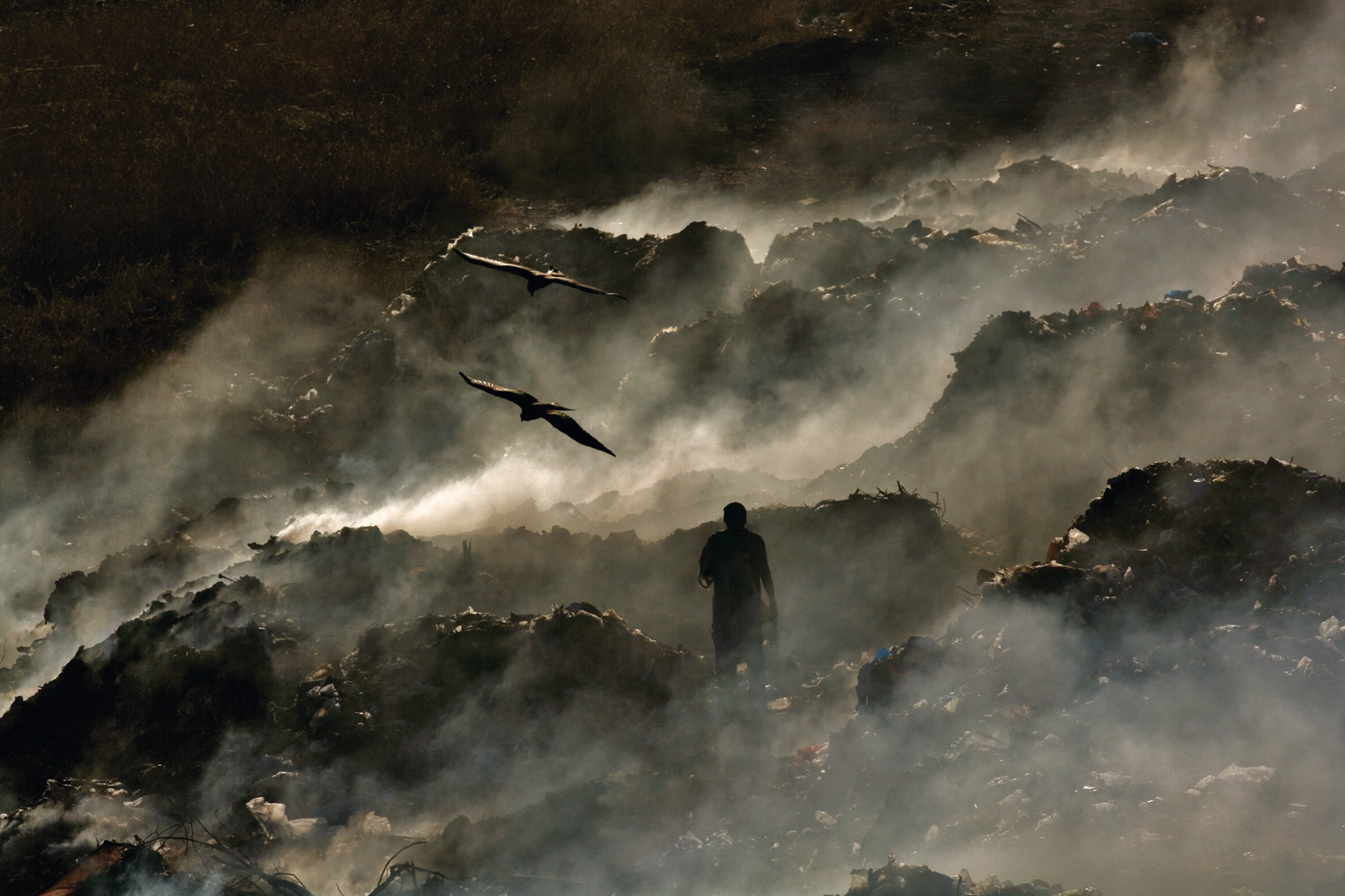
Mbeubeuss dump site in Malika, in Dakar, Senegal (14°48' N - 17°19' W).
Holmsarlon lake near the Myrdalsjökull glacier, Iceland (63°51' N - 19°53' W).
Louis-Saint-Laurent icebreaker in Resolute Bay, Nunavut Territory, Canada (74°42' N - 95°18' W).
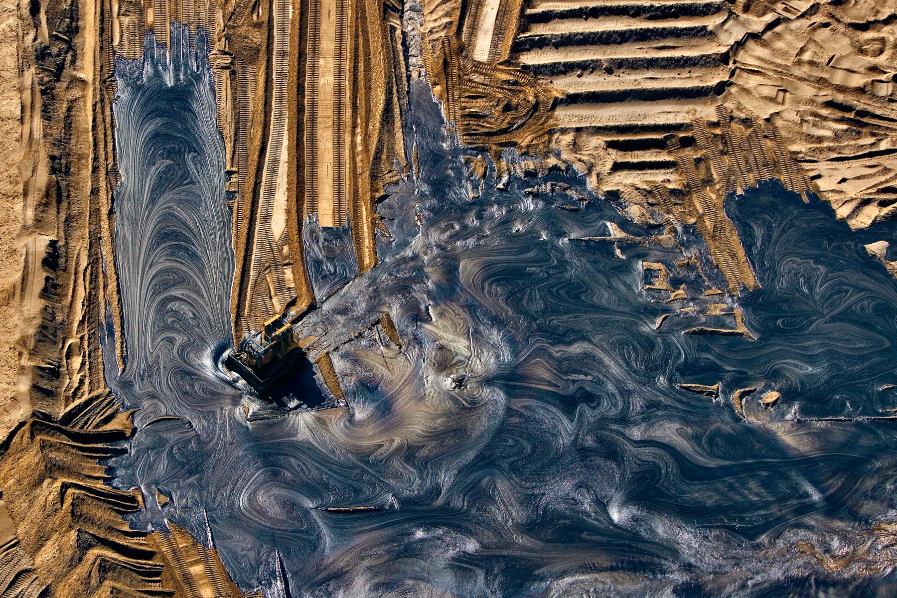
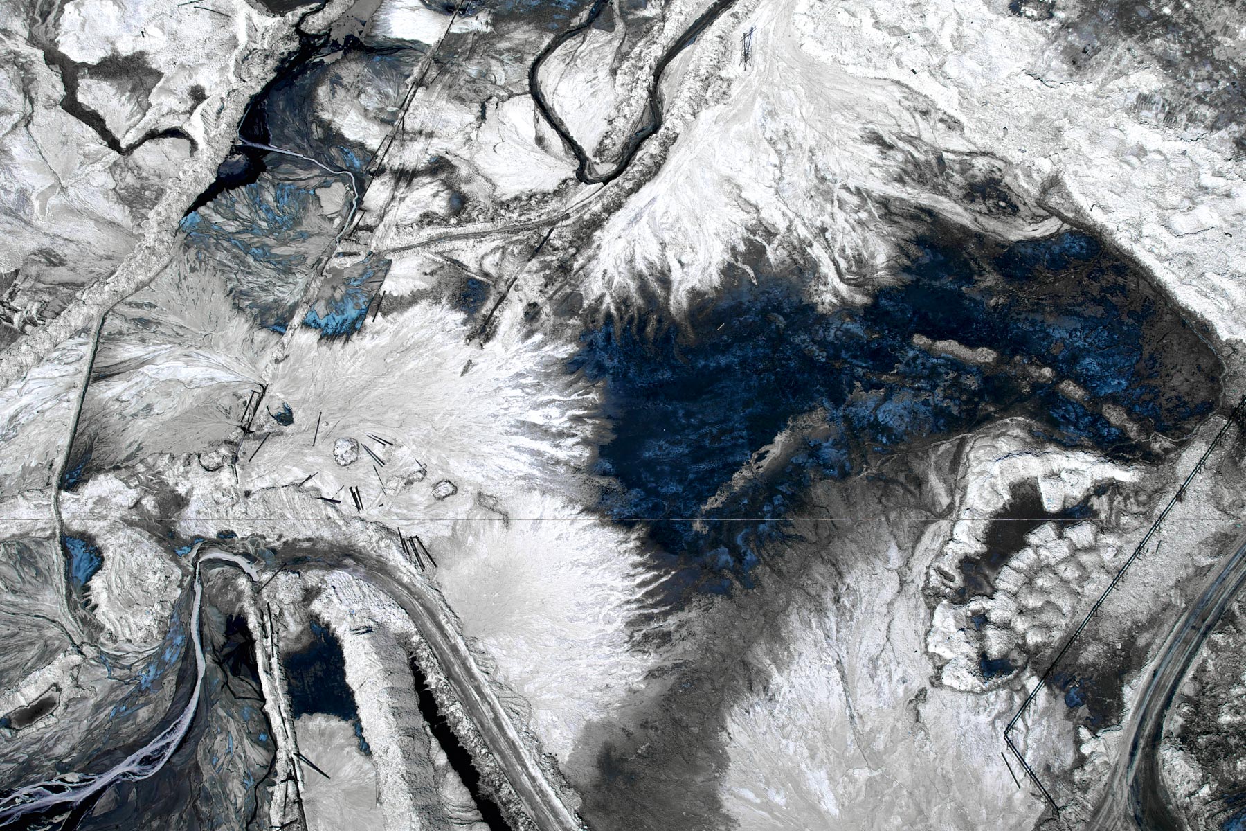
Enfouissement de résidus pétroliers issus de l’exploitation des sables bitumineux, Fort McMurray, Alberta, Canada (57°01’ N – 111°38’ O). Oil residue landfill from the exploitation of oil sands, Fort McMurray, Alberta, Canada (57°01' N - 111°38' W).
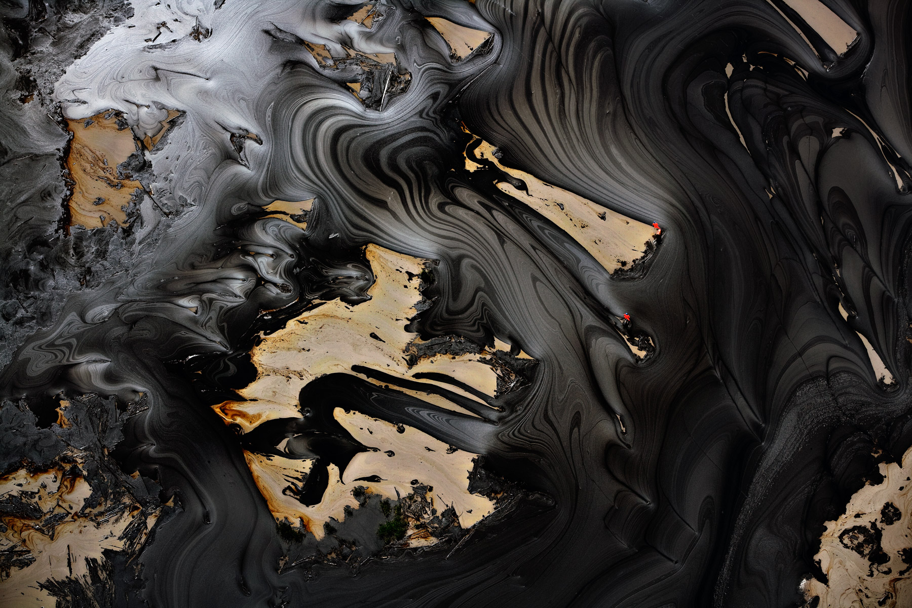
Dépôts de goudron dans un bassin après extraction des sables bitumineux d'Athabasca, Fort Mac Murray, province d'Alberta, Canada (57°01' N –111°38' O).
Cotton harvesting on the banks of the Euphrates River, near Deir ez-Zor, Syria (35°23' N - 40°07' E).
Rano Kau volcano in Rapa Nui National Park, Easter Island, Chile (27°11' S - 109°26' W).
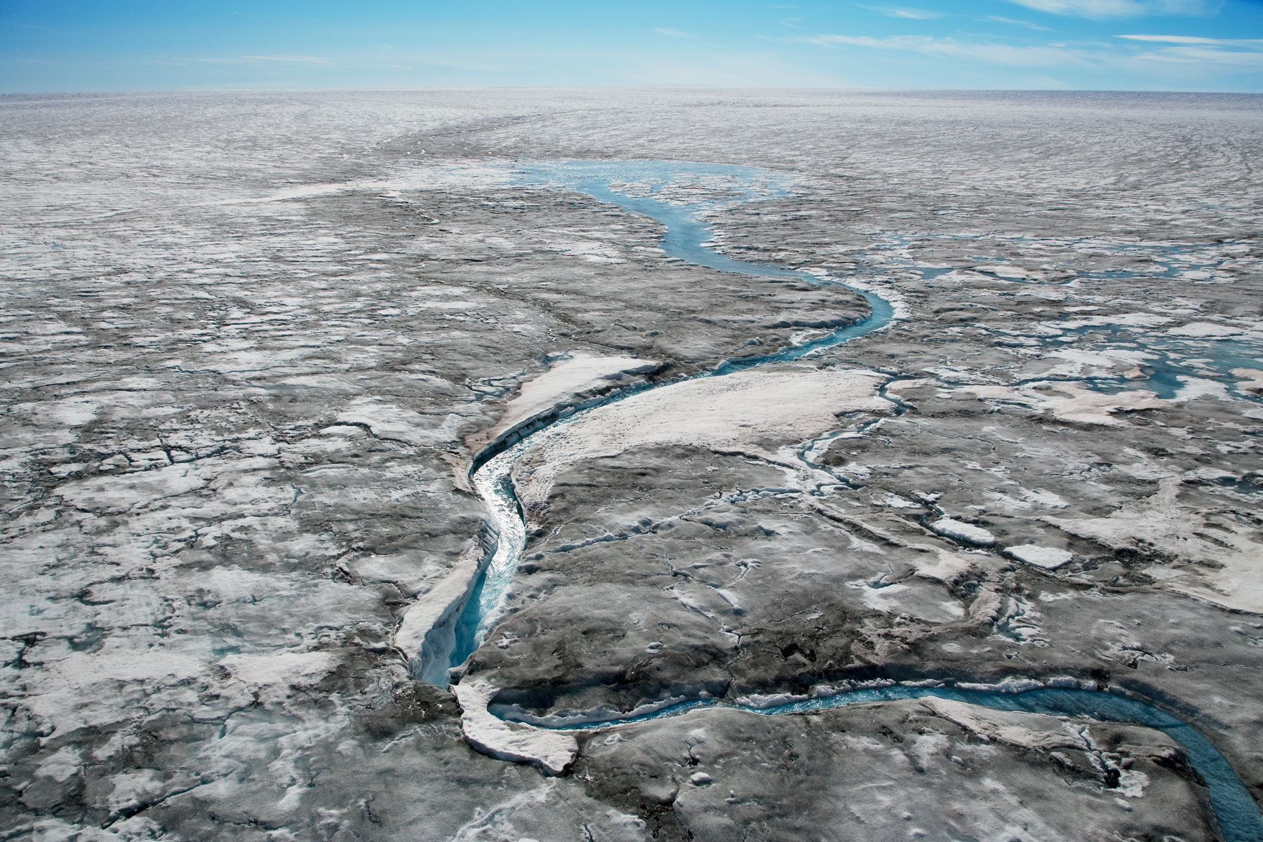
Glacial rill on Greenland's ice sheet, near Nordlit Sermiat, Greenland, Denmark (61°05' N - 46°27' W).
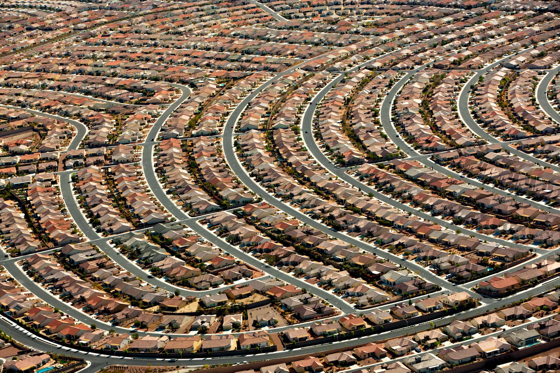
Henderson, Las Vegas suburb, Nevada, United States (35°60’ N - 115°05’ W).
Femmes au puit près de Khudiala, Rajasthan, Inde (26°26’ N – 72°40’ E).
Gold mining, borneo, Indonesia (1°32’ S, 113°05’ E).
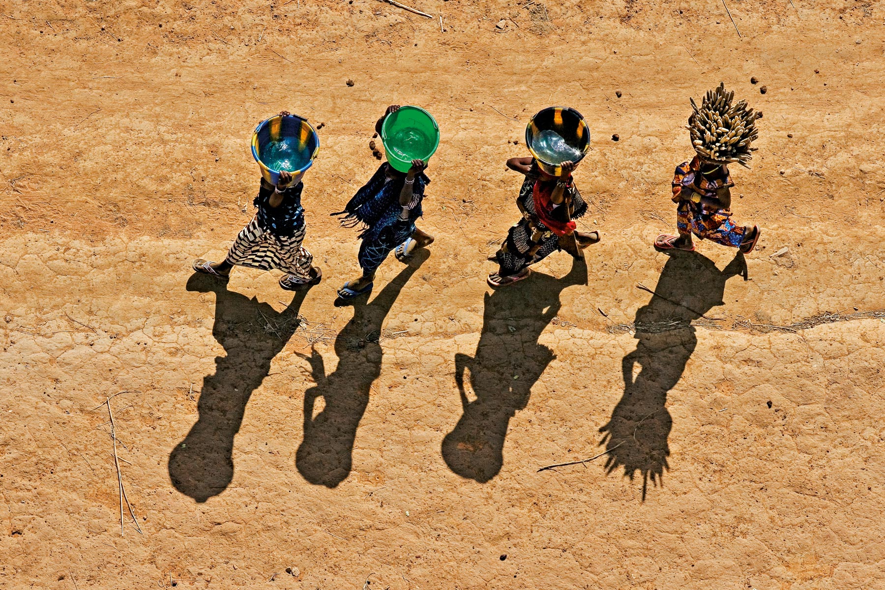
Young girls carrying buckets in the Dogon region, near Bandiagara, Mali (14°20' N - 3°37' W).
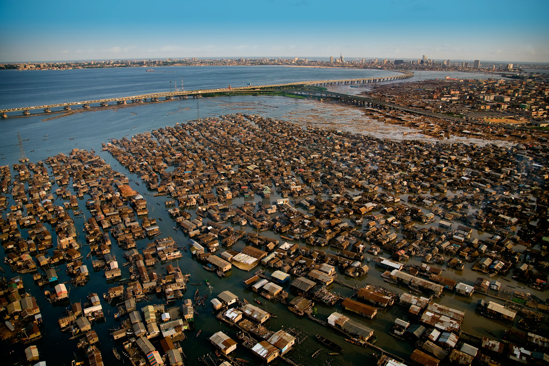
Makoko shanty town, Lagos lagoon, Lagos State, Nigeria (6°30' N - 3°24' E).
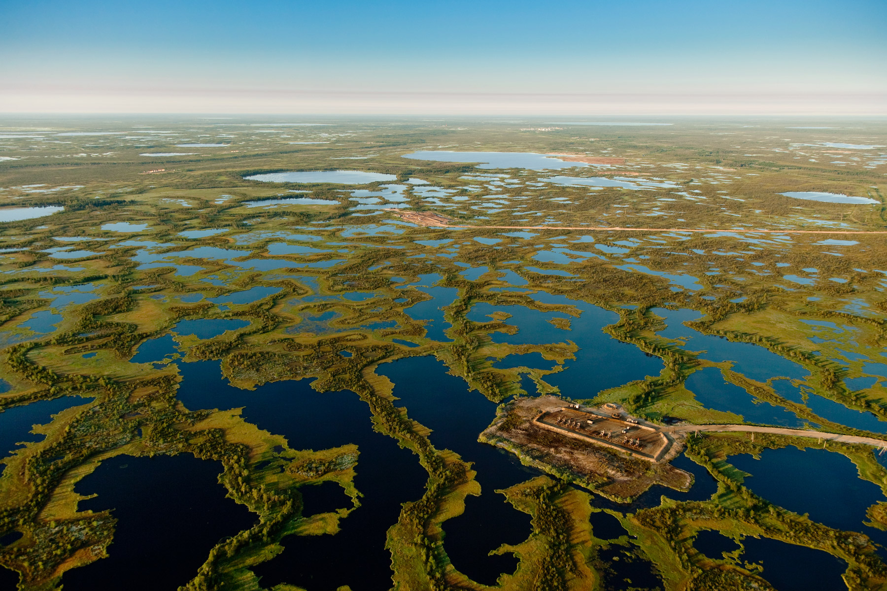
Oil drillings near Surgut, Siberia, Russia (61°30’N, 75°26’E).
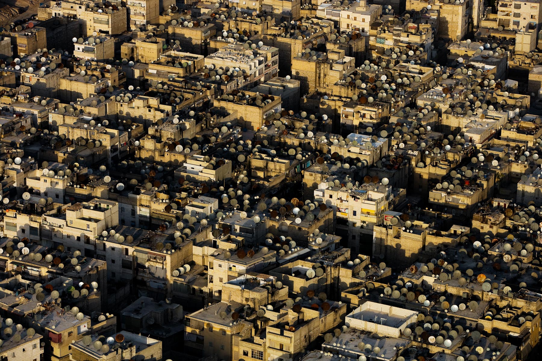
Satellite dishes on the roofs of Aleppo, Syria (36°13' N – 37°10' E).
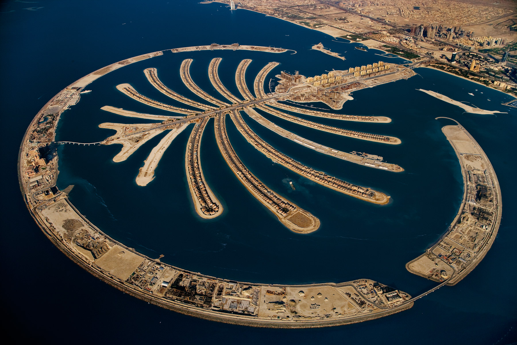
Palm Jumeirah artificial island, Dubai, United Arab Emirates (25°07’ N - 55°08’ E).
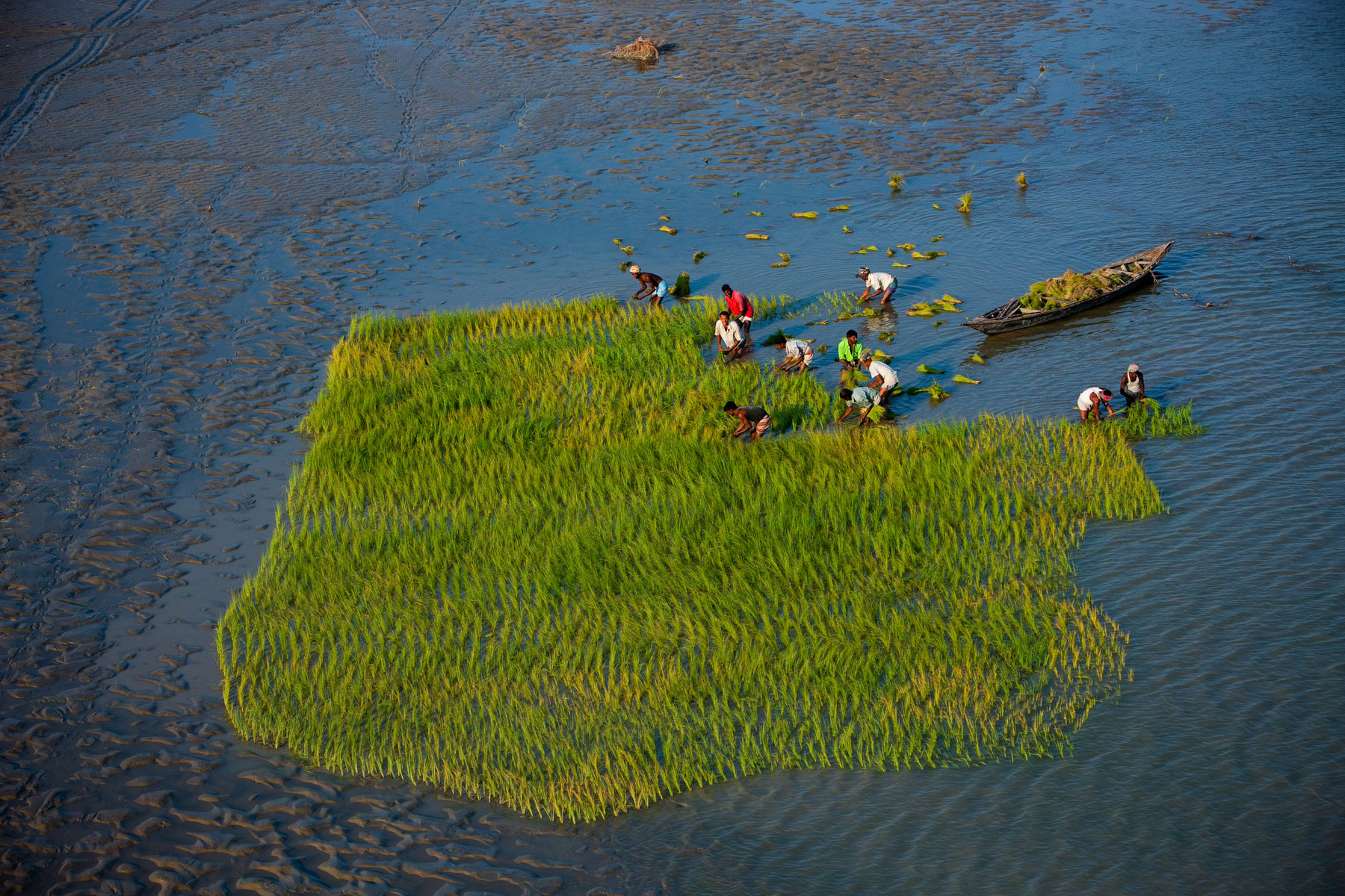
Farmers transplanting rice in the river bed of the Brahmaputra River, near Gaibanda, Bangladesh (25°15’ N – 89°39’E).
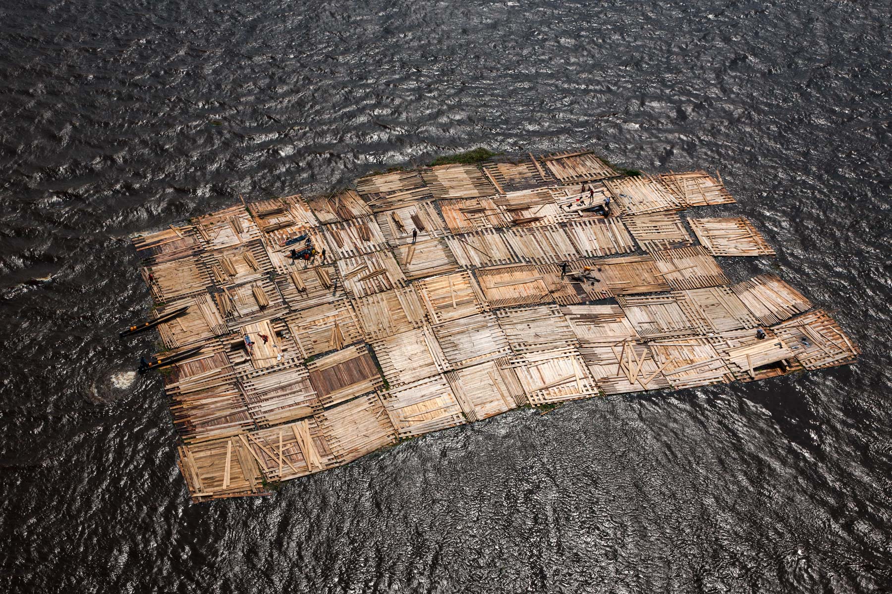
Floating wood near Port-Gentil, province of Ogooué-Maritime, Gabon (0°43' – 8°47' E).
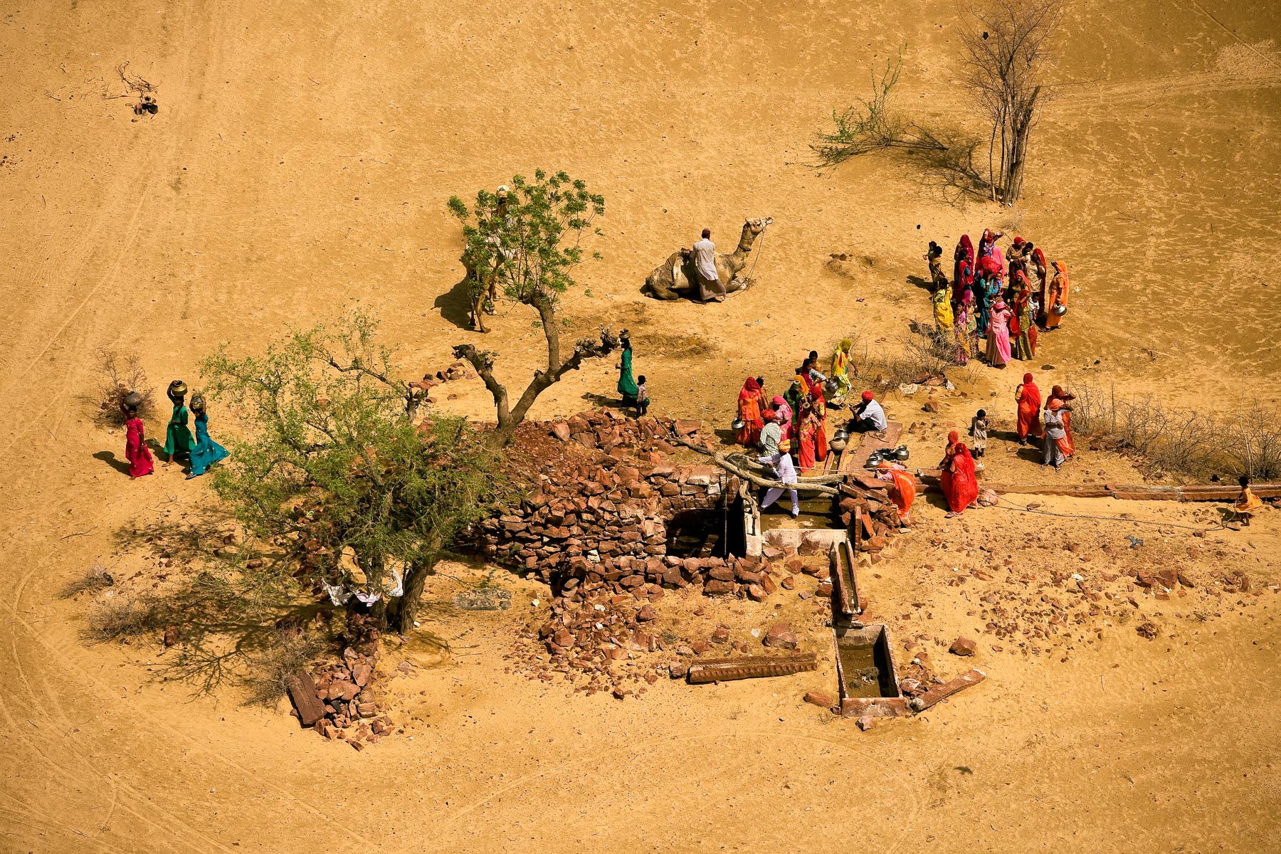
Goats and camels at a well in Ti-n-Tehoun, Timbuktu region, Mali (16°58' N – 2°57' W).
Oil drilling near Surgut, Siberia, Russia (61°07’– 73°26’E).
White Pelicans in the Senegal River Delta near St. Louis, Djoudj National Park Sanctuary, Senegal (16° 25' N – 16°16' W).
Leaf vegetables’ crops along the Senegal River near Saint-Louis, Senegal (16° 32' N – 16° 09' W).
Marsh landscape in West Coast National Park, Republic of South Africa (33°11'S – 18°06' E).
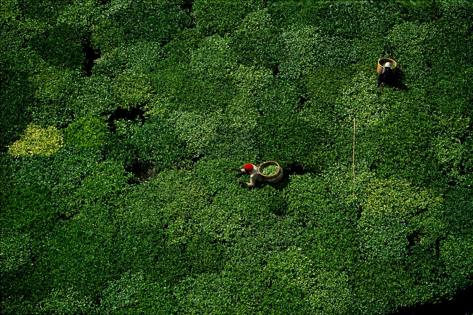
Tea picking, Kericho region, Kenya (0°22' S - 35°13' E).
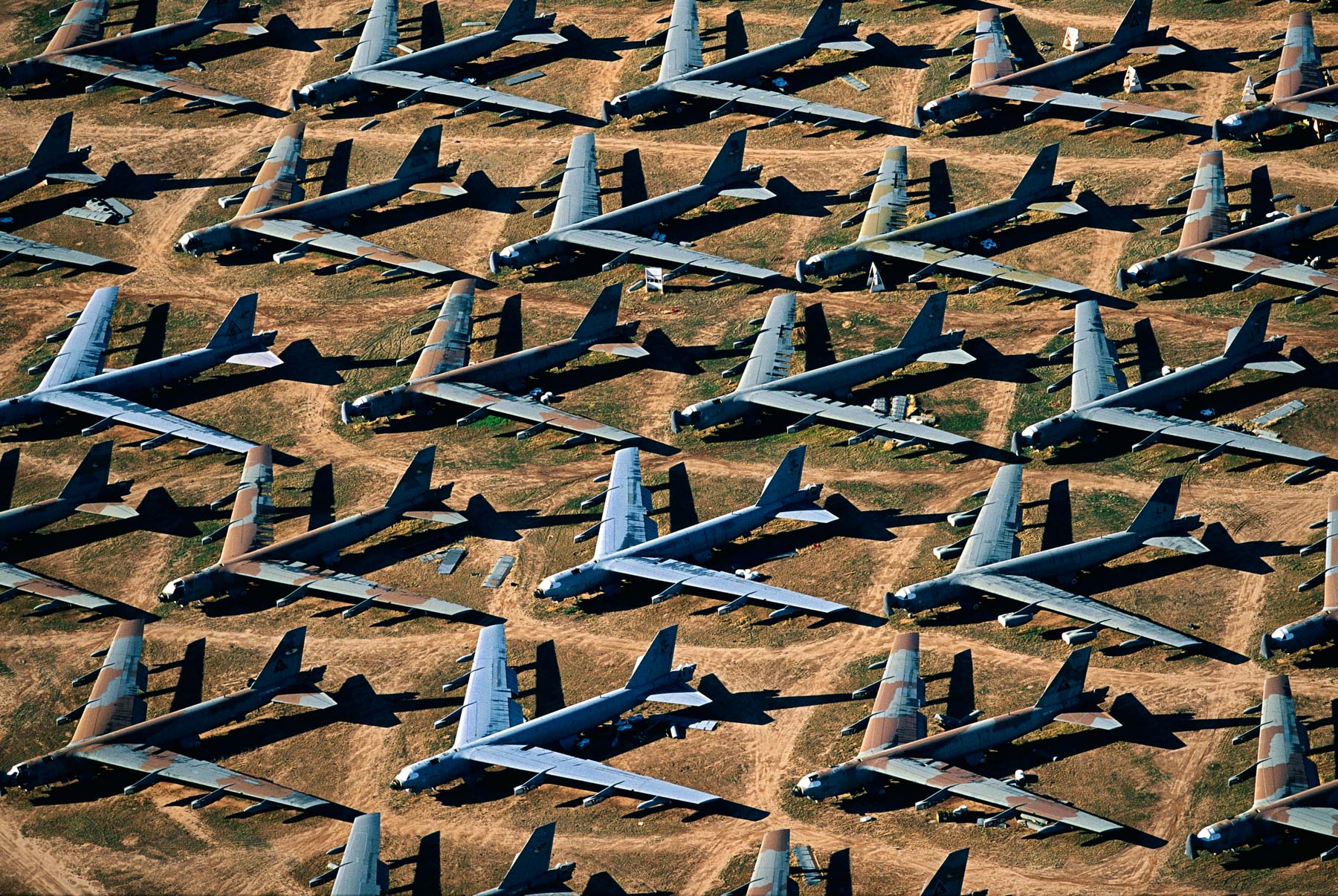
Storage of military planes on the Davis Monthan Air Base, Arizona, United States (32°11' N – 110°53' W).
Beach Resort near Arrecife, Lanzarote, Canary Islands, Spain (29°00' N – 13°28' W).
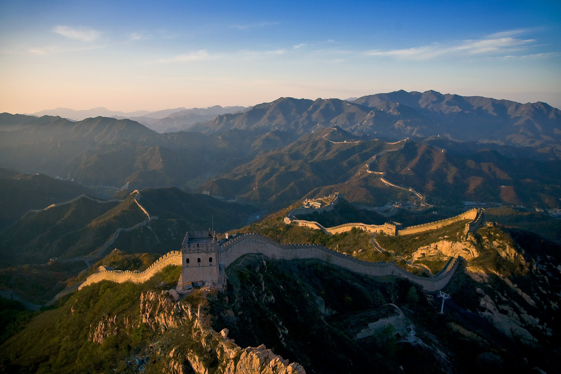
Great chinese Wall near Beijing, Badaling stretch of the wall. Hebei province, People’s Republic of China (40°22’ N, 116°01’ E).
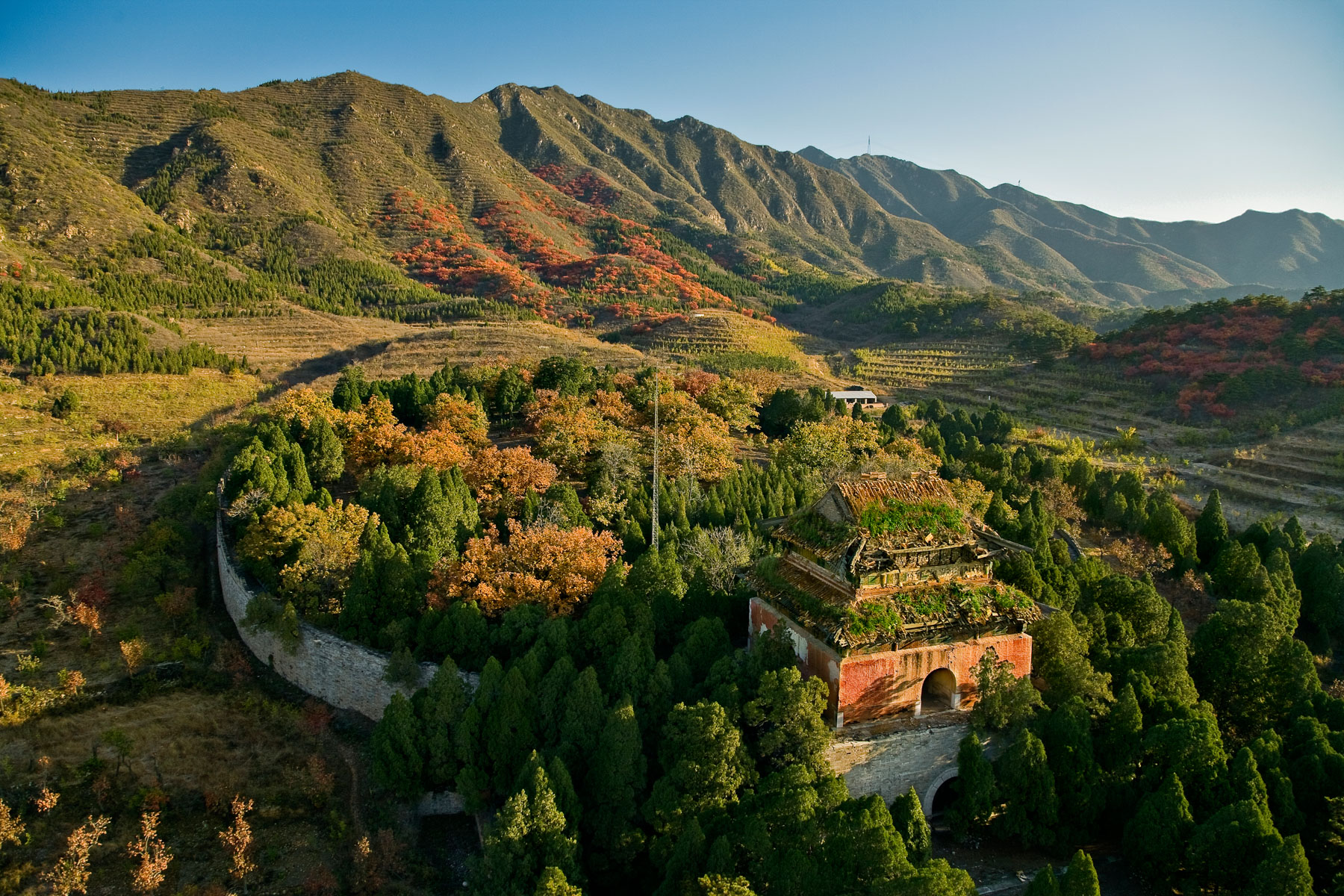
Ming tombs, valley south of Tianshou Mountain (Heavenly Longevity Mountain), People’s Republic of China (40°18’N, 116°14’E).
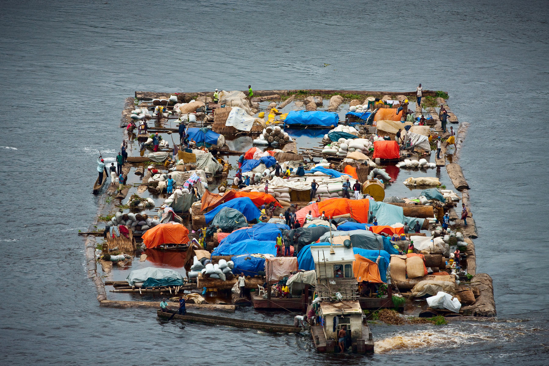
Wooden dugout canoe and rower on Congo River heading Brazzaville, Republic of the Congo (Congo-Brazzaville) (1°03’ S - 17°10’ E).
Fisherman on Imboulou Dam, Republic of the Congo (Congo-Brazzaville) (2°52’ S, 15°54’ E).
Green algae on mussels at Saint-Brieuc bay, Côtes- d'Armor, France (48°32’ N – 2°40’ W).
Flooded Honda Industrial Park near Ayutthaya, Ayutthaya Province, Thailand (14°21' N - 100°38' E).
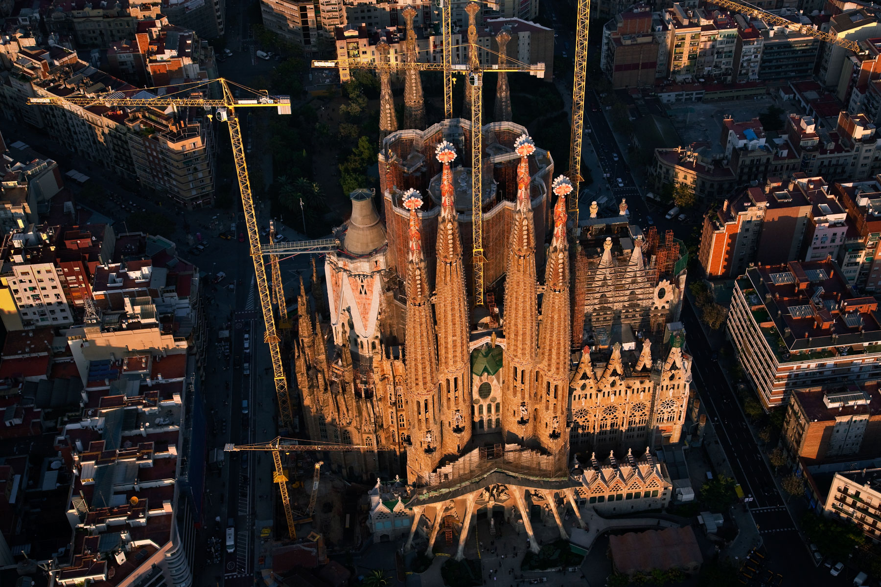
The Sagrada Família © Antoni Gaudí (UNESCO World Heritage Site), Barcelona, Catalonia, Spain (41° 24′ 12″ N - 2° 10′ 28″ E).
Settling basin of a phosphate processing plant near Udaipur, Rajasthan, India (24°36’ N, 73°49’ E).
"Sand diggers” boats in Kalaban Koro, outskirts of Bamako, Mali (12°34’ N – 8°02’ W).
Brickyard near Antananarivo, Madagascar (18°53’ S– 47°39’ E).
Fishing nets in the area of Dhaka, Bangladesh (23°43’ N, 90°20’ E).
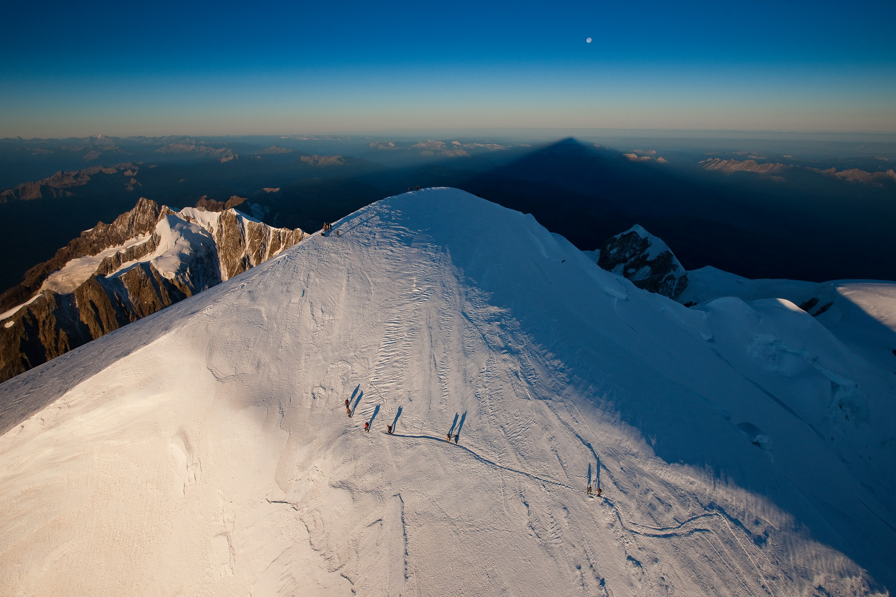
Roped party of mountaineers climbing Mont Blanc, Haute-Savoie, France (45°50’ N, 6°53’ E).
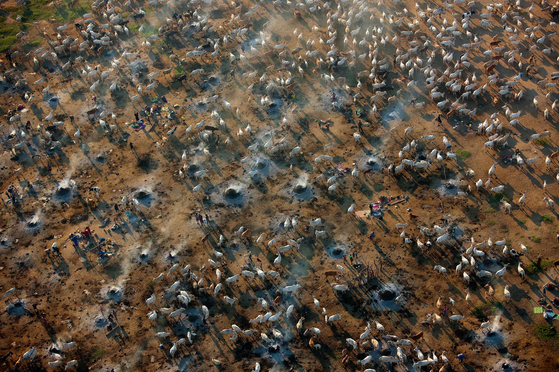
Cattle camp near Bor, Jonglei, South Sudan (6°17’ N - 31°34’ E).
Field cultivation near Bor, Jonglei, South Sudan (6°28’ N - 31°34’ E).
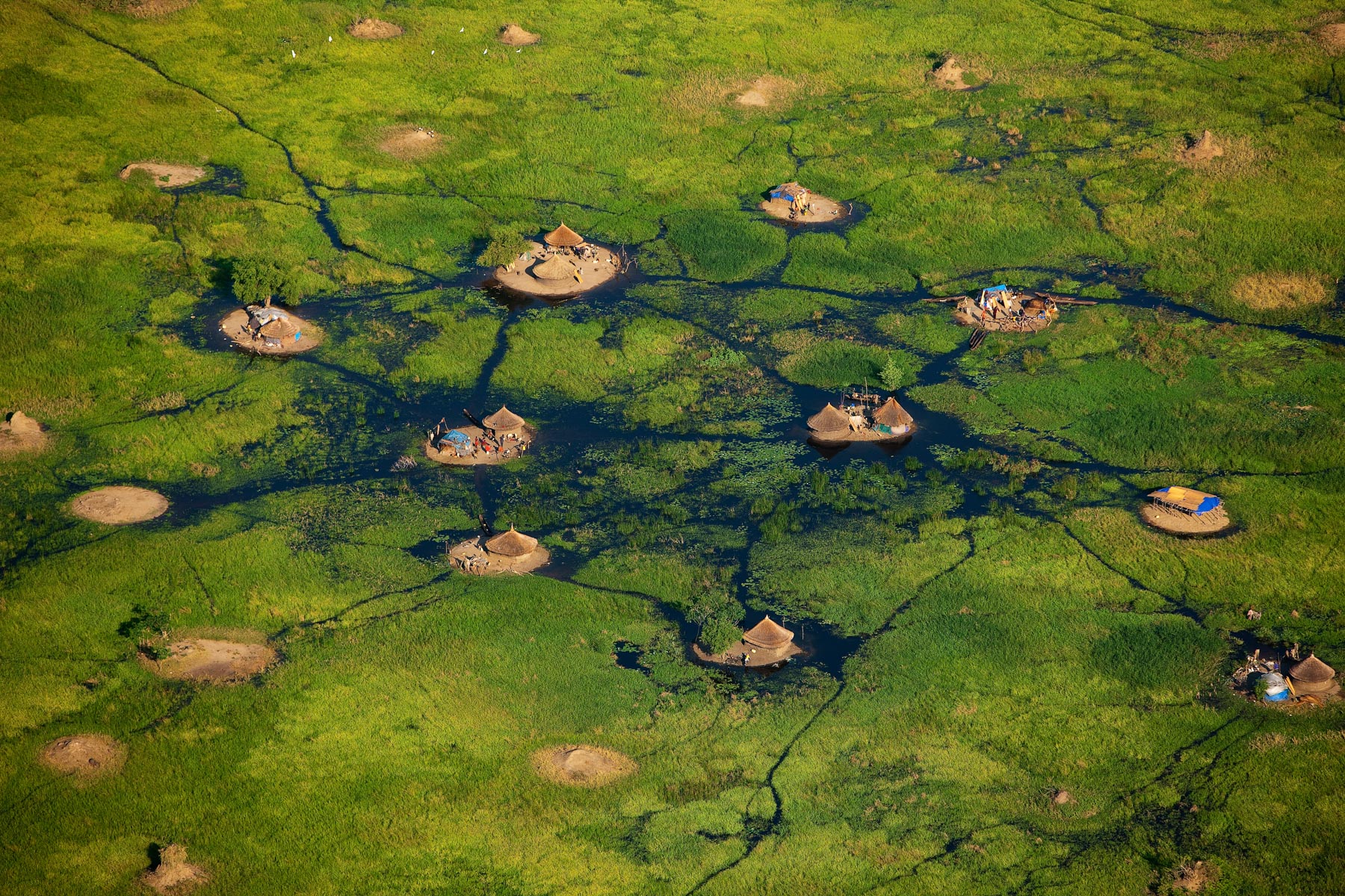
Village in the White Nile swamps near Bor, Jonglei, South Sudan (6°22’ N – 31°32’ E).
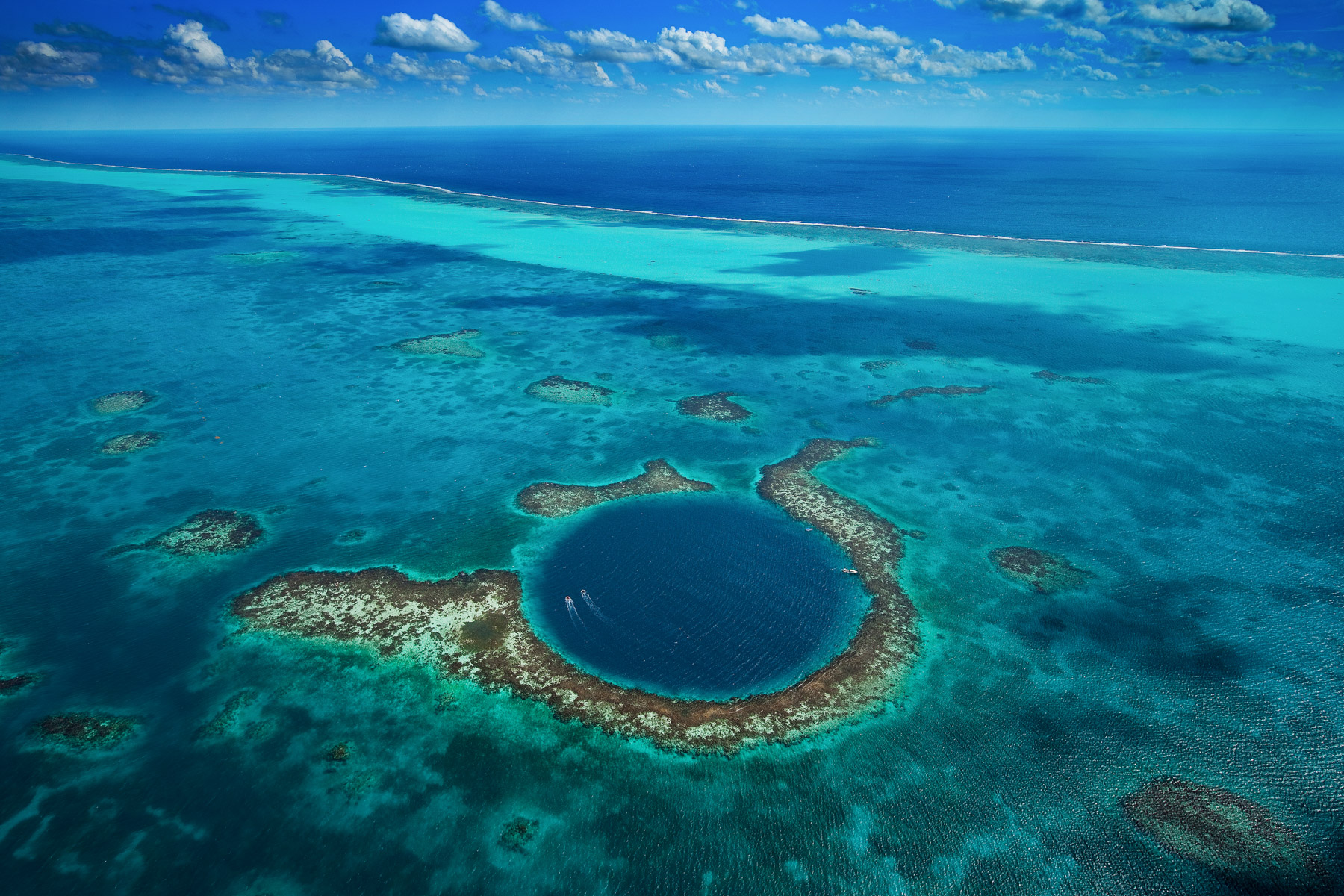
The Great Blue Hole, Lighthouse Reef, Belize (17°19' N – 87°32' W).
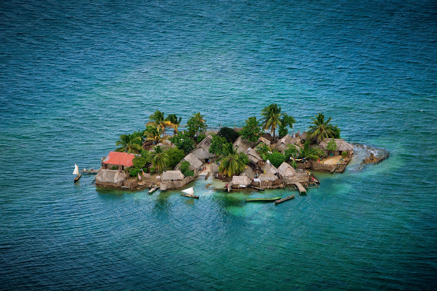
Kuna settlement, Robeson Islands, San Blas archipelago, Panama (9°31’ N - 79°03’ W).
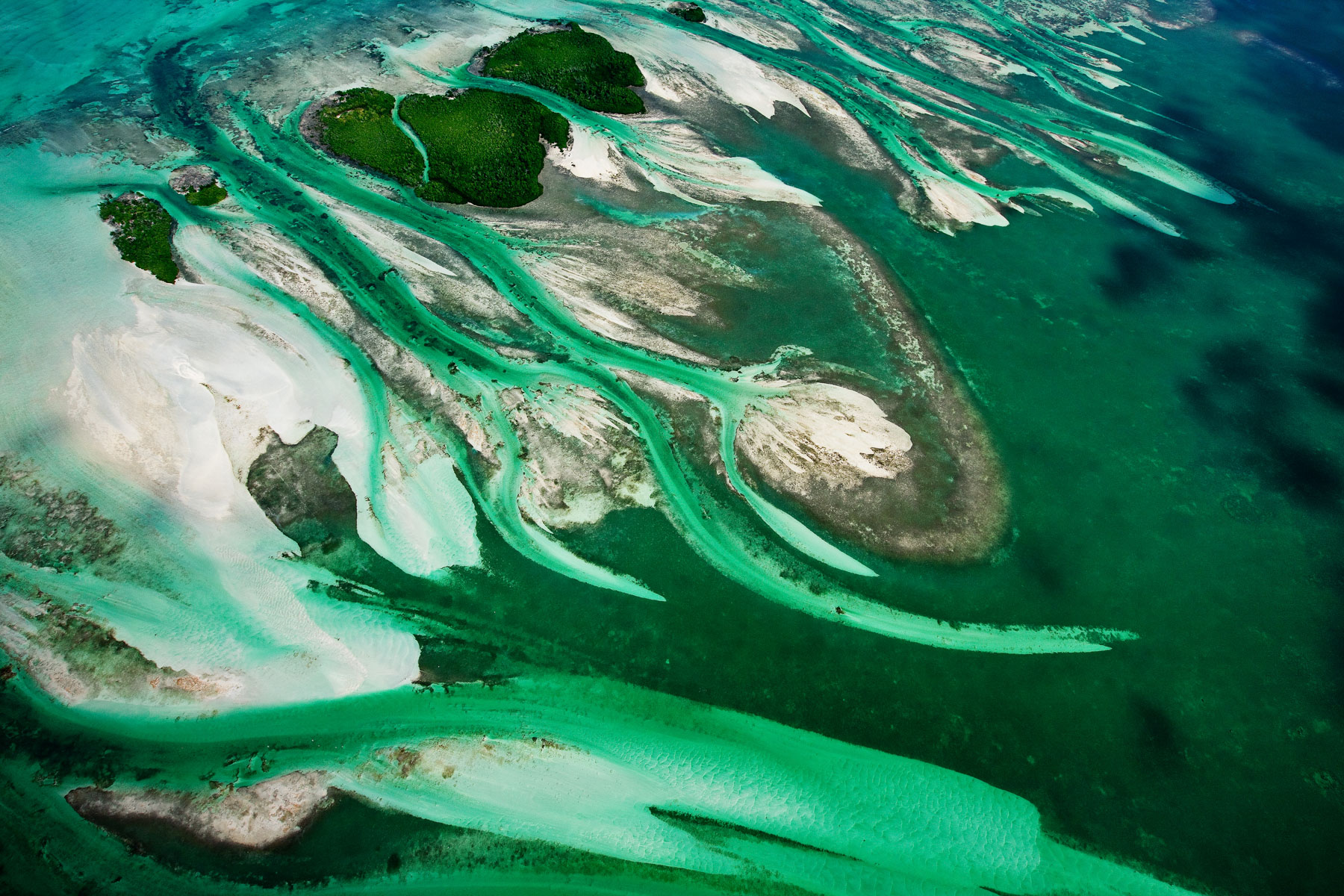
Barracuda Keys, Florida, United States (24°43' N – 81°38' W).

Shark Bay, Henri Freycinet Harbour, Western Australia, Australia (26°32’ S, 113°37’ E).
Shark Bay, sandbanks in L’Haridon Bight, Peron Peninsula, Western Australia, Australia (25°59’ S, 113°44’ E).
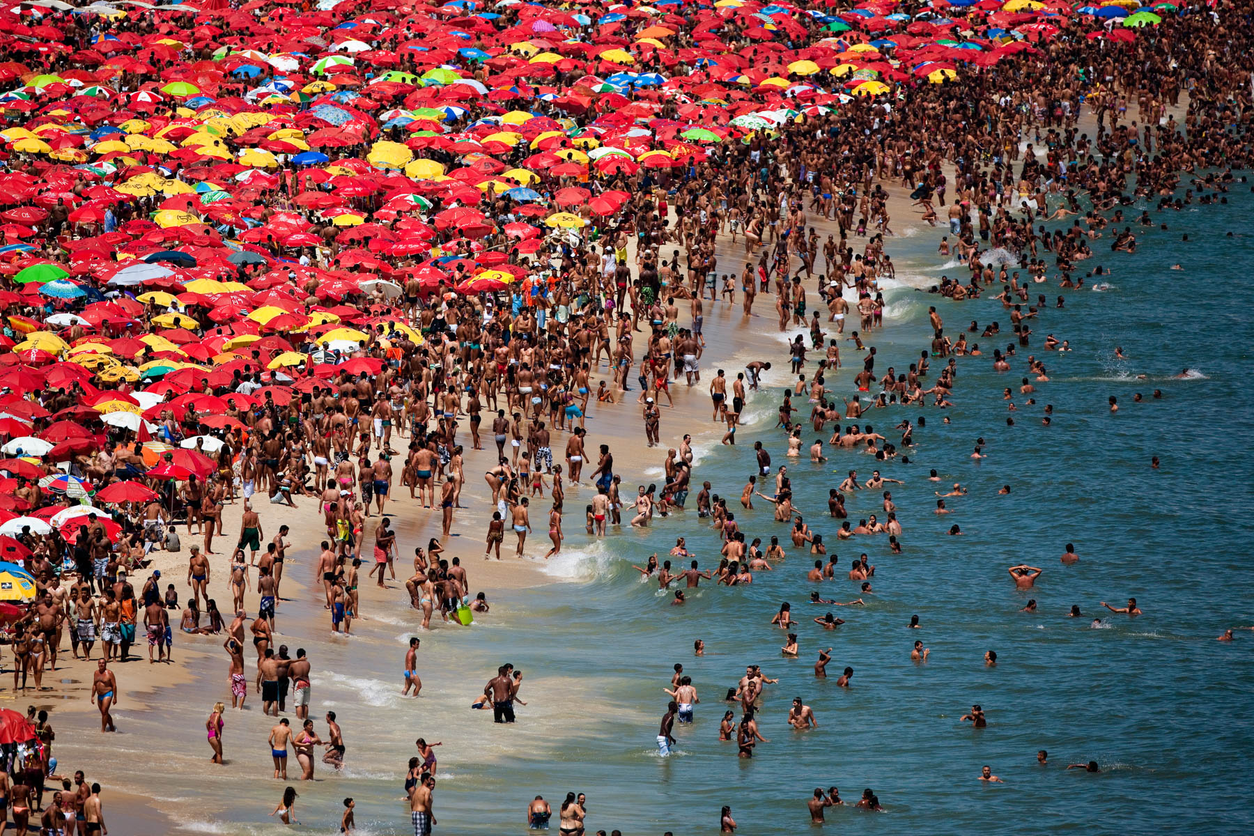
Ipanema Beach, Rio de Janeiro, Brazil (22°59’ S - 43°12’ W).
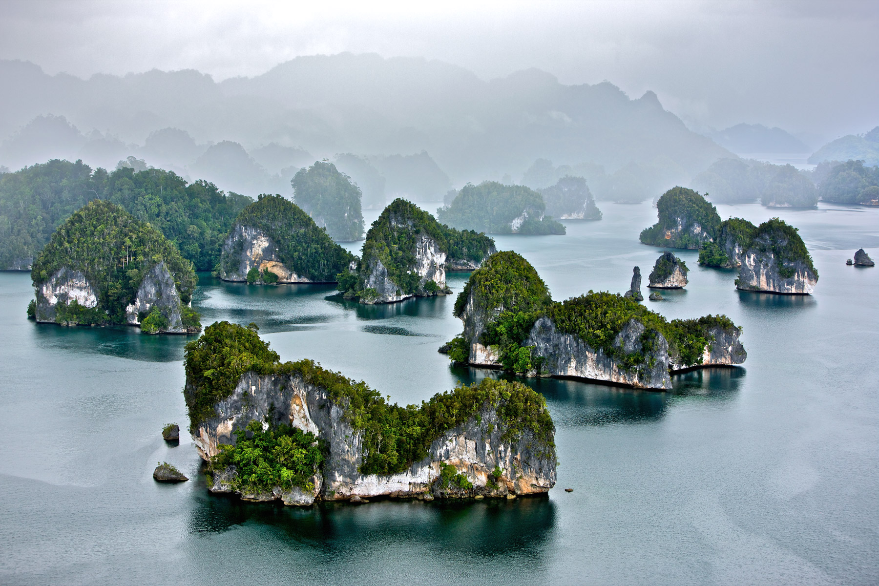
Raja Ampat Islands: Waigeo Island, Kabui Bay, West Papua province, Indonesia (0°19’ S, 130°37’ E).
Pink Flamingos and crystalline formations on lake Magadi, Kenya (1°44’ S, 36°17’ E).
Pink Flamingos and crystalline formations on lake Magadi, Kenya (1°52’ S, 36°17’ E).
Bird flying over the algae of Lake Turkana, Kenya (3°59’ N, 35°55’ E).
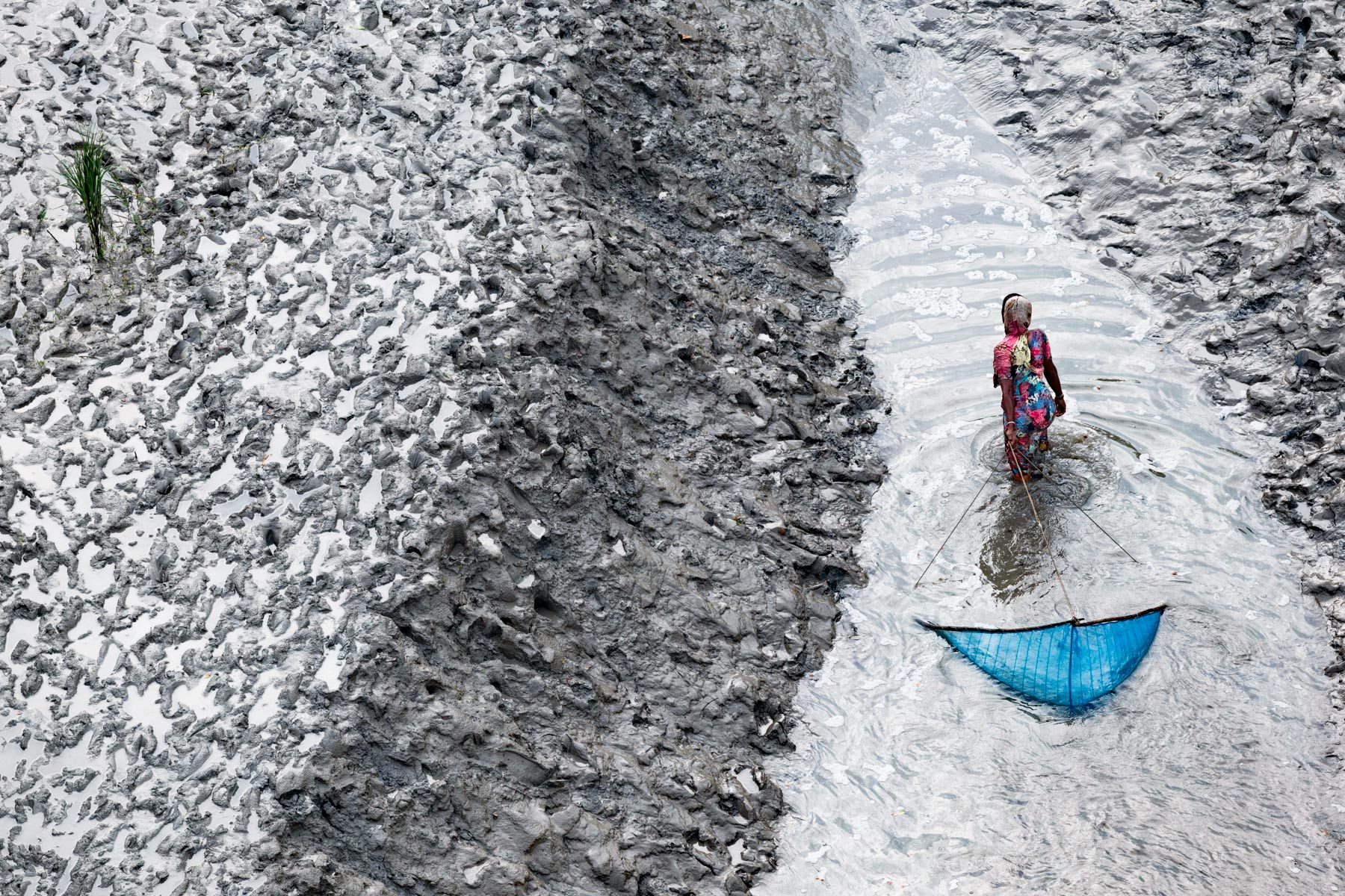
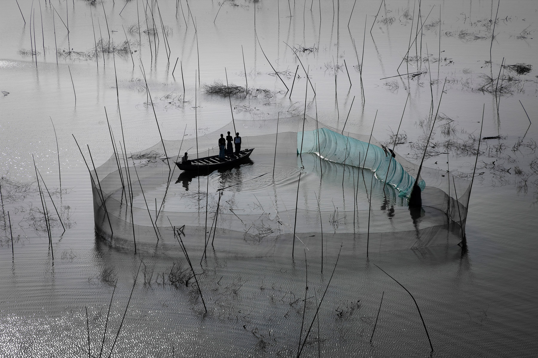
Femme pêchant au filet sur un bras du Delta, sud de Padmapukur, District de Khulna, Bangladesh (22° 15’ 58,86” N – 89° 11’ 42,63” E)_Woman fishing with a net on the delta, South of Padmapukur, Khulna District, Bangladesh (22° 15’ 58,86” N – 89° 11’ 42,63” E).
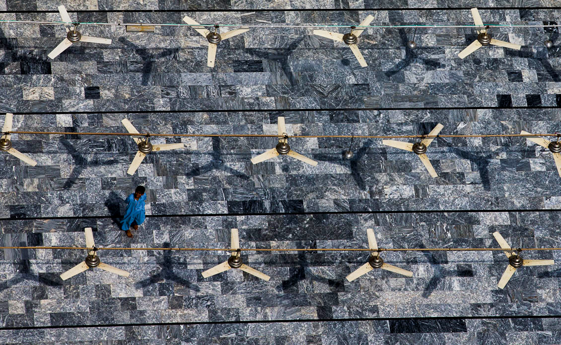
Femmes à Bahawalpur, Pendjab, Pakistan (29° 24’ N – 71° 40’ E).
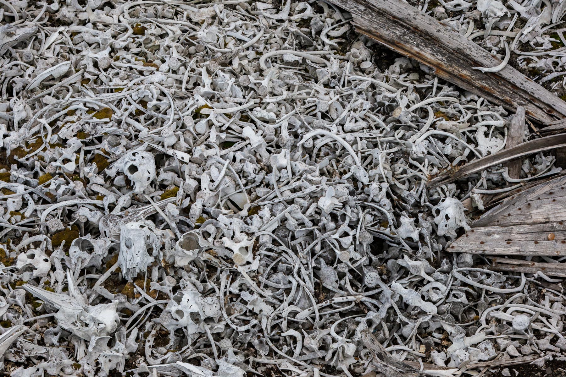
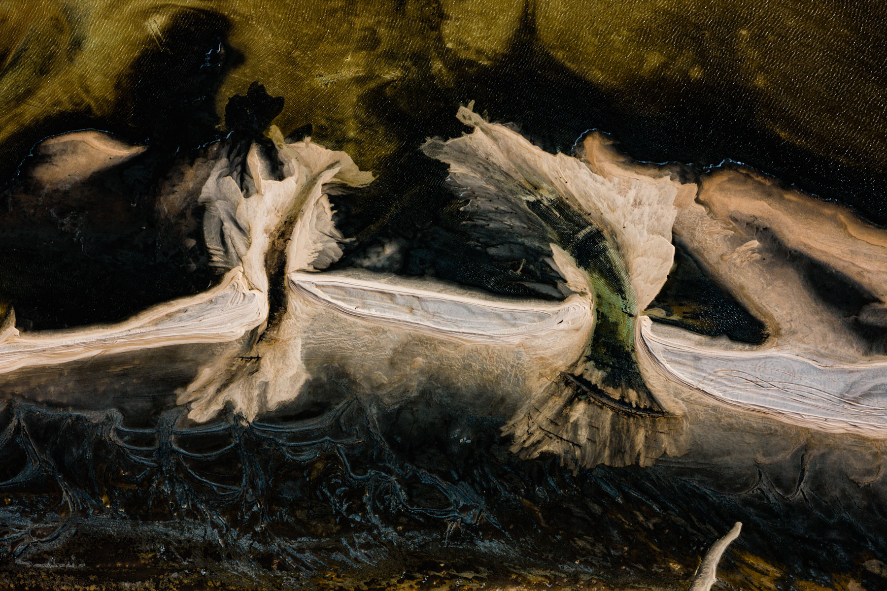
Beluga Bones, Van Keulenfjord, Spitsbergen Island, Svalbard, Norway (77° 33’ 9,00” N – 15° 36’ 18,45” E).

Rice fields near Betafo, Vakinankaratra Region, Madagascar (19° 48’ 57” S – 46° 52’ 12” E).
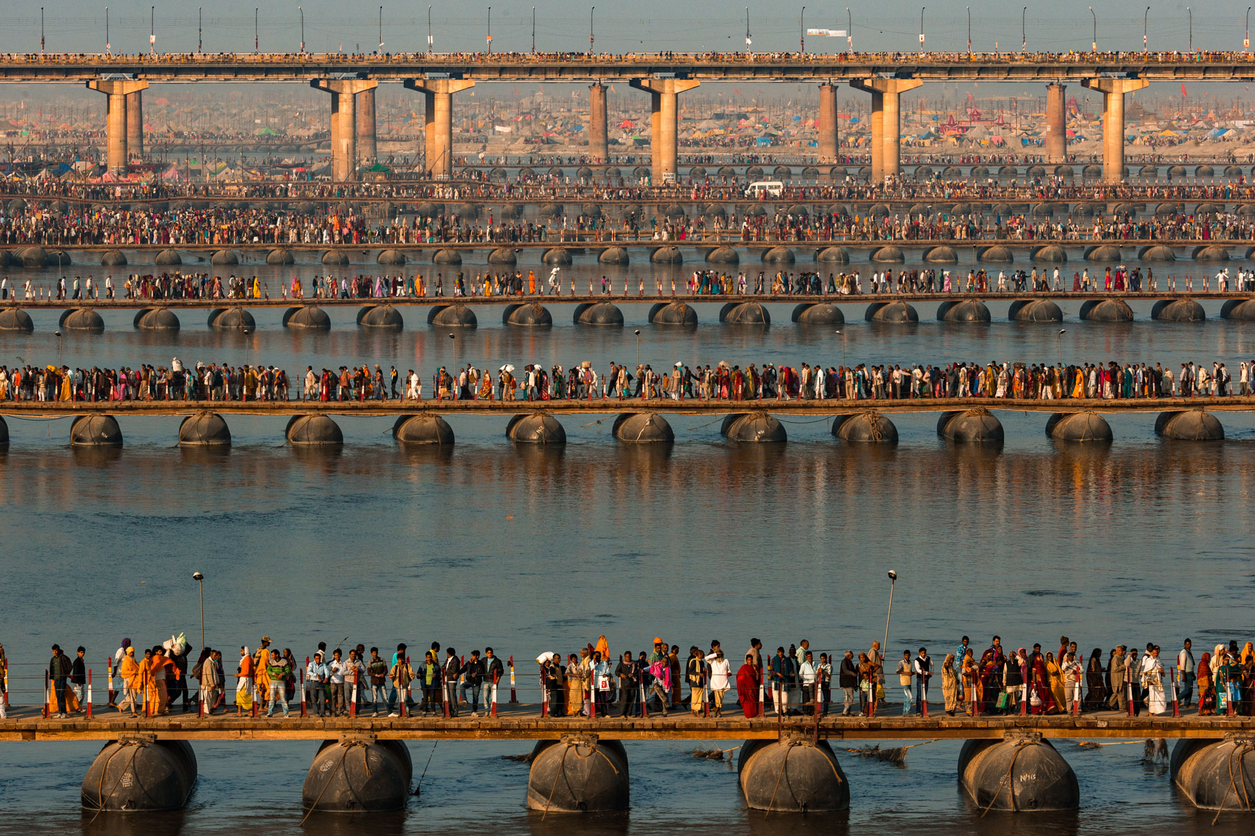
Kumbh Mela Religious Festival on the banks of the Ganges, Allahabad, Uttar Pradesh, India (25° 26’ 13,10” N – 81° 53’ 25,62” E).
Market in Cité Soleil, Port-Au-Prince, Port-Au-Prince District, Haiti (18° 34’ 26,31” N – 72° 19’ 56,47” O).
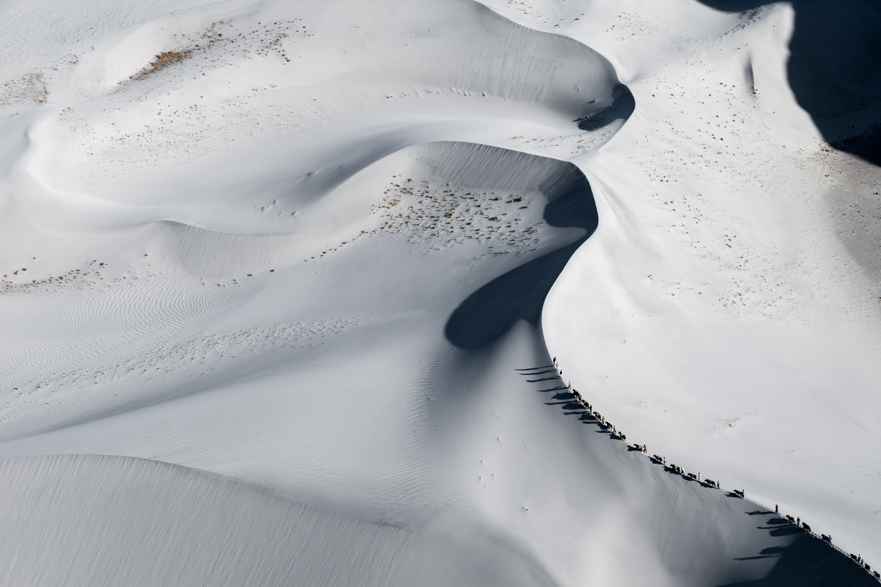
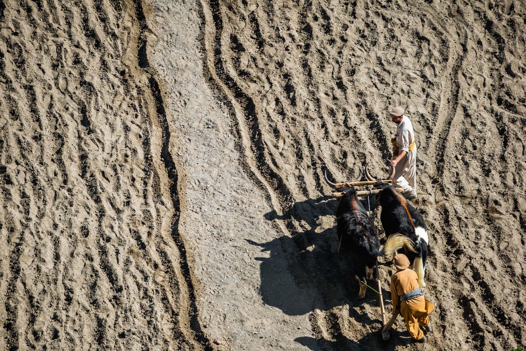
Caravan of Dzos in the dunes near Skardu, Indus Valley, Gilgit-Balistan, Pakistan (35° 19' 23.92" N – 75° 43' 23.98" E)
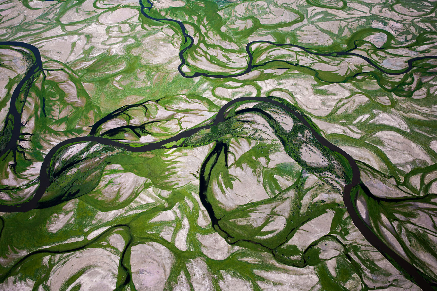
Meanders in the Tuul river, south of Lün, Mongolia (47° 16’ 26,96” N – 105° 26’ 46,86” E).
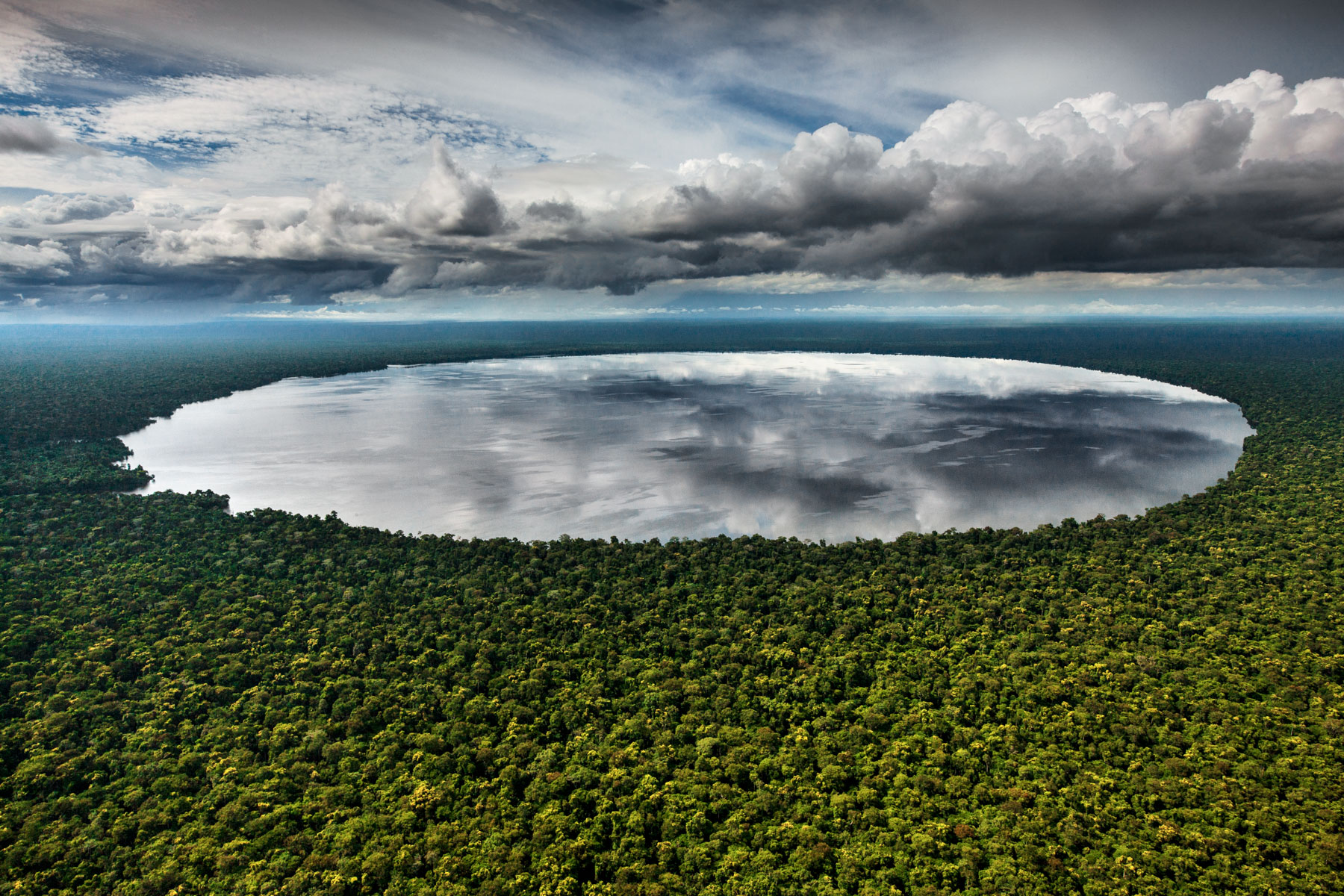
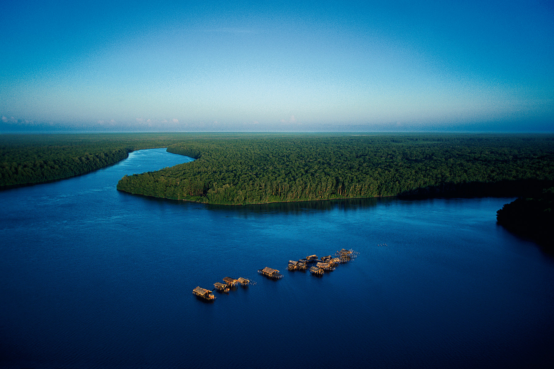
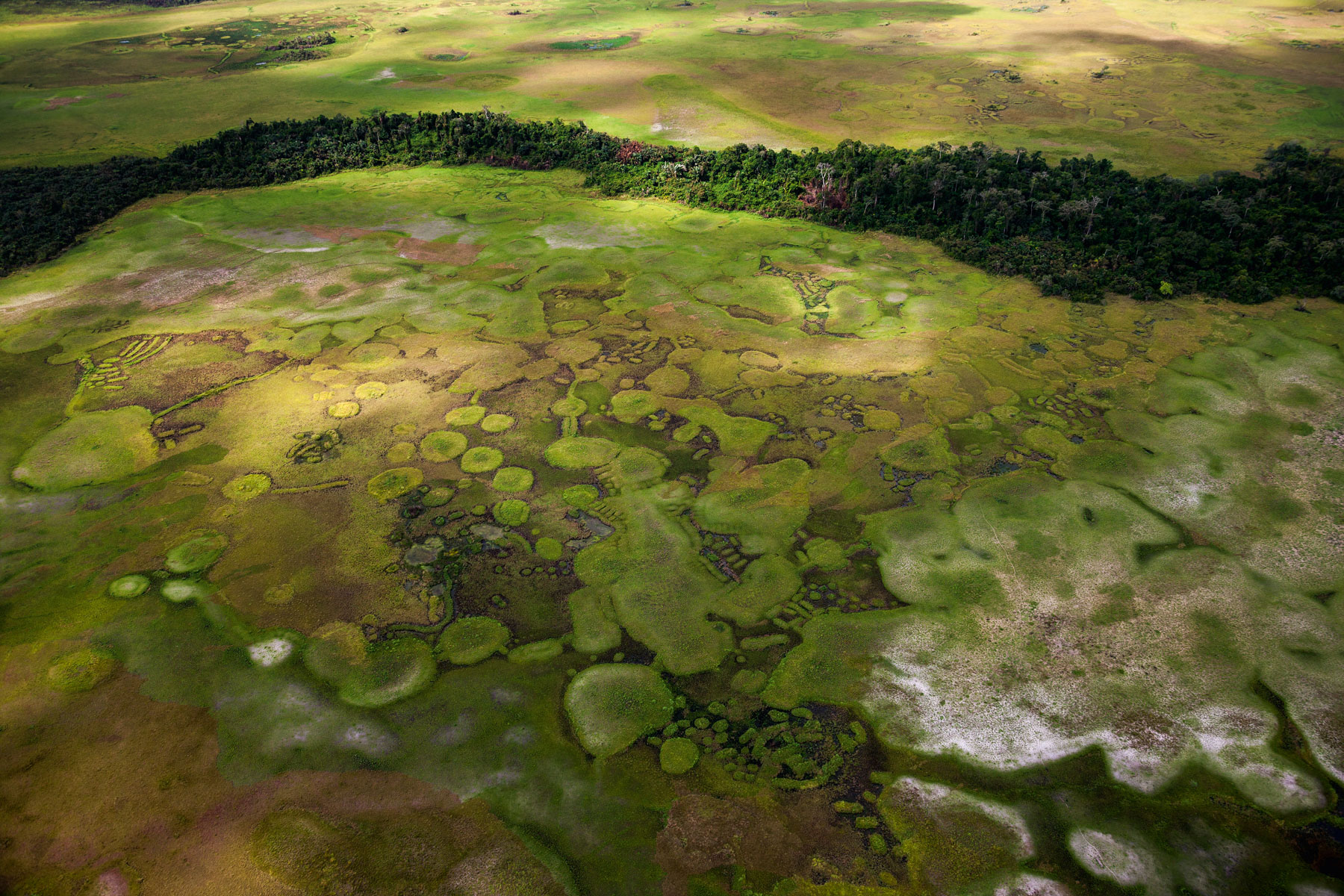
Lake Télé (community reserve of the Lake Télé Likouala-aux-Herbes), department of Likouala, Republic of Congo (Congo-Brazzaville) (1°20'45.48"N - 17° 9'8.37"E).
Port au Prince : pêcheurs dans la Baie de Port au Prince au large de Cité Soleil, Haïti (18°34'50"N - 72°20'22"O)
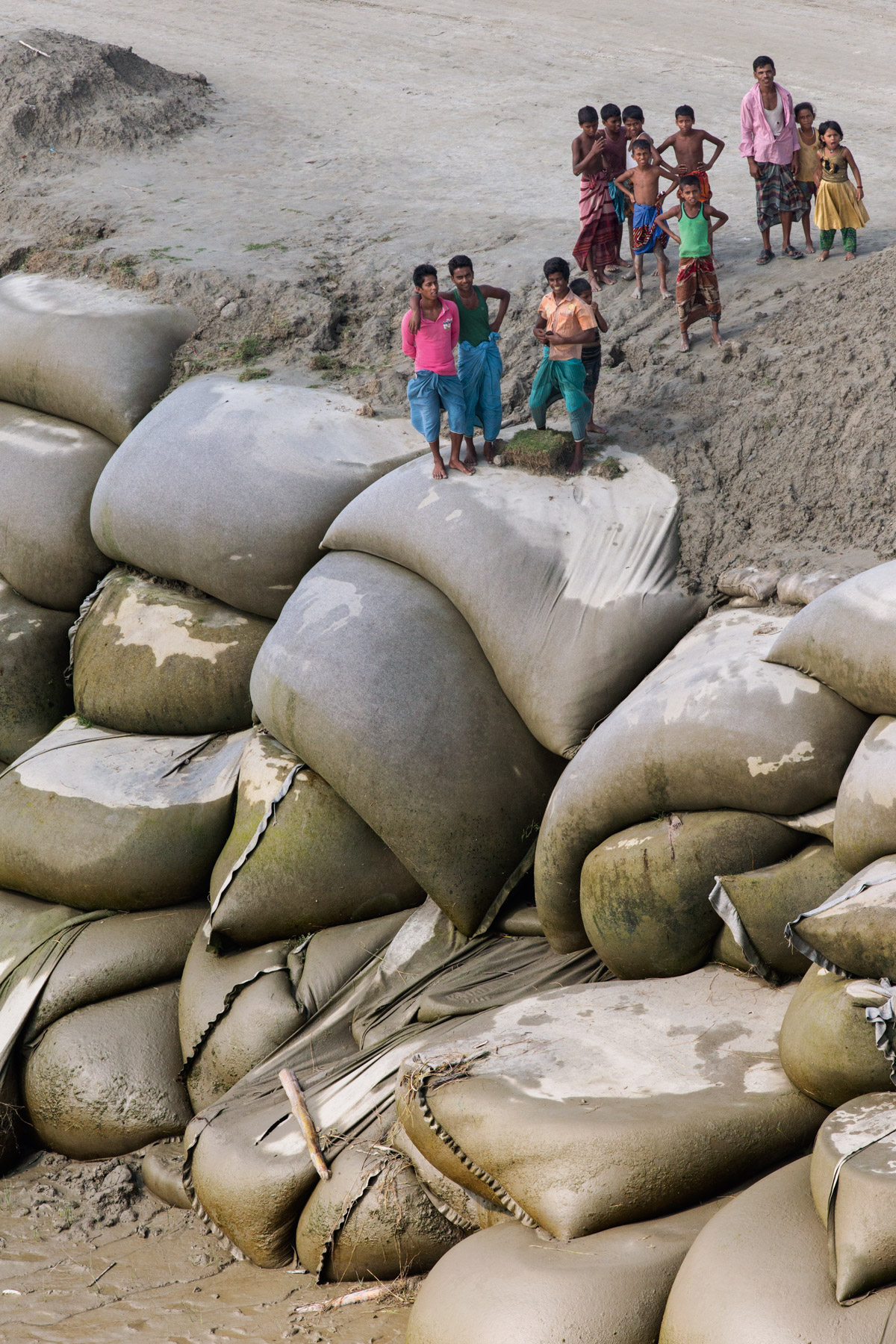
BARRAGE ÉDIFIÉ EN SACS DE SABLE SUR LE DELTA DU GANGE, CHITTAGONG DISTRICT, BANGLADESH (22° 47’ 2,92’’ N – 91° 21’ 23,84 E).

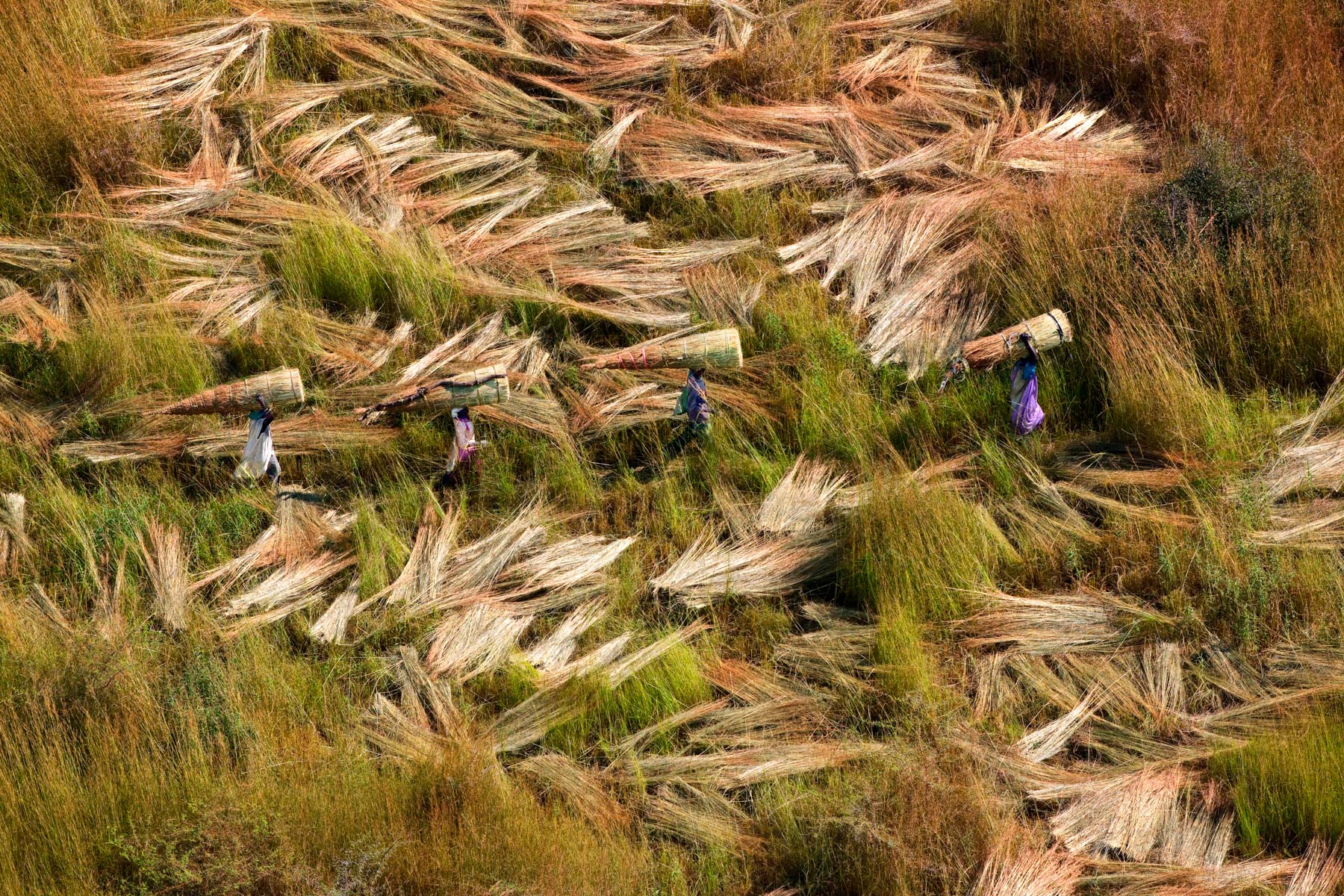
Séchage du riz sur une esplanade devant une ferme, nord-est de Dhamrai, district de Dhaka, Bangladesh (23° 55’ 21,14” N - 90° 11’ 57,06” E).
Mine de saphirs à ciel ouvert à Ilakaka, ouest de Ihosy, province de Fianarantsoa, Madagascar ( 22°42'13.21"S - 45°13'13.77"E)
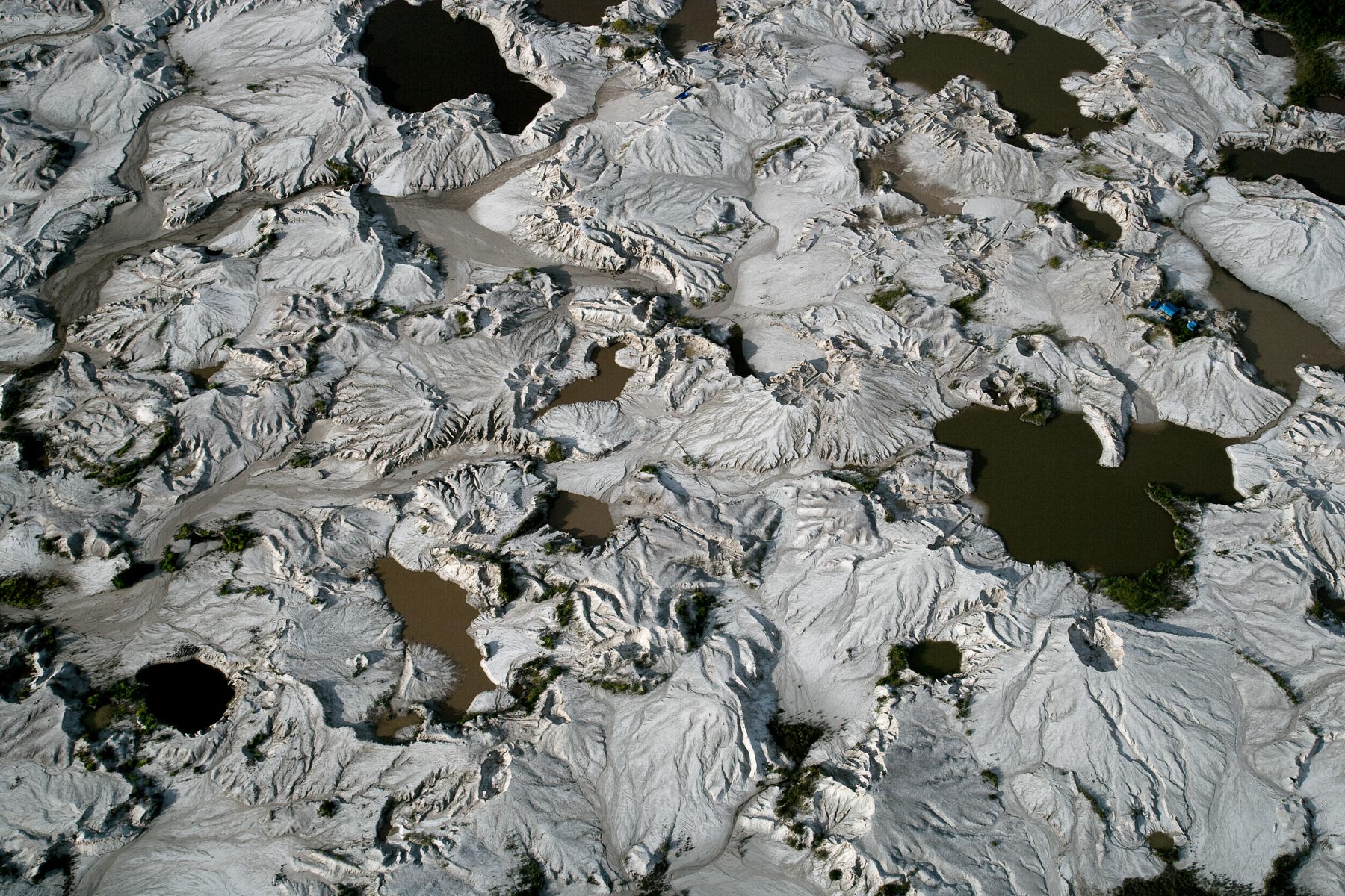
Marais salés près de Belon'i Tsiribihina (Belo sur Tsiribihina), nord de Morondava, province de Toliara (19°49'58.15" S - 44°33'11.22"E)
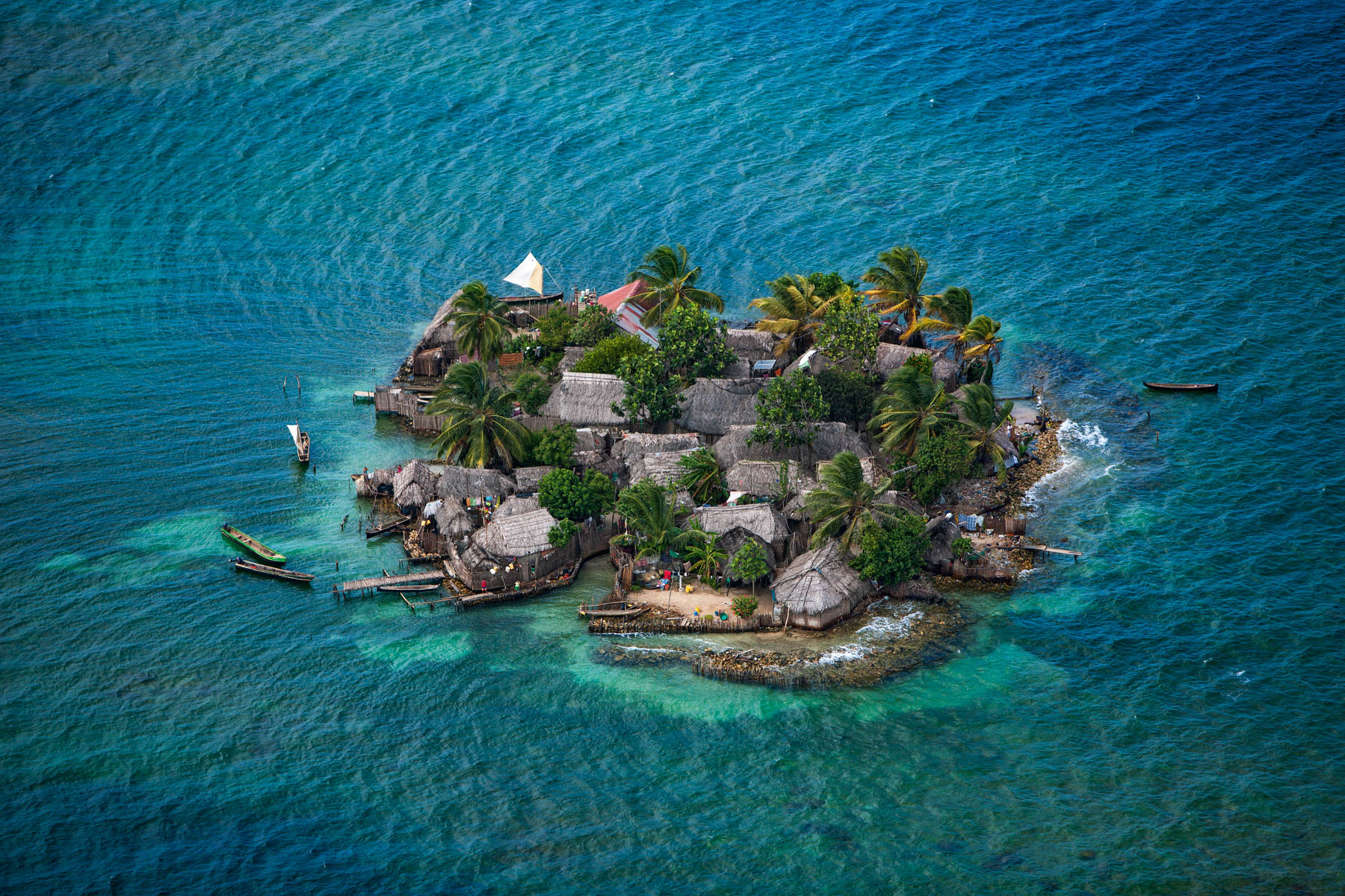
Habitations des Indiens Kuna, Iles Robeson, archipel des San Blas, Panama (9°31' N – 79°03' O).
Lac Attabad, Vallée de la Hunza, Gilgit-Baltistan, Pakistan (36° 18’ N – 74° 50’ E).
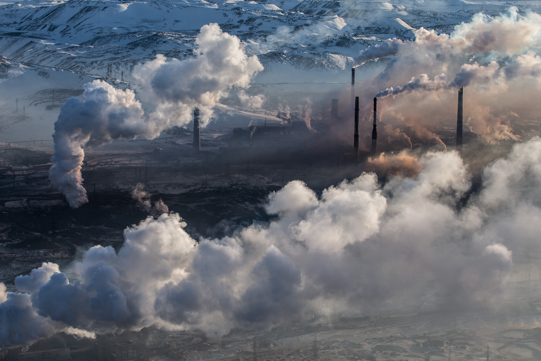
Fumées des usines de traitement de minerais dans la ville de Norilsk, Krai de Krasnoïarsk, Russie (69°19'18.68" N, 88°15'27.43" E).
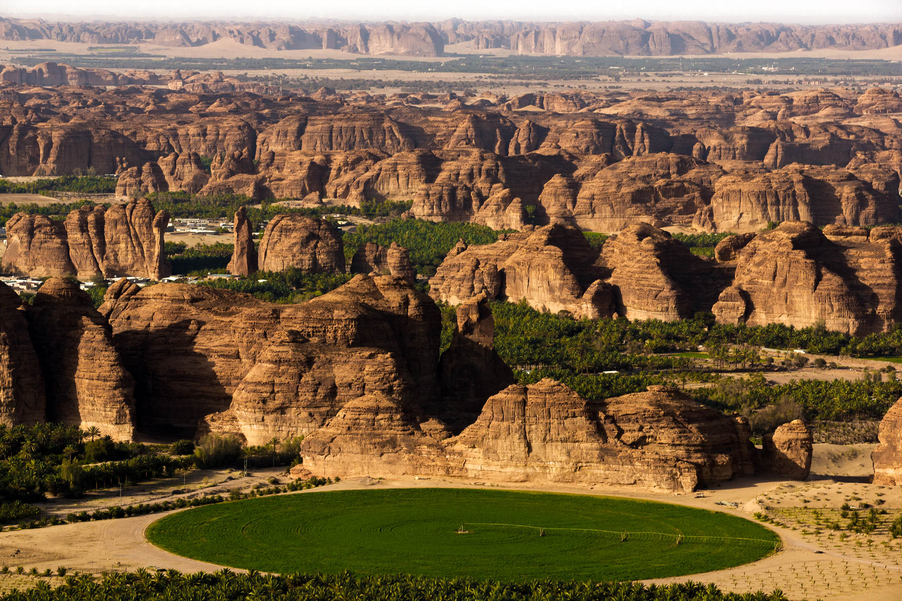
Oasis de Al-‘Ula, province de Médine, Arabie saoudite (26°43’40.09 N-37°53’27.90 E)
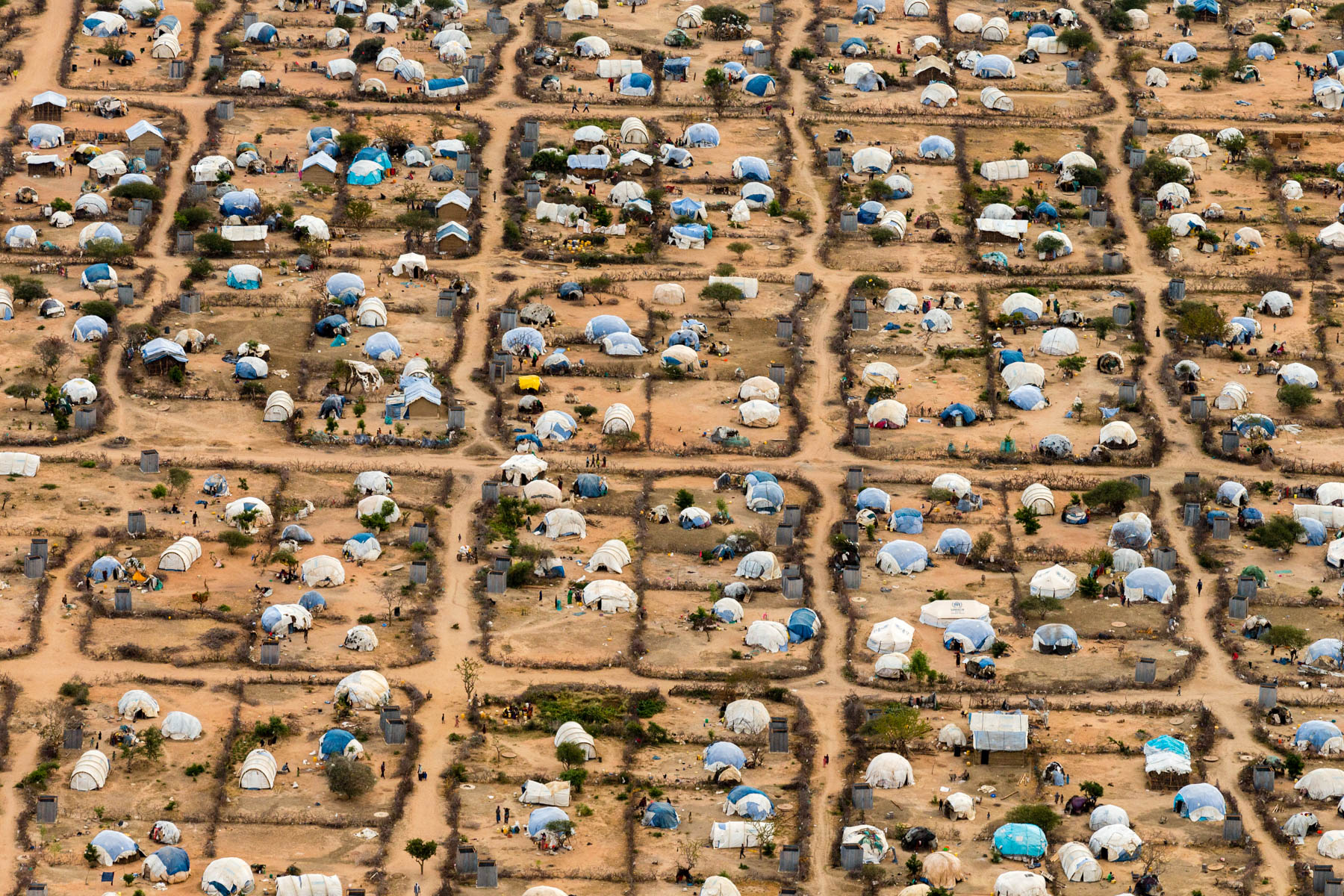
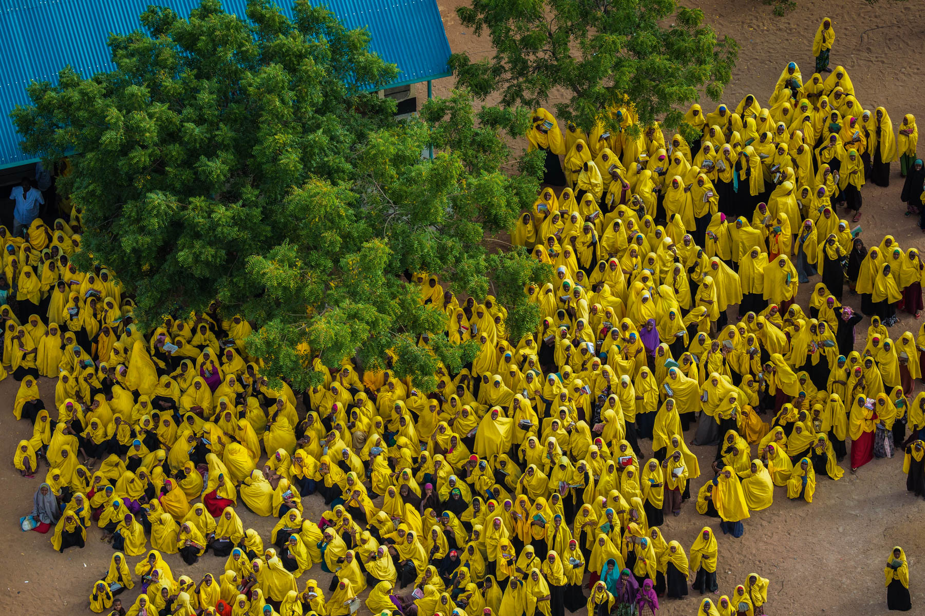
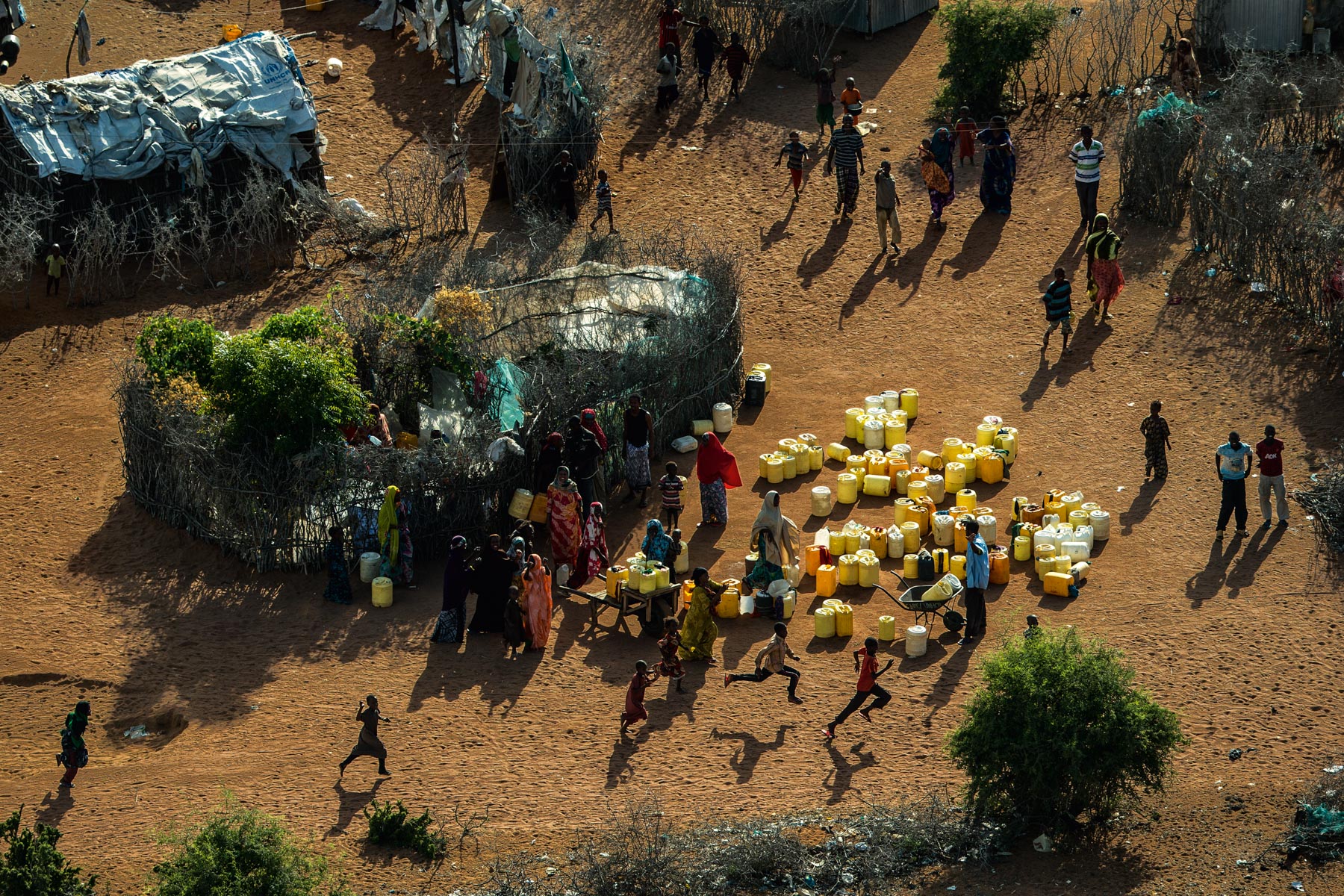
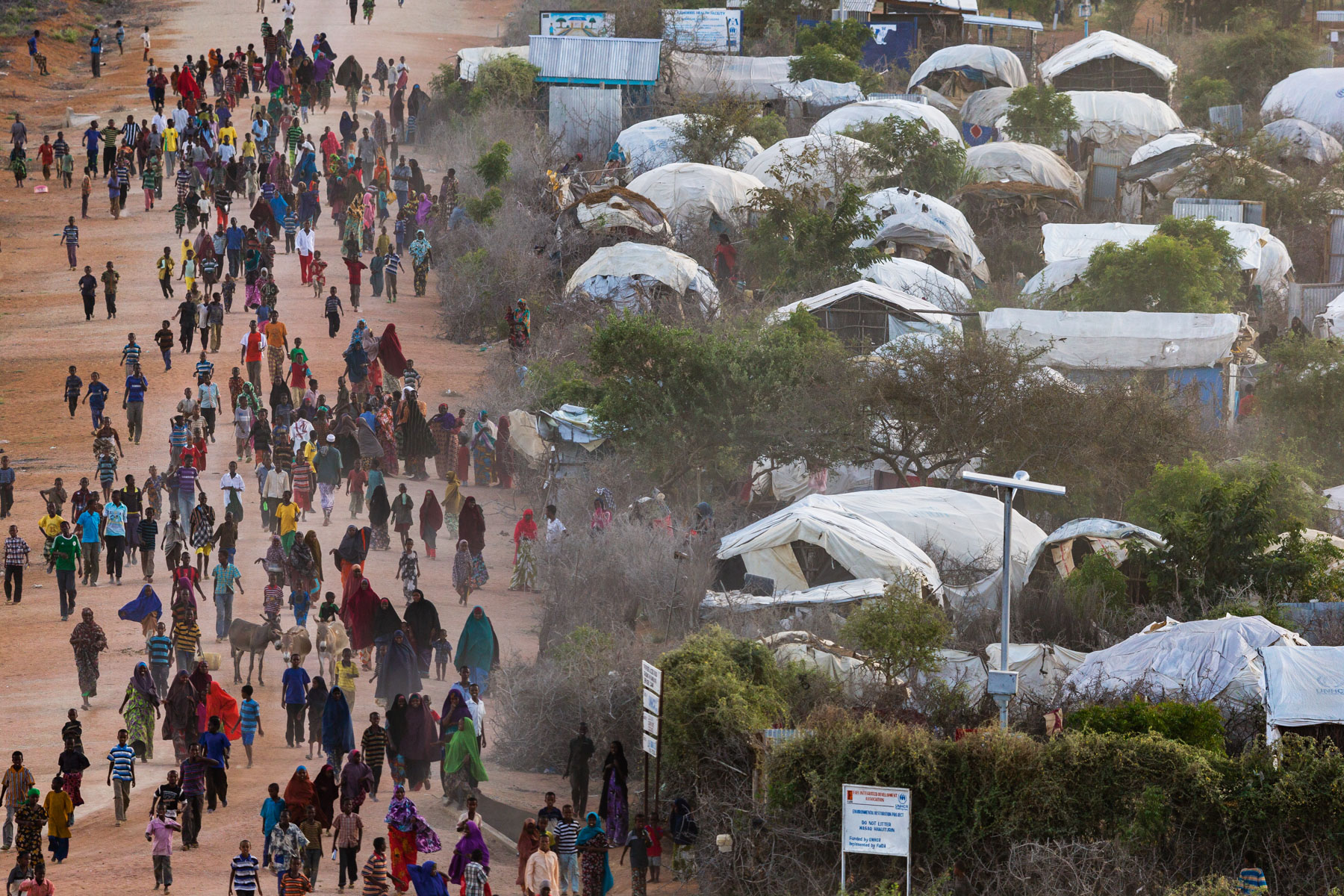
IFO 2 Somali refugee camp, Daadab, Garissa County, Kenya (0° 9’ 15,82” N – 40° 19’ 30,66” E).
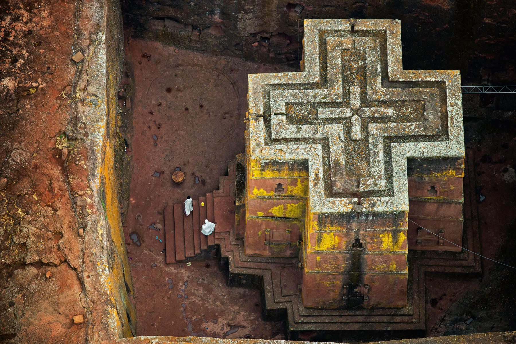
Church of St George, Lalibela, Amhara Region, Ethiopia (12° 1’ 53,78” N 39° 2’ 28,19” E).
Caravan carrying salt from Lake Karoum, Ethiopia (14° 6’ 15,35” N – 40° 19’ 56,95” E).
Killick Stenio Vincent, Jalousie, Petionville, Port-Au-Prince District, Haiti (18° 30’ 39,25” N – 72° 17’ 41,41” O).
PÊCHEURS, BAIE DE PORT-AU-PRINCE AU LARGE DE CITÉ SOLEIL, HAÏTI (18° 34’ 52,11” N – 72° 20’ 36,01” O).
Shark Bay : sandbanks in L’Haridon Bight, Peron Peninsula (Conservation area in the UNESCO) - Western Australia - Australia

Pirogue sur la rivière Jamuna (Brahmapoutre) près de Gaibandha, Bangladesh (25°15’ N - 89°39’E).

Pêcheur sur un bras du delta, au sud de Padma Pukur, Khulna District, Bangladesh (22°15'7.51"N-89°11'34.76"E)
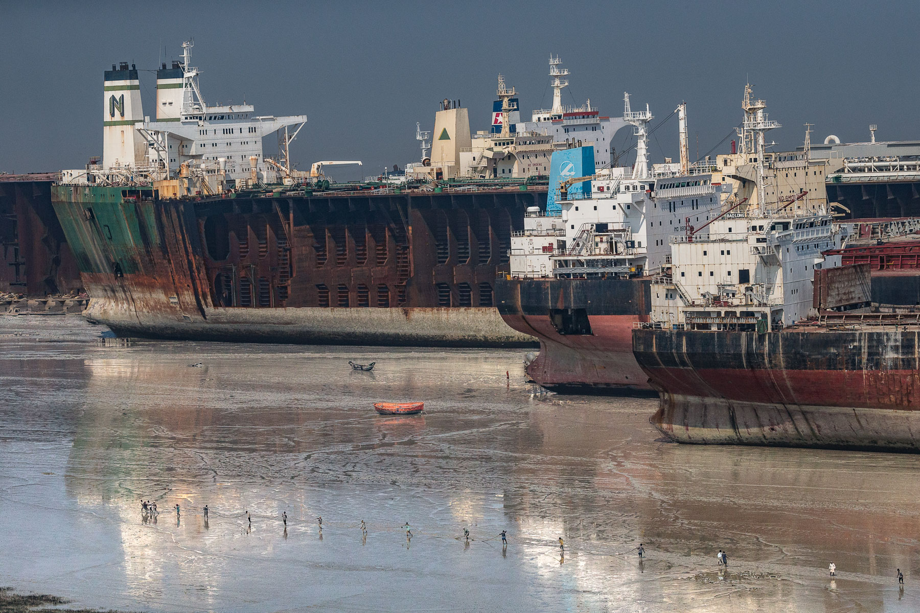
Démantèlement de bateaux, Bhatiari, District de Chittagong, Bangladesh (22° 25’ 45 74” N – 91° 43’ 52,88” E).
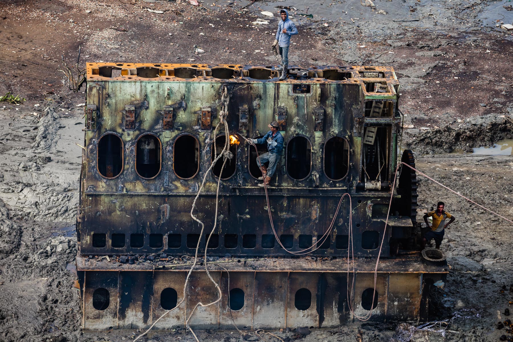
Chantier de démantèlement - Chittagong - Bangladesh
CULTURE SUR LE BORD DE LA RIVIÈRE JAMUNA, SUD DE SIRAJGANJ, DISTRICT DE SIRAJGANJ, BANGLADESH (24° 15’ 8,85” N – 89° 48’ 11,51” E).

Skate Park près de l'église Notre Dame de la Chapelle, Bruxelles, Belgique
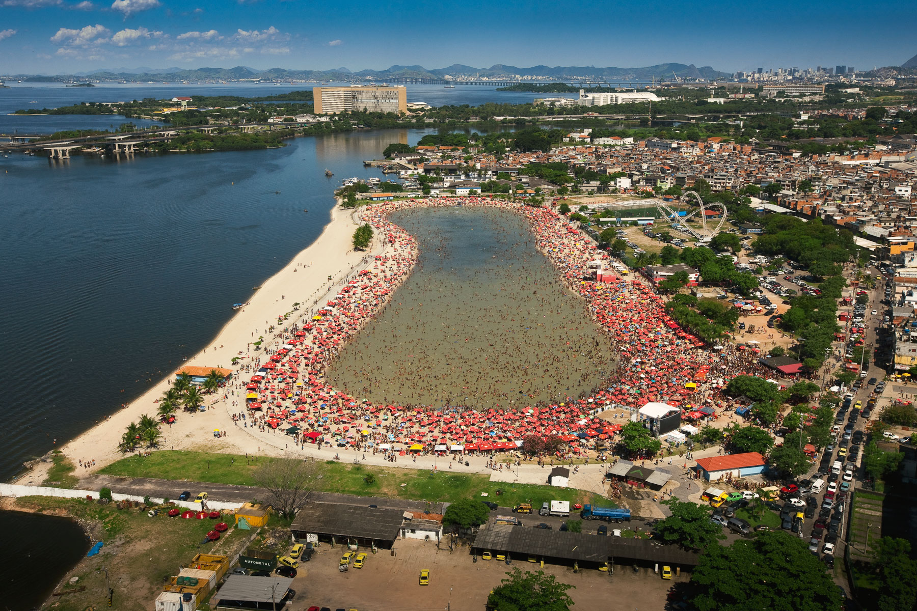
Rio de Janeiro : piscine d'eau de mer, quartier de Ramos, Rio de Janeiro, État de Rio de Janeiro, Brésil ( 22°50'21.36"S - 43°15'2.27"O)
Parc national des Lençóis Maranhenses : lagune, Etat de Maranhão, Brésil ( 2°29'26.18"S - 2°29'26.18"S).
Fleuve Rio Grande, Lago de Bétania, Parc national des Lençóis Maranhenses Etat de Maranhão, Brésil (2°33'13.48"S - 43°11'15.17"O)
Canoë et plongeur au large de l'atoll de Lighthouse Reef, District de Belize, Belize

Pêcheur sur le lac du barrage d’Imboulou, sur la rivière Léfini, Département du Pool, République du Congo (Congo - Brazzaville) (2° 56’ 14,06” S – 16° 2’ 6,93” E).
Buttes anthropiques dans un marais près de Tchikapika, Cuvette, république du Congo (1° 15’ S - 16° 19’ E).
-République du Congo (Congo - Brazzaville)
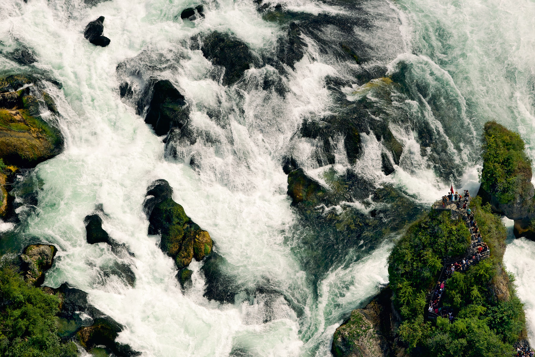
Chutes du Rhin entre Neuhausen et Flurligen, Cantons de Schaffhouse et de Zurich, Suisse (47° 40’ 39,84” N – 8° 36’ 54,47” E).

Mouth of the Kalou wadi in the Lake Assal, Republic of Djibouti (11°37' N - 42°23' E).
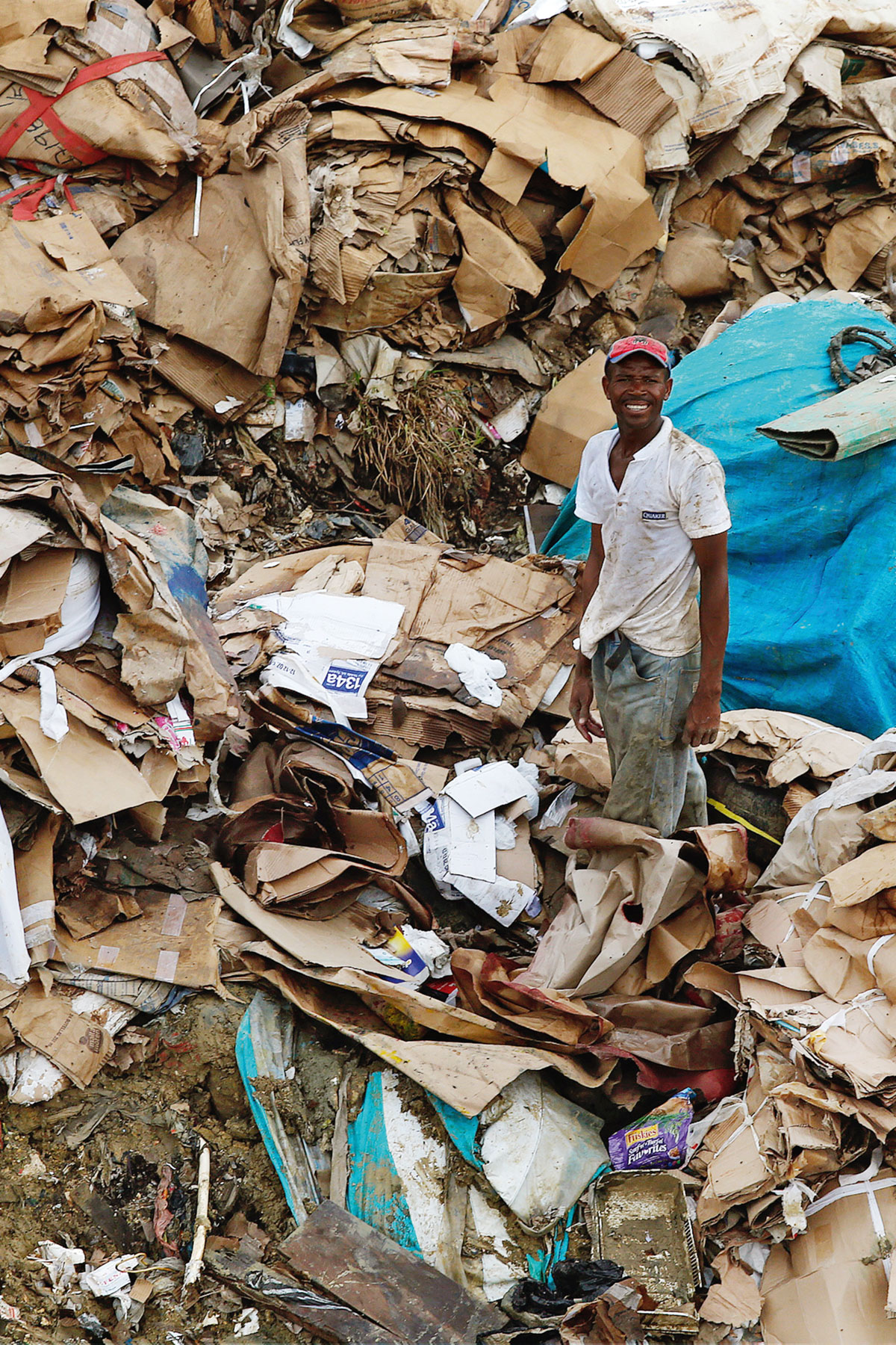
Décharge à ciel ouvert, Saint-Domingue, District National, République Dominicaine (18° 33’ 46,14” N – 69° 57’ 59,77” O).
République Dominicaine
Huttes touaregs (Zéribas) près de Tamanrasset, massif du Hoggar, Wilaya de Tamanrasset, Algérie
Salines à Alexandrie, Égypte (31° 07’ N - 29° 50’ E).
Felucca on Lake Burullus, Nile Delta near Rosetta, Kafr el-Sheikh Governorate, Egypt
Barques sur le lac Burullus, delta du Nil, Kafr el-Cheik, Égypte (31° 27 ’N - 30° 46’ E).
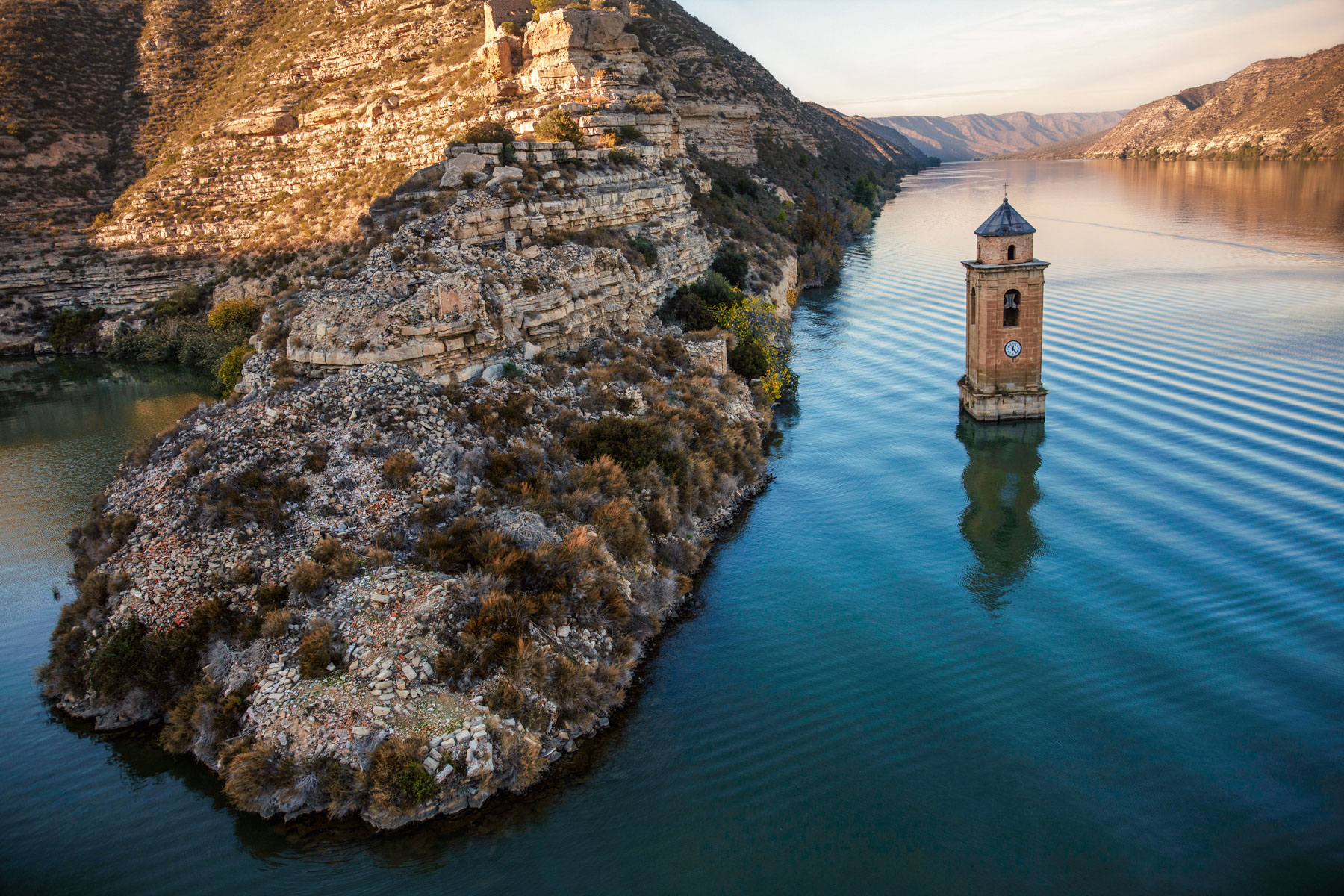
Château et église engloutie de l'ancien village de Fayon dans le lac du Barrage Riba Roja sur l'Ebre, province de Saragosse, communauté autonome d'Aragon, Espagne
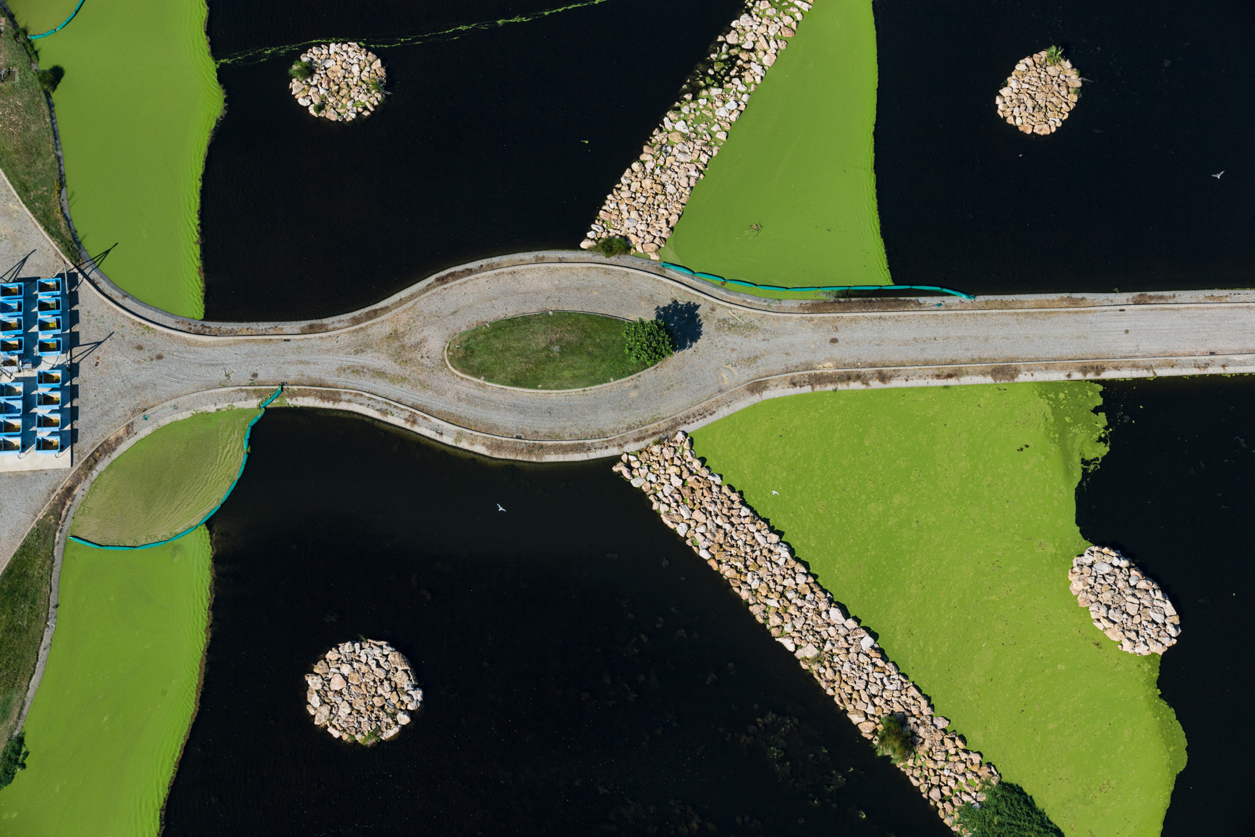
Empuriabrava : station d'épuration, Province de Gérone, Espagne (42°14'36.73"N-3° 6'18.04"E)
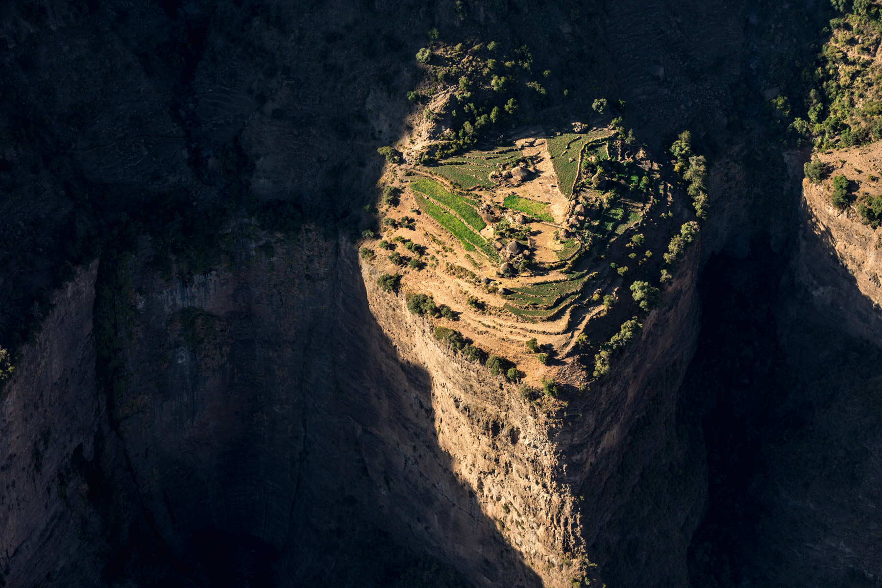
Parc national du Simien (classé à l'UNESCO) : village suspendu, région Amhara, Ethiopie ( 13°19'13.05"N - 38°30'59.37"E).
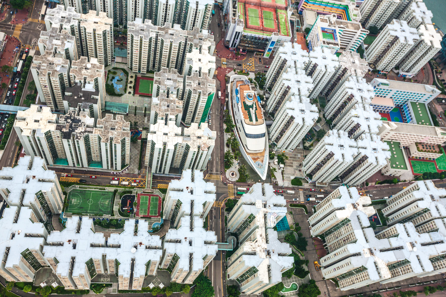
The Whampoa, Centre Commercial et résidences à Kowloon, Hong Kong, Chine (22° 18’ N – 114° 11’ E).
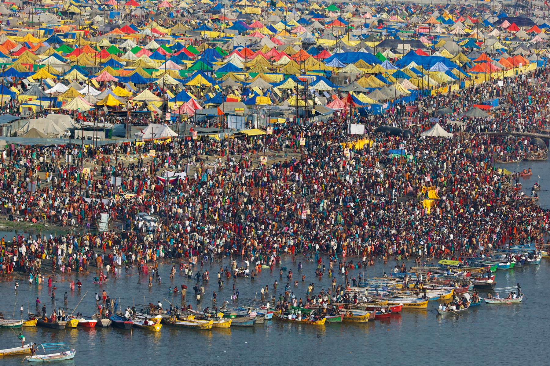
Allahabad, Uttar Pradesh, Inde. La Kumbhamela.

La ville bombardée de Mossoul (26 mai 2018), Irak (36°20'47" N 43°8'1" E)
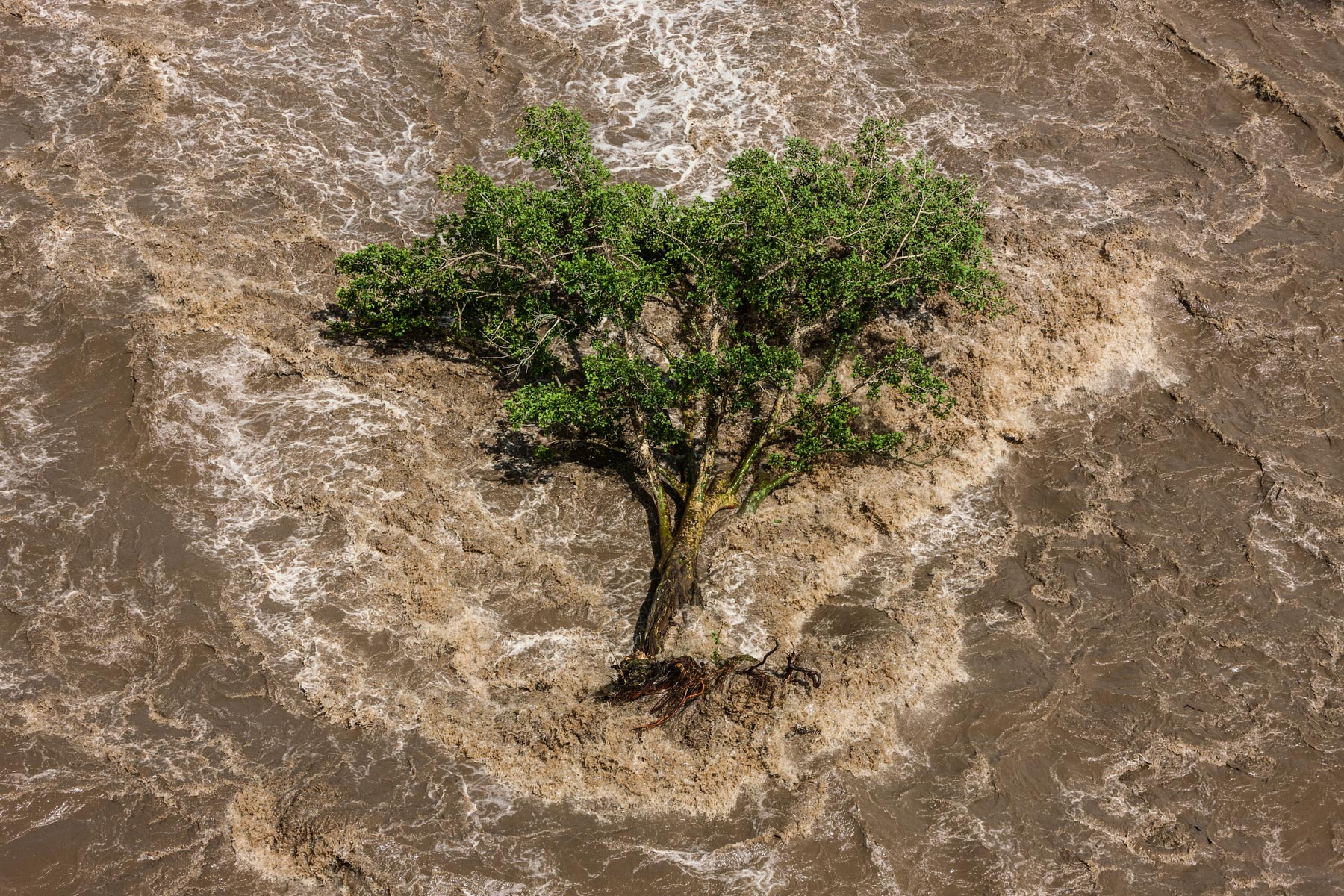
Arbre déraciné dans la rivière Ewaso Ng'iro (nord de Nanyuki), province de la vallée du Rift, Kenya (0°34'34.85"N - 36°52'6.25"E)
Formations cristallines et reflets dans le lac Little Magadi, près du lac Magadi, province de la vallée du Rift, Kenya
Formations cristallines sur le lac Magadi, province de la vallée du Rift, Kenya (1°57'12.95"S - 36°14'46.86"E)
Camps de réfugiés somaliens de Dadaab: le camp de Hagadera, province nord-orientale, Kenya (0° 0'0.39"S - 40°21'52.99"E).
Formations cristallines dans le lac Magadi, province de la vallée du Rift, Kenya (1°51'59.32"S - 36°14'11.80"E)
Formations cristallines dans le lac Magadi, province de la vallée du Rift, Kenya (1°51'59.32"S - 36°14'11.80"E)
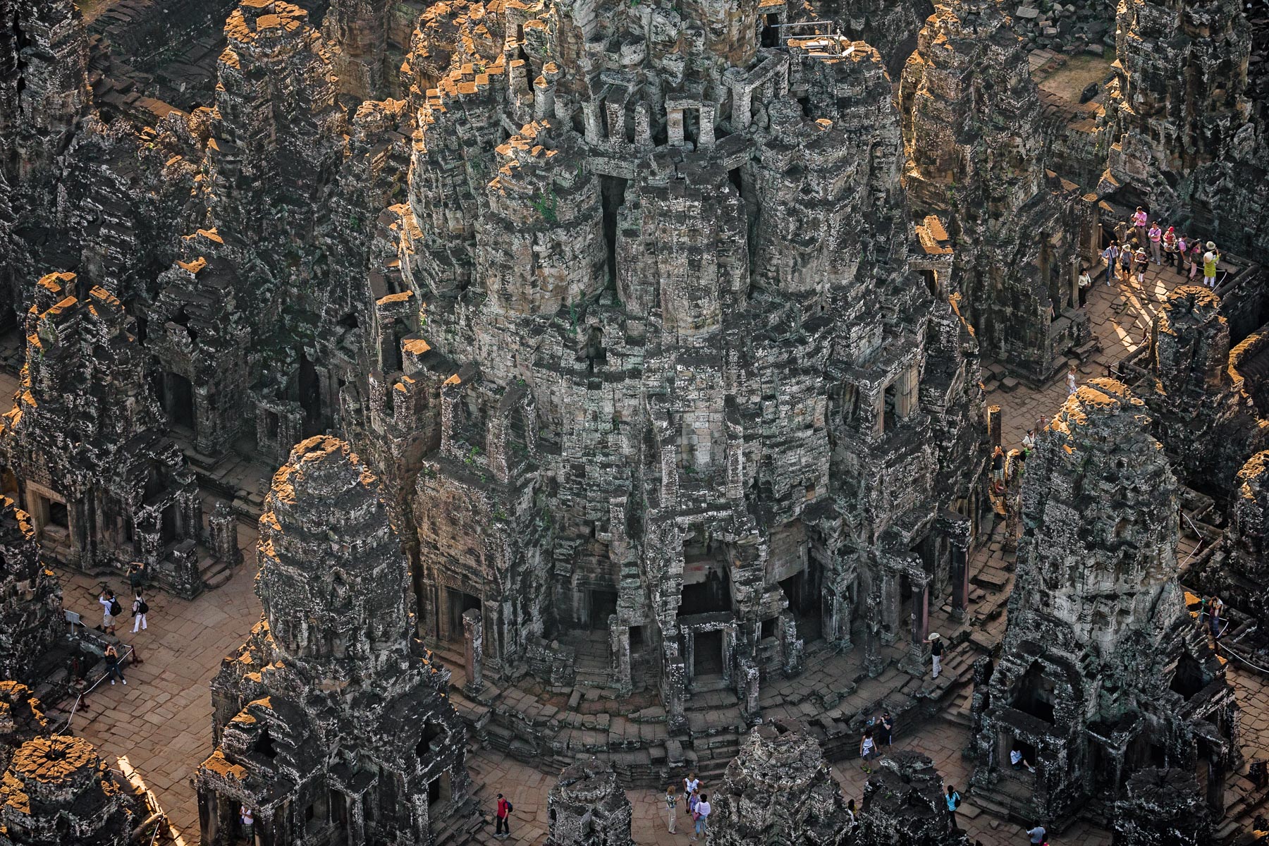
TEMPLE DU BAYON DANS L’ENCEINTE D’ANGKOR THOM, PROVINCE DE SIEM REAP, CAMBODGE (13° 26’ 28,54” N – 103° 51’ 31,93” E).
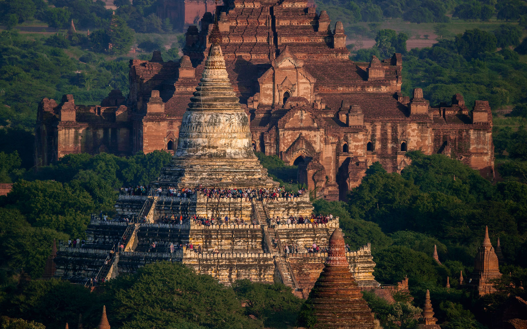
Bagan, Région de Mandalay, République de l'Union du Myanmar (Birmanie)
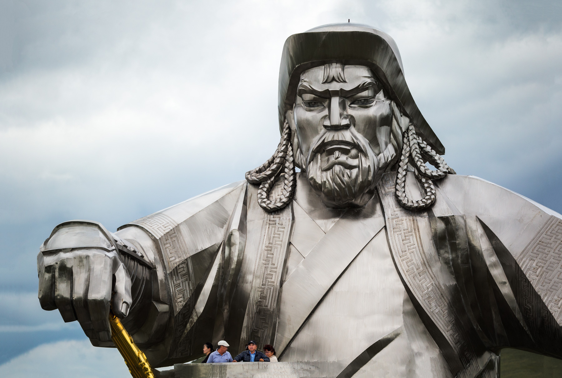
Statue équestre de Genghis Khan près d'Oulan-Bator (40m de haut - la plus grande du monde), Oulan-Bator, Mongolie ( 47°48'28.32"N - 107°31'46.71"E)
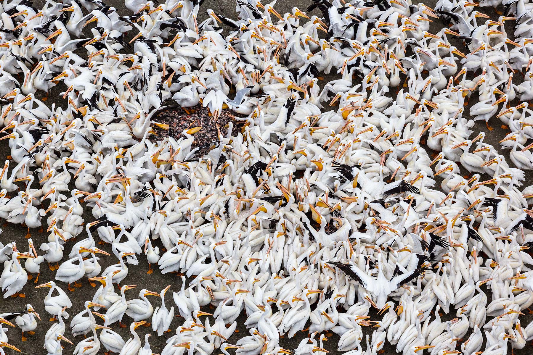
Pélicans blancs sur le lac de Chapala, près de Petatan, Etat de Michoacan, Mexique (19°32'3.90"N - 102°14'57.31"O)

Match de football sur un terrain de campagne, Coyotepec, état de Mexico, Mexique (19° 47’ 22,19” N – 99° 13’ 2,88” O).
© Yann Arthus Bertrand/Mexique/Human 03-2013
Labours près de Sadpara, vallée de Skardu, Gilgit–Baltistan (Territoires du Nord), Pakistan ( 35°11'31.57"N - 75°36'54.23"E)
Bahawalpur : cour intérieure, Pendjab, Pakistan
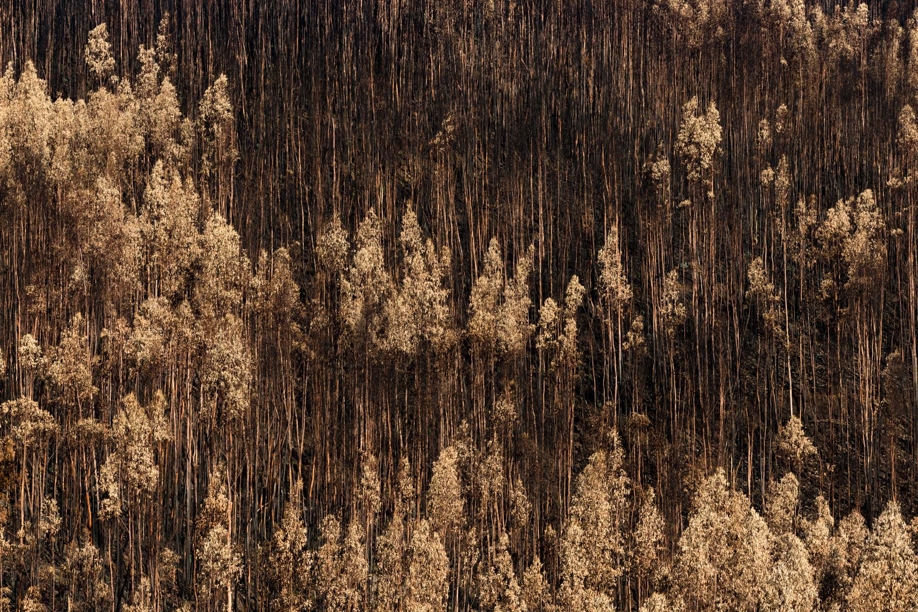
Feu de forêt de juin 2017 près de Chimpeles, district de Leira, Pinhal intérieur Nord, region Centre, Portugal (39°56'20.68" N - 8°18'21.45" O)
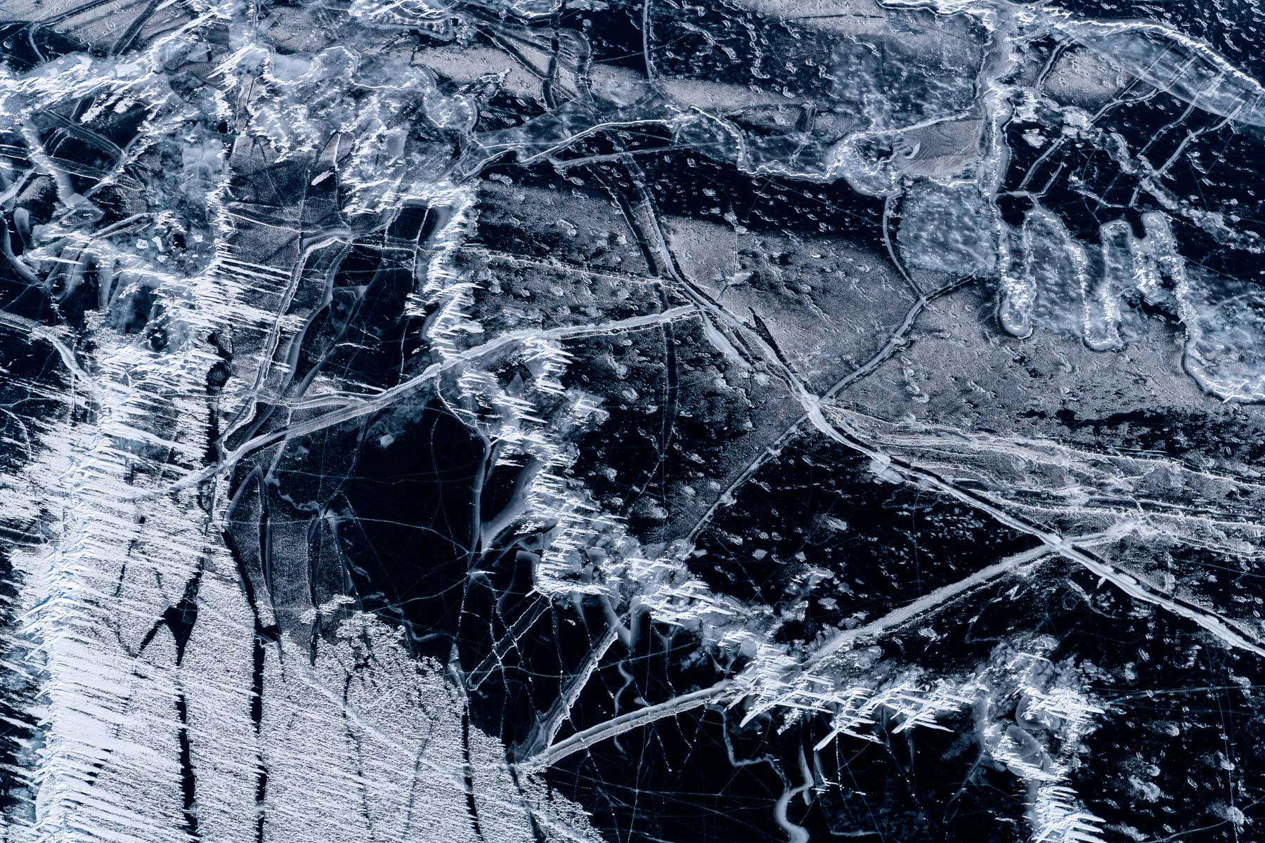
Lac Baîkal gelé dans la région d'Irkoutsk, Plateau de Sibérie centrale, Russie
Déplacement d’un campement nénètse le long du fleuve Ienisseï près de Doudinka, kraï de Krasnoïarsk, Russie (69° 21’ 42,53” N - 84° 30’ 43,75” E).
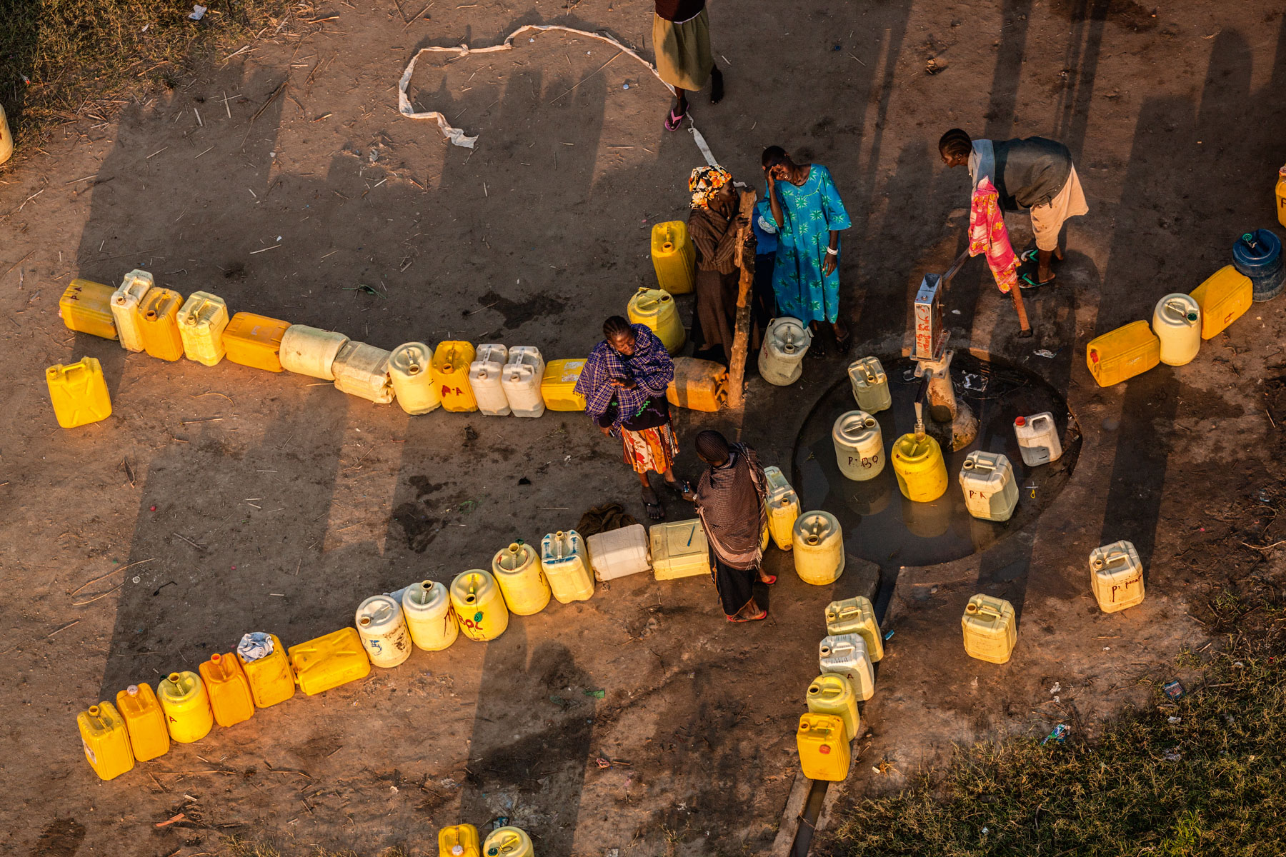
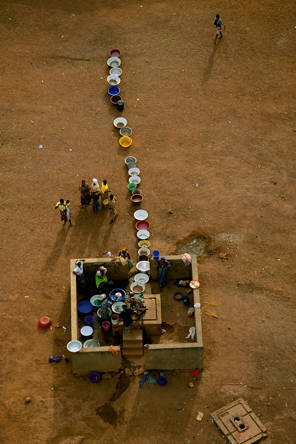
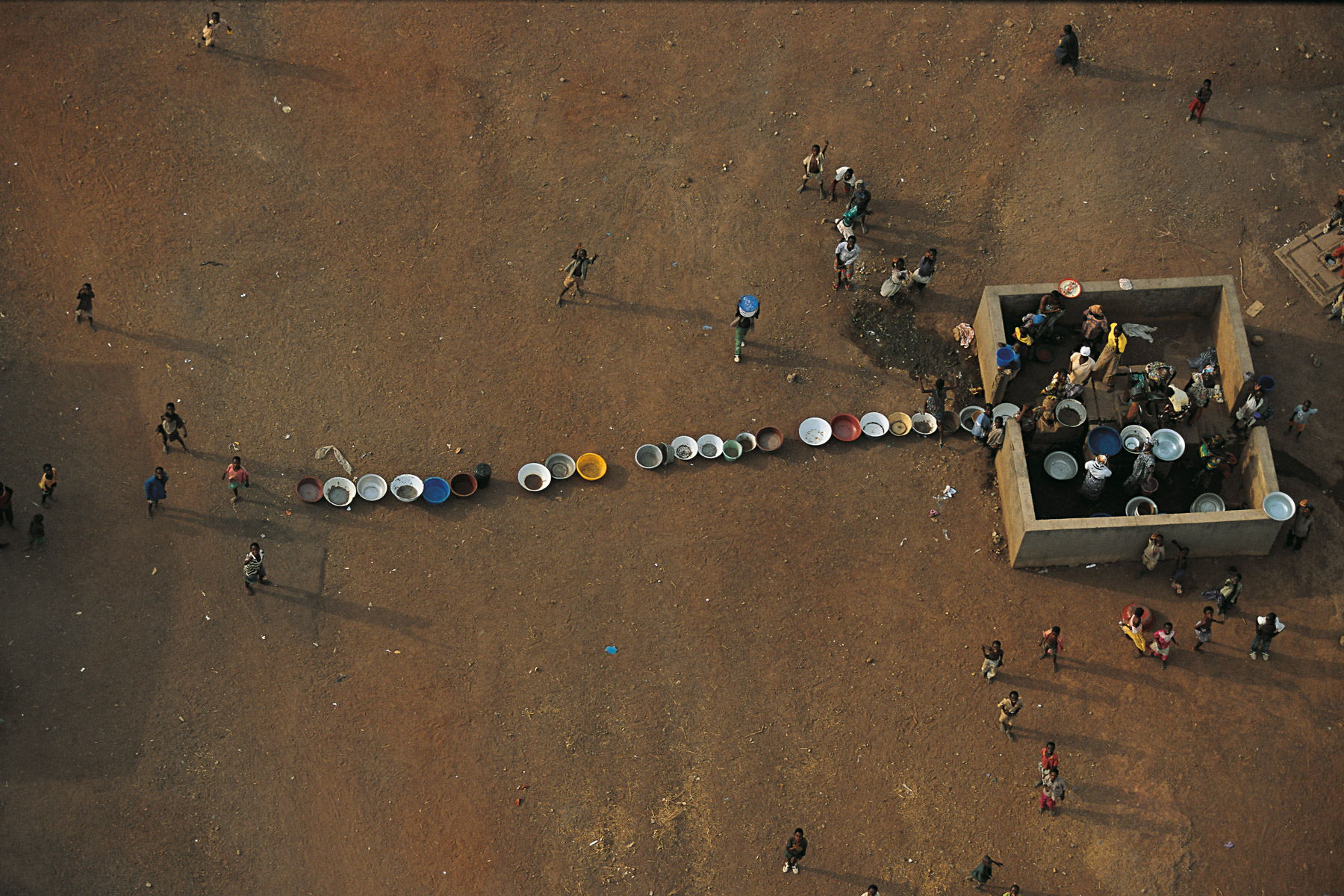
Remplissage de jerricans d’eau par des villageoises à la fontaine près de Bor, état de Jonglei, Soudan du Sud (6° 26’ 41,21” N – 31° 33’ 10,47” E).
Grande mosquée d'Alep, Syrie (36°12' N - 37°09' E).
Inondations nov. 2011: Habitation près du temple Wat Srikhet Nantharam School, amphoe de Pak Kret, région de Nonthaburi, Thailande( 13°59'3.35"N - 100°25'13.43"E)
Mine de charbon à ciel ouvert, Arizona, Etats-Unis (32°21’ N - 111°12’ O).
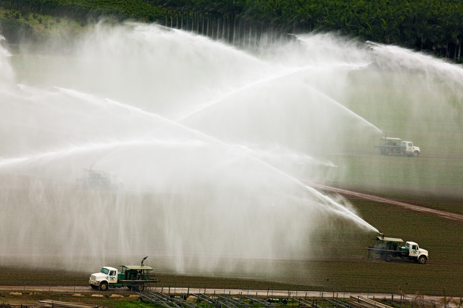
Arrosage agricole près de Homestead, Comté de Miami-Dade, Floride, Etats-Unis ( 25°23'50.54"N - 80°32'13.39"O)

Transport de déchets par bateau hors de l’île de Manhattan, New York, État de New York, États-Unis (40° 42’ 13,08” N - 74° 0’ 45,50” O).

Amandiers arracjés dans une plantation près de Los Angelès, Californie, Etats Unis (35° 32’ N – 119° 40’ O).
Éléphants dans le parc de Meru, Kenya (0°05'N – 38°12'E).
Boat on the Nile, Egypt (31°08' N - 30°38' E)

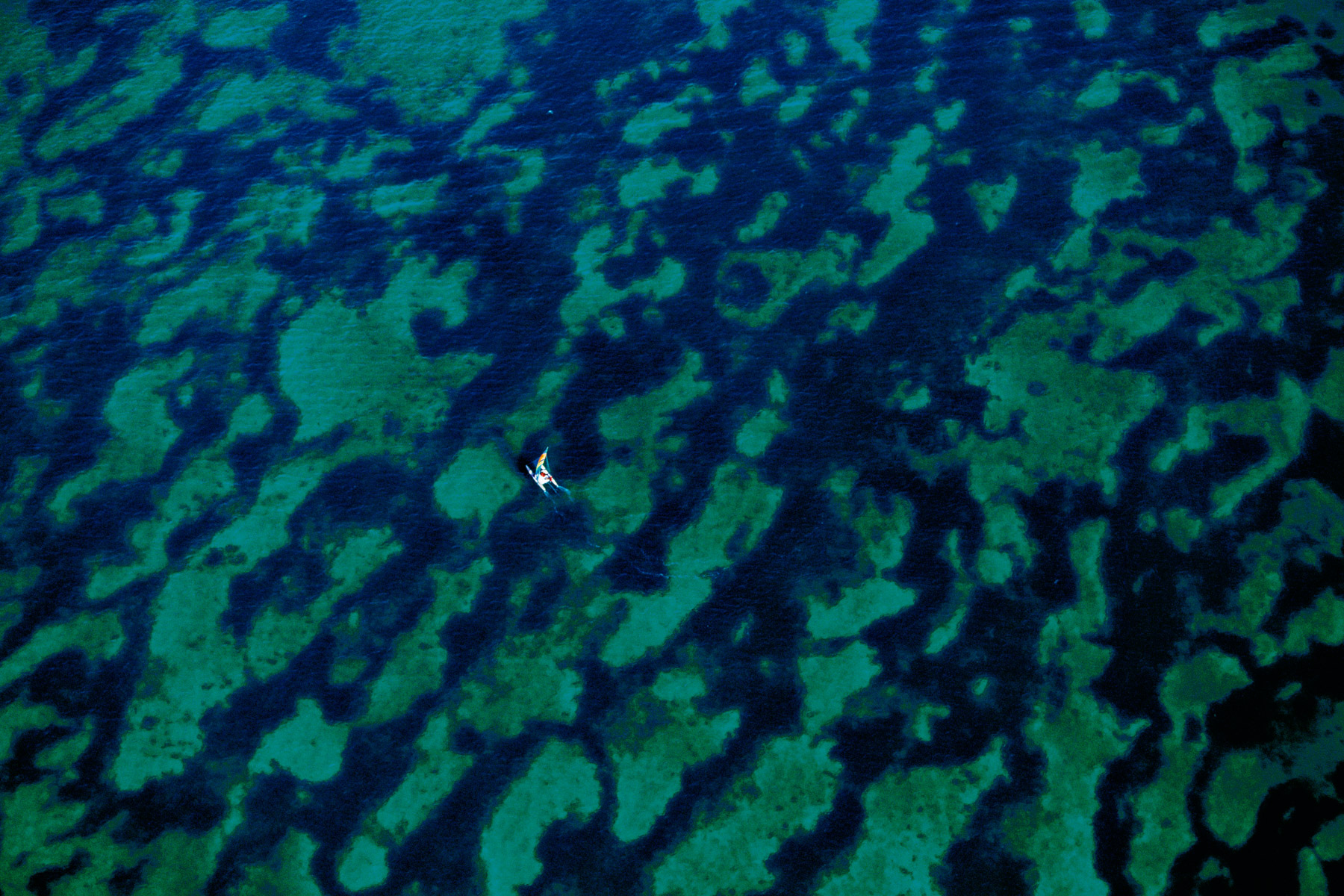
Récolte des algues, Bali, Indonésie (8°17' S – 115°06' E).
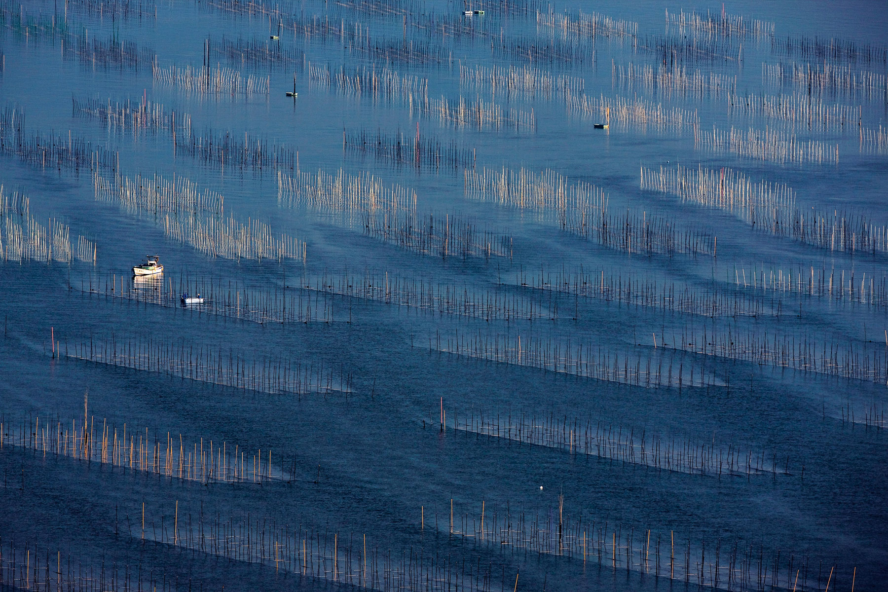
Culture de l'algue nori dans la mer d'Ariaké, île de Kyushu, Japon (33° 07’ N – 130° 13’ E).
Bateau de pêche sur le Yangtsé au large de Shanghai, Chine (31°28' N - 121°27' E).
Place de la Concorde, Paris, France (48°51’ N, 2°21’ E).
Tarmac de l'aéroport Charles de Gaulle, piste n°4, Roissy en France, France.
Érosion sur les flancs d’un volcan près d’Ankisabe, région de Tananarive, Madagascar (19°04’ S – 46°39’ E).
Barque sur le fleuve Niger, région de Tombouctou, Mali (16°38’ N – 3°04’ O).
Séchage du linge au bord du fleuve Chari près de N’Djamena, Tchad (12°7’ N – 15°03’ E).
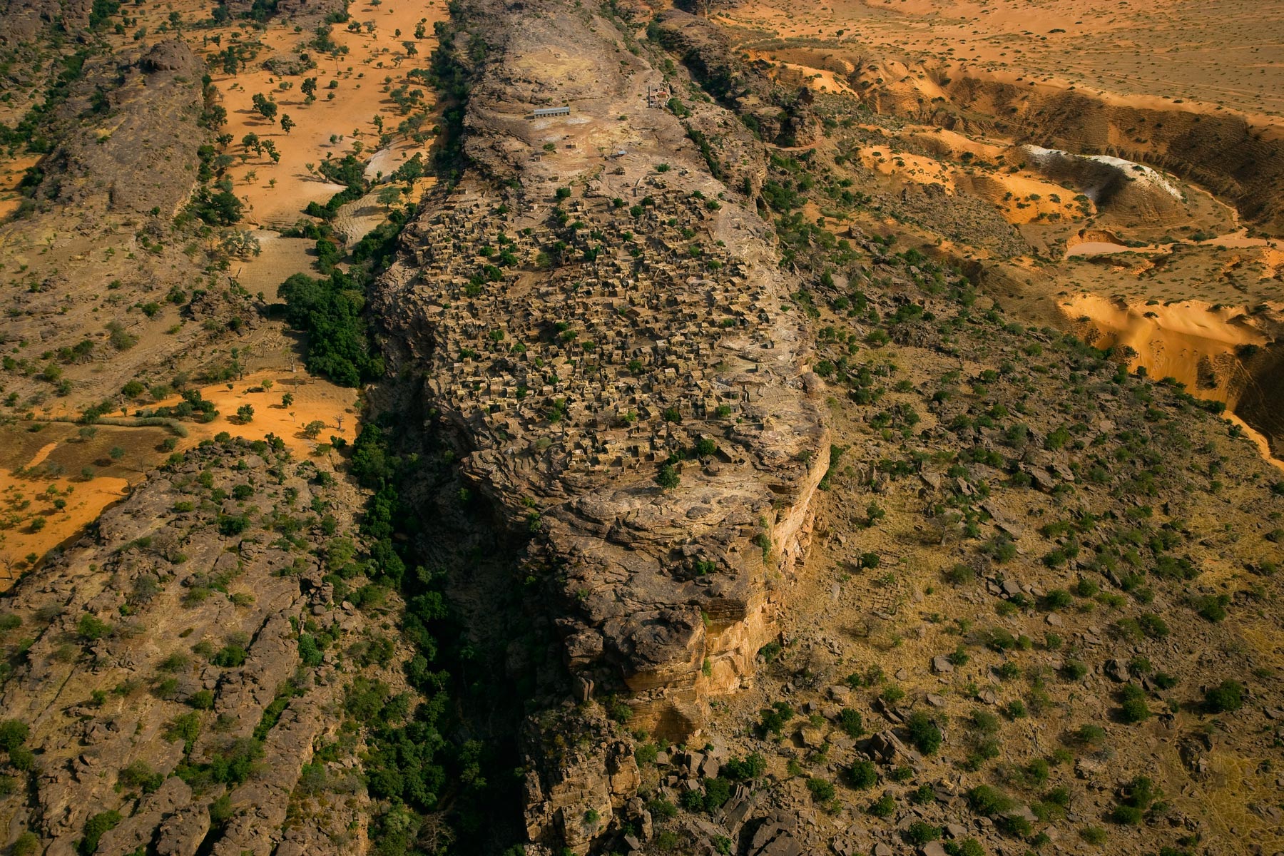
Falaise de Bandiagara en pays dogon, Mali (14°18’ N – 03°25‘ O).
Parc à bois de Port-Gentil, province de l’Ogooué-Maritime, Gabon (0°43’ S – 8°47’ E).
Salar de Atacama, Chili (23°18’ S – 68°11’ O).
Dessins dans la cour d’une maison à Khudiala, Rajasthan, Inde (26°31’ N – 72°41’ E).
Lac Nourek, Tadjikistan (38°32’ N – 69°39’ E).
5981-KENYA01
Nids de tilapias sur les rives du fleuve Ogooué, province de l’Ogooué-Maritime, Gabon (0°58’ S – 8°34’ E).
Île de Lalu, Sun Moon lake, Taiwan (N 23°52’-E 120°55’).
La Nouvelle-Orléans inondée après le passage de l’ouragan Katrina - Hélicoptère de Yann Arthus-Bertrand sur le toit d'une maison, Louisiane, Etats-Unis
Plantation of eucalyptus, reservoir of the dam in Paso del Plamar, Soriano Department, Easter Republic of Uruguay (33°05’ S, 57°56’ W).
Herd of sheeps near the river Arerunguá, Salto Department, Eastern Republic of Uruguay (31°35’S, 56°39’W).
Seaside resort of Aguas Dulces, Rocha Department, Eastern Republic of Uruguay (34°16’S, 53°47’W).

Drying fish in the countryside in North Bangkok, Thailand (14°00' N - 100°36' E).
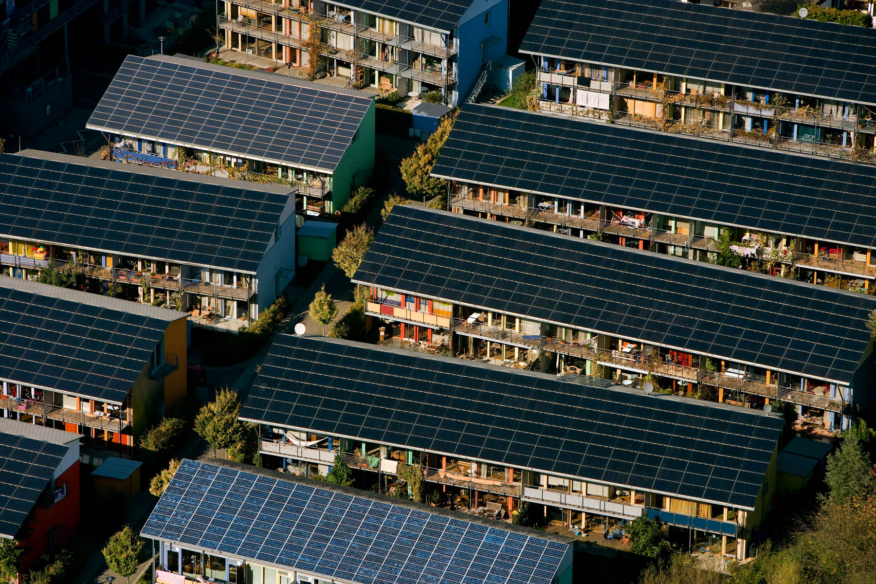
Solar houses in the Vauban ecoquarter in Freiburg im Breisgau, Germany (47°58' N - 7°50' E).

L'ancienne cité antique de Palmyre et le temple de Bêl, Governorat de Homs, Syrie (34° 32’ 51,46” N – 38° 16’ 26,28” E).
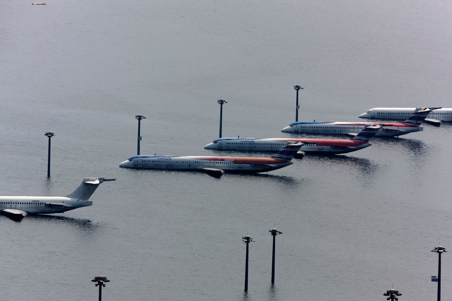
Inondations nov. 2011: Aéroport de Don Muang, district de Don Mueang, Bangkok, région de Bangkok ( 13°54'58.00"N - 100°36'35.88"E)
Grumier dans le port de Busan, Détroit de Tsushima, Busan, Corée du Sud (35° 4'20.65"N -128°50'0.19"E)
Barques sur le lac Tonlé Sap, province de Siem Reap, Cambodge.
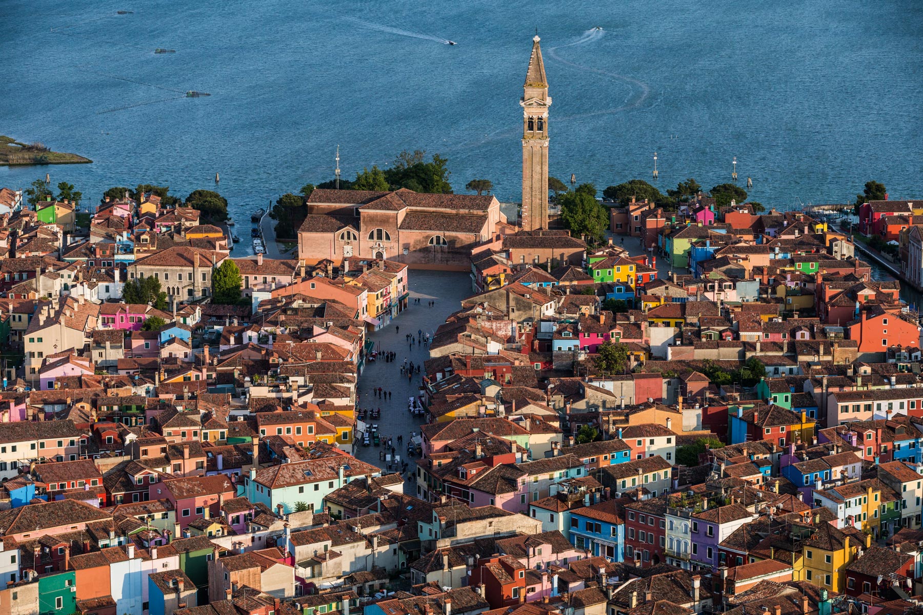
Ile de Burano dans la lagune de Venise, province de Venise, Vénétie, Italie ( 45°29'8.18"N - 12°25'3.78"E)
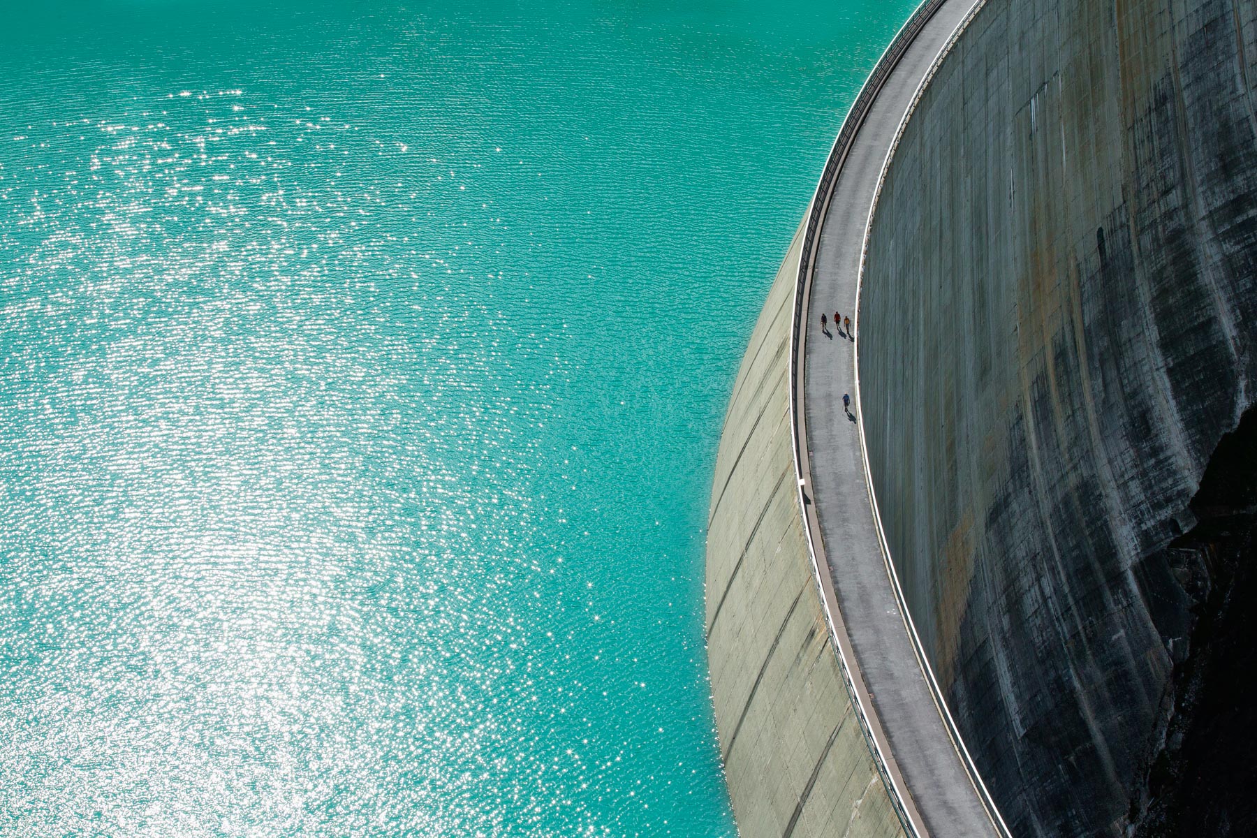
Lac et barrage voûte de Moiry, Canton du Valais, Suisse (46° 7'39.02"N - 7°34'11.39"E)
Après le tremblement de terre.HAITI PORT AU PRINCE
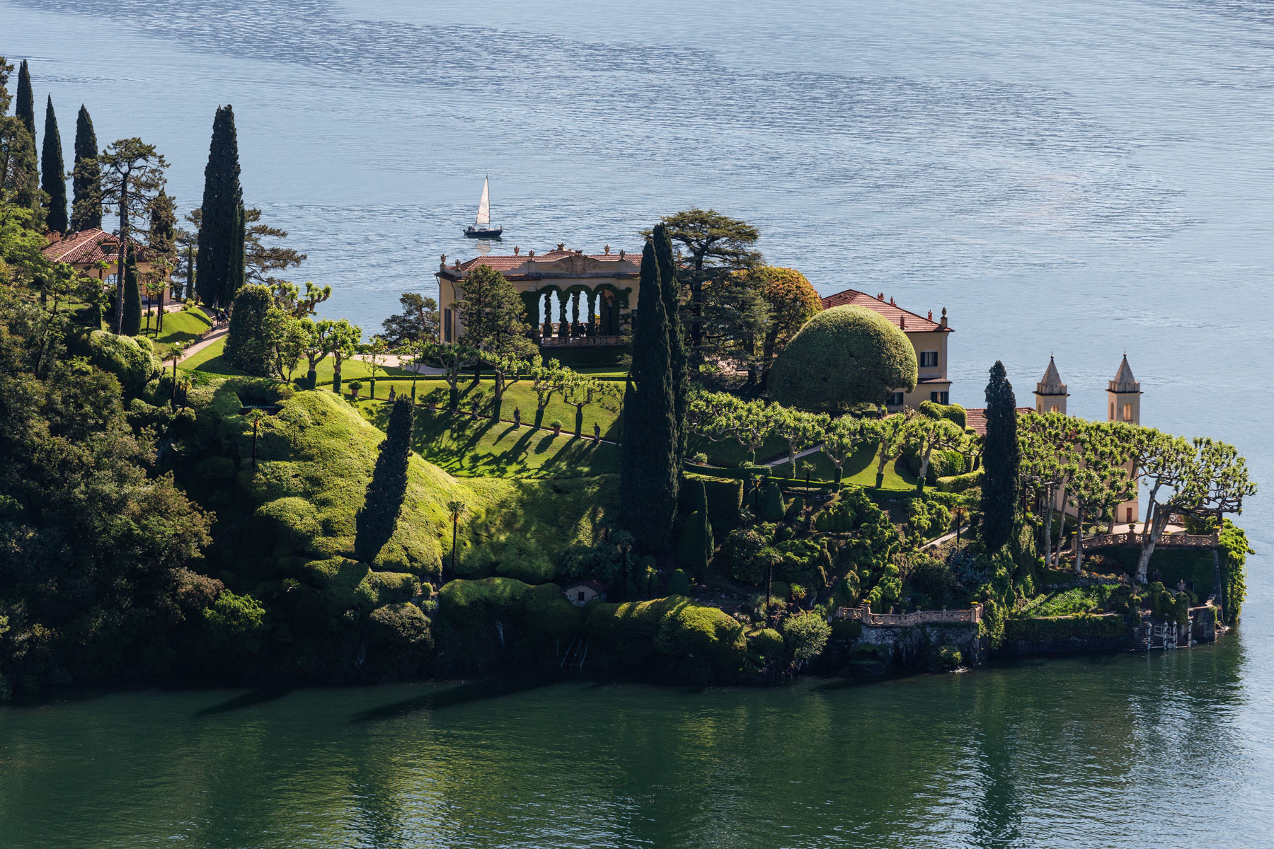
Villa del Balbianello sur la presqu’île de Lavedo, au bord du lac de Côme, Lenno, province de Côme, Lombardie, Italie
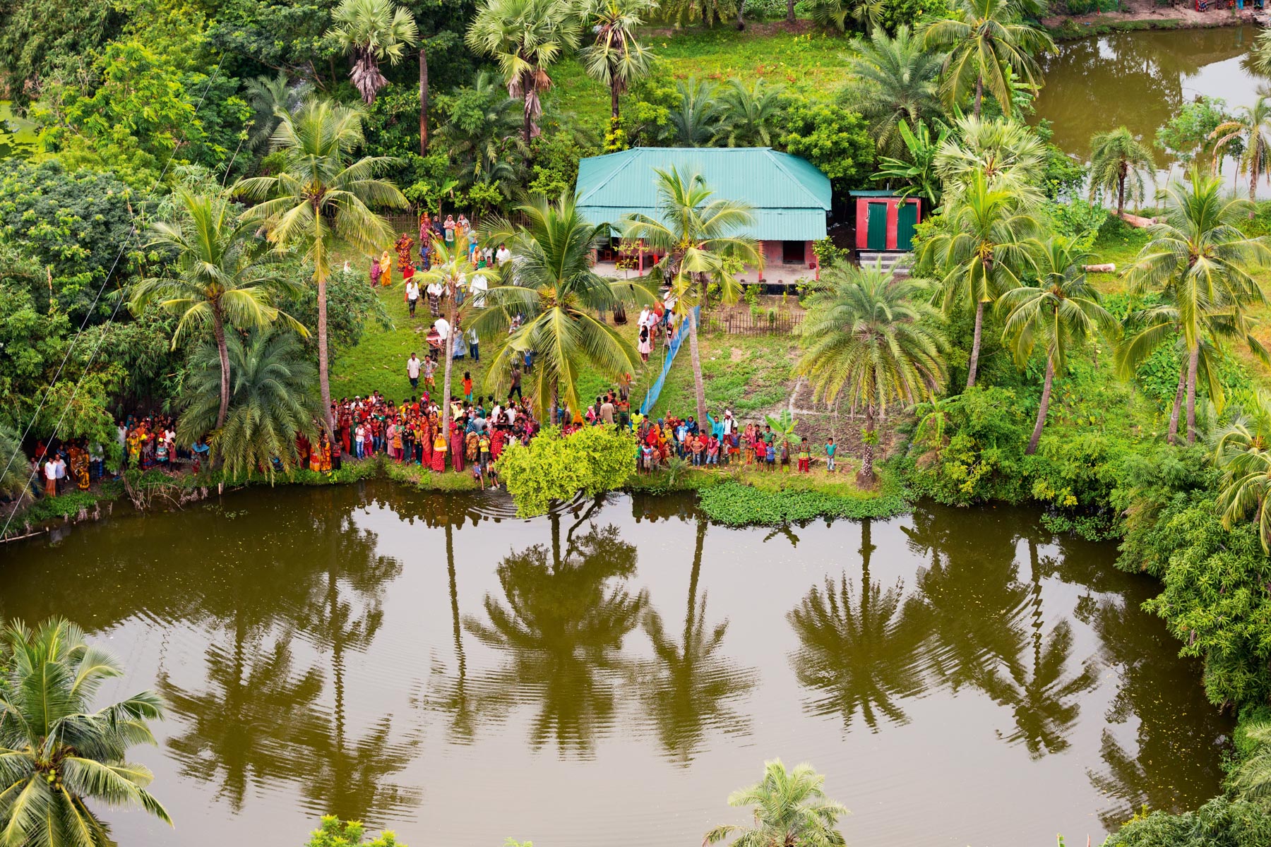
Ecole au sud-ouest de Padma Pukur, Barisal Division, Bangladesh (22°18'51.73"N- 89°13’22.48 »E).

Barrage édifié en sacs de sable sur le delta du Gange, Chittagong District, Bangladesh (22°47'2.92" N - 91°21’23.84" E).
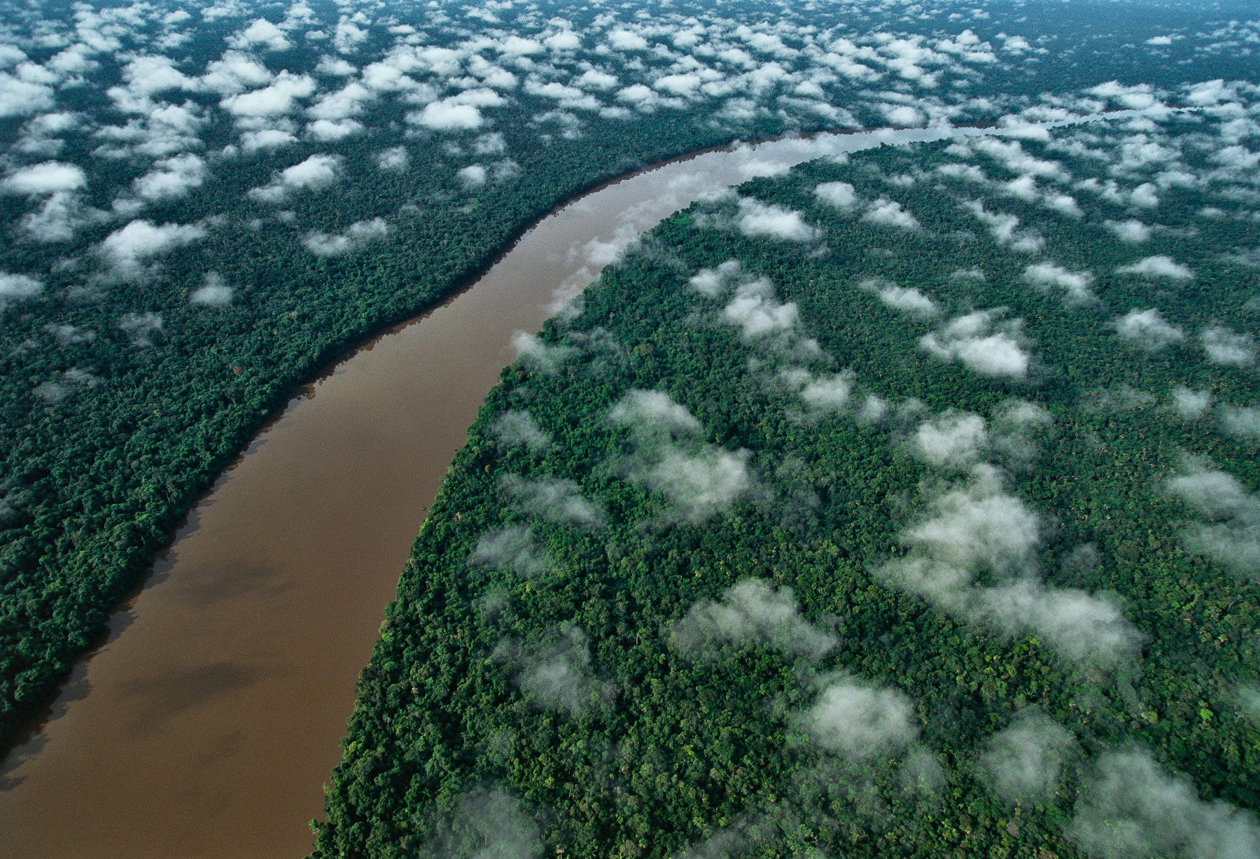
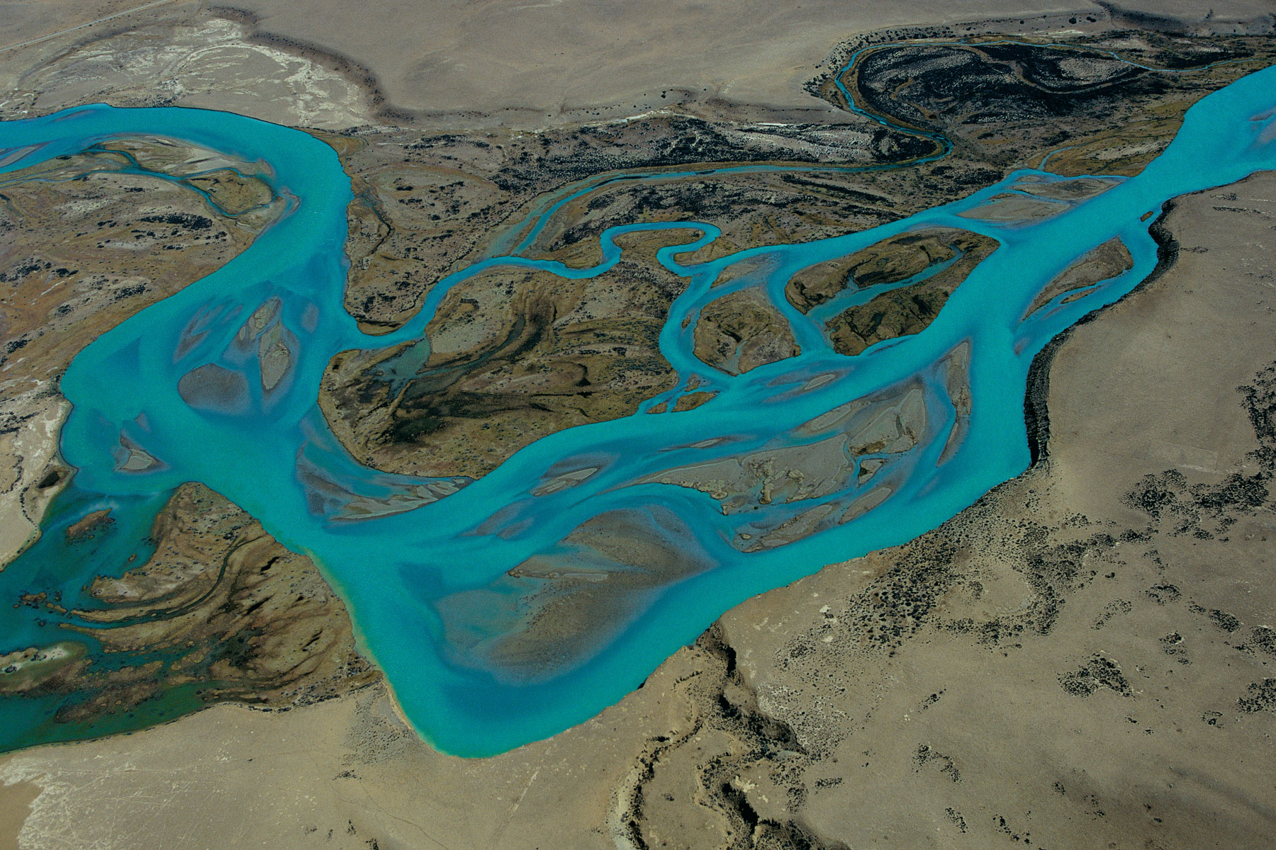
The Orinoco River near the Esmeralda (Amazon Rain Forest), Amazonas region, Venezuela (3°10'N - 65°33'W).
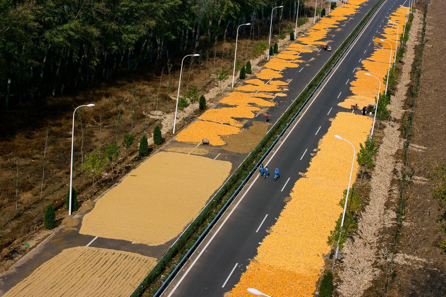
Drying corn on a highway near Cuicun, Beijing region, People’s Republic of China (40°21’ N, 116°34’ E).