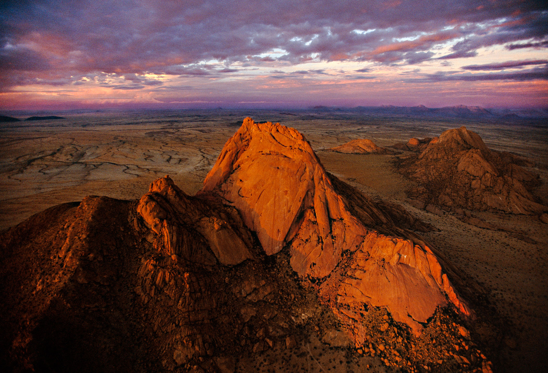
Spitzkoppe Massif at sunset, Damaraland region, Namibia (21°50' S - 15°11' E).
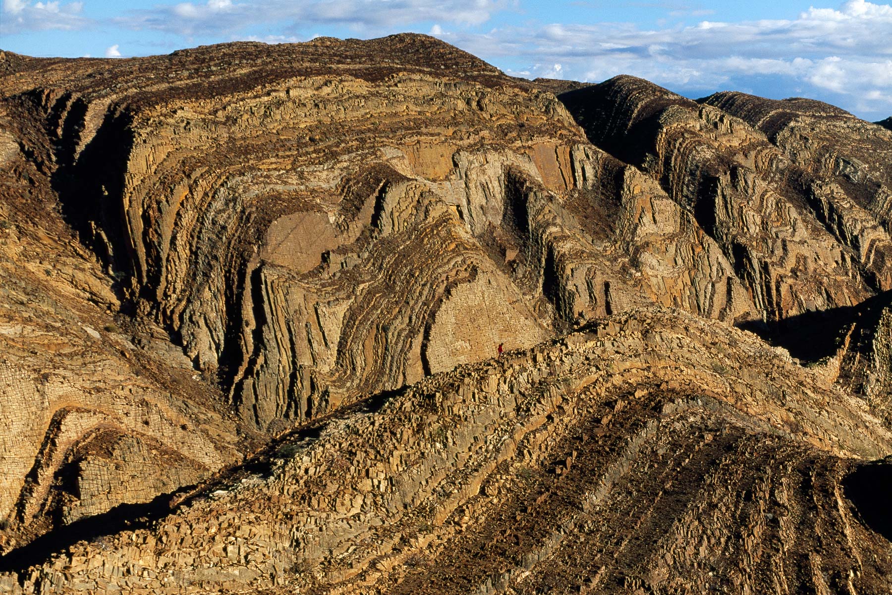
Mountains in Brandberg West, Damaraland region, Namibia (21°10'S - 14°33'E).
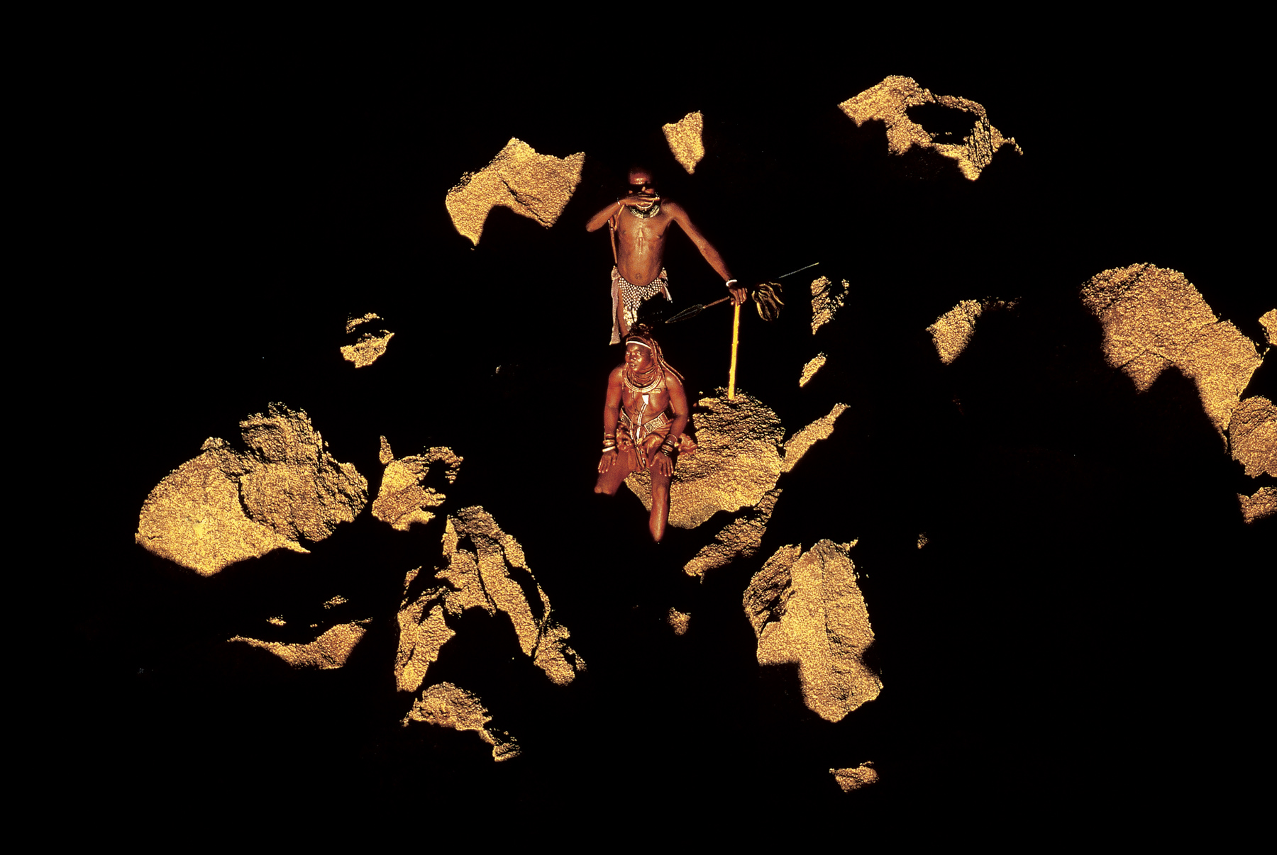
Himbas, Kunene region, Namibia (18°15' S - 13°26' E).
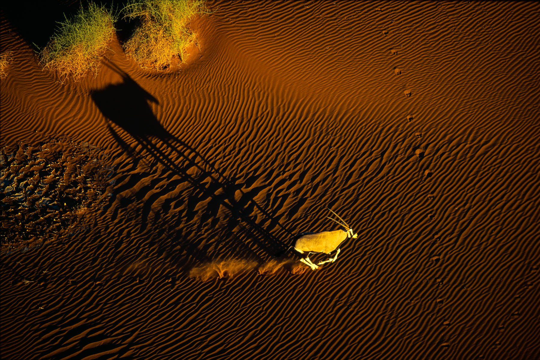
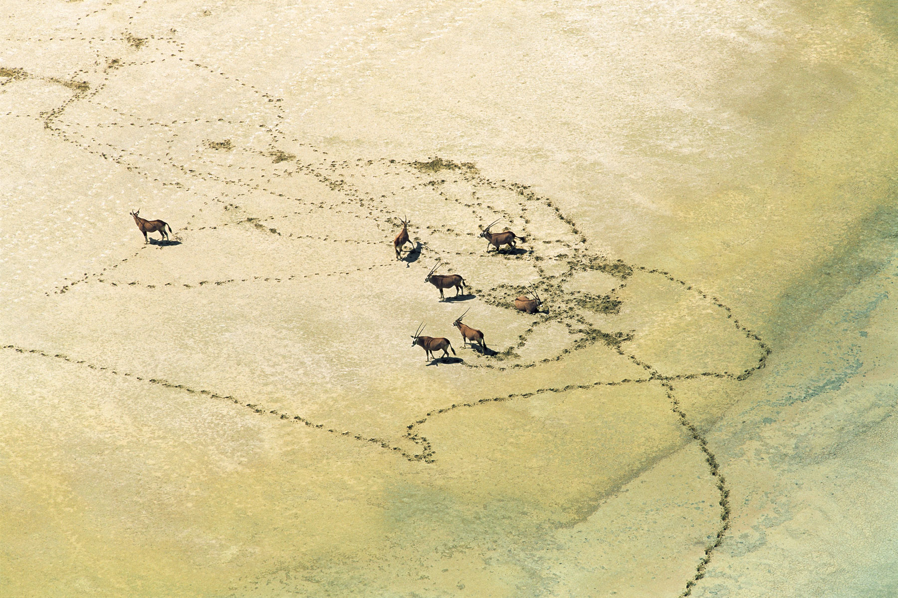
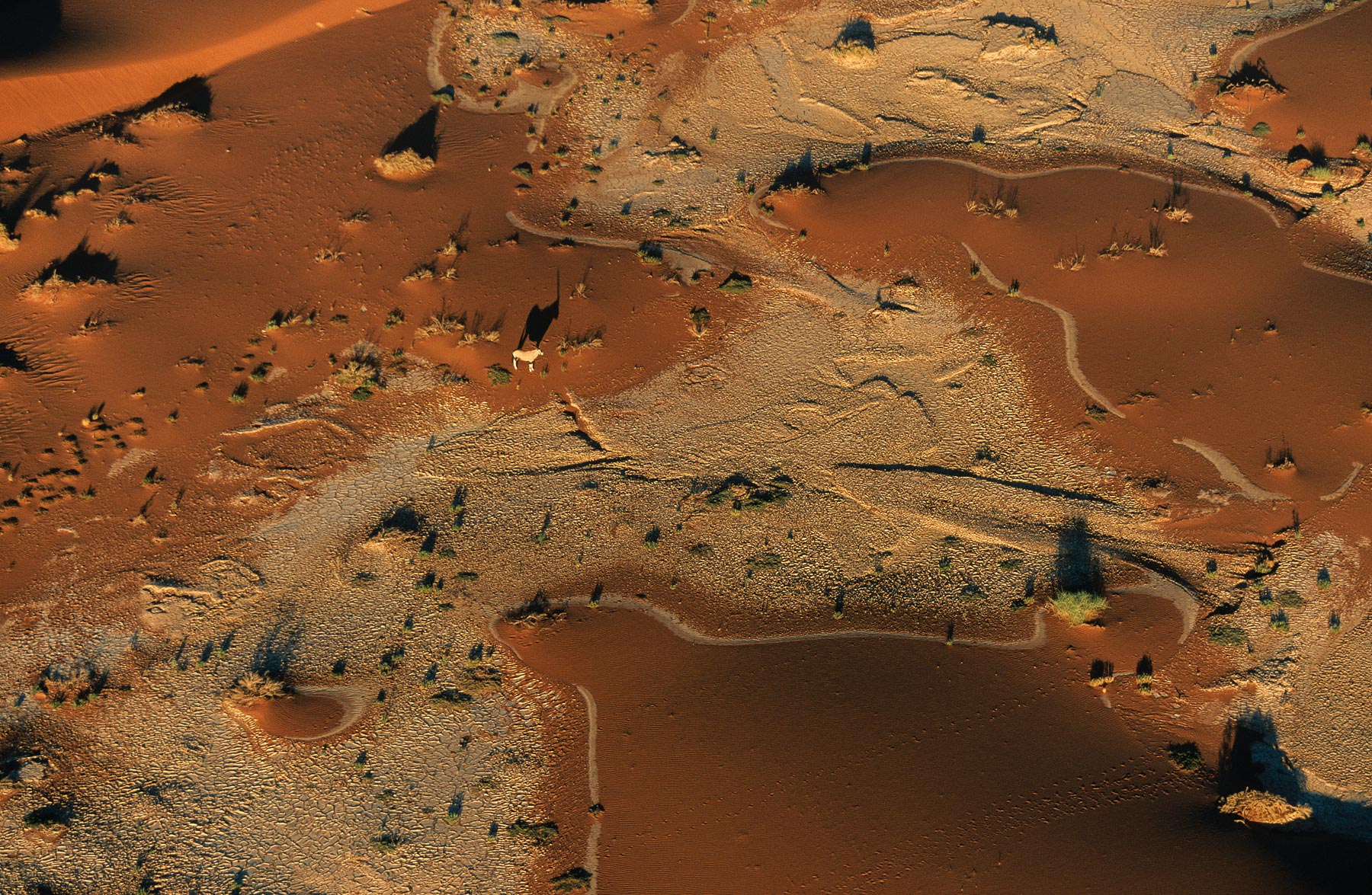
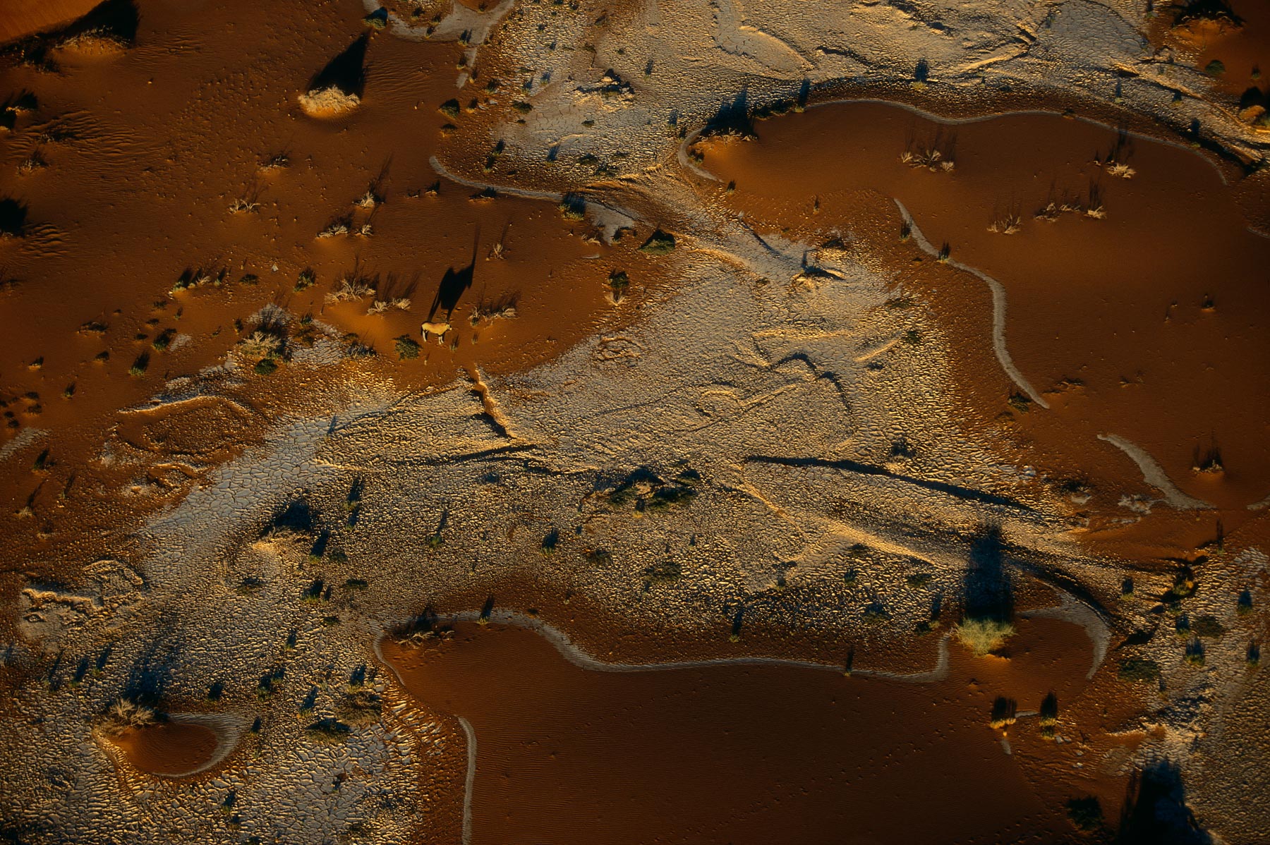
Oryx near the dunes of Sossusvlei in the Namib desert, Swakopmund, Namibia (24°44' S, 15°18' E).
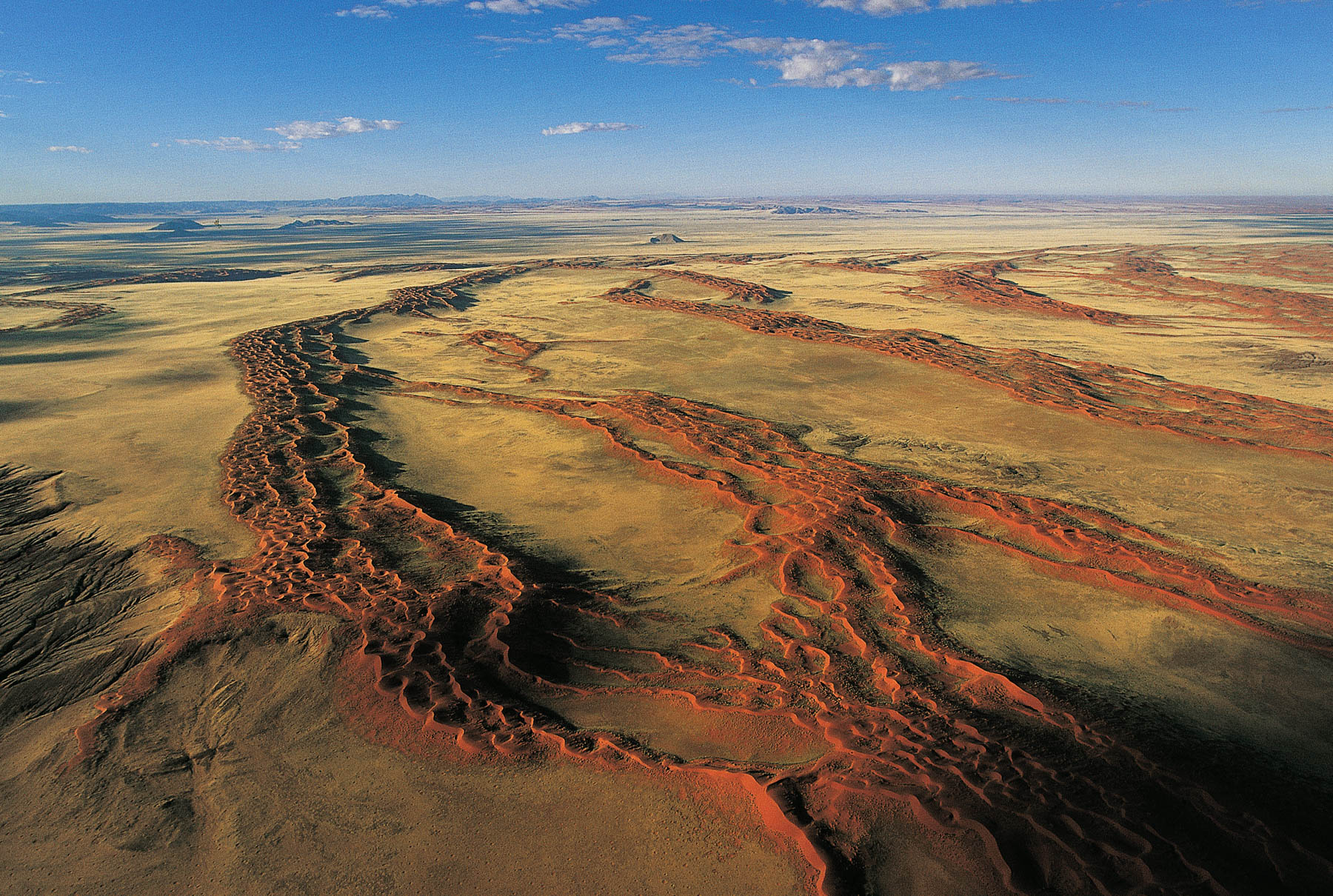
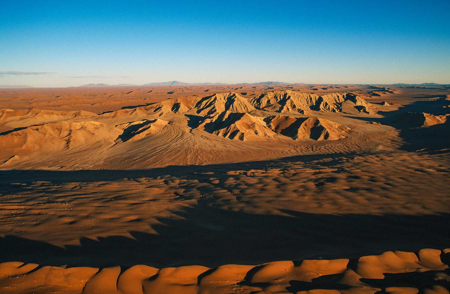
The beginning of the Namib Desert, west of Gamsberg, Windhoek region, Namibia (22°35' S – 17° 02' E).
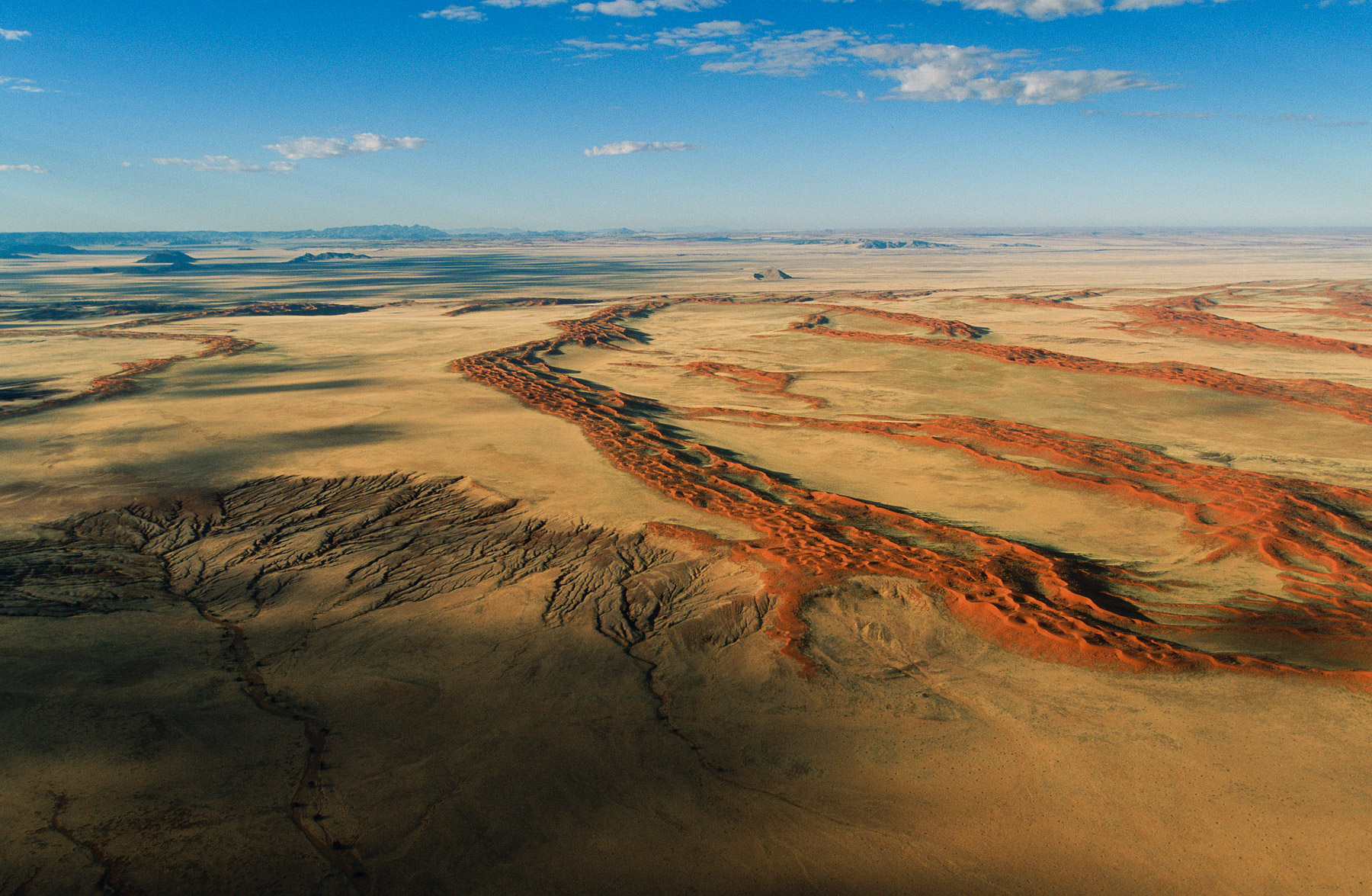
The beginning of the Namib Desert, west of Gamsberg, Windhoek region, Namibia (22°35' S – 17° 02' E).
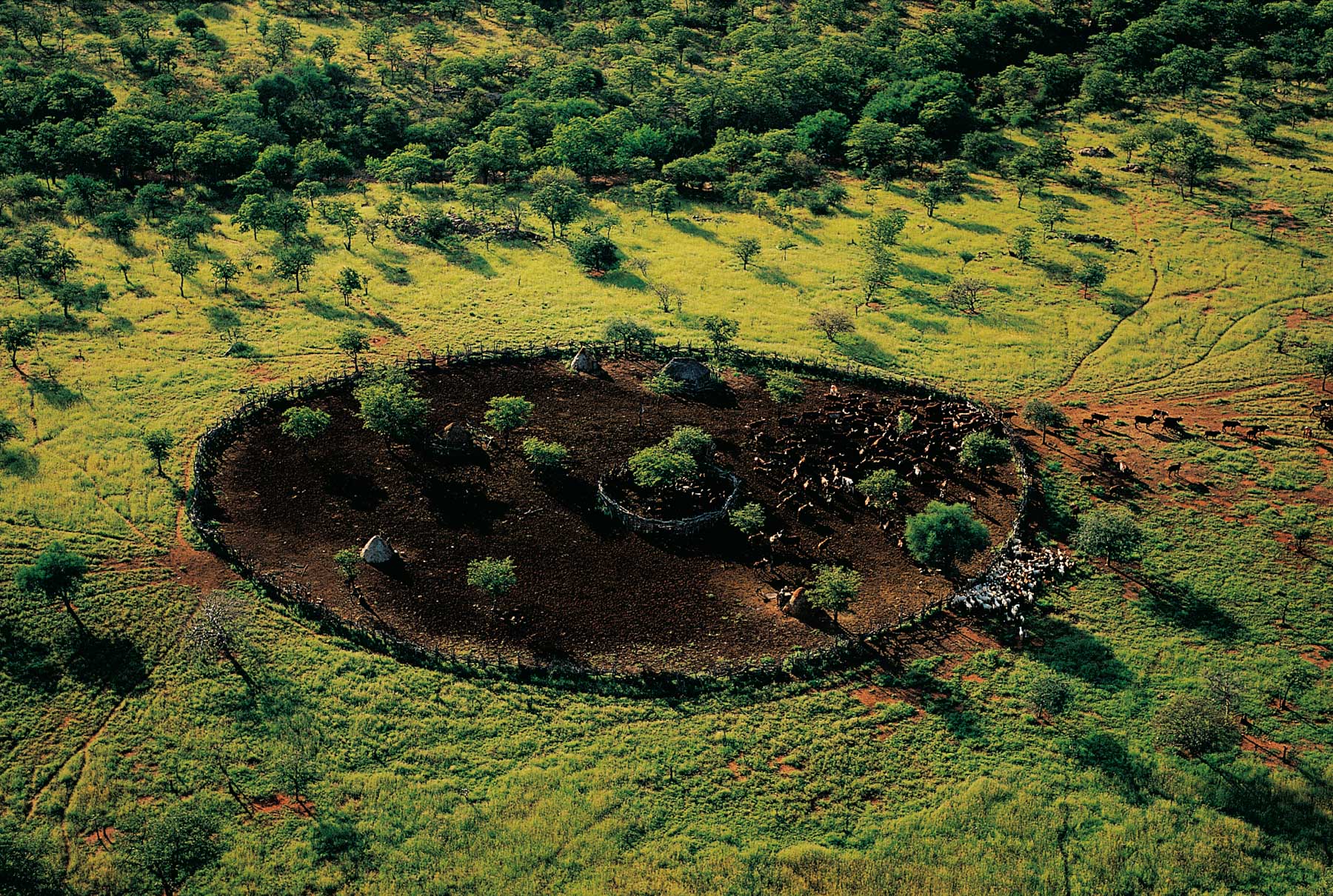
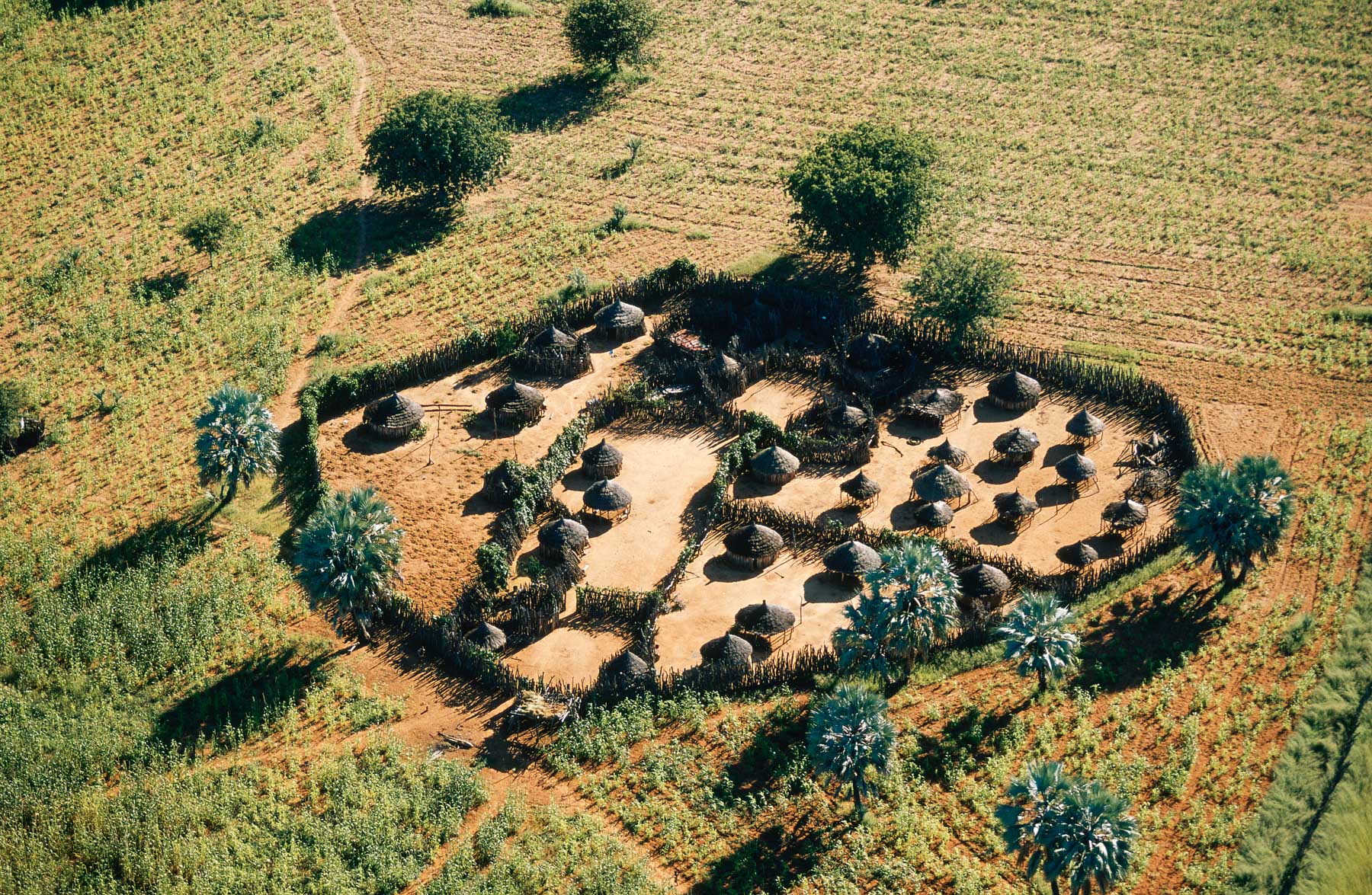
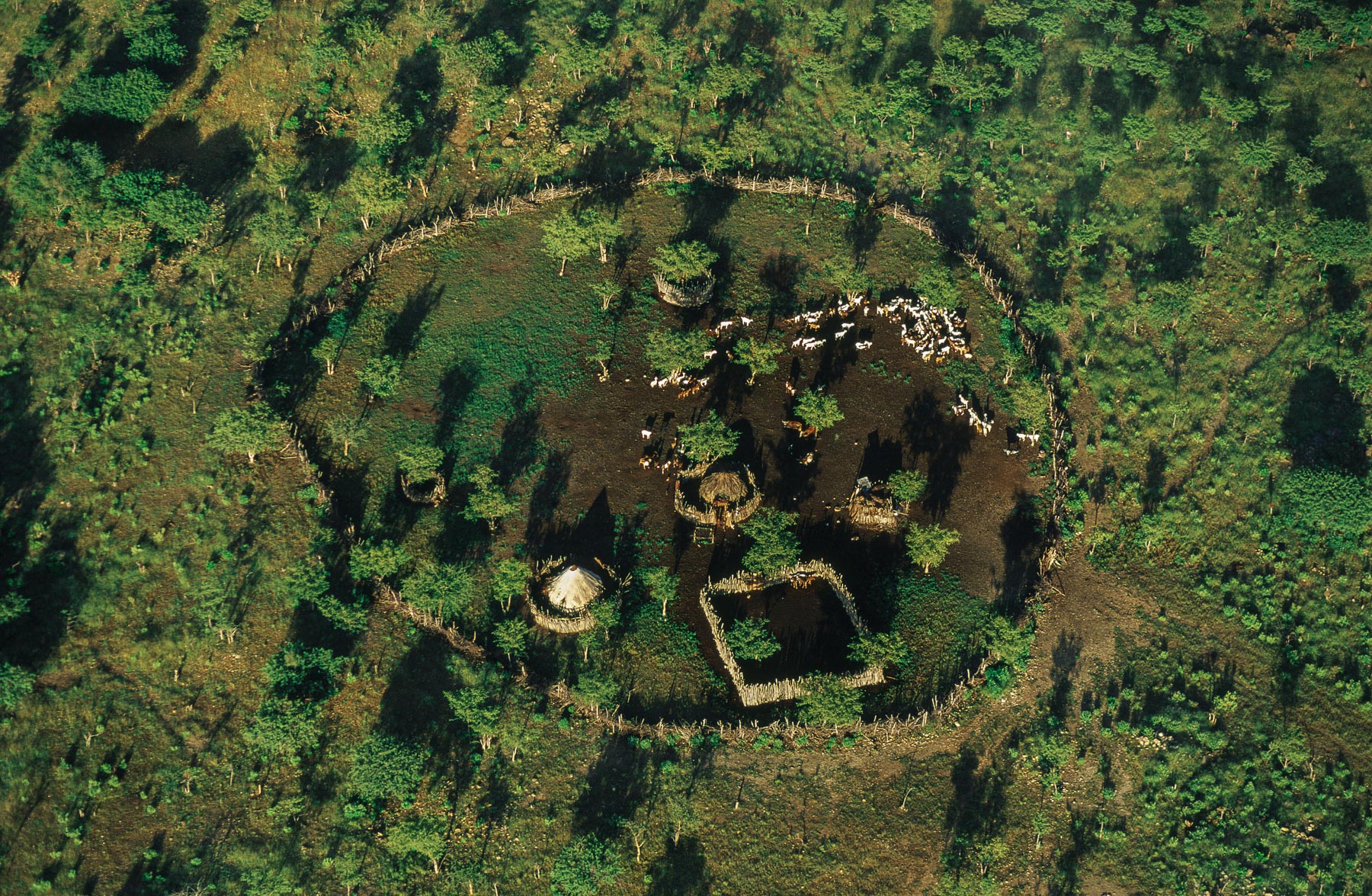
General view of a Himba village enclosure, Kunene region, Namibia (18°15’ S, 13°00’ E).
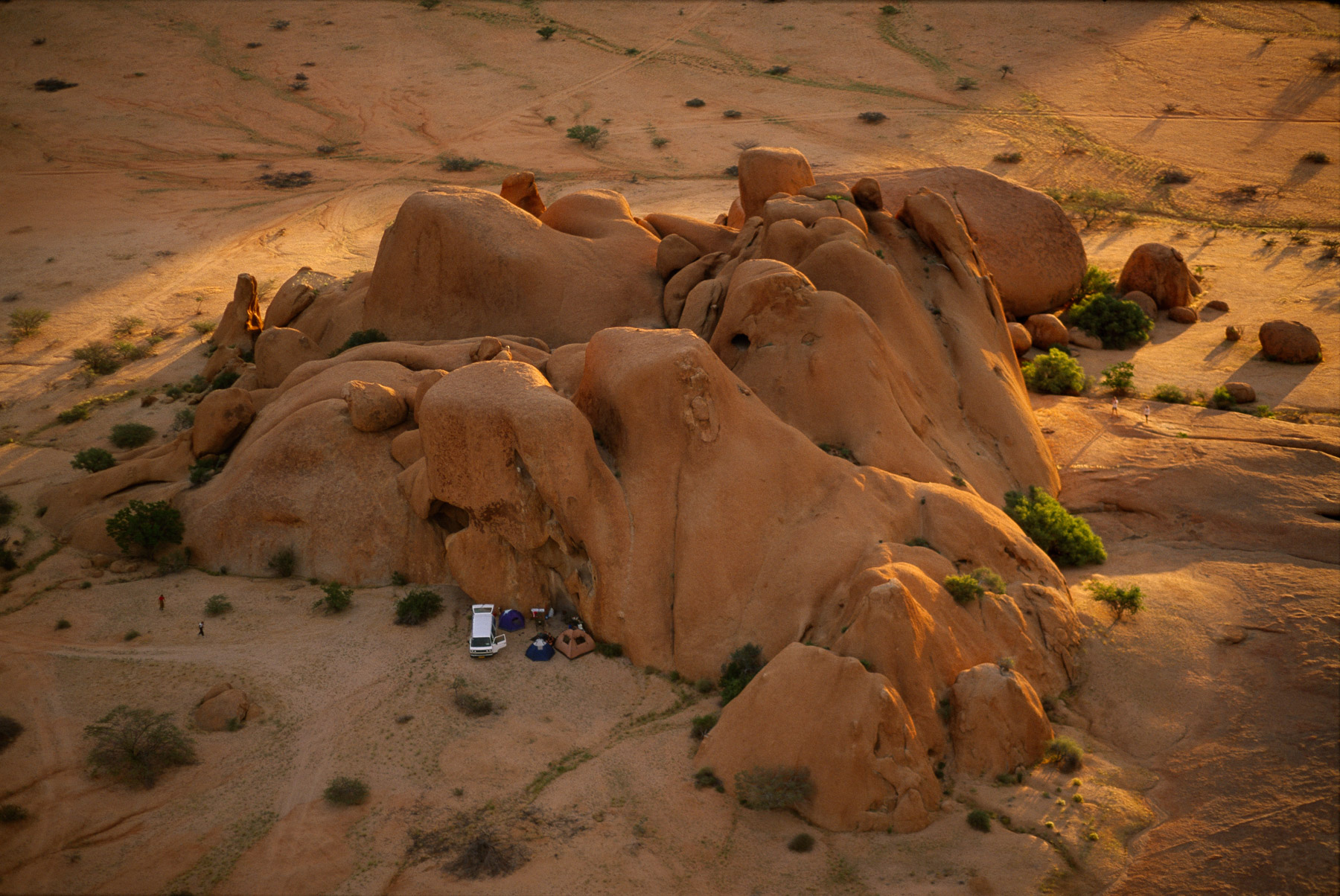
Tourists near the massif of Spitkoppe, Damaraland Région, Namibia (22°03 ' - 17°02 ' E).
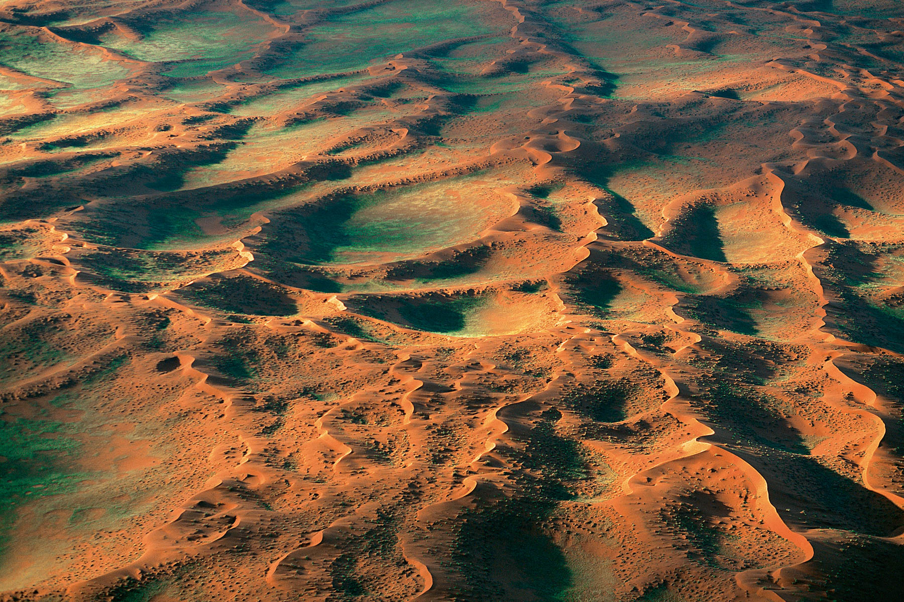
Beginning of the Namib desert, west of Gamsberg, region of Windhoek, Namibia (22°35' S - 17°02' E).
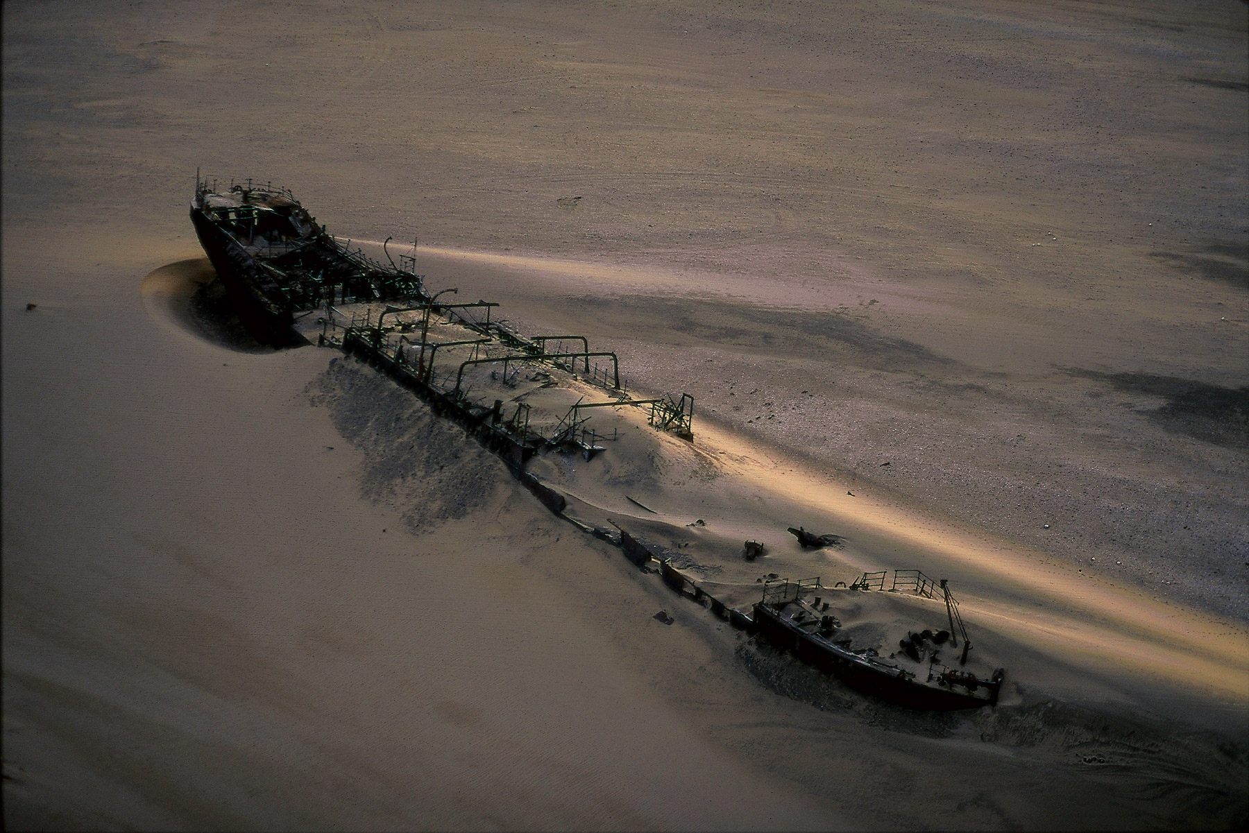
Eduard Bohlen boat run aground on the beach, Hardap Region, Namibia (23°59' S – 14°27' E).
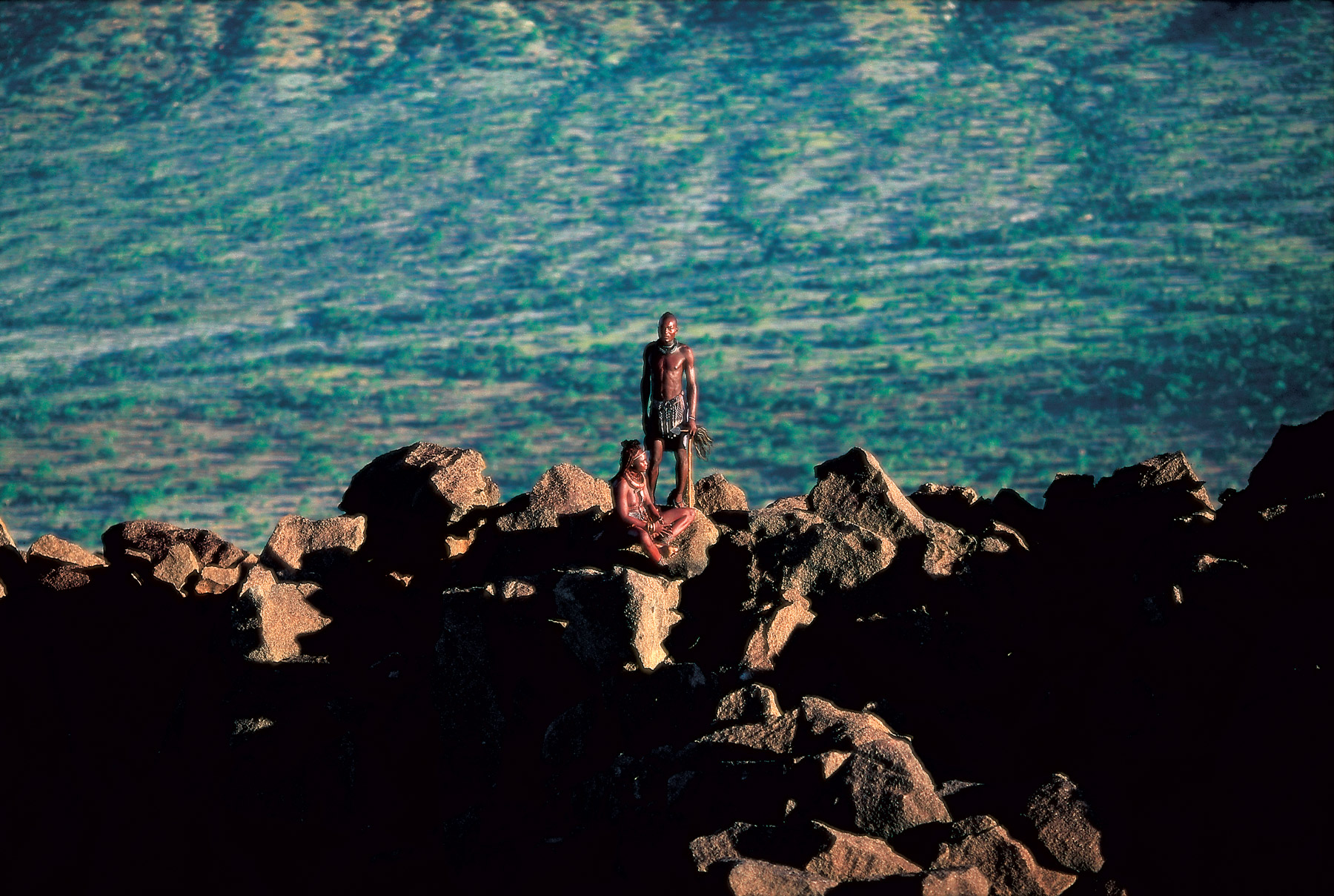
Himbas, Kunene region, Namibia (18°15' S - 13°26' E).
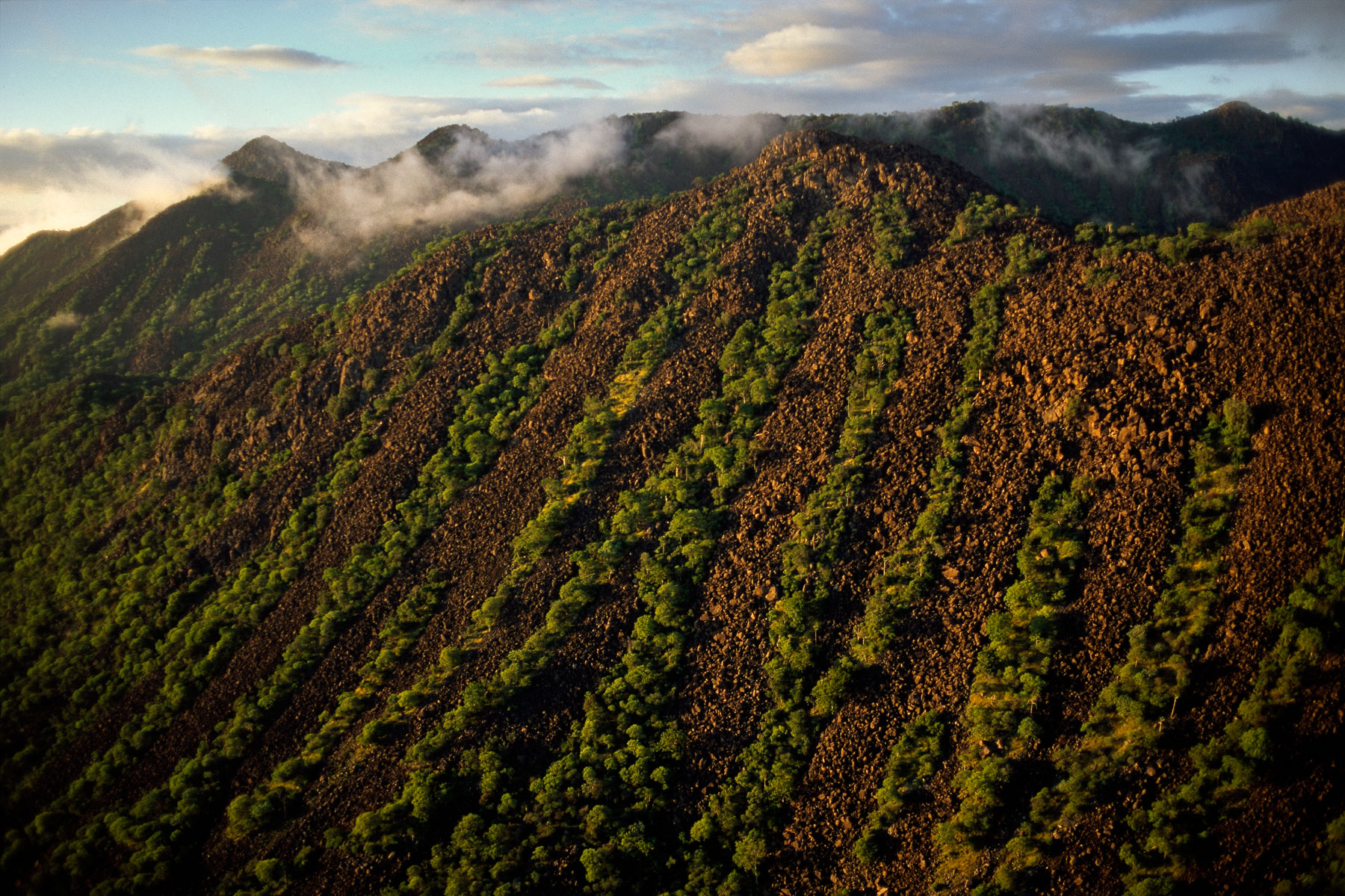
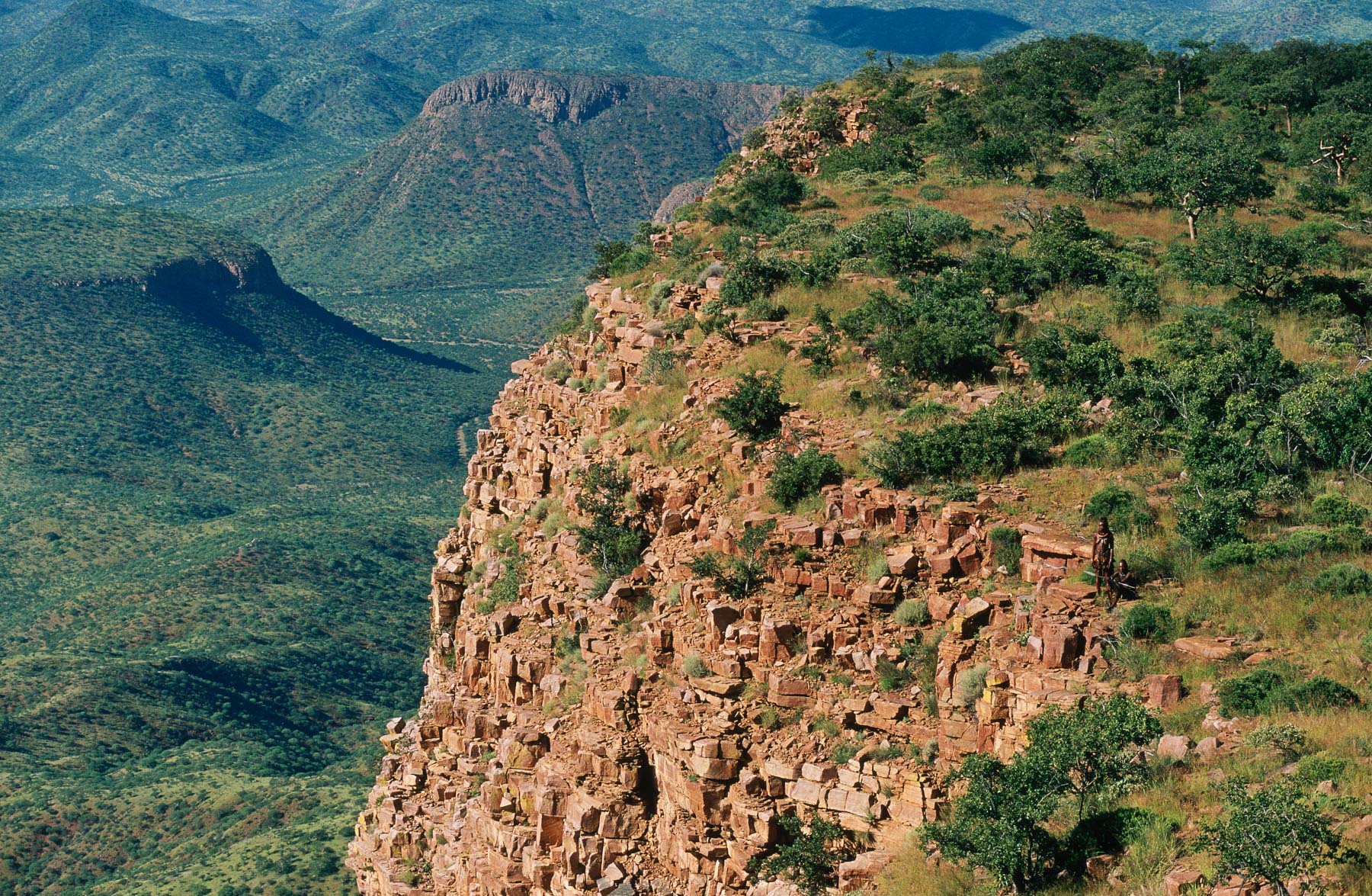
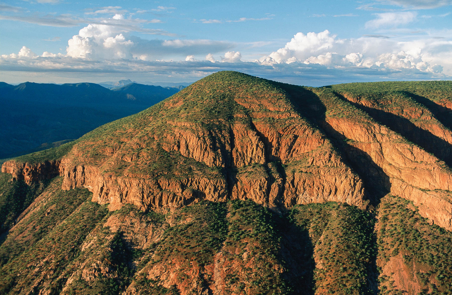
Mountainside in the Zebra Mountains, Kaokoland, Namibia (17°20' S - 13°00' E).
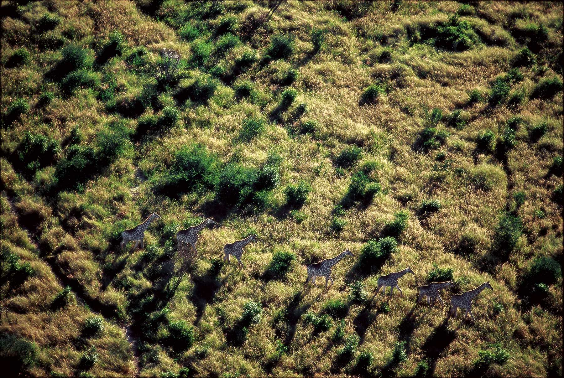
Giraffes in Etosha National Park, Namibia (19°00' S - 15°50' E).
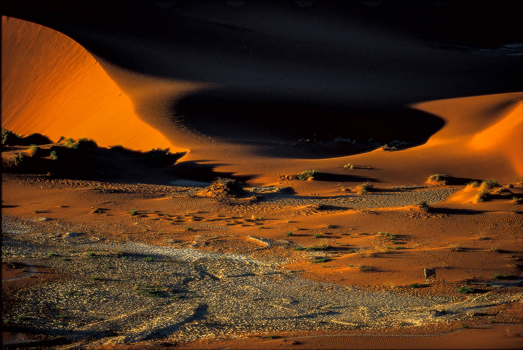
Oryx near the dunes of Sossusvlei in the Namib desert, Swakopmund, Namibia (24°44' S, 15°18' E).
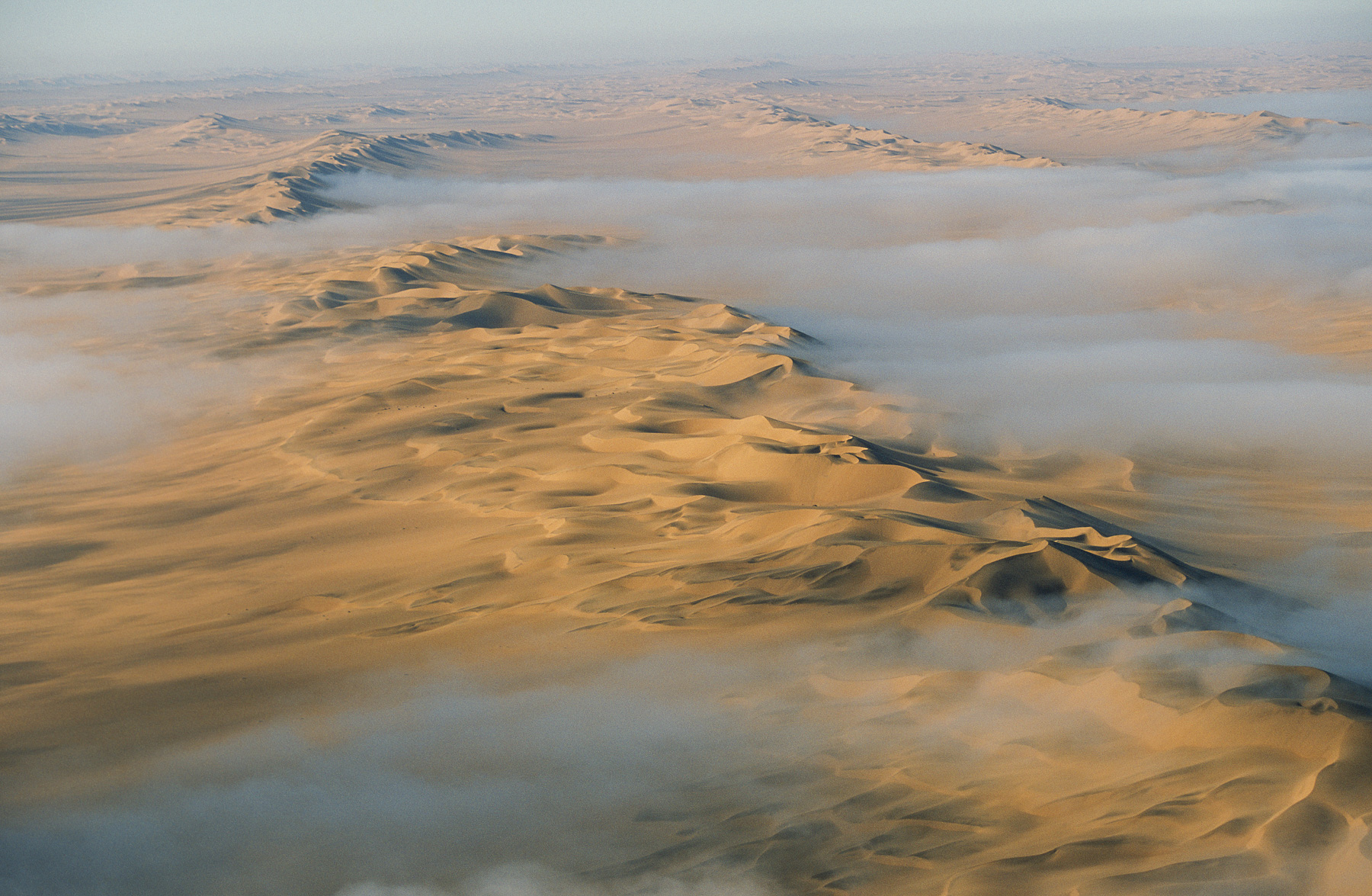
Fog over sand dunes in the Namib Desert, Swakopmund Region, Namibia
Fog over sand dunes in the Namib Desert, Swakopmund Region, Namibia
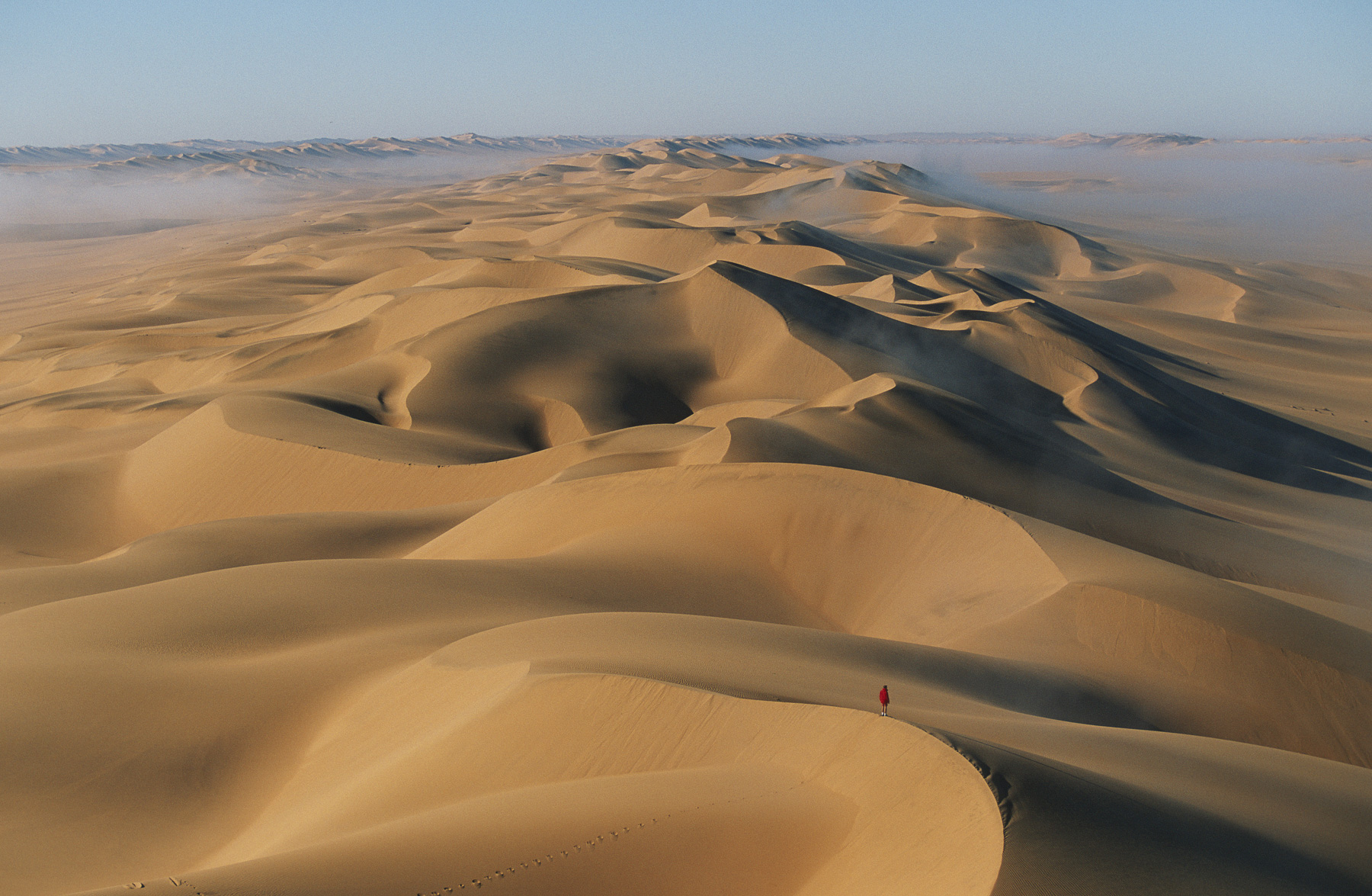
Fog over sand dunes in the Namib Desert, Swakopmund Region, Namibia
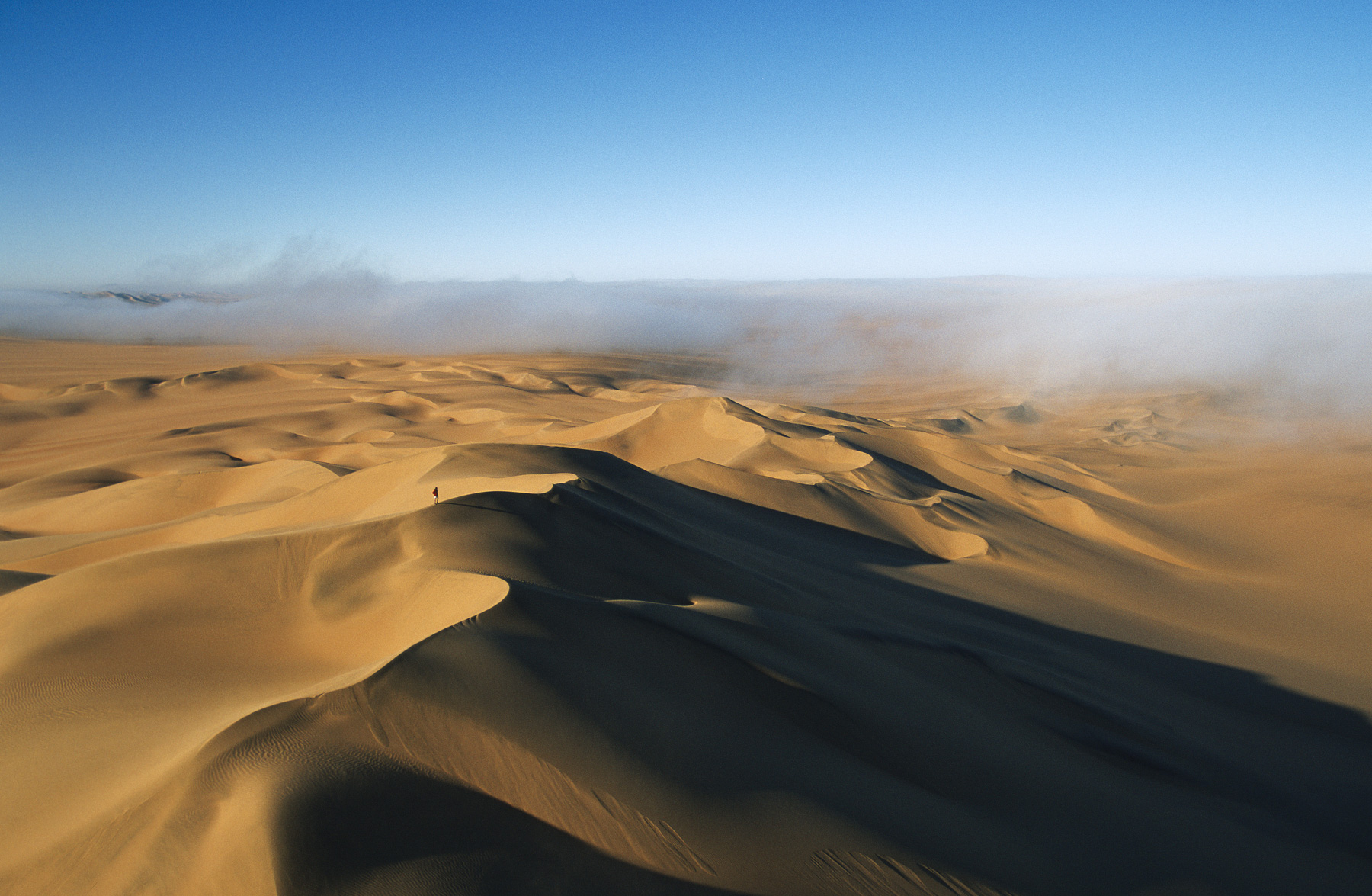
Fog over sand dunes in the Namib Desert, Swakopmund Region, Namibia
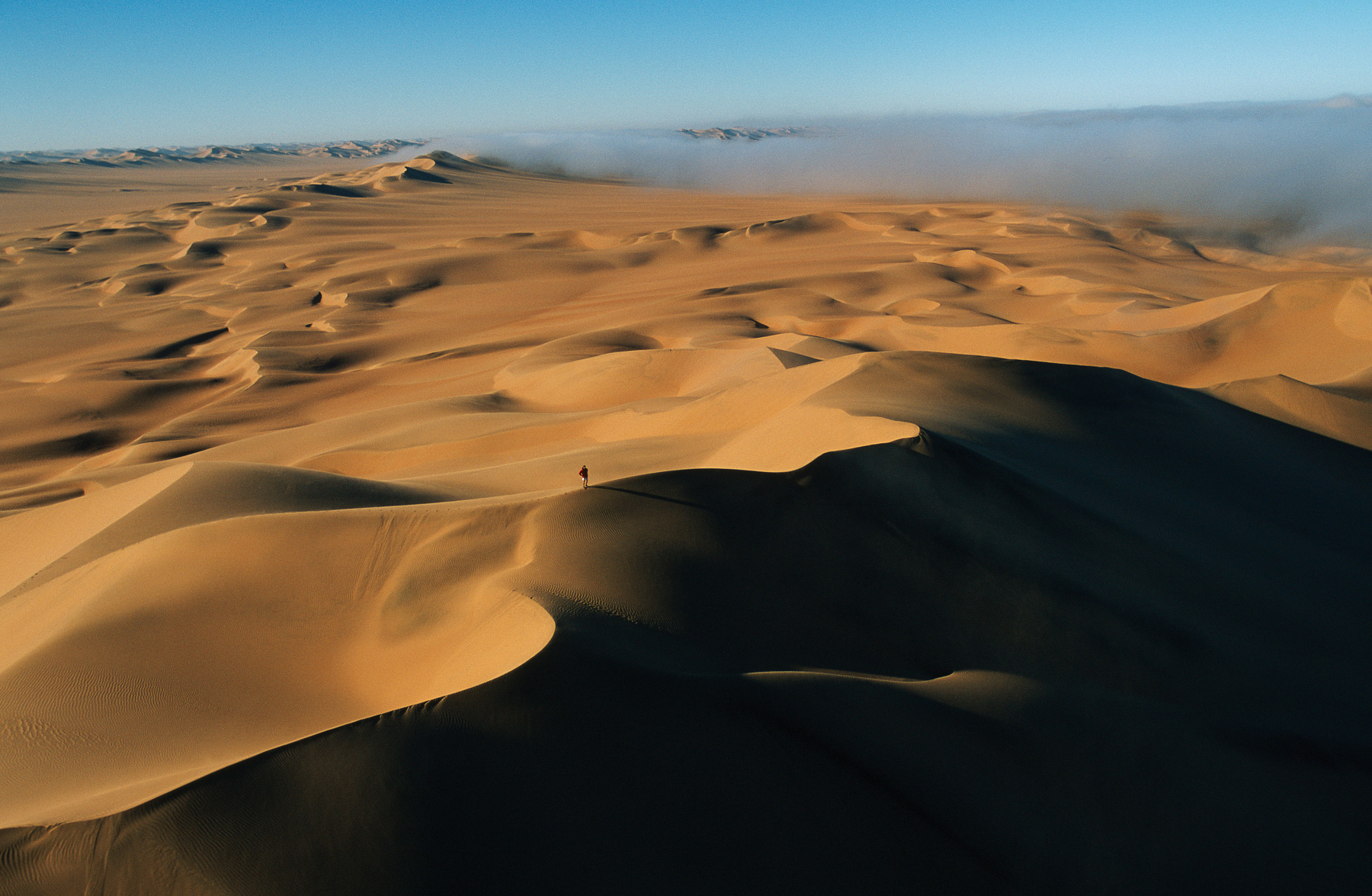
Fog over sand dunes in the Namib Desert, Swakopmund Region, Namibia
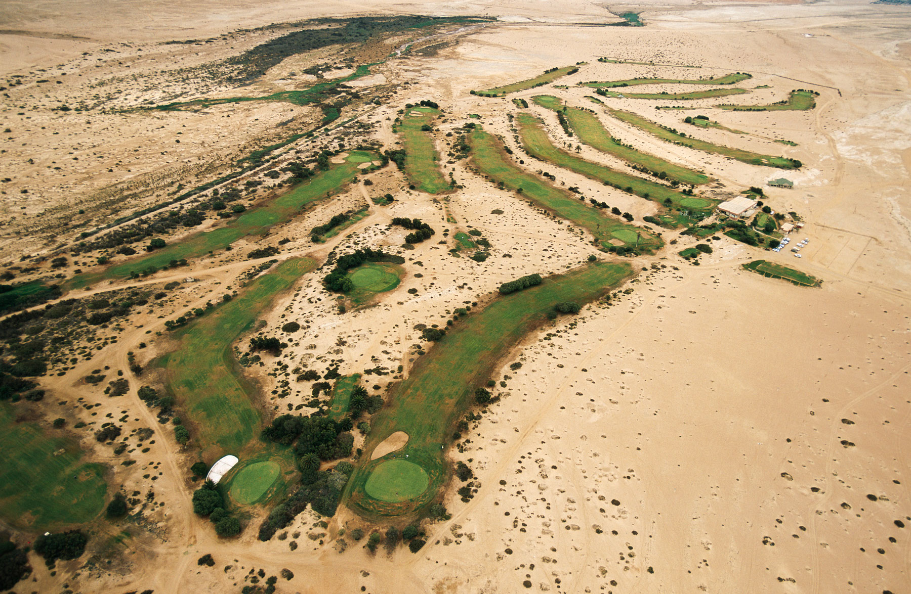
Golf course in the desert near Swakopmund, Erongo Region, Namibia
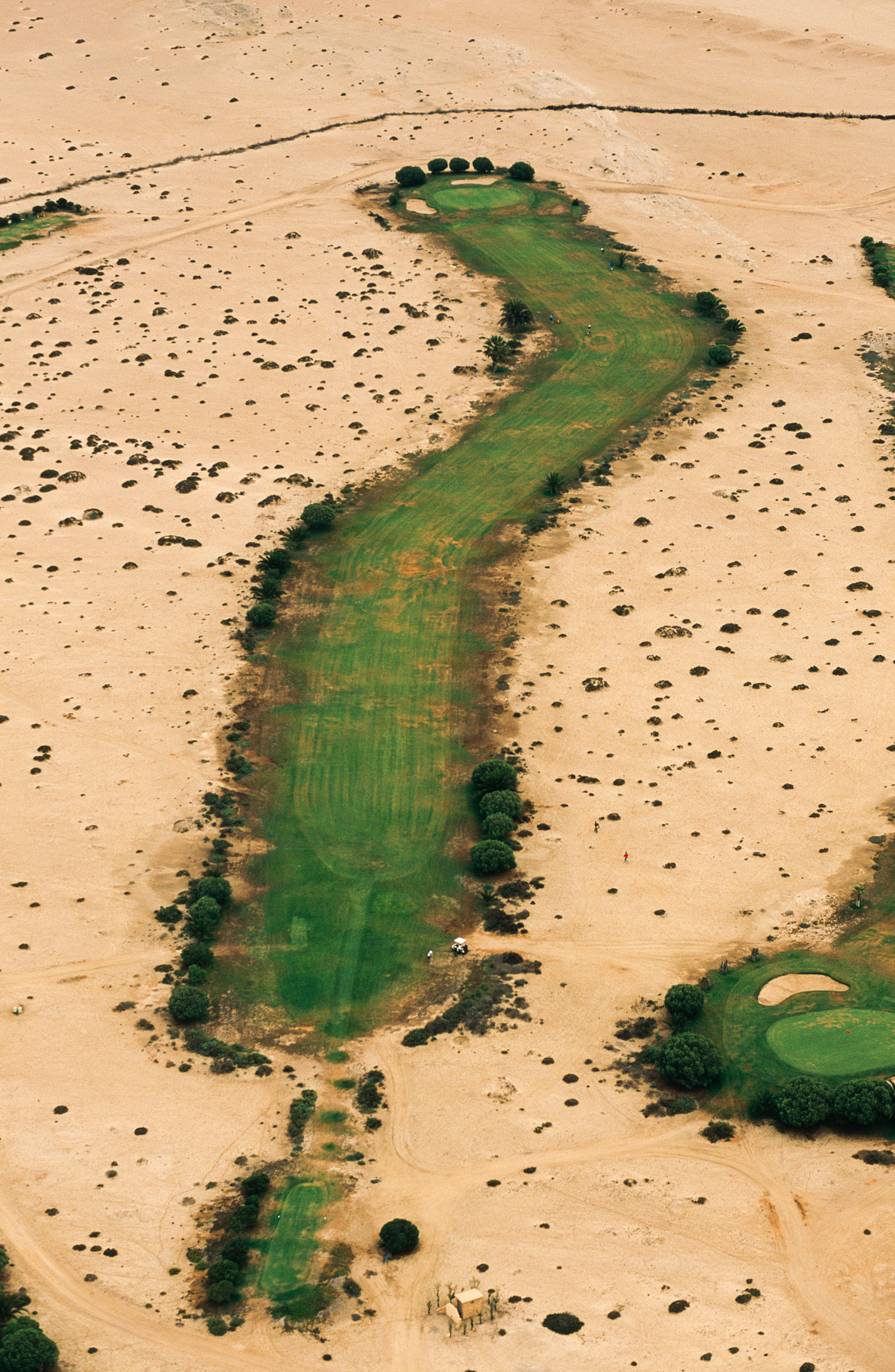
Golf course in the desert near Swakopmund, Erongo Region, Namibia
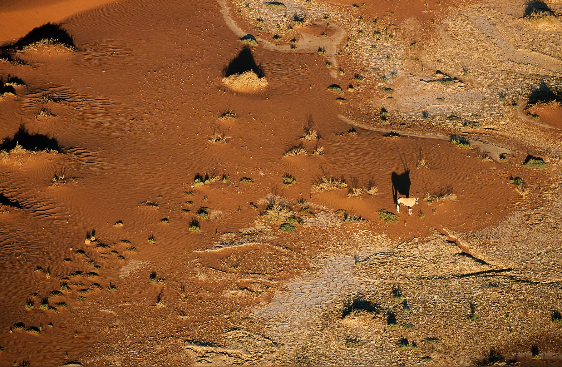
Oryx near the dunes of Sossusvlei in the Namib desert, Swakopmund, Namibia (24°44' S, 15°18' E).
Oryx near the dunes of Sossusvlei in the Namib desert, Swakopmund, Namibia (24°44' S, 15°18' E).
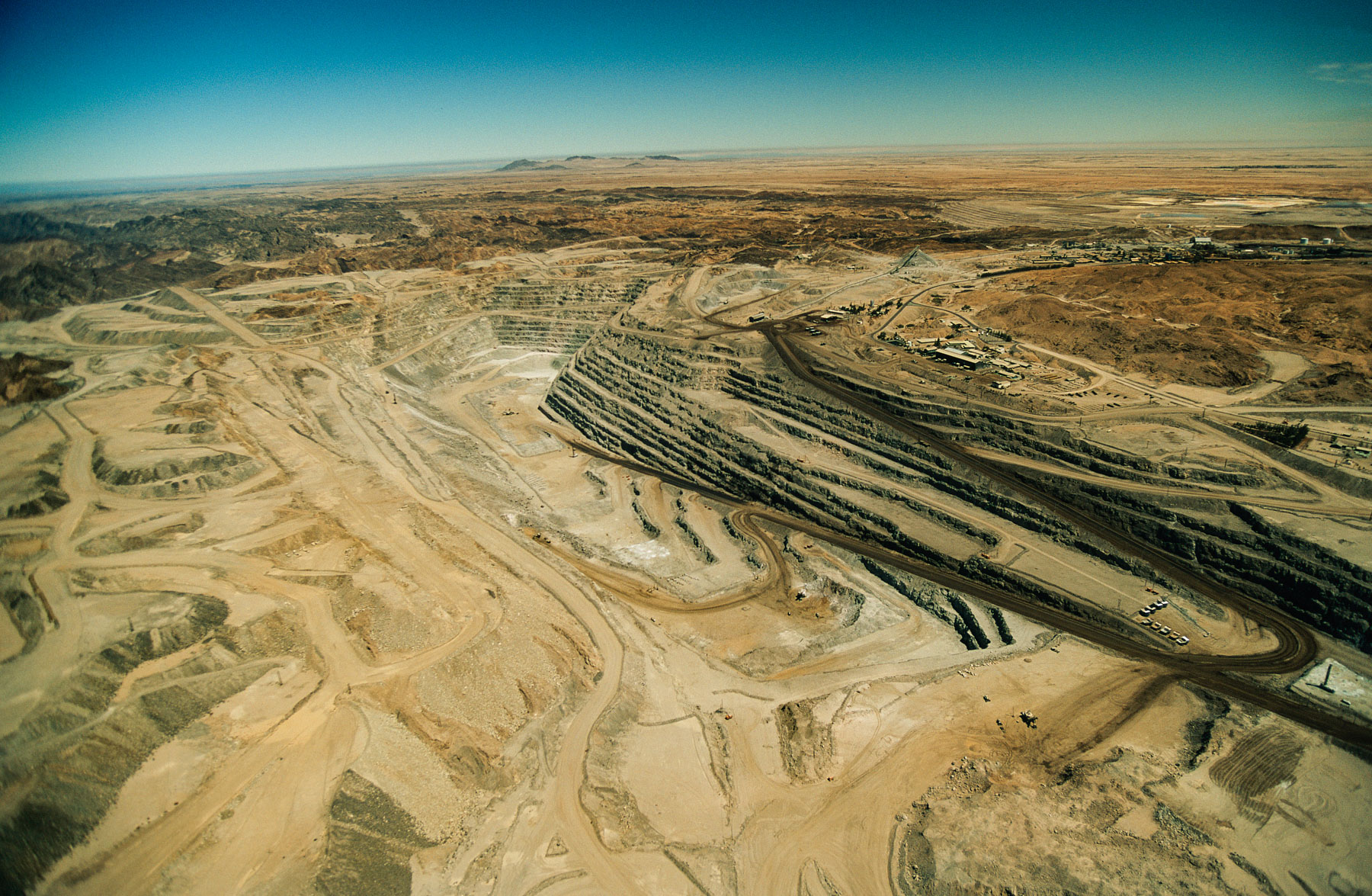
Rössing Uranium Mine near Swakopmund, Erongo Region, Namibia
Desert near Windhoek, Khomas Region, Namibia
Desert near Windhoek, Khomas Region, Namibia
Bank of a river in Etosha National Park, Namibia (18°43' S - 15°33' E).
Bank of a river in Etosha National Park, Namibia (18°43' S - 15°33' E).
Etosha National Park near Outjo, Oshikoto Region - Etosha National Park : Etosha Pan – Namibia
Road Near Outjo, Oshikoto Region, Etosha National Park, Namibia
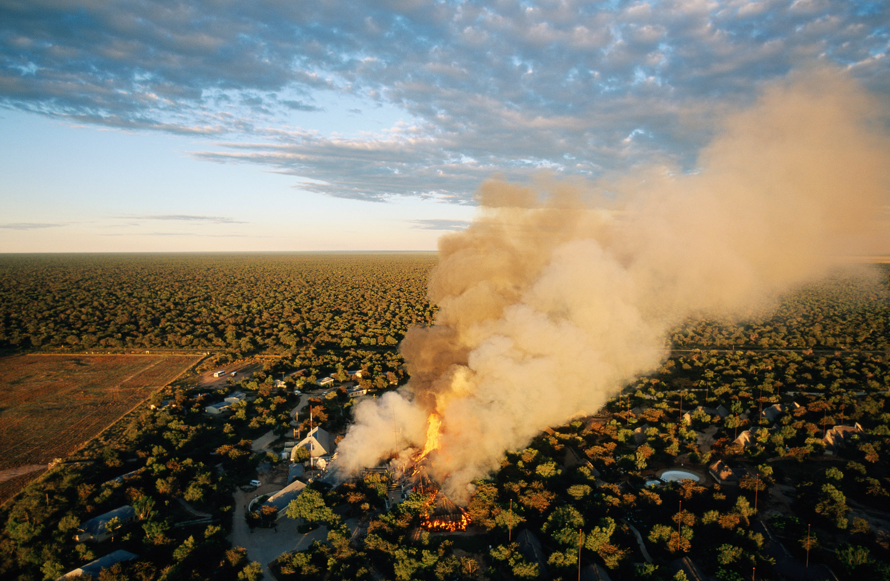
Near Outjo, Oshikoto Region, Etosha National Park : Mokuti Lodge on fire - Namibia
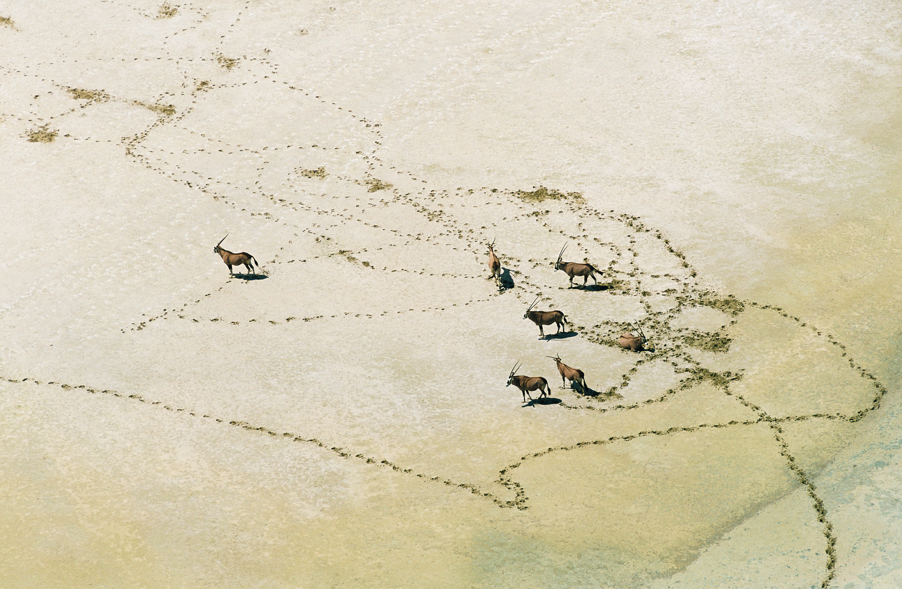
Oryx in the Etosha National Park, Namibia
Oryx in the Etosha National Park, Namibia
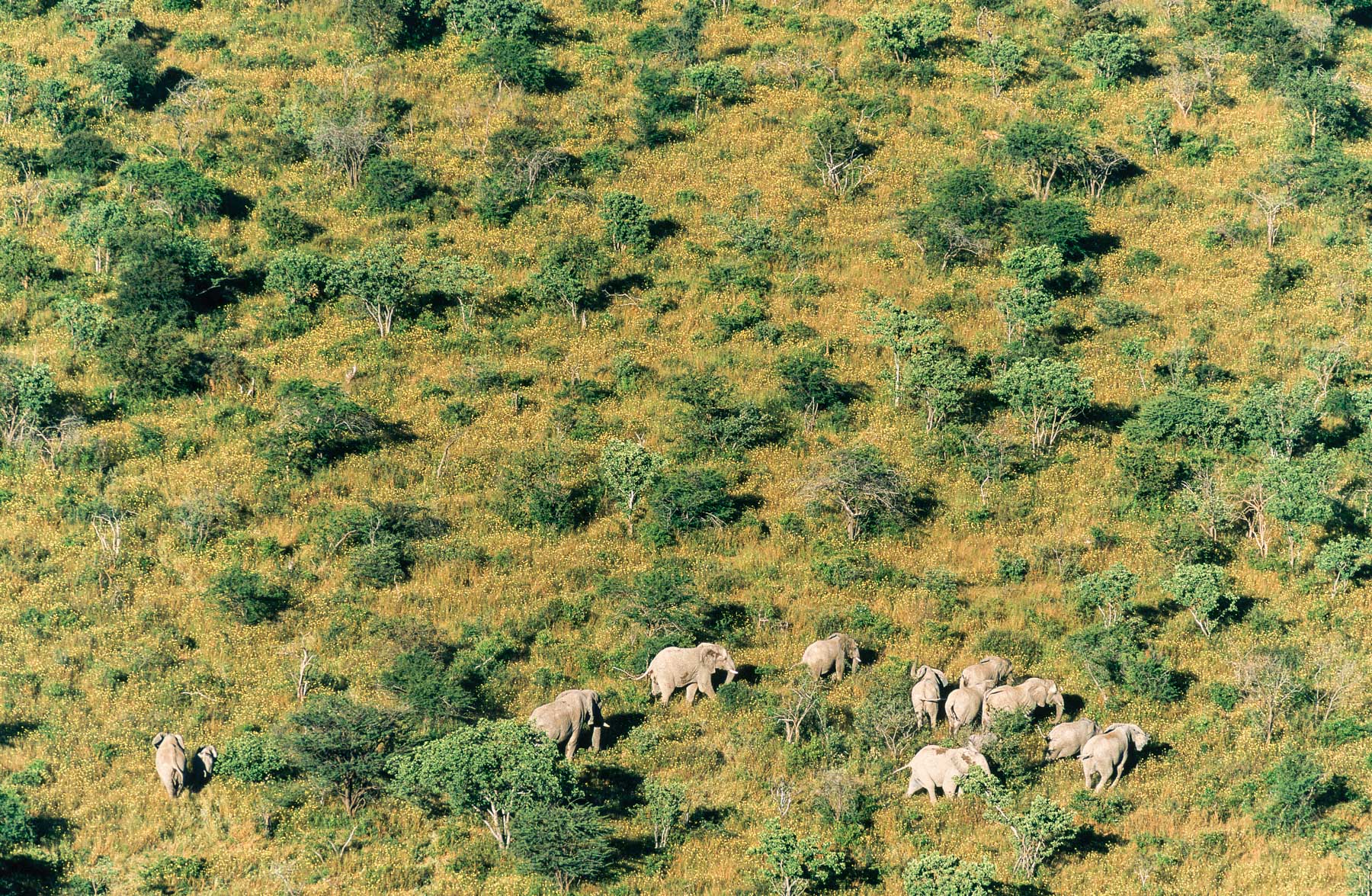
Near Outjo, Oshikoto Region, Etosha National Park, elephants, Namibia
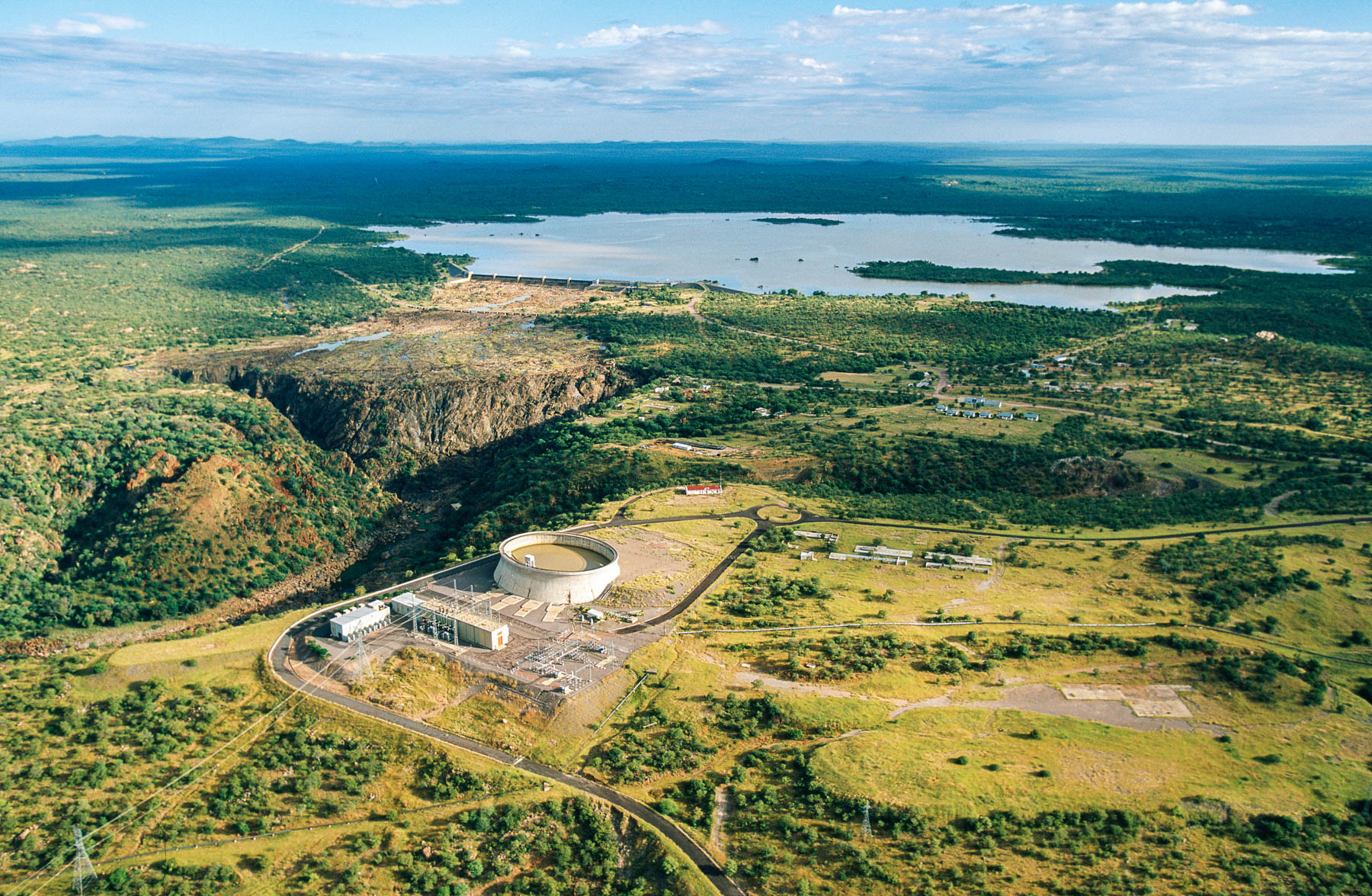
Omusati Region - Ruacana hydroelectric power plant - Namibia
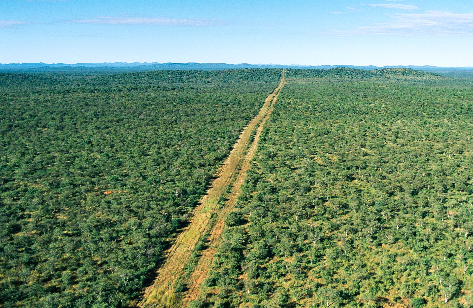
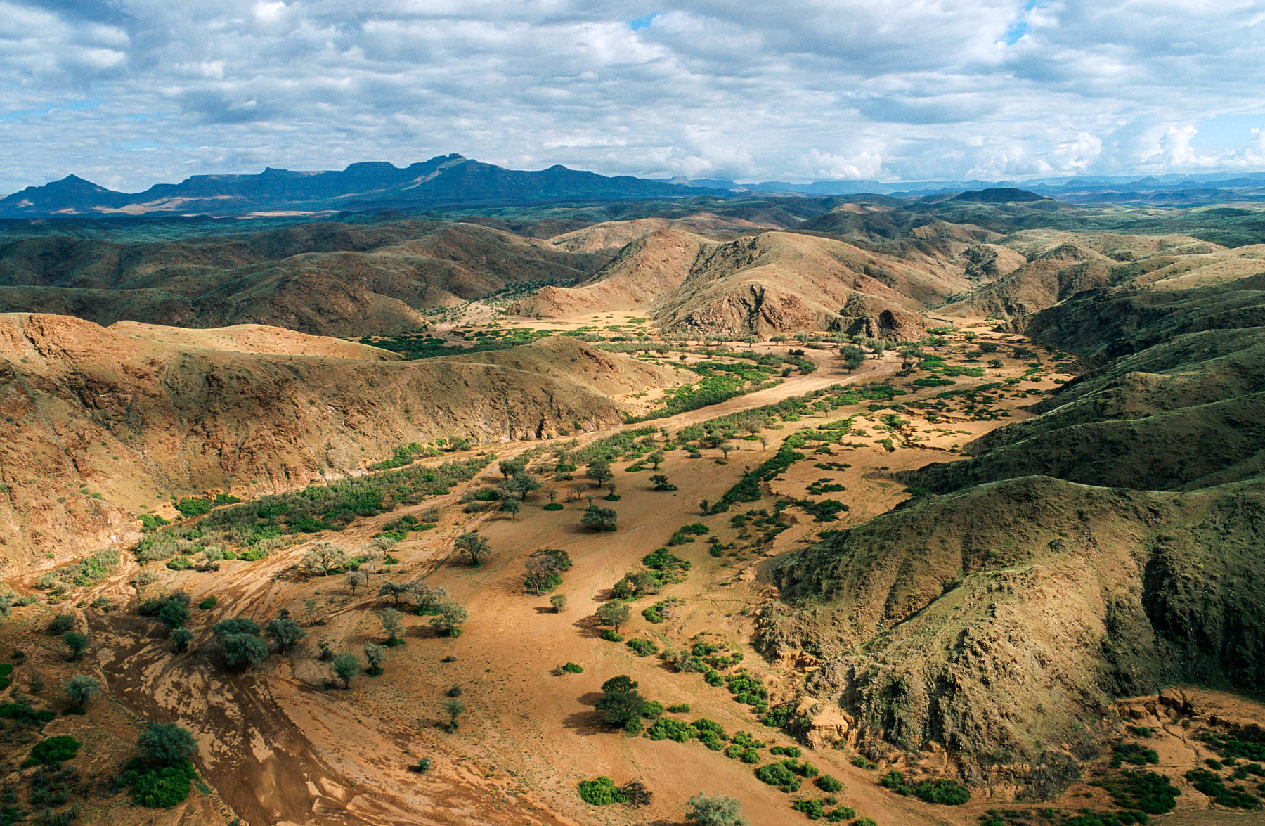
Omusati Region - Road through the bush - Namibia
Omusati Region - Village Owambo - Namibia
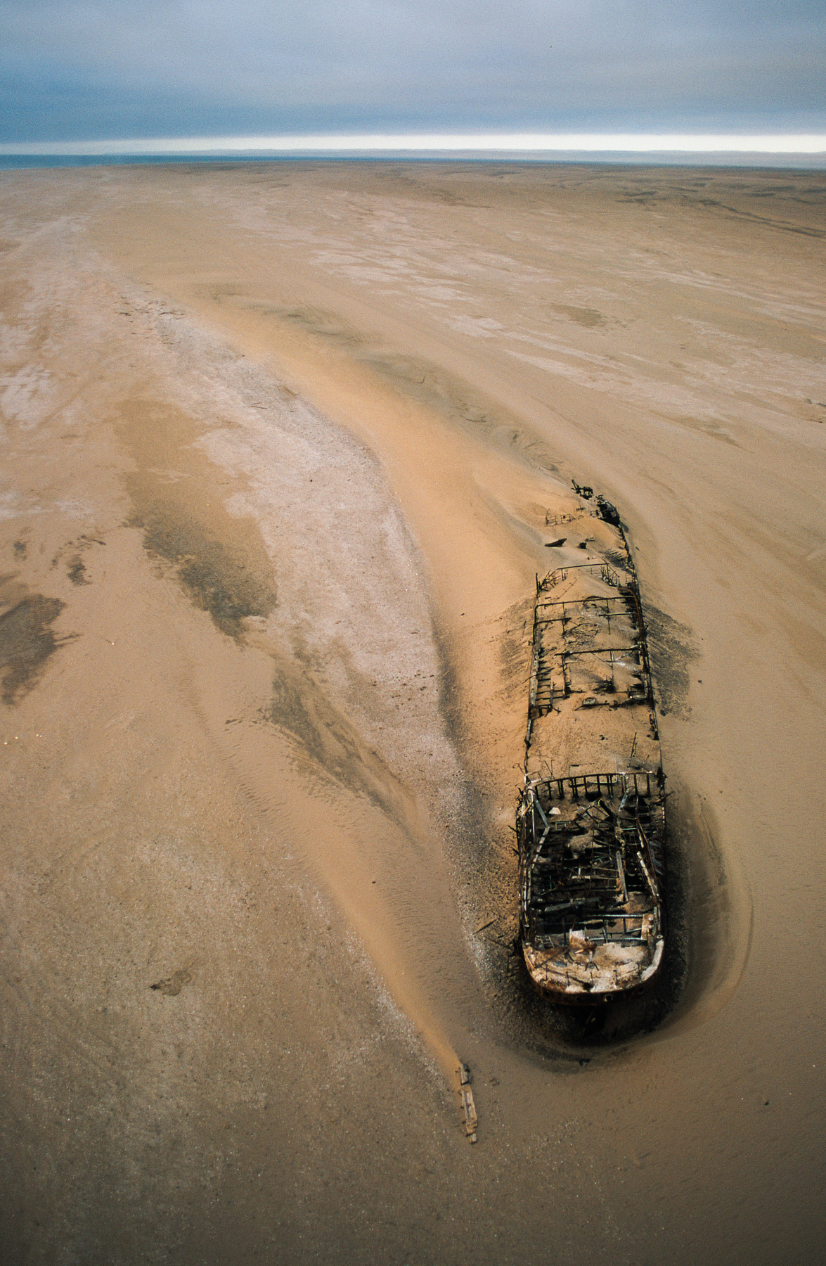
Eduard Bohlen boat run aground on the beach, Hardap Region, Namibia (23°59' S – 14°27' E).
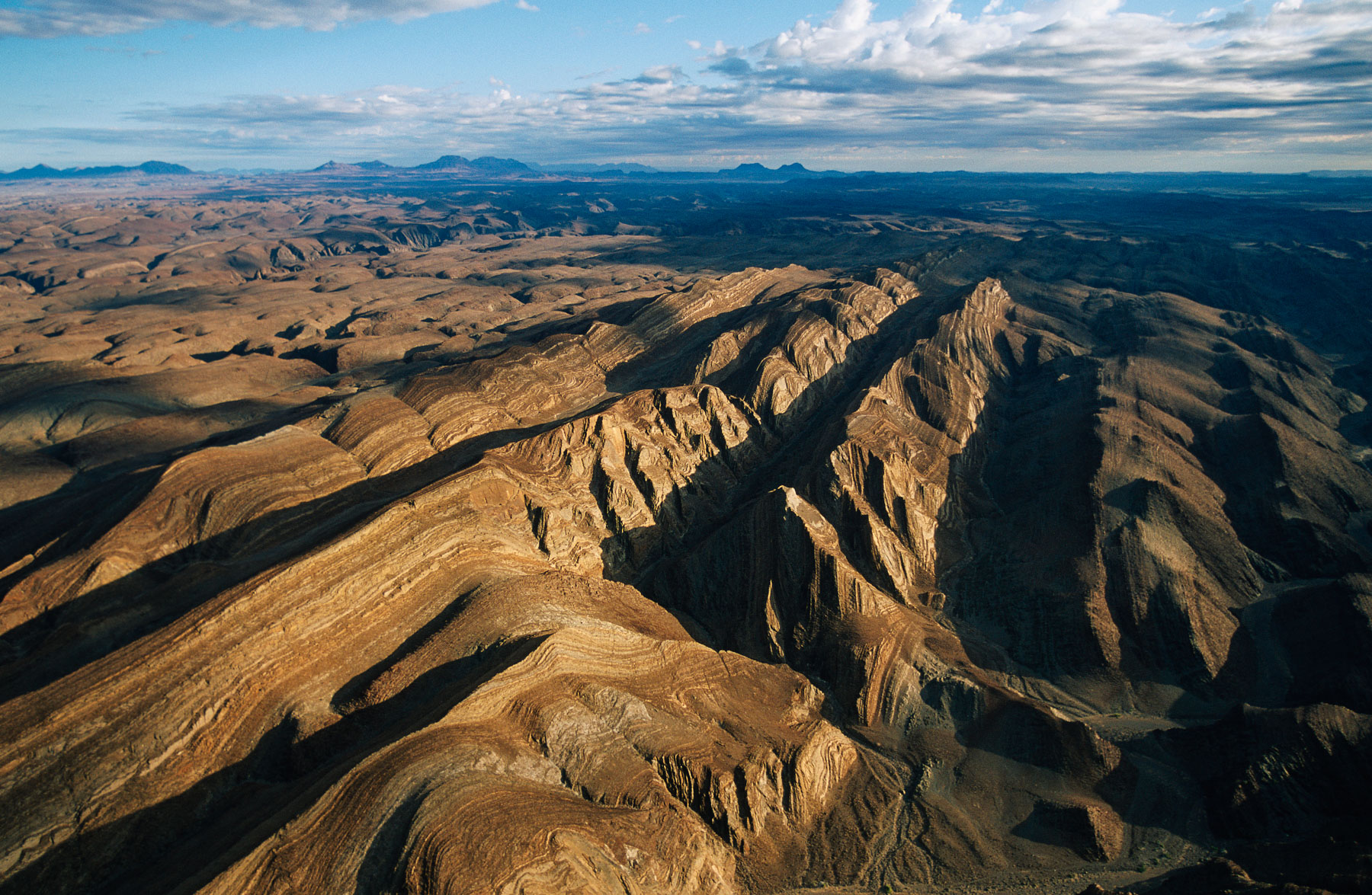
Landscape, Mountains in Brandberg, Damaraland region, Namibia
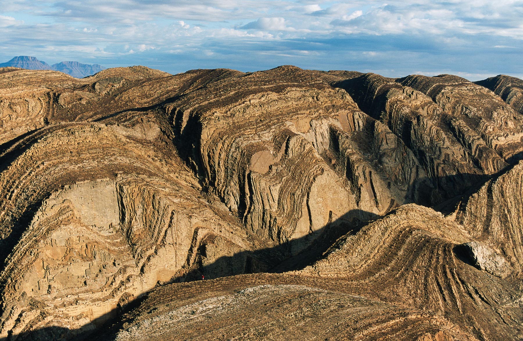
Mountains in Brandberg West, Damaraland region, Namibia (21°10'S - 14°33'E).
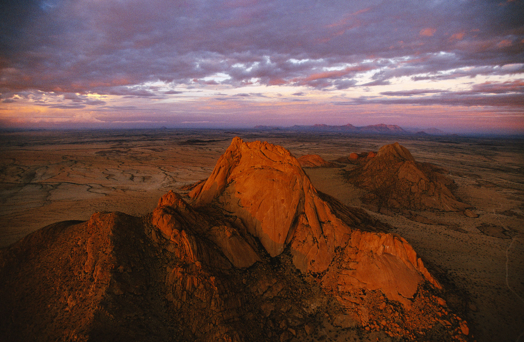
Spitzkoppe Massif at sunset, Damaraland region, Namibia (21°50' S - 15°11' E).
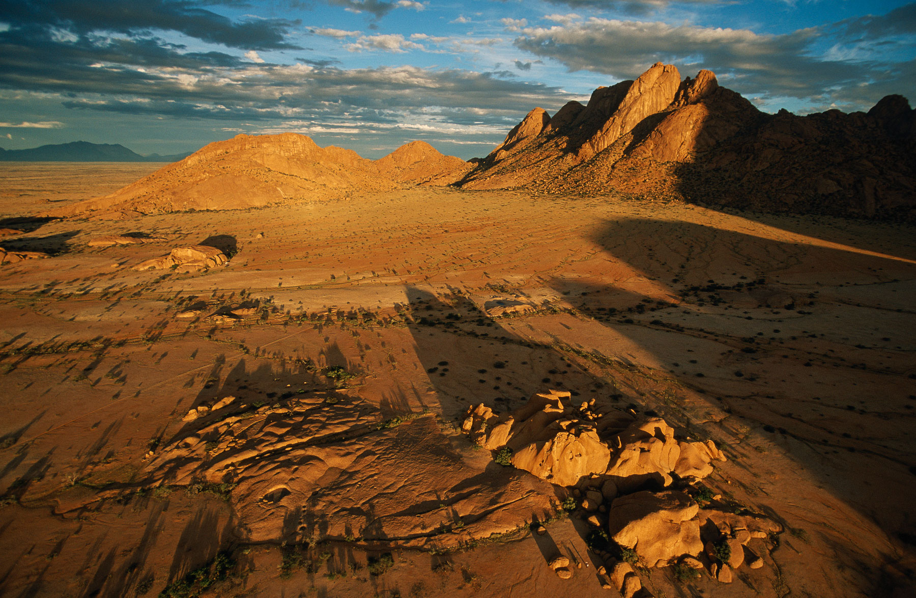
Spitzkoppe Massif at sunset, Damaraland region, Namibia (21°50' S - 15°11' E).
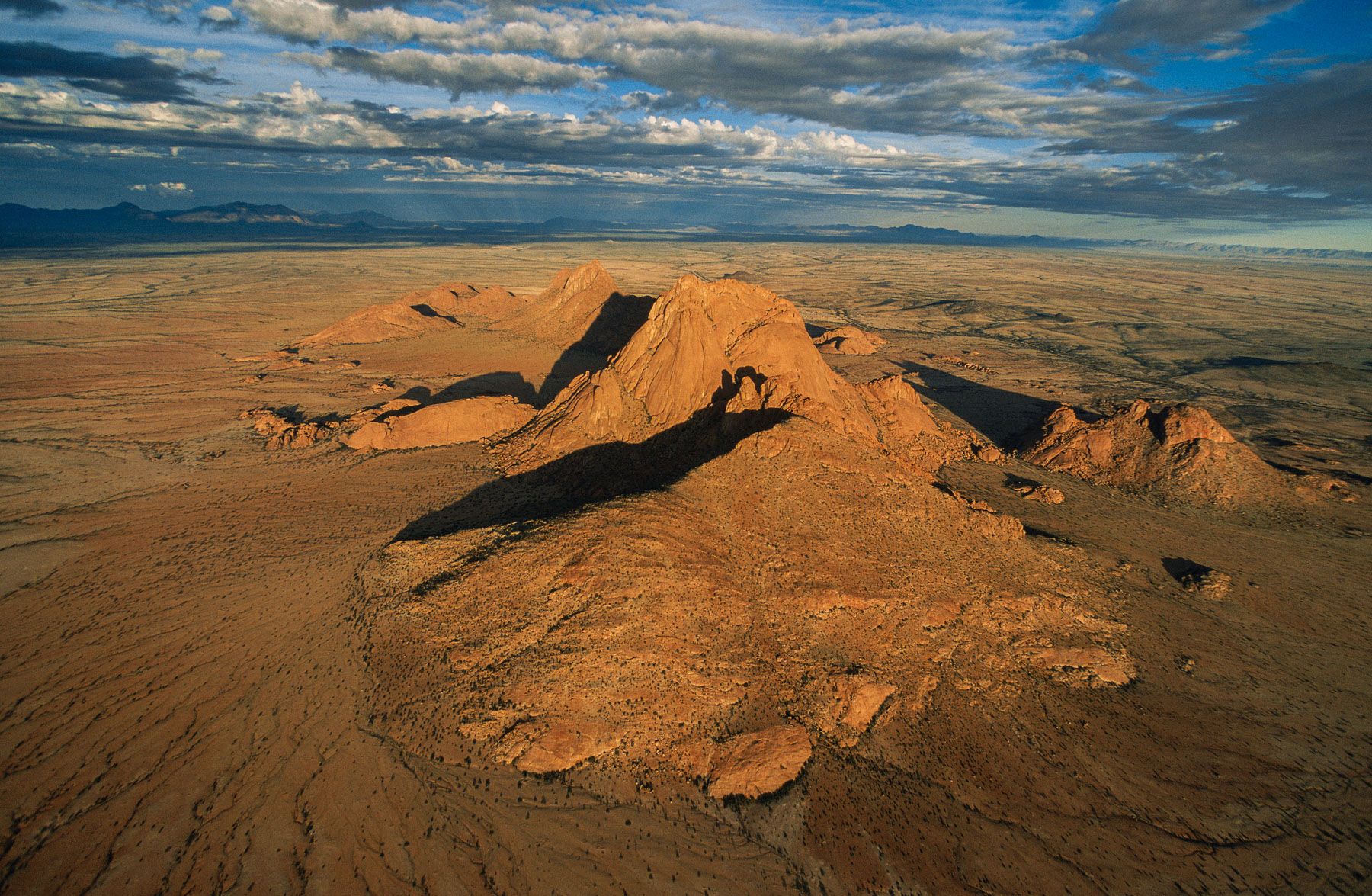
Spitzkoppe Massif at sunset, Damaraland region, Namibia (21°50' S - 15°11' E).
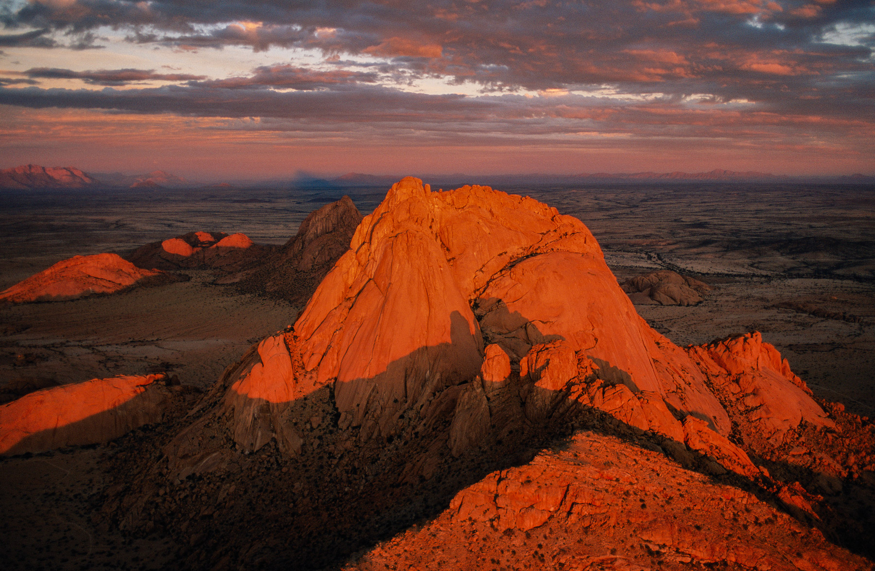
Spitzkoppe Massif at sunset, Damaraland region, Namibia (21°50' S - 15°11' E).
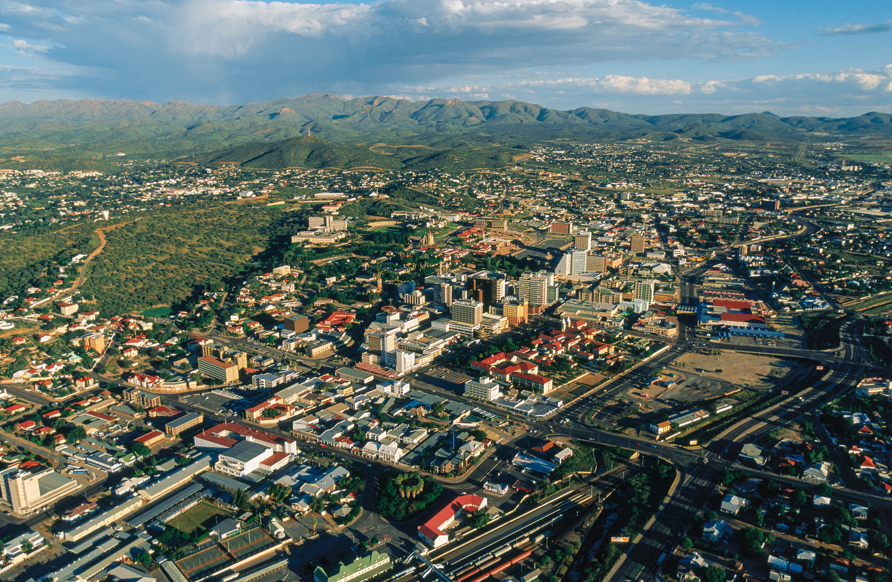
City of Windhoek, Khomas Region, Namibia
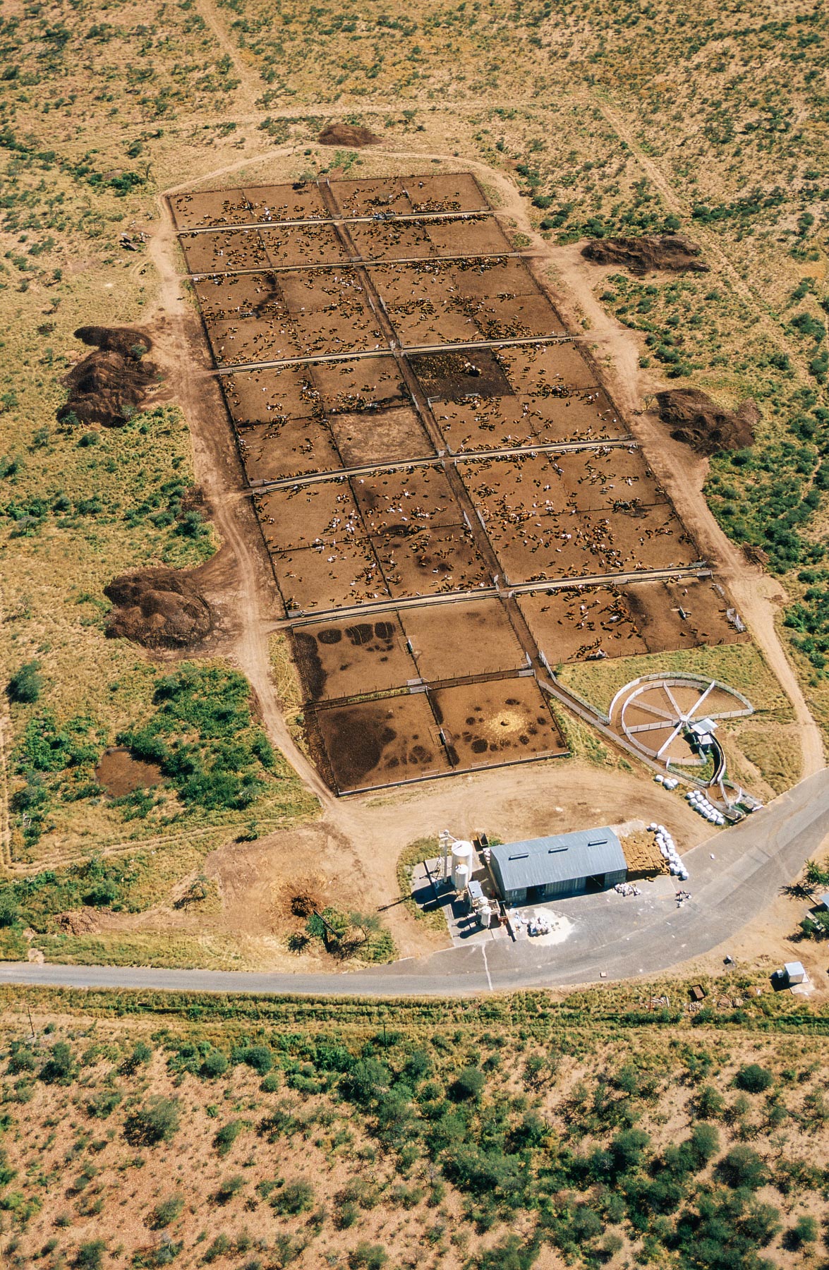
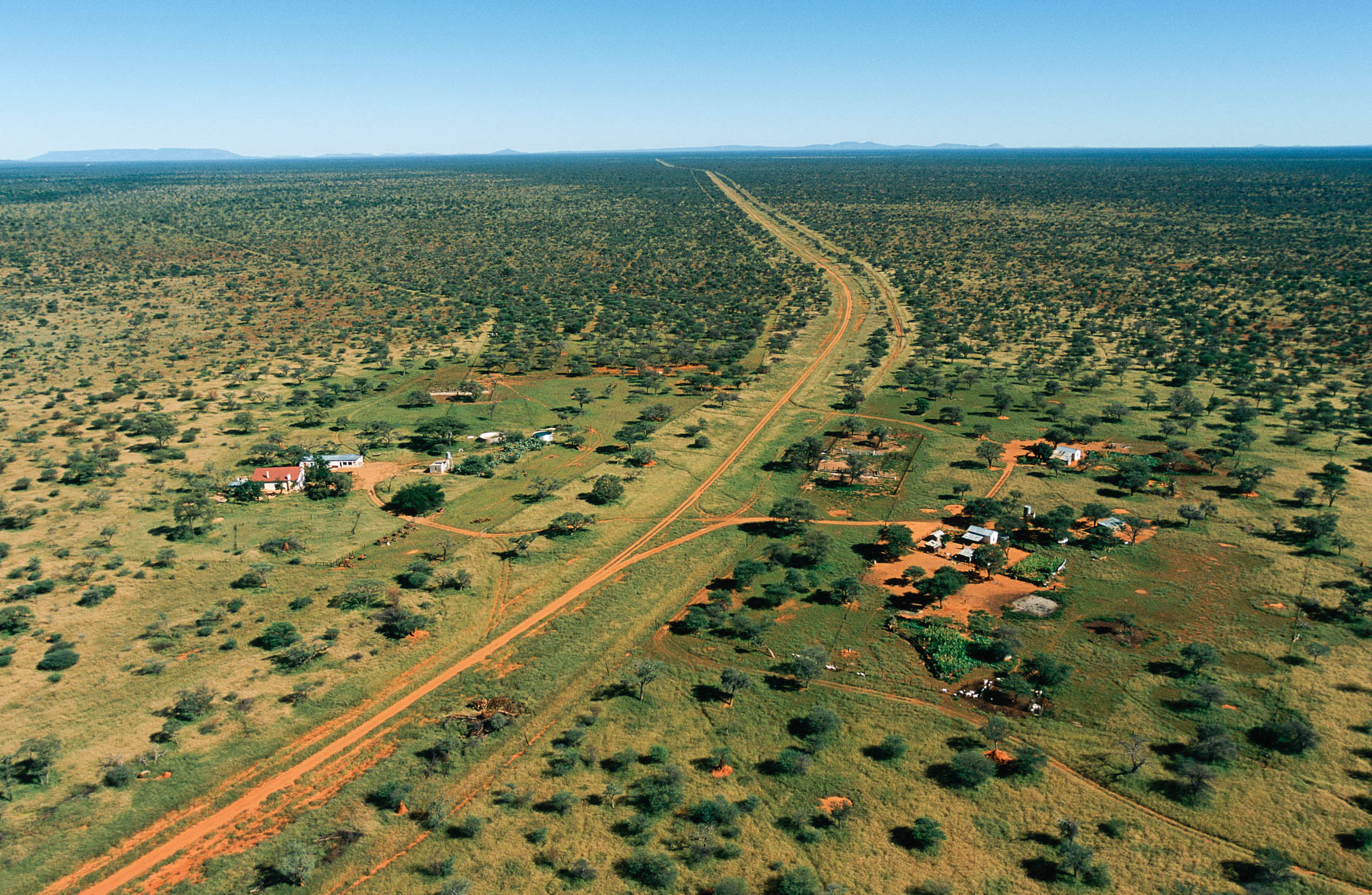
Farm near Windhoek, Khomas Region, Namibia
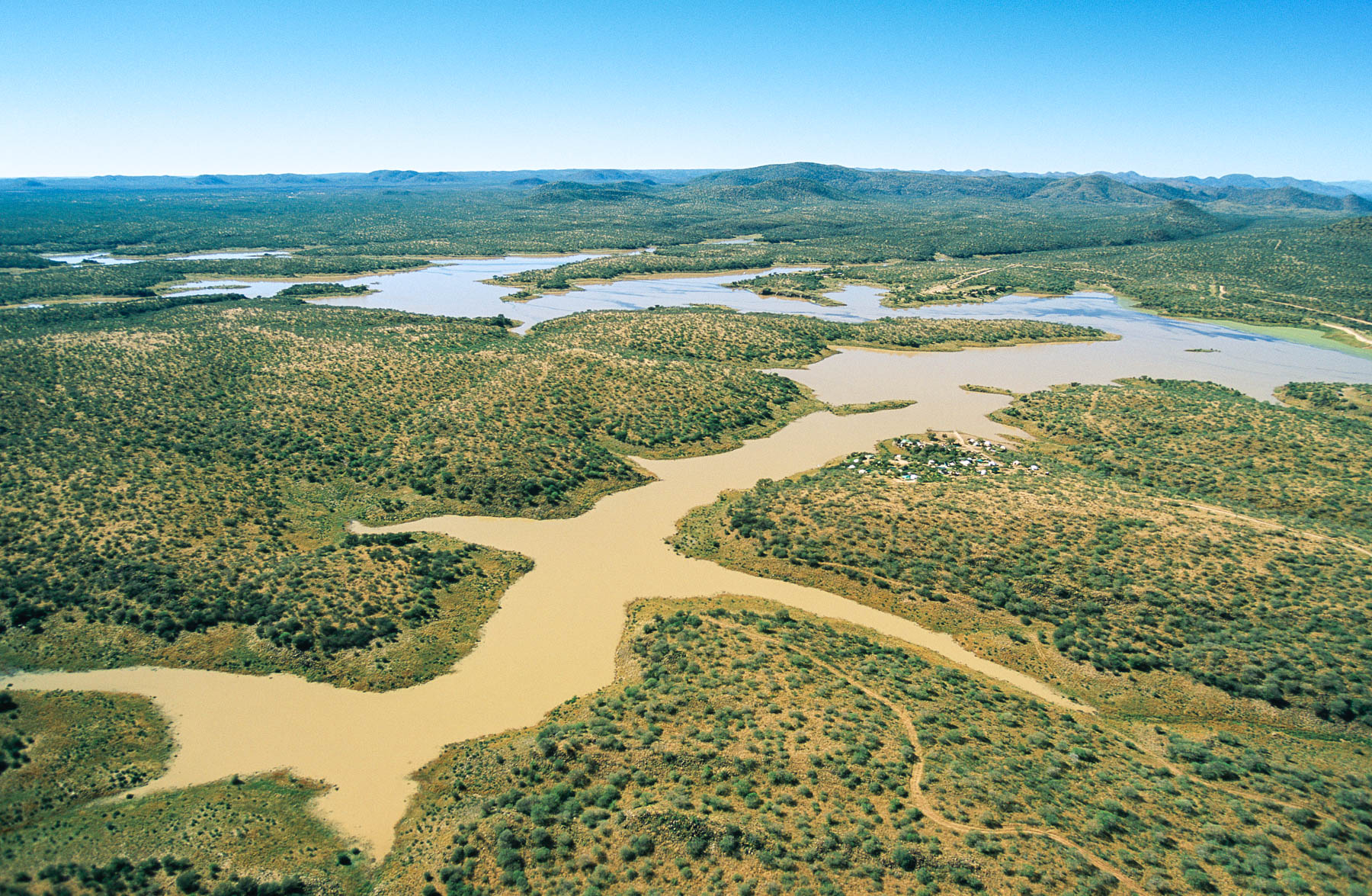
Von Bach Dam at Okahandja, near Windhoek, Khomas Region, Namibia
The Moon Landscape in the fog near Swakopmund, Erongo Region, Namibia
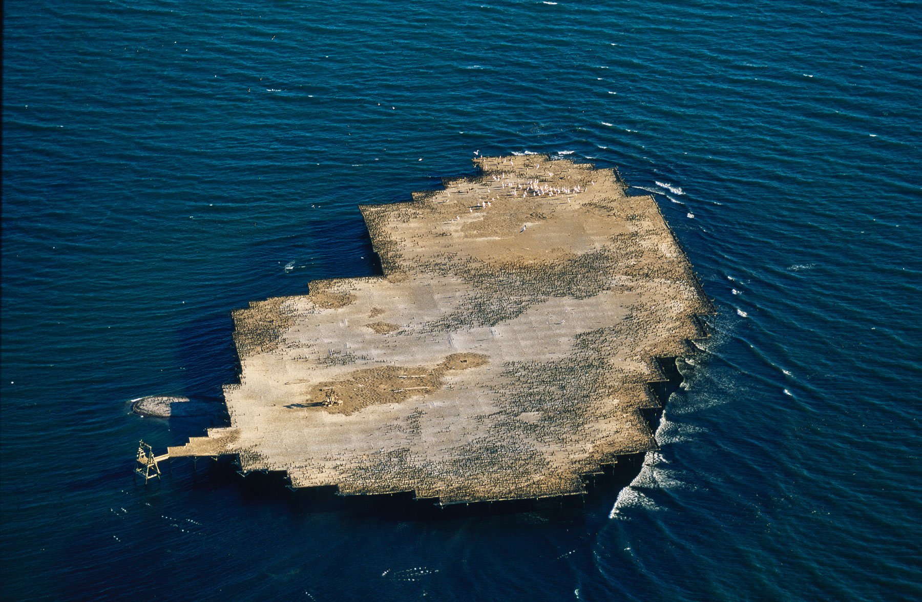
Artificial Island of Guano (Bird Island) near Walvis Bay, Erongo Region, Namibia
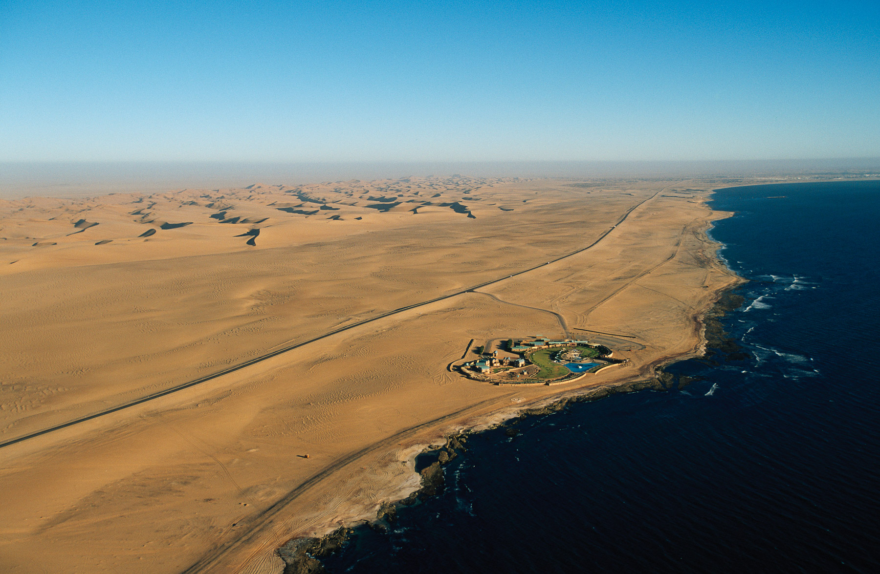
Hotel on Skeleton Coast, North of Walvis Bay, Dolphin Park Resort, Erongo Region, Namibia
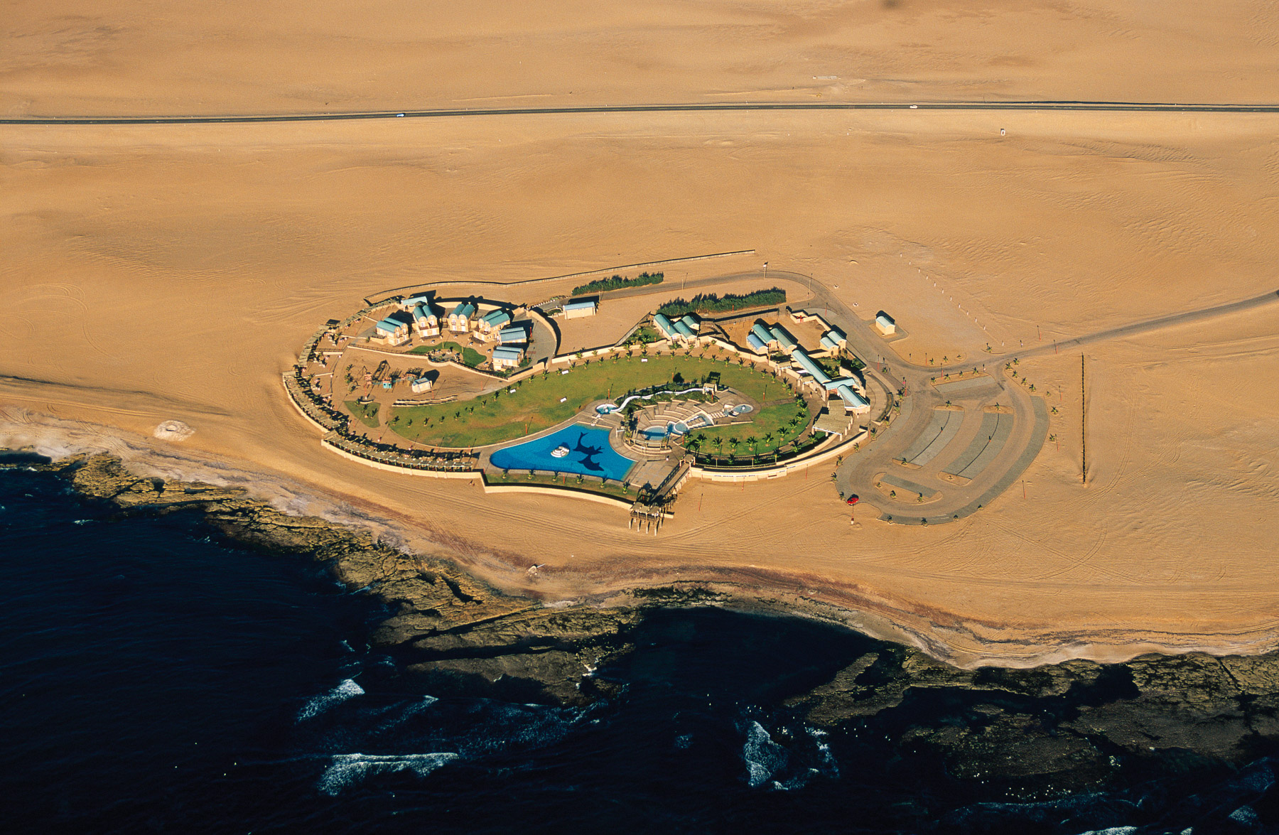
Hotel on Skeleton Coast, North of Walvis Bay, Dolphin Park Resort, Erongo Region, Namibia
Rössing Mountains, Erongo Region, Namibia
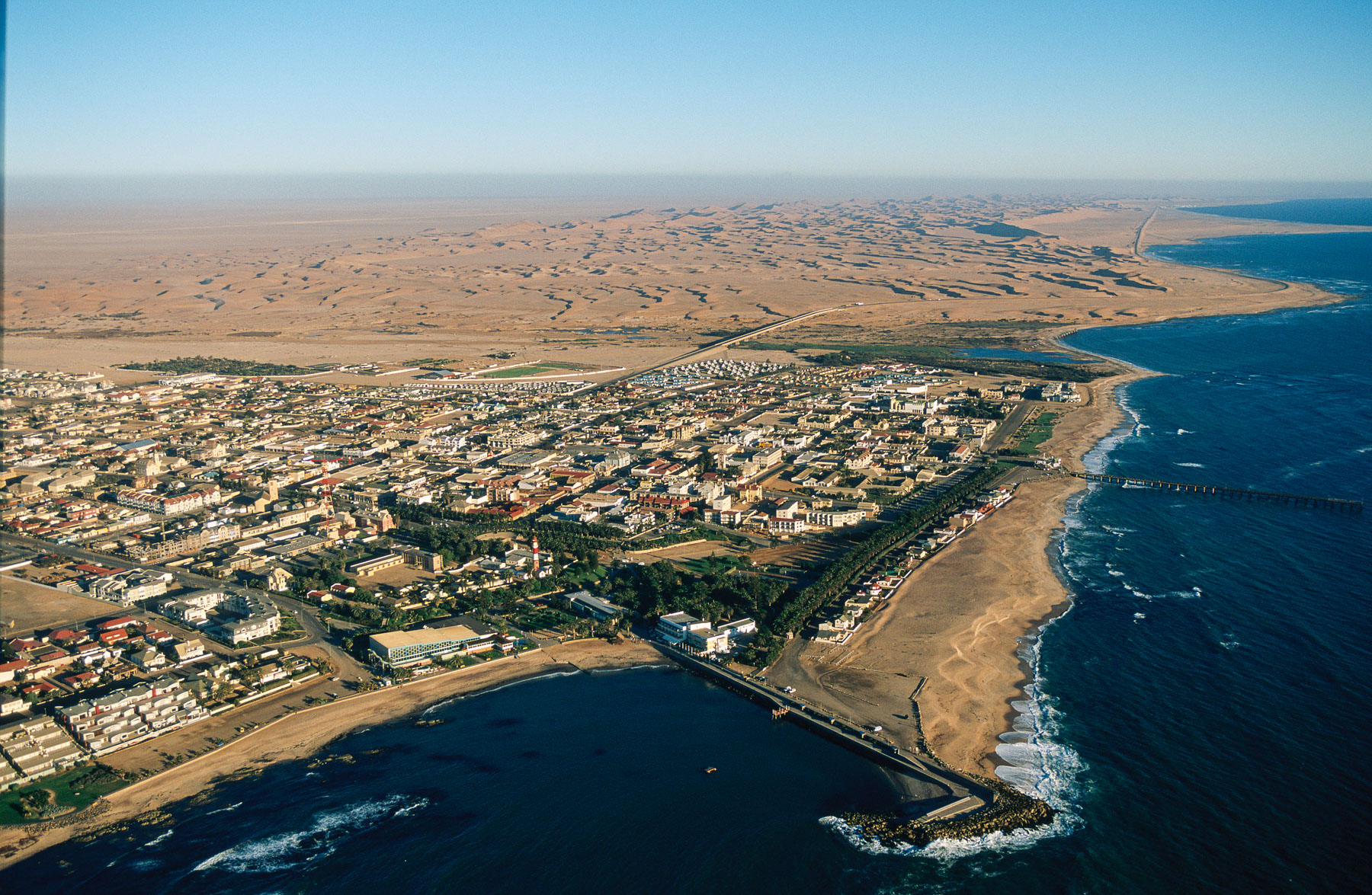
City of Swakopmund, Erongo Region, Namibia
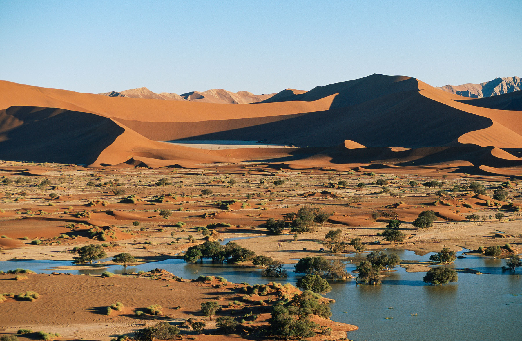
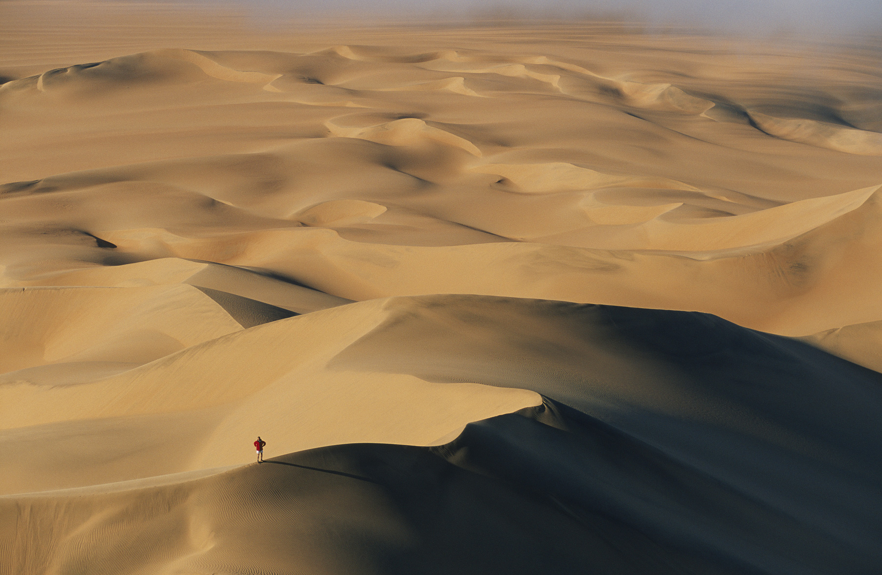
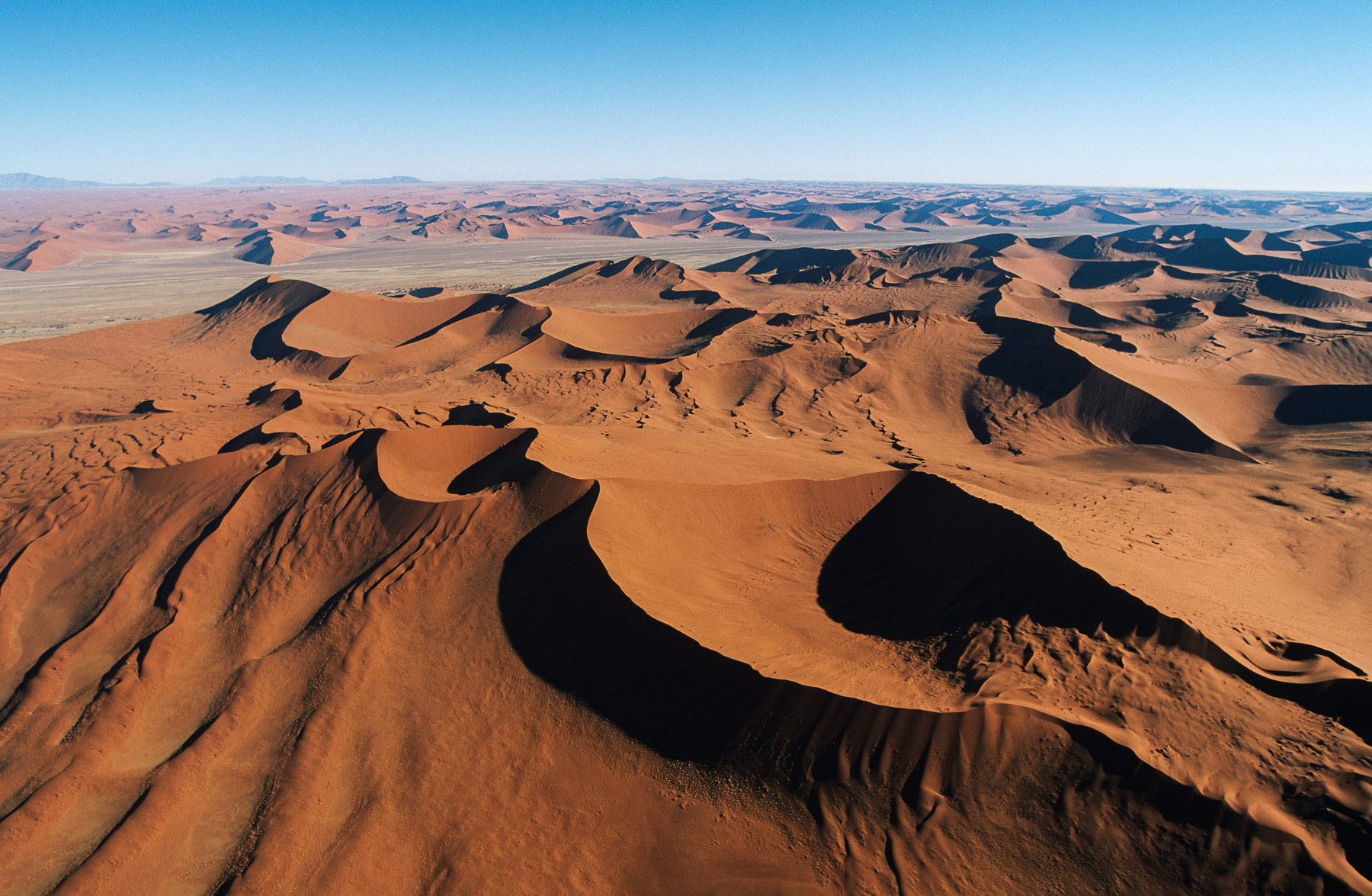
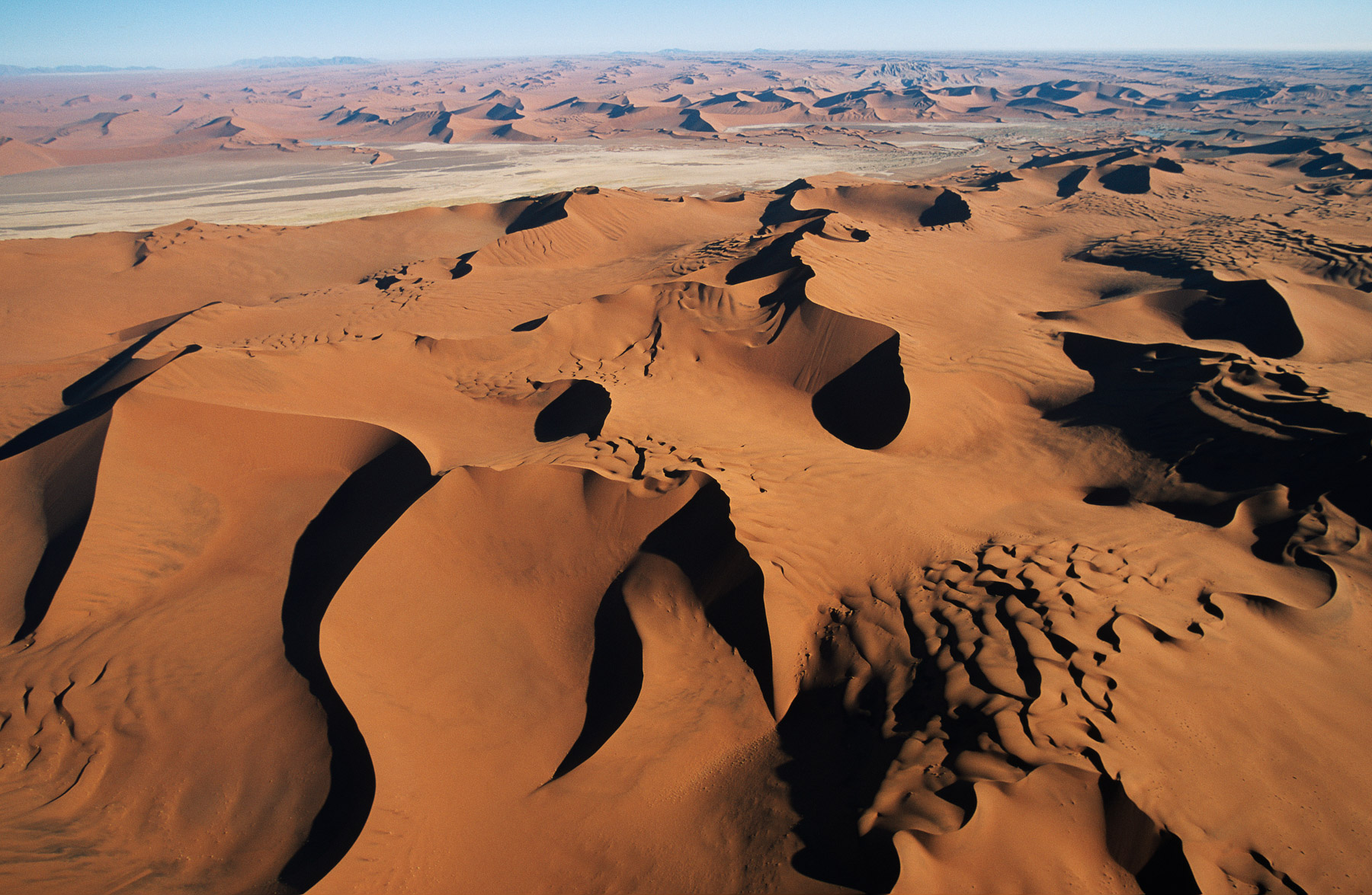
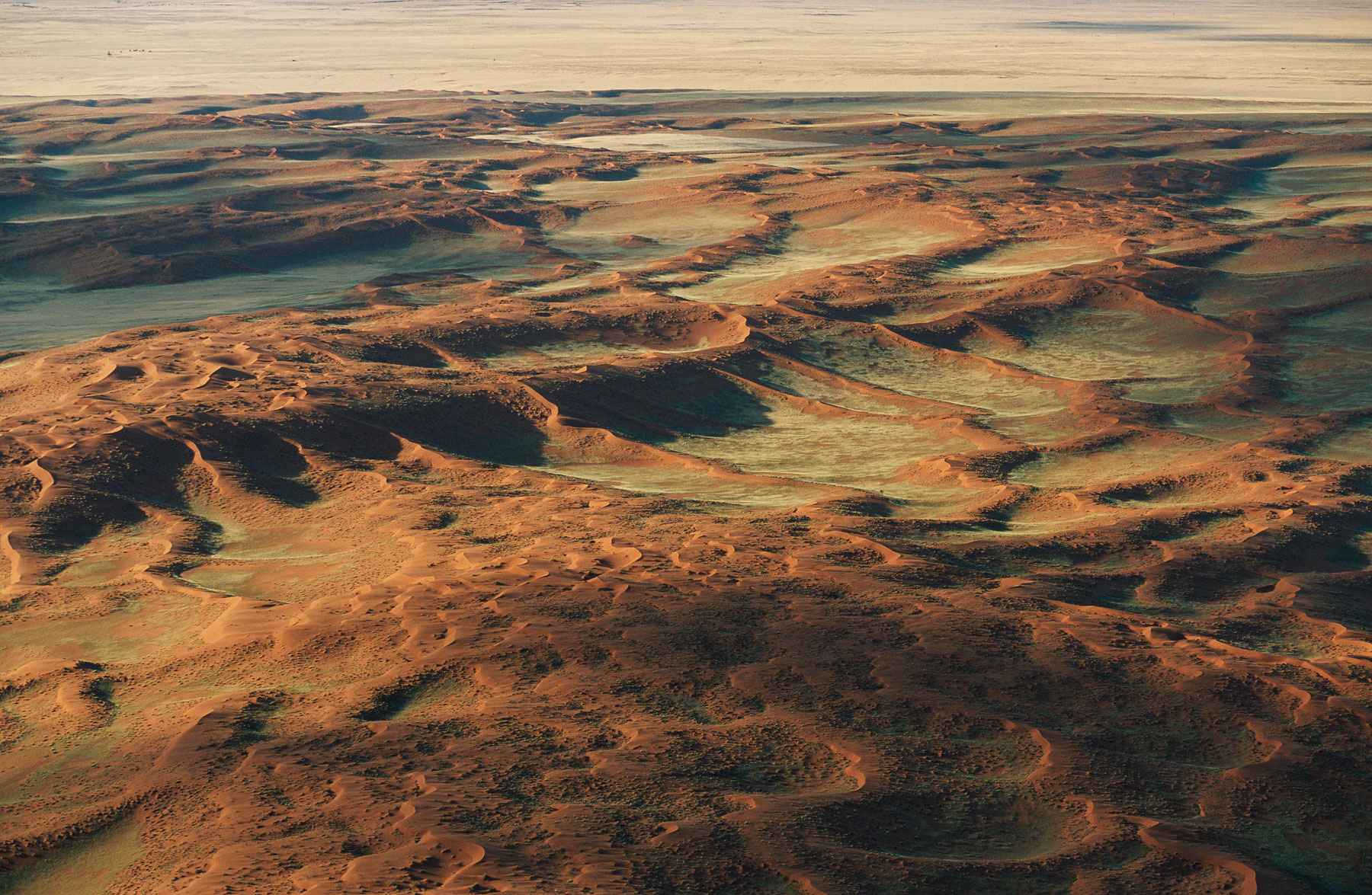
Sand dunes of Sossusvlei, Hardap Region, Namibia
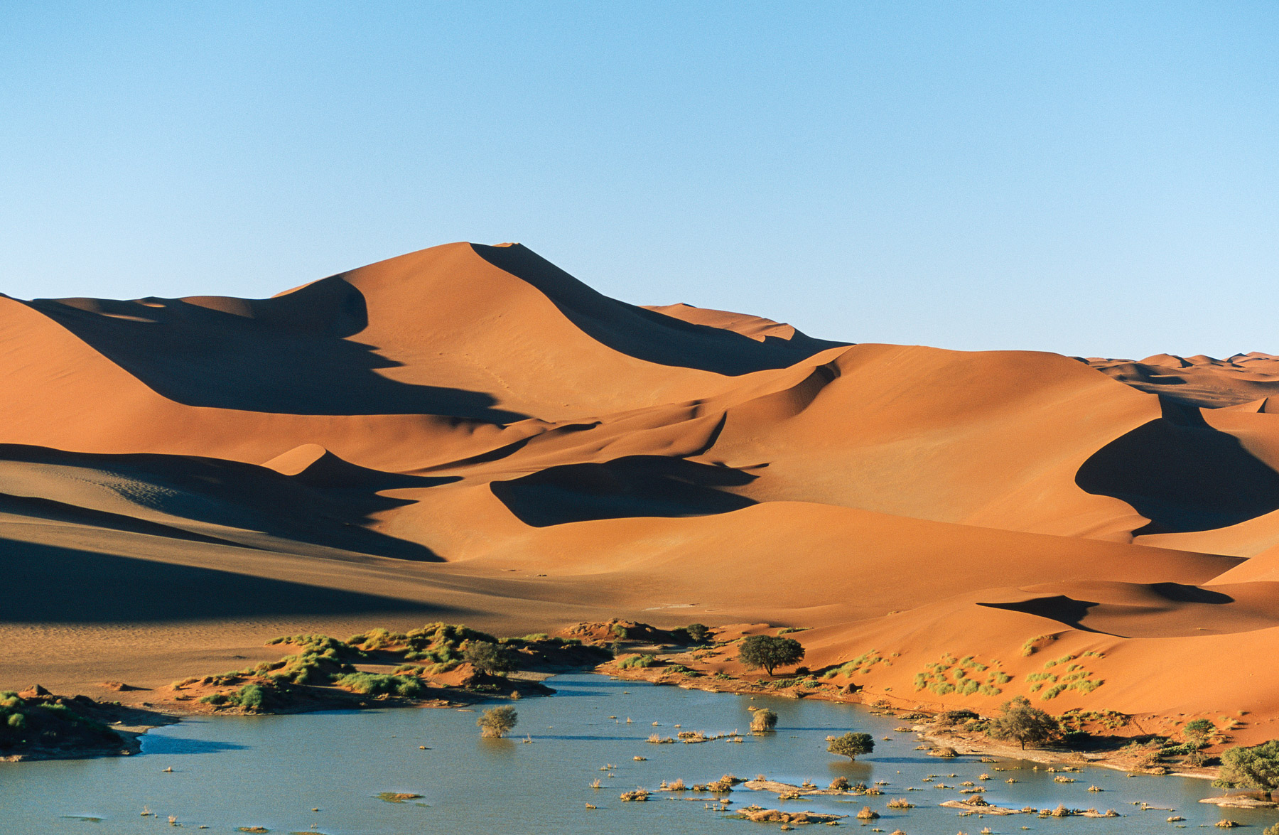
Sand dunes of Sossusvlei, Hardap Region, Namibia

Sand dunes of Sossusvlei, Hardap Region, Namibia
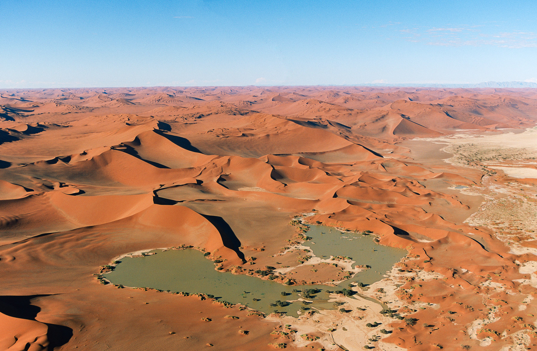
Sand dunes of Sossusvlei, Hardap Region, Namibia
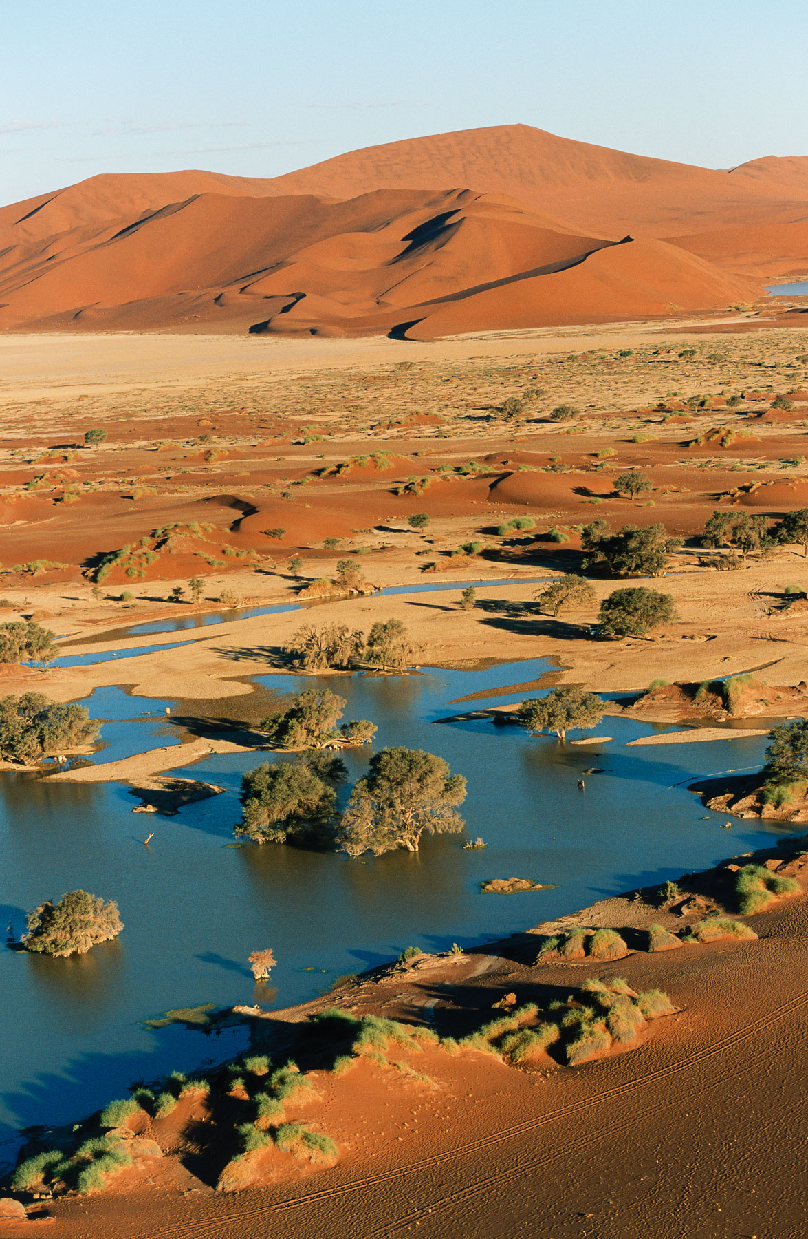
Sand dunes of Sossusvlei, Hardap Region, Namibia
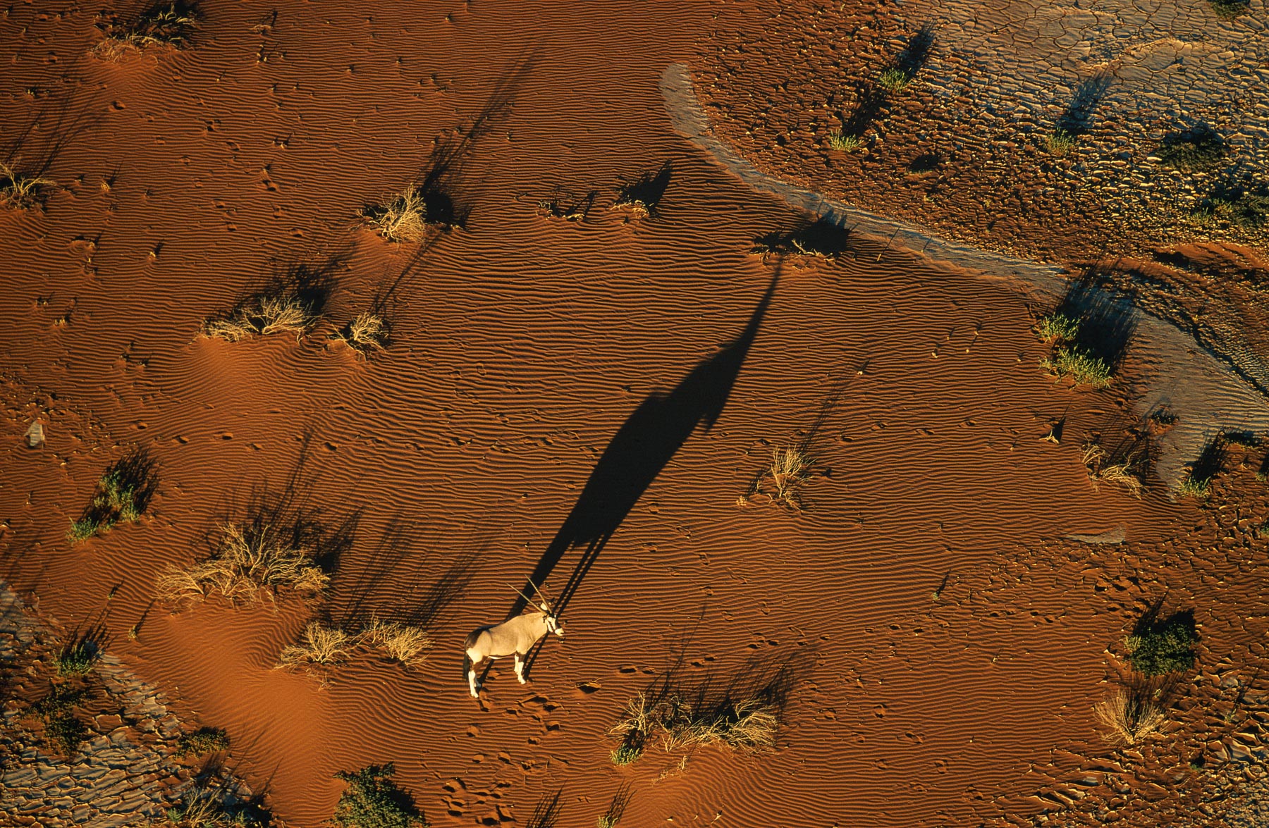
Oryx in the Namib desert, Swakopmund, Namibia (24°39’ S – 15°07’ E).
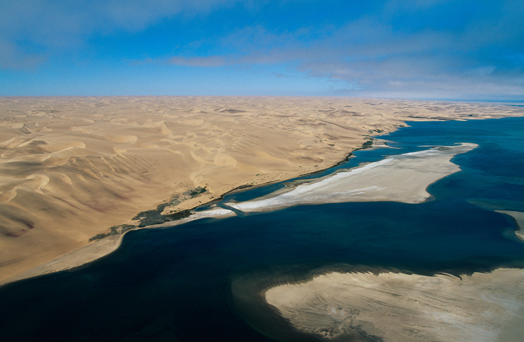
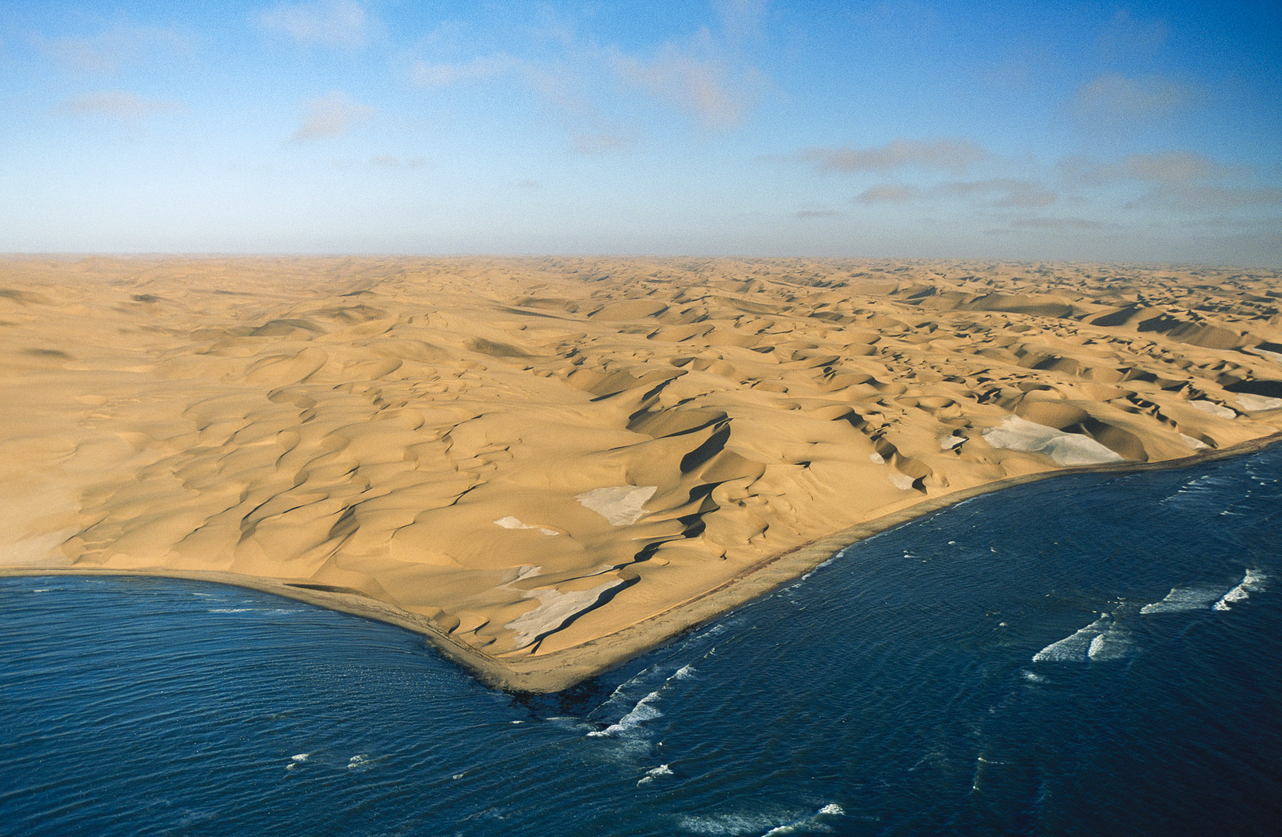
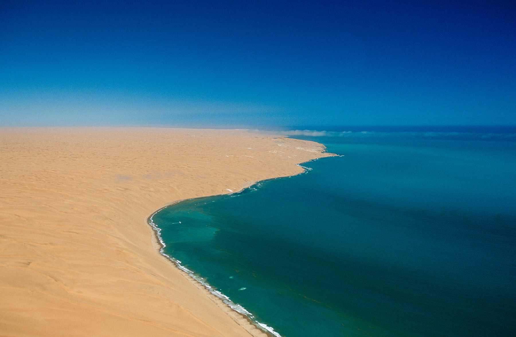
Sandwich Harbour, south of Walvis Bay, Erongo Region, Namibia
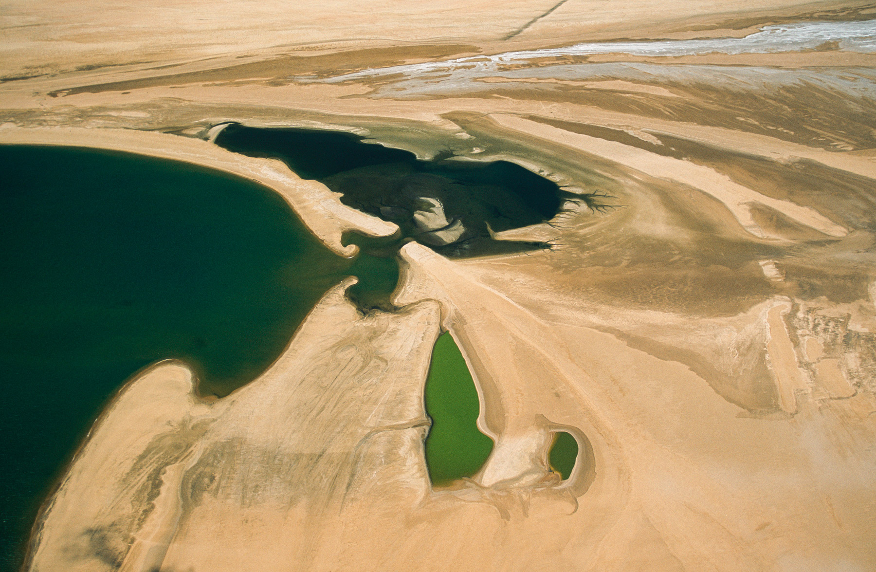
Sandwich Harbour, south of Walvis Bay, Erongo Region, Namibia
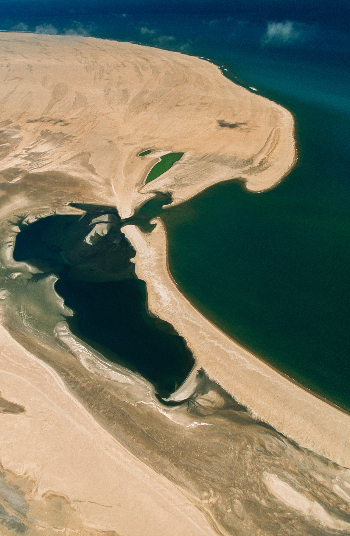
Sandwich Harbour, south of Walvis Bay, Erongo Region, Namibia
Landscape near of the Namib Desert, Swakopmund Region, Namibia
Beginning of the Namib desert, west of Gamsberg, region of Windhoek, Namibia (22°35' S - 17°02' E).
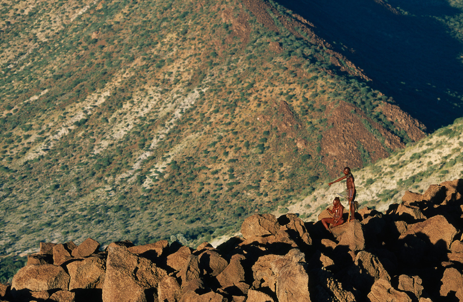
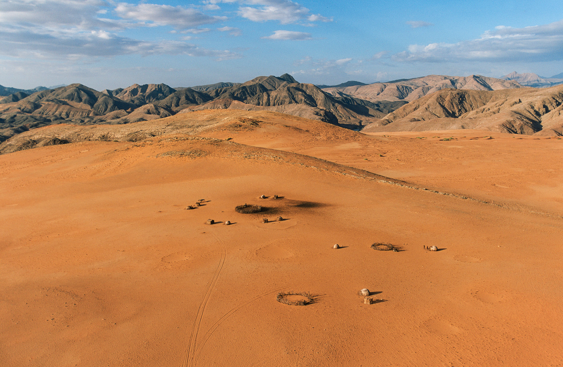
Himbas, Kaoland region, Namibia (18°15' S - 13°26' E).
Himbas, Kaoland region, Namibia
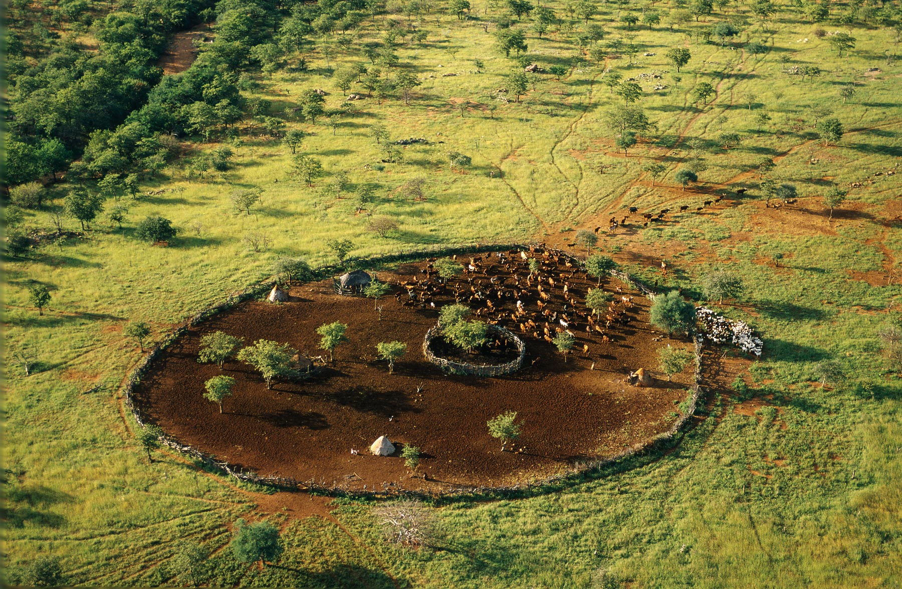
General view of a Himba village enclosure, Kunene region, Namibia (18°15 S - 13°00 E)
General view of a Himba village enclosure, Kaoland region, Namibia
Kunene Region - Camp in the border with Angola - Namibia
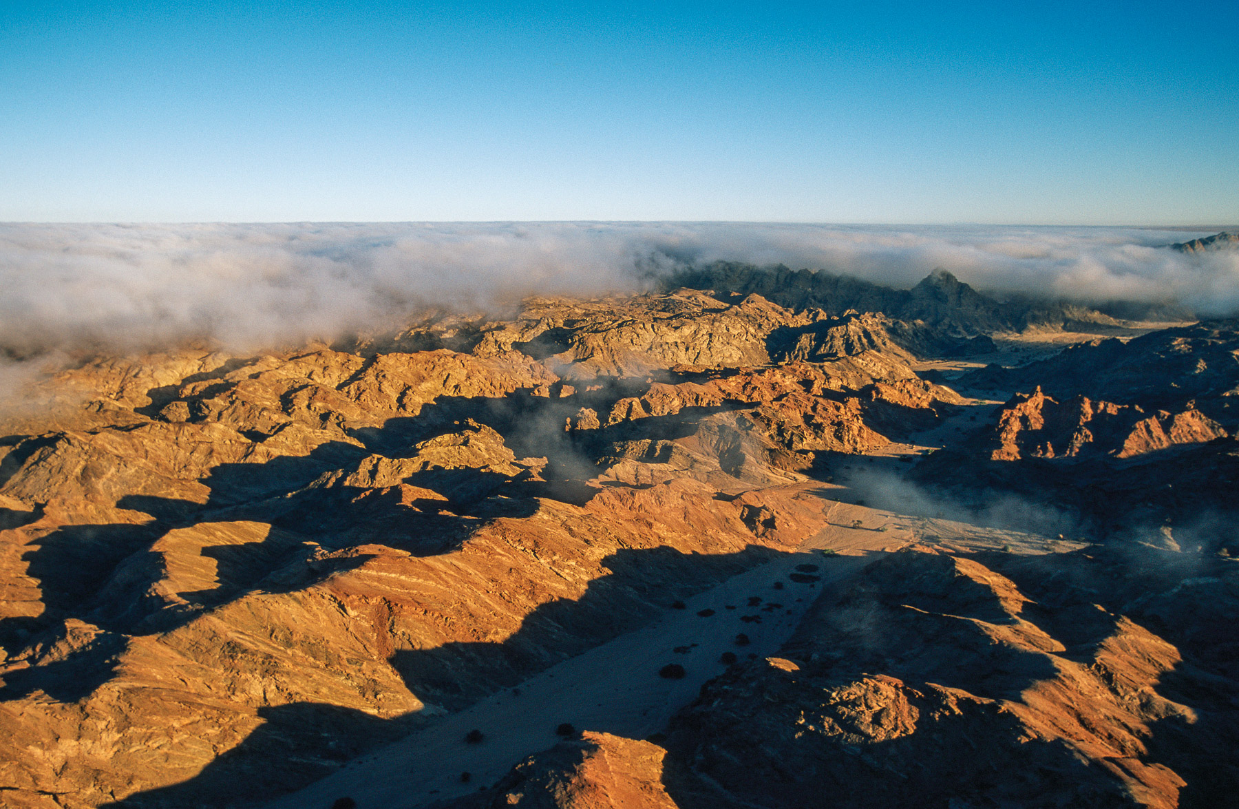
Baynes Mountains, Kunene Region, Namibia
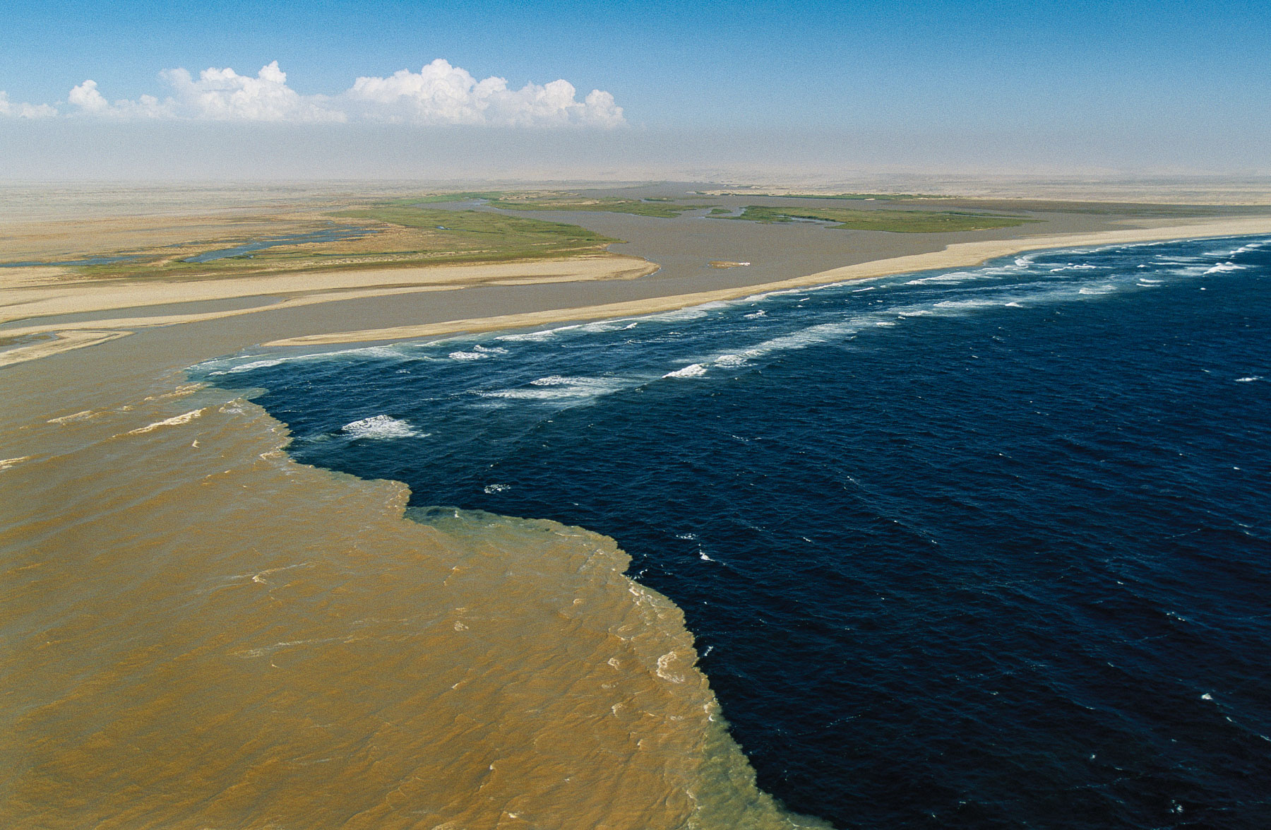
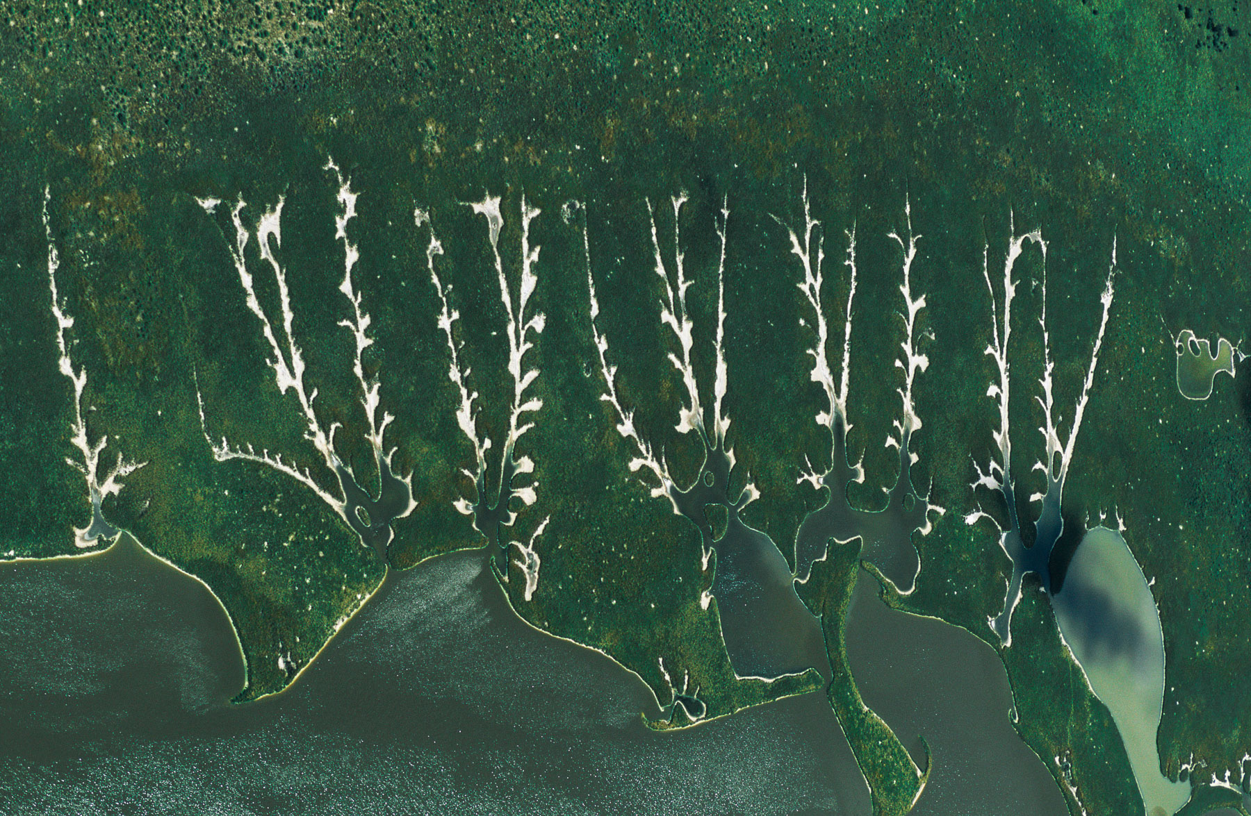
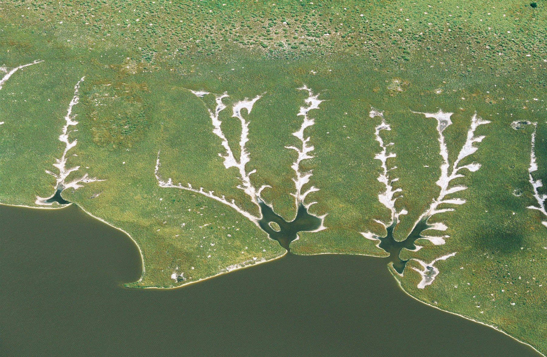
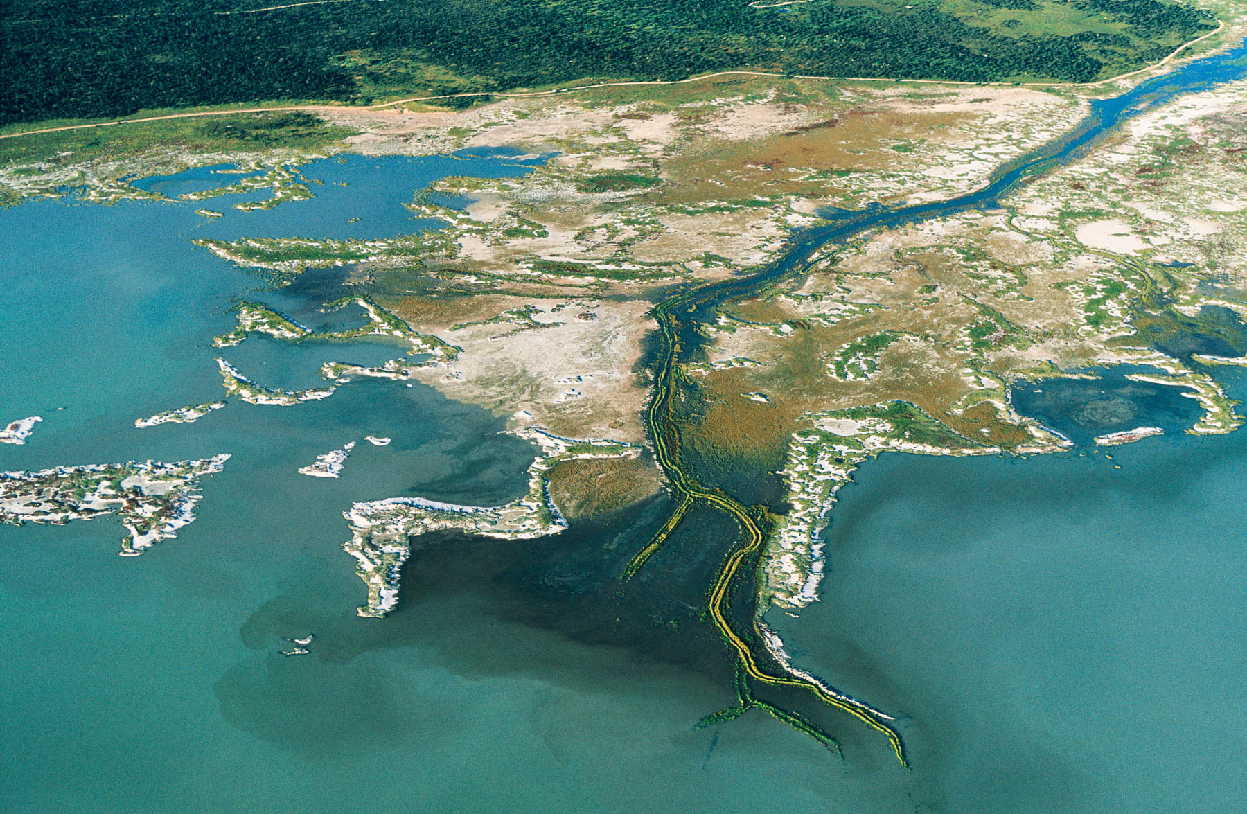
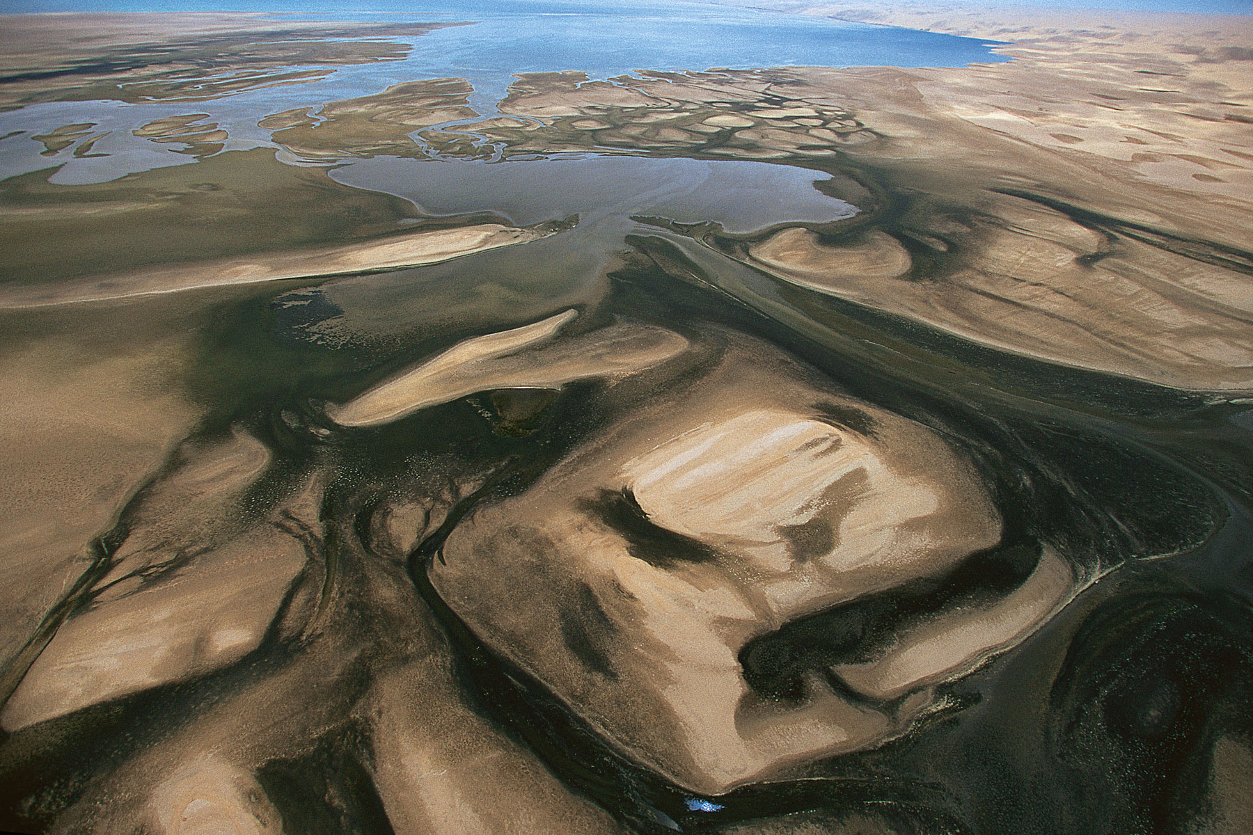
Kunene River mouth, border with Angola, Kunene Region, Namibia
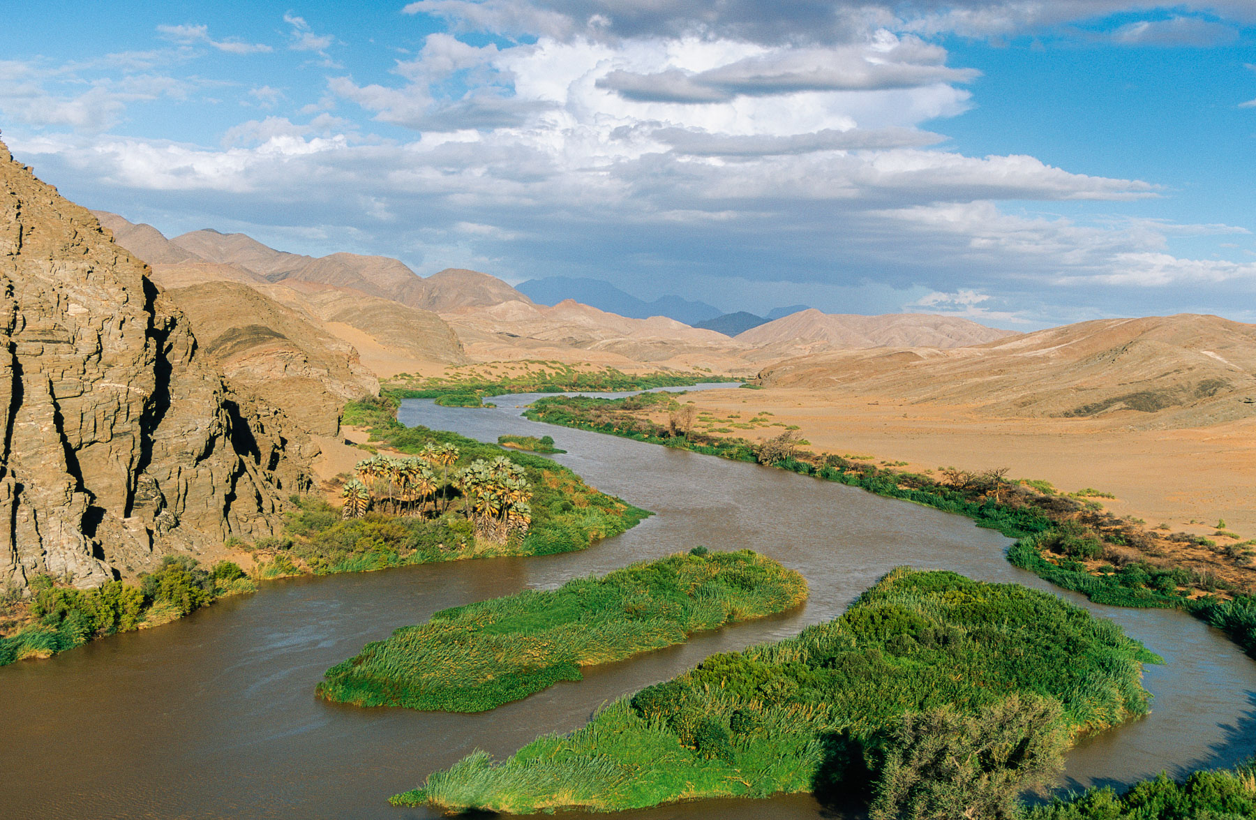
Kunene River, border with Angola, Kunene Region, Namibia
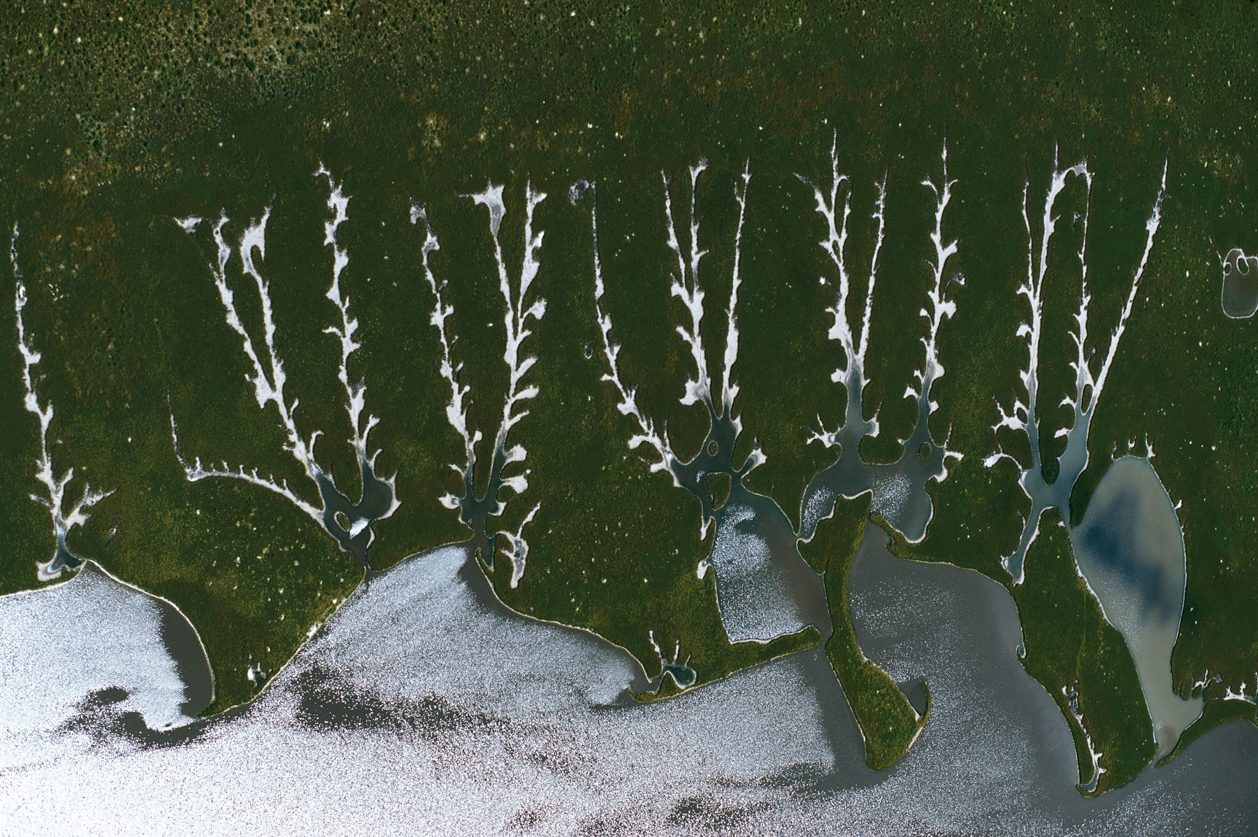
Hoanib River near Möwe Bay, Kunene Region, Namibia
Skeleton Coast, Kunene Region, Namibia
Skeleton Coast, Kunene Region, Namibia
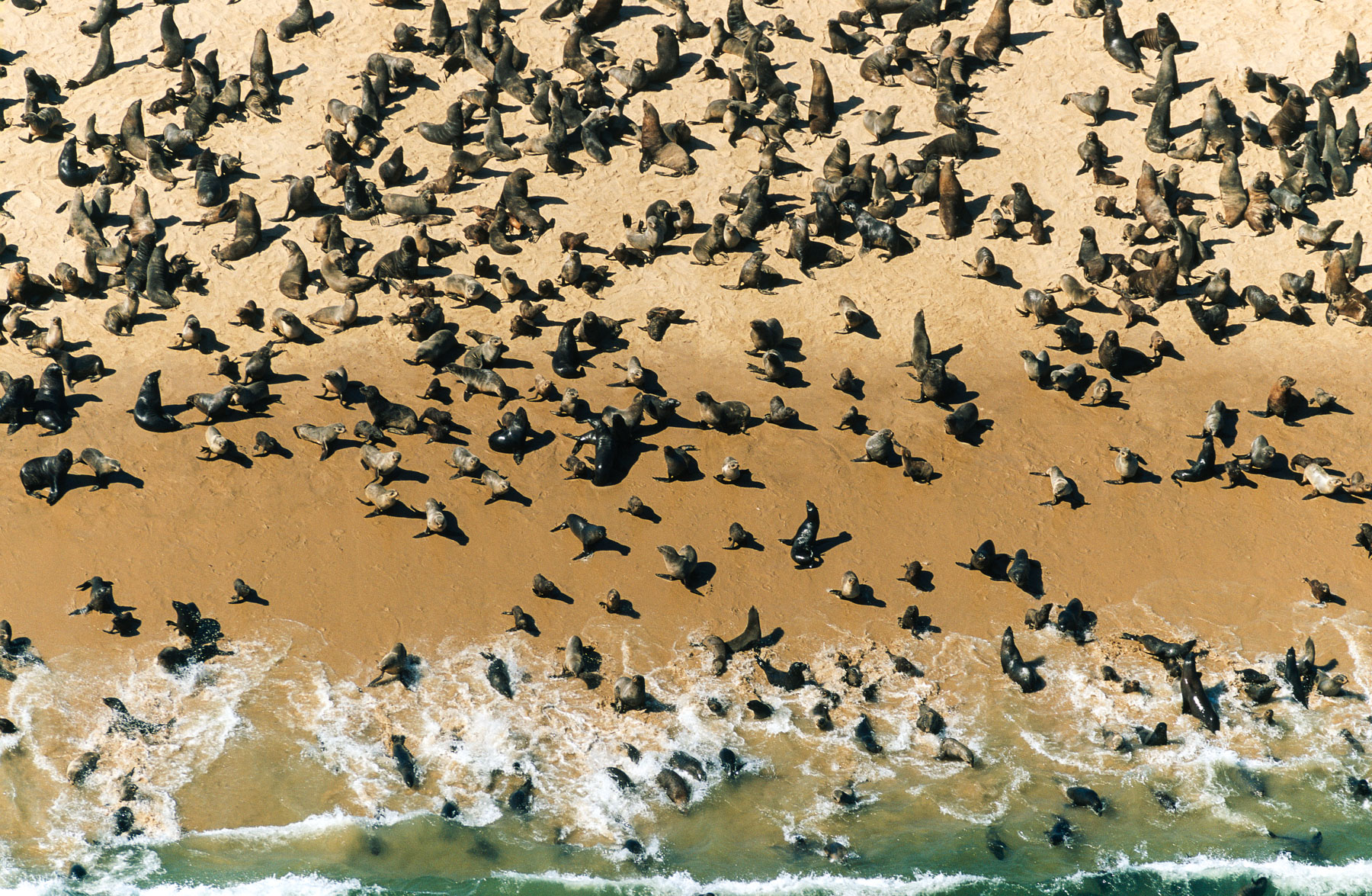
Seals in the north of Möwe Bay, Kunene Region, Namibia
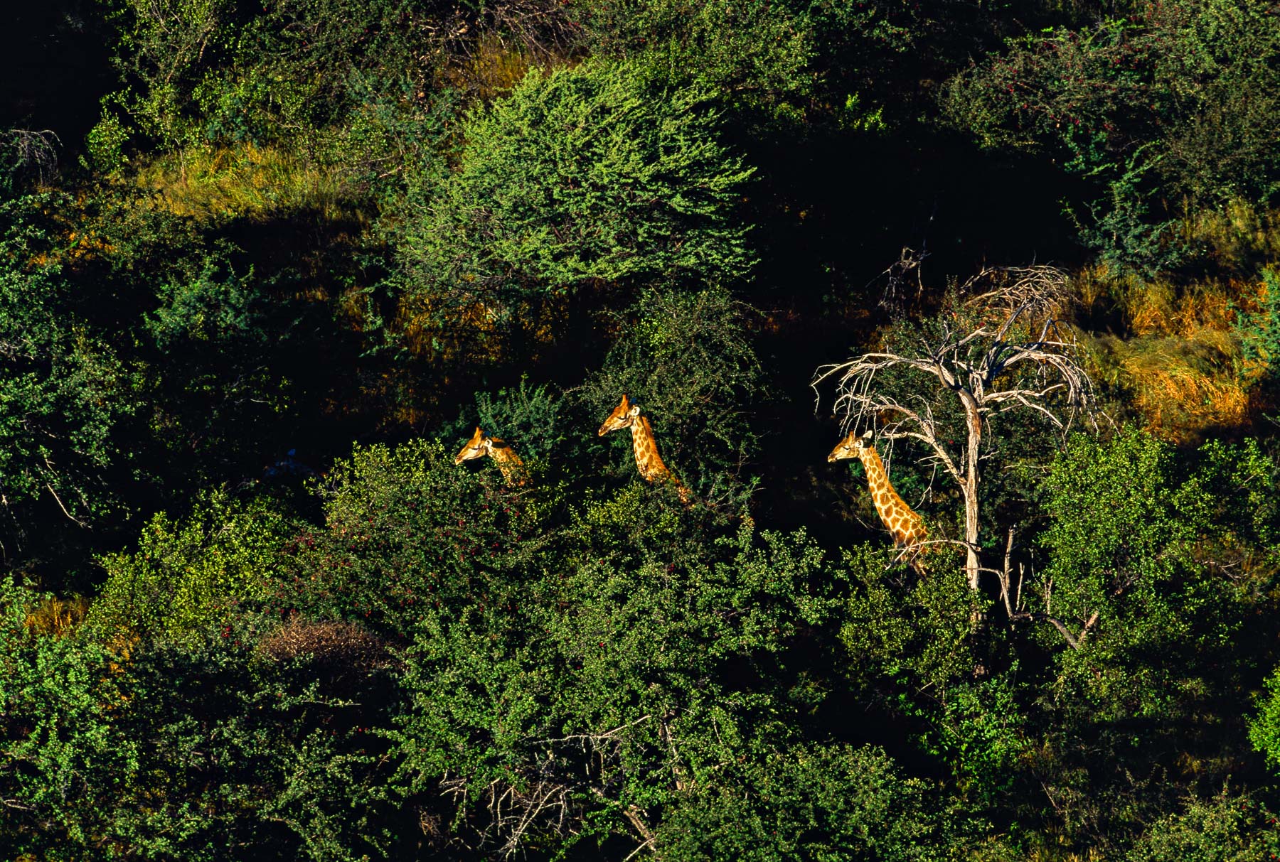
Giraffes in Etosha National Park, Namibia
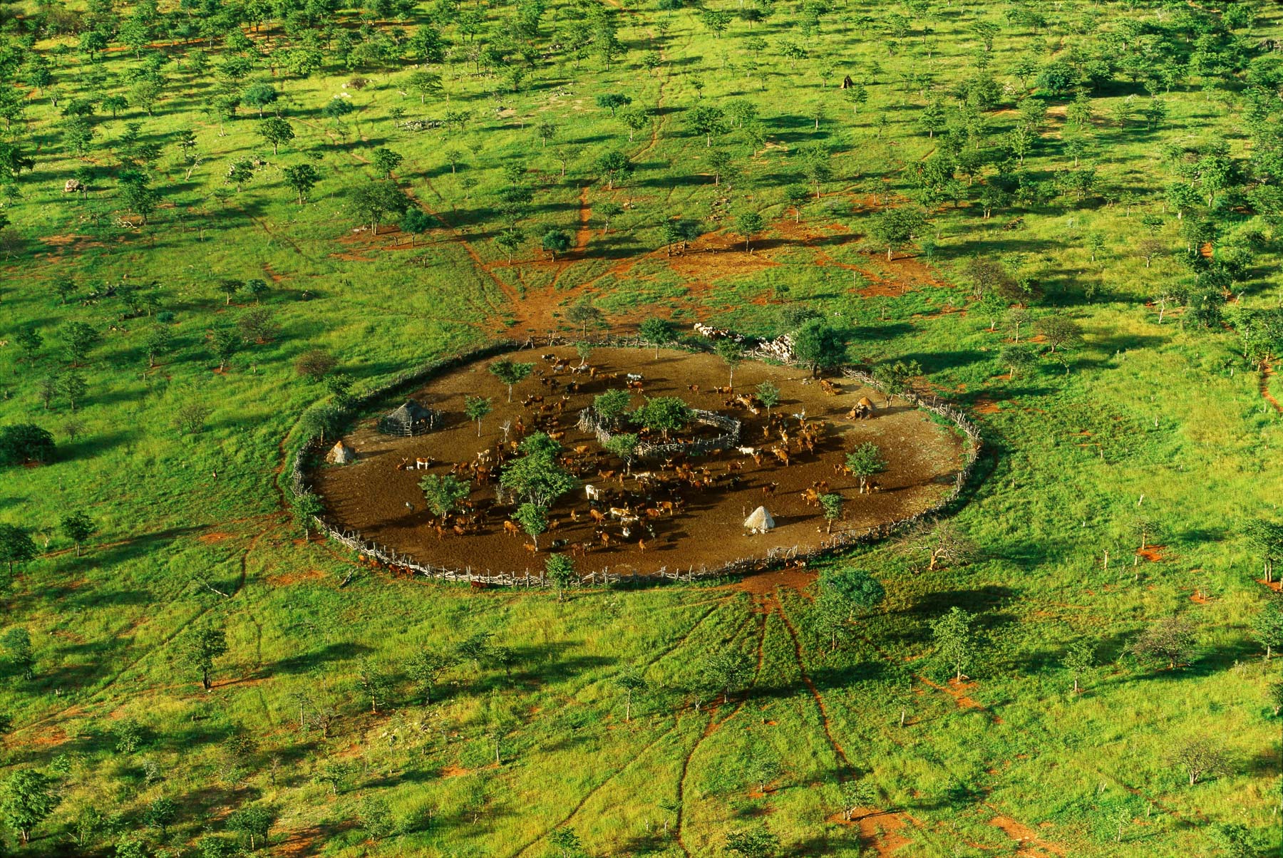
General view of a Himba village enclosure, Kunene region, Namibia (18°15 S - 13°00 E)
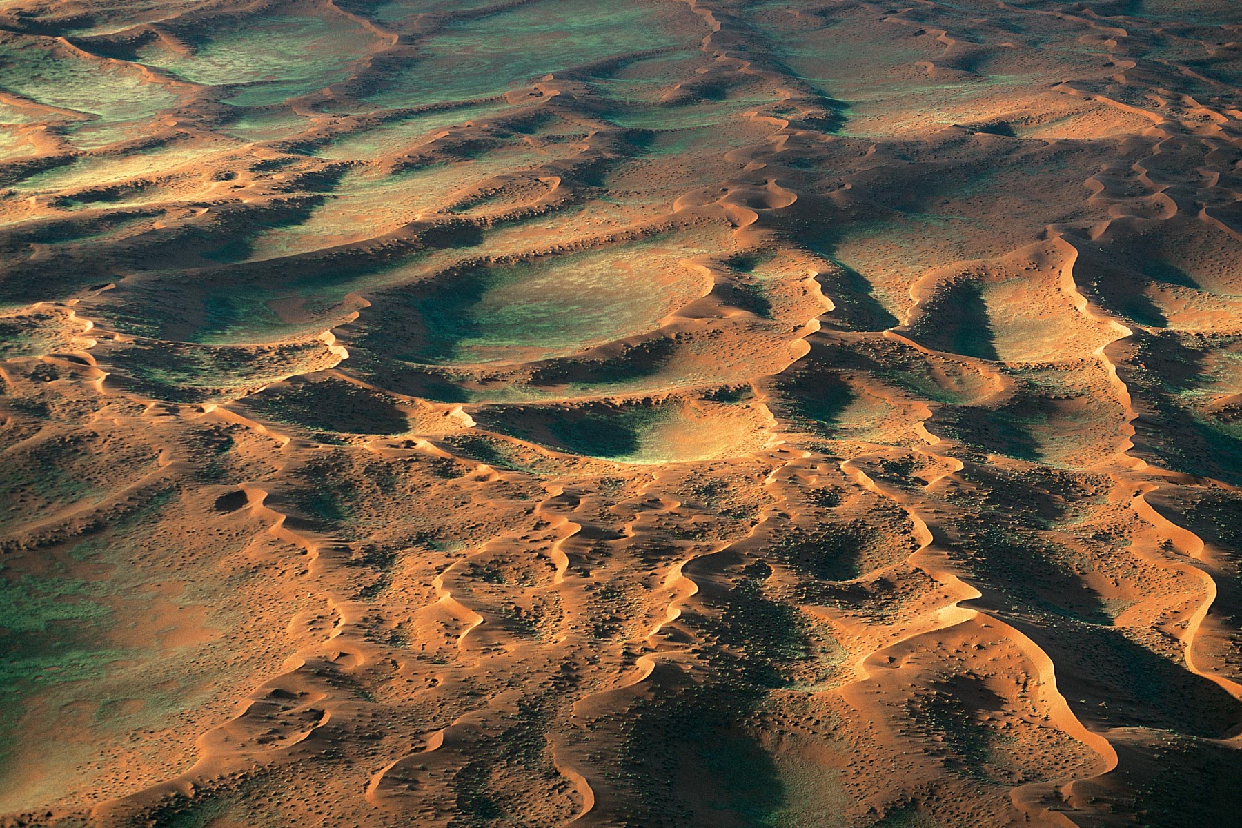
Beginning of the Namib desert, west of Gamsberg, region of Windhoek, Namibia (22°35' S, 17°02' E).
Sandwich Harbor, Swakopmund region, Namibia (23°22' S, 14°03' E).
Bank of a river in Etosha National Park, Namibia (18°43' S - 15°33' E).
Oryx in the Namib desert, Swakopmund, Namibia (24°39’ S – 15°07’ E).
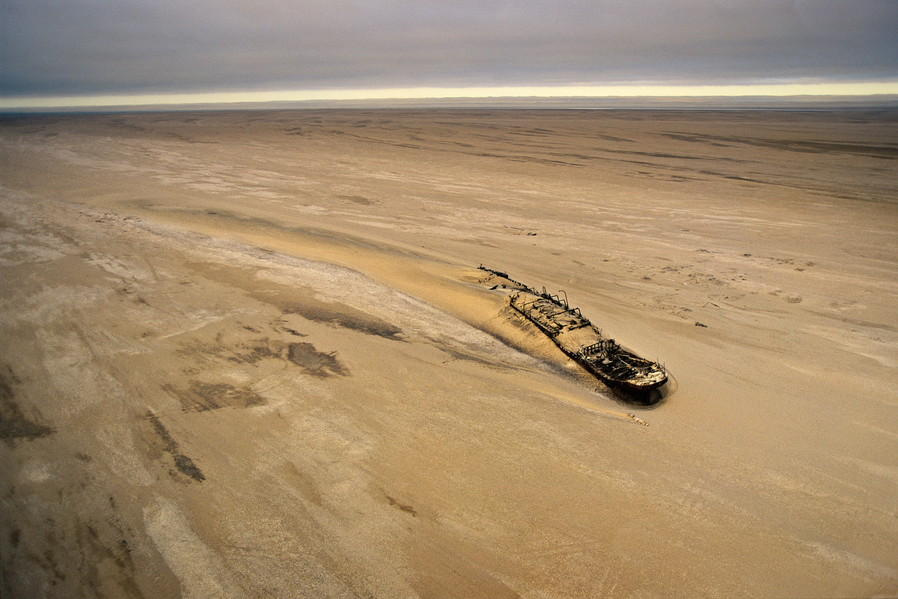
Eduard Bohlen boat run aground on the beach, Namibia (23°59' S – 14°27' E).